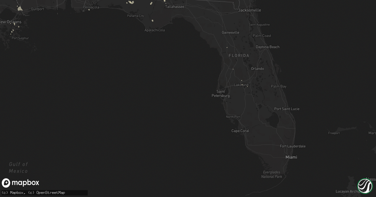
Hail Map in Florida on July 29, 2015
Get this storm
July 29 map
$229
one time, instant access
Download today. No call, no setup
Keep the $229
Bought the map and want the full workflow? Apply the entire $229 to a subscription within 7 days. None of it is wasted.
Every map, not just this one
This buys you this map. Subscription and you get every map we run, in the markets you choose from a few cities to whole states to nationwide. Plus real-time alerts the moment a storm fires.
Contact data
Name, contact info, occupancy, even credit band for addresses in the footprint. You go from where it hit to who to call.
Become the source they trust
Unlimited branding weather history reports on demand. You already have the documented answer ready for the property owner, and you are the one who showed up with it.
Property data and RoofTrace estimates
Pull up any address you have got, its value and the exact code rules for that jurisdiction, straight from One Click Code. Then RoofTrace estimates the squares, pitch, and roof value, priced the way you price.
Storm reports in Florida
Florida
| Date | Description |
|---|---|
| 07/29/20155:37 PM CDT | Tree down on luten road outside of quincy. |
| 07/29/20154:45 PM CDT | Scattered power outages caused by a combination by trees down on power lines from strong winds and lightning hitting transformers. |
| 07/29/20154:30 PM CDT | Scattered power outages caused by combination of trees falling on power lines from strong winds and lightning. |
| 07/29/20154:00 PM CDT | A large tree branch fell on a power line in the graceville area causing the line to come down |
| 07/29/20153:35 PM CDT | Tree down |
| 07/29/20153:35 PM CDT | Tree down on i-10 blocking right lane of westbound traffic. |
| 07/29/20153:02 PM CDT | Dispatch reports numerous trees and power lines down across dixie county. |
| 07/29/20152:45 PM CDT | Dispatch says numerous reports of trees and power lines down in dixie county with the storms. |
| 07/29/20152:35 PM CDT | Trees down in the leesburg area. Report from wftv. |
| 07/29/20152:25 PM CDT | Damage to roofs... Numerous trees and power lines down in tavares. Possible tornado. Relayed by lake county sheriffs office. |
| 07/29/20152:24 PM CDT | Very large oak tree blown down blocking cherry lake circle. Wires also down at this location. |
All States Impacted by Hail Map on July 29, 2015
Cities Impacted by Hail Map on July 29, 2015
- Pretty Prairie, KS
- Milton, FL
- Paducah, KY
- Gould, OK
- Spearville, KS
- Wright, KS
- Medicine Lodge, KS
- Lake City, KS
- Altha, FL
- Pratt, KS
- Sawyer, KS
- Grand Chain, IL
- Karnak, IL
- Otisco, IN
- Marysville, IN
- Joshua Tree, CA
- Turon, KS
- Sylvia, KS
- Braithwaite, LA
- Shelbyville, KY
- Smithfield, KY
- Eminence, KY
- Lakeland, FL
- Baton Rouge, LA
- Sun City, KS
- Ludlow, CA
- Boaz, KY
- Hickory, KY
- Lexington, IN
- Nabb, IN
- Nebo, KY
- Cheney, KS
- Murdock, KS
- Kingman, KS
- Eddyville, KY
- Belle Chasse, LA
- Kevil, KY
- La Center, KY
- Hebron, KY
- Burlington, KY
- Woodland, MS
- Mantee, MS
- Dixon, KY
- Clinton, KY
- Shidler, OK
- Litchfield, ME
- Monmouth, ME
- Sabattus, ME
- West Paducah, KY
- Scottsburg, IN
- Saint Gabriel, LA
- Borden, IN
- Sellersburg, IN
- Memphis, IN
- Bowdoin, ME
- Bloomfield, KY
- Chaplin, KY
- Dexter, KS
- Arkansas City, KS
- Safford, AL
- Vernon, FL
- Celestine, IN
- Phil Campbell, AL
- Adelanto, CA
- Coats, KS
- Lexington, TN
- Wildersville, TN
- Pensacola, FL
- Finchville, KY
- Simpsonville, KY
- Larned, KS
- Rush Center, KS
- Uniontown, AL
- Gracey, KY
- Hopkinsville, KY
- Palmdale, CA
- Littlerock, CA
- Franklin, LA
- Blanchester, OH
- Cadiz, KY
- Parsons, TN
- Sulligent, AL
- Detroit, AL
- Beaverton, AL
- Dunnellon, FL
- Haven, KS
- Anderson, AL
- Maple City, KS
- Winfield, KS
- Saint Bernard, LA
- Lanesville, IN
- Bainbridge, GA
- Flat Rock, IL
- Bridgeport, IL
- Lawrenceville, IL
- Barstow, CA
- Yermo, CA
- Daggett, CA
- Houston, MS
- Floyds Knobs, IN
- Saint Francisville, IL
- Sumner, IL
- South Haven, KS
- Dawson Springs, KY
- Mount Hope, KS
- Hesperia, CA
- Victorville, CA
- Ponce De Leon, FL
- Fayette, AL
- Guin, AL
- Dodge City, KS
- Chattahoochee, FL
- Crestwood, KY
- Ashburn, GA
- Sycamore, GA
- Lafitte, LA
- Petersburg, KY
- Shorter, AL
- Gretna, LA
- New Orleans, LA
- Thebes, IL
- Salem, IN
- Caryville, FL
- Violet, LA
- Meraux, LA
- Elk City, OK
- Pearl River, LA
- Fairfield, IL
- Wingo, KY
- Bristol, FL
- Wewahitchka, FL
- Ferdinand, IN
- Caldwell, KS
- Franklin, OH
- Middletown, OH
- Hutchinson, KS
- Enfield, IL
- West Salem, IL
- Viola, KS
- Aurora, IN
- Moores Hill, IN
- Cerulean, KY
- Princeton, KY
- Goshen, KY
- Lebanon Junction, KY
- Shepherdsville, KY
- Boston, KY
- Quincy, FL
- Winter Haven, FL
- Gretna, FL
- Sawyerville, AL
- Frankfort, KY
- Elizabeth, IN
- Laconia, IN
- Taylorsville, KY
- Topsham, ME
- Hahira, GA
- Mill Shoals, IL
- Seymour, IN
- Brownstown, IN
- Louisville, KY
- North Bend, OH
- Scott City, MO
- Chaffee, MO
- Benton, KY
- Slidell, LA
- Stennis Space Center, MS
- Cynthiana, KY
- Pleasureville, KY
- Milton, KY
- Bedford, KY
- Twentynine Palms, CA
- Sonoita, AZ
- Leitchfield, KY
- Hanover, IN
- Golden Gate, IL
- Ellery, IL
- Protection, KS
- Metropolis, IL
- Brooksville, FL
- Symsonia, KY
- Kirksey, KY
- Greenville, IN
- Birdseye, IN
- French Lick, IN
- Haleyville, AL
- Calvert City, KY
- Bardwell, KY
- Benson, AZ
- Jetmore, KS
- Gilbertsville, KY
- Livermore Falls, ME
- Wayne, ME
- Leeds, ME


