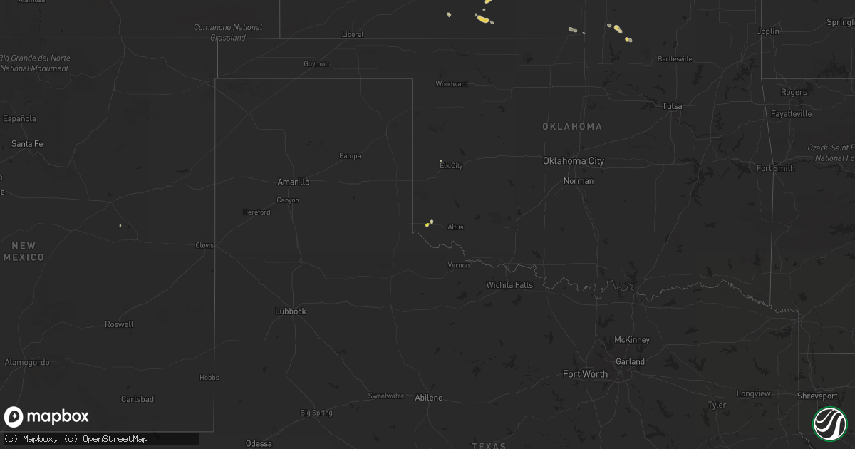
Hail Map on July 29, 2015
Get this storm
July 29 map
$229
one time, instant access
Download today. No call, no setup
Keep the $229
Bought the map and want the full workflow? Apply the entire $229 to a subscription within 7 days. None of it is wasted.
Every map, not just this one
This buys you this map. Subscription and you get every map we run, in the markets you choose from a few cities to whole states to nationwide. Plus real-time alerts the moment a storm fires.
Contact data
Name, contact info, occupancy, even credit band for addresses in the footprint. You go from where it hit to who to call.
Become the source they trust
Unlimited branding weather history reports on demand. You already have the documented answer ready for the property owner, and you are the one who showed up with it.
Property data and RoofTrace estimates
Pull up any address you have got, its value and the exact code rules for that jurisdiction, straight from One Click Code. Then RoofTrace estimates the squares, pitch, and roof value, priced the way you price.
States Impacted by Hail Map on July 29, 2015
Storm reports
Maine
| Date | Description |
|---|---|
| 07/29/20152:40 PM CDT | Large branches and power lines down causing power outages |
| 07/29/20152:20 PM CDT | Large trees down |
| 07/29/20151:43 PM CDT | A local report indicates 1.00 inch wind near LITCHFIELD |
| 07/29/20151:14 PM CDT | Multiple reports of trees down and lots of photos on twitter feed. |
| 07/29/20151:10 PM CDT | A local report indicates 1.00 inch wind near MONMOUTH |
| 07/29/20151:07 PM CDT | Trees down and power outages being reported. |
| 07/29/201512:25 PM CDT | Trees and wires down on russ pt flying pond. |
Georgia
| Date | Description |
|---|---|
| 07/29/20156:36 PM CDT | Tree on powerline on faceville highway. |
| 07/29/20155:53 PM CDT | Tree down on monroe road near ga hwy 112. |
| 07/29/20152:08 PM CDT | Several reports of trees and power lines down within the city limits of valdosta. |
| 07/29/20152:00 PM CDT | Tree down |
| 07/29/20151:48 PM CDT | Tree down |
| 07/29/20151:48 PM CDT | Tree down |
| 07/29/20151:48 PM CDT | Tree down |
Kentucky
| Date | Description |
|---|---|
| 07/29/20155:50 PM CDT | Trees reported down. Winds estimated at 45 mph. Report relayed to television station weht from muhlenberg emergency manager. |
| 07/29/20155:18 PM CDT | Tree down washburn lane and new la grange road. |
| 07/29/20155:18 PM CDT | Power pole down new la grange road and arterburn drive. |
| 07/29/20155:18 PM CDT | Tree down at the intersection of glen arbor and greenlawn. |
| 07/29/20155:18 PM CDT | Trees down frankfort avenue and story avenue. |
| 07/29/20154:59 PM CDT | Tree down on a horse farm at murphy lane and highway 22. |
Oklahoma
| Date | Description |
|---|---|
| 07/28/20158:15 PM CDT | Via kswo |
| 07/28/20157:55 PM CDT | Around 8 stockade fence panels blown down. Minor tree damage also reported. Relayed by kwso lawton. |
| 07/28/20157:55 PM CDT | Via kswo |
Vermont
| Date | Description |
|---|---|
| 07/29/20154:45 PM CDT | Trees down on falls rd |
Florida
| Date | Description |
|---|---|
| 07/29/20155:37 PM CDT | Tree down on luten road outside of quincy. |
| 07/29/20154:45 PM CDT | Scattered power outages caused by a combination by trees down on power lines from strong winds and lightning hitting transformers. |
| 07/29/20154:30 PM CDT | Scattered power outages caused by combination of trees falling on power lines from strong winds and lightning. |
| 07/29/20154:00 PM CDT | A large tree branch fell on a power line in the graceville area causing the line to come down |
| 07/29/20153:35 PM CDT | Tree down on i-10 blocking right lane of westbound traffic. |
| 07/29/20153:35 PM CDT | Tree down |
| 07/29/20153:02 PM CDT | Dispatch reports numerous trees and power lines down across dixie county. |
| 07/29/20152:45 PM CDT | Dispatch says numerous reports of trees and power lines down in dixie county with the storms. |
| 07/29/20152:35 PM CDT | Trees down in the leesburg area. Report from wftv. |
| 07/29/20152:25 PM CDT | Damage to roofs... Numerous trees and power lines down in tavares. Possible tornado. Relayed by lake county sheriffs office. |
| 07/29/20152:24 PM CDT | Very large oak tree blown down blocking cherry lake circle. Wires also down at this location. |
Alabama
| Date | Description |
|---|---|
| 07/29/20153:23 PM CDT | Scattered trees reported down across the southern half of lamar county including millport. |
| 07/29/20153:13 PM CDT | Scattered trees reported down across the northern half of lamar county including in the city of vernon. |
| 07/29/20152:55 PM CDT | Several trees down in the alabaster and helena areas including one tree snapped along hwy 58 near the navajo hills entrance. Other locations include roy dr in helena an |
| 07/29/20152:40 PM CDT | Tree down on a house in the 3400 block of tal meadow dr. No report of injuries at this time. Time estimated from radar. |
| 07/29/20151:02 PM CDT | Tree uprooted in the northport area. Winds etimated 40-45 mph. Time corrected. |
| 07/29/201512:55 PM CDT | Tree uprooted along lock road nine. Winds estimated 40-45 mph. |
| 07/29/201512:14 PM CDT | Thunderstorm winds knocked down 2-3 trees onto cr 70 and cr 26. Time estimated by radar. |
| 07/29/201512:00 PM CDT | Thunderstorm winds knocked 2-3 trees down in anderson. Time estimated by radar. |
California
| Date | Description |
|---|---|
| 07/29/20156:57 PM CDT | Bicycle lake airfield measured sustained winds from the east at 46 mph with a gust of 60 mph. |
Mississippi
| Date | Description |
|---|---|
| 07/29/20155:00 PM CDT | Several trees blown down in the southern portion of the county as storms passed through. Time estimated by radar. |
| 07/29/20155:00 PM CDT | Several trees blown down in the southern portion of the county as storms passed through. Time estimated by radar. |
| 07/29/20154:00 PM CDT | A few trees down in the area around macon |
| 07/29/20153:55 PM CDT | Tree down on hwy 389 blocking the road. |
| 07/29/20153:45 PM CDT | Tree down on miller road |
| 07/29/20153:40 PM CDT | A pool business had a window blown out and a door blown off the hinges as well as a little bit of roof damage. |
| 07/29/20153:40 PM CDT | Numerous trees down and power outages due to trees on lines. A few shingles blown off roofs as well. |
| 07/29/20153:30 PM CDT | A couple trees down in north part of county between caledonia and columbus. |
| 07/29/20153:30 PM CDT | Trees down and a fence blown over |
| 07/29/20153:30 PM CDT | Trees down and a fence blown over |
Cities Impacted by Hail Map on July 29, 2015
- Pretty Prairie, KS
- Milton, FL
- Paducah, KY
- Gould, OK
- Spearville, KS
- Wright, KS
- Medicine Lodge, KS
- Lake City, KS
- Altha, FL
- Pratt, KS
- Sawyer, KS
- Grand Chain, IL
- Karnak, IL
- Otisco, IN
- Marysville, IN
- Joshua Tree, CA
- Turon, KS
- Sylvia, KS
- Braithwaite, LA
- Shelbyville, KY
- Smithfield, KY
- Eminence, KY
- Lakeland, FL
- Baton Rouge, LA
- Sun City, KS
- Ludlow, CA
- Boaz, KY
- Hickory, KY
- Lexington, IN
- Nabb, IN
- Nebo, KY
- Cheney, KS
- Murdock, KS
- Kingman, KS
- Eddyville, KY
- Belle Chasse, LA
- Kevil, KY
- La Center, KY
- Hebron, KY
- Burlington, KY
- Woodland, MS
- Mantee, MS
- Dixon, KY
- Clinton, KY
- Shidler, OK
- Litchfield, ME
- Monmouth, ME
- Sabattus, ME
- West Paducah, KY
- Scottsburg, IN
- Saint Gabriel, LA
- Borden, IN
- Sellersburg, IN
- Memphis, IN
- Bowdoin, ME
- Bloomfield, KY
- Chaplin, KY
- Dexter, KS
- Arkansas City, KS
- Safford, AL
- Vernon, FL
- Celestine, IN
- Phil Campbell, AL
- Adelanto, CA
- Coats, KS
- Lexington, TN
- Wildersville, TN
- Pensacola, FL
- Finchville, KY
- Simpsonville, KY
- Larned, KS
- Rush Center, KS
- Uniontown, AL
- Gracey, KY
- Hopkinsville, KY
- Palmdale, CA
- Littlerock, CA
- Franklin, LA
- Blanchester, OH
- Cadiz, KY
- Parsons, TN
- Sulligent, AL
- Detroit, AL
- Beaverton, AL
- Dunnellon, FL
- Haven, KS
- Anderson, AL
- Maple City, KS
- Winfield, KS
- Saint Bernard, LA
- Lanesville, IN
- Bainbridge, GA
- Flat Rock, IL
- Bridgeport, IL
- Lawrenceville, IL
- Barstow, CA
- Yermo, CA
- Daggett, CA
- Houston, MS
- Floyds Knobs, IN
- Saint Francisville, IL
- Sumner, IL
- South Haven, KS
- Dawson Springs, KY
- Mount Hope, KS
- Hesperia, CA
- Victorville, CA
- Ponce De Leon, FL
- Fayette, AL
- Guin, AL
- Dodge City, KS
- Chattahoochee, FL
- Crestwood, KY
- Ashburn, GA
- Sycamore, GA
- Lafitte, LA
- Petersburg, KY
- Shorter, AL
- Gretna, LA
- New Orleans, LA
- Thebes, IL
- Salem, IN
- Caryville, FL
- Violet, LA
- Meraux, LA
- Elk City, OK
- Pearl River, LA
- Fairfield, IL
- Wingo, KY
- Bristol, FL
- Wewahitchka, FL
- Ferdinand, IN
- Caldwell, KS
- Franklin, OH
- Middletown, OH
- Hutchinson, KS
- Enfield, IL
- West Salem, IL
- Viola, KS
- Aurora, IN
- Moores Hill, IN
- Cerulean, KY
- Princeton, KY
- Goshen, KY
- Lebanon Junction, KY
- Shepherdsville, KY
- Boston, KY
- Quincy, FL
- Winter Haven, FL
- Gretna, FL
- Sawyerville, AL
- Frankfort, KY
- Elizabeth, IN
- Laconia, IN
- Taylorsville, KY
- Topsham, ME
- Hahira, GA
- Mill Shoals, IL
- Seymour, IN
- Brownstown, IN
- Louisville, KY
- North Bend, OH
- Scott City, MO
- Chaffee, MO
- Benton, KY
- Slidell, LA
- Stennis Space Center, MS
- Cynthiana, KY
- Pleasureville, KY
- Milton, KY
- Bedford, KY
- Twentynine Palms, CA
- Sonoita, AZ
- Leitchfield, KY
- Hanover, IN
- Golden Gate, IL
- Ellery, IL
- Protection, KS
- Metropolis, IL
- Brooksville, FL
- Symsonia, KY
- Kirksey, KY
- Greenville, IN
- Birdseye, IN
- French Lick, IN
- Haleyville, AL
- Calvert City, KY
- Bardwell, KY
- Benson, AZ
- Jetmore, KS
- Gilbertsville, KY
- Livermore Falls, ME
- Wayne, ME
- Leeds, ME