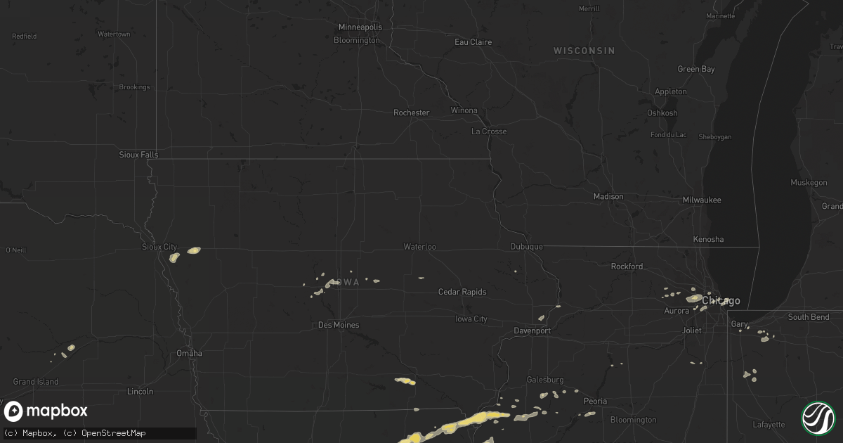
Hail Map in Kansas on July 28, 2011
Get this storm
July 28 map
$229
one time, instant access
Download today. No call, no setup
Keep the $229
Bought the map and want the full workflow? Apply the entire $229 to a subscription within 7 days. None of it is wasted.
Every map, not just this one
This buys you this map. Subscription and you get every map we run, in the markets you choose from a few cities to whole states to nationwide. Plus real-time alerts the moment a storm fires.
Contact data
Name, contact info, occupancy, even credit band for addresses in the footprint. You go from where it hit to who to call.
Become the source they trust
Unlimited branding weather history reports on demand. You already have the documented answer ready for the property owner, and you are the one who showed up with it.
Property data and RoofTrace estimates
Pull up any address you have got, its value and the exact code rules for that jurisdiction, straight from One Click Code. Then RoofTrace estimates the squares, pitch, and roof value, priced the way you price.
Storm reports in Kansas
Kansas
| Date | Description |
|---|---|
| 07/28/20116:45 PM CDT | A local report indicates 1.00 inch wind near 8 NNW RANSOM |
| 07/28/20116:18 PM CDT | Pea-sized hail. |
| 07/28/20116:15 PM CDT | Hail estimated to be between half dollar and ping pong ball in size. Hail covering the ground. |
| 07/28/20116:03 PM CDT | A local report indicates 80 MPH wind near 13 N GOODLAND |
| 07/28/20116:00 PM CDT | A local report indicates 65 MPH wind near 4 WSW NESS CITY |
| 07/28/20115:23 PM CDT | Round-top calf shed blown over. Calves appear uninjured. Pea to dime sized hail also. |
| 07/28/20115:15 PM CDT | A local report indicates 75 MPH wind near 6 SSE THE SAUNDERS ELEV |
| 07/28/20115:15 PM CDT | A local report indicates 1.00 inch wind near 6 SSE THE SAUNDERS ELEV |
| 07/28/20115:02 PM CDT | Also received 1.41 inches of rain. |
| 07/28/20114:40 PM CDT | Estimated 60 mph winds. |
| 07/28/20114:35 PM CDT | Half-dollar size hail ongoing at the bird city airport. |
| 07/28/20114:05 PM CDT | 12 power poles were blown down across 111 road between garnett and ross blvd. Powerlines fell across one vehicle with a person trapped inside who was eventually rescued |
| 07/27/201111:33 PM CDT | Reports of dock braking loose from the lake perry marina. Wind speed unknown |
| 07/27/201110:17 PM CDT | Estimated 60 to 65 mph winds on the north side of town |
| 07/27/20119:50 PM CDT | A local report indicates 60 MPH wind near 5 S OLSBURG |
| 07/27/20119:38 PM CDT | 4 inch tree limb blown out of maple tree with estimated 60 mph winds. |
| 07/27/20119:00 PM CDT | Four block area in stilwell had around a dozen large trees knocked down...with a few landing on homes. Multiple power poles snapped off with power outages in town. One |
| 07/27/20118:26 PM CDT | A local report indicates 1.00 inch wind near 6 WSW OAK HILL |
| 07/27/20118:26 PM CDT | A local report indicates 65 MPH wind near 6 WSW OAK HILL |
| 07/27/20118:24 PM CDT | A local report indicates 70 MPH wind near 6 WSW OAK HILL |
| 07/27/20118:24 PM CDT | A local report indicates 1.00 inch wind near 6 WSW OAK HILL |
| 07/27/20118:20 PM CDT | Power line reported down in bucyrus. Thunderstorm wind gusts were estimated up to 60 mph. Time estimated. |
| 07/27/20118:16 PM CDT | A local report indicates 1.00 inch wind near 2 NNE WELLS |
| 07/27/20118:16 PM CDT | A local report indicates 80 MPH wind near 2 NNE WELLS |
| 07/27/20118:14 PM CDT | A local report indicates 70 MPH wind near 2 NNE WELLS |
| 07/27/20118:14 PM CDT | A local report indicates 1.00 inch wind near 2 NNE WELLS |
| 07/27/20118:11 PM CDT | Delayed multiple reports of wind damage in ottawa county near the state lake. Windows blown out of a house near the intersection of n 180th rd and limestone rd. Three t |
All States Impacted by Hail Map on July 28, 2011
Cities Impacted by Hail Map on July 28, 2011
- Deering, ND
- Glenburn, ND
- Wakefield, KS
- Clay Center, KS
- Lodgepole, SD
- Dupree, SD
- Eagle Butte, SD
- Ekalaka, MT
- Bethune, CO
- Salix, IA
- Moville, IA
- Bronson, IA
- Hornick, IA
- Hoyt, KS
- Denison, KS
- Philadelphia, MO
- Emden, MO
- Shelbina, MO
- Shelbyville, MO
- Ness City, KS
- Buffalo, SD
- Reva, SD
- Bushnell, IL
- Burlington, CO
- Trenton, NE
- Culbertson, NE
- Belle Fourche, SD
- Valley Falls, KS
- Holton, KS
- Yuma, CO
- Prairie City, SD
- Meadow, SD
- Bison, SD
- Arriba, CO
- Lindon, CO
- Anton, CO
- Cope, CO
- Goodland, KS
- Pritchett, CO
- Flagler, CO
- Kit Carson, CO
- Ames, IA
- Benkelman, NE
- Joes, CO
- Burlington, ND
- Minot, ND
- Lombard, IL
- Alzada, MT
- Logan, KS
- Fort Myers, FL
- Ursa, IL
- Jetmore, KS
- Dover, MO
- Higginsville, MO
- Pekin, IL
- Akron, CO
- Pittsburgh, PA
- Verona, PA
- Karval, CO
- Laingsburg, MI
- Paw Paw, MI
- Weskan, KS
- La Monte, MO
- Knob Noster, MO
- Des Lacs, ND
- Berthold, ND
- Oskaloosa, KS
- Wallace, NE
- Greenwood, MO
- Pleasant Hill, MO
- Bosworth, MO
- Lexington, MO
- Winigan, MO
- New Boston, MO
- Linneus, MO
- Purdin, MO
- Monticello, MO
- Lewistown, MO
- Capitol, MT
- Paola, KS
- Spearfish, SD
- Keystone, SD
- Hill City, SD
- Rapid City, SD
- Clyde, KS
- Reeder, ND
- Edina, MO
- Baring, MO
- Kirksville, MO
- Fort Pierre, SD
- Marshall, MO
- Green Castle, MO
- Brookfield, MO
- Green City, MO
- Meadville, MO
- Wheeling, MO
- Milan, MO
- Browning, MO
- Enders, NE
- Wauneta, NE
- Hettinger, ND
- Raton, NM
- Wiley, CO
- Lamar, CO
- Bennington, KS
- Minneapolis, KS
- Miltonvale, KS
- Upton, WY
- Moorcroft, WY
- Scranton, ND
- Bowman, ND
- Terry, MT
- Riley, KS
- Randolph, KS
- Green, KS
- Leonardville, KS
- Blakesburg, IA
- Ottumwa, IA
- Whiting, KS
- Wild Horse, CO
- Manter, KS
- Vona, CO
- Hayes Center, NE
- Chestertown, MD
- Rock Hall, MD
- Branson, CO
- Bird City, KS
- Berwick, IL
- Abingdon, IL
- Saint Augustine, IL
- Burdett, KS
- Dallas City, IL
- Gorin, MO
- Novinger, MO
- Hurdland, MO
- Greentop, MO
- Hamilton, IL
- Brashear, MO
- Rutledge, MO
- Memphis, MO
- Wyaconda, MO
- Luray, MO
- Montrose, IA
- Keokuk, IA
- Blandinsville, IL
- Wayland, MO
- Nauvoo, IL
- Arbela, MO
- Carthage, IL
- Kahoka, MO
- La Harpe, IL
- Saint Patrick, MO
- La Plata, MO
- Argyle, IA
- Niota, IL
- Lees Summit, MO
- Champion, NE
- Lantry, SD
- Colby, KS
- Oakley, KS
- Wanatah, IN
- Valparaiso, IN
- Boone, IA
- Holyoke, CO
- Palisade, NE
- Lemmon, SD
- Eads, CO
- Avon, IL
- Prairie City, IL
- Colorado Springs, CO
- Las Cruces, NM
- Saint Petersburg, FL
- Tribune, KS
- Saint Charles, IL
- Maple Park, IL
- Elburn, IL
- Fremont, OH
- Clyde, OH
- Utica, KS
- Ransom, KS
- Bunceton, MO
- Tipton, MO
- White Sands Missile Range, NM
- Warrendale, PA
- Cranberry Township, PA
- Wexford, PA
- Mars, PA
- Baden, PA
- Venice, FL
- Ralph, SD
- Cheyenne Wells, CO
- Devils Tower, WY
- Hulett, WY
- Sheridan Lake, CO
- Beaver, PA
- Beaver Falls, PA
- Anthon, IA
- Correctionville, IA
- Cawker City, KS
- Downs, KS
- Esbon, KS
- Corder, MO
- Monroe City, MO
- Hunnewell, MO
- La Grange, MO
- Nortonville, KS
- Allen, KS
- Kirk, CO
- Maquon, IL
- London Mills, IL
- Syracuse, KS
- Vernon, CO
- Walsenburg, CO
- Parks, NE
- Villa Park, IL
- West Chicago, IL
- Glendale Heights, IL
- Elmhurst, IL
- Wheaton, IL
- Addison, IL
- Carol Stream, IL
- Winfield, IL
- Glen Ellyn, IL
- Bensenville, IL
- Melrose Park, IL
- Osawatomie, KS
- Burlingame, KS
- Marietta, IL
- Sweet Springs, MO
- Odessa, MO
- Oak Grove, MO
- Bates City, MO
- Braymer, MO
- Gettysburg, SD
- Newell, SD
- Hamilton, MO
- Gallatin, MO
- Topeka, KS
- Mayetta, KS
- Spring Hill, KS
- Nemo, SD
- Deadwood, SD
- Lead, SD
- Hardin, MO
- Arapahoe, CO
- Edgerton, KS
- Imperial, NE
- Holt, MO
- Leoti, KS
- Central City, NE
- Humphreys, MO
- Bernard, IA
- Aurora, KS
- Saint Francis, KS
- Fallon, MT
- Richmond, MO
- Norborne, MO
- Wayne, IL
- Folsom, NM
- Mckeesport, PA
- Fair Oaks, IN
- Rensselaer, IN
- Sharon Springs, KS
- Kim, CO
- Mendon, IL
- Warsaw, IL
- Sutter, IL
- Jamestown, ND
- Buchanan, ND
- Placida, FL
- Rotonda West, FL
- Tornillo, TX
- Harrisonville, MO
- Peculiar, MO
- Chelsea, MI
- Clifton, KS
- Morganville, KS
- Magnolia, IL
- Selby, SD
- Concordia, KS
- Soldier, KS
- Silver Creek, NE
- Clarks, NE
- Ordway, CO
- Sugar City, CO
- Stratton, CO
- Wray, CO
- Coloma, MI
- Elkhart, KS
- Estero, FL
- Reading, KS
- Pingree, ND
- Plaza, ND
- Clinton, IA
- Fulton, IL
- Elk Grove Village, IL
- Schaumburg, IL
- Medinah, IL
- Roselle, IL
- Seneca, SD
- Bucyrus, KS
- Corning, KS
- Goff, KS
- Havensville, KS
- Royal, AR
- Monroeville, PA
- Turtle Creek, PA
- Carman, IL
- East Pittsburgh, PA
- Macomb, IL
- Colchester, IL
- Belton, MO
- Louisburg, KS
- Stilwell, KS
- Rush, CO
- Albia, IA
- Moravia, IA
- Bloomfield, IA
- Drakesville, IA
- Laredo, MO
- Trenton, MO
- Enon Valley, PA
- Darlington, PA
- Lawrence, MI
- Hartford, MI
- Horton, KS
- Muscotah, KS
- Eckley, CO
- Lebanon, SD
- Tolstoy, SD
- Lomax, IL
- Risingsun, OH
- New Springfield, OH
- New Galilee, PA
- East Palestine, OH
- Petersburg, OH
- Bessemer, PA
- Lisbon, OH
- Rogers, OH
- Naples, FL
- Armstrong, MO
- Westville, IN
- Lakin, KS
- Raritan, IL
- Smithshire, IL
- Manito, IL
- Moscow, KS
- Onaga, KS
- Vermillion, KS
- Chicago, IL
- Harwood Heights, IL
- Lyons, KS
- Stockton, KS
- Ewing, MO
- Canton, MO
- Loraine, IL
- Blue Springs, MO
- Grain Valley, MO
- Paradise, KS
- Mount Judea, AR
- Hugo, CO
- Courtenay, ND
- Nisland, SD
- Middleville, MI
- Grass Lake, MI
- Jackson, MI
- Darien, IL
- La Grange, IL
- Hinsdale, IL
- Willowbrook, IL
- Western Springs, IL
- Brookfield, IL
- Elgin, IL
- Hampshire, IL
- Woodridge, IL
- Downers Grove, IL
- Brunswick, MO
- Glasgow, MO
- Union Mills, IN
- Sewickley, PA
- New Brighton, PA
- Yates City, IL
- Glenshaw, PA
- Allison Park, PA
- Irwin, PA
- Duquesne, PA
- North Versailles, PA
- Greenock, PA
- Cheswick, PA
- Tarentum, PA
- Downing, MO
- Longford, KS
- Grand Junction, IA
- Ogden, IA
- Midland, PA
- East Liverpool, OH
- Negley, OH
- Higbee, MO
- Westmoreland, KS
- Olsburg, KS
- Fostoria, OH
- Tiffin, OH
- Winchester, KS
- McLouth, KS
- McClave, CO
- Watervliet, MI
- Gary, IN
- Hobart, IN
- Merrillville, IN
- Zelienople, PA
- Conway, PA
- Rochester, PA
- Freedom, PA
- Ambridge, PA
- Monaca, PA
- Bradfordwoods, PA
- Aliquippa, PA
- Evans City, PA
- Lone Jack, MO
- Cicero, IL
- Mount Ida, AR
- Larned, KS
- Salina, KS
- West Point, IL
- Cuba, IL
- Hill City, KS
- Frankfort, KS
- Kankakee, IL
- Portage, IN
- Hoven, SD
- Bonfield, IL
- Hastings, MI
- Mcpherson, KS
- Walsh, CO
- Effingham, KS
- Clemons, IA
- Kansas, OH
- New Middletown, OH
- Ludlow, MO
- Trinidad, CO
- Taylor, MO
- Maywood, MO
- La Belle, MO
- Bethel, MO
- Marshalltown, IA
- Albion, IA
- Jeannette, PA
- Penn, PA
- Harrison City, PA
- Trafford, PA
- Manor, PA
- Kidder, MO
- Jamesport, MO
- New Waterford, OH
- Mattawan, MI
- Capulin, NM
- Des Moines, NM
- Rushville, MO
- Wasco, IL
- Rocheport, MO
- Columbia, MO
- Whiteman Air Force Base, MO
- Camp Crook, SD
- Wampum, PA
- Ellwood City, PA
- Carrollton, MO
- Davenport, IA
- Princeton, IA
- Eldridge, IA
- Le Claire, IA
- Hoxie, KS
- Fombell, PA
- Quincy, IL
- Durham, MO
- McCallsburg, IA
- Brimfield, IL
- Elmwood, IL
- Madrid, IA
- Woodward, IA
- Atchison, KS
- Youngstown, OH
- Dysart, IA
- Hagarville, AR
- Westmont, IL
- North Port, FL


