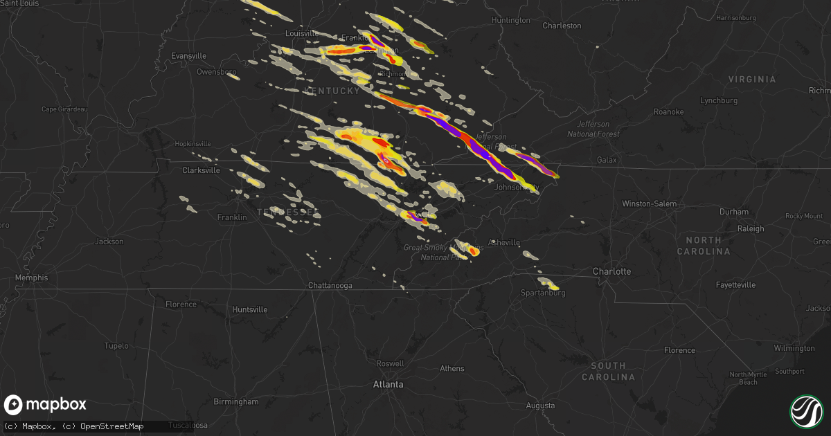
Hail Map on July 27, 2014
Get this storm
July 27 map
$229
one time, instant access
Download today. No call, no setup
Keep the $229
Bought the map and want the full workflow? Apply the entire $229 to a subscription within 7 days. None of it is wasted.
Every map, not just this one
This buys you this map. Subscription and you get every map we run, in the markets you choose from a few cities to whole states to nationwide. Plus real-time alerts the moment a storm fires.
Contact data
Name, contact info, occupancy, even credit band for addresses in the footprint. You go from where it hit to who to call.
Become the source they trust
Unlimited branding weather history reports on demand. You already have the documented answer ready for the property owner, and you are the one who showed up with it.
Property data and RoofTrace estimates
Pull up any address you have got, its value and the exact code rules for that jurisdiction, straight from One Click Code. Then RoofTrace estimates the squares, pitch, and roof value, priced the way you price.
States Impacted by Hail Map on July 27, 2014
Storm reports
Vermont
| Date | Description |
|---|---|
| 07/27/20146:40 PM CDT | Tree down on thaddeus stevens road |
| 07/27/20146:20 PM CDT | A local report indicates 1.00 inch wind near 2 NNW WILLISTON |
| 07/27/20145:40 PM CDT | 1 inch hail covered ground. |
| 07/27/20144:35 PM CDT | A local report indicates 1.50 inch wind near 2 WSW WESTFORD |
| 07/27/20144:20 PM CDT | 1.5 inch diameter hail |
| 07/27/20144:18 PM CDT | A local report indicates 1.00 inch wind near NORTH FERRISBURGH |
| 07/27/20144:10 PM CDT | Tree wires down on converse bay road. |
Ohio
| Date | Description |
|---|---|
| 07/27/20146:54 PM CDT | Power pole down in the county road 15 and county road h area. |
| 07/27/20146:18 PM CDT | One tree down. Time estimated from radar. |
| 07/27/20145:43 PM CDT | One tree down on mccloskey school road |
| 07/27/20145:39 PM CDT | One tree down on harin-wapokoneta road |
| 07/27/20145:15 PM CDT | Power lines were blown down on the west side of cridersville. |
| 07/27/20145:05 PM CDT | 4 inch diameter tree limb broken off...sr 117 and sr 66 near spencerville. |
| 07/27/20144:40 PM CDT | Multiple trees down. Heavy rain. |
| 07/27/20144:38 PM CDT | Power outages caused by downed trees on power lines |
| 07/27/20144:38 PM CDT | Power outages caused by downed trees on power lines |
| 07/27/20143:50 PM CDT | A local report indicates 1.25 inch wind near HANNIBAL |
| 07/27/20143:47 PM CDT | One tree down across palmer road |
| 07/27/20142:40 PM CDT | A barn roof was partially removed...leading to partial collapse |
| 07/27/20142:29 PM CDT | Part of roof including trusses lifted off home on us 36 and several apple trees uprooted. Time estimated from radar. |
| 07/27/20142:29 PM CDT | Roof damage to a residence...large tree uprooted...and several branches down in the area. |
| 07/27/20142:26 PM CDT | Part of roof including trusses lifted off home on us 36 and several apple trees uprooted. Time estimated from radar. |
| 07/27/20142:26 PM CDT | Roof damage to a residence...large tree uprooted...and several branches down in the area. |
| 07/27/201412:45 PM CDT | Several trees down across the northern part of the county. Time and specific location estimated. |
| 07/27/201412:33 PM CDT | Time estimated from radar. |
| 07/27/201412:30 PM CDT | Car shelter blown away...broken windows in rv...several 6-9 inch limbs down |
| 07/27/201412:25 PM CDT | Large tree down at state route 4 and hoskins rd. Time estimated from radar. |
| 07/27/201412:18 PM CDT | A few trees down in price cemetery. Time estimated from radar. |
| 07/27/201411:55 AM CDT | Large hail and tree limbs down near 739 northwest of richwood. |
| 07/27/201411:23 AM CDT | A local report indicates 1.00 inch wind near 4 E BELLE CENTER |
| 07/27/201410:39 AM CDT | Tree and power lines down. Semi trailer flipped over. |
| 07/26/20148:46 PM CDT | Section of large tree down on home along meadowbrook drive causing some damage. |
| 07/26/20148:35 PM CDT | 8 inch diameter tree across road near 303 and stanley road. |
| 07/26/20148:30 PM CDT | Several trees were reported down in rome township along dodgeville road. |
| 07/26/20148:20 PM CDT | At least 4 trees were blown down in kinsman township. |
| 07/26/20148:05 PM CDT | Small to medium branches down. Wind estimated at 65 to 75 mph. |
| 07/26/20148:00 PM CDT | 80 mph wind estimated with gust front. A few small trees and branches down on 43. |
| 07/26/20147:52 PM CDT | Spotter estimates 50 to 60 mph wind gust and heard trees snap and break with the wind. |
| 07/26/20147:43 PM CDT | Numerous trees and power lines blown down along route 62 south of hillsboro. A mobile home was partially turned. |
| 07/26/20147:43 PM CDT | Numerous trees and power lines were blown down along route 62 south of hillsboro. Green...ervin...and ivy hill roads are closed due to debris. A mobile home was partial |
| 07/26/20147:27 PM CDT | A large tree was blown over. |
| 07/26/20147:20 PM CDT | A large tree was knocked down. Scattered power outages were reported in lakewood. |
Nevada
| Date | Description |
|---|---|
| 07/27/20144:40 PM CDT | Warm springs summit community environmental monitoring program mesonet site...7550 feet above sea leve |
Maryland
| Date | Description |
|---|---|
| 07/27/201410:33 AM CDT | Tree down on falls rd near the intersection of mt carmel rd |
| 07/26/201411:29 PM CDT | Large tree fell into a house in the 1600 block of clayton road. Several other large trees down along clayton road. |
| 07/26/201411:25 PM CDT | Several large tree branches down on property. |
| 07/26/201410:35 PM CDT | Tree down on falls rd near the intersection of mt carmel rd. |
| 07/26/201410:33 PM CDT | Tree down on falls rd near the intersection of mt carmel rd |
| 07/26/201410:30 PM CDT | Trees down near the intersection of grave run road and roller road. |
New York
| Date | Description |
|---|---|
| 07/27/20143:10 PM CDT | Tree and broken pole down. Route 66 blocked. |
| 07/27/20142:55 PM CDT | A local report indicates 1.25 inch wind near AVERILL PARK |
| 07/27/20142:55 PM CDT | A tree down on route 66 and also route 43b. |
| 07/27/20142:51 PM CDT | Nickel and quarter size hail |
| 07/27/20142:20 PM CDT | Trees...large tree limbs and wires down on 1157 7th avenue...313 7th st...and 559 4th avenue. |
| 07/27/20143:17 AM CDT | Pine tree limb down through mobile home roof |
| 07/27/20143:00 AM CDT | Trees limbs reported down |
Connecticut
| Date | Description |
|---|---|
| 07/27/20146:55 PM CDT | Trees and wires down on johnathan lane |
| 07/27/20146:52 PM CDT | Tree down on wires on route 320 by the mansfield line |
| 07/27/20146:43 PM CDT | Trees and wires down on reed road at mile hill |
| 07/27/20146:40 PM CDT | Trees and wires down on cider mill road |
| 07/27/20146:32 PM CDT | Tree down on wires at frog hill road |
| 07/27/20146:18 PM CDT | A local report indicates 1.00 inch wind near ENFIELD |
| 07/27/20146:18 PM CDT | Trees and wires down on north maple street |
| 07/27/20146:05 PM CDT | Trees and wires down on george wood road |
| 07/27/20145:55 PM CDT | A local report indicates 58 MPH wind near ENFIELD |
| 07/27/20145:55 PM CDT | Tree on a car located on shaker road |
| 07/27/201411:50 AM CDT | Ef-o tornado confirmed by nws storm survey. For additional information see the public information statement. |
| 07/26/20147:05 PM CDT | A tree and wires down on codfish falls road |
Pennsylvania
| Date | Description |
|---|---|
| 07/27/20146:45 PM CDT | Trees down |
| 07/27/20146:31 PM CDT | Trees and wires down in state college...pine grove mills and bellefonte. |
| 07/27/20146:30 PM CDT | Trees down |
| 07/27/20146:29 PM CDT | Trees and wires down. |
| 07/27/20146:25 PM CDT | Trees and wires down in pine grove mills |
| 07/27/20146:25 PM CDT | Confirmed microburst 80 mph |
| 07/27/20145:48 PM CDT | Trees down across |
| 07/27/20145:45 PM CDT | Numerous trees and wires down east of shiremanstown |
| 07/27/20145:45 PM CDT | Trees down |
| 07/27/20145:37 PM CDT | Trees and wires down. |
| 07/27/20145:35 PM CDT | Trees and wires down. |
| 07/27/20145:35 PM CDT | Trees and wires down. |
| 07/27/20145:35 PM CDT | A local report indicates 65 MPH wind near MECHANICSBURG |
| 07/27/20145:30 PM CDT | Trees down |
| 07/27/20145:05 PM CDT | Multiple trees down |
| 07/27/20144:30 PM CDT | Ten to fifteen trees blown down near cavalier drive. Several other trees snapped and minor damage to a barn. |
| 07/27/20144:30 PM CDT | Trees down on wires. |
| 07/27/20144:26 PM CDT | A local report indicates 1.00 inch wind near MCCONNELLSTOWN |
| 07/27/20144:15 PM CDT | Multiple trees down in farmington twp....wasington twp....and highland twp. |
| 07/27/20143:35 PM CDT | Trees down on powerlines at 627 n. Cherry st. In worthington |
| 07/26/201410:50 PM CDT | Trees and wires down in glenolden. |
| 07/26/201410:50 PM CDT | Three trees down in philadelphia. |
| 07/26/201410:50 PM CDT | Trees and wires down in upper darby. |
| 07/26/201410:49 PM CDT | Trees and wires down in folcroft. |
| 07/26/201410:48 PM CDT | Trees and wires down in collingdale. |
| 07/26/201410:36 PM CDT | A few trees and limbs down with roads blocked off in middletown twp. |
| 07/26/201410:29 PM CDT | A few trees and limbs down with some roads blocked off in concord twp. |
| 07/26/20149:57 PM CDT | Tree down in franconia township. |
| 07/26/20149:50 PM CDT | A few trees down in lower salford twp. Tree down along cressman road and shadynook road. Tree down along old skippack road. Tree down along main street and maple ave. T |
| 07/26/20149:40 PM CDT | Several large limbs down. |
| 07/26/20148:34 PM CDT | Route 10 closed at wawassan drive due to downed poles and wires. |
| 07/26/20147:30 PM CDT | Trees down at dutch wonderland |
| 07/26/20147:00 PM CDT | Trees down |
Massachusetts
| Date | Description |
|---|---|
| 07/27/20145:57 PM CDT | Tree down on a house on prynnwood road |
| 07/27/20145:50 PM CDT | Large branches down on route 202 |
| 07/27/20145:40 PM CDT | A large tree and power lines are down on elmwood road |
| 07/27/20145:32 PM CDT | Several trees are down on route 57 |
| 07/27/20145:30 PM CDT | Tree down on meadow road |
| 07/27/20145:30 PM CDT | Trees and wires down on prospect ave |
| 07/27/20145:20 PM CDT | Tree down on tolland road |
| 07/27/20145:16 PM CDT | A local report indicates 1.00 inch wind near OTIS |
| 07/27/20145:05 PM CDT | Trees and power lines down on route 20 |
| 07/27/20144:45 PM CDT | Tree down on wires on route 20 near route 112. |
| 07/27/20144:21 PM CDT | Large tree and wires down on becket road |
| 07/27/20144:01 PM CDT | Tree down |
| 07/27/20143:55 PM CDT | The tornado touched down in greenridge park along south street and moved southeast up a hill and ended behind residences along lindsay drive. The tornado almost complet |
| 07/27/20143:55 PM CDT | Possible microburst. Several trees down and damage to houses. Time estimated by radar. |
| 07/27/20143:50 PM CDT | Trees down on holmes road |
| 07/27/20143:40 PM CDT | Tree down on wires on powder mtn rd. |
New Jersey
| Date | Description |
|---|---|
| 07/27/201412:08 AM CDT | Trees down with some damage to homes in the hoot owl subdivision in medford township. Two homes with major damage and uninhabitable. About 4 to 5 homes with some shingl |
Virginia
| Date | Description |
|---|---|
| 07/27/20145:35 PM CDT | A local report indicates 1.75 inch wind near 1 NW BRISTOL VA |
| 07/27/20144:12 PM CDT | A local report indicates 2.75 inch wind near DUFFIELD |
| 07/27/20144:12 PM CDT | Several trees down |
| 07/27/20144:10 PM CDT | 2 police cars destroyed by damage from golf ball size or larger hail. Lots of debris on roadways. |
| 07/27/20144:03 PM CDT | A local report indicates 2.00 inch wind near DRYDEN |
| 07/27/20144:00 PM CDT | A local report indicates 2.50 inch wind near PENNINGTON GAP |
| 07/27/20144:00 PM CDT | A local report indicates 1.75 inch wind near DRYDEN |
| 07/27/20143:54 PM CDT | A local report indicates 1.75 inch wind near PENNINGTON GAP |
| 07/26/20148:53 PM CDT | At residence on stout rd. |
| 07/26/20148:50 PM CDT | Golf ball size hail reported in the 3700 block of swover creek road. |
West Virginia
| Date | Description |
|---|---|
| 07/27/20146:18 PM CDT | Trees down all along rt 16 from ellenboro north to pleasants county |
| 07/27/20146:18 PM CDT | Time estimated from radar. Multiple trees blocking turkey run off rt 16. Crews are still attempting to clear the roads. |
| 07/27/20144:00 PM CDT | An nws storm survey found damage north of new martinsville on the afternoon of july 27th was from a downburst with an estiamted maximum wind speed near 75 mph. The down |
| 07/27/20143:50 PM CDT | Multiple mobile homes damaged from fallen trees in new martinsville |
| 07/27/20143:50 PM CDT | A local report indicates 1.75 inch wind near 2 N NEW MARTINSVILLE |
| 07/26/20149:20 PM CDT | Large tree down along smith creek rd |
| 07/26/20149:15 PM CDT | Tree down across jefferson road. |
| 07/26/20149:10 PM CDT | Evidence of large branches down on i64 on ramp at mccorkle ave. |
| 07/26/20148:39 PM CDT | Wv511 reports trees down across road at glady fork and us33 wb |
| 07/26/20148:35 PM CDT | Substantial damage to trees and power infrastructure along shavers fork road and channels mill road relayed via emergency management and social media. Numerous trees sn |
| 07/26/20148:34 PM CDT | Multiple trees and powerlines down in leading creek...gilman...and kerens areas of randolph county. Report via facebook. |
| 07/26/20148:33 PM CDT | Substantial damage to trees and power infrastructure along shavers fork road and channels mill road relayed via emergency management and social media. Numerous trees sn |
| 07/26/20148:25 PM CDT | Several trees reported down. Time estimated from radar. |
| 07/26/20148:20 PM CDT | Several trees and powerlines down in the gilman and leading creek communities. Time estimated from radar. |
| 07/26/20148:11 PM CDT | Trees down on audra park state rd. 911 center said trees down all over barbour county. |
| 07/26/20148:07 PM CDT | Twitter picture of hail next to a golf ball...roughly 1 inch estimated. |
| 07/26/20148:07 PM CDT | Wv511 reports trees down across us250nb at belington industrial park rd. |
| 07/26/20148:02 PM CDT | Trees down through audra state park. |
| 07/26/20147:55 PM CDT | Numerous trees down along rt 20 near century. Time estimated from radar. |
| 07/26/20147:55 PM CDT | Structural damage to home in century. Photo on twitter. |
| 07/26/20147:50 PM CDT | Rv destroyed in the century 2 community. |
| 07/26/20147:16 PM CDT | Media received a report of a tornado in north bend state park. Time est from radar |
| 07/26/20147:04 PM CDT | Large tree branches and top halves of several trees snapped along n river rd. |
Tennessee
| Date | Description |
|---|---|
| 07/27/20146:57 PM CDT | A local report indicates 1.00 inch wind near 1 E OAK RIDGE |
| 07/27/20146:45 PM CDT | 2 trees down on indian gap rd in andersonville. |
| 07/27/20146:40 PM CDT | Numerous trees down as the storms passed through knoxville. |
| 07/27/20146:30 PM CDT | A local report indicates 1.00 inch wind near LAUREL BLOOMERY |
| 07/27/20146:30 PM CDT | Few trees down. |
| 07/27/20146:20 PM CDT | A local report indicates 1.00 inch wind near NORRIS |
| 07/27/20146:15 PM CDT | Two trees down - 1 in maynardville and 1 in corryton. |
| 07/27/20145:42 PM CDT | Tree down and power outage on briar ave. |
| 07/27/20145:40 PM CDT | Tree fell onto a house and car on old allardt road just southeast of jamestown |
| 07/27/20145:40 PM CDT | Tree fell onto a house and car in jamestown |
| 07/27/20145:39 PM CDT | Quarter size hail reported by 911 center and trained spotter in jamestown |
| 07/27/20145:33 PM CDT | Trees and power lines down sw and south of jamestown |
| 07/27/20145:05 PM CDT | 10 homes completely destroyed in speedwell along old hwy 63. Reported by emergency manager. |
| 07/27/20144:58 PM CDT | Ef3 tornado with estimated winds between 140 and 150 mph. Path length was 4.65 miles...with a width of 800 yards. Numerous trees were uprooted and snapped along the ent |
| 07/27/20144:54 PM CDT | Possible tornado damage near gray. Numerous trees and powerlines down along with damage to several homes. |
| 07/27/20144:53 PM CDT | A local report indicates 1.75 inch wind near GRAY |
| 07/27/20144:47 PM CDT | Ef1 tornado with estimated winds of 100 mph. Path length was 7.1 miles...with a width of 300 yards. Many trees were blown down along the path. Some houses had structura |
| 07/27/20144:45 PM CDT | Ef1 tornado with estimated winds of 110 mph. Path length was 0.5 miles...with a width of 50 yards. One house was heavily damaged...and a few other houses and barns had |
| 07/27/20144:45 PM CDT | Possible tornado damage from roughly exit 56 on i-81 to exit 10 on i-26. Several damaged or destroyed homes and other structures. Large trees down throughout this area. |
| 07/27/20144:42 PM CDT | A local report indicates 2.75 inch wind near KINGSPORT |
| 07/27/20144:40 PM CDT | Several trees down |
| 07/27/20144:38 PM CDT | A local report indicates 1.75 inch wind near 3 W KINGSPORT |
| 07/27/20144:35 PM CDT | Reports of a possible tornado touchdown in the church hill and carter valley area. Numerous trees and powerlines down with moderate damage to some homes. |
| 07/27/20144:35 PM CDT | Several tress and powerlines down |
| 07/27/20143:00 PM CDT | A local report indicates 1.75 inch wind near 4 SW JELLICO |
| 07/27/20142:41 PM CDT | A local report indicates 2.75 inch wind near WINFIELD |
| 07/26/201411:45 PM CDT | Few trees down along foothills parkway. |
| 07/26/201411:30 PM CDT | Few trees down along foothills parkway. |
| 07/26/201411:28 PM CDT | Tree down across old shelbyville rd |
| 07/26/201411:20 PM CDT | Powerlines down along jacksboro rd |
| 07/26/201411:15 PM CDT | Couple of trees down in newport. |
| 07/26/201411:10 PM CDT | Few trees down along highway 30. |
| 07/26/201410:50 PM CDT | Few trees down along susong rd. |
| 07/26/201410:45 PM CDT | Trees down across crossville highway |
| 07/26/201410:40 PM CDT | Several broken limbs... Largest being 18 inches in diameter and 70 to 80 feet long |
| 07/26/201410:30 PM CDT | Power pole snapped in half across fred hill road |
| 07/26/201410:30 PM CDT | Few trees down along sandbar rd. |
| 07/26/201410:30 PM CDT | Few trees down along sandbar rd. |
| 07/26/201410:30 PM CDT | Several trees down. |
| 07/26/201410:20 PM CDT | Trees down across the 2600 block of oak grove road |
| 07/26/201410:20 PM CDT | Tree down on house in lyles |
| 07/26/201410:20 PM CDT | Several trees down in andersonville. |
| 07/26/201410:20 PM CDT | Few trees down along bibles chapel rd. |
| 07/26/201410:15 PM CDT | Tree down in jackson valley subdivision |
| 07/26/201410:10 PM CDT | Numerous trees down across roadways in area of cookeville highway and pine grove road with several homes damaged. Ema currently assessing damage in area. |
| 07/26/201410:05 PM CDT | Few trees down along woolsey rd. |
| 07/26/201410:00 PM CDT | Tree fell onto a house and car on cornwell avenue in watertown causing significant damage |
| 07/26/201410:00 PM CDT | Most of fentress county without power and numerous trees down blocking roadways |
| 07/26/20149:54 PM CDT | Multiple trees were reported down on tidwell switch road. Power outages were also reported in bon aqua. |
| 07/26/20149:50 PM CDT | Tree down at chandler road and old lebanon dirt road in hermitage |
| 07/26/20149:50 PM CDT | Tree down at tulip grove rd and chandler rd with tulip grove road blocked and closed. |
| 07/26/20149:50 PM CDT | Several trees down and minor damage to three homes. |
| 07/26/20149:45 PM CDT | Tree fell on power lines in north cookeville |
| 07/26/20149:40 PM CDT | A tree was snapped and fell onto a carport badly damaging the carport and the two cars under it. |
| 07/26/20149:35 PM CDT | Power lines down on hill street in lebanon |
| 07/26/20149:30 PM CDT | Tree down across old hunters point pike blocking the roadway |
| 07/26/20149:28 PM CDT | Tree down along saundersville rd next to old hickory lake |
| 07/26/20149:27 PM CDT | A tree was blocking the roadway at bradshaw road and nw williams road. |
| 07/26/20149:27 PM CDT | Tree down at the intersection of estes road and luchan road. The tree was blocking the roadway. |
| 07/26/20149:25 PM CDT | Tree down on greenhill road at windtree trace blocking the roadway |
| 07/26/20149:25 PM CDT | Tree down blocking hunters crossing drive |
| 07/26/20149:15 PM CDT | Tree down on lickton pike |
| 07/26/20148:50 PM CDT | Tree down in coopertown |
| 07/26/20148:45 PM CDT | Trees down across the southern portions of whitehouse |
| 07/26/20148:45 PM CDT | Three trees down in yard of home in adams |
| 07/26/20148:40 PM CDT | Tree down on johnny spears road |
| 07/26/20148:33 PM CDT | Quarter sized hail reported by spotter and amateur radio. |
| 07/26/20148:25 PM CDT | Tree down at highway 31 and gifford lane in bethpage. A few other scattered trees down around bethpage. |
| 07/26/20148:15 PM CDT | Trees down and a carport damaged on ford pike near the tennessee river and university height apartments. |
| 07/26/20148:12 PM CDT | Quarter sized hail on alcoa hwy about 1/2 mile from ut medical center. |
| 07/26/20147:53 PM CDT | Trees down on boyds creek rd and east park lane. |
| 07/26/20147:50 PM CDT | Large tree fell on a bus stop shelter near the university heights apartments...1319 knotty pine way. The bus stop shelter was completely destroyed. |
| 07/26/20147:44 PM CDT | Trees down on hwy 321 between walland and townsend. |
| 07/26/20147:42 PM CDT | Quarter sized hail 1 mile east of shaad rd. |
| 07/26/20147:34 PM CDT | Quarter size hail on cusick rd. |
| 07/26/20147:00 PM CDT | Trees down across southern end of jefferson county. |
| 07/26/20147:00 PM CDT | Trees down in the topside rd area just nw of the airport. |
Michigan
| Date | Description |
|---|---|
| 07/27/20146:17 PM CDT | A couple of downed trees |
| 07/27/20146:04 PM CDT | 10 trees down blocking road |
| 07/27/20145:51 PM CDT | 14 inch tree limb reported down. |
| 07/27/20145:51 PM CDT | At green and plymouth |
| 07/27/20145:46 PM CDT | 3 foot diameter tree down on a house at jefferson and east |
| 07/27/20145:30 PM CDT | 10 inch diameter limb down |
| 07/27/20145:30 PM CDT | Large limbs down near waterloo and roe roads |
| 07/27/20145:29 PM CDT | Eaton 911 center reporting trees down in the area to include wilcox rd near boody hwy and houston rd |
| 07/27/20145:25 PM CDT | Trees down near telegraph and armstrong |
| 07/27/20145:21 PM CDT | A local report indicates 1.00 inch wind near MANCHESTER |
| 07/27/20145:21 PM CDT | At austin rd and manchester rd |
| 07/27/20145:13 PM CDT | Trees and wires reported down in leslie and onondaga area. |
| 07/27/20145:00 PM CDT | Limbs down and power outages |
| 07/27/20144:53 PM CDT | Tree down at m50 and billmyer rd |
| 07/27/20144:53 PM CDT | Trees down up to 3 feet in diameter on m-57 between irish rd and m-15 |
| 07/27/20144:47 PM CDT | Tree limbs greater than one foot diameter down near metro beach in harrison twp |
| 07/27/20144:46 PM CDT | Large tree fell onto house. Multiple large tree limbs also down. |
| 07/27/20144:46 PM CDT | Trees snapped and uprooted at metro villa dr and north pointe pkwy in harrison twp |
| 07/27/20144:37 PM CDT | 25 mile and jewell |
| 07/27/20144:30 PM CDT | A local report indicates 1.25 inch wind near EDMORE |
| 07/27/20144:30 PM CDT | At martin and hoover |
| 07/27/20144:30 PM CDT | Large branch down on powerlines |
| 07/27/20144:30 PM CDT | A local report indicates 60 MPH wind near 3 SE BIRCH RUN |
| 07/27/20144:28 PM CDT | Small branches down |
| 07/27/20144:24 PM CDT | Few trees reported down by em |
| 07/27/20144:20 PM CDT | Fell for 7 minutes at half dollar size. Also 45 mph gust. |
| 07/27/20144:15 PM CDT | One large limb down at stanford and cambridge in berkley |
| 07/27/20144:15 PM CDT | 15 inch diameter limb down |
| 07/27/20144:14 PM CDT | Large tree limbs down at 12 mile and dequindre |
| 07/27/20144:10 PM CDT | At square lake and woodward |
| 07/27/20144:07 PM CDT | Power lines down for one half mile and damage to porch at birch run and stewart |
| 07/27/20144:07 PM CDT | Spotter estimated quarter size hail falling at the time of report |
| 07/27/20144:07 PM CDT | Barn roof torn off... Trees uprooted. Fergus rd in st charles |
| 07/27/20144:05 PM CDT | Received a call from the public regard a power pole and tree that was down nearest to raymond and westbrook. Power lines were down in the yard. Time est by radar. |
| 07/27/20144:05 PM CDT | At square lake and opdyke |
| 07/27/20144:05 PM CDT | Large limbs down on i-75 south of square lake road |
| 07/27/20144:05 PM CDT | A local report indicates 60 MPH wind near CHESANING |
| 07/27/20144:02 PM CDT | 4 inch diameter branches down at cass lake and orchard lake roads |
| 07/27/20144:00 PM CDT | A couple of trees down with size unknown. |
| 07/27/20144:00 PM CDT | A local report indicates 1.00 inch wind near ALMA |
| 07/27/20144:00 PM CDT | Tree uprooted |
| 07/27/20144:00 PM CDT | 10 inch diameter branch took down powerline across frost road |
| 07/27/20144:00 PM CDT | 6 inch limb down at west bloomfield and cass lake road |
| 07/27/20144:00 PM CDT | Multiple limbs down at telegraph and voorhies. Relayed via twitter. |
| 07/27/20144:00 PM CDT | Tree fell onto house. |
| 07/27/20143:58 PM CDT | Tree branches down in the area |
| 07/27/20143:55 PM CDT | A local report indicates 1.00 inch wind near PARCHMENT |
| 07/27/20143:55 PM CDT | Few trees down with size unknown. |
| 07/27/20143:50 PM CDT | Small trees snapped and a large oak tree uprooted. Metal car port roof destroyed. Damage occurred near cooley lake road and cass elizabeth road. |
| 07/27/20143:50 PM CDT | Measured at airport road and m-59 |
| 07/27/20143:49 PM CDT | Measured at pontiac oakland county international airport /kptk/ |
| 07/27/20143:45 PM CDT | Large limbs down |
| 07/27/20143:45 PM CDT | Delayed report received |
| 07/27/20143:43 PM CDT | Measured at bogie lk and cooley lk roads |
| 07/27/20143:42 PM CDT | A local report indicates 1.75 inch wind near WHITE LAKE |
| 07/27/20143:40 PM CDT | Public sent pictures of 2 inch hail to local media which was relayed to nws courtesy of wood-tv. |
| 07/27/20143:40 PM CDT | A local report indicates 1.00 inch wind near PLAINWELL |
| 07/27/20143:40 PM CDT | A local report indicates 1.75 inch wind near 4 SE ROSE CENTER |
| 07/27/20143:40 PM CDT | Measured in white lake twp |
| 07/27/20143:38 PM CDT | Measured in white lake twp |
| 07/27/20143:38 PM CDT | Spotter measured golfball size hail near allegan st. In cooper township area |
| 07/27/20143:35 PM CDT | Power lines down. |
| 07/27/20143:35 PM CDT | At mobile home park at milford and middle roads. 80 percent of mobile homes damaged with broken windows. |
| 07/27/20143:35 PM CDT | At duck lake rd and m-59 |
| 07/27/20143:35 PM CDT | Trees and large limbs down blocking the road. Sheriff on the scene. |
| 07/27/20143:35 PM CDT | Trained spotter estimated 60 mph gust near ravine and 6th st. Dime size hail was also falling. |
| 07/27/20143:32 PM CDT | Report relayed with pictures. At harvey lake and wardlow. |
| 07/27/20143:31 PM CDT | A local report indicates 1.75 inch wind near HIGHLAND |
| 07/27/20143:30 PM CDT | A local report indicates 1.00 inch wind near EDMORE |
| 07/27/20143:30 PM CDT | Harvey lake rd and milford rd |
| 07/27/20143:25 PM CDT | At m-20 and 11 mile |
| 07/27/20143:23 PM CDT | Local business reported that multiple trees were knocked down in the waterloo state recreation trails blocking trails. |
| 07/27/20143:23 PM CDT | A local report indicates 1.00 inch wind near 1 SW WATERLOO |
| 07/27/20143:15 PM CDT | A local report indicates 1.00 inch wind near 3 ENE HARTLAND |
| 07/27/20143:05 PM CDT | Numerous trees down in rives and parma townships. |
| 07/27/20143:04 PM CDT | Report relayed by media of quarter size hail that fell for approximately 6 minutes near big rapids. |
| 07/27/20143:03 PM CDT | Report relayed by ham radio operator of quarter size hail that fell in zeeland area |
| 07/27/20142:38 PM CDT | Multiple trees down on blackmore rd...flag pole snapped in half and half inch hail |
| 07/27/20142:38 PM CDT | Road commission reported that they had to clean off multiple trees on winn road just south of m20. |
| 07/27/20142:35 PM CDT | Time of event estimated from radar. |
| 07/27/20142:30 PM CDT | A local report indicates 1.00 inch wind near 2 E DEWITT |
| 07/27/20142:25 PM CDT | Trees down in prudenville |
| 07/27/20142:15 PM CDT | A local report indicates 1.00 inch wind near 4 S TRAVERSE CITY |
| 07/27/20142:12 PM CDT | Powerlines down in houghton lake |
| 07/27/20142:10 PM CDT | Relayed with pictures |
| 07/27/20142:10 PM CDT | A local report indicates 1.25 inch wind near 5 N BAY CITY |
| 07/27/20142:10 PM CDT | In bangor twp right on saginaw bay |
| 07/27/20142:06 PM CDT | A local report indicates 1.00 inch wind near 1 NE STEVENSVILLE |
| 07/27/20142:05 PM CDT | Relayed via shave project |
| 07/27/20142:00 PM CDT | A local report indicates 1.75 inch wind near KAWKAWLIN |
| 07/27/20142:00 PM CDT | Relayed via shave project. |
| 07/27/20142:00 PM CDT | Relayed via shave project |
| 07/27/20141:56 PM CDT | Relayed via shave project |
| 07/27/20141:55 PM CDT | A local report indicates 1.00 inch wind near 2 E WURTSMITH AIRFIELD |
| 07/27/20141:55 PM CDT | A local report indicates 1.00 inch wind near 2 E WURTSMITH AIRFIELD |
| 07/27/20141:52 PM CDT | Relayed by ema with video footage of hail to golfball size falling |
| 07/27/20141:50 PM CDT | Relayed via shave project |
| 07/27/20141:50 PM CDT | Relayed via shave project |
| 07/27/20141:49 PM CDT | Relayed via shave project |
| 07/27/20141:43 PM CDT | Relayed by shave project |
| 07/27/20141:41 PM CDT | Relayed via shave project. |
| 07/27/20141:30 PM CDT | A local report indicates 2.00 inch wind near 2 ENE MIDLAND |
| 07/27/20141:30 PM CDT | Lots of 1.5 inch hail...a few to 1.75 inches. Relayed via facebook with pictures. |
| 07/27/20141:30 PM CDT | Relayed via shave project |
| 07/27/20141:21 PM CDT | Relayed via shave report. |
| 07/27/20141:15 PM CDT | Trees down in glennie |
| 07/27/201412:58 PM CDT | A local report indicates 1.00 inch wind near 4 NE FREDERIC |
| 07/27/201412:55 PM CDT | 8 inch diameter pine tree snapped in half in waters |
| 07/27/201412:55 PM CDT | Couple trees blown over. Also reported 1/2 inch hail. |
| 07/27/201411:49 AM CDT | Hail ranging in size from dime sized to quarter sized |
| 07/27/201411:40 AM CDT | A local report indicates 1.00 inch wind near GRAYLING |
| 07/27/201411:40 AM CDT | A 4 to 6 inch healthy tree fell on a car. A 16 to 18 inch dead and rotting tree fell on house. |
| 07/27/201411:20 AM CDT | A local report indicates 1.00 inch wind near FREDERIC |
Maine
| Date | Description |
|---|---|
| 07/27/20146:15 PM CDT | Trees down at storrs hill ski area |
Indiana
| Date | Description |
|---|---|
| 07/27/20145:22 PM CDT | One tree downed on caldwell road |
| 07/27/20145:17 PM CDT | One tree downed blocking foundry road. Time estimated. |
| 07/27/20144:26 PM CDT | Small to medium branches down in town |
| 07/27/20144:05 PM CDT | Numerous tree limbs and power lines down in mooresville. |
| 07/27/20144:02 PM CDT | Downed tree on state road 1 and tonkel rd. Other debris on the road. |
| 07/27/20143:43 PM CDT | Posted on nws facebook page |
| 07/27/20143:31 PM CDT | Intersection of coldwater and till roads |
| 07/27/20143:23 PM CDT | Fountain county dispatch reported a tree down on a power line near sr-63 just north of the warren county line. |
| 07/27/20143:18 PM CDT | Picture of at least golf ball size hail |
| 07/27/20143:10 PM CDT | A local report indicates 1.00 inch wind near 2 N NORTH WEBSTER |
| 07/27/20143:06 PM CDT | Power line down us 33 near churbusco |
| 07/27/20143:06 PM CDT | Tree down covering epworth forest road. Size unknown but front end loader being requested |
| 07/27/20142:55 PM CDT | On us 6 just east of state route 15 |
| 07/27/20142:50 PM CDT | Reports of tree limbs and power down along us 33 in southern parts of the county. |
| 07/27/20142:50 PM CDT | A local report indicates 1.25 inch wind near SOUTH BEND |
| 07/27/20142:37 PM CDT | A local report indicates 1.00 inch wind near 2 N NORTH WEBSTER |
| 07/27/20142:20 PM CDT | A local report indicates 1.25 inch wind near 5 WNW WOODLAND |
| 07/27/20142:19 PM CDT | Fountain county dispatch reported a tree down on a power line near sr-63 just north of the warren county line. |
| 07/27/20142:00 PM CDT | Picture of larger than quarter size hail on nws facebook page |
| 07/27/201410:20 AM CDT | Hail up to quarter size. |
North Carolina
| Date | Description |
|---|---|
| 07/27/201411:04 AM CDT | A roof blown off from a house on nahunta rd. Time estimated from radar. |
| 07/27/201411:00 AM CDT | All siding blown off of building next to courthouse on 3rd street. Time estimated. |
| 07/27/201410:38 AM CDT | Trees and powerlines reported down in pikeville... Time estimated by radar |
| 07/27/201410:38 AM CDT | Wind gust of 64 mph reported at gsb |
| 07/27/201410:37 AM CDT | Trees and powerlines reported down in goldsboro... Time estimated by radar |
| 07/27/201412:25 AM CDT | Several additional trees down over east asheville from latest round of thunderstorm winds. |
| 07/27/201412:04 AM CDT | Trees down off wilson ave just south of swannanoa... Nc. |
| 07/26/201411:55 PM CDT | Trees down nw of weaverville... Nc. |
| 07/26/201411:10 PM CDT | Several trees reported down across the county.the spring creek area had the greatest number of power outages. Time determined from radar data. |
| 07/26/201410:00 PM CDT | Several large branches blown down off old country rd. |
| 07/26/20149:46 PM CDT | One large tree and numerous large branches blown down off old country rd sw of clyde... Nc. |
| 07/26/20149:40 PM CDT | One large tree and numerous large branches blown down nne of waynesville... Nc. |
| 07/26/20148:49 PM CDT | Large tree on house in green hill community. |
| 07/26/20148:49 PM CDT | Report received on social media. |
| 07/26/20148:45 PM CDT | Trees and power lines down on poors ford road. Trees down on thunder road. Time of occurrence estimated from radar location of storm. |
| 07/26/20148:40 PM CDT | Multiple trees down on soco mountain. Report from wrgc in sylva. |
| 07/26/20148:40 PM CDT | *** 1 fatal *** broadcast media reported a 53-year-old man was extricated from his vehicle then later died from injuries suffered after a tree fell on his vehicle as he |
| 07/26/20148:35 PM CDT | Time determined from radar data. Report from social media. |
| 07/26/20148:10 PM CDT | A tree came down with the initial storm gust near the lake lure dam. At least another tall tree came down near the intersection of pheasant street and red bird drive bl |
| 07/26/20148:00 PM CDT | County reports several trees and power lines down in mountain home area. |
| 07/26/20148:00 PM CDT | Tree and powerline down near apple blossom park drive. Power reported out in the fletcher and arden areas. |
| 07/26/20147:55 PM CDT | Several wind damage reports from haywood county. 849 pm tree down on ratcliff cove road. 850 pm tree down at cruso road and harvest lane. 905 pm trees on power lines on |
| 07/26/20147:55 PM CDT | Cataloochee ranch reported pea sized hail and multiple trees down near the ranch. |
| 07/26/20147:45 PM CDT | Multiple trees down in asheville vicinity... Including cedar lane and old buncombe highway. |
| 07/26/20147:36 PM CDT | Tree down on baileys branch road blocking both lanes in marshall. |
| 07/26/20147:36 PM CDT | Tree down on power line on haywood road. |
| 07/26/20147:35 PM CDT | A couple of trees down blocking chambers farm road and fines creek road. Time determined from radar data. |
| 07/26/20147:07 PM CDT | Tree down on guntertown road. Both lanes blocked. |
New Hampshire
| Date | Description |
|---|---|
| 07/27/20146:15 PM CDT | Trees down at storrs hill ski area |
| 07/27/20146:15 PM CDT | Tree down on mack ave. |
Texas
| Date | Description |
|---|---|
| 07/26/201410:20 PM CDT | Thunderstorm winds downed three utility poles and heavily damaged/destroyed two tin outbuildings. Nearby mesonet and schoolnet sites recorded peak gusts of 57 mph and 5 |
Wisconsin
| Date | Description |
|---|---|
| 07/27/20141:15 PM CDT | One large branch down. Source is twitter photo. Time estimated from radar. |
| 07/27/201412:24 PM CDT | Public report relayed by media. |
| 07/27/201412:00 PM CDT | A local report indicates 1.00 inch wind near PLYMOUTH |
South Carolina
| Date | Description |
|---|---|
| 07/26/20149:46 PM CDT | Numerous trees reported down just west and nw of thicketty... Nc. |
Kentucky
| Date | Description |
|---|---|
| 07/27/20144:40 PM CDT | A local report indicates 1.75 inch wind near 3 N WHITLEY CITY |
| 07/27/20144:35 PM CDT | Tree down on ky-1804 |
| 07/27/20144:35 PM CDT | Tree down along i-25w |
| 07/27/20144:15 PM CDT | Tree down along i-25w in the vicinity of jellico |
| 07/27/20144:15 PM CDT | Tree down on ky-1804 |
| 07/27/20144:15 PM CDT | Tree down along ky-699 |
| 07/27/20144:10 PM CDT | One tree down along pigeon roost road |
| 07/27/20144:05 PM CDT | One tree down along ky-836 |
| 07/27/20144:00 PM CDT | A local report indicates 1.50 inch wind near WHITLEY CITY |
| 07/27/20143:50 PM CDT | Quarter to golf-ball sized hail at alpine recreational area. |
| 07/27/20143:50 PM CDT | A local report indicates 1.75 inch wind near 1 SSE JAMESTOWN |
| 07/27/20143:45 PM CDT | A local report indicates 1.25 inch wind near ALPINE |
| 07/27/20143:40 PM CDT | A local report indicates 1.00 inch wind near S SHIELDS |
| 07/27/20143:38 PM CDT | Hail an inch in diameter... Falling for the past seven minutes. |
| 07/27/20143:36 PM CDT | Trees down off hwy 3140 |
| 07/27/20143:35 PM CDT | A local report indicates 1.00 inch wind near 1 ENE NOLANSBURG |
| 07/27/20143:30 PM CDT | A local report indicates 1.00 inch wind near BRONSTON |
| 07/27/20143:28 PM CDT | Spotter reported quarter size or bigger hail... Also some strong winds. |
| 07/27/20143:24 PM CDT | An ef1 tornado touched down briefly along highway 2009 in southern leslie county. The tornado uprooted and snapped hardwood and softwood trees in a consistent damage pa |
| 07/27/20143:20 PM CDT | Wind ripped vinyl siding off of home. |
| 07/27/20143:18 PM CDT | Trees down. |
| 07/27/20143:15 PM CDT | Trees down knocking out phone service on robinsons creek. |
| 07/27/20143:15 PM CDT | A local report indicates 1.75 inch wind near SSE ESSIE |
| 07/27/20143:11 PM CDT | A local report indicates 1.00 inch wind near ROCK HOUSE |
| 07/27/20143:10 PM CDT | In the community of conley bottom resort |
| 07/27/20143:10 PM CDT | A local report indicates 1.00 inch wind near SSE ESSIE |
| 07/27/20143:05 PM CDT | A local report indicates 2.75 inch wind near BEAR BRANCH |
| 07/27/20143:00 PM CDT | A local report indicates 1.75 inch wind near E PEABODY |
| 07/27/20142:55 PM CDT | Numerous trees down along hwy 66s between peabody and gardner. Trash and debris reported across highway. |
| 07/27/20142:55 PM CDT | A local report indicates 4.25 inch wind near BEAR BRANCH |
| 07/27/20142:54 PM CDT | Trees down due to high winds. |
| 07/27/20142:50 PM CDT | A local report indicates 1.00 inch wind near 1 SW HYDEN |
| 07/27/20142:41 PM CDT | A local report indicates 1.75 inch wind near 2 E STRUNK |
| 07/27/20142:40 PM CDT | A local report indicates 1.00 inch wind near 2 E STRUNK |
| 07/27/20142:40 PM CDT | One tree down. Power lines down on residence. |
| 07/27/20142:40 PM CDT | 2 trees down along ky-149 near mile marker 6 in the vicinity of hector. |
| 07/27/20142:35 PM CDT | 2 trees down along hwy 421 in between mile marker 21 and 22. |
| 07/27/20142:35 PM CDT | In the community of marsh creek. |
| 07/27/20142:35 PM CDT | A local report indicates 2.00 inch wind near E WHITLEY CITY |
| 07/27/20142:29 PM CDT | In the community of revelo |
| 07/27/20142:28 PM CDT | Damage to cars from large hail. |
| 07/27/20142:25 PM CDT | A local report indicates 2.75 inch wind near BURNING SPRINGS |
| 07/27/20142:00 PM CDT | One tree down along scaffold cane road |
| 07/27/20141:55 PM CDT | Tree down along hwy 1350 in the vicinity of dory. |
| 07/27/20141:54 PM CDT | In the community of eadsville. |
| 07/27/20141:25 PM CDT | Trees down on highway 7 and 931. |
| 07/27/20141:25 PM CDT | Trees down on highway 7 and 1103. |
| 07/27/20141:20 PM CDT | A local report indicates 2.75 inch wind near BURNING SPRINGS |
| 07/27/20141:20 PM CDT | Tree across road. |
| 07/27/20141:15 PM CDT | Trees down off hwy 92 |
| 07/27/20141:15 PM CDT | Tree across road on clifty school road. |
| 07/27/20141:10 PM CDT | In the community of maple grove road |
| 07/27/20141:08 PM CDT | One tree down along pigeon roost road |
| 07/27/20141:00 PM CDT | Tree down along ky-1146 |
| 07/27/201412:45 PM CDT | Tree down along ky-267 |
| 07/27/201412:40 PM CDT | Tree down near tenny ave. |
| 07/27/201412:38 PM CDT | A local report indicates 1.50 inch wind near HIATT |
| 07/27/201412:35 PM CDT | Quarter to half dollar size hail |
| 07/27/201412:35 PM CDT | Tree fell across hwy 1110. |
| 07/27/201412:30 PM CDT | A local report indicates 1.25 inch wind near DANVILLE |
| 07/27/201412:25 PM CDT | Tree fell across hwy 1110. |
| 07/27/201412:20 PM CDT | Mudslide with trees in the road on hwy 1812 panbowl lake rd. |
| 07/27/201412:20 PM CDT | Tree and power lines down on wolvervine rd. Next to chestnut gap road. |
| 07/27/201412:20 PM CDT | Tree across road at shoulderblade on 30 west. |
| 07/27/201412:10 PM CDT | Three trees down off hwy 57 near east union |
| 07/27/201412:10 PM CDT | Tree across gilliam road. |
| 07/27/201412:05 PM CDT | Tree across road at old railroad bed road. |
| 07/27/201412:05 PM CDT | Tree across road. |
| 07/27/201412:05 PM CDT | Tree across road blankey branch rd. |
| 07/27/201412:00 PM CDT | Tree across hopewell road. |
| 07/27/201412:00 PM CDT | One tree down along highway 11s in the proctor area. |
| 07/27/201412:00 PM CDT | Tree across black ridge road |
| 07/27/201411:49 AM CDT | A local report indicates 1.00 inch wind near CYNTHIANA |
| 07/27/201411:40 AM CDT | One tree down little hardwicks creek and furnace jct. |
| 07/27/201411:30 AM CDT | One tree down on ky-851 between mile markers 10 and 11. |
| 07/27/201411:30 AM CDT | One tree down along highway 82 between mile markers 3 and 4. |
| 07/27/201411:25 AM CDT | One tree down along ky-89s between mile markers 7 and 8. |
| 07/27/201411:25 AM CDT | One tree down near route 1057 |
| 07/27/201411:20 AM CDT | Tree down on truck near eku campus. |
| 07/27/201411:14 AM CDT | Trees down |
| 07/27/201410:55 AM CDT | Downed trees and 1.75 inch hail near the junction of interstate 75 and interstate 64 |
| 07/27/201410:52 AM CDT | Several trees down in the newtown pike-interstate 75 area along with one inch hail |
| 07/27/201410:50 AM CDT | A brick building destroyed along with several downed trees in the mark avenue area |
| 07/27/201410:44 AM CDT | A local report indicates 2.00 inch wind near VERSAILLES |
| 07/27/201410:40 AM CDT | A local report indicates 1.75 inch wind near LEXINGTON |
| 07/27/201410:39 AM CDT | Significant damage to corn...soybean...and tobacco crops at uk north research farm. Reported by university ag dept. |
| 07/27/201410:35 AM CDT | Straight line winds damaged around six homes and downed many trees between masterson station park and highlands park. Winds were generally around 70 mph... With peak wi |
| 07/27/201410:25 AM CDT | Trees down... Roof of barn partially torn off. |
| 07/27/201410:25 AM CDT | A local report indicates 2.00 inch wind near MT. EDEN |
| 07/27/201410:12 AM CDT | A local report indicates 1.50 inch wind near TAYLORSVILLE |
| 07/27/20149:31 AM CDT | A local report indicates 1.00 inch wind near NE HISEL |
| 07/26/201410:30 PM CDT | One tree down on ky-851 between mile markers 10 and 11. |
| 07/26/201410:25 PM CDT | One tree down along ky-89s between mile markers 7 and 8. |
| 07/26/201410:00 PM CDT | One tree down along highway 11s in the proctor area. |
| 07/26/20149:20 PM CDT | Several trees down in the south end of the county including on highways 2996...628...1804 and 25w. |
| 07/26/20149:00 PM CDT | Several trees down near goldbug and canada town. |
| 07/26/20148:16 PM CDT | Trees down in the northern part of the county. |
| 07/26/20147:55 PM CDT | Hwy 3140 closed due to several downed trees. |
| 07/26/20147:27 PM CDT | Large tree down in town square |
| 07/26/20147:15 PM CDT | One tree down. Also pea size hail. |
| 07/26/20147:06 PM CDT | One tree down. Time estimated from radar. |
Cities Impacted by Hail Map on July 27, 2014
- La Follette, TN
- Pioneer, TN
- Georgetown, KY
- Lexington, KY
- Walland, TN
- Seymour, TN
- Maryville, TN
- Hereford, TX
- Quemado, NM
- Camden, IN
- Logansport, IN
- Delphi, IN
- Galveston, IN
- Clayton, IN
- Danville, IN
- Coatesville, IN
- Paris, KY
- Sadieville, KY
- Corinth, KY
- Cynthiana, KY
- Warsaw, IN
- Danville, KY
- Harrodsburg, KY
- Lancaster, KY
- Mathias, WV
- Duffield, VA
- Stephentown, NY
- Monroe, TN
- Alpine, TN
- Byrdstown, TN
- Jamestown, TN
- Versailles, KY
- Abingdon, VA
- Luther, MI
- Tustin, MI
- Booneville, KY
- Manistee, MI
- Tawas City, MI
- Pennington Gap, VA
- Dryden, VA
- Troy, WV
- Warbranch, KY
- Mozelle, KY
- Helton, KY
- Chappell, KY
- Midland, MI
- Zanesfield, OH
- Bellefontaine, OH
- Huntsville, OH
- Lewistown, OH
- East Liberty, OH
- Burnside, KY
- Bronston, KY
- Monticello, KY
- Whitley City, KY
- Parkers Lake, KY
- Trementina, NM
- Mesick, MI
- Voorhees, NJ
- Gibbsboro, NJ
- Stratford, NJ
- Clementon, NJ
- Somerdale, NJ
- Nappanee, IN
- Clifford, MI
- Silverwood, MI
- Mayville, MI
- Sedona, AZ
- Kawkawlin, MI
- Auburn, MI
- Bay City, MI
- Waterford, OH
- Mackville, KY
- San Carlos, AZ
- Otisville, MI
- Clio, MI
- Millington, MI
- Proctor, WV
- New Martinsville, WV
- Munith, MI
- Jackson, MI
- Grass Lake, MI
- Richmond, KY
- Winchester, KY
- Young, AZ
- Brodhead, KY
- Kingsley, MI
- Sterling, MI
- Standish, MI
- Lost City, WV
- Montrose, MI
- Birch Run, MI
- Somerset, KY
- Oak Park, MI
- Southfield, MI
- Farmington, MI
- Berkley, MI
- Stanwood, MI
- Big Rapids, MI
- West Mansfield, OH
- Rushsylvania, OH
- Ridgeway, OH
- Richwood, OH
- Mount Victory, OH
- Celina, TN
- Zeeland, MI
- Holland, MI
- Manton, MI
- Bloomfield, KY
- Waddy, KY
- Shelbyville, KY
- Taylorsville, KY
- Mount Eden, KY
- Lawrenceburg, KY
- Mcconnelsville, OH
- Malta, OH
- New Boston, MI
- Belleville, MI
- Bloomsbury, NJ
- Milford, NJ
- Ann Arbor, MI
- Camden, WV
- Rutherfordton, NC
- Columbus, NC
- Quincy, MI
- Reading, MI
- Colchester, VT
- Essex Junction, VT
- Westford, VT
- Milton, VT
- Raton, NM
- Big Creek, KY
- Manchester, KY
- Highland, MI
- Holly, MI
- Columbia City, IN
- Albion, IN
- Churubusco, IN
- Mount Carmel, TN
- Blountville, TN
- Kingsport, TN
- Church Hill, TN
- Johnson City, TN
- Gate City, VA
- South Boardman, MI
- Fife Lake, MI
- Linwood, MI
- Pinconning, MI
- Mill Creek, IN
- Stevensville, MI
- Saint Joseph, MI
- London, KY
- Perryville, KY
- Coxs Creek, KY
- Junction City, KY
- Shepherdsville, KY
- Annville, KY
- Butler, TN
- Piney Flats, TN
- Weber City, VA
- Brooks, KY
- Elizabeth, IN
- Rogersville, TN
- Jonesborough, TN
- Hyden, KY
- Holmes Mill, KY
- Stamping Ground, KY
- Midway, KY
- Waco, KY
- Irvine, KY
- Big Stone Gap, VA
- McKee, KY
- Keokee, VA
- Crab Orchard, KY
- Oneida, KY
- Evarts, KY
- Watauga, TN
- Sextons Creek, KY
- Closplint, KY
- Bledsoe, KY
- Big Laurel, KY
- Sizerock, KY
- Clermont, KY
- Louisville, KY
- Fairfield, KY
- Elizabethton, TN
- East Bernstadt, KY
- Mauckport, IN
- Mount Washington, KY
- Laconia, IN
- Livingston, KY
- Corydon, IN
- Saint Charles, VA
- Ravenna, KY
- Central, IN
- Frankfort, KY
- Totz, KY
- Tyner, KY
- Thousandsticks, KY
- West Point, KY
- Orlando, KY
- Stanford, KY
- Burgin, KY
- Springfield, KY
- Stinnett, KY
- Putney, KY
- Mount Vernon, KY
- Essie, KY
- Willisburg, KY
- Bear Branch, KY
- Blackwater, VA
- Waynesburg, KY
- Lebanon Junction, KY
- Muldraugh, KY
- Brandenburg, KY
- Nicholasville, KY
- Bardstown, KY
- Roan Mountain, TN
- Hampton, TN
- Smithville, TN
- Walling, TN
- Knoxville, TN
- Albion, MI
- Springport, MI
- Belle Center, OH
- Radnor, OH
- Waldo, OH
- Delaware, OH
- La Rue, OH
- Prospect, OH
- Beverly, OH
- Stockport, OH
- Glennie, MI
- Roy, NM
- Oscoda, MI
- Kalamazoo, MI
- Richland, MI
- Plainwell, MI
- Baker, CA
- Commerce Township, MI
- Davisburg, MI
- Waterford, MI
- Pontiac, MI
- Hartland, MI
- Howell, MI
- Milford, MI
- Fenton, MI
- West Bloomfield, MI
- White Lake, MI
- Keego Harbor, MI
- Bloomfield Hills, MI
- Newcomb, TN
- Carlisle, PA
- Plymouth, WI
- Kohler, WI
- Sheboygan Falls, WI
- Sevierville, TN
- Roscommon, MI
- Charlotte, VT
- North Ferrisburgh, VT
- Crooksville, OH
- Franklin, PA
- Thorn Hill, TN
- Washburn, TN
- Newport, MI
- West Liberty, OH
- Oconto, WI
- Santa Fe, NM
- Kalkaska, MI
- Jackson Center, OH
- Russells Point, OH
- Cable, OH
- De Graff, OH
- Lakeview, OH
- Quincy, OH
- Raymond, OH
- Wapakoneta, OH
- Mountain, WI
- Dungannon, VA
- Mountain City, TN
- Bristol, VA
- Nickelsville, VA
- Shady Valley, TN
- Mendota, VA
- Bristol, TN
- Hiltons, VA
- Lebanon, VA
- Brownsville, IN
- Liberty, IN
- Huntertown, IN
- Fort Wayne, IN
- Fowler, CO
- Summer Shade, KY
- Nashville, TN
- Whites Creek, TN
- Cromwell, IN
- Larwill, IN
- North Webster, IN
- Pierceton, IN
- Russell Springs, KY
- Clarington, OH
- Hannibal, OH
- Sardis, OH
- Littleton, WV
- Bainbridge, IN
- Roachdale, IN
- Rochester, IN
- Monterey, IN
- Los Lunas, NM
- Franklin, KY
- Columbia, KY
- Dunnville, KY
- Utica, MI
- Wrightsville, PA
- Red Lion, PA
- Windsor, PA
- Washington Boro, PA
- Columbia, PA
- York, PA
- Deford, MI
- Cass City, MI
- East Jordan, MI
- Whitmore Lake, MI
- Plymouth, MI
- South Lyon, MI
- Ypsilanti, MI
- East Tawas, MI
- Troy, NY
- Watervliet, NY
- Albany, NY
- Wynantskill, NY
- Latham, NY
- Newville, PA
- Rockford, TN
- Lake, MI
- Texline, TX
- Springer, NM
- Frenchburg, KY
- Haslett, MI
- Laingsburg, MI
- Perry, MI
- East Lansing, MI
- Atlanta, MI
- Johannesburg, MI
- Mancelona, MI
- Rapid City, MI
- Jean, NV
- Clarksville, TN
- Guthrie, KY
- Trenton, KY
- Mule Creek, NM
- Strunk, KY
- Pine Knot, KY
- Sparta, TN
- Mount Sterling, KY
- Owingsville, KY
- Carlisle, KY
- Sharpsburg, KY
- Hope, KY
- Means, KY
- Mosquero, NM
- Conchas Dam, NM
- Cubero, NM
- Marion, MI
- Ekron, KY
- Guston, KY
- Elizabethtown, KY
- Fort Knox, KY
- Radcliff, KY
- Vine Grove, KY
- Rineyville, KY
- Caryville, TN
- Rose City, MI
- Fenwick, MI
- Hubbardston, MI
- Campton, KY
- Sharps Chapel, TN
- Maynardville, TN
- Tazewell, TN
- Bean Station, TN
- Morristown, TN
- Jefferson City, TN
- Talbott, TN
- Rutledge, TN
- New Tazewell, TN
- Enola, PA
- Mechanicsburg, PA
- Battletown, KY
- Logan, NM
- Bard, NM
- Grayling, MI
- Hodgenville, KY
- New Haven, KY
- Burkesville, KY
- Chesaning, MI
- Tererro, NM
- Windsor, KY
- Nancy, KY
- Unionville, MI
- Sebewaing, MI
- Gagetown, MI
- Basye, VA
- Mount Jackson, VA
- Edinburg, VA
- Detroit, MI
- Newton, WI
- Cleveland, WI
- Dalton, MA
- Lanesborough, MA
- Pittsfield, MA
- Hinsdale, MA
- Bird In Hand, PA
- Dallastown, PA
- Ronks, PA
- New Holland, PA
- Gap, PA
- Narvon, PA
- Willow Street, PA
- Leola, PA
- Smoketown, PA
- Elverson, PA
- Gordonville, PA
- Conestoga, PA
- Millersville, PA
- Kinzers, PA
- East Earl, PA
- Honey Brook, PA
- Morgantown, PA
- Lancaster, PA
- Williamsburg, KY
- Riverdale, MI
- Underhill, VT
- Boiling Springs, SC
- Chesnee, SC
- Sheboygan, WI
- Shermans Dale, PA
- Cresson, PA
- Gallitzin, PA
- Marshall, MI
- Middletown, PA
- Dillsburg, PA
- Manheim, PA
- York Haven, PA
- Newmanstown, PA
- Hershey, PA
- Annville, PA
- Marysville, PA
- Stevens, PA
- Ephrata, PA
- Boiling Springs, PA
- New Cumberland, PA
- Lemoyne, PA
- Mount Gretna, PA
- Lititz, PA
- Elizabethtown, PA
- Highspire, PA
- Harrisburg, PA
- Camp Hill, PA
- Hummelstown, PA
- Landisburg, PA
- Palmyra, PA
- Etters, PA
- Lebanon, PA
- Lewisberry, PA
- Hesston, PA
- Huntingdon, PA
- Williamsburg, PA
- Upper Darby, PA
- Havertown, PA
- Hollidaysburg, PA
- Roaring Spring, PA
- Edmore, MI
- Alma, MI
- Sumner, MI
- Elwell, MI
- Vestaburg, MI
- Sand Lake, NY
- West Sand Lake, NY
- Averill Park, NY
- Quebeck, TN
- Doyle, TN
- Chadds Ford, PA
- Wilmington, DE
- West Chester, PA
- Aston, PA
- Garnet Valley, PA
- Kennett Square, PA
- Thornton, PA
- Media, PA
- Chester Heights, PA
- Glen Mills, PA
- Payson, AZ
- Littlefield, AZ
- Baldwin, MI
- Williamston, MI
- McBain, MI
- Edmonton, KY
- Breeding, KY
- Jamestown, PA
- Greenville, PA
- Syracuse, IN
- North Liberty, IN
- Laotto, IN
- Bremen, IN
- Walkerton, IN
- Leesburg, IN
- New Paris, IN
- Lakeville, IN
- Mishawaka, IN
- Milford, IN
- Wakarusa, IN
- South Bend, IN
- Leo, IN
- Ligonier, IN
- Goshen, IN
- Rolling Prairie, IN
- Kimmell, IN
- New Carlisle, IN
- West Branch, MI
- Lewiston, MI
- Mio, MI
- Frederic, MI
- Luzerne, MI
- South Branch, MI
- Deshler, OH
- Sylva, NC
- Gaffney, SC
- Cowpens, SC
- Spartanburg, SC
- Salvisa, KY
- Merritt, MI
- Falmouth, MI
- Rye, CO
- Elmira, MI
- Mitchell, IN
- Shoals, IN
- Winfield, TN
- Oneida, TN
- Stockbridge, MI
- Kinde, MI
- Cement City, MI
- Addison, MI
- Hendersonville, TN
- Gallatin, TN
- Troy, OH
- Fletcher, OH
- Piqua, OH
- Fostoria, MI
- Otter Lake, MI
- Columbiaville, MI
- North Branch, MI
- Amistad, NM
- Fountain, MI
- Ferrisburgh, VT
- Muir, MI
- Pie Town, NM
- Portage, PA
- Ebensburg, PA
- Lilly, PA
- Ionia, MI
- Liberty, TN
- Woodbury, TN
- Mill Spring, NC
- Sandisfield, MA
- Monterey, MA
- East Otis, MA
- Otis, MA
- Romulus, MI
- Jeffersonville, KY
- Owenton, KY
- Webberville, MI
- Cub Run, KY
- Clarkson, KY
- Munfordville, KY
- Farwell, MI
- Clare, MI
- Rosebush, MI
- Weidman, MI
- Montague, MA
- Leverett, MA
- Harrod, OH
- Waynesfield, OH
- Coleman, MI
- Augusta, MI
- Battle Creek, MI
- Lenoir, NC
- Albany, IN
- Eaton, IN
- Muncie, IN
- Farmland, IN
- Parker City, IN
- Fredericksburg, IN
- Salem, IN
- Campbellsburg, IN
- Orleans, IN
- West Baden Springs, IN
- Paoli, IN
- Hardinsburg, IN
- Woodburn, IN
- Buffalo, KY
- Free Soil, MI
- Centerville, IN
- Milton, IN
- Chestnut Mound, TN
- Baxter, TN
- Granville, TN
- Elmwood, TN
- Buffalo Valley, TN
- Au Gres, MI
- Spring Run, PA
- Burnt Cabins, PA
- Newburg, PA
- Neelyton, PA
- Shade Gap, PA
- Concord, PA
- Amberson, PA
- Dry Run, PA
- Doylesburg, PA
- Blairs Mills, PA
- Orrstown, PA
- Willow Hill, PA
- Lascassas, TN
- Milton, TN
- Murfreesboro, TN
- Morehead, KY
- Claypool, IN
- Greensburg, KY
- La Porte, IN
- Helenwood, TN
- Charleston, AR
- Newark, DE
- Hockessin, DE
- Sunbright, TN
- Lancing, TN
- North Adams, MI
- Onsted, MI
- Brooklyn, MI
- Saline, MI
- Manchester, MI
- Jerome, MI
- Tipton, MI
- Eastview, KY
- Big Clifty, KY
- Mechanicville, NY
- Ballston Spa, NY
- Round Lake, NY
- Huntsville, TN
- New Haven, IN
- Monroeville, IN
- Payne, OH
- Scott, OH
- Williston, VT
- West Union, OH
- Huntington, IN
- South Whitley, IN
- Waynesville, NC
- Cherokee, NC
- Maggie Valley, NC
- Essexville, MI
- Wausaukee, WI
- Saint Charles, MI
- White House, TN
- Greenbrier, TN
- Revelo, KY
- Glens Fork, KY
- Stearns, KY
- Jamestown, KY
- Otsego, MI
- Allegan, MI
- Gobles, MI
- Decatur, IN
- Ossian, IN
- Hoagland, IN
- Cotopaxi, CO
- Leicester, NC
- Candler, NC
- Harlan, KY
- Coalgood, KY
- Cadillac, MI
- Leroy, MI
- Gaston, IN
- Kinsman, OH
- Gregory, MI
- Essex, NY
- Mount Pleasant, MI
- Hemlock, MI
- Wheeler, MI
- Shepherd, MI
- Breckenridge, MI
- Merrill, MI
- Sanford, MI
- Saint Louis, MI
- Hillsdale, MI
- Akron, NY
- Walsenburg, CO
- Willcox, AZ
- Owosso, MI
- Sheridan, MI
- Carson City, MI
- Siler, KY
- Palmer, TN
- Luttrell, TN
- Colorado Springs, CO
- Brown City, MI
- Peshtigo, WI
- Coleman, WI
- Fowler, MI
- Westfield, MA
- Chester, MA
- West Springfield, MA
- Middlefield, MA
- Huntington, MA
- Somers, CT
- East Longmeadow, MA
- New Lebanon, NY
- Feeding Hills, MA
- Southampton, MA
- Springfield, MA
- Becket, MA
- Worthington, MA
- Holyoke, MA
- Agawam, MA
- Longmeadow, MA
- Enfield, CT
- Berea, KY
- Tallassee, TN
- Vassar, MI
- Elgin, AZ
- Southgate, MI
- Grosse Ile, MI
- Riverview, MI
- Wyandotte, MI
- Walton, IN
- Burnettsville, IN
- Kodak, TN
- Mascot, TN
- Strawberry Plains, TN
- New Market, TN
- Harrietta, MI
- Boon, MI
- Cambridge City, IN
- Straughn, IN
- Connersville, IN
- Jackson, KY
- Staffordsville, KY
- Oil Springs, KY
- Shipshewana, IN
- Lagrange, IN
- Stanton, KY
- Port Austin, MI
- Livonia, MI
- Kittanning, PA
- Worthington, PA
- Caro, MI
- French Lick, IN
- Jonesboro, IN
- Fairmount, IN
- Swayzee, IN
- Greentown, IN
- Burt, MI
- Oakley, MI
- Westport, NY
- Forest Lakes, AZ
- Mayking, KY
- Premium, KY
- Ermine, KY
- Whitesburg, KY
- National City, MI
- Galesburg, MI
- Blanchard, MI
- Mecosta, MI
- Remus, MI
- Whittier, NC
- East Windsor, CT
- South Windsor, CT
- Broad Brook, CT
- Ellington, CT
- Saginaw, MI
- Lansing, WV
- Victor, WV
- Lookout, WV
- Edmond, WV
- Mikado, MI
- Depauw, IN
- North Lewisburg, OH
- Mingo, OH
- Fennville, MI
- Palmyra, IN
- Greenville, IN
- Borden, IN
- Pekin, IN
- Floyds Knobs, IN
- Pueblo, CO
- Marinette, WI
- Tompkinsville, KY
- Cardington, OH
- Ashley, OH
- Roundhead, OH
- Lewisville, IN
- New Castle, IN
- Rockwood, MI
- Gladwin, MI
- Bryson City, NC
- Ithaca, MI
- Perrinton, MI
- Ashley, MI
- Middleton, MI
- Bellevue, MI
- Olivet, MI
- Milton, KY
- Bedford, KY
- Mount Olivet, KY
- Burton, OH
- Middlefield, OH
- Dalhart, TX
- Beaumont, KY
- Glasgow, KY
- Mount Hermon, KY
- Taylorsville, NC
- Northville, MI
- Riegelsville, PA
- Kintnersville, PA
- Cabot, PA
- Mcminnville, TN
- Emmett, MI
- Avoca, MI
- Williamsburg, MI
- Portland, TN
- Bethpage, TN
- Kingston, MI
- Crivitz, WI
- Porterfield, WI
- Albany, KY
- Alpha, KY
- Corbin, KY
- Rockholds, KY
- Duncansville, PA
- Altoona, PA
- Barbourville, KY
- Fountain Run, KY
- Gamaliel, KY
- Cimarron, NM
- Cherry Hill, NJ
- West Berlin, NJ
- Marlton, NJ
- Woodbury, NJ
- Sewell, NJ
- Glendora, NJ
- Magnolia, NJ
- Lawnside, NJ
- Barrington, NJ
- Blackwood, NJ
- Runnemede, NJ
- Rimersburg, PA
- Sligo, PA
- Mount Sherman, KY
- West Farmington, OH
- North Bloomfield, OH
- Hamtramck, MI
- Gruetli Laager, TN
- Leavenworth, IN
- Dewitt, MI
- Eagle, MI
- Lansing, MI
- Portland, MI
- Bath, MI
- Saint Johns, MI
- Grand Ledge, MI
- Frankenmuth, MI
- Clinton, TN
- Oliver Springs, TN
- Oak Ridge, TN
- Fort Loramie, OH
- Hale, MI
- Burlington, KY
- Florence, KY
- Marietta, OH
- Whipple, OH
- Bowie, AZ
- Yeaddiss, KY
- Hope, MI
- English, IN
- Eckerty, IN
- Montpelier, IN
- Pennville, IN
- Bryant, IN
- Beachwood, OH
- Cleveland, OH
- Pound, WI
- Reno, OH
- Lowell, OH
- Newport, OH
- Lebanon, TN
- Oostburg, WI
- Summitville, IN
- Ridgeville, IN
- Winchester, IN
- Turners Station, KY
- Kings Mountain, KY
- Middleburg, KY
- Maurertown, VA
- Wardensville, WV
- Knob Lick, KY
- Center, KY
- Idaville, IN
- Heiskell, TN
- Powell, TN
- Pullman, MI
- Portage, MI
- Grand Junction, MI
- Bloomingdale, MI
- Hickory Corners, MI
- Norman, IN
- Freetown, IN
- Brownstown, IN
- Philadelphia, PA
- Cheltenham, PA
- Mountville, PA
- Paradise, PA
- Coatesville, PA
- Felton, PA
- Intercourse, PA
- Strasburg, PA
- Glenmoore, PA
- Vanceburg, KY
- Decker, MI
- Barryton, MI
- Sears, MI
- Weston, WV
- Jane Lew, WV
- Dearborn Heights, MI
- Dearborn, MI
- McEwen, TN
- Cottontown, TN
- Auburntown, TN
- Watertown, TN
- Hartford City, IN
- Marion, IN
- Rocky Top, TN
- Allardt, TN
- Robbins, TN
- Pall Mall, TN
- Andersonville, TN
- Chittenden, VT
- Rutland, VT
- Pittsford, VT
- Sulphur, IN
- Poestenkill, NY
- Clifton Park, NY
- Rexford, NY
- Cohoes, NY
- Schenectady, NY
- Sulphur, OK
- Davis, OK
- Paint Lick, KY
- Harrison, MI
- Corryton, TN
- Frakes, KY
- Coal Run, OH
- Saint Marys, WV
- Belmont, WV
- Roseville, OH
- Mount Perry, OH
- Somerset, OH
- Corning, OH
- New Lexington, OH
- Lakeview, MI
- Royersford, PA
- Schwenksville, PA
- Mount Vernon, OH
- Lake City, MI
- Clarion, PA
- Lucinda, PA
- Shippenville, PA
- Strattanville, PA
- Bennington, OK
- Mineral Bluff, GA
- Murphy, NC
- Morganton, GA
- Dexter, MI
- Hardyville, KY
- Odon, IN
- Sandborn, IN
- Elnora, IN
- Branch, AR
- Jeffersonville, IN
- Clarksville, IN
- New Albany, IN
- Parma, MI
- Houghton Lake, MI
- Whiteriver, AZ
- Eubank, KY
- Casstown, OH
- Charlotte, MI
- River Rouge, MI
- Blissfield, MI
- Ottawa Lake, MI
- Gladwyne, PA
- Bryn Mawr, PA
- Narberth, PA
- Alexandria, TN
- Hickman, TN
- Lancaster, TN
- Roanoke, IN
- Greeneville, TN
- Lake Lure, NC
- Kokomo, IN
- Bunker Hill, IN
- Monticello, IN
- Wagon Mound, NM
- Sandgap, KY
- Independence, KY
- Spencerville, OH
- Jellico, TN
- Goodlettsville, TN
- Springfield, TN
- Castalian Springs, TN
- Amo, IN
- Leslie, MI
- Onondaga, MI
- Rives Junction, MI
- Katonah, NY
- Amawalk, NY
- Fowlerville, MI
- New Matamoras, OH
- Cairo, WV
- Rushville, OH
- Hardinsburg, KY
- Stephensport, KY
- Adamsville, PA
- Mooresville, IN
- Wickliffe, OH
- Willoughby, OH
- Grawn, MI
- Philpot, KY
- Whitesville, KY
- Reynolds Station, KY
- Holgate, OH
- Fresno, OH
- Bon Aqua, TN
- Dickson, TN
- Westphalia, IN
- Howard, OH
- Gambier, OH
- Pleasant Lake, MI
- Chelsea, MI
- Marion, OH
- Hersey, MI
- Monroe, MI
- Bloomingdale, OH
- Fort Blackmore, VA
- Emlenton, PA
- Bonnyman, KY
- Sassafras, KY
- Vicco, KY
- Bulan, KY
- Hazard, KY
- Krypton, KY
- Happy, KY
- Dundee, MI
- Wilmar, AR
- Blandford, MA
- Wilmore, KY
- Ecorse, MI
- Paris, MI
- Inman, SC
- Mayo, SC
- Idlewild, MI
- South Burlington, VT
- North Manchester, IN
- Silver Lake, IN
- Louisville, TN
- Marengo, IN
- Fairview, MI
- Coventry, CT
- Harrison Township, MI
- Fraser, MI
- Sterling Heights, MI
- Lincoln Park, MI
- Clinton Township, MI
- Eastpointe, MI
- Warren, MI
- Center Line, MI
- Roseville, MI
- Highland Park, MI
- Saint Clair Shores, MI
- Mount Clemens, MI
- Fisherville, KY
- Simpsonville, KY
- Knox, PA
- Duff, TN
- Canmer, KY
- Gradyville, KY
- Science Hill, KY
- Speedwell, TN
- Horse Cave, KY
- Lima, OH
- Marlette, MI
- Petersburg, NY
- Berlin, NY
- Sellersville, PA
- Quakertown, PA
- Perkasie, PA
- Valders, WI
- Kiel, WI
- Malvern, PA
- Irons, MI
- Sedan, NM
- Madison, TN
- Pigeon Forge, TN
- Parker, PA
- Eaton Rapids, MI
- Granville, MA
- Sidney, OH
- Fletcher, OK
- Delton, MI
- Uhrichsville, OH
- Tippecanoe, OH
- Chuckey, TN
- Uniondale, IN
- Bluffton, IN
- Blairsville, GA
- Beattyville, KY
- Zoe, KY
- Berry, KY
- Vincent, KY
- Turner, MI
- Easthampton, MA
- Briceville, TN
- Bloomington, IN
- Reed City, MI
- North Ridgeville, OH
- Pleasant Shade, TN
- Carthage, TN
- Pewamo, MI
- Walnut Bottom, PA
- Shippensburg, PA
- Whittemore, MI
- White Mills, KY
- Glendale, KY
- Sonora, KY
- Cullowhee, NC
- Partridge, KY
- Pinehill, NM
- Celina, OH
- Buckland, OH
- Mendon, OH
- Saint Marys, OH
- Venus, PA
- Ovid, MI
- Manchester, OH
- Fairgrove, MI
- Traverse City, MI
- Allensville, KY
- Ewing, KY
- Hillsboro, KY
- Flemingsburg, KY
- Luray, VA
- Mills, NM
- Vernon Rockville, CT
- Yoder, IN
- Clarksville, OH
- Wilmington, OH
- Waverly, WV
- Gaylord, MI
- Newport, TN
- Bybee, TN
- Burton, WV
- Pine Grove, WV
- Reader, WV
- Woodsfield, OH
- Algodones, NM
- Fairview, NC
- Cuba, NM
- Trenton, MI
- Castlewood, VA
- Whitwell, TN
- Bluewater, NM
- Danville, OH
- Todd, PA
- James Creek, PA
- North East, PA
- Erie, PA
- New Providence, NJ
- Summit, NJ
- Clairfield, TN
- Yale, MI
- Bitely, MI
- Weston, CO
- Walled Lake, MI
- Wixom, MI
- Readyville, TN
- Cedar Grove, WI
- Chaplin, KY
- South Rockwood, MI
- Carleton, MI
- West Union, WV
- New Milton, WV
- Alum Bridge, WV
- Harrisville, WV
- Pennsboro, WV
- Pullman, WV
- Hopkinsville, KY
- Union, KY
- Erlanger, KY
- Walton, KY
- Oak Grove, KY
- Pembroke, KY
- Newbury, OH
- Novelty, OH
- Chagrin Falls, OH
- Hudson, KY
- Leitchfield, KY
- Dixon Springs, TN
- Hartsville, TN
- Irvington, KY
- Webster, KY
- Dunlap, TN
- Warsaw, OH
- Adairville, KY
- Russellville, KY
- Hestand, KY
- Farragut, TN
- Wilder, TN
- Alcoa, TN
- Deer Lodge, TN
- Rugby, TN
- Wartburg, TN
- Allons, TN
- East Nassau, NY
- Chase, MI
- Crawfordsville, IN
- Waveland, IN
- Cookeville, TN
- Silver Point, TN
- Craigville, IN
- Van Wert, OH
- Willshire, OH
- Venedocia, OH
- Rockford, OH
- Ohio City, OH
- Delphos, OH
- Idaho Springs, CO
- Orleans, MI
- Capac, MI
- Allenton, MI
- East Point, KY
- Hagerhill, KY
- Auxier, KY
- Prestonsburg, KY
- Scio, OH
- Cadiz, OH
- Tyringham, MA
- Frankfort, IN
- Evart, MI
- Ballston Lake, NY
- Lost Creek, KY
- Clayhole, KY
- Rowdy, KY
- Manchester, MD
- Pottstown, PA
- Chester Springs, PA
- Spring City, PA
- Delano, TN
- Riceville, TN
- Loogootee, IN
- Crane, IN
- Tecumseh, MI
- Santa Rosa, NM
- Caliente, NV
- Wooton, KY
- Smilax, KY
- Viper, KY
- Spencerville, IN
- Grabill, IN
- Harlan, IN
- Campbellsville, KY
- Mannsville, KY
- Brush Creek, TN
- Gordonsville, TN
- Byron, MI
- Ocate, NM
- Royal Oak, MI
- Linden, MI
- Birmingham, MI
- Clarkston, MI
- Troy, MI
- Franklin, MI
- Auburn Hills, MI
- Clawson, MI
- Novi, MI
- Fordsville, KY
- Jacksboro, TN
- Williamsburg, MA
- Chesterfield, MA
- Kenton, OH
- Stanton, MI
- Dansville, MI
- Gatlinburg, TN
- Upland, IN
- Duncannon, PA
- New Bloomfield, PA
- Newport, PA
- Mount Juliet, TN
- Vandervoort, AR
- Cove, AR
- Clarklake, MI
- Horton, MI
- Hermitage, TN
- Old Hickory, TN
- Huntington Woods, MI
- Benton Harbor, MI
- Climax, MI
- Millersburg, KY
- Clayton, NM
- Gordon, KY
- Bluff City, TN
- Cumberland, KY
- Salt Lick, KY
- Olympia, KY
- Creston, NC