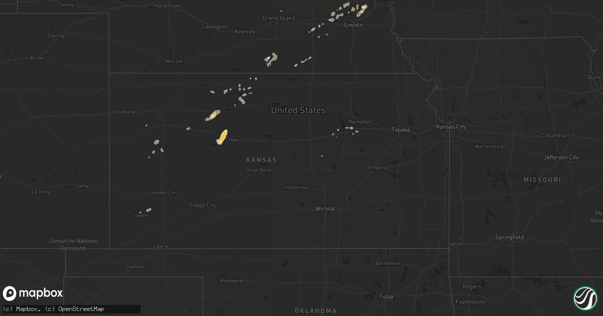
Hail Map in Kansas on July 27, 2011
Get this storm
July 27 map
$229
one time, instant access
Download today. No call, no setup
Keep the $229
Bought the map and want the full workflow? Apply the entire $229 to a subscription within 7 days. None of it is wasted.
Every map, not just this one
This buys you this map. Subscription and you get every map we run, in the markets you choose from a few cities to whole states to nationwide. Plus real-time alerts the moment a storm fires.
Contact data
Name, contact info, occupancy, even credit band for addresses in the footprint. You go from where it hit to who to call.
Become the source they trust
Unlimited branding weather history reports on demand. You already have the documented answer ready for the property owner, and you are the one who showed up with it.
Property data and RoofTrace estimates
Pull up any address you have got, its value and the exact code rules for that jurisdiction, straight from One Click Code. Then RoofTrace estimates the squares, pitch, and roof value, priced the way you price.
Storm reports in Kansas
Kansas
| Date | Description |
|---|---|
| 07/27/20116:30 PM CDT | A local report indicates 1.00 inch wind near 4 S ELLIS |
| 07/27/20116:30 PM CDT | A local report indicates 60 MPH wind near 2 E ENTERPRISE |
| 07/27/20116:25 PM CDT | Hail up to the size of golfballs fell. |
| 07/27/20116:25 PM CDT | A damaging wet microburst moved through ellis causing widespread tree and powerline/powerpole damage...including numerous broken windows...and a camper trailer blown ov |
| 07/27/20116:05 PM CDT | 60 to 70 mph wind gust estimated based on tree limbs down and also multiple 4x8 foot bales of hay blown off a 12 foot stack. |
| 07/27/201112:54 AM CDT | A local report indicates 70 MPH wind near 2 W CEDAR |
| 07/27/201112:20 AM CDT | Power outages reported |
| 07/27/201112:15 AM CDT | Phillipsburg airport awos 58 mph wind gusting to 81 mph |
| 07/26/20118:56 PM CDT | Tree blocking hwy 177 south of interstate 70. Semi truck blown over on 177 2 mile south of interstate 70. |
| 07/26/20118:56 PM CDT | Tree blocking hwy 177 south of interstate 70. Semi truck blown over on 177 1 mile north of interstate 70. |
| 07/26/20118:52 PM CDT | A local report indicates 85 MPH wind near 2 S MANHATTAN |
| 07/26/20118:41 PM CDT | 18 inch elm tree limb blown down. |
| 07/26/20118:41 PM CDT | A local report indicates 80 MPH wind near 10 SSW MANHATTAN |
| 07/26/20118:36 PM CDT | Power lines down and tree damage on south side of town. |
| 07/26/20118:34 PM CDT | A local report indicates 69 MPH wind near FORT RILEY AIRFIELD |
| 07/26/20118:27 PM CDT | A local report indicates 72 MPH wind near WINONA |
| 07/26/20118:26 PM CDT | A local report indicates 69 MPH wind near FORT RILEY AIRFIELD |
| 07/26/20118:25 PM CDT | Delayed report. Pieces of siding and roofing were blown off. A small shed was ripped apart and pieces of it were thrown. A 12 foot trailer was thrown approx. 350 feet. |
| 07/26/20118:25 PM CDT | Delayed report from last evening. Garage destroyed and three utility poles on property broken as a result of thunderstorm downburst. Time estimated and based on nearby |
| 07/26/20118:25 PM CDT | A local report indicates 60 MPH wind near 5 E WINONA |
| 07/26/20118:16 PM CDT | A local report indicates 60 MPH wind near 3 N JUNCTION CITY |
| 07/26/20118:00 PM CDT | 4 inch diameter limb blown down. |
| 07/26/20117:25 PM CDT | A local report indicates 60 MPH wind near BRIDGEPORT |
All States Impacted by Hail Map on July 27, 2011
Cities Impacted by Hail Map on July 27, 2011
- Winslow, IL
- Browntown, WI
- Ceresco, NE
- New Glarus, WI
- Mount Horeb, WI
- Blanchardville, WI
- Belleville, WI
- Durango, IA
- Bee, NE
- Spanish Fork, UT
- Salem, UT
- Marengo, IL
- Garden Prairie, IL
- Genoa, IL
- Manning, IA
- Manilla, IA
- Valentine, NE
- Omaha, NE
- Chana, IL
- Ithaca, NE
- Ashland, NE
- Hopkinton, IA
- Delhi, IA
- Earlville, IA
- Worthington, IA
- Dyersville, IA
- Fort Davis, TX
- Buffalo, WY
- Gypsum, KS
- Kensington, KS
- Monroe, WI
- Argyle, WI
- Waverly, NE
- Greenwood, NE
- Rapid City, SD
- Monticello, WI
- Oelwein, IA
- Ellis, KS
- Manchester, IA
- Dundee, IA
- Kit Carson, CO
- Elizabeth, IL
- Stockton, IL
- Moorcroft, WY
- Wood, SD
- White River, SD
- Fort Calhoun, NE
- Schiller Park, IL
- Hinsdale, IL
- Arlington Heights, IL
- Maywood, IL
- Downers Grove, IL
- Cicero, IL
- Forest Park, IL
- Park Ridge, IL
- Broadview, IL
- Elk Grove Village, IL
- River Grove, IL
- Franklin Park, IL
- Harwood Heights, IL
- Addison, IL
- Glen Ellyn, IL
- Clarendon Hills, IL
- Darien, IL
- Medinah, IL
- Brookfield, IL
- Mount Prospect, IL
- Elmwood Park, IL
- Wood Dale, IL
- Willow Springs, IL
- Elmhurst, IL
- Lombard, IL
- Wheaton, IL
- Chicago, IL
- Warrenville, IL
- Lemont, IL
- Bensenville, IL
- Riverside, IL
- Carol Stream, IL
- Glendale Heights, IL
- Homer Glen, IL
- Hillside, IL
- West Chicago, IL
- Woodridge, IL
- Itasca, IL
- Lisle, IL
- Willowbrook, IL
- Oak Brook, IL
- Roselle, IL
- Winfield, IL
- Oak Park, IL
- Stone Park, IL
- Berwyn, IL
- River Forest, IL
- Melrose Park, IL
- Bellwood, IL
- Berkeley, IL
- Des Plaines, IL
- Westchester, IL
- Hines, IL
- Westmont, IL
- Naperville, IL
- La Grange Park, IL
- Rolling Meadows, IL
- Villa Park, IL
- Schaumburg, IL
- Mullen, NE
- Ann Arbor, MI
- Grass Lake, MI
- Manchester, MI
- Chelsea, MI
- Shelby, IA
- Peosta, IA
- Hazleton, IA
- Independence, IA
- Colome, SD
- Winner, SD
- McCool Junction, NE
- Saint Francis, SD
- Mission, SD
- Parmelee, SD
- Rosebud, SD
- Crookston, NE
- Hill City, KS
- Shannon, IL
- Pearl City, IL
- Lanark, IL
- Seward, NE
- Byron, IL
- Winnebago, IL
- Rockford, IL
- Stillman Valley, IL
- Hanover, IL
- Savanna, IL
- Presho, SD
- Hamill, SD
- Gregory, SD
- Bellevue, IA
- Maquoketa, IA
- Elkhorn, NE
- Waterloo, NE
- Lindenwood, IL
- Davis Junction, IL
- Monroe Center, IL
- Hubertus, WI
- Hartford, WI
- Colgate, WI
- Hartland, WI
- Fayette, IA
- Maynard, IA
- Elkport, IA
- Wadena, IA
- Lamont, IA
- Sumner, IA
- Westgate, IA
- Randalia, IA
- Elkader, IA
- Arlington, IA
- Strawberry Point, IA
- Hawkeye, IA
- Volga, IA
- Greeley, IA
- Aurora, IA
- Stanley, IA
- Fredericksburg, IA
- Edgewood, IA
- Kirwin, KS
- Glade, KS
- Phillipsburg, KS
- Haswell, CO
- Geddes, SD
- York, NE
- Walnut, IA
- Enterprise, KS
- Holy Cross, IA
- Sherrill, IA
- Leoti, KS
- Smith Center, KS
- Junction City, KS
- Harvard, IL
- Ideal, SD
- Pecatonica, IL
- Platteville, WI
- Belmont, WI
- Kyle, SD
- Palco, KS
- Bogue, KS
- Zwingle, IA
- Guttenberg, IA
- Colesburg, IA
- Garber, IA
- Scott City, KS
- Dubuque, IA
- La Motte, IA
- Berry, AL
- Exira, IA
- Audubon, IA
- Prairie View, KS
- Logan, KS
- Cuba City, WI
- Fort Benning, GA
- Kirkland, IL
- Clare, IL
- Hoffman Estates, IL
- Elgin, IL
- Barrington, IL
- Hampton, IA
- Allison, IA
- Witten, SD
- Oakland, IA
- Bladen, NE
- Stockton, KS
- Platte, SD
- Chamberlain, SD
- Burke, SD
- Coralville, IA
- Darlington, WI
- Galena, IL
- Lena, IL
- Davenport, NE
- Scales Mound, IL
- Cascade, IA
- Potosi, WI
- Luxemburg, IA
- Apple River, IL
- Farley, IA
- Hazel Green, WI
- Bernard, IA
- New Vienna, IA
- East Dubuque, IL
- Epworth, IA
- Delaware, IA
- Masonville, IA
- Sundance, WY
- Utica, NE
- Scranton, IA
- Fort Atkinson, WI
- Emelle, AL
- Hancock, IA
- Fort Riley, KS
- Rozet, WY
- Palatine, IL
- Lenora, KS
- Denver, IA
- Waverly, IA
- Janesville, IA
- Ulysses, KS
- Garland, NE
- Dundee, IL
- Greensboro, AL
- Freeport, IL
- Black Hawk, SD
- Custer, SD
- Kingston, IL
- Belvidere, SD
- Long Valley, SD
- Springview, NE
- Fairfax, IA
- Cedar Rapids, IA
- Swisher, IA
- Winthrop, IA
- Oak, NE
- Deshler, NE
- Deadwood, SD
- Hill City, SD
- Lead, SD
- Saint Charles, IL
- Beaver Crossing, NE
- Waco, NE
- Wayland, MI
- Readlyn, IA
- Blue Hill, NE
- Red Cloud, NE
- Porcupine, SD
- Wahoo, NE
- Woodston, KS
- Scenic, SD
- Munith, MI
- Gaylord, KS
- Carleton, NE
- Kieler, WI
- Fairbank, IA
- Kent, IL
- Tripoli, IA
- Ionia, IA
- Mount Carroll, IL
- Frederika, IA
- Oran, IA
- Plainfield, IA
- Clarksville, IA
- Ryan, IA
- Bristow, IA
- Greene, IA
- Nora, IL
- Warren, IL
- Avoca, IA
- Raymond, NE
- Norris, SD
- Starkville, MS
- Friend, NE
- Dwight, NE
- Lincoln, NE
- Chapman, KS
- Abilene, KS
- Lannon, WI
- Menomonee Falls, WI
- Sussex, WI
- Howes, SD
- Jackson, WI
- Richfield, WI
- Germantown, WI
- Neosho, WI
- Rubicon, WI
- Oconomowoc, WI
- Homewood, IL
- Hazel Crest, IL
- Exeter, NE
- Baileyville, IL
- Forreston, IL
- Hanksville, UT
- Middleville, MI
- Hastings, MI
- Caledonia, MI
- Cedar Falls, IA
- New Hartford, IA
- Damar, KS
- Sturgis, MS
- South Wayne, WI
- Brent, AL
- Las Animas, CO
- Helenville, WI
- Sullivan, WI
- Grand Island, NE
- Mineral Point, WI
- Oakley, KS
- Winona, KS
- Weston, NE
- Valparaiso, NE
- Brainard, NE
- Elk Horn, IA
- Kimballton, IA
- Neola, IA
- Missouri Valley, IA
- Honey Creek, IA
- Paton, IA
- Gowrie, IA
- Churdan, IA
- Superior, NE
- Ruskin, NE
- Nelson, NE
- Coon Rapids, IA
- Wanblee, SD
- Jefferson, WI
- Cedar, KS
- Northport, AL
- Memphis, NE
- Kilgore, NE
- Otter, MT
- Pewaukee, WI
- Delafield, WI
- Nashotah, WI
- Quinter, KS
- Park, KS
- Okaton, SD
- Hollandale, WI
- Tinley Park, IL
- Orland Park, IL
- Oak Forest, IL
- Altamont, UT
- Alta Vista, KS
- Mequon, WI
- Milwaukee, WI
- Kadoka, SD
- Rowan, IA
- Alexander, IA
- Dows, IA
- Latimer, IA
- Oregon, WI
- Brooklyn, WI
- Lake, MS
- Templeton, IA
- Carroll, IA
- Arcadia, IA
- Clarion, IA
- Duchesne, UT
- Ridott, IL
- Palos Hills, IL
- Palos Park, IL
- Buffalo Gap, SD
- Bartlett, IL
- Streamwood, IL
- Louisville, MS
- Murdo, SD
- Hamlin, IA
- Fairmont, NE
- Staplehurst, NE


