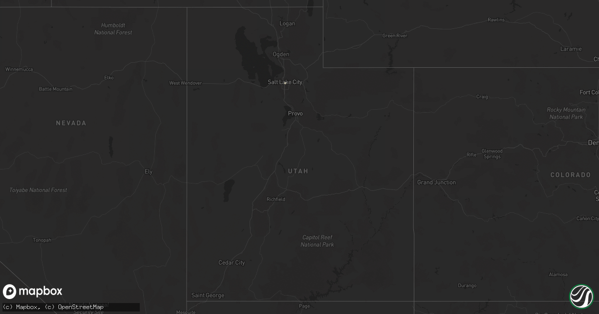
Hail Map in Utah on July 26, 2023
Get this storm
July 26 map
$229
one time, instant access
Download today. No call, no setup
Keep the $229
Bought the map and want the full workflow? Apply the entire $229 to a subscription within 7 days. None of it is wasted.
Every map, not just this one
This buys you this map. Subscription and you get every map we run, in the markets you choose from a few cities to whole states to nationwide. Plus real-time alerts the moment a storm fires.
Contact data
Name, contact info, occupancy, even credit band for addresses in the footprint. You go from where it hit to who to call.
Become the source they trust
Unlimited branding weather history reports on demand. You already have the documented answer ready for the property owner, and you are the one who showed up with it.
Property data and RoofTrace estimates
Pull up any address you have got, its value and the exact code rules for that jurisdiction, straight from One Click Code. Then RoofTrace estimates the squares, pitch, and roof value, priced the way you price.
Storm reports in Utah
Utah
| Date | Description |
|---|---|
| 07/26/20236:30 PM CDT | Mesonet station utdcd us-189 at deer creek dam. |
| 07/26/20236:16 PM CDT | Awos station kpvu provo municipal airport. |
| 07/26/20236:16 PM CDT | Awos station kpvu provo municipal airport. |
| 07/26/20236:15 PM CDT | Awos station kpvu provo municipal airport. |
| 07/26/20236:15 PM CDT | Awos station kpvu provo municipal airport. |
| 07/26/20234:50 PM CDT | Mesonet station pc349 nephi west. |
| 07/26/20234:45 PM CDT | Mesonet station dpg31 west granite. |
| 07/26/20234:25 PM CDT | Asos station kvel vernal rgnl airport. |
| 07/26/20234:20 PM CDT | Mesonet station utash us-40 at mp 140 asphalt ridge. |
| 07/25/20239:39 PM CDT | Top of campground stage ripped off by wind. |
| 07/25/20239:30 PM CDT | Mesonet station kcc02 marina station elevation: 4220 ft. |
| 07/25/20238:44 PM CDT | Mesonet station as768 great salt lake marina station elevation: 4206 ft. |
| 07/25/20238:10 PM CDT | Mesonet station dpg06 camel back mtn station elevation: 5077 ft. |
| 07/25/20238:10 PM CDT | Mesonet station dpg14 wig mountain station elevation: 4352 ft. |
| 07/25/20238:05 PM CDT | Mesonet station dpg06 camel back mtn station elevation: 5077 ft. |
| 07/25/20237:55 PM CDT | Mesonet station dpg13 durand road station elevation: 4538 ft. |
| 07/25/20237:50 PM CDT | Mesonet station dpg02 callao gate station elevation: 4250 ft. |
| 07/25/20237:20 PM CDT | Mesonet station dpg19 fish springs. |
| 07/25/20237:00 PM CDT | Mesonet station dpg21 simpson spring. |
| 07/25/20237:00 PM CDT | Mesonet station dpg21 simpson spring station elevation: 4645 ft. |
All States Impacted by Hail Map on July 26, 2023
Cities Impacted by Hail Map on July 26, 2023
- Gratiot, WI
- Apple River, IL
- Elizabeth, IL
- Warren, IL
- Stockton, IL
- McConnell, IL
- Nora, IL
- Dakota, IL
- Kent, IL
- Pearl City, IL
- South Wayne, WI
- Cedarville, IL
- Browntown, WI
- Winslow, IL
- Monroe, WI
- Lena, IL
- Freeport, IL
- Orangeville, IL
- Ridott, IL
- Rock City, IL
- Davis, IL
- Roscoe, IL
- Brodhead, WI
- Shirland, IL
- Rockford, IL
- Winnebago, IL
- Durand, IL
- Juda, WI
- Pecatonica, IL
- Rockton, IL
- South Beloit, IL
- Beloit, WI
- Machesney Park, IL
- Caledonia, IL
- Clinton, WI
- Poplar Grove, IL
- Capron, IL
- Harvard, IL
- Wonder Lake, IL
- Lake Geneva, WI
- Crystal Lake, IL
- Woodstock, IL
- Hebron, IL
- Mchenry, IL
- Walworth, WI
- Island Lake, IL
- Sharon, WI
- Richmond, IL
- Ringwood, IL
- Wauconda, IL
- North Chicago, IL
- Gurnee, IL
- Waukegan, IL
- Libertyville, IL
- Spring Grove, IL
- Round Lake, IL
- Lake Villa, IL
- Lake Bluff, IL
- Grayslake, IL
- Fox Lake, IL
- Great Lakes, IL
- Ingleside, IL
- Mundelein, IL
- Winthrop Harbor, IL
- Genoa City, WI
- Twin Lakes, WI
- Trevor, WI
- Zion, IL
- Wadsworth, IL
- Antioch, IL
- Fontana, WI
- Pleasant Prairie, WI
- Kenosha, WI
- Bristol, WI
- Vernon Hills, IL
- Lake Zurich, IL
- Highland Park, IL
- Highwood, IL
- Deerfield, IL
- Lincolnshire, IL
- Lake Forest, IL
- Garden Prairie, IL
- Marengo, IL
- Union, IL
- Loves Park, IL
- Belvidere, IL
- Barrington, IL
- Cary, IL
- Buffalo Grove, IL
- Glencoe, IL
- Arlington Heights, IL
- Winnetka, IL
- Wheeling, IL
- Northbrook, IL
- Monticello, WI
- Brooklyn, WI
- Belleville, WI
- Evansville, WI
- Albany, WI
- Janesville, WI
- Edgerton, WI
- Stoughton, WI
- Oregon, WI
- Milton, WI
- Fort Atkinson, WI
- Whitewater, WI
- Delavan, WI
- Elkhorn, WI
- Eagle, WI
- Palmyra, WI
- East Troy, WI
- Burlington, WI
- Mukwonago, WI
- Waterford, WI
- Big Bend, WI
- Rochester, WI
- Kansasville, WI
- Muskego, WI
- Union Grove, WI
- Franksville, WI
- Franklin, WI
- Racine, WI
- Caledonia, WI
- Sturtevant, WI
- New Buffalo, MI
- Michigan City, IN
- La Porte, IN
- Beverly Shores, IN
- Three Oaks, MI
- New Carlisle, IN
- Buchanan, MI
- Galien, MI
- Rolling Prairie, IN
- South Bend, IN
- Niles, MI
- Notre Dame, IN
- Granger, IN
- Mishawaka, IN
- Edwardsburg, MI
- Osceola, IN
- Elkhart, IN
- Union, MI
- Bristol, IN
- White Pigeon, MI
- Middlebury, IN
- Goshen, IN
- Howe, IN
- Shipshewana, IN
- Sturgis, MI
- Burr Oak, MI
- Lagrange, IN
- Montpelier, OH
- Orland, IN
- Bronson, MI
- Montgomery, MI
- Fremont, IN
- Angola, IN
- Coldwater, MI
- Camden, MI
- Edon, OH
- Topeka, IN
- Ligonier, IN
- Millersburg, IN
- Wolcottville, IN
- Bloomington, WI
- Knob Noster, MO
- Sweet Springs, MO
- Cherry Valley, IL
- Rockport, IL
- Pleasant Hill, IL
- New Berlin, IL
- Pleasant Plains, IL
- Springfield, IL
- Frankford, MO
- Louisiana, MO
- La Cygne, KS
- Bowling Green, MO
- Greenview, IL
- Lyle, MN
- Glenville, MN
- Campbellsport, WI
- Austin, MN
- Clarksville, MO
- Linden, WI
- Mineral Point, WI
- Rewey, WI
- Pittsfield, IL
- Murrayville, IL
- Winchester, IL
- Bellflower, MO
- Truxton, MO
- High Hill, MO
- Jonesburg, MO
- Rubicon, WI
- Iron Ridge, WI
- Lancaster, WI
- West Bend, WI
- Slinger, WI
- Kewaskum, WI
- Middletown, MO
- Silex, MO
- Warrensburg, MO
- Petersburg, IL
- Dexter, MN
- Sargeant, MN
- Forest City, IL
- Manito, IL
- Topeka, IL
- Green Valley, IL
- Montgomery City, MO
- Vermont, IL
- Rushville, IL
- Astoria, IL
- Muskegon, MI
- Hamburg, IL
- Annada, MO
- Nebo, IL
- Pearl, IL
- Roodhouse, IL
- Juneau, WI
- Horicon, WI
- Hartford, WI
- Allenton, WI
- Hustisford, WI
- Mayville, WI
- Glen Haven, WI
- Scales Mound, IL
- Vandalia, MO
- Laddonia, MO
- Kansas City, MO
- Prairie Village, KS
- Platteville, WI
- Ipava, IL
- Industry, IL
- Concordia, MO
- Liverpool, IL
- Canton, IL
- Delavan, IL
- Lewistown, IL
- Eolia, MO
- Pleasanton, KS
- Mound City, KS
- Wellsville, MO
- Bagley, WI
- Belmont, WI
- Livingston, WI
- Hopkins, MI
- Eldred, IL
- Fieldon, IL
- Pioneer, OH
- Waldron, MI
- Hillsdale, MI
- Osseo, MI
- Pittsford, MI
- Alvordton, OH
- Clarklake, MI
- Cement City, MI
- Brooklyn, MI
- Jackson, MI
- Manchester, MI
- Tipton, MI
- Wauseon, OH
- Lyons, OH
- Morenci, MI
- Hudson, MI
- Fayette, OH
- Sand Creek, MI
- Clayton, MI
- Norvell, MI
- Grass Lake, MI
- Jasper, MI
- Metamora, OH
- Blissfield, MI
- Saline, MI
- Chelsea, MI
- Dexter, MI
- Ann Arbor, MI
- Ypsilanti, MI
- Whitmore Lake, MI
- Canton, MI
- Belleville, MI
- Romulus, MI
- Wayne, MI
- Plymouth, MI
- Northville, MI
- South Lyon, MI
- Westland, MI
- Delta, OH
- Swanton, OH
- Berkey, OH
- Sylvania, OH
- Ottawa Lake, MI
- Riga, MI
- Holland, OH
- Maumee, OH
- Rossford, OH
- Toledo, OH
- Perrysburg, OH
- Northwood, OH
- Monclova, OH
- Walbridge, OH
- Napoleon, MI
- Detroit, MI
- Garden City, MI
- Livonia, MI
- Inkster, MI
- Taylor, MI
- Redford, MI
- Dearborn, MI
- Dearborn Heights, MI
- Southfield, MI
- Farmington, MI
- Lincoln Park, MI
- Melvindale, MI
- Allen Park, MI
- Ecorse, MI
- River Rouge, MI
- Ferndale, MI
- Oak Park, MI
- Huntington Woods, MI
- Larkspur, CO
- Castle Rock, CO
- Royal Oak, MI
- Berkley, MI
- Highland Park, MI
- Pleasant Ridge, MI
- Lambertville, MI
- Temperance, MI
- Erie, MI
- Oregon, OH
- Harbor View, OH
- Millbury, OH
- Curtice, OH
- Franktown, CO
- Warren, MI
- Grosse Pointe, MI
- Hamtramck, MI
- Hazel Park, MI
- Harper Woods, MI
- Saint Clair Shores, MI
- Center Line, MI
- Madison Heights, MI
- Eastpointe, MI
- Roseville, MI
- Clinton Township, MI
- Harrison Township, MI
- Sterling Heights, MI
- Fraser, MI
- Williston, OH
- Martin, OH
- Oak Harbor, OH
- Graytown, OH
- Elbert, CO
- Elmore, OH
- Lacarne, OH
- Port Clinton, OH
- Rocky Ridge, OH
- Genoa, OH
- Clay Center, OH
- Fremont, OH
- Vickery, OH
- Put In Bay, OH
- Middle Bass, OH
- Lakeside Marblehead, OH
- Isle Saint George, OH
- Castalia, OH
- Sandusky, OH
- Kelleys Island, OH
- Whitehouse, OH
- Waterville, OH
- Liberty Center, OH
- Neapolis, OH
- Grand Rapids, OH
- Haskins, OH
- Bowling Green, OH
- Luckey, OH
- Stony Ridge, OH
- Woodville, OH
- Pemberville, OH
- Weston, OH
- Portage, OH
- Tontogany, OH
- Dunbridge, OH
- Lindsey, OH
- Bradner, OH
- Gibsonburg, OH
- Monroeville, OH
- Bellevue, OH
- Clyde, OH
- Wayne, OH
- Troy, MI
- Clawson, MI
- Mount Clemens, MI
- New Baltimore, MI
- Macomb, MI
- Helena, OH
- Calhan, CO
- Ramah, CO
- Milan, OH
- Huron, OH
- Norwalk, OH
- Berlin Heights, OH
- Collins, OH
- Maxwell, NE
- North Platte, NE
- Brady, NE
- Solen, ND
- Flasher, ND
- Mandan, ND
- Bismarck, ND
- Menoken, ND
- Moffit, ND
- Hazelton, ND
- Hayes, SD
- Fort Pierre, SD
- Sherwood, MI
- Mendon, MI
- Colon, MI
- Leonidas, MI
- Fulton, MI
- Athens, MI
- Union City, MI
- Burlington, MI
- Tekonsha, MI
- Quincy, MI
- Litchfield, MI
- Jonesville, MI
- Homer, MI
- Driscoll, ND
- Sterling, ND
- Steele, ND
- Anselmo, NE
- Dawson, ND
- Auxvasse, MO
- Fostoria, OH
- Arcadia, OH
- Alvada, OH
- Midland, SD
- West Unity, OH
- Archbold, OH
- Stryker, OH
- Elsberry, MO
- Salt Lake City, UT
- Dowagiac, MI
- Peyton, CO
- Rush, CO
- Yoder, CO
- McClure, OH
- Hughesville, MO
- Willis, MI
- Dupree, SD
- Hurtsboro, AL
- Bryan, OH
- Napoleon, OH
- Decatur, MI
- Custar, OH
- Colorado Springs, CO
- Athens, IL
- Show Low, AZ
- Winslow, AZ
- Grelton, OH
- Malinta, OH
- Benton Harbor, MI
- Burgoon, OH
- Hugo, CO
- Broken Bow, NE
- Vivian, SD
- Presho, SD
- Eckley, CO
- Yuma, CO
- Vernon, CO
- Joes, CO
- Kirk, CO
- Idalia, CO
- Burlington, CO
- Kanorado, KS
- Goodland, KS
- Saint Francis, KS
- Wray, CO
- Wauneta, NE
- Edson, KS
- McDonald, KS
- Atwood, KS
- Bird City, KS
- Colby, KS
- Brewster, KS
- Levant, KS
- Ludell, KS
- Herndon, KS
- Gem, KS
- Nogales, AZ
- Crookston, MN
- Mcville, ND
- Fort Yates, ND
- Selfridge, ND
- Benkelman, NE
- Arnold, NE
- Parks, NE
- Larimore, ND
- Inkster, ND
- Haigler, NE
- East Brady, PA
- Chicora, PA
- Tappen, ND
- Hayes Center, NE
- Shields, ND
- Vail, AZ
- Benson, AZ
- Niagara, ND
- Karval, CO
- Eagle Butte, SD
- Palisade, NE
- Enders, NE
- Trenton, NE
- Max, NE
- Stratton, NE
- Tucson, AZ
- Olney Springs, CO
- Ordway, CO
- La Junta, CO
- Akron, CO
- Three Rivers, MI
- Constantine, MI
- Jones, MI
- Woodworth, ND
- Trinidad, CO
- Bremen, IN
- Nappanee, IN
- Zeeland, ND
- Wakarusa, IN
- Las Animas, CO
- Andover, OH
- Jefferson, OH
- Rome, OH
- Centreville, MI
- Wakeman, OH
- Oberlin, OH
- Niobrara, NE
- Clearwater, FL
- Rio Rico, AZ
- Hartford, MI
- Cassopolis, MI
- Arapahoe, CO
- Weskan, KS
- Petersburg, ND
- Aneta, ND
- Lawton, MI
- Kit Carson, CO
- Risingsun, OH
- Lower Brule, SD
- Tallassee, AL
- Hague, ND
- New London, OH
- Wellington, OH
- Mansfield, OH
- Mentor, MN
- Erskine, MN
- Mcintosh, MN
- Fosston, MN
- Gully, MN
- Gonvick, MN
- Clearbrook, MN
- Trail, MN
- Coolidge, AZ
- San Tan Valley, AZ
- Florence, AZ
- Queen Creek, AZ
- Gilbert, AZ
- Mesa, AZ
- Chandler, AZ
- Tempe, AZ
- Scottsdale, AZ
- Phoenix, AZ
- Paradise Valley, AZ
- Glendale, AZ
- Peoria, AZ
- Bemidji, MN
- Tenstrike, MN
- Hines, MN
- Blackduck, MN
- Eloy, AZ
- Thief River Falls, MN
- Goodridge, MN
- Gold Canyon, AZ
- Sells, AZ
- Loomis, NE
- Bertrand, NE
- Plummer, MN
- Oklee, MN
- Red Lake Falls, MN
- Rimersburg, PA
- Beltrami, MN
- Williamsfield, OH
- Loman, MN
- Elm Creek, NE
- Fertile, MN
- Grygla, MN
- Northwood, ND
- Marana, AZ
- Puposky, MN
- Holdrege, NE
- Gackle, ND
- Ryegate, MT
- Washburn, WI
- Ontonagon, MI
- White Pine, MI
- Gordon, WI
- Davenport, ND
- Arlington, NE
- North Branch, MN
- Harris, MN
- Finland, MN
- Arivaca, AZ
- Amado, AZ
- Isabella, MN
- Dalbo, MN
- Silver Bay, MN
- Marcus, IA
- Foreston, MN
- Milaca, MN
- Stanchfield, MN
- Cambridge, MN
- Grandy, MN
- Center City, MN
- Lindstrom, MN
- Mount Lemmon, AZ
- Northome, MN
- Squaw Lake, MN
- Max, MN
- Ogilvie, MN
- Braham, MN
- Taylors Falls, MN
- Bergland, MI
- Ewen, MI
- Marenisco, MI
- Minong, WI
- Royal, IA
- Cornucopia, WI
- Hayward, WI
- Schroeder, MN
- Saint Croix Falls, WI
- Shafer, MN
- Peterson, IA
- Sioux Rapids, IA
- Cable, WI
- Solon Springs, WI


