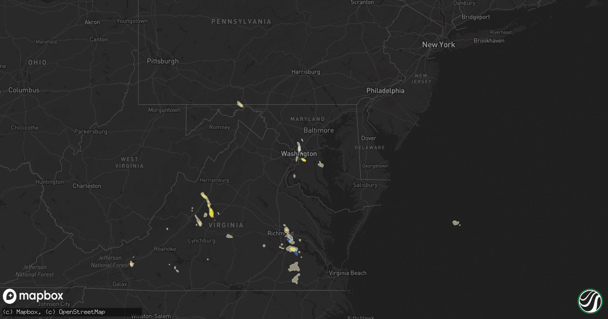
Hail Map on July 26, 2021
Get this storm
July 26 map
$229
one time, instant access
Download today. No call, no setup
Keep the $229
Bought the map and want the full workflow? Apply the entire $229 to a subscription within 7 days. None of it is wasted.
Every map, not just this one
This buys you this map. Subscription and you get every map we run, in the markets you choose from a few cities to whole states to nationwide. Plus real-time alerts the moment a storm fires.
Contact data
Name, contact info, occupancy, even credit band for addresses in the footprint. You go from where it hit to who to call.
Become the source they trust
Unlimited branding weather history reports on demand. You already have the documented answer ready for the property owner, and you are the one who showed up with it.
Property data and RoofTrace estimates
Pull up any address you have got, its value and the exact code rules for that jurisdiction, straight from One Click Code. Then RoofTrace estimates the squares, pitch, and roof value, priced the way you price.
States Impacted by Hail Map on July 26, 2021
Storm reports
Vermont
| Date | Description |
|---|---|
| 07/26/20215:33 PM CDT | Nearly two-dozen trees were uprooted or snapped within a quarter mile radius of a house northwest of barnard. Based on photos and an interview with the owner of the hou |
North Carolina
| Date | Description |
|---|---|
| 07/26/20213:42 PM CDT | 911 call center reported tree down on residence on brentwood cir |
| 07/26/20213:23 PM CDT | Tree down on caleb rd completely blocking roadway. Reported via facebook. Time estimated from radar. |
| 07/26/20213:10 PM CDT | A few trees were blown down in the southern part of cleveland county as the storms moved through. |
| 07/26/20212:45 PM CDT | Fire dept/rescue received call of tree across roadway near intersection of joe johnson rd and mathis church rd |
| 07/26/20212:35 PM CDT | 911 call center reported tree down on mapleleaf rd |
| 07/26/20212:30 PM CDT | 911 call center reported tree down on brady circle rd |
| 07/26/20212:30 PM CDT | Amateur radio reported trees down near 900 block of casar-lawndale rd |
| 07/26/20212:00 PM CDT | 911 call center reported trees down on dunlap gate rd |
| 07/26/20211:50 PM CDT | Tree down along hw 704 near collinstown. |
| 07/26/20211:45 PM CDT | 911 call center reported trees down on howards bridge rd |
| 07/26/20211:24 PM CDT | 3 trees down along 115... East of wilksboro. |
| 07/25/202111:33 PM CDT | At 433 PM EDT, a severe thunderstorm was located 8 miles southwest of Gastonia, or near Crowders Mountain State Park, moving east at 25 mph. HAZARD...60 mph wind gusts and penny size hail. SOURCE...Radar indicated. IMPACT...Expect damage to trees and power lines. Locations impacted include... Gastonia, Belmont, South Gastonia, Clover, Cramerton, Crowders Mountain State Park, Lake Wylie, Kings Mountain State Park, Crowders and Bethany. |
| 07/25/202111:09 PM CDT | At 409 PM EDT, severe thunderstorms were located along a line extending from Bassett to near Collinsville to near Mountain Valley, moving east at 20 mph. HAZARD...60 mph wind gusts. SOURCE...Radar indicated. IMPACT...Expect damage to roofs, siding, and trees. Locations impacted include... Martinsville... Bassett... Axton... Spencer... Leatherwood... Villa Heights... and Chatmoss.This includes The following Locations The Martinsville Speedway andMartinsville Airport. |
| 07/25/202110:28 PM CDT | At 327 PM EDT, a severe thunderstorm was located 5 miles southwest of Statesville, or near Troutman, moving east at 20 mph. HAZARD...60 mph wind gusts and penny size hail. SOURCE...Radar indicated. IMPACT...Expect damage to trees and power lines. Locations impacted include... Statesville, Mooresville, Troutman, Cleveland, Lake Norman State Park, Mount Ulla, Doolie, Sherrills Ford, Piedmont Research Station and Woodleaf. |
| 07/25/202110:26 PM CDT | At 326 PM EDT, a severe thunderstorm was located 15 miles north of Shelby, or over Casar, moving east at 20 mph. HAZARD...60 mph wind gusts and penny size hail. SOURCE...Radar indicated. IMPACT...Expect damage to trees and power lines. Locations impacted include... Belwood, Lawndale, Fallston, Polkville, Waco, Casar and Vale. |
| 07/25/20219:33 PM CDT | At 232 PM EDT, a severe thunderstorm was located 12 miles south of Ronda, or near Love Valley, moving southeast at 10 mph. HAZARD...60 mph wind gusts and penny size hail. SOURCE...Radar indicated. IMPACT...Expect damage to trees and power lines. Locations impacted include... Stony Point, Harmony, Love Valley, Turnersburg, Olin, Union Grove and Cool Springs. |
| 07/25/20219:19 PM CDT | At 219 PM EDT, a severe thunderstorm was located near Collinstown, or near Stuart, moving southeast at 25 mph. HAZARD...60 mph wind gusts. SOURCE...Radar indicated. IMPACT...Expect damage to roofs, siding, and trees. Locations impacted include... Stuart... Danbury... Francisco... Sandy Ridge... Collinstown... Ayersville... and Hanging Rock State Park. |
| 07/25/20218:24 PM CDT | At 124 PM EDT, severe thunderstorms were located along a line extending from near Bottom to near Darby, moving southeast at 30 mph. HAZARD...60 mph wind gusts. SOURCE...Radar indicated. IMPACT...Expect damage to roofs, siding, and trees. Locations impacted include... Mount Airy... North Wilkesboro... Elkin... Wilkesboro... Fairview... Yadkinville... and Jonesville. |
South Dakota
| Date | Description |
|---|---|
| 07/26/20218:30 AM CDT | A local report indicates 1.00 inch wind near GLENHAM |
| 07/26/20214:43 AM CDT | At 943 AM CDT, a severe thunderstorm was located near Glenham, or 7 miles southeast of Mobridge, moving east at 45 mph. HAZARD...Quarter size hail. SOURCE...Radar indicated. IMPACT...Damage to vehicles is expected. This severe thunderstorm will be near... Selby around 1000 AM CDT.Other locations in the path of this severe thunderstorm include Java. |
Tennessee
| Date | Description |
|---|---|
| 07/26/20213:25 PM CDT | Damage to home siding... Outbuilding destroyed... A/c unit pushed off foundation. Microburst signature... But 40 mph max from radar. Damage concentrated on hudson road. |
| 07/26/20211:29 AM CDT | At 629 PM CDT, severe thunderstorms were located along a line extending from 14 miles southwest of Woodbury to 9 miles north of Manchester to 9 miles southwest of McMinnville, moving south at 15 mph. HAZARD...60 mph wind gusts. SOURCE...Radar indicated. IMPACT...Expect damage to roofs, siding, and trees. Locations impacted include... Manchester and Summitville. This includes Interstate 24 between mile markers 100 and 111. |
| 07/26/202112:55 AM CDT | At 555 PM CDT, a severe thunderstorm was located over Thompson's Station, or near Franklin, moving southeast at 15 mph. HAZARD...60 mph wind gusts. SOURCE...Radar indicated. IMPACT...Expect damage to roofs, siding, and trees. Locations impacted include... Franklin, Columbia, Spring Hill, Thompson's Station and I-65 East Of Columbia.This includes the following highways... Interstate 65 between mile markers 42 and 67. Interstate 840 between mile markers 23 and 37. |
| 07/25/20219:47 PM CDT | At 247 PM CDT, a severe thunderstorm was located near Decherd, or 8 miles northeast of Winchester, moving southeast at 10 mph. HAZARD...60 mph wind gusts. SOURCE...Radar indicated. IMPACT...Expect damage to roofs, siding, and trees. Locations impacted include... Winchester, Decherd, Estill Springs, Cowan, Sewanee, Tims Ford Lake, Woods Reservoir, Arnold AFB and Alto. |
| 07/25/20218:40 PM CDT | At 139 PM EDT, a severe thunderstorm was located 8 miles south of Wilkerson, or 10 miles northeast of La Follette, moving southeast at 20 mph. HAZARD...60 mph wind gusts and penny size hail. SOURCE...Radar indicated. IMPACT...Expect damage to roofs, siding, and trees. Locations impacted include... Fincastle, Clairfield and Sharps Chapel. |
Nevada
| Date | Description |
|---|---|
| 07/26/20213:00 PM CDT | 69mph gusts measured at the a06aa mesonet site. |
| 07/25/202111:34 PM CDT | At 434 PM PDT, a severe thunderstorm was located over Pioche, moving north at 15 mph. HAZARD...60 mph wind gusts and quarter size hail. SOURCE...Radar indicated. IMPACT...Hail damage to vehicles is expected. Expect wind damage to roofs and trees. Locations impacted include... Pioche. |
| 07/25/20219:05 PM CDT | At 204 PM PDT, a severe thunderstorm was located over Echo Canyon State Park, or near Ursine, moving southwest at 5 mph. HAZARD...60 mph wind gusts and quarter size hail. SOURCE...Radar indicated. IMPACT...Hail damage to vehicles is expected. Expect wind damage to roofs and trees. Locations impacted include... Ursine and Echo Canyon State Park. |
Michigan
| Date | Description |
|---|---|
| 07/26/20216:33 AM CDT | At 1132 PM CDT, severe thunderstorms were located along a line extending from 9 miles north of Carter to 8 miles southwest of Antigo to near Rib Mountain, moving east at 55 mph. HAZARD...60 mph wind gusts and penny size hail. SOURCE...Law enforcement. IMPACT...Expect damage to roofs, siding, and trees. Locations impacted include... Neopit, Wittenberg, Keshena, Shawano, Wausaukee, Legend Lake, Gillett and Pulaski. |
| 07/26/20215:42 AM CDT | At 1042 PM EDT/942 PM CDT/, a severe thunderstorm was located 7 miles north of Sidnaw, or 17 miles southwest of Baraga, moving southeast at 30 mph. HAZARD...60 mph wind gusts and quarter size hail. SOURCE...Radar indicated. IMPACT...Hail damage to vehicles is expected. Expect wind damage to roofs, siding, and trees. This severe thunderstorm will be near... Sidnaw around 1055 PM EDT. Covington around 1100 PM EDT.Other locations in the path of this severe thunderstorm include U.S.141 between Covington and Amasa. |
| 07/26/20215:30 AM CDT | At 1030 PM CDT, a severe thunderstorm was located 7 miles west of Phelps, or 10 miles north of Eagle River, moving east at 25 mph. HAZARD...60 mph wind gusts and quarter size hail. SOURCE...Radar indicated. IMPACT...Hail damage to vehicles is expected. Expect wind damage to roofs, siding, and trees. This severe thunderstorm will be near... Phelps around 1050 PM CDT.Other locations in the path of this severe thunderstorm includeKentuck Lake Campground. |
| 07/26/20215:12 AM CDT | At 1011 PM EDT/911 PM CDT/, a severe thunderstorm was located 12 miles north of Bessemer, or 16 miles northeast of Ironwood, moving southeast at 60 mph. HAZARD...60 mph wind gusts and quarter size hail. SOURCE...Radar indicated. IMPACT...Hail damage to vehicles is expected. Expect wind damage to roofs, siding, and trees. This severe thunderstorm will be near... Porcupine Mountains State Park around ${dateUtil.format(${pc.time}, ${timeFormat.clock}, ${pc.timeZone})}.Other locations in the path of this severe thunderstorm includeMarenisco. |
| 07/26/20213:42 AM CDT | At 842 PM EDT/742 PM CDT/, a severe thunderstorm was located near Powers, or 17 miles west of Escanaba, moving southeast at 25 mph. HAZARD...Quarter size hail. SOURCE...Radar indicated. IMPACT...Damage to vehicles is expected. This severe thunderstorm will remain over mainly rural areas of southwestern Delta and northeastern Menominee Counties, including the following locations... Wilson, Gourley, Bark River and Spalding. |
| 07/26/20212:12 AM CDT | At 712 PM CDT, a severe thunderstorm was located 9 miles west of La Branche, or 19 miles east of Iron Mountain, moving southeast at 20 mph. HAZARD...Quarter size hail. SOURCE...Radar indicated. IMPACT...Damage to vehicles is expected. Locations impacted include... Hermansville and Powers. |
| 07/26/202112:38 AM CDT | Pictures from facebook show multiple trees down in the escanaba area. Time estimated via radar. |
| 07/25/202111:30 PM CDT | Corrects previous tstm wnd dmg report from 5 ssw randville. Reported significant winds and power outages. Have pictures online of grasses and plants blown in a single d |
| 07/25/202111:19 PM CDT | Public report of power lines down and large trees uprooted at peavey falls. Time estimated by radar. |
| 07/25/202111:08 PM CDT | At 407 PM CDT, a severe thunderstorm was located 9 miles southwest of Marinette, moving southeast at 20 mph. HAZARD...70 mph wind gusts and quarter size hail. SOURCE...Radar indicated. IMPACT...Hail damage to vehicles is expected. Expect considerable tree damage. Wind damage is also likely to mobile homes, roofs, and outbuildings. Locations impacted include... Marinette, Oconto, Peshtigo, Porterfield, Lena, Harmony, Cullen and County Line. |
| 07/25/202110:45 PM CDT | At 345 PM CDT, a severe thunderstorm was located 9 miles east of Crivitz, or 11 miles northwest of Menominee, moving east at 25 mph. HAZARD...60 mph wind gusts and quarter size hail. SOURCE...Radar indicated. IMPACT...Hail damage to vehicles is expected. Expect wind damage to roofs, siding, and trees. Locations impacted include... Marinette, Menominee, Crivitz, Pound, Peshtigo, Porterfield, Beaver, Middle Inlet, Coleman and Harmony. |
| 07/25/20219:50 PM CDT | U.s. National forest service rangers from the ottawa national forest reported downed and uprooted trees along u.s. Forest service road 8190 or dunham road located west |
| 07/25/20219:50 PM CDT | U.s. National forest service rangers reported downed and uprooted trees at the access road into the ottawa national forest bobcat lake campground located to the southea |
| 07/25/20219:50 PM CDT | Marenisco township fire department reported significant roof damage at a newly built garage structure at the corner of hall and mill streets in marenisco. Over a quarte |
| 07/25/20219:50 PM CDT | Multiple reports of trees down... Several road closures... And numerous power outages near marenisco. Time estimated with radar. |
| 07/25/20219:45 PM CDT | U.s. National forest service rangers from the ottawa national forest reported significant tree damage along forest service road 9300 and wolf mountain road in the ottaw |
| 07/25/20219:45 PM CDT | U.s. National forest service rangers from the ottawa national forest reported significant tree damage along the great lakes road approx. 5 miles northwest of marenisco |
| 07/25/20219:30 PM CDT | Ironwood public safety department reports extensive storm damage throughout gogebic county with numerous trees and power lines down. Time estimated by radar. |
South Carolina
| Date | Description |
|---|---|
| 07/26/20214:45 PM CDT | 911 call center reported power lines down on executive ct off charlotte hwy |
| 07/26/20214:40 PM CDT | Multiple healthy trees damaged including one snapped near junction of duck haven ln and bonum rd |
| 07/26/202112:45 AM CDT | At 544 PM EDT, a severe thunderstorm was located 10 miles northwest of Indian Land, or near Steele Creek, moving southeast at 10 mph. HAZARD...60 mph wind gusts. SOURCE...Radar indicated. IMPACT...Expect damage to trees and power lines. Locations impacted include... Rock Hill, Southwest Charlotte, Fort Mill, Pineville, Tega Cay, Steele Creek, Carowinds, Lake Wylie, Community of Almond Glen and The Arboretum. |
| 07/25/202110:55 PM CDT | At 354 PM EDT, a severe thunderstorm was located near Shelby, moving east at 10 mph. HAZARD...60 mph wind gusts. SOURCE...Radar indicated. IMPACT...Expect damage to trees and power lines. Locations impacted include... Shelby, Kings Mountain, Cherryville, Grover, Patterson Springs, Waco, Earl, Lawndale, Bessemer City and Crowders Mountain State Park. |
District of Columbia
| Date | Description |
|---|---|
| 07/26/20216:36 PM CDT | At least 100 trees down across the district of columbia. |
| 07/26/20216:19 PM CDT | Tree down on row house in the 600 block of irving street nw. |
| 07/26/20216:18 PM CDT | A local report indicates 67 MPH wind near 1 WSW CATHOLIC UNIVERSI |
| 07/26/20216:18 PM CDT | Tree down on quincy street nw. |
| 07/26/20216:18 PM CDT | Several branches down on 16th street nw near kalorama road nw. |
| 07/26/20216:17 PM CDT | Tree down in the 1200 block of randolph street nw. |
| 07/26/20216:16 PM CDT | Tree down on georgia ave nw near taylor street nw. |
| 07/26/20216:14 PM CDT | Tree down on car on taylor street nw near kansas ave nw. |
| 07/26/20216:10 PM CDT | Tree down on house on the 1300 block of webster street ne |
| 07/26/20216:10 PM CDT | Tree down near the intersection of 15th street nw and south street nw |
| 07/26/20216:10 PM CDT | Tree down on occupied vehicle on the 1100 block of 5th street ne |
| 07/26/20212:36 AM CDT | At 735 PM EDT, severe thunderstorms were located along a line extending from Arlington to Linton Hall, moving southeast at 10 mph. HAZARD...60 mph wind gusts and quarter size hail. SOURCE...Radar indicated. IMPACT...Damaging winds will cause some trees and large branches to fall. This could injure those outdoors, as well as damage homes and vehicles. Roadways may become blocked by downed trees. Localized power outages are possible. Unsecured light objects may become projectiles. Locations impacted include... Arlington, Alexandria, Centreville, Dale City, Annandale, Springfield, Fort Washington, Fort Hunt, Groveton, Falls Church, Huntington, Mantua, Fort Belvoir, Pimmit Hills, Woodbridge, Rosslyn, Crystal City, Reagan National Airport, Lake Ridge and Burke. |
New Mexico
| Date | Description |
|---|---|
| 07/25/202111:50 PM CDT | At 450 PM MDT, a severe thunderstorm was located 17 miles northwest of Maljamar, or 32 miles northeast of Artesia, moving northeast at 15 mph. HAZARD...60 mph wind gusts and quarter size hail. SOURCE...Radar indicated. IMPACT...Hail damage to vehicles is expected. Expect wind damage to roofs, siding, and trees. This severe thunderstorm will remain over mainly rural areas of east central Chaves County. |
| 07/25/20219:49 PM CDT | At 249 PM MDT, a severe thunderstorm was located near Pep, or 30 miles south of Portales, moving northeast at 5 mph. HAZARD...60 mph wind gusts and quarter size hail. SOURCE...Radar indicated. IMPACT...Hail damage to vehicles is expected. Expect wind damage to roofs, siding, and trees. Locations impacted include... Causey, Milnesand, Lingo and Pep. |
| 07/25/20218:57 PM CDT | At 157 PM MDT, a severe thunderstorm was located near Oasis State Park, or near Portales, moving northeast at 15 mph. HAZARD...60 mph wind gusts and quarter size hail. SOURCE...Radar indicated. IMPACT...Hail damage to vehicles is expected. Expect wind damage to roofs, siding, and trees. Locations impacted include... Portales, Floyd, Cannon Air Force Base and Oasis State Park. This includes Highway 60 between Mile Markers 380 and 381. |
Oklahoma
| Date | Description |
|---|---|
| 07/26/20214:07 PM CDT | A local report indicates 60 MPH wind near 4 WNW NORMAN |
| 07/26/20213:40 PM CDT | Tree limbs downed. |
| 07/26/20212:50 PM CDT | A local report indicates 65 MPH wind near 4 SSE MARSHALL |
| 07/26/20213:45 AM CDT | A local report indicates 64 MPH wind near 4 WNW EUFAULA |
| 07/26/20213:39 AM CDT | A local report indicates 59 MPH wind near 4 WNW EUFAULA |
Georgia
| Date | Description |
|---|---|
| 07/26/20214:45 AM CDT | Tree down near the intersection of river rd and river vista rd |
Virginia
| Date | Description |
|---|---|
| 07/26/20216:59 PM CDT | Tree down on belle haven road near radcliff road. |
| 07/26/20216:59 PM CDT | Tree down near the intersection of stonebridge rd and stonebridge ct. |
| 07/26/20216:59 PM CDT | Road closure due to power lines down |
| 07/26/20216:55 PM CDT | Tree down on harrison lane near huntley meadows lane. |
| 07/26/20216:50 PM CDT | Two trees down on polins court near harrison lane. |
| 07/26/20216:50 PM CDT | Tree down on stonebridge court. |
| 07/26/20216:43 PM CDT | Tree down near the intersection of colchester road and clifton springs drive |
| 07/26/20216:43 PM CDT | Powerlines down near the intersection of fenwick drive and huntington avenue |
| 07/26/20216:37 PM CDT | Tree down on frost way near shelley lane. |
| 07/26/20216:24 PM CDT | Power lines down. |
| 07/26/20215:58 PM CDT | Trees down in the daleville area. |
| 07/26/20215:53 PM CDT | Public report of a tree in their driveway. |
| 07/26/20215:53 PM CDT | Photos emailed to the office of a tree down on a steel car cover... Lawn mower... And trailed of kayaks. |
| 07/26/20215:44 PM CDT | Tree down on quicksburg road |
| 07/26/20215:41 PM CDT | Tree down on the 7000 block of south middle road |
| 07/26/20215:40 PM CDT | A few trees down. |
| 07/26/20215:00 PM CDT | Bank and bowlingbrook sts closed at crater road due to water over roadway. Numerous reports of 3-4 of rainfall in this area over the past 90 minutes. |
| 07/26/20214:21 PM CDT | Thunderstorm winds blew down multiple trees in the town of hiwasse. |
| 07/26/20214:20 PM CDT | Trees down along little river dam road. Time estimated by radar. |
| 07/26/20214:05 PM CDT | Large tree limbs downed along us-460 northwest of windsor. Numerous power outages reported in this area. Time is radar estimated. |
| 07/26/20213:54 PM CDT | Two reports of a tree down near the intersection of gieseke road and james madison highway. Time estimated by radar. |
| 07/26/20213:48 PM CDT | Thunderstorm winds blew down multiple trees in the town of fairlawn. |
| 07/26/20213:48 PM CDT | Thunderstorm winds blew down one tree along the 500 block of eastbrook road. |
| 07/26/20213:45 PM CDT | Large tree blocking both lanes on stoney mountain road. |
| 07/26/20213:32 PM CDT | Nws employee reports a tree down on woodpecker rd. |
| 07/26/20213:24 PM CDT | Thunderstorm winds blew down multiple trees near the intersection of harrison creek road and puppy creek road. |
| 07/26/20213:24 PM CDT | Report of multiple trees as well as power lines down in the radford area. Time and location estimated by radar. |
| 07/26/20213:16 PM CDT | Report of trees down on the 1300 block of james river drive. |
| 07/26/20213:13 PM CDT | Thunderstorm winds blew down multiple trees on baileys sawmill road. |
| 07/26/20213:05 PM CDT | Trees downed at va-623 northbound. |
| 07/26/20213:05 PM CDT | 911 call center reported trees down on hines rd. |
| 07/26/20213:03 PM CDT | Thunderstorm winds blew down multiple trees along the 300 block of mount pleasant road. |
| 07/26/20213:00 PM CDT | Tree down along courthouse road. |
| 07/26/20212:56 PM CDT | Public reports several trees down and power out near the intersection of mill creek rd and old stage rd. Time estimated from radar. |
| 07/26/20212:55 PM CDT | Tree down at highway 5 at herring creek road via vdot. |
| 07/26/20212:55 PM CDT | Tree down on the 3000 block of tye brook highway |
| 07/26/20212:55 PM CDT | Email report of damage to a homes tin roof on thrasher creek road. |
| 07/26/20212:50 PM CDT | 911 call center reported trees down on millstone drive. |
| 07/26/20212:16 PM CDT | One tree down on greystone lane. |
| 07/26/20212:14 PM CDT | Thunderstorm winds blew down one tree at the intersection of triple creek road and treetop road. |
| 07/26/20212:11 PM CDT | Report of a tree down on darbytown ct. Time estimated from radar. |
| 07/26/20212:09 PM CDT | Report of a tree down on hawkes ln. Time estimated from radar. |
| 07/26/20212:07 PM CDT | Media reports partial collapse of gas station canopy at citgo on williamsburg rd. One injury reported. Time estimated from radar. |
| 07/26/20212:06 PM CDT | Thunderstorm winds blew down one tree near the 500 block of power dam road. |
| 07/26/20211:58 PM CDT | Thunderstorm winds blew down a power line at the intersection of fifth street and highland avenue. |
| 07/26/20211:50 PM CDT | Trees downed along keitts corner road and beulah church rd |
| 07/26/20211:41 PM CDT | Tree down on coachman drive. Reported by wdbj-tv. |
| 07/26/20211:35 PM CDT | A local report indicates 1.50 inch wind near 3 SW AFTON |
| 07/26/20211:26 PM CDT | Tree down along collinstown road. Time estimated by radar. |
| 07/26/20211:19 PM CDT | Thunderstorm winds blew down one tree on the 16000 block of snow creek road. |
| 07/26/20211:05 PM CDT | A local report indicates 1.00 inch wind near 1 NNE STAUNTON |
| 07/26/20211:05 PM CDT | A local report indicates 1.00 inch wind near 1 W STAUNTON |
| 07/26/20211:05 PM CDT | Multiple reports of quarter sized hail across the city of staunton |
| 07/26/20211:01 PM CDT | Numerous trees and powerlines down across the city of staunton |
| 07/26/20211:01 PM CDT | Tree down on house on 1500 block of lyle ave. |
| 07/26/202112:57 PM CDT | Large tree down. Report via social media. |
| 07/26/202112:56 PM CDT | Multiple trees down along churchville ave between churchville and staunton |
| 07/26/202112:14 PM CDT | Large tree limb down on power lines along west ruritan road. Time estimated by radar. |
| 07/26/202112:08 PM CDT | Tree down near summit ridge road. |
| 07/26/20214:16 AM CDT | At 916 PM EDT, a severe thunderstorm was located over Fredericksburg, moving southeast at 25 mph. HAZARD...60 mph wind gusts and nickel size hail. SOURCE...Radar indicated. IMPACT...Expect damage to trees and powerlines. This severe thunderstorm will be near, Bowling Green, Milford and Fort A.p. Hill around 950 PM EDT.Other locations impacted by this severe thunderstorm includeRappahannock Academy, Sparta, Golansville, Villboro, Hustle, Guinea,Corbin, Supply, Central Point and Penola. |
| 07/26/20213:46 AM CDT | At 846 PM EDT, a severe thunderstorm was located 8 miles southeast of Woodbridge, moving southeast at 15 mph. HAZARD...60 mph wind gusts. SOURCE...Radar indicated. IMPACT...Damaging winds will cause some trees and large branches to fall. This could injure those outdoors, as well as damage homes and vehicles. Roadways may become blocked by downed trees. Localized power outages are possible. Unsecured light objects may become projectiles. Locations impacted include... La Plata, King George, Dahlgren, Nanjemoy Creek, Port Tobacco River, Popes Creek, Wicomico, Bryans Road, Potomac Heights, Pomfret, Port Tobacco Village, Marbury, Weedonville, Port Tobacco, Ironsides, Ripley, Mount Victoria, Rison, Bel Alton and Newburg. |
| 07/26/20212:30 AM CDT | At 730 PM EDT, a severe thunderstorm was located over RFK Stadium, moving south at 15 mph. HAZARD...60 mph wind gusts. SOURCE...Radar indicated. IMPACT...Damaging winds will cause some trees and large branches to fall. This could injure those outdoors, as well as damage homes and vehicles. Roadways may become blocked by downed trees. Localized power outages are possible. Unsecured light objects may become projectiles. Locations impacted include... Clinton, Fort Washington, Forestville, Coral Hills, Bladensburg, National Harbor, Nationals Park, Howard University, Gallaudet University, Fort Totten, RFK Stadium, Andrews Air Force Base, Landover, Camp Springs, Oxon Hill, Hyattsville, East Riverdale, Walker Mill, Rosaryville and Friendly. |
| 07/26/20212:24 AM CDT | At 722 PM EDT, a severe thunderstorm was located near Daleville and Hollins, moving southwest at 15 mph. HAZARD...60 mph wind gusts. SOURCE...Radar indicated. IMPACT...Expect damage to roofs, siding, and trees. Locations impacted include... Roanoke... Salem... Vinton... Troutville... Stewartsville... Montvale... and Hollins. and Interstate 81 between mild markers 135 and 155 and Interstate 581 through Roanoke.This includes The following Locations The Salem Fairgrounds andRoanoke Regional Airport. |
| 07/26/20212:07 AM CDT | At 707 PM EDT, a severe thunderstorm was located over Fort Totten, moving south at 15 mph. HAZARD...Ping pong ball size hail and 60 mph wind gusts. SOURCE...Radar indicated. IMPACT...Damaging winds will cause some trees and large branches to fall. This could injure those outdoors, as well as damage homes and vehicles. Roadways may become blocked by downed trees. Localized power outages are possible. Unsecured light objects may become projectiles. Locations impacted include... Coral Hills, RFK Stadium, Nationals Park, Howard University, Gallaudet University, Walker Mill, Chevy Chase, Marlow Heights, Martin's Additions, US Capitol, Anacostia, Adams Morgan, District Heights, Forest Heights, Rock Creek, Suitland-Silver Hill, The Mall, Catholic University, National Zoo and Bolling Air Force. |
| 07/26/20211:50 AM CDT | At 649 PM EDT, a severe thunderstorm was located over Fincastle, or near Troutville, moving south at 15 mph. HAZARD...60 mph wind gusts. SOURCE...Radar indicated. IMPACT...Expect damage to roofs, siding, and trees. Locations impacted include... Troutville... Fincastle... Nace... Laymantown... Daleville... Lithia... and Blue Ridge... and Interstate 81 between mile markers 146 and 160. |
| 07/26/20211:37 AM CDT | At 636 PM EDT, a severe thunderstorm was located near Mount Jackson, or 16 miles southwest of Woodstock, moving southeast at 15 mph. HAZARD...60 mph wind gusts and quarter size hail. SOURCE...Radar indicated. IMPACT...Damaging winds will cause some trees and large branches to fall. This could injure those outdoors, as well as damage homes and vehicles. Roadways may become blocked by downed trees. Localized power outages are possible. Unsecured light objects may become projectiles. Locations impacted include... Luray, Broadway, Timberville, Mount Jackson, New Market, Alma, Kimball, Newport, Honeyville, Shenandoah Caverns, Leaksville, Hamburg, Lacey Spring, Quicksburg, Fairview, Hawkinstown, Forestville and Mount Clifton. |
| 07/26/202112:50 AM CDT | At 548 PM EDT, a severe thunderstorm was located near Indian Valley, moving south at 15 mph. HAZARD...70 mph wind gusts. SOURCE...Radar indicated. IMPACT...Expect considerable tree damage. Damage is likely to mobile homes, roofs, and outbuildings. Locations impacted include... Hillsville... Willis... Fancy Gap... Dugspur... Laurel Fork... Sylvatus... and Gladesboro. |
| 07/26/202112:10 AM CDT | At 510 PM EDT, severe thunderstorms were located along a line extending from Pulaski to near Copper Valley, moving southeast at 15 mph. HAZARD...60 mph wind gusts. SOURCE...Radar indicated. IMPACT...Expect damage to roofs, siding, and trees. Locations impacted include... Pulaski... Dublin... Indian Valley... Willis... Allisonia... Claytor Dam... and Claytor Lake State Park. |
| 07/26/202112:05 AM CDT | Tree down across bateman bridge road near thomas jefferson road. |
| 07/25/202111:57 PM CDT | At 457 PM EDT, severe thunderstorms were located along a line extending from near Guinea Mills to near Andersonville, moving east at 25 mph. HAZARD...60 mph wind gusts. SOURCE...Radar indicated. IMPACT...Expect damage to roofs, siding, and trees. Locations impacted include... Dillwyn... Sheppards... and Andersonville. |
| 07/25/202111:33 PM CDT | At 432 PM EDT, a severe thunderstorm was located over Elberon, or over Surry, moving southeast at 40 mph. HAZARD...60 mph wind gusts and quarter size hail. SOURCE...Radar indicated. IMPACT...Minor damage to vehicles is possible. Expect wind damage to trees and powerlines. This severe thunderstorm will be near, Smithfield around 450 PM EDT. Isle Of Wight around 455 PM EDT. Rescue around 500 PM EDT.Other locations impacted by this severe thunderstorm includeRushmere, Booth Fork, Carsley, Pons, Carrollton, Chippokes StatePark, Longview, Benns Church, Oriana and Spring Grove. |
| 07/25/202111:32 PM CDT | At 432 PM EDT, a severe thunderstorm was located near Concord, and is nearly stationary. HAZARD...60 mph wind gusts and quarter size hail. SOURCE...Radar indicated. IMPACT...Hail damage to vehicles is expected. Expect wind damage to roofs, siding, and trees. Locations impacted include... Appomattox... Concord... Pamplin City... Mike... Appomattox National Historic Park... Stonewall... and Oakville. |
| 07/25/202111:23 PM CDT | At 423 PM EDT, a severe thunderstorm was located over Homeville, or 8 miles southwest of Waverly, moving east at 25 mph. HAZARD...60 mph wind gusts and quarter size hail. SOURCE...Radar indicated. IMPACT...Minor damage to vehicles is possible. Expect wind damage to trees and powerlines. This severe thunderstorm will be near, Waverly around 440 PM EDT. Wakefield around 450 PM EDT.Other locations impacted by this severe thunderstorm includeLumberton, Newville, Booker and Littleton. |
| 07/25/202111:19 PM CDT | At 418 PM EDT, a severe thunderstorm was located between Radford and Dublin...moving east-southeast at 5 mph. HAZARD...60 mph wind gusts and quarter size hail. SOURCE...Radar indicated. IMPACT...Hail damage to vehicles is expected. Expect wind damage to roofs, siding, and trees. Locations impacted include... Radford... Graysontown... Claytor Dam... Fairlawn... Childress... and Claytor Lake State Park. |
| 07/25/202111:14 PM CDT | At 413 PM EDT, a severe thunderstorm was located over Colonial Heights, moving southeast at 20 mph. HAZARD...60 mph wind gusts and nickel size hail. SOURCE...Radar indicated. IMPACT...Expect damage to trees and powerlines. This severe thunderstorm will be near, Hopewell and Fort Lee around 420 PM EDT. Prince George around 435 PM EDT.Other locations impacted by this severe thunderstorm include NewBohemia, Jordan Point Country Club, Richard Bland College, BirchettEstate and Petersburg National Battlefield. |
| 07/25/202110:49 PM CDT | At 349 PM EDT, severe thunderstorms were located along a line extending from near Lowesville to near Oronoco, moving east at 25 mph. HAZARD...60 mph wind gusts. SOURCE...Radar indicated. IMPACT...Expect damage to roofs, siding, and trees. Locations impacted include... Amherst... Forks Of Buffalo... Clifford... Pleasant View... Falconerville... New Glasgow... and Lowesville. |
| 07/25/202110:39 PM CDT | At 338 PM EDT, a severe thunderstorm was located over Jordans Point, or near Hopewell, moving southeast at 20 mph. HAZARD...60 mph wind gusts and nickel size hail. SOURCE...Radar indicated. IMPACT...Expect damage to trees and powerlines. This severe thunderstorm will be near, Garysville around 350 PM EDT. Charles City around 355 PM EDT. Burrowsville around 405 PM EDT. Cabin Point around 415 PM EDT. Rustic around 420 PM EDT. Claremont around 425 PM EDT.Other locations impacted by this severe thunderstorm include TaylorsCorner, Carsley, Chickahominy Shore, Birchett Estate, Wayside, SpringGrove, Brandon, Jordan Point Country Club, Barham and Governors Land. |
| 07/25/202110:14 PM CDT | At 314 PM EDT, a severe thunderstorm was located near Wintergreen, or 14 miles north of Clifford, moving south at 15 mph. HAZARD...60 mph wind gusts and half dollar size hail. SOURCE...Radar indicated. IMPACT...Damaging winds will cause some trees and large branches to fall. This could injure those outdoors, as well as damage homes and vehicles. Roadways may become blocked by downed trees. Localized power outages are possible. Unsecured light objects may become projectiles. Locations impacted include... Shipman, Schuyler, Wintergreen, Montebello, Nellysford, Arrington, Lovingston, Bryant, Tye River, Roseland, Tyro, Rockfish, Buffalo Springs, Greenfield, Norwood, Five Forks, Jonesboro, Wingina, Elma and Faber. |
| 07/25/202110:05 PM CDT | At 305 PM EDT, a severe thunderstorm was located near Montebello, or 14 miles north of Clifford, moving southeast at 20 mph. HAZARD...60 mph wind gusts and quarter size hail. SOURCE...Radar indicated. IMPACT...Damaging winds will cause some trees and large branches to fall. This could injure those outdoors, as well as damage homes and vehicles. Roadways may become blocked by downed trees. Localized power outages are possible. Unsecured light objects may become projectiles. Locations impacted include... Montebello. |
| 07/25/202110:00 PM CDT | At 259 PM EDT, severe thunderstorms were located along a line extending from near Wintergreen to Rockbridge Baths, moving southeast at 10 mph. HAZARD...60 mph wind gusts. SOURCE...Radar indicated. IMPACT...Expect damage to roofs, siding, and trees. Locations impacted include... Lexington... Buena Vista... Goshen... Rockbridge Baths... Forks Of Buffalo... Cornwall... and Brownsburg.This includes The following Location VMI. |
| 07/25/20219:59 PM CDT | At 259 PM EDT, a severe thunderstorm was located near Bottoms Bridge, or near Highland Springs, moving southeast at 20 mph. HAZARD...60 mph wind gusts and nickel size hail. SOURCE...Radar indicated. IMPACT...Expect damage to trees and powerlines. This severe thunderstorm will be near, Bottoms Bridge around 305 PM EDT. Roxbury around 320 PM EDT. Providence Forge around 335 PM EDT. Adkins Store around 340 PM EDT. Charles City and Ruthville around 345 PM EDT.Other locations impacted by this severe thunderstorm include WrightsCorner, Richmond Heights, Wayside, Mountcastle, Orapax Farms, Elko,Montrose, Sandston, Glendale and Richmond International. |
| 07/25/20219:47 PM CDT | At 246 PM EDT, a severe thunderstorm was located over Wintergreen, or 10 miles south of Waynesboro, moving south at 20 mph. HAZARD...60 mph wind gusts and quarter size hail. SOURCE...Radar indicated. IMPACT...Damaging winds will cause some trees and large branches to fall. This could injure those outdoors, as well as damage homes and vehicles. Roadways may become blocked by downed trees. Localized power outages are possible. Unsecured light objects may become projectiles. Locations impacted include... Sherando, Shipman, Wintergreen, Nellysford, Lovingston, Bryant, Roseland, Tyro, Greenfield, Jonesboro, Elma, Massies Mill and Piney River. |
| 07/25/20219:44 PM CDT | At 244 PM EDT, a severe thunderstorm was located near Rocky Mount, and is drifting very slowly southeast. HAZARD...60 mph wind gusts and quarter size hail. SOURCE...Radar indicated. IMPACT...Hail damage to vehicles is expected. Expect wind damage to roofs, siding, and trees. Locations impacted include... Chatham... Gretna... Callands... Penhook... Mt Airy... Snow Creek... and Dry Fork. |
| 07/25/20219:25 PM CDT | At 224 PM EDT, a severe thunderstorm was located over Studley, or near Mechanicsville, moving southeast at 15 mph. HAZARD...60 mph wind gusts and quarter size hail. SOURCE...Radar indicated. IMPACT...Minor damage to vehicles is possible. Expect wind damage to trees and powerlines. This severe thunderstorm will be near, Highland Springs around 235 PM EDT. Tunstall around 300 PM EDT. Bottoms Bridge around 305 PM EDT.Other locations impacted by this severe thunderstorm include Quinton,Wrights Corner, Fair Oaks, Atlee, Orapax Farms, Sandston, Westwood,Ashcake and Chamberlayne. |
| 07/25/20219:14 PM CDT | At 214 PM EDT, a severe thunderstorm was located near Stuarts Draft, or near Waynesboro, moving southeast at 35 mph. HAZARD...60 mph wind gusts and half dollar size hail. SOURCE...Radar indicated. IMPACT...Damaging winds will cause some trees and large branches to fall. This could injure those outdoors, as well as damage homes and vehicles. Roadways may become blocked by downed trees. Localized power outages are possible. Unsecured light objects may become projectiles. Locations impacted include... Waynesboro, Stuarts Draft, Sherando, Wintergreen, Afton, Fishersville, Lyndhurst, Nellysford, North Garden, Batesville, Covesville, Greenfield, Faber and Afton Mountain. |
| 07/25/20219:07 PM CDT | At 206 PM EDT, a severe thunderstorm was located near Catawba, moving southeast at 40 mph. HAZARD...60 mph wind gusts. SOURCE...Radar indicated. IMPACT...Expect damage to roofs, siding, and trees. Locations impacted include... Roanoke... Salem... Vinton... Troutville... Montvale... Catawba... and Hollins.This includes The following Locations The Salem Fairgrounds andRoanoke Regional Airport. |
| 07/25/20218:56 PM CDT | At 156 PM EDT, a severe thunderstorm was located near Penhook, moving southeast at 15 mph. HAZARD...60 mph wind gusts and quarter size hail. SOURCE...Radar indicated. IMPACT...Hail damage to vehicles is expected. Expect wind damage to roofs, siding, and trees. Locations impacted include... Chatham... Gretna... Callands... Penhook... Sago... Swansonville... and Dry Fork. |
| 07/25/20218:34 PM CDT | At 134 PM EDT, a severe thunderstorm was located near Staunton, moving southeast at 30 mph. HAZARD...60 mph wind gusts and quarter size hail. SOURCE...Radar indicated. IMPACT...Damaging winds will cause some trees and large branches to fall. This could injure those outdoors, as well as damage homes and vehicles. Roadways may become blocked by downed trees. Localized power outages are possible. Unsecured light objects may become projectiles. Locations impacted include... Staunton, Waynesboro, Stuarts Draft, Fishersville, Verona, Lyndhurst and Hermitage. |
| 07/25/20218:08 PM CDT | Tree down in the 3300 block of fall hill ave. |
| 07/25/20218:07 PM CDT | At 107 PM EDT, a severe thunderstorm was located near Laymantown, or near Vinton, moving southeast at 15 mph. HAZARD...60 mph wind gusts and quarter size hail. SOURCE...Radar indicated. IMPACT...Hail damage to vehicles is expected. Expect wind damage to roofs, siding, and trees. Locations impacted include... Roanoke... Vinton... Bedford... Troutville... Stewartsville... Huddleston... and Moneta.This includes The following Locations The National D-Day Memorial andRoanoke Regional Airport. |
Kentucky
| Date | Description |
|---|---|
| 07/26/20216:04 PM CDT | Multiple trees down on power lines generally along and near highway 127 north. |
| 07/26/20215:42 PM CDT | Houseboat flipped over from thunderstorm winds on lake cumberland near state dock. Time estimated from radar. |
| 07/26/202112:41 AM CDT | At 541 PM CDT, a severe thunderstorm was located near Cabell, moving southeast at 10 mph. HAZARD...60 mph wind gusts and quarter size hail. SOURCE...Radar indicated. IMPACT...Hail damage to vehicles is expected. Expect wind damage to roofs, siding, and trees. This severe thunderstorm will remain over mainly rural areas of northeastern Clinton and south central Russell Counties, including the following locations... Long Bottom, Helm, Cumberland City, Manntown, Rowena and Seventy Six. |
Texas
| Date | Description |
|---|---|
| 07/26/20212:55 AM CDT | At 754 PM CDT, a severe thunderstorm was located 5 miles south of Cactus, or 7 miles north of Dumas, and is nearly stationary. HAZARD...Quarter size hail. SOURCE...Radar indicated. IMPACT...Damage to vehicles is expected. Locations impacted include... Dumas and Cactus. |
| 07/26/202112:21 AM CDT | At 521 PM MDT, a severe thunderstorm was located 9 miles north of Glenrio, or 20 miles south of Nara Visa, moving north at 10 mph. HAZARD...60 mph wind gusts and quarter size hail. SOURCE...Radar indicated. IMPACT...Hail damage to vehicles is expected. Expect wind damage to roofs, siding, and trees. This severe thunderstorm will remain over mainly rural areas of east central Quay County. |
| 07/25/20219:52 PM CDT | At 251 PM MDT, a severe thunderstorm was located near Arch, or 18 miles southeast of Portales, moving northeast at 5 mph. HAZARD...60 mph wind gusts and quarter size hail. SOURCE...Radar indicated. IMPACT...Hail damage to vehicles is expected. Expect wind damage to roofs, siding, and trees. Locations impacted include... Causey and Arch. |
| 07/25/20219:17 PM CDT | At 217 PM MDT, a severe thunderstorm was located 13 miles west of Cornudas, moving north at 20 mph. HAZARD...60 mph wind gusts and quarter size hail. SOURCE...Radar indicated. IMPACT...Hail damage to vehicles is expected. Expect wind damage to roofs, siding, and trees. Locations impacted include... Cornudas Mountains. |
Kansas
| Date | Description |
|---|---|
| 07/26/20214:49 PM CDT | Delayed report. Kake broadcaster sent a of minor tree damage. |
| 07/26/20214:46 PM CDT | Delayed report. Kake broadcaster reported a branch had snapped during the storm near this location. |
| 07/26/20214:43 PM CDT | Delayed report. Tree down at envision in south wichita. Report via twitter. Time estimated. |
| 07/26/20214:36 PM CDT | Awos station kiab mcconnell afb. |
| 07/25/202111:42 PM CDT | At 442 PM CDT, a severe thunderstorm was located over Mcconnell Air Force Base, or 6 miles southwest of Andover, and is nearly stationary. HAZARD...60 mph wind gusts. SOURCE...Radar indicated. IMPACT...Expect damage to roofs, siding, and trees. This severe thunderstorm will be near... Wichita around 445 PM CDT. South Wichita around 455 PM CDT.Other locations in the path of this severe thunderstorm includeMcconnell Air Force Base, Eastborough and East Wichita.This includes the following highways... Interstate 135 between Mile Markers 1 and 7. Interstate 35 between Mile Markers 43 and 54. |
| 07/25/202110:08 PM CDT | At 308 PM CDT, severe thunderstorms were located along a line extending from 5 miles northeast of Braman to 5 miles southeast of Billings to 3 miles east of Marshall to 4 miles west of Cimarron City, moving east at 15 mph. HAZARD...60 mph wind gusts and nickel size hail. SOURCE...Radar indicated. IMPACT...Expect damage to roofs, siding, and trees. Locations impacted include... Ponca City, Guthrie, Blackwell, Perry, Kingfisher, Tonkawa, Newkirk, Crescent, Garber, Cashion, Covington, Billings, Lamont, Cedar Valley, Red Rock, Marshall, Mulhall, Marland, Braman and Cimarron City. |
Utah
| Date | Description |
|---|---|
| 07/25/202111:00 PM CDT | At 400 PM MDT, severe thunderstorms were located along a line extending from near Dameron Valley to near Washington, moving north at 15 mph. HAZARD...60 mph wind gusts and half dollar size hail. SOURCE...Radar indicated. IMPACT...Hail damage to vehicles is expected. Expect wind damage to roofs, siding, and trees. Locations impacted include... St George, Washington, Hurricane, Dameron Valley, Gunlock State Park, Quail Creek State Park, Ivins, Gunlock, Veyo and Snow Canyon State Park.This includes the following highways... Interstate 15 between mile markers 12 and 20. Utah Route 18 between mile markers 6 and 28. |
| 07/25/202110:30 PM CDT | At 330 PM MDT, a severe thunderstorm was located over Washington, or 20 miles northeast of Virgin River Gorge, moving northwest at 10 mph. HAZARD...60 mph wind gusts and half dollar size hail. SOURCE...Radar indicated. IMPACT...Hail damage to vehicles is expected. Expect wind damage to roofs, siding, and trees. Locations impacted include... St George, Washington, Santa Clara, Ivins and Snow Canyon State Park.This includes the following highways... Interstate 15 between mile markers 5 and 15. Utah Route 18 between mile markers 0 and 11. |
| 07/25/202110:20 PM CDT | At 320 PM MDT, a severe thunderstorm was located 14 miles southwest of Beaver, moving northwest at 10 mph. HAZARD...60 mph wind gusts and half dollar size hail. SOURCE...Radar indicated. IMPACT...Hail damage to vehicles is expected. Expect wind damage to roofs, siding, and trees. Locations impacted include... Minersville and Adamsville. This includes Utah Route 21 between mile markers 86 and 99. |
| 07/25/202110:07 PM CDT | At 307 PM MDT, a severe thunderstorm was located 15 miles southwest of Beaver, moving northwest at 10 mph. HAZARD...60 mph wind gusts and half dollar size hail. SOURCE...Radar indicated. IMPACT...Hail damage to vehicles is expected. Expect wind damage to roofs, siding, and trees. Locations impacted include... Minersville and Adamsville. This includes Utah Route 21 between mile markers 86 and 100. |
| 07/25/202110:01 PM CDT | At 300 PM MDT, a severe thunderstorm was located 14 miles south of Milford, moving northwest at 10 mph. HAZARD...60 mph wind gusts and half dollar size hail. SOURCE...Radar indicated. IMPACT...Hail damage to vehicles is expected. Expect wind damage to roofs, siding, and trees. Locations impacted include... Minersville.This includes Utah Route 21 between mile markers 79 and 92. |
| 07/25/20218:37 PM CDT | At 136 PM MDT, a severe thunderstorm was located near Apple Valley, or 9 miles southwest of Zion National Park, moving west at 10 mph. HAZARD...60 mph wind gusts and half dollar size hail. SOURCE...Radar indicated. IMPACT...Hail damage to vehicles is expected. Expect wind damage to roofs, siding, and trees. Locations impacted include... Zion National Park, Hurricane, La Verkin, Apple Valley, Toquerville, Virgin, Springdale and Rockville. |
North Dakota
| Date | Description |
|---|---|
| 07/26/20216:45 PM CDT | Lots of smaller hail also fell. Wind was light. |
| 07/26/20211:42 AM CDT | At 642 PM CDT, a severe thunderstorm was located 6 miles north of Streeter, or 10 miles south of Medina, moving southeast at 30 mph. HAZARD...60 mph wind gusts and half dollar size hail. SOURCE...Radar indicated. IMPACT...Hail damage to vehicles is expected. Expect wind damage to roofs, siding, and trees. Locations impacted include... Gackle. |
| 07/25/202110:05 PM CDT | At 304 AM MDT, a severe thunderstorm was located near Mclaughlin, moving southeast at 25 mph. HAZARD...Half dollar size hail. SOURCE...Radar indicated. IMPACT...Damage to vehicles is expected. This severe thunderstorm will be near... Mclaughlin around 320 AM MDT.Other locations in the path of this severe thunderstorm includeMahto. |
Wisconsin
| Date | Description |
|---|---|
| 07/26/20215:11 PM CDT | Law enforcement reported two trees down and blocking a road in algoma. Delayed report. |
| 07/26/20214:07 PM CDT | Law enforcement reported several trees down and blocking the road along highway b. Delayed report. |
| 07/26/20214:05 PM CDT | Report via social media. Time estimated by radar. |
| 07/26/20214:03 PM CDT | Trained spotter reported roof off of a silo. Time estimated from radar. Delayed report. |
| 07/26/20216:58 AM CDT | At 1157 PM CDT, severe thunderstorms were located along a line extending from near Neopit to 9 miles southeast of Wittenberg to near Bevent, moving southeast at 55 mph. HAZARD...70 mph wind gusts and penny size hail. SOURCE...Radar indicated. IMPACT...Expect considerable tree damage. Damage is likely to mobile homes, roofs, and outbuildings. Severe thunderstorms will be near... Clintonville around 1215 AM CDT. New London around 1230 AM CDT. Waupaca around 1240 AM CDT. Appleton around 1245 AM CDT. Kaukauna, Little Chute, Kimberly and Fremont around 1250 AM CDT. Darboy around 1255 AM CDT.Other locations impacted by these severe thunderstorms includeNichols, Fitzgerald Corners, Mackville, Leeman, Schmidt Corner,Northport, Sugar Bush, Rose Lawn, North Star and Freedom. |
| 07/26/20216:47 AM CDT | At 1147 PM CDT, a severe thunderstorm was located near Drummond, or 26 miles north of Hayward, moving southeast at 40 mph. HAZARD...60 mph wind gusts and quarter size hail. SOURCE...Radar indicated. IMPACT...Hail damage to vehicles is expected. Expect wind damage to roofs, siding, and trees. This severe thunderstorm will be near... Drummond around 1155 PM CDT.Other locations in the path of this severe thunderstorm includeNamekagon Lake, Namekagon and Clam Lake. |
| 07/26/20216:47 AM CDT | At 1146 PM CDT, a severe thunderstorm was located over Norway, or near Iron Mountain, moving southeast at 45 mph. HAZARD...60 mph wind gusts and penny size hail. SOURCE...Radar indicated. IMPACT...Expect damage to roofs, siding, and trees. Locations impacted include... Hermansville and Powers. |
| 07/26/20216:42 AM CDT | At 1141 PM CDT, a severe thunderstorm was located over Namekagon Lake, or 22 miles north of Chippewa Flowage East, moving southeast at 40 mph. HAZARD...60 mph wind gusts and quarter size hail. SOURCE...Radar indicated. IMPACT...Hail damage to vehicles is expected. Expect wind damage to roofs, siding, and trees. This severe thunderstorm will be near... Namekagon around 1145 PM CDT. Clam Lake around 1155 PM CDT.Other locations in the path of this severe thunderstorm includeGlidden and Butternut. |
| 07/26/20216:20 AM CDT | At 1120 PM CDT, a severe thunderstorm was located near Lake Nebagamon, or 27 miles southeast of Superior, moving southeast at 35 mph. HAZARD...60 mph wind gusts and half dollar size hail. SOURCE...Radar indicated. IMPACT...Hail damage to vehicles is expected. Expect wind damage to roofs, siding, and trees. This severe thunderstorm will be near... Iron River around 1130 PM CDT. Barnes around 1135 PM CDT.Other locations in the path of this severe thunderstorm includeDrummond. |
| 07/26/20216:11 AM CDT | At 1111 PM CDT, severe thunderstorms were located along a line extending from near Crandon to 7 miles northeast of Parrish to near Dutch Corners to 14 miles south of New Wood Wildlife Area, moving southeast at 45 mph. HAZARD...60 mph wind gusts and penny size hail. SOURCE...Law enforcement. IMPACT...Expect damage to roofs, siding, and trees. Severe thunderstorms will be near... Crandon around 1115 PM CDT. North Otter Creek Natural Area around 1120 PM CDT. Veterans Memorial County Park and Woodlawn around 1125 PM CDT. Pearson and Ma Ka Ja Wan Scout Reservation around 1130 PM CDT.Other locations in the path of these severe thunderstorms includeWausau, Antigo, Rib Mountain, Carter, Weston, Mosinee, White Lake andMcCaslin Mountain Natural Area. |
| 07/26/20216:06 AM CDT | At 1105 PM CDT, a severe thunderstorm was located near Wisconsin Slough Natural Area, or 9 miles southwest of Iron River, moving east at 35 mph. HAZARD...60 mph wind gusts and penny size hail. SOURCE...Radar indicated. IMPACT...Expect damage to roofs, siding, and trees. This severe thunderstorm will be near... Tipler and Wisconsin Slough Natural Area around 1115 PM CDT.Other locations in the path of this severe thunderstorm includeWhisker Lake Wilderness, Fern, Florence, Homestead and Kingsford. |
| 07/26/20215:53 AM CDT | At 1053 PM CDT, a severe thunderstorm was located near Stambaugh, or near Iron River, moving southeast at 35 mph. HAZARD...60 mph wind gusts and penny size hail. SOURCE...Radar indicated. IMPACT...Expect damage to roofs, siding, and trees. This severe thunderstorm will be near... Crystal Falls around 1105 PM CDT.Other locations in the path of this severe thunderstorm includeKingsford, Iron Mountain, Kingsford and Norway. |
| 07/26/20215:45 AM CDT | At 1044 PM CDT, a severe thunderstorm was located near Willow Reservoir, or 19 miles west of Rhinelander, moving southeast at 35 mph. HAZARD...60 mph wind gusts and nickel size hail. SOURCE...Radar indicated. IMPACT...Expect damage to roofs, siding, and trees. This severe thunderstorm will be near... Tomahawk around 1100 PM CDT.Other locations in the path of this severe thunderstorm includeWoodboro, Rhinelander and Harrison. |
| 07/26/20215:43 AM CDT | At 1042 PM EDT/942 PM CDT/, a severe thunderstorm was located near Marenisco, or 22 miles east of Ironwood, moving southeast at 65 mph. HAZARD...60 mph wind gusts and penny size hail. SOURCE...Radar indicated. IMPACT...Expect damage to roofs, siding, and trees. Locations impacted include... Watersmeet. |
| 07/26/20215:26 AM CDT | At 1025 PM CDT, a severe thunderstorm was located near Watersmeet, or 21 miles north of Eagle River, moving southeast at 35 mph. HAZARD...60 mph wind gusts and quarter size hail. SOURCE...Radar indicated. IMPACT...Hail damage to vehicles is expected. Expect wind damage to roofs, siding, and trees. This severe thunderstorm will remain over mainly rural areas of southwestern Iron and southeastern Gogebic Counties, including the following locations... Hagerman Lake, Gaastra, Caspian, Tamarack Lake, Golden Lake and Mineral Hills. |
| 07/26/20212:30 AM CDT | At 730 PM CDT, a severe thunderstorm was located near Canyon, or 20 miles north of Cloquet, moving southeast at 35 mph. HAZARD...60 mph wind gusts and half dollar size hail. SOURCE...Radar indicated. IMPACT...Hail damage to vehicles is expected. Expect wind damage to roofs, siding, and trees. This severe thunderstorm will be near... Saginaw around 750 PM CDT.Other locations in the path of this severe thunderstorm include PikeLake Near Duluth, Hermantown, Proctor, Superior, Oliver, WisconsinPoint and South Range. |
| 07/26/20211:40 AM CDT | Multiple pine trees uprooted. |
| 07/26/20211:31 AM CDT | A few smaller trees down and the top of a bigger tree down due to damaging winds. |
| 07/26/20211:09 AM CDT | Trees and power lines down. Time estimated by radar. Scattered wind damage noted across the northern half of the county. |
| 07/26/20211:09 AM CDT | Half dollar sized hail reported in hayward. |
| 07/26/20211:00 AM CDT | Trees and power lines down. Time estimated by radar. |
| 07/26/202112:54 AM CDT | Report from mping. Thunderstorm tree damage. |
| 07/26/202112:49 AM CDT | Green bay airport measured wind gust. |
| 07/26/202112:43 AM CDT | Trees and power lines down. Time estimated by radar. |
| 07/26/202112:40 AM CDT | Report via local media. 12 to 18 inch diameter tree down on fenced area. Time estimated by radar. |
| 07/26/202112:35 AM CDT | Trees and power lines down in howard...suamico and the west side of green bay from 1235 am to 1255 am. Report via social media. |
| 07/26/202112:35 AM CDT | Several trees down on oakland street. Photos sent via social media. Time estimated by radar. |
| 07/26/202112:30 AM CDT | Report via social media. Trees down. Estimated gusts to 60 mph. |
| 07/26/202112:30 AM CDT | Trees down on powerlines causing power outage. Tree size not known at this time. |
| 07/26/202112:20 AM CDT | Several trees down on oakland street. Photos sent via social media. Time estimated by radar. |
| 07/26/202112:15 AM CDT | Mping report. |
| 07/26/202112:07 AM CDT | Mountain raws fire observation. |
| 07/26/202112:07 AM CDT | Trees and power lines down. Time estimated by radar. |
| 07/26/202112:07 AM CDT | A couple of trees down. Time estimated by radar. |
| 07/26/202112:06 AM CDT | Multiple trees reported down in port wing. Time estimated by radar. |
| 07/26/202112:01 AM CDT | Trees and power lines down. Time estimated by radar. |
| 07/26/202112:00 AM CDT | 8 inch tree down. |
| 07/25/202111:58 PM CDT | At 458 PM CDT, a severe thunderstorm was located near Luxemburg, or 9 miles northwest of Kewaunee, moving east at 35 mph. HAZARD...60 mph wind gusts and penny size hail. SOURCE...Radar indicated. IMPACT...Expect damage to roofs, siding, and trees. This severe thunderstorm will be near... Algoma around 515 PM CDT. |
| 07/25/202111:55 PM CDT | A local report indicates 1.00 inch wind near 4 NW NAMEKAGON |
| 07/25/202111:38 PM CDT | A local report indicates 1.00 inch wind near MAPLE |
| 07/25/202111:32 PM CDT | Measured at wausau downtown airport. |
| 07/25/202111:32 PM CDT | At 431 PM CDT, a severe thunderstorm was located 10 miles east of Oconto, or 12 miles south of Marinette, moving southeast at 20 mph. HAZARD...70 mph wind gusts. SOURCE...Radar indicated. IMPACT...Expect considerable tree damage. Damage is likely to mobile homes, roofs, and outbuildings. Locations impacted include... Sturgeon Bay, Brussels, Forestville, Clay Banks, Vignes, Maplewood, Potawatomi State Park, Rosiere, Kolberg and Carnot. |
| 07/25/202111:30 PM CDT | A local report indicates 1.00 inch wind near BRULE |
| 07/25/202111:28 PM CDT | Trees and power lines down. Time estimated by radar. |
| 07/25/202111:27 PM CDT | Trained spotter measured this wind gust just west of antigo. |
| 07/25/202111:20 PM CDT | Photos of numerous large hailstones - bigger than a golf ball in the photo. |
| 07/25/202111:10 PM CDT | Trees and power lines down in tipler and across florence county. |
| 07/25/202111:10 PM CDT | Spotter reported 1 and 9 sixteenths inch diameter hail approximately 1110 pm. |
| 07/25/202111:08 PM CDT | Trees and power lines down. Time estimated by radar. |
| 07/25/202111:00 PM CDT | Several 2 to 3 inch hail stones. Time estimated. |
| 07/25/202111:00 PM CDT | A local report indicates 2.50 inch wind near 1 WSW MAPLE |
| 07/25/202111:00 PM CDT | A local report indicates 2.00 inch wind near SUPERIOR |
| 07/25/202110:57 PM CDT | A local report indicates 1.75 inch wind near 5 SE SUPERIOR |
| 07/25/202110:56 PM CDT | Trees and power lines down. Time estimated by radar. |
| 07/25/202110:56 PM CDT | Numerous trees and power lines down. Time estimated by radar. |
| 07/25/202110:53 PM CDT | Trees and power lines down. Reports of trees and power lines down across the northern half of the county. |
| 07/25/202110:52 PM CDT | At 351 PM CDT, a severe thunderstorm was located 9 miles northwest of Menominee, moving east at 25 mph. HAZARD...Quarter size hail. SOURCE...Radar indicated. IMPACT...Damage to vehicles is expected. This severe thunderstorm will be near... Menominee and Menominee around 410 PM CDT. |
| 07/25/202110:42 PM CDT | Trees and power lines down. Time estimated by radar. |
| 07/25/202110:36 PM CDT | Trees and power lines down. Time estimated by radar. |
| 07/25/202110:30 PM CDT | Videos and photos via social media show several trees down and a tree down on a vehicle. Time estimated by radar. |
| 07/25/202110:03 PM CDT | Multiple trees down in town of mercer. Fire dept dispatched to several locations across town. |
| 07/25/20219:03 PM CDT | A photo was received of a downed tree in gordon. |
| 07/25/20218:26 PM CDT | Multiple reports received of trees down around superior. |
Pennsylvania
| Date | Description |
|---|---|
| 07/25/20219:52 PM CDT | At 252 PM EDT, a severe thunderstorm was located near Barnes Gap, or near Hancock, moving southeast at 10 mph. HAZARD...60 mph wind gusts and half dollar size hail. SOURCE...Radar indicated. IMPACT...Damaging winds will cause some trees and large branches to fall. This could injure those outdoors, as well as damage homes and vehicles. Roadways may become blocked by downed trees. Localized power outages are possible. Unsecured light objects may become projectiles. Locations impacted include... Hancock, Berkeley Springs, Great Cacapon, Clear Spring, Pecktonville, Big Pool, Johnsons Mill, Cherry Run, Lineburg, Valley View, Spohrs Crossroads, Spruce Pine Hollow, Rock Gap, Forest Park, Bellegrove, Smith Crossroads, Berryville, New Hope, Sleepy Creek and Shady Grove. |
Minnesota
| Date | Description |
|---|---|
| 07/26/20216:55 PM CDT | Large pine tree uprooted. Report via social media. Time estimated from radar. |
| 07/26/20216:50 PM CDT | A few trees were reported down in deer river. Time estimated by radar. |
| 07/26/20216:50 PM CDT | Tree down in bassett township. |
| 07/26/20216:34 PM CDT | Hail up to 2.9 inches measured near bena. Photo and report via twitter. Time estimated from radar. |
| 07/26/20216:17 PM CDT | Photos and video received of damage along the shore of jessie lake. A dock was overturned along with a boat lift. The pontoon boat on the lift was also overturned. |
| 07/26/20216:15 PM CDT | Estimate at least ping-pong ball size hail per videos posted on snapchat. Time and location estimated. |
| 07/26/20216:13 PM CDT | 2.5 inch hail reported via social media with image. |
| 07/26/20216:12 PM CDT | Photos received of tree and dock damage around side lake. Time estimated from radar. |
| 07/26/20216:10 PM CDT | Several reports of tennis ball to baseball sized hail near pennington in southern moose lake and in brook lake townships from 610 to 620 om cdt. Photos and reports post |
| 07/26/20216:00 PM CDT | A photo was received of a snapped power pole in wirt. Time estimated by radar. |
| 07/26/20216:00 PM CDT | Structural damage reported. |
| 07/26/20216:00 PM CDT | Golf ball sized hail. |
| 07/26/20215:45 PM CDT | Large hail and damaging winds from 545 to 555 pm cdt. Several large branches broken down near the turtle river lake road from southern port hope township into northern |
| 07/26/20215:44 PM CDT | Report of trees bent. |
| 07/26/20215:40 PM CDT | Large hail and damaging winds. Trees snapped and windows broken out around gull lake and northern port hope township from 535 through 545 pm cdt. Additional reports and |
| 07/26/20215:35 PM CDT | Golf ball sized hail reported at the blackduck golf course. Damaging winds and large hail occurred across most of the blackduck lake area and hines township from 530 th |
| 07/26/20215:35 PM CDT | Golf ball sized hail reported at the blackduck golf course. |
| 07/26/20215:23 PM CDT | This tornado was likely warpped in downburst winds... Heavy rain... And large hail. The tornado corssed several county and township roads as it tracked to the southeast |
| 07/26/20215:16 PM CDT | This tornado formed near the shore of lower red lake and tracked to the southeast. It crossed mn hwy 1 near the intersection with bia15 and penetrated deeply in to a fo |
| 07/26/20215:15 PM CDT | Hail up to tennis ball sized... And damaging downburst winds up to 70 mph... Pummelled the area between the communities of red lake and redby... And nearby tribal lands |
| 07/26/20215:13 PM CDT | Initial report of tornado on lower red lake which quickly moved onshore at red lake and likely tracked for less than a mile... Ending by 515 pm cdt. Damaging downburst |
| 07/26/20215:07 PM CDT | Quarter to half dollar sized hail reported. |
| 07/26/20216:52 AM CDT | At 1152 PM CDT, a severe thunderstorm was located over northern White Earth Nation, or 36 miles west of Bemidji, moving southeast at 35 mph. HAZARD...Half dollar size hail. SOURCE...Radar indicated. IMPACT...Damage to vehicles is expected. This severe thunderstorm will be near... Pine Bend around 1155 PM CDT. Roy Lake, Mahkonce and Rice Lake around 1205 AM CDT. Lower Rice Lake and Naytahwaush around 1210 AM CDT.Other locations in the path of this severe thunderstorm includeZerkel and Long Lost Lake. |
| 07/26/20215:56 AM CDT | At 1055 PM CDT, a severe thunderstorm was located near South Range, or 11 miles southeast of Superior, moving southeast at 40 mph. HAZARD...60 mph wind gusts and quarter size hail. SOURCE...Radar indicated. IMPACT...Hail damage to vehicles is expected. Expect wind damage to roofs, siding, and trees. This severe thunderstorm will be near... Hawthorne and Poplar around 1105 PM CDT. Maple around 1110 PM CDT.Other locations in the path of this severe thunderstorm include LakeNebagamon and Brule. |
| 07/26/20214:14 AM CDT | At 913 PM CDT, a severe thunderstorm was located near Squaw Lake, or 29 miles east of Bemidji, moving southeast at 50 mph. HAZARD...60 mph wind gusts and half dollar size hail. SOURCE...Radar indicated. IMPACT...Hail damage to vehicles is expected. Expect wind damage to roofs, siding, and trees. This severe thunderstorm will be near... Lake Winnibigoshish and Inger around 930 PM CDT. |
| 07/26/20214:07 AM CDT | At 907 PM CDT, a severe thunderstorm was located near Decker Lake, or 26 miles northeast of Bemidji, moving east at 30 mph. HAZARD...Quarter size hail. SOURCE...Radar indicated. IMPACT...Damage to vehicles is expected. This severe thunderstorm will remain over mainly rural areas of southeastern Beltrami County. |
| 07/26/20214:02 AM CDT | At 902 PM CDT, a severe thunderstorm was located 7 miles southwest of Hibbing, moving southeast at 30 mph. HAZARD...60 mph wind gusts and half dollar size hail. SOURCE...Radar indicated. IMPACT...Hail damage to vehicles is expected. Expect wind damage to roofs, siding, and trees. This severe thunderstorm will be near... Toivola around 930 PM CDT.Other locations impacted by this severe thunderstorm include SwanLake, Hart Lake, Silica, Little Swan and Marble. |
| 07/26/20213:49 AM CDT | At 849 PM CDT, a severe thunderstorm was located over Nashwauk, or 9 miles west of Hibbing, moving southeast at 30 mph. HAZARD...60 mph wind gusts and half dollar size hail. SOURCE...Radar indicated. IMPACT...Hail damage to vehicles is expected. Expect wind damage to roofs, siding, and trees. This severe thunderstorm will be near... Toivola around 915 PM CDT.Other locations impacted by this severe thunderstorm include HartLake, Kelly Lake, Calumet, Swan Lake, Marble, Silica, Little Swan,Hill Annex Mine State Park and Floodwood Lake. |
| 07/26/20212:53 AM CDT | At 752 PM CDT, severe thunderstorms were located along a line extending from near Floodwood, to 9 miles northeast of Big Sandy Lake, to Libby, moving southeast at 45 mph. These are very dangerous storms. HAZARD...80 mph wind gusts and two inch hail. SOURCE...Radar indicated. IMPACT...Flying debris will be dangerous to those caught without shelter. Mobile homes will be heavily damaged. Expect considerable damage to roofs, windows, and vehicles. Extensive tree damage and power outages are likely. Severe thunderstorms will be near... McGregor and Tamarack around 810 PM CDT.Other locations in the path of these severe thunderstorms includeCromwell, Kettle River, Moose Lake, Mahtowa, Barnum, Willow River andNemadji. This warning replaces earlier warnings for this storm. |
| 07/26/20212:29 AM CDT | At 728 PM CDT, a severe thunderstorm was located near Hill City, or 15 miles south of Grand Rapids, moving southeast at 35 mph. HAZARD...70 mph wind gusts and ping pong ball size hail. SOURCE...Radar indicated. IMPACT...People and animals outdoors will be injured. Expect hail damage to roofs, siding, windows, and vehicles. Expect considerable tree damage. Wind damage is also likely to mobile homes, roofs, and outbuildings. This severe thunderstorm will be near... Libby around 755 PM CDT. Big Sandy Lake around 800 PM CDT.Other locations impacted by this severe thunderstorm include SplitHand Lake, Savanna Portage State Park, Balsam and Ball Bluff. |
| 07/26/20212:14 AM CDT | At 713 PM CDT, a severe thunderstorm was located near Remer, or 20 miles southwest of Grand Rapids, moving southeast at 30 mph. HAZARD...70 mph wind gusts and ping pong ball size hail. SOURCE...Radar indicated. IMPACT...People and animals outdoors will be injured. Expect hail damage to roofs, siding, windows, and vehicles. Expect considerable tree damage. Wind damage is also likely to mobile homes, roofs, and outbuildings. This severe thunderstorm will be near... Hill City and Swatara around 750 PM CDT.Other locations impacted by this severe thunderstorm include LauraLake, Tobique, Goose Lake and Thunder Lake. |
| 07/26/20212:13 AM CDT | At 712 PM CDT, a severe thunderstorm was located near Warba, or 8 miles east of Grand Rapids, moving southeast at 30 mph. HAZARD...70 mph wind gusts and ping pong ball size hail. SOURCE...Radar indicated. IMPACT...People and animals outdoors will be injured. Expect hail damage to roofs, siding, windows, and vehicles. Expect considerable tree damage. Wind damage is also likely to mobile homes, roofs, and outbuildings. This severe thunderstorm will be near... Warba around 725 PM CDT. Swan River around 735 PM CDT. Jacobson around 740 PM CDT. Floodwood around 800 PM CDT.Other locations impacted by this severe thunderstorm includeBlackberry, Ball Bluff, Floodwood Lake, Savanna Portage State Park,Bovey, Wawina, Goodland, Marble, Island and La Prairie. |
| 07/26/20211:51 AM CDT | At 651 PM CDT, a severe thunderstorm was located 9 miles southeast of Cherry, or 19 miles east of Hibbing, moving southeast at 50 mph. HAZARD...60 mph wind gusts and half dollar size hail. SOURCE...Radar indicated. IMPACT...Hail damage to vehicles is expected. Expect wind damage to roofs, siding, and trees. This severe thunderstorm will be near... Cotton around 700 PM CDT.Other locations impacted by this severe thunderstorm include NicholsLake, Iron Junction, Leonidas, Kelsey, Murphy Lake, Melrude, West TwoRivers Reservoir, Makinen, Zim and Kinney. |
| 07/26/20211:45 AM CDT | At 644 PM CDT, a severe thunderstorm was located near Cohasset, or 9 miles northwest of Grand Rapids, moving southeast at 35 mph. HAZARD...70 mph wind gusts and ping pong ball size hail. SOURCE...Radar indicated. IMPACT...People and animals outdoors will be injured. Expect hail damage to roofs, siding, windows, and vehicles. Expect considerable tree damage. Wind damage is also likely to mobile homes, roofs, and outbuildings. This severe thunderstorm will be near... Grand Rapids and Pokegama Dam around 655 PM CDT.Other locations in the path of this severe thunderstorm includeCohasset, Pokegama Lake and Gunn. |
| 07/26/20211:41 AM CDT | At 641 PM CDT, a severe thunderstorm was located near Federal Dam, or 26 miles northeast of Walker, moving southeast at 30 mph. HAZARD...70 mph wind gusts and ping pong ball size hail. SOURCE...Radar indicated. IMPACT...People and animals outdoors will be injured. Expect hail damage to roofs, siding, windows, and vehicles. Expect considerable tree damage. Wind damage is also likely to mobile homes, roofs, and outbuildings. This severe thunderstorm will be near... Ball Club around 645 PM CDT. Boy River around 650 PM CDT. Remer around 715 PM CDT.Other locations impacted by this severe thunderstorm include Six MileLake, Boy Lake, Tobique, Laura Lake, Schoolcraft State Park, MudLake, Goose Lake and Sugar Lake. |
| 07/26/20211:26 AM CDT | At 626 PM CDT, a severe thunderstorm was located near Biwabik, or 20 miles south of Lake Vermilion, moving east at 35 mph. HAZARD...60 mph wind gusts and half dollar size hail. SOURCE...Radar indicated. IMPACT...Hail damage to vehicles is expected. Expect wind damage to roofs, siding, and trees. This severe thunderstorm will be near... Aurora and Embarrass around 640 PM CDT.Other locations in the path of this severe thunderstorm include HoytLakes. |
| 07/26/20211:14 AM CDT | At 614 PM CDT, a severe thunderstorm was located over Marcell, or 28 miles north of Grand Rapids, moving southeast at 40 mph. HAZARD...Ping pong ball size hail and 60 mph wind gusts. SOURCE...Radar indicated. IMPACT...People and animals outdoors will be injured. Expect hail damage to roofs, siding, windows, and vehicles. Expect wind damage to roofs, siding, and trees. This severe thunderstorm will remain over mainly rural areas of central Itasca County, including the following locations... Jessie Lake, Spring Lake, North Star Lake, Talmoon, Bass Lake, Lawrence Lake, Wabana Lake, Spider Lake, Bowstring and Gunn Lake. |
| 07/26/202112:00 AM CDT | A local report indicates 1.00 inch wind near 5 W PINE BEND |
| 07/25/202111:30 PM CDT | At 429 PM CDT, a severe thunderstorm was located over northwestern Red Lake Nation, or 36 miles east of Thief River Falls, moving east at 35 mph. HAZARD...60 mph wind gusts and quarter size hail. SOURCE...Radar indicated. IMPACT...Hail damage to vehicles is expected. Expect wind damage to roofs, siding, and trees. Locations impacted include... Redby, Red Lake, Lower Red Lake, Ponemah, Upper Red Lake, Little Rock and Otto. |
| 07/25/202111:00 PM CDT | Corrects: erroneous report please disregard. |
| 07/25/20219:12 PM CDT | 12 miles south of hibbing. |
| 07/25/20218:15 PM CDT | Half of a tree fallen over a house. Nickel size hail. Time approximate. |
| 07/25/20218:11 PM CDT | Report from mping: quarter |
| 07/25/20218:10 PM CDT | Mainly pea to dime size hail. A few quarter size hailstones. Time estimated by spotter. |
| 07/25/20218:10 PM CDT | Large portion of a 50-60 foot tree broke off... Taking out power line. |
| 07/25/20217:40 PM CDT | Trees down in jacobson. Fire dept also dispatched to powerline down. Time radar estimated. |
| 07/25/20217:36 PM CDT | Top part of a healthy pine tree knocked over... Puncturing garage roof. |
| 07/25/20217:28 PM CDT | Location approximate. Marble size hail... Approximately 9 80 foot tall norway pine trees uprooted. |
| 07/25/20217:20 PM CDT | Hail still falling at time of report. Location approximate. |
| 07/25/20217:16 PM CDT | Report from mping: quarter |
| 07/25/20217:14 PM CDT | Report from mping: quarter |
| 07/25/20217:13 PM CDT | Mn-it-39. |
| 07/25/20217:08 PM CDT | Big branches off trees and a flag pole snapped in half due to damaging winds. Location approximate. |
| 07/25/20217:06 PM CDT | Report from mping: quarter |
| 07/25/20217:05 PM CDT | Several golf ball-sized hail but mostly quarter-sized hail. Time estimated by radar. |
| 07/25/20217:00 PM CDT | 16 inch tree uprooted. |
Maryland
| Date | Description |
|---|---|
| 07/26/20216:16 PM CDT | Tree and wires down near the intersection of university blvd west and reedie drive |
| 07/26/20216:10 PM CDT | Tree down on house and powerlines down on the 8100 block of flower avenue |
| 07/26/20216:10 PM CDT | Numerous trees and powerlines down across the city of takoma park |
| 07/26/20216:08 PM CDT | Tree down on house and wires down on road in the 7400 block of piney branch road. |
| 07/26/20216:04 PM CDT | Tree down on house in the 7900 block of piney branch road. |
| 07/26/20216:01 PM CDT | Numerous trees and powerlines down within the city of silver spring |
| 07/26/20215:57 PM CDT | Tree down on house in the 8100 block of flower ave. Wires also down. |
| 07/26/20215:53 PM CDT | Numerous wires and trees down on sligo creek parkway. |
| 07/26/20215:52 PM CDT | Tree blew down onto a house in the 11700 block of fullham street. |
| 07/26/20215:49 PM CDT | Tree down on house on fulham street off of kersey road. |
| 07/26/20215:49 PM CDT | Tree and wires down on scott drive near beaumont road. Telephone pole snapped. |
| 07/26/20215:49 PM CDT | Tree down on house on fulham street off of kersey road. |
| 07/26/20215:48 PM CDT | Tree and wires down on university blvd west near reedie drive. |
| 07/26/20212:30 PM CDT | Tree and powerlines down near summer city blvd and 4th street |
| 07/26/20212:26 PM CDT | Multiple trees and powerlines down in north beach area. |
| 07/26/20214:07 AM CDT | At 906 PM EDT, severe thunderstorms were located along a line extending from 6 miles northeast of Potomac Creek to 7 miles west of Fredericksburg, moving southeast at 15 mph. HAZARD...60 mph wind gusts. SOURCE...Radar indicated. IMPACT...Damaging winds will cause some trees and large branches to fall. This could injure those outdoors, as well as damage homes and vehicles. Roadways may become blocked by downed trees. Localized power outages are possible. Unsecured light objects may become projectiles. Locations impacted include... Stafford, Fredericksburg, King George, Quantico, Fairview Beach, Potomac Creek, Aquia Creek, Triangle, Massaponax, Spotsylvania, Cherry Hill, Falmouth, Passapatanzy, Stones Corner, Roseville, Garrisonville, Ramoth, Thornburg, Dunavant and White Oak. |
| 07/26/20213:24 AM CDT | At 824 PM EDT, a severe thunderstorm was located over Camp Springs, or over Andrews Air Force Base, moving southeast at 20 mph. HAZARD...60 mph wind gusts and half dollar size hail. SOURCE...Radar indicated. IMPACT...Damaging winds will cause some trees and large branches to fall. This could injure those outdoors, as well as damage homes and vehicles. Roadways may become blocked by downed trees. Localized power outages are possible. Unsecured light objects may become projectiles. Locations impacted include... Clinton, Forestville, National Harbor, Upper Marlboro, Andrews Air Force Base, Camp Springs, Oxon Hill, Rosaryville, Friendly, Marlton, Temple Hills, Marlow Heights, Brandywine, District Heights, Forest Heights, Baden, Morningside, Suitland-Silver Hill and Cheltenham. |
| 07/26/20213:01 AM CDT | At 801 PM EDT, severe thunderstorms were located along a line extending from Lake Ridge to 8 miles south of Linton Hall, moving southeast at 25 mph. HAZARD...60 mph wind gusts. SOURCE...Radar indicated. IMPACT...Damaging winds will cause some trees and large branches to fall. This could injure those outdoors, as well as damage homes and vehicles. Roadways may become blocked by downed trees. Localized power outages are possible. Unsecured light objects may become projectiles. Locations impacted include... Dale City, La Plata, Woodbridge, Quantico, Lake Ridge, Linton Hall, Montclair, Lorton, Triangle, Dumfries, Manassas, Cherry Hill, Independent Hill, Bryans Road, Mason Neck, Nokesville, Potomac Heights, Occoquan, Pomfret and Catlett. |
| 07/26/20211:46 AM CDT | At 646 PM EDT, a severe thunderstorm was located over Wheaton-Glenmont, or near Langley Park, moving southeast at 10 mph. HAZARD...Ping pong ball size hail and 60 mph wind gusts. SOURCE...Radar indicated. IMPACT...Damaging winds will cause some trees and large branches to fall. This could injure those outdoors, as well as damage homes and vehicles. Roadways may become blocked by downed trees. Localized power outages are possible. Unsecured light objects may become projectiles. Locations impacted include... Columbia, Rockville, Bethesda, Bowie, Severn, Olney, College Park, Greenbelt, Langley Park, Beltsville, Coral Hills, Bladensburg, University of Maryland, Fedex Field, Fort Totten, Aspen Hill, North Bethesda, Odenton, Laurel and Fairland. |
| 07/25/202110:21 PM CDT | At 321 PM EDT, a severe thunderstorm was located over Deale, moving southeast at 5 mph. HAZARD...Golf ball size hail and 70 mph wind gusts. SOURCE...Radar indicated. IMPACT...Expect wind damage to trees and power lines. Hail is large enough to dent and damage vehicles. Some hail damage to roofs, siding, and windows is possible. Locations impacted include... Shady Side, Chesapeake Beach, Deale, Dunkirk, Owings, Friendship, Mount Harmony and Tracys Landing. |
| 07/25/20218:08 PM CDT | Ten trees down in the nanjemoy area. |
| 07/25/20218:05 PM CDT | At 105 AM EDT, a severe thunderstorm was located over Massey, or 11 miles southwest of Middletown, moving southeast at 15 mph. HAZARD...60 mph wind gusts. SOURCE...Radar indicated. IMPACT...Damage to roofs, siding, trees, and power lines is possible. Locations impacted include... Clayton, Millington, Sudlersville, Hartly, Sassafras, Delaney Corner, Massey, Galena and Kenton. |
| 07/25/20217:48 PM CDT | Multiple trees down in the marbury area. |
| 07/25/20217:33 PM CDT | A local report indicates 1.25 inch wind near 1 SW ANDREWS AFB |
| 07/25/20217:27 PM CDT | Tree and wires down on chicamuxen road near henry e. Lackey high school. |
| 07/25/20217:27 PM CDT | Tree and wires down on chicamuxen road near henry e. Lackey high school. |
| 07/25/20217:27 PM CDT | A couple trees down in the indian head area. |
Cities Impacted by Hail Map on July 26, 2021
- Mechanicsville, VA
- Merrill, WI
- Sagola, MI
- Wallace, MI
- Porterfield, WI
- Menominee, MI
- Glade Hill, VA
- Rocky Mount, VA
- Hopewell, VA
- Whitley City, KY
- Parkers Lake, KY
- Dumas, TX
- Dimmitt, TX
- Spalding, MI
- Wilson, MI
- Hermansville, MI
- Perronville, MI
- Powers, MI
- Redby, MN
- Garden, MI
- Thorp, WI
- Stanley, WI
- Vesuvius, VA
- Amherst, VA
- Disputanta, VA
- Prince George, VA
- Rapid River, MI
- Chesterfield, VA
- Amelia Court House, VA
- Columbus, MS
- Bard, NM
- Hiwassee, VA
- Pulaski, VA
- Arcadia, WI
- Fountain City, WI
- La Plata, MD
- Indian Head, MD
- Welcome, MD
- Boyceville, WI
- Pep, NM
- Wichita, KS
- Haysville, KS
- Wetumka, OK
- Muleshoe, TX
- Clinton, MD
- Mcpherson, KS
- Windom, KS
- Withee, WI
- Lublin, WI
- Brussels, WI
- Luxemburg, WI
- New Franken, WI
- Burrton, KS
- Raphine, VA
- Foster City, MI
- Willard, WI
- Roseland, VA
- Neillsville, WI
- Rock, MI
- Beltrami, MN
- Crookston, MN
- Fort Washington, MD
- Temple Hills, MD
- Sudan, TX
- Rutland, VT
- Sandston, VA
- Naubinway, MI
- Engadine, MI
- Gould City, MI
- Curtis, MI
- Germfask, MI
- Washington, DC
- Takoma Park, MD
- Vulcan, MI
- Athelstane, WI
- Crivitz, WI
- Montebello, VA
- Tyro, VA
- Geuda Springs, KS
- Crystal Falls, MI
- Prairie Farm, WI
- Ridgeland, WI
- Wheeler, WI
- Land O'Lakes, WI
- Mahnomen, MN
- Mcintosh, MN
- Fosston, MN
- Mason, TN
- Nellysford, VA
- Portales, NM
- Oxon Hill, MD
- Greenbrier, TN
- Rib Lake, WI
- Westboro, WI
- Medford, WI
- Fairchild, WI
- Nardin, OK
- Colton, NY
- Peshtigo, WI
- Sturgeon Bay, WI
- Oconto, WI
- Forestville, WI
- Marinette, WI
- Conover, WI
- Tripoli, WI
- Augusta, WI
- Staunton, VA
- Fishersville, VA
- Waynesboro, VA
- Drumright, OK
- Jennings, OK
- Greenwood, WI
- Tomahawk, WI
- South Haven, KS
- Lyons, KS
- Little River, KS
- Amite, LA
- Trout Creek, MI
- Pelkie, MI
- Perkins, MI
- Hennessey, OK
- San Jon, NM
- Glenham, SD
- Chevy Chase, MD
- Kensington, MD
- Hyattsville, MD
- Silver Spring, MD
- Kim, CO
- Owings, MD
- Warfordsburg, PA
- Artemas, PA
- Little Orleans, MD
- Hancock, MD
- Faber, VA
- Duff, TN
- Gladys, VA
- Stony Creek, VA
- Sedley, VA
- Yale, VA
- Waverly, VA
- Wakefield, VA
- Bark River, MI
- Escanaba, MI
- Canton, NY
- Sterling, KS
- Guthrie, OK
- Casco, WI
- Little Lake, MI
- Shelbyville, TN
- Kaukauna, WI
- De Pere, WI
- Pioche, NV
- Benton, KS
- Towanda, KS
- Andover, KS
- Augusta, KS
- Rogers, NM
- Selby, SD
- Mobridge, SD
- Jamestown, KY
- Crescent, OK
- New Auburn, WI
- Mountain, WI
- Stuarts Draft, VA
- Dublin, VA
- Covington, OK
- Garber, OK
- Erath, LA
- Cadott, WI
- Arab, AL
- Providence Forge, VA
- Norwood, NY
- Potsdam, NY
- Milnesand, NM
- Afton, VA
- Lyndhurst, VA
- Suring, WI
- Granton, WI
- Inman, KS
- Franklin, TN
- Salina, KS
- Lindsborg, KS
- Braman, OK
- Meeker, OK
- Corinth, MS
- Nahma, MI
- Edmond, OK
- Cornell, MI
- Fluker, LA
- Roseland, LA
- Grenville, NM
- Michie, TN
- Chippewa Falls, WI
- Boyd, WI
- Purvis, MS
- Hattiesburg, MS
- Angie, LA
- Franklinton, LA
- Albany, KY
- Naytahwaush, MN
- Redlake, MN
- Puposky, MN
- Algoma, WI
- Pound, WI
- Friendship, MD
- Sunderland, MD
- Chesapeake Beach, MD
- Tracys Landing, MD
- North Beach, MD
- Okmulgee, OK
- Reliance, TN
- Tellico Plains, TN
- Hominy, OK
- Mass City, MI
- Ontonagon, MI
- Winfield, KS
- Penhook, VA
- Weleetka, OK
- Spring Grove, VA
- Courtland, VA
- Franklin, VA
- Newsoms, VA
- Capron, VA
- Dawson, ND
- Stephenson, MI
- Galva, KS
- Alma, WI
- Cochrane, WI
- Owen, WI
- Ogema, WI
- Catawba, WI
- Pleasant View, TN
- Springfield, TN
- Joelton, TN
- Iron Mountain, MI
- Monroe, VA
- Rockbridge Baths, VA
- Radford, VA
- Morgan City, LA
- Bogalusa, LA
- Ponemah, MN
- Blackduck, MN
- Gillett, WI
- Lawrenceville, GA
- Crossroads, NM
- Tatum, NM
- Andover, SD
- Roswell, NM
- Kentwood, LA
- Buckingham, VA
- Appomattox, VA
- Dillwyn, VA
- Hodgen, OK
- Clayton, NM
- Henrico, VA
- Henryetta, OK
- Somerset, KY
- Texico, NM
- Dustin, OK
- Cornell, WI
- Holcombe, WI
- Bloomer, WI
- Jim Falls, WI
- Deer Creek, OK
- Sedan, NM
- Chester, VA
- Colonial Heights, VA
- Petersburg, VA
- Iron River, MI
- Fairmont, OK
- Pawnee, OK
- Falun, KS
- Cleveland, OK
- Lovingston, VA
- Clearwater, KS
- Broadview, NM
- Sheldon, WI
- Murfreesboro, AR
- Manchester, TN
- Campo, CO
- Arkansas City, KS
- Gilman, WI
- Churchville, VA
- Swoope, VA
- Mcminnville, TN
- Gladstone, MI
- Charles City, VA
- Bells, TN
- Crossville, TN
- Saint George, UT
- Dalton, GA
- Blackwell, OK
- Piedmont, OK
- Eagle Rock, VA
- Fincastle, VA
- Gary, MN
- Causey, NM
- Alexandria, VA
- Arlington, VA
- Watersmeet, MI
- Bowman, GA
- Richmond, VA
- Wellston, OK
- Burtonsville, MD
- Spencerville, MD
- Mcconnell Afb, KS
- Derby, KS
- Bison, OK
- Hayward, WI
- Clam Lake, WI
- Cable, WI
- Butternut, WI
- Maple, WI
- Lake Nebagamon, WI
- Glidden, WI
- Superior, WI
- Mellen, WI
- Brule, WI
- Solon Springs, WI
- Iron River, WI
- Drummond, WI
- Poplar, WI
- South Range, WI
- Minong, WI
- Gordon, WI
- Tappen, ND
- Deer River, MN
- Hines, MN
- Cass Lake, MN
- Bena, MN
- Bemidji, MN
- Tenstrike, MN
- Pennington, MN
- Marcell, MN
- Bigfork, MN
- Spring Lake, MN
- Talmoon, MN
- Grand Rapids, MN
- Bovey, MN
- Hibbing, MN
- Coleman, WI
- Birnamwood, WI
- Cecil, WI
- Embarrass, WI
- Bear Creek, WI
- Clintonville, WI
- Gresham, WI
- Mattoon, WI
- Little Suamico, WI
- Shawano, WI
- Oconto Falls, WI
- Wittenberg, WI
- Tigerton, WI
- Oneida, WI
- Marion, WI
- Antigo, WI
- Hatley, WI
- Rothschild, WI
- Suamico, WI
- Deerbrook, WI
- Bowler, WI
- Bonduel, WI
- Summit Lake, WI
- Elton, WI
- Lena, WI
- Iola, WI
- Brokaw, WI
- Aniwa, WI
- Krakow, WI
- White Lake, WI
- Schofield, WI
- Neopit, WI
- Nichols, WI
- Ogdensburg, WI
- Irma, WI
- Eland, WI
- Rosholt, WI
- Ringle, WI
- Pulaski, WI
- Leopolis, WI
- Sobieski, WI
- Wausau, WI
- Shiocton, WI
- New London, WI
- Tilleda, WI
- Green Valley, WI
- Manawa, WI
- Bryant, WI
- Caroline, WI
- Athens, WI
- Seymour, WI
- Abrams, WI
- Mosinee, WI
- Keshena, WI
- Green Bay, WI
- Black Creek, WI
- Gleason, WI
- Washington, UT