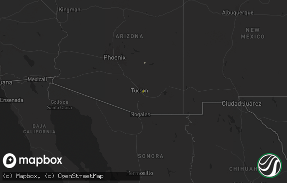
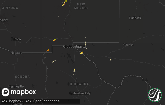
Hail Map in Arizona on July 25, 2019
The weather event in Arizona on July 25, 2019 includes Hail map. 11 states and 91 cities were impacted and suffered possible damage. The total estimated number of properties impacted is 1.

Hail
1
Estimated number of impacted properties by a 1.00" hail or larger0
Estimated number of impacted properties by a 1.75" hail or larger0
Estimated number of impacted properties by a 2.50" hail or largerStorm reports in Arizona
Arizona
| Date | Description |
|---|---|
| 07/25/20196:15 PM CDT | Corrects previous tstm wnd gst report from 21 wnw rio rico. Corrects previous heavy rain report from 21 wnw rio rico. Time estimated from radar. Trained spotter recorde |
| 07/25/20191:56 AM CDT | At 655 PM MST, a severe thunderstorm was located 10 miles north of Santa Rosa, or 25 to 30 miles southwest of Casa Grande, moving northwest at 15 mph. HAZARD...60 mph wind gusts and penny size hail along with heavy rain. SOURCE...Radar indicated. IMPACT...Expect damage to roofs, siding, and trees. Locations impacted include... Santa Rosa, Anegam, North Komelik, Kohatk, Palo Verde Stand, Ventana, Ak Chin, San Luis and Santa Rosa School. |
| 07/25/20191:12 AM CDT | At 610 PM MST, an area of severe thunderstorms was located 10 to 18 miles northeast of Santa Rosa, or 28 to 35 miles south of Casa Grande, moving northwest at 10 mph. HAZARD...60 mph wind gusts and quarter size hail along with blowing dust, followed by heavy rain. SOURCE...Radar indicated. IMPACT...Hail damage to vehicles is expected. Expect wind damage to roofs, siding, and trees. Locations impacted include... North Komelik, Kohatk, Jack Rabbit and Shopishk. |
| 07/25/20191:03 AM CDT | At 602 PM MST, a severe thunderstorm was located near San Miguel, or 19 miles south of Sells, moving northwest at 10 mph. HAZARD...60 mph wind gusts and quarter size hail along with heavy rain. SOURCE...Radar indicated. IMPACT...Hail damage to vehicles is expected. Expect wind damage to roofs, siding, and trees. Locations impacted include... Vamori, Choulic, Coldfields, South Komelik and Itak. |
| 07/25/20191:02 AM CDT | At 602 PM MST/702 PM MDT/, a severe thunderstorm was located near Keams Canyon, moving northeast at 15 mph. HAZARD...60 mph wind gusts and quarter size hail. SOURCE...Radar indicated. IMPACT...Hail damage to vehicles is expected. Expect wind damage to roofs, siding, and trees. Locations impacted include... Keams Canyon, Low Mountain, Jadito, Whippoorwill Chapter House and Jeddito. |
| 07/24/201911:00 PM CDT | At 400 PM MST, a severe thunderstorm was located over Arivaca, or 15 miles west of Tubac, moving northwest at 10 mph. HAZARD...60 mph wind gusts and quarter size hail. SOURCE...Radar indicated. IMPACT...Hail damage to vehicles is expected. Expect wind damage to roofs, siding, and trees. Locations impacted include... Arivaca and Arivaca Lake. This includes Route 286 between mile markers 6 and 24, and near milemarker 26. |
| 07/24/201910:55 PM CDT | At 354 PM MST, a severe thunderstorm was located near Tanque Verde, or 14 miles northeast of Davis-Monthan Air Force Base, moving west at 10 mph. HAZARD...60 mph wind gusts and penny size hail along with heavy rain. SOURCE...Radar indicated. IMPACT...Expect damage to roofs, siding, and trees. Locations impacted include... Tanque Verde, Saguaro National Park East, Seven Falls and Sabino Canyon. |
| 07/24/201910:34 PM CDT | At 333 PM MST, a severe thunderstorm was located 10 miles northwest of Benson, moving west at 15 mph. HAZARD...60 mph wind gusts and penny size hail along with heavy rain. SOURCE...Radar indicated. IMPACT...Expect damage to roofs, siding, and trees. Locations impacted include... Benson, Saguaro National Park East and Mescal. This includes the following highways... Interstate 10 between mile markers 290 and 306. Route 80 between mile markers 293 and 294. Route 90 near mile marker 290. |
All States Impacted by Hail Map on July 25, 2019
Cities Impacted by Hail Map on July 25, 2019
- Cheyenne Wells, CO
- Burlington, CO
- Tucson, AZ
- Sells, AZ
- Hill City, SD
- Madison, MN
- Brainerd, MN
- Fort Ripley, MN
- Cushing, MN
- Tribune, KS
- Palisade, MN
- Milan, MN
- Montevideo, MN
- Appleton, MN
- Watson, MN
- Burtrum, MN
- Swanville, MN
- Casa Grande, AZ
- North Palm Beach, FL
- West Palm Beach, FL
- Palm Beach Gardens, FL
- Isle, MN
- Mora, MN
- Roseau, MN
- Wannaska, MN
- Clara City, MN
- Mcgregor, MN
- Benson, MN
- Glenwood, MN
- Starbuck, MN
- Granite Falls, MN
- Sacred Heart, MN
- Maynard, MN
- Clontarf, MN
- Renville, MN
- Kelliher, MN
- Pompano Beach, FL
- Cubero, NM
- Strathcona, MN
- Salol, MN
- Thoreau, NM
- Gordon, NE
- Hillman, MN
- Weskan, KS
- Prewitt, NM
- Tamarack, MN
- Echo, MN
- Karlstad, MN
- Brooten, MN
- Chambers, AZ
- Batesland, SD
- Allen, SD
- Martin, SD
- Cook, MN
- Mount Lemmon, AZ
- Page, ND
- Luverne, ND
- Blomkest, MN
- Porcupine, SD
- Kit Carson, CO
- Sunburg, MN
- Murdock, MN
- De Kalb Junction, NY
- Cooperstown, ND
- Opa Locka, FL
- Miami Gardens, FL
- Prinsburg, MN
- Raymond, MN
- Grey Eagle, MN
- Desert Center, CA
- Hermosa, SD
- Hannaford, ND
- Bethune, CO
- Danvers, MN
- Shonto, AZ
- Pennock, MN
- Valley City, ND
- Grygla, MN
- Kerkhoven, MN
- Kennedy, MN
- Bellingham, MN
- Odessa, MN
- Olivia, MN
- Correll, MN
- Lake Lillian, MN
- Danube, MN
- Dawson, MN
- Holloway, MN
- Arivaca, AZ
- Onamia, MN
- Miami, FL


