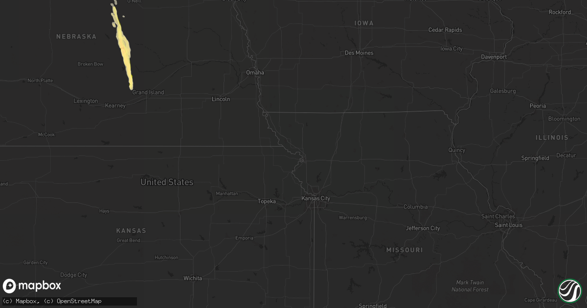
Hail Map in Montana on July 24, 2013
Get this storm
July 24 map
$229
one time, instant access
Download today. No call, no setup
Keep the $229
Bought the map and want the full workflow? Apply the entire $229 to a subscription within 7 days. None of it is wasted.
Every map, not just this one
This buys you this map. Subscription and you get every map we run, in the markets you choose from a few cities to whole states to nationwide. Plus real-time alerts the moment a storm fires.
Contact data
Name, contact info, occupancy, even credit band for addresses in the footprint. You go from where it hit to who to call.
Become the source they trust
Unlimited branding weather history reports on demand. You already have the documented answer ready for the property owner, and you are the one who showed up with it.
Property data and RoofTrace estimates
Pull up any address you have got, its value and the exact code rules for that jurisdiction, straight from One Click Code. Then RoofTrace estimates the squares, pitch, and roof value, priced the way you price.
Storm reports in Montana
Montana
| Date | Description |
|---|---|
| 07/24/20136:45 PM CDT | A local report indicates 60 MPH wind near 6 NNE BABB |
| 07/24/20136:45 PM CDT | A local report indicates 1.00 inch wind near 6 NNE BABB |
| 07/24/20136:40 PM CDT | Half dollar sized hail covering ground. Hail duration 5 minutes |
| 07/24/20136:30 PM CDT | Mostly pea sized hail was observed but there were a couple the size of half dollars. |
| 07/24/20136:21 PM CDT | Estimated golfball sized hail. 71 mph wind. |
| 07/24/20136:08 PM CDT | Hail ended at 524pm. |
| 07/24/20136:05 PM CDT | A local report indicates 1.75 inch wind near HINSDALE |
| 07/24/20136:04 PM CDT | Golfball sized hail. 25 to 30 mph wind. Hail duration 10 minutes |
| 07/24/20135:55 PM CDT | A local report indicates 1.50 inch wind near 6 NNE BABB |
| 07/24/20135:45 PM CDT | A local report indicates 1.00 inch wind near 5 ENE SACO |
| 07/24/20135:45 PM CDT | Hail ended at 500pm |
| 07/24/20135:18 PM CDT | Quarter size hail covering road. |
| 07/24/20135:05 PM CDT | Hail lasted until 420 pm. |
| 07/24/20134:49 PM CDT | Quarter sized hail covering ground. |
| 07/24/20134:40 PM CDT | Quarter sized hail covering road. |
| 07/24/20134:20 PM CDT | Quarter size hail covered ground. Heavy rain. Hail duration 10 minutes |
| 07/24/20133:56 PM CDT | Hail aobut 2 1/4 inch. Some crop damage hail duration 7 minutes |
| 07/24/20133:55 PM CDT | Ping pong hail size at grain church about 20 miles north of nashua. |
| 07/24/20139:55 AM CDT | Multiple social media photos posts of quarter sized hail or larger along bootlegger trail. Location and time estimated from radar. |
| 07/24/20131:34 AM CDT | Accompanied by pea size hail. |
| 07/24/201312:40 AM CDT | Accompanied by pea size hail and very heavy rainfall totalling 1.50 inches. |
| 07/24/201312:30 AM CDT | Thunderstorm wind gusts estimated at 60 mph or more. Part of barn roof peeled off. Extensive tree damage. Accompanied by hail up to quarter size. |
| 07/24/201312:30 AM CDT | A few hailstones up to quarter size with damage to house. Accompanied by thunderstorm wind gusts of 60 mph or more. |
| 07/23/201311:48 PM CDT | Several outbuildings that were being used for livestock were destroyed along highway 59. Debris was all blown downwind in one direction...indicative of straight-line wi |
| 07/23/201310:35 PM CDT | Quarter inch hail. Some broken windows. Time estimated from radar |
| 07/23/20139:58 PM CDT | Quarter sized hail. Heavy rain. Wind speed ~30 - 40 mph. |
| 07/23/20139:55 PM CDT | Multiple social media photos posts of quarter sized hail or larger along bootlegger trail. Location and time estimated from radar. |
| 07/23/20139:40 PM CDT | Trees 8-10 inch diameter broken off. Pea sized hail. |
| 07/23/20139:32 PM CDT | Golfball sized hail. Wind gust ~ 55 mph. |
| 07/23/20139:20 PM CDT | Benton lake area |
| 07/23/20139:08 PM CDT | Quarter sized hail lasted about 5 minutes. Wind estimated 58 mph just ahead of hail. Hail duration 5 minutes observer location in brockway |
| 07/23/20139:08 PM CDT | 30 - 40 mph winds |
| 07/23/20139:00 PM CDT | A local report indicates 1.00 inch wind near 3 NE DUTTON |
| 07/23/20138:55 PM CDT | Lufborough hill dot site reported 60mph wind gust. |
| 07/23/20138:42 PM CDT | A local report indicates 73 MPH wind near 7 SSW CONRAD |
| 07/23/20138:15 PM CDT | Golf ball sized hail reported in the area. Windows broken out on home. |
| 07/23/20138:02 PM CDT | Golfball sized hail covering ground. |
| 07/23/20137:50 PM CDT | Quarter sized hail. Heavy rain. |
| 07/23/20137:37 PM CDT | Nickle sized hail and a few quarter sized. |
| 07/23/20137:35 PM CDT | Wind gust 59mph 635 pm. |
| 07/23/20137:20 PM CDT | A local report indicates 1.00 inch wind near 1 W CUT BANK |
| 07/23/20137:20 PM CDT | Quarter sized hail. Wind approx 50 mph. |
| 07/23/20137:20 PM CDT | Quarter sized hail and widespread crop damage. |
| 07/23/20137:20 PM CDT | Quarter sized hail and widespread crop damage. |
| 07/23/20137:15 PM CDT | Quarter sized hail covering ground. |
| 07/23/20137:00 PM CDT | A local report indicates 1.00 inch wind near 6 N FRAZER |
| 07/23/20137:00 PM CDT | 1/2 inch hail also reported. Total crop loss was observed. |
All States Impacted by Hail Map on July 24, 2013
Cities Impacted by Hail Map on July 24, 2013
- Keysville, VA
- Wasta, SD
- Howes, SD
- Crawford, NE
- Hanna, WY
- Saco, MT
- Hinsdale, MT
- Glendo, WY
- Hemingford, NE
- Glendive, MT
- Wolf Point, MT
- Glasgow, MT
- Vandalia, MT
- Harrison, NE
- Plainview, TX
- Alliance, NE
- Broadwater, NE
- Angora, NE
- Lisco, NE
- Bridgeport, NE
- Floweree, MT
- Power, MT
- Circle, MT
- Casper, WY
- Pueblo, CO
- Nashua, MT
- Wall, SD
- Sedalia, CO
- Woodland Park, CO
- Sidney, NE
- Bloomfield, MT
- Fort Bliss, TX
- Cloudcroft, NM
- Richey, MT
- Friona, TX
- Muleshoe, TX
- Hay Springs, NE
- Albin, WY
- Pine Bluffs, WY
- Enning, SD
- Claude, TX
- Newell, SD
- Aurora, NC
- Burns, WY
- Boyes, MT
- Hammond, MT
- Kenton, OK
- Boise City, OK
- Long Prairie, MN
- Valier, MT
- Cut Bank, MT
- Rogers, NM
- Cohagen, MT
- Sand Springs, MT
- Forsyth, MT
- Union Center, SD
- Terry, MT
- Glenrock, WY
- Douglas, WY
- Great Falls, MT
- Dutton, MT
- Socorro, NM
- Lagrange, WY
- Clayton, NM
- Payson, AZ
- Broadus, MT
- Alzada, MT
- Whitney, NE
- Carpenter, WY
- Babb, MT
- Ericson, NE
- North Loup, NE
- Burwell, NE
- Ord, NE
- Cheyenne, WY
- Brockway, MT
- Jordan, MT
- Vida, MT
- Browning, MT
- Malta, MT
- Marsland, NE
- Hereford, TX
- Lodgepole, NE
- Walsh, CO
- Campo, CO
- Lyons, CO
- Lindsay, MT
- Howard, CO
- Harrisburg, NE
- Hawk Springs, WY
- Fort Peck, MT
- Wheatland, WY
- Manville, WY
- Lancaster, MN
- Frazer, MT
- Cairo, NE
- Ravenna, NE
- Sunland Park, NM
- Santa Teresa, NM
- El Paso, TX
- Westcliffe, CO
- Amarillo, TX
- Gladstone, VA
- Lockney, TX
- Shawnee, WY
- Bosler, WY
- Salida, CO
- Monument, CO
- Colorado Springs, CO
- Melrose, MN
- Sauk Centre, MN
- Grey Eagle, MN
- Ashton, NE
- Brady, MT
- Choteau, MT
- Conrad, MT
- Roswell, NM
- Adrian, TX
- Yoder, WY
- Quitaque, TX
- Sebeka, MN
- Fort Gaines, GA
- Canyon, TX
- Elgin, OK
- Elizabethtown, NC
- Larslan, MT
- Zortman, MT
- Brusett, MT
- Dodson, MT
- Moultrie, GA
- Prospect, VA
- Cullen, VA
- Meherrin, VA
- Farmville, VA
- Charlotte Court House, VA
- Pamplin, VA
- Warrenton, NC
- Macon, NC
- Hollister, NC
- Littleton, NC
- Geyser, MT
- Chinook, MT
- Lloyd, MT
- Hays, MT
- Tulia, TX
- Happy, TX
- Estancia, NM
- Rapid City, SD
- Nisland, SD
- Star, NC
- Seagrove, NC
- Hartsfield, GA
- Raleigh, NC
- Chugwater, WY
- Raynesford, MT
- Roaring River, NC
- North Wilkesboro, NC
- Monahans, TX
- Pyote, TX
- Grenville, NM
- Robbins, NC
- Abbeville, AL
- Shorterville, AL
- Concord, NC
- Walsenburg, CO
- Lake George, CO
- Eunice, NM
- Farwell, NE
- Boelus, NE
- Rockville, NE
- Elba, NE
- Amelia, NE
- Belle Fourche, SD
- Brodnax, VA
- La Crosse, VA
- Fowler, CO
- Tallahassee, FL
- Thief River Falls, MN
- Viking, MN
- Newfolden, MN
- Pitkin, LA
- Marion, NC
- Truth Or Consequences, NM
- Eagle Bend, MN
- Shamrock, TX
- Fosston, MN
- Lengby, MN
- Claunch, NM
- Conchas Dam, NM
- Trementina, NM
- Trenton, NC
- Pink Hill, NC
- Richfield, KS
- Dalton, NE
- Eagle Springs, NC
- Fort Davis, TX
- Volborg, MT
- Peyton, CO
- Chappell, NE
- Lovington, NM
- Quitman, GA
- Wildorado, TX
- Sand Coulee, MT
- Belt, MT
- South Hill, VA
- Kenbridge, VA
- Trinidad, CO
- Grover, CO
- Stuart, NE
- Atkinson, NE
- Newport, NE
- Coolidge, GA
- Pavo, GA
- Yoder, CO
- Appomattox, VA
- Magdalena, NM
- Otter, MT
- Aguilar, CO
- Weston, CO
- Kress, TX
- Mescalero, NM
- Clarendon, TX
- Lelia Lake, TX
- Scotia, NE
- Loup City, NE
- Elyria, NE
- Dimmitt, TX
- Fairfield, NC
- Thomasville, GA
- Ronda, NC
- Cedar City, UT
- Avondale, CO
- Carrizozo, NM
- Freeport, MN
- Lunenburg, VA
- Douglas, AZ
- Portales, NM
- Windsor, NC
- O'Brien, FL
- Laramie, WY
- Brookwood, AL
- Shelton, NE
- Norman Park, GA
- Villa Grove, CO
- Ponsford, MN
- Detroit Lakes, MN
- Osage, MN
- Shawnee, CO
- Cotopaxi, CO
- Eufaula, AL
- Vado, NM
- Barney, GA
- Newton, NC
- Hickory, NC
- Rock River, WY
- Boulder, UT
- Mangum, OK
- Chambers, NE
- Canon City, CO
- Jal, NM
- Allenspark, CO
- Fe Warren Afb, WY
- Andrews, TX
- Boone, CO
- Menahga, MN
- Wheeler, TX
- Larkspur, CO
- Suffolk, VA
- Lyman, NE
- Carter, MT
- Highwood, MT


