Hail Map on July 20, 2024
Get this storm
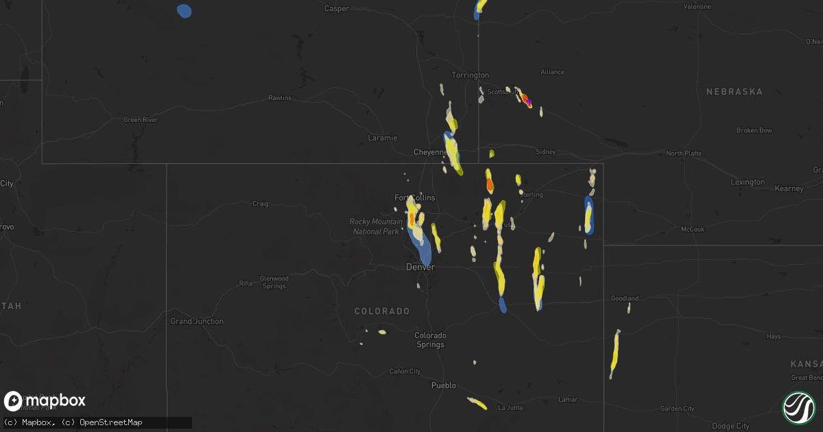
July 20 map
$229
one time, instant access
Download today. No call, no setup
Keep the $229
Bought the map and want the full workflow? Apply the entire $229 to a subscription within 7 days. None of it is wasted.
Every map, not just this one
This buys you this map. Subscription and you get every map we run, in the markets you choose from a few cities to whole states to nationwide. Plus real-time alerts the moment a storm fires.
Contact data
Name, contact info, occupancy, even credit band for addresses in the footprint. You go from where it hit to who to call.
Become the source they trust
Unlimited branding weather history reports on demand. You already have the documented answer ready for the property owner, and you are the one who showed up with it.
Property data and RoofTrace estimates
Pull up any address you have got, its value and the exact code rules for that jurisdiction, straight from One Click Code. Then RoofTrace estimates the squares, pitch, and roof value, priced the way you price.
States Impacted by Hail Map on July 20, 2024
Storm reports
South Carolina
| Date | Description |
|---|---|
| 07/20/20245:03 PM CDT | Tree down at 58 big rd. |
| 07/20/20244:55 PM CDT | Tree limb down on a power line on the 1900 block of trask parkway. The power line later started the tree on fire. |
| 07/20/20244:34 PM CDT | Tree down at 156 twickenham rd |
| 07/20/20244:30 PM CDT | Sc highway patrol reported a tree down on coosaw scenic drive. Time estimated by radar. |
| 07/20/20244:14 PM CDT | Two small trees down near the intersection of great swamp road and gensie shuman road. Time estimated based on radar. |
| 07/20/20243:18 PM CDT | Tree down at the intersection of hendersonville highway and combahee road. Time estimated by radar. |
| 07/20/20243:17 PM CDT | Sc highway patrol reported a tree down on stephanie circle. Time based on report. |
| 07/20/20242:53 PM CDT | Tree down on low country highway near state road s-15-28. Time estimated based on radar. |
| 07/20/20242:27 PM CDT | Tree down on lands end road. Time estimated by radar. |
West Virginia
| Date | Description |
|---|---|
| 07/20/20246:10 PM CDT | There were several calls for trees and wires blown down south of great cacapon... Including in the 500 block of wv-9 rockford road/cacapon road... The 3200 block of wv- |
| 07/20/20246:10 PM CDT | There were several calls for trees and wires blown down in and near berkeley springs and great cacapon... Including in the 500 block of us-522 hancock road... The 3200 |
Florida
| Date | Description |
|---|---|
| 07/20/20242:55 PM CDT | Jefferson county 911 reports a tree on a power line on lake rd. |
| 07/20/20242:40 PM CDT | Leon county 911 reports a power line down at jefferson rd and mahan. |
| 07/19/20247:20 PM CDT | [landspout] waterspout on lake george went onto drayton island and became a land spout. No damage was reported. |
Oklahoma
| Date | Description |
|---|---|
| 07/20/202412:12 AM CDT | Report from mping: quarter |
| 07/20/202412:05 AM CDT | A local report indicates 58 MPH wind near Altus Air Force Base |
| 07/19/202411:55 PM CDT | Barn destroyed... Damage to roof of home. |
| 07/19/20249:00 PM CDT | Large tree limbs downed; pivot irrigation overturned. |
| 07/19/20248:10 PM CDT | Mesonet station hint hinton. |
Virginia
| Date | Description |
|---|---|
| 07/20/20245:03 PM CDT | Large hardwood tree down on a house on white chapel road in norfolk. Time estimated from radar data. |
| 07/20/20245:03 PM CDT | Corrects previous tstm wnd dmg report from 1 wsw norview. Large hardwood tree down on a house on white chapel road in norfolk. The tree also damaged an suv. Time estima |
| 07/20/20244:57 PM CDT | Broadcast media reported a roof blown off a pool house as well as medium sized branches down in the bells farm neighborhood of norfolk. Time estimated from radar. |
| 07/20/20244:51 PM CDT | Corrects previous tstm wnd dmg report from 1 wsw norview. Corrects previous tstm wnd dmg report from 1 wsw norview. Large hardwood tree down on a house on white chapel |
Georgia
| Date | Description |
|---|---|
| 07/20/20243:19 PM CDT | Social media posted a picture of a large tree limb down near griffin lake... Likely due to outflow. Time estimated by radar. |
Iowa
| Date | Description |
|---|---|
| 07/20/20245:10 PM CDT | [landspout] brief touchdown - no known damage. Report with video via social media. Time and location estimated from report and radar data. |
Texas
| Date | Description |
|---|---|
| 07/20/20242:57 PM CDT | Mesonet station 26 gail 2se. |
| 07/20/20242:52 PM CDT | Mesonet station 93 snyder 3ssw scurry county. |
Utah
| Date | Description |
|---|---|
| 07/20/20244:51 PM CDT | Landspout. |
| 07/20/20243:20 PM CDT | Corrects timing of previous tornado report from verdure. Several videos showed landspout. |
Nebraska
| Date | Description |
|---|---|
| 07/20/20244:40 PM CDT | Emergency manager measured one inch hailstones with calipers. |
| 07/20/20242:36 PM CDT | A local report indicates 2.00 inch wind near 5 E Bayard |
| 07/20/20242:36 PM CDT | A local report indicates 3.00 inch wind near 5 E Bayard |
| 07/20/20242:26 PM CDT | Reported quarter to golf ball size hail. |
Nevada
| Date | Description |
|---|---|
| 07/19/202411:37 PM CDT | Mesonet station blun2 bluewing mountain. |
Idaho
| Date | Description |
|---|---|
| 07/19/202410:50 PM CDT | Public reports downed power lines off highway drive in the area of us-20 which caused a fire and several power outages in the area. Time estimated based on surface obse |
Colorado
| Date | Description |
|---|---|
| 07/20/20246:45 PM CDT | Mesonet station dw1011 longmont. |
| 07/20/20246:20 PM CDT | A local report indicates 58 MPH wind near Fort Morgan |
| 07/20/20244:54 PM CDT | Weather underground site kcoflagl13. |
| 07/20/20244:52 PM CDT | Estimated 60-70 mph winds near ballyneal along with pea size hail that lasted for 2-3 minutes. Time was estimated via radar. |
| 07/20/20244:42 PM CDT | Mesonet station co048 us 385 holyoke. Also recorded a sustained wind of 57 mph. |
| 07/20/20244:35 PM CDT | Awos station kheq holyoke airport. |
| 07/19/202410:21 PM CDT | Tree down on a car. Photo via social media. Time estimated by radar. |
| 07/19/20249:58 PM CDT | Mesonet station co207 denver i-70/york st. |
| 07/19/20249:58 PM CDT | Mesonet station co003 denver i-70/colorado blvd. |
| 07/19/20249:34 PM CDT | A local report indicates 60 MPH wind near 2 SE Erie |
| 07/19/20249:27 PM CDT | Corrects previous non-tstm wnd gst report from 4 ese erie. Mesonet station co010 broomfield i-25/highway 7. |
| 07/19/20249:21 PM CDT | A local report indicates 65 MPH wind near Dacono |
| 07/19/20249:19 PM CDT | Report from mping: 1-inch tree limbs broken; shingles blown off. |
| 07/19/20249:16 PM CDT | Report from mping: 1-inch tree limbs broken; shingles blown off. |
| 07/19/20249:15 PM CDT | Delayed report. Time estimated by radar. |
| 07/19/20249:00 PM CDT | A local report indicates 1.00 inch wind near 2 SSW Berthoud |
| 07/19/20248:58 PM CDT | Report from mping: 1-inch tree limbs broken; shingles blown off. |
| 07/19/20248:53 PM CDT | A local report indicates 1.00 inch wind near 3 SSE Gilcrest |
| 07/19/20248:52 PM CDT | Delayed report. Time estimated by radar. |
| 07/19/20248:49 PM CDT | A local report indicates 64 MPH wind near 2 WSW Berthoud |
| 07/19/20248:48 PM CDT | A local report indicates 58 MPH wind near 4 WSW Berthoud |
| 07/19/20248:47 PM CDT | Mesonet station co037 i-25 berthoud. |
| 07/19/20248:45 PM CDT | Up to half dollar size hail fell for a duration of 6 minutes. |
| 07/19/20248:44 PM CDT | A local report indicates 1.50 inch wind near 1 NW Campion |
| 07/19/20248:40 PM CDT | A local report indicates 1.00 inch wind near 3 SW Loveland |
| 07/19/20248:34 PM CDT | A local report indicates 1.00 inch wind near 3 NW Campion |
| 07/19/20248:33 PM CDT | Asos station klic limon. |
| 07/19/20247:53 PM CDT | Between half inch to 1 inch diameter hail fell for 5 minutes. |
Wyoming
| Date | Description |
|---|---|
| 07/20/20246:34 PM CDT | Spotter reports quarter-size hail. |
| 07/20/20246:25 PM CDT | Trained spotter reports quarter-size hail. |
| 07/20/20244:11 PM CDT | Asos station klnd lander airport. |
| 07/20/20242:45 PM CDT | A local report indicates 60 MPH wind near 10 N Van Tassell |
Cities Impacted by Hail Map on July 20, 2024
- Minatare, NE
- Scottsbluff, NE
- Swainsboro, GA
- Twin City, GA
- Cordele, GA
- Arabi, GA
- Edgemont, SD
- Harrison, NE
- Bayard, NE
- Pitts, GA
- Metter, GA
- Big Sandy, MT
- Hanover, NM
- Rochelle, GA
- Lusk, WY
- Circle, MT
- Freeport, TX
- Clute, TX
- Bridgeport, NE
- Abbeville, GA
- Register, GA
- Statesboro, GA
- Roseau, MN
- Rhine, GA
- Gail, TX
- Milan, GA
- Knott, TX
- Akron, CO
- Dunbar, WI
- Jacksonville, GA
- Martinsdale, MT
- Badger, MN
- Julesburg, CO
- Iron Mountain, MI
- Sagola, MI
- Felch, MI
- Fence, WI
- Cresbard, SD
- Clyo, GA
- McRae Helena, GA
- Cope, CO
- Anton, CO
- Vulcan, MI
- Ely, MN
- Homerville, GA
- Wrenshall, MN
- Argonne, WI
- Amherst, CO
- Watauga, SD
- Broadview, MT
- Lavina, MT
- Hunter, OK
- Enid, OK
- Lander, WY
- Bushnell, NE
- Barnum, MN
- Alma, GA
- Garber, OK
- Holyoke, CO
- Wray, CO
- Flagler, CO
- Kettle River, MN
- McIntosh, SD
- Skidmore, TX
- Laona, WI
- Crandon, WI
- Columbus, MT
- Adams, ND
- Bison, OK
- Lyman, NE
- Yoder, WY
- New Raymer, CO
- Arriba, CO
- Sterling, CO
- Yemassee, SC
- Ridgeland, SC
- Coosawhatchie, SC
- Sheldon, SC
- Green Cove Springs, FL
- Waukomis, OK
- Douglas, OK
- Fairmont, OK
- Jacksonville, FL
- Wabeno, WI
- Park City, MT
- Joliet, MT
- Willcox, AZ
- Merino, CO
- Fairdale, ND
- Brockton, MT
- Duluth, MN
- Tillman, SC
- Hennessey, OK
- Rincon, GA
- Beeville, TX
- Mathis, TX
- Hardeeville, SC
- Tamarack, MN
- Stoneham, CO
- Snyder, CO
- Fort Morgan, CO
- Hillrose, CO
- Lagrange, WY
- Hawk Springs, WY
- Newcastle, WY
- George West, TX
- Milton, ND
- Eagle Lake, FL
- Bartow, FL
- Winter Haven, FL
- Benson, AZ
- Weldona, CO
- Roberts, MT
- Fromberg, MT
- Edinburg, ND
- Aneta, ND
- Otis, CO
- Meriden, WY
- Cheyenne, WY
- Brush, CO
- Yuma, CO
- Burns, WY
- Albin, WY
- Bridger, MT
- Tynan, TX
- Hillsdale, WY
- Peridot, AZ
- Custer, SD
- Big Timber, MT
- Greycliff, MT
- Palatka, FL
- Goodland, KS
- Sonoita, AZ
- Carpenter, WY
- Pine, AZ
- Elgin, AZ
- Sedona, AZ
- Calumet, OK
- Grover, CO
- Wolf Point, MT
- Geary, OK
- Nunn, CO
- Vail, AZ
- Brocket, ND
- Webster, ND
- Leeds, ND
- Sharon, ND
- Lakota, ND
- Sharon Springs, KS
- Weskan, KS
- Menahga, MN
- Edmore, ND
- Wiggins, CO
- Tribune, KS
- Deer Trail, CO
- Woodrow, CO
- Limon, CO
- Agate, CO
- Hydro, OK
- Lookeba, OK
- Hinton, OK
- Byers, CO
- Onaka, SD
- Laporte, CO
- Fort Collins, CO
- Crary, ND
- Stratton, CO
- Kirk, CO
- Loveland, CO
- Berthoud, CO
- Longmont, CO
- Eagle Butte, SD
- Timnath, CO
- Arcadia, FL
- Edmond, OK
- La Salle, CO
- Platteville, CO
- Lawton, ND
- Sheyenne, ND
- Fort Lupton, CO
- Cando, ND
- Mead, CO
- Lafayette, CO
- Erie, CO
- Broomfield, CO
- Brighton, CO
- Hudson, CO
- Dacono, CO
- Frederick, CO
- Firestone, CO
- Denver, CO
- Pekin, ND
- Tolna, ND
- Park Rapids, MN
- Thornton, CO
- Henderson, CO
- Fort Meade, FL
- Esmond, ND
- Dupont, CO
- Commerce City, CO
- Aurora, CO
- Carnegie, OK
- Minnewaukan, ND
- Kingman, KS
- Johnstown, CO
- Windsor, CO
- Dupree, SD
- Denhoff, ND
- Wing, ND
- Drake, CO
- Hansboro, ND
- Goodrich, ND
- Fort Totten, ND
- Saint Michael, ND
- Fort Cobb, OK
- Lankin, ND
- Warwick, ND
- Bowdon, ND
- Glasgow, MT
- Harper, KS
- Rocklake, ND
- Oberon, ND
- Littleton, CO
- New Rockford, ND
- Guffey, CO
- Cathay, ND
- Fessenden, ND
- Grace City, ND
- Louviers, CO
- Saint Marie, MT
- Lyons, CO
- Kensal, ND
- Hurdsfield, ND
- Pingree, ND
- Kearny, AZ
- Lehr, ND
- Chaseley, ND
- Wishek, ND
- Buchanan, ND
- Tappen, ND
- Spivey, KS
- Streeter, ND
- Jamestown, ND
- Medina, ND
- Gackle, ND
- Seymour, TX
- Carrington, ND
- Napoleon, ND
- Dill City, OK
- Zeeland, ND
- Davidson, OK
- Blair, OK
- Altus, OK
- Altus Afb, OK