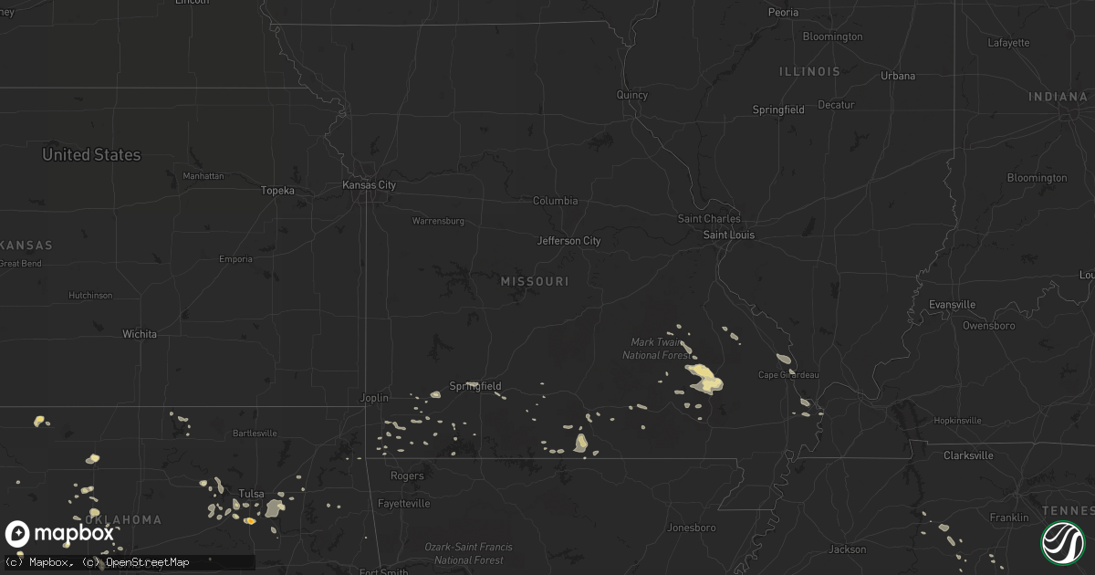
Hail Map in Missouri on July 20, 2015
Get this storm
July 20 map
$229
one time, instant access
Download today. No call, no setup
Keep the $229
Bought the map and want the full workflow? Apply the entire $229 to a subscription within 7 days. None of it is wasted.
Every map, not just this one
This buys you this map. Subscription and you get every map we run, in the markets you choose from a few cities to whole states to nationwide. Plus real-time alerts the moment a storm fires.
Contact data
Name, contact info, occupancy, even credit band for addresses in the footprint. You go from where it hit to who to call.
Become the source they trust
Unlimited branding weather history reports on demand. You already have the documented answer ready for the property owner, and you are the one who showed up with it.
Property data and RoofTrace estimates
Pull up any address you have got, its value and the exact code rules for that jurisdiction, straight from One Click Code. Then RoofTrace estimates the squares, pitch, and roof value, priced the way you price.
Storm reports in Missouri
Missouri
| Date | Description |
|---|---|
| 07/20/20156:16 PM CDT | Emergency management reported a tree down on highway dd se of kimberling city. Time estimated by radar. |
| 07/20/20155:53 PM CDT | Missouri highway patrol reported a tree down near cape fair. Time estimated by radar. |
| 07/19/20158:55 PM CDT | Small tree limbs broken and debris from trees scattered across area |
| 07/19/20158:55 PM CDT | Power lines down on maud street near kanell blvd...and also at business 67 and vine street. |
| 07/19/20157:40 PM CDT | Law enforcement reported a tree down near thomasville. Time estimated by radar. |
| 07/19/20157:20 PM CDT | Tree down. Bb hwy. |
All States Impacted by Hail Map on July 20, 2015
Cities Impacted by Hail Map on July 20, 2015
- Geary, OK
- Calumet, OK
- Sudan, TX
- Nara Visa, NM
- Amarillo, TX
- Lovington, NM
- Nazareth, TX
- Dimmitt, TX
- Hart, TX
- Hedley, TX
- Lelia Lake, TX
- Sand Springs, OK
- Sapulpa, OK
- Clines Corners, NM
- Tulsa, OK
- Hobart, OK
- Fordland, MO
- Plainview, TX
- Olton, TX
- Kress, TX
- Mosquero, NM
- Tucumcari, NM
- Charleston, MO
- Vega, TX
- Dover, OK
- Hennessey, OK
- Gruver, TX
- Spearman, TX
- Hulbert, OK
- Mcalister, NM
- Great Falls, SC
- Yukon, OK
- Logan, NM
- Saint Cloud, FL
- Kenansville, FL
- Elida, NM
- Conchas Dam, NM
- Erick, OK
- Sayre, OK
- Cheyenne, OK
- Sweetwater, OK
- Wellington, TX
- Hollis, OK
- Mount Vernon, MO
- Mclean, TX
- Capitan, NM
- Clearwater, KS
- Wheeler, TX
- Cleveland, OK
- Chouteau, OK
- Ellsinore, MO
- Poplar Bluff, MO
- Elk City, OK
- Panhandle, TX
- Covelo, CA
- Carnegie, OK
- Briscoe, TX
- McClure, IL
- Cape Girardeau, MO
- Gage, OK
- Mobeetie, TX
- Alva, OK
- Lone Wolf, OK
- Moody, MO
- Caulfield, MO
- Pottersville, MO
- West Plains, MO
- Rogers, NM
- Causey, NM
- Farmington, MO
- Sainte Genevieve, MO
- Kiefer, OK
- Glenpool, OK
- Silva, MO
- Lodi, MO
- Patterson, MO
- Rogersville, AL
- Shattuck, OK
- Ringgold, GA
- Tunnel Hill, GA
- Hohenwald, TN
- Dora, MO
- Cape Fair, MO
- Coarsegold, CA
- Oakhurst, CA
- Masterson, TX
- Channing, TX
- Miami, TX
- Montague, CA
- Yreka, CA
- North Fork, CA
- O'Neals, CA
- Newkirk, OK
- Crandall, GA
- Sharon, OK
- Silverton, TX
- Canadian, TX
- Stilwell, OK
- Metropolis, IL
- Leedey, OK
- Hammon, OK
- Wildorado, TX
- Happy, TX
- Cochran, GA
- Stotts City, MO
- Sarcoxie, MO
- Crawford, OK
- Arnett, OK
- Durham, OK
- Udall, KS
- Cashion, OK
- Kingfisher, OK
- Baltic, CT
- North Franklin, CT
- Noel, MO
- Lanagan, MO
- Floral, AR
- Kellyville, OK
- Jesup, GA
- Hurricane Mills, TN
- Shell Knob, MO
- Clovis, NM
- Hilger, MT
- Lawrenceburg, TN
- Birch Tree, MO
- Mounds, OK
- Bixby, OK
- Sturgis, KY
- Clubb, MO
- Bay Minette, AL
- Maryville, TN
- Friendsville, TN
- Lenoir City, TN
- Greenback, TN
- Lobelville, TN
- Donaldsonville, LA
- Belleview, MO
- Grady, NM
- Piedmont, MO
- Ellington, MO
- Arnold, CA
- Colchester, CT
- Tahlequah, OK
- Canyon, TX
- San Jon, NM
- Tulia, TX
- Waverly, TN
- Neosho, MO
- Goodman, MO
- Newton, KS
- Hillsboro, KS
- Goessel, KS
- Canton, KS
- Moundridge, KS
- Waynesboro, MS
- Cairo, IL
- Hereford, TX
- Burlington, OK
- Hattieville, AR
- Greenville, MO
- Des Arc, MO
- Annapolis, MO
- Fredericktown, MO
- Pineville, MO
- Anderson, MO
- Farwell, TX
- Gainesville, MO
- Franklin, LA
- Edmond, OK
- Oklahoma City, OK
- Tuttle, OK
- Bison, OK
- Thibodaux, LA
- Monett, MO
- Pierce City, MO
- Vici, OK
- Camargo, OK
- Patton, MO
- Cassville, MO
- Long Barn, CA
- Denmark, SC
- Big Sandy, MT
- Muleshoe, TX
- Portales, NM
- Washburn, MO
- Exeter, MO
- Cherokee, OK
- Coweta, OK
- Enochs, TX
- Galena, MO
- Reydon, OK
- Broken Arrow, OK
- Golconda, IL
- Gamaliel, AR
- Clarkridge, AR
- Mountain Home, AR
- Lakeview, TX
- Mulberry, AR
- Alma, AR
- Haskell, OK
- Bowling Green, KY
- Morgantown, KY
- Weatherford, OK
- Hazlehurst, GA
- Denton, GA
- Pampa, TX
- Drumright, OK
- Mannford, OK
- Bristow, OK
- Gulfport, MS
- Mill Spring, MO
- Hardy, AR
- El Reno, OK
- Mustang, OK
- Pep, NM
- Clarendon, TX
- Kremlin, OK
- Enid, OK
- Bass Lake, CA
- Wishon, CA
- Morganfield, KY
- Burbank, OK
- Verona, MO
- Crane, MO
- Aurora, MO
- Jay, OK
- Ames, OK
- Drummond, OK
- Richton, MS
- White, GA
- Cartersville, GA
- Marion, KS
- Ocean City, MD
- Waukomis, OK
- Bertrand, MO
- Willard, NM
- Winona, MO
- Selbyville, DE
- Fenwick Island, DE
- Bishopville, MD
- Centerville, TN
- Purdy, MO
- Columbia, TN
- Osage, OK
- Pomona, MO
- Terlton, OK
- Melbourne, AR
- Only, TN
- Nunnelly, TN
- Douglass, KS
- Adrian, TX
- Shidler, OK
- Pocasset, OK
- Jerusalem, AR
- Plattenville, LA
- Belle Rose, LA
- Viola, AR
- Gepp, AR
- Shawneetown, IL
- Acworth, GA
- Kennesaw, GA
- Kaw City, OK
- Rogersville, MO
- Blackville, SC
- Cypress, IL
- Belknap, IL
- Vienna, IL
- Lumber City, GA
- Springfield, SC
- Rocky Comfort, MO
- Stella, MO
- Hayes, VA
- Udall, MO
- Tecumseh, MO
- Earth, TX
- Tumbling Shoals, AR
- Drasco, AR
- Ida, AR
- Inola, OK
- Pryor, OK
- Claremore, OK
- Aiken, SC
- New Ellenton, SC
- Beech Island, SC
- Ava, MO
- Mountain View, MO
- Squires, MO
- Boley, OK
- Perryville, MO
- Danville, AR
- Belgrade, MO
- Caledonia, MO
- Hartville, MO
- Hale Center, TX
- Marietta, GA
- Jackson, MO
- Heath Springs, SC
- Lancaster, SC
- Lexington, AL
- Killen, AL
- Loxley, AL
- Albany, GA
- Sacramento, KY
- Bremen, KY
- Quail, TX
- Denton, MT
- Dardanelle, AR
- Guthrie, OK
- Augusta, KS
- Lloyd, MT
- Norwood, MO
- Macomb, MO
- Schriever, LA
- Grantsburg, IL
- Hampshire, TN
- Summertown, TN
- Willow Springs, MO
- Chester, OK
- Fairview, OK
- Branson, MO
- Reeds Spring, MO
- Atlanta, GA
- Granby, MO
- Fairview, MO
- Alton, MO
- Culleoka, TN
- Brownsville, KY
- Roundhill, KY
- Hawesville, KY
- Lewisport, KY
- Dalton, GA
- Vulcan, MO
- Lesterville, MO
- Ironton, MO
- Springlake, TX
- Smithville, GA
- Leesburg, GA
- Catoosa, OK
- Haysville, KS
- Rose Hill, KS
- Derby, KS
- Wichita, KS
- Shamrock, TX
- Cohutta, GA
- Neeses, SC
- Arcadia, MO
- Carrier, OK
- Texola, OK
- Soda Springs, CA
- Jonesville, VA
- Benton, KY
- Kevil, KY
- Grand Chain, IL
- Springfield, MO


