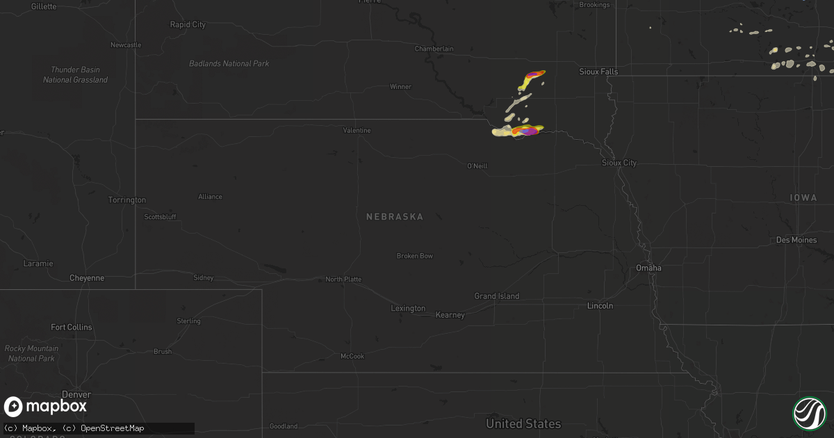
Hail Map in Nebraska on July 17, 2020
Get this storm
July 17 map
$229
one time, instant access
Download today. No call, no setup
Keep the $229
Bought the map and want the full workflow? Apply the entire $229 to a subscription within 7 days. None of it is wasted.
Every map, not just this one
This buys you this map. Subscription and you get every map we run, in the markets you choose from a few cities to whole states to nationwide. Plus real-time alerts the moment a storm fires.
Contact data
Name, contact info, occupancy, even credit band for addresses in the footprint. You go from where it hit to who to call.
Become the source they trust
Unlimited branding weather history reports on demand. You already have the documented answer ready for the property owner, and you are the one who showed up with it.
Property data and RoofTrace estimates
Pull up any address you have got, its value and the exact code rules for that jurisdiction, straight from One Click Code. Then RoofTrace estimates the squares, pitch, and roof value, priced the way you price.
Storm reports in Nebraska
Nebraska
| Date | Description |
|---|---|
| 07/17/20208:46 AM CDT | Quarter size hail at the santee tribe museum but another report in town said hail was just a little smaller than golfball size. |
| 07/17/20203:26 AM CDT | At 825 AM CDT, a severe thunderstorm was located over Springfield, or 8 miles south of Tyndall, moving east at 20 mph. HAZARD...Ping pong ball size hail. SOURCE...Radar indicated. IMPACT...People and animals outdoors will be injured. Expect damage to roofs, siding, windows, and vehicles. This severe thunderstorm will be near... Tabor around 900 AM CDT. Lewis And Clark State Recreation Area around 915 AM CDT.Other locations impacted by this severe thunderstorm includeLesterville. |
All States Impacted by Hail Map on July 17, 2020
Cities Impacted by Hail Map on July 17, 2020
- Braddock, ND
- Hazelton, ND
- Kenton, TN
- Thayer, MO
- Koshkonong, MO
- Alton, MO
- Grafton, ND
- Anamoose, ND
- Sheyenne, ND
- New Rockford, ND
- Granville, ND
- Velva, ND
- Scottsville, KY
- New York Mills, MN
- Bismarck, ND
- Center, ND
- Baldwin, ND
- Mandan, ND
- Mcclusky, ND
- Medina, ND
- Hartland, MN
- New Richland, MN
- Esmont, VA
- Scottsville, VA
- Ellington, MO
- Wolf Lake, IL
- Pomona, IL
- Alto Pass, IL
- Churchs Ferry, ND
- Minnewaukan, ND
- Saint Michael, ND
- Warwick, ND
- Cando, ND
- Lakota, ND
- Leeds, ND
- Crary, ND
- York, ND
- Bisbee, ND
- Pekin, ND
- Tolna, ND
- Devils Lake, ND
- Maddock, ND
- Penn, ND
- Knox, ND
- Mcville, ND
- Fort Totten, ND
- Oberon, ND
- Bowdon, ND
- Hague, ND
- Springfield, SD
- Niobrara, NE
- Brainerd, MN
- Emily, MN
- Remer, MN
- Park Rapids, MN
- Akeley, MN
- Walker, MN
- Hackensack, MN
- Pine River, MN
- Menahga, MN
- Longville, MN
- Outing, MN
- Backus, MN
- Osage, MN
- Nevis, MN
- Fifty Lakes, MN
- Tripp, SD
- Palermo, ND
- Bena, MN
- Kensett, IA
- Northwood, IA
- Joice, IA
- Ellsinore, MO
- Henderson, NC
- Norcross, MN
- Surrey, ND
- Voltaire, ND
- East Grand Forks, MN
- Laporte, MN
- Berthold, ND
- Carpio, ND
- Avon, SD
- Starkweather, ND
- Pingree, ND
- Woodworth, ND
- Sykeston, ND
- Pettibone, ND
- Cathay, ND
- Webster, ND
- Rugby, ND
- Esmond, ND
- Carrington, ND
- Randall, MN
- Little Falls, MN
- Saint James, MN
- Pleasant Garden, NC
- Norwood, NC
- Staples, MN
- Motley, MN
- Pequot Lakes, MN
- Parkston, SD
- Foster City, MI
- Salisbury, NC
- Rockwell, NC
- Concord, NC
- China Grove, NC
- Kannapolis, NC
- Ruso, ND
- Benedict, ND
- Butte, ND
- Balfour, ND
- Bottineau, ND
- Dunseith, ND
- Rogers, ND
- Oriska, ND
- Valley City, ND
- Hannaford, ND
- Dazey, ND
- Luverne, ND
- Barrett, MN
- Herman, MN
- Napoleon, ND
- Couch, MO
- Dyer, TN
- Trenton, TN
- Strasburg, ND
- Linton, ND
- Swan River, MN
- Cornell, MI
- Osage, IA
- New Kent, VA
- Marble Hill, MO
- Evansville, MN
- Brandon, MN
- Battle Lake, MN
- Ashby, MN
- Glenwood, MN
- Brooten, MN
- Martinsville, VA
- Norwich, ND
- Sawyer, ND
- Ashley, ND
- Eureka, SD
- Liberty, NC
- Karlsruhe, ND
- Towner, ND
- Aldrich, MN
- Bertha, MN
- Verndale, MN
- Browerville, MN
- Des Lacs, ND
- Deerbrook, WI
- Antigo, WI
- Bryant, WI
- Wausau, WI
- Meadow, SD
- Tomahawk, WI
- Marshville, NC
- Minot, ND
- Saint John, ND
- Belcourt, ND
- Galesburg, ND
- Page, ND
- Streeter, ND
- Tappen, ND
- Fergus Falls, MN
- Dawson, ND
- Steele, ND
- Oak Grove, KY
- Herndon, KY
- Hopkinsville, KY
- East Bend, NC
- Kintyre, ND
- Hillman, MN
- Pierz, MN
- Albemarle, NC
- Ada, MN
- Arcadia, MO
- Spiritwood, ND
- Jamestown, ND
- Courtenay, ND
- Buchanan, ND
- Rustburg, VA
- Cooperstown, ND
- Delavan, MN
- Easton, MN
- Perth, ND
- Donnelly, MN
- Starbuck, MN
- Dunnville, KY
- Columbia, KY
- Wilton, ND
- Balta, ND
- Bluffton, MN
- Wadena, MN
- Ponsford, MN
- Clarksville, VA
- Keshena, WI
- Lynch, NE
- Cleveland, ND
- New London, NC
- Gold Hill, NC
- Richfield, NC
- Mount Pleasant, NC
- Ethan, SD
- Holyoke, MN
- Wishek, ND
- Zeeland, ND
- Denhoff, ND
- Drake, ND
- Ogema, MN
- Haw River, NC
- Burlington, NC
- Graham, NC
- Bemidji, MN
- Long Prairie, MN
- Carlos, MN
- Osakis, MN
- Eagle Bend, MN
- Bloomer, WI
- New Auburn, WI
- Bassett, VA
- Penhook, VA
- Ypsilanti, ND
- Montpelier, ND
- Lynchburg, VA
- Denton, NC
- Lexington, NC
- Tyndall, SD
- Deering, ND
- New Town, ND
- Burlington, ND
- Plaza, ND
- Parshall, ND
- Glenburn, ND
- Tabor, SD
- Crivitz, WI
- Richwoods, MO
- Foley, MN
- Foreston, MN
- Milaca, MN
- Florence, SD
- Watertown, SD
- Maryland Heights, MO
- Saint Louis, MO
- Swatara, MN
- Hill City, MN
- Mercer, ND
- Turtle Lake, ND
- Fort Ransom, ND
- Powhatan, VA
- Menoken, ND
- Skandia, MI
- Athelstane, WI
- Dante, SD
- Wagner, SD
- Fredericktown, MO
- Annapolis, MO
- Goodrich, ND
- Audubon, MN
- Le Roy, MN
- Van Buren, MO
- Warrenton, NC
- Indian Trail, NC
- Englewood, FL
- Alexandria, MN
- Chippewa Falls, WI
- Jim Falls, WI
- Sanford, NC
- Sebeka, MN
- Sutton, ND
- Willow City, ND
- Rolette, ND
- Wolford, ND
- Rolla, ND
- Mylo, ND
- Nisswa, MN
- Grenville, SD
- Eden, SD
- Roslyn, SD
- Chesterfield, MO
- Wheaton, MN
- Emery, SD
- Alexandria, SD
- Washington, MO
- Union, MO
- Sturgeon Lake, MN
- Mountain, WI
- Highlandville, MO
- Deer Creek, MN
- Parkers Prairie, MN
- Osnabrock, ND
- Birch Tree, MO
- Egeland, ND
- Fort Ripley, MN
- Lyle, MN
- Chesterfield, VA
- Kensal, ND
- Abrams, WI
- Little Suamico, WI
- Saint Clair, MO
- Freeport, MN
- Dutton, VA
- North, VA
- Foster, VA
- Hartfield, VA
- Gloucester, VA
- Cobbs Creek, VA
- Perham, MN
- Bullock, NC
- Nelson, VA
- Buffalo Junction, VA
- Stanton, TN
- Whiteville, TN
- Elizabeth, MN
- Belgrade, MN
- Pickerel, WI
- Oconto, WI
- Waubun, MN
- Princeton, MN
- Cambridge, MN
- Isanti, MN
- Summerfield, NC
- Greensboro, NC
- Leopold, MO
- Borup, MN
- Avon, MN
- Albany, MN
- West Point, VA
- Aitkin, MN
- Swanville, MN
- Argonne, WI
- Hickory, KY
- Mayfield, KY
- Hansboro, ND
- Danville, VA
- Leasburg, NC
- Semora, NC
- Blanch, NC
- Hoople, ND
- Federal Dam, MN
- Edmore, ND
- Lawton, ND
- Fairdale, ND
- Adams, ND
- Keeling, VA
- Vernon Hill, VA
- Sutherlin, VA
- Pillager, MN
- Deer River, MN
- Sacred Heart, MN
- Saluda, VA
- Advance, MO
- Marion, ND
- Lake Park, MN
- Bock, MN
- Oconto Falls, WI
- Lena, WI
- Gillett, WI
- Forest City, IA
- Langdon, ND
- Brownsville, KY
- Jamaica, VA
- Harvey, ND
- Martin, ND
- Doe Run, MO
- Blue Earth, MN
- Bricelyn, MN
- Frost, MN
- Hampden, ND
- Alsen, ND
- Paynesville, MN
- Java, VA
- Lancaster, VA
- Macon, NC
- Mchenry, ND
- Binford, ND
- Glenfield, ND
- Trout Creek, MI
- Staley, NC
- Siler City, NC
- Wing, ND
- Fort Yates, ND
- Kettle River, MN
- Moose Lake, MN
- Verona, ND
- Good Thunder, MN
- Robinson, ND
- Dora, MO
- West Plains, MO
- Harshaw, WI
- Hewitt, MN
- Crosby, MN
- Clarissa, MN
- Cushing, MN
- Crosslake, MN
- Ottertail, MN
- Palisade, MN
- Lake George, MN
- Warsaw, VA
- Farnham, VA
- Tappahannock, VA
- Dunnsville, VA
- Center Cross, VA
- Clinton, KY
- Merrill, WI
- Sauk Centre, MN
- Laona, WI
- Stanfield, NC
- Oakboro, NC
- Fessenden, ND
- Blooming Prairie, MN
- Bardwell, KY
- Huntersville, NC
- Jacobson, MN
- Austinville, VA
- Hillsville, VA
- Barnum, MN
- Pelican Lake, WI
- King And Queen Court House, VA
- Laneview, VA
- Ringgold, VA
- Munich, ND
- Rocklake, ND
- Melrose, MN
- Bantry, ND
- Baxter, MN
- Morris, MN
- Lonedell, MO
- Badin, NC
- Frazee, MN
- Perronville, MI
- Austin, MN
- Potosi, MO
- Belgrade, MO
- Blackstone, VA
- Milton, ND
- Park City, KY
- Smiths Grove, KY
- Salem, AR
- Rutherford, TN
- Wells, MN
- Mineral Point, MO
- Tuttle, ND
- Greensburg, KY
- Campbellsville, KY
- Evening Shade, AR
- Sidney, AR
- Sterling, ND
- Manly, IA
- Farmington, MO
- Ironton, MO
- Isle, MN
- Alden, MN
- Brighton, TN
- Covington, TN
- Cold Spring, MN
- Saint Joseph, MN
- Brockwell, AR
- Elbow Lake, MN
- Poughkeepsie, AR
- Grand Tower, IL
- Trinity, NC
- Rose Creek, MN
- Adams, MN
- Titonka, IA
- Oxford, NC
- Madelia, MN
- Peever, SD
- Hoffman, MN
- Clinchco, VA
- Birchleaf, VA
- Minneola, KS
- Webster, SD
- Colfax, WI
- Wheeler, WI
- Scotland, SD
- Benton, KY
- Saint Paul, MN
- Minneapolis, MN
- Fancy Gap, VA
- Gladstone, MI
- Perkins, MI
- Rapid River, MI
- Lewisburg, KY
- Jamestown, NC
- Fairmount, ND
- Campbell, MN
- Tintah, MN
- Lake Norden, SD
- Sargeant, MN
- Waltham, MN
- Dexter, MN
- Frohna, MO
- Mcgregor, MN
- Dyersburg, TN
- Newton, NC
- Vale, NC
- Hawley, MN
- Amelia Court House, VA
- Litchville, ND
- Hudson, FL
- Max, ND
- Ridgely, TN
- Cass Lake, MN
- Delmont, SD
- Dimock, SD
- Garfield, MN
- Cyrus, MN
- Suring, WI
- Pound, WI
- Doniphan, MO
- Stony Point, NC
- Catawba, NC
- Statesville, NC
- Fort Myers, FL
- Altenburg, MO
- Rhinelander, WI
- Presque Isle, WI
- Vulcan, MI
- Pennock, MN
- Sunburg, MN
- Woden, IA
- Disputanta, VA
- Rives, TN
- Union City, TN
- Williford, AR
- Hardy, AR
- Miltona, MN
- Cadet, MO
- Finlayson, MN
- Bradenton, FL
- Sarasota, FL
- Dalton, MN
- Glenville, MN
- Roxboro, NC
- Calvin, ND
- Cumberland, VA
- Durham, NC
- Saint Ansgar, IA
- Hecla, SD
- Chester, VA
- Wallace, SD
- Edinburg, ND
- South Boston, VA
- Hayward, MN
- Jud, ND
- Pomona, MO
- Lanexa, VA
- Boulder Junction, WI
- Appleton, MN
- Taopi, MN
- Shacklefords, VA
- Mattaponi, VA
- Barhamsville, VA
- Petersburg, VA
- Mooresville, NC
- Murdock, MN
- White Stone, VA
- Bowling Green, KY
- Oakes, ND
- Frederick, SD
- Ellendale, ND
- Rice, MN
- Saint Stephen, MN
- Hope, ND
- Grandin, MO
- Lake Wilson, MN
- Asheboro, NC
- Walhalla, ND
- Albert Lea, MN
- Solon Springs, WI
- White Lake, WI
- Rock Hill, SC
- Henning, MN
- Gretna, VA
- Yorktown, VA
- Erie, ND
- Richmond, VA
- Rocky Hill, KY
- High Point, NC
- Ellendale, MN
- Taylorsville, KY
- McGrath, MN
- Souris, ND
- Stephenson, MI
- Carney, MI
- Daggett, MI
- Hendersonville, NC
- Clarks Grove, MN
- Lake Mills, IA
- Wyndmere, ND
- Granite Falls, MN
- Correll, MN
- Middleburg, NC
- Hanlontown, IA
- Clear Lake, IA
- Fertile, IA
- Ripley, TN
- Henning, TN
- Montevideo, MN
- Nathalie, VA
- Waxhaw, NC
- Brantwood, WI
- Willow River, MN
- Oakland, KY
- Freeman, SD
- New London, MN
- Driscoll, ND
- Bloomfield, KY
- Mammoth Spring, AR
- Camp, AR
- Dolph, AR
- Regan, ND
- Dumont, MN
- Deerwood, MN
- Kerrick, MN
- Lake Nebagamon, WI
- Crystal Falls, MI
- Mason City, IA
- Stuart, VA
- Prospect Hill, NC
- Hurdle Mills, NC
- Chetek, WI
- Cabool, MO
- Cobden, IL
- Draper, VA
- Myrtle, MO
- Suamico, WI
- Sobieski, WI
- Green Bay, WI
- Cherokee Village, AR
- Inkster, ND
- Sugar Grove, VA
- Matthews, NC
- Lidgerwood, ND
- Hankinson, ND
- Big Lake, MN
- Monticello, MN
- Newsoms, VA
- Finley, TN
- Wimbledon, ND
- Underwood, MN
- Cedar, MN
- Bethel, MN
- Anoka, MN
- Saint Francis, MN
- Fredonia, KS
- Big Timber, MT
- Dexter, MO
- Symsonia, KY
- Paducah, KY
- Saint Thomas, ND
- Bloomfield, MO
- Essex, MO
- Garden City, MN
- Vernon Center, MN
- Ventura, IA
- Alton, VA
- Aniwa, WI
- Irma, WI
- Gleason, WI
- Ashland, WI
- Mason, WI
- Marengo, WI
- Eland, WI
- Wittenberg, WI
- Custer, WI
- Rosholt, WI
- Stevens Point, WI
- Hatley, WI
- Mosinee, WI
- Harrodsburg, KY
- Mount Eden, KY
- Lawrenceburg, KY
- Salvisa, KY
- Sarles, ND
- Wales, ND
- Maida, ND
- Hannah, ND
- Neche, ND
- Cavalier, ND
- Forest River, ND
- Gilby, ND
- Fertile, MN
- Manvel, ND
- Plummer, MN
- Shevlin, MN
- Petersburg, ND
- Warren, MN
- Red Lake Falls, MN
- Dahlen, ND
- Lankin, ND
- Park River, ND
- Gully, MN
- Arvilla, ND
- Alvarado, MN
- Thief River Falls, MN
- Euclid, MN
- Mcintosh, MN
- Bagley, MN
- Brooks, MN
- Beltrami, MN
- Winger, MN
- Larimore, ND
- Mekinock, ND
- Oklee, MN
- Crookston, MN
- Gonvick, MN
- Thompson, ND
- Clearbrook, MN
- Minto, ND
- Emerado, ND
- Saint Hilaire, MN
- Bejou, MN
- Fosston, MN
- Lengby, MN
- Fordville, ND
- Leonard, MN
- Trail, MN
- Solway, MN
- Climax, MN
- Grand Forks, ND
- Erskine, MN
- Grand Forks Afb, ND
- Mahnomen, MN
- Naytahwaush, MN
- Oslo, MN
- Brocket, ND
- Niagara, ND
- Fisher, MN
- Pisek, ND
- Michigan, ND
- Mentor, MN
- Reynolds, ND
- Nielsville, MN
- Northwood, ND
- Hatton, ND
- Buxton, ND
- Gary, MN
- Nekoma, ND
- Crystal, ND
- Goodridge, MN
- Agate, ND
- Argyle, MN
- Viking, MN
- Strandquist, MN
- Drayton, ND
- Stephen, MN
- Newfolden, MN
- Arthur, ND
- Absaraka, ND
- Ayr, ND
- Wheatland, ND
- Casselton, ND
- Argusville, ND
- Hunter, ND
- Amenia, ND
- Columbia, SD
- Summit, SD
- Stirum, ND
- Gwinner, ND
- Dickey, ND
- Claremont, SD
- Forman, ND
- Wilmot, SD
- Fullerton, ND
- Waubay, SD
- Berlin, ND
- Rutland, ND
- Lisbon, ND
- Ortley, SD
- Marvin, SD
- Cayuga, ND
- Milnor, ND
- Houghton, SD
- Lake City, SD
- Havana, ND
- Cogswell, ND
- Claire City, SD
- Amherst, SD
- Veblen, SD
- Britton, SD
- Lamoure, ND
- Sisseton, SD
- Lehr, ND
- Gackle, ND
- Gladys, VA
- Brookneal, VA
- Concord, VA
- Colonial Heights, VA
- Hopewell, VA
- Stanley, ND
- Bridgewater, SD
- Grand Rapids, MN
- Grandy, MN
- Onamia, MN
- Vergas, MN
- Rush City, MN
- Bowlus, MN
- Dalbo, MN
- Saint Croix Falls, WI
- Royalton, MN
- Stanchfield, MN
- Dent, MN
- Ogilvie, MN
- Grantsburg, WI
- Braham, MN
- Harris, MN
- Detroit Lakes, MN
- Pease, MN
- Oak Park, MN
- Hitterdal, MN
- Pine City, MN
- Richville, MN
- Flensburg, MN
- Mora, MN
- Merrifield, MN
- Ironton, MN
- Rosholt, SD
- Nelson, MN
- Burtrum, MN
- Saint Martin, MN
- Grey Eagle, MN
- Holdingford, MN
- Sartell, MN
- Clear Lake, MN
- Becker, MN
- Sauk Rapids, MN
- Elrosa, MN
- Richmond, MN
- Saint Cloud, MN
- West Union, MN
- Waite Park, MN
- Upsala, MN
- Chokio, MN
- Alberta, MN
- Hancock, MN
- Spicer, MN
- Benson, MN
- South Haven, MN
- Buffalo, MN
- Atwater, MN
- Annandale, MN
- Kimball, MN
- Watkins, MN
- Dassel, MN
- Eden Valley, MN
- Kandiyohi, MN
- Waverly, MN
- Maple Lake, MN
- Willmar, MN
- Litchfield, MN
- Grove City, MN
- Howard Lake, MN
- Cokato, MN
- Roscoe, MN
- Elko New Market, MN
- Jordan, MN
- Prior Lake, MN
- Webster, MN
- Northfield, MN
- Chanhassen, MN
- Farmington, MN
- Eden Prairie, MN
- Shakopee, MN
- Chaska, MN
- Savage, MN
- Burnsville, MN
- Lakeville, MN
- Montgomery, MN
- Kilkenny, MN
- New Prague, MN


