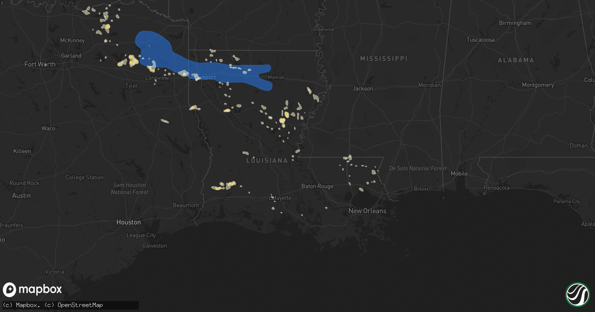
Hail Map in Louisiana on July 16, 2023
Get this storm
July 16 map
$229
one time, instant access
Download today. No call, no setup
Keep the $229
Bought the map and want the full workflow? Apply the entire $229 to a subscription within 7 days. None of it is wasted.
Every map, not just this one
This buys you this map. Subscription and you get every map we run, in the markets you choose from a few cities to whole states to nationwide. Plus real-time alerts the moment a storm fires.
Contact data
Name, contact info, occupancy, even credit band for addresses in the footprint. You go from where it hit to who to call.
Become the source they trust
Unlimited branding weather history reports on demand. You already have the documented answer ready for the property owner, and you are the one who showed up with it.
Property data and RoofTrace estimates
Pull up any address you have got, its value and the exact code rules for that jurisdiction, straight from One Click Code. Then RoofTrace estimates the squares, pitch, and roof value, priced the way you price.
Storm reports in Louisiana
Louisiana
| Date | Description |
|---|---|
| 07/16/20235:50 PM CDT | Large branch snapped from thunderstorm outflow. Time estimated based on radar. |
| 07/16/20235:00 PM CDT | Numerous trees and power poles were blown down across the parish. Damage is being assessed by the catahoula oep. |
| 07/16/20234:46 PM CDT | A tree was downed onto power lines on nugent street in jena. |
| 07/16/20234:31 PM CDT | A tree was downed in olla. |
| 07/16/20234:31 PM CDT | A tree was downed in the urania community. |
| 07/16/20234:30 PM CDT | A tree was downed across rowland road. |
| 07/16/20234:30 PM CDT | A tree was downed onto a power line on joe white road. |
| 07/16/20234:18 PM CDT | A tree was downed across highway 546 near leckie road. |
| 07/16/20234:11 PM CDT | A tree was blown down across boatner road just south of caney lake. |
| 07/16/20234:01 PM CDT | A large tree limb was downed onto highway 485 in powhatan. |
| 07/16/20233:59 PM CDT | Numerous trees were downed across much of union parish. Some trees fell onto structures and vehicles. |
| 07/16/20233:45 PM CDT | Numerous trees down across west union parish. |
| 07/16/20233:40 PM CDT | 100 foot hotel sign blown down just off exit 85 along interstate twenty. |
| 07/16/20233:40 PM CDT | Numerous trees and power lines were downed in ruston and throughout lincoln parish. Much of ruston and choudrant are without power. |
| 07/16/20233:36 PM CDT | Causeway mesonet measured 68mph wind gust. |
| 07/16/20233:35 PM CDT | Multiple trees down. |
| 07/16/20233:08 PM CDT | Numerous trees and power lines down. |
| 07/16/20232:46 PM CDT | Power poles snapped |
| 07/16/20232:46 PM CDT | Corrects previous tstm wnd dmg report from 4 ene eastwood. Tree down on power lines in the princeton community. |
| 07/16/20232:40 PM CDT | Power poles snapped |
| 07/16/20232:37 PM CDT | Tree down on power lines in the princeton community. |
| 07/16/20232:37 PM CDT | Shingles blown off. |
| 07/16/20232:35 PM CDT | A large tree fell onto a home on parkway drive in bossier city. |
| 07/16/20232:35 PM CDT | Multiple trees and power lines down in the shady grove subdivision in south bossier city. |
| 07/16/20232:34 PM CDT | A local report indicates 60 MPH wind near 1 NE Barksdale Air Forc |
| 07/16/20232:32 PM CDT | Power lines down on hallmark drive between hallmark circle and hillsboro drive. |
| 07/16/20232:31 PM CDT | Power lines down on garfield drive. |
| 07/16/20232:29 PM CDT | Trees snapped power poles broken. |
| 07/16/20232:27 PM CDT | Tree down across dixie shreveport highway near i-220 east. |
| 07/16/20232:19 PM CDT | Trees down onto highway 169 near south lakeshore drive. |
| 07/16/20232:18 PM CDT | Power lines down on wilkinson street between linwood ave and william ave. |
| 07/16/20232:13 PM CDT | Trees down across blanchard-furrh road between republic church road and highway 169 near the longwood community. |
| 07/16/20232:13 PM CDT | *** 1 inj *** a tree fell across highway 169 near blanchard-furrh road near the longwood community... Crushing a car with the female driver suffering serious injuries. |
| 07/16/20232:10 PM CDT | A local report indicates 60 MPH wind near 3 ESE Shreveport |
| 07/16/20232:03 PM CDT | Trees and power lines down on fairfield ave and stephenson st. |
| 07/15/20237:38 PM CDT | Roof damage to one home. Time estimated based on radar. |
| 07/15/20237:25 PM CDT | Several power poles down or leaning. Time estimated based on radar. |
All States Impacted by Hail Map on July 16, 2023
Cities Impacted by Hail Map on July 16, 2023
- Corning, KS
- Centralia, KS
- Goff, KS
- Talco, TX
- Mount Pleasant, TX
- Winfield, TX
- Mount Vernon, TX
- Cookville, TX
- Omaha, TX
- Scroggins, TX
- Leesburg, TX
- Pittsburg, TX
- Ore City, TX
- Daingerfield, TX
- Gilmer, TX
- Naples, TX
- Marietta, TX
- Hughes Springs, TX
- Avinger, TX
- Diana, TX
- Lone Star, TX
- Douglassville, TX
- Linden, TX
- Holdrege, NE
- Funk, NE
- Campbell, TX
- Cumby, TX
- Sulphur Springs, TX
- Havensville, KS
- Soldier, KS
- Colbert, OK
- Spearville, KS
- Emmett, KS
- Burchard, NE
- Axtell, KS
- Summerfield, KS
- Paris, TX
- Hanover, KS
- Point, TX
- Emory, TX
- Longview, TX
- Clatonia, NE
- Cortland, NE
- Hallam, NE
- Wetmore, KS
- Mill Creek, OK
- Mannsville, OK
- Riverdale, NE
- Windom, TX
- Honey Grove, TX
- Ben Franklin, TX
- Pecan Gap, TX
- Ladonia, TX
- Klondike, TX
- Cooper, TX
- Roxton, TX
- Bennington, OK
- Walters, OK
- Geronimo, OK
- Sumner, TX
- Arthur City, TX
- Holton, KS
- Pawnee City, NE
- Platte City, MO
- Dearborn, MO
- Weston, MO
- Telephone, TX
- Winnsboro, TX
- Waterville, KS
- Bremen, KS
- Home, KS
- Marysville, KS
- Onaga, KS
- Frankfort, KS
- Duncan, OK
- Quitman, TX
- Mineola, TX
- Alba, TX
- Blue Rapids, KS
- Powderly, TX
- Baileyville, KS
- Springer, OK
- Westville, FL
- Ponce De Leon, FL
- Hendrix, OK
- Delia, KS
- Vermillion, KS
- Ravenna, TX
- Petty, TX
- Ivanhoe, TX
- Arlington, TX
- Fort Worth, TX
- Beattie, KS
- Seneca, KS
- Wolfe City, TX
- Commerce, TX
- Wills Point, TX
- Davis, OK
- Bokchito, OK
- Savoy, TX
- Hollenberg, KS
- Oketo, KS
- Morrowville, KS
- Washington, KS
- Jefferson, TX
- Harleton, TX
- Marshall, TX
- Karnack, TX
- Bivins, TX
- Mooringsport, LA
- Waskom, TX
- Shreveport, LA
- Oil City, LA
- Belcher, LA
- Vivian, LA
- Blanchard, LA
- Warrenton, MO
- Wright City, MO
- Foristell, MO
- Wentzville, MO
- Marthasville, MO
- Haughton, LA
- Minden, LA
- Benton, LA
- Bossier City, LA
- Cotton Valley, LA
- Barksdale Afb, LA
- Princeton, LA
- Doyline, LA
- Defiance, MO
- O'Fallon, MO
- Lake Saint Louis, MO
- Kensington, KS
- Agra, KS
- Athol, KS
- Gaylord, KS
- Cedar, KS
- Phillipsburg, KS
- Sibley, LA
- Jamestown, LA
- Dubberly, LA
- Heflin, LA
- Homer, LA
- Athens, LA
- Arcadia, LA
- Dubach, LA
- Gibsland, LA
- Simsboro, LA
- Bienville, LA
- Quitman, LA
- Ruston, LA
- Shipman, IL
- Carlinville, IL
- Festus, MO
- Hillsboro, MO
- Pevely, MO
- Herculaneum, MO
- Osborne, KS
- Portis, KS
- Alton, KS
- Glade, KS
- Valmeyer, IL
- Crystal City, MO
- Prairie Du Rocher, IL
- Fults, IL
- Red Bud, IL
- Grambling, LA
- Farmerville, LA
- Choudrant, LA
- Downsville, LA
- Calhoun, LA
- Chatham, LA
- Eros, LA
- West Monroe, LA
- Waldo, KS
- Natoma, KS
- Columbia, LA
- Luray, KS
- Paradise, KS
- Lucas, KS
- Russell, KS
- Bunker Hill, KS
- Dorrance, KS
- Sorento, IL
- Walshville, IL
- Panama, IL
- Donnellson, IL
- Greenville, IL
- Wilson, KS
- Oelrichs, SD
- Chadron, NE
- Pine Ridge, SD
- Lebanon, IN
- Brownsburg, IN
- Zionsville, IN
- Pittsboro, IN
- Whitestown, IN
- Indianapolis, IN
- Hay Springs, NE
- Hoisington, KS
- Claflin, KS
- Holyrood, KS
- Great Bend, KS
- Ellinwood, KS
- Bison, KS
- Otis, KS
- Rush Center, KS
- Albert, KS
- Olmitz, KS
- Pawnee Rock, KS
- St John, KS
- Larned, KS
- Wounded Knee, SD
- Batesland, SD
- Manderson, SD
- Stover, MO
- Covington, IN
- Perrysville, IN
- Buffalo, MO
- Meta, MO
- Abita Springs, LA
- Covington, LA
- Herrin, IL
- Johnston City, IL
- Marion, IL
- Jena, LA
- Jonesville, LA
- Bland, MO
- Mount Sterling, MO
- Owensville, MO
- Hermann, MO
- Morrison, MO
- Ringgold, LA
- Mount Olive, IL
- Stoutland, MO
- Montreal, MO
- Kilgore, TX
- Dodson, LA
- Rocky Mount, MO
- Eldon, MO
- Como, TX
- Fidelity, IL
- Piasa, IL
- Brighton, IL
- Magnolia, AR
- Bogalusa, LA
- Quincy, MO
- Wheatland, MO
- Campti, LA
- Natchitoches, LA
- Edgemont, SD
- Nacogdoches, TX
- Franklinton, LA
- Kiln, MS
- Tullos, LA
- Jewell, KS
- Amite, LA
- Vancleave, MS
- Carmel, IN
- Lebanon, KS
- Smith Center, KS
- Phillips, WI
- Kentwood, LA
- Springhill, LA
- Taylor, AR
- Russellville, MO
- Barnett, MO
- Randall, KS
- Jamestown, KS
- Beloit, KS
- Moss Point, MS
- Belle, MO
- Sainte Genevieve, MO
- Castor, LA
- Saint Thomas, MO
- Henley, MO
- Tuscumbia, MO
- Logansport, LA
- Jupiter, FL
- Hobe Sound, FL
- Mansfield, LA
- Osyka, MS
- Freeburg, MO
- Argyle, MO
- Koeltztown, MO
- Jefferson City, MO
- Saint Elizabeth, MO
- Eugene, MO
- Westphalia, MO
- Staunton, IL
- Phillipsburg, MO
- Jeanerette, LA
- Baldwin, LA
- Franklin, LA
- Coushatta, LA
- Jonesburg, MO
- Cuba, MO
- Ashland, LA
- Sullivan, MO
- Richwoods, MO
- Lonedell, MO
- Netawaka, KS
- Glenmora, LA
- Joaquin, TX
- Grand Cane, LA
- Lisbon, LA
- Litchfield, IL
- Marksville, LA
- Hawkins, TX
- New Iberia, LA
- Delcambre, LA
- Madisonville, LA
- Glasco, KS
- Simpson, KS
- Sarepta, LA
- Plain Dealing, LA
- Magnolia, MS
- Centreville, MS
- Olla, LA
- Trout, LA
- Harrisonburg, LA
- New Douglas, IL
- Leasburg, MO
- Riverton, NE
- Carriere, MS
- Picayune, MS
- Cairo, GA
- Whigham, GA
- Robertsville, MO
- Belle Rose, LA
- Richland, MO
- Sikes, LA
- Hineston, LA
- Lettsworth, LA
- Bourbon, MO
- Bainbridge, GA
- Climax, GA
- Linn, MO
- Loose Creek, MO
- Damascus, GA
- Hallsville, TX
- Independence, LA
- Greenville, FL
- Monterey, LA
- Dittmer, MO
- Catawissa, MO
- Cedar Hill, MO
- Woodbine, GA
- Poplarville, MS
- Potosi, MO
- Goldonna, LA
- Natchez, MS
- Versailles, MO
- Olean, MO
- Gillespie, IL
- Butler, IL
- Chesterfield, IL
- Medora, IL
- Greensburg, LA
- Saint Charles, MO
- Saint Peters, MO
- Ponchatoula, LA
- Hammond, LA
- Pollock, LA
- Glen Elder, KS
- Pittsburg, IL
- Bush, LA
- Bunker Hill, IL
- Pocahontas, IL
- Worden, IL
- Livingston, IL
- Alhambra, IL
- Fayette, MS
- Union Church, MS
- Pattison, MS
- Lorman, MS
- Macksville, KS
- Belpre, KS
- Hazlehurst, MS
- Hermanville, MS
- Alliance, NE
- Ellsworth, NE
- Gordon, NE
- Merriman, NE
- Byers, KS
- Iuka, KS
- Pratt, KS
- Haviland, KS
- Lakeside, NE
- Bingham, NE
- Oshkosh, NE
- Coats, KS
- Sawyer, KS
- Nekoma, KS
- Ashby, NE
- Sun City, KS
- Medicine Lodge, KS
- Lewellen, NE
- Arthur, NE
- Lemoyne, NE
- Farmington, CT
- West Hartford, CT
- New Britain, CT
- Newington, CT
- Hartford, CT
- Wethersfield, CT
- East Hartford, CT
- Windsor, CT
- South Windsor, CT
- Berlin, CT
- Rocky Hill, CT
- East Berlin, CT
- Cromwell, CT
- Glastonbury, CT
- South Glastonbury, CT
- Manchester, CT
- Vernon Rockville, CT
- Bolton, CT
- Coventry, CT
- Stafford Springs, CT
- Tolland, CT
- Ellington, CT
- Willington, CT
- Storrs Mansfield, CT
- Keystone, NE
- Offerle, KS
- Bucklin, KS
- Ford, KS
- Lewis, KS
- Hudson, KS
- Sylvia, KS
- Lake City, KS
- Minneola, KS
- Ashland, KS
- Hardtner, KS
- Kiowa, KS
- Creal Springs, IL
- Fort Necessity, LA
- Winnsboro, LA
- Duson, LA
- Lafayette, LA
- Muscoda, WI
- Boscobel, WI
- Kingman, IN
- Veedersburg, IN
- Saint Marys, KS
- Mobile, AL
- Eight Mile, AL
- Dequincy, LA
- Ragley, LA
- New Ross, IN
- Ladoga, IN
- Roachdale, IN
- North Salem, IN
- Crawfordsville, IN
- Marshall, IN
- Greenfield, IN
- Ellsworth, KS
- Lorraine, KS
- Tallulah, LA
- Newellton, LA
- Rushville, NE
- Golconda, IL
- Simpson, IL
- Vienna, IL
- Waupaca, WI
- Amherst, WI
- Merrimac, WI
- North Freedom, WI
- Lodi, WI
- Baraboo, WI
- Prairie Du Sac, WI
- Circleville, KS
- Roxie, MS
- Campbellsburg, IN
- Clayton, LA
- Lake Charles, LA
- Mccordsville, IN
- Ferriday, LA
- Vicksburg, MS
- Sicily Island, LA
- Gilbert, LA
- West Frankfort, IL
- Carterville, IL
- Stonefort, IL
- Energy, IL
- Fort Lauderdale, FL
- Lucedale, MS
- Kanopolis, KS
- Sylvan Grove, KS
- Loganville, WI
- Plain, WI
- Woodville, MS
- Reeves, LA
- Wesson, MS
- Geneseo, KS
- Porterfield, WI
- Wallace, MI
- Neenah, WI
- Kinder, LA
- Mitchell, IN
- Orleans, IN
- Richland Center, WI
- Soldiers Grove, WI
- Blue River, WI
- Hillpoint, WI
- Rayne, LA
- Gays Mills, WI
- Cazenovia, WI
- Jennings, LA
- Sawyerville, IL
- Enterprise, LA
- Reedsville, WI
- Abbeville, LA
- Maurice, LA
- New Burnside, IL
- Menasha, WI
- Larsen, WI
- Loxley, AL
- Bay Minette, AL
- Stapleton, AL
- Broxton, GA
- Aimwell, LA
- Jamestown, IN
- Eddyville, IL
- Eden, WI
- Pepperell, MA
- Townsend, MA
- Hollis, NH
- Brookline, NH
- Merrimack, NH
- Nashua, NH
- Amherst, NH
- Bloomfield, CT
- Kimballton, IA
- Audubon, IA
- Elk Horn, IA
- Exira, IA
- Brayton, IA
- Anita, IA
- Stuart, IA
- Menlo, IA
- Sauk City, WI
- Poynette, WI
- Arlington, WI
- Fond Du Lac, WI
- Winterset, IA
- Earlham, IA
- Dexter, IA
- Saint Cloud, WI
- Campbellsport, WI
- Mount Calvary, WI
- Glenbeulah, WI
- Persia, IA
- Shelby, IA
- Avoca, IA
- Columbia, IL
- Saint Charles, IA
- Prole, IA
- Bevington, IA
- Indianola, IA
- Atlantic, IA
- Blackwell, MO
- De Soto, MO
- Coulterville, IL
- Pinckneyville, IL
- Tamaroa, IL
- Du Quoin, IL
- California, MO
- Lohman, MO
- Centertown, MO
- Marshall, MO
- Harlan, IA
- Oconto, NE
- Portsmouth, IA
- Lexington, NE
- Callaway, NE
- Danville, IN
- Eddyville, NE
- Campbell Hill, IL
- McCracken, KS
- Alexander, KS
- Deputy, IN
- Scottsburg, IN
- Woodbine, IA
- Panama, IA
- Gerald, MO
- Rosebud, MO
- New Bloomfield, MO
- Arnold, NE
- Saint Louis, MO
- Chamois, MO
- Vallonia, IN
- Tebbetts, MO
- Austin, IN
- Salem, IN
- Galatia, IL
- Downs, KS
- High Ridge, MO
- Eureka, MO
- House Springs, MO
- Rio Grande City, TX
- Wilcox, NE
- Leslie, MO
- Beaufort, MO
- Stafford, KS
- Saint Clair, MO
- Goshen, KY
- Charlestown, IN
- Union, MO
- Marissa, IL
- Adair, IA
- Hartsburg, MO
- Jamestown, MO
- Boonville, MO
- Columbia, MO
- Wooldridge, MO
- Prairie Home, MO
- Ashland, MO
- Bonnots Mill, MO
- Holts Summit, MO
- Mulkeytown, IL
- Turon, KS
- Comanche, OK
- Bloomsdale, MO
- North Vernon, IN
- Vernon, IN
- New Athens, IL
- Imperial, MO
- Pacific, MO
- Ballwin, MO
- Fenton, MO
- Freeburg, IL
- Waterloo, IL
- Millstadt, IL
- East Carondelet, IL
- Wildwood, MO
- Arnold, MO
- Valley Park, MO
- Belleville, IL
- Smithton, IL
- Sherwood, WI
- New Haven, MO
- New Palestine, IN
- Brownstown, IN
- Crestwood, KY
- Buckner, KY
- La Grange, KY
- Marysville, IN
- Nabb, IN
- Otisco, IN
- Percy, IL
- Cutler, IL
- Sesser, IL
- Nelson, MO
- Blackwater, MO
- Wright, KS
- Dodge City, KS
- Crothersville, IN
- Hamlin, IA
- Fontanelle, IA
- Bridgewater, IA
- Soldier, IA
- Moorhead, IA
- Dunlap, IA
- Logan, IA
- Neola, IA
- Minden, IA
- Herman, NE
- Tekamah, NE
- Craig, NE
- Blair, NE
- Greenfield, IA
- Creston, IA
- Prescott, IA
- Orient, IA
- Saint Mary, MO
- Elgin, NE
- Petersburg, NE
- Albion, NE
- Cromwell, IA
- Newman Grove, NE
- Lenox, IA
- Shannon City, IA
- Perryville, MO
- Decatur, NE
- Lindsay, NE
- Laurel, NE
- Dixon, NE
- Coleridge, NE
- Diagonal, IA
- Mount Ayr, IA
- Saint Edward, NE
- Madison, NE
- Humphrey, NE
- Wayne, NE
- Concord, NE
- Blencoe, IA
- Little Sioux, IA
- Knoxville, IA
- Harvey, IA
- Tracy, IA
- Bussey, IA
- Oskaloosa, IA
- Creston, NE
- Wakefield, NE
- Eddyville, IA
- Leighton, IA
- Leigh, NE
- Hatfield, MO
- Eagleville, MO
- Martinsville, MO
- Kellerton, IA
- Franklin, NE
- Bloomington, NE
- Pisgah, IA
- Marne, IA
- Wiota, IA
- Kiron, IA
- Vail, IA
- Deloit, IA
- Arcadia, IA
- Breda, IA
- Westside, IA
- Gray, IA
- Manning, IA
- Manilla, IA
- Casey, IA
- Aspinwall, IA
- Irwin, IA
- Naponee, NE
- Hildreth, NE
- Oakland, NE
- Karnak, IL
- Belknap, IL
- Boss, MO
- Davisville, MO
- Ellis Grove, IL
- Walsh, IL
- Platte Center, NE
- Bonne Terre, MO
- Park Hills, MO
- Leadwood, MO
- Mineral Point, MO
- Central City, NE
- Marquette, NE
- Hordville, NE
- Lyons, NE
- Royalton, IL
- Freeman Spur, IL
- Orient, IL
- Zeigler, IL
- Steelville, MO
- Raleigh, IL
- Irondale, MO
- Farmington, MO
- French Village, MO
- Cadet, MO
- Elkville, IL
- Vergennes, IL
- Saint Marys, IA
- Patterson, IA
- Viburnum, MO
- Bixby, MO
- Cypress, IL
- Sumner, NE
- Broken Bow, NE
- Overton, NE
- Onawa, IA
- Belgrade, MO
- Columbus, NE
- Saint James, MO
- Whittington, IL
- Benton, IL
- Scheller, IL
- Chester, IL
- Vichy, MO
- Vienna, MO
- Fletcher, MO
- Axtell, NE
- Elm Creek, NE
- Hancock, IA
- Missouri Valley, IA
- Anselmo, NE
- Hampton, NE
- Bradshaw, NE
- Polk, NE
- Mondamin, IA
- Stanton, NE
- Norfolk, NE
- Massena, IA
- Tingley, IA
- Kirkman, IA
- Fulton, MO
- Redfield, IA


