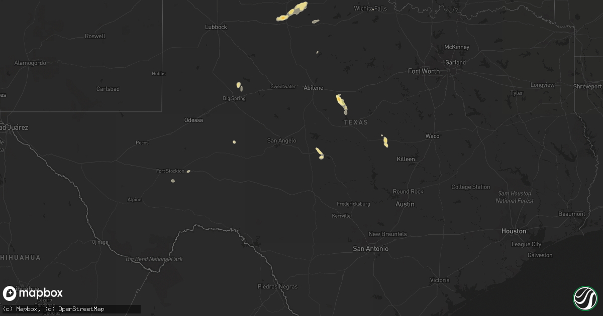
Hail Map in Texas on July 16, 2014
Get this storm
July 16 map
$229
one time, instant access
Download today. No call, no setup
Keep the $229
Bought the map and want the full workflow? Apply the entire $229 to a subscription within 7 days. None of it is wasted.
Every map, not just this one
This buys you this map. Subscription and you get every map we run, in the markets you choose from a few cities to whole states to nationwide. Plus real-time alerts the moment a storm fires.
Contact data
Name, contact info, occupancy, even credit band for addresses in the footprint. You go from where it hit to who to call.
Become the source they trust
Unlimited branding weather history reports on demand. You already have the documented answer ready for the property owner, and you are the one who showed up with it.
Property data and RoofTrace estimates
Pull up any address you have got, its value and the exact code rules for that jurisdiction, straight from One Click Code. Then RoofTrace estimates the squares, pitch, and roof value, priced the way you price.
Storm reports in Texas
Texas
| Date | Description |
|---|---|
| 07/16/20146:55 PM CDT | Estimated 70 to 75 mph winds associated with the rear flank downdraft. |
| 07/16/20146:55 PM CDT | A local report indicates 1.00 inch wind near 14 WSW GRUVER |
| 07/16/20146:41 PM CDT | A local report indicates 1.00 inch wind near 10 W GRUVER |
| 07/16/20146:14 PM CDT | *** 1 inj *** a microburst occurred in the indian creek neighborhood in grape creek near the intersection of glass road and grape creek road. Shingles were blown off of |
| 07/16/20146:00 PM CDT | A local report indicates 1.00 inch wind near 5 W GRUVER |
| 07/15/201410:16 PM CDT | A local report indicates 1.75 inch wind near 10 N VEGA |
| 07/15/201410:16 PM CDT | A local report indicates 1.00 inch wind near 6 NNW DAWN |
| 07/15/201410:08 PM CDT | A local report indicates 1.75 inch wind near 6 NE VEGA |
| 07/15/20149:11 PM CDT | Estimated 60 to 70 mph winds. |
| 07/15/20148:35 PM CDT | Golfball size hail damaged corn and sorghum crops along highway 281. |
| 07/15/20148:23 PM CDT | Emergency manager provided storm spotter video of a tornado west southwest of cactus. Corn stalks were reportedly blown down in a field near highway 281. |
| 07/15/20147:30 PM CDT | Numerous large tree limbs down. A few trees were uprooted. |
| 07/15/20147:30 PM CDT | 20 foot tree downed in stratford and power poles and fences downed just south of stratford. |
| 07/15/20147:26 PM CDT | A storm chaser observed a tornado south of stratford. This tornado damaged utility lines and a small outbuilding near us highway 287. |
| 07/15/20147:23 PM CDT | Power lines down on highway 287 |
| 07/15/20147:20 PM CDT | Numerous trees down or uprooted. The largest tree was 28 inches in diameter...and 30 feet long. The tree is blocking the road. Power lines were also down. |
| 07/15/20147:19 PM CDT | A local report indicates 1.50 inch wind near STRATFORD |
| 07/15/20147:14 PM CDT | Two tree reported down in cross plains |
| 07/15/20147:08 PM CDT | Storm spotter reported a brief tornado near highway 54 northeast of stratford. |
| 07/15/20147:00 PM CDT | Damaging thunderstorms winds removed all of the roof decking from a residence... A hay barn was completely destroyed...a 100 year old oak tree was toppled...and two tel |
Cities Impacted by Hail Map on July 16, 2014
- Gruver, TX
- Dumas, TX
- Evant, TX
- Colorado Springs, CO
- Elbert, CO
- Devol, OK
- Texhoma, OK
- Stratford, TX
- Big Spring, TX
- Ocate, NM
- Crowell, TX
- Paducah, TX
- Hereford, TX
- Vega, TX
- Cisco, TX
- Cross Plains, TX
- Cactus, TX
- Melvin, TX
- Tierra Amarilla, NM
- Coahoma, TX
- Rush, CO
- Hugo, CO
- Ramah, CO
- Model, CO
- Trinidad, CO
- Woodland Park, CO
- Dimmitt, TX
- Walters, OK
- Grandfield, OK
- Dulce, NM
- Wetmore, CO
- Beulah, CO
- Rye, CO
- Pueblo, CO
- Florence, CO
- Tyrone, OK
- Amarillo, TX
- Trinchera, CO
- Lampasas, TX
- Wildorado, TX
- Ordway, CO
- Ojo Caliente, NM
- Peyton, CO
- Fort Stockton, TX
- Steamboat Springs, CO
- Clayton, NM
- Cascade, CO
- Manitou Springs, CO
- Nazareth, TX
- Boise City, OK
- Dalhart, TX
- Usaf Academy, CO
- Karval, CO
- Walden, CO
- Bovina, TX
- Sunray, TX
- Loveland, OK
- Brownwood, TX
- Brady, TX
- Rising Star, TX
- Wichita Falls, TX
- Grover, CO
- Grenville, NM
- Gladstone, NM
- Cimarron, NM
- Des Moines, NM
- Carpenter, WY
- Moriarty, NM
- Haskell, TX
- Hamilton, TX
- Calhan, CO
- Yoder, CO
- Channing, TX
- Coalmont, CO
- Pagosa Springs, CO
- Albuquerque, NM
- Hugoton, KS
- Altus, OK
- Eden, TX
- Baird, TX
- Big Lake, TX
- Estancia, NM
- Avondale, CO
- Hereford, CO
- Bayfield, CO
- Branson, CO
- Cheyenne, WY
- Green Mountain Falls, CO
- Canon City, CO
- May, TX
- Seymour, TX
- Kirtland Afb, NM
- Briggsdale, CO
- Fountain, CO
- Hartley, TX
- Rocky Ford, CO


