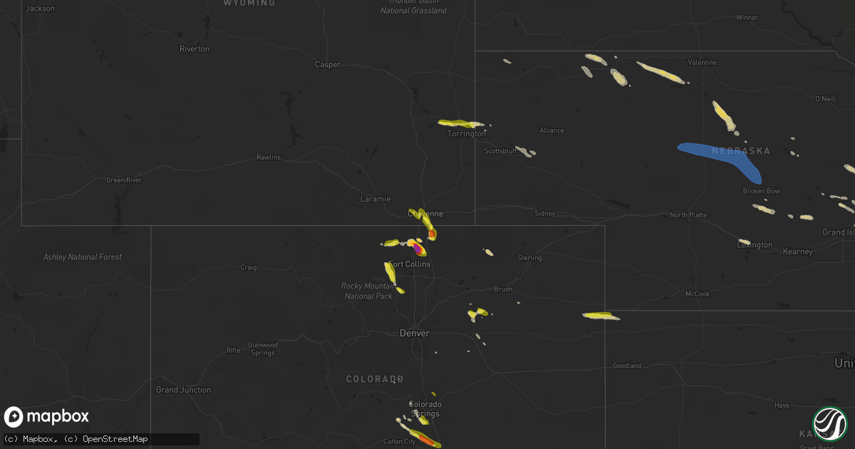
Hail Map on July 15, 2023
Get this storm
July 15 map
$229
one time, instant access
Download today. No call, no setup
Keep the $229
Bought the map and want the full workflow? Apply the entire $229 to a subscription within 7 days. None of it is wasted.
Every map, not just this one
This buys you this map. Subscription and you get every map we run, in the markets you choose from a few cities to whole states to nationwide. Plus real-time alerts the moment a storm fires.
Contact data
Name, contact info, occupancy, even credit band for addresses in the footprint. You go from where it hit to who to call.
Become the source they trust
Unlimited branding weather history reports on demand. You already have the documented answer ready for the property owner, and you are the one who showed up with it.
Property data and RoofTrace estimates
Pull up any address you have got, its value and the exact code rules for that jurisdiction, straight from One Click Code. Then RoofTrace estimates the squares, pitch, and roof value, priced the way you price.
States Impacted by Hail Map on July 15, 2023
Storm reports
Georgia
| Date | Description |
|---|---|
| 07/15/20236:35 PM CDT | Mcduffie co 911 reported a tree down on old milledgeville rd and mt pleasant rd... Sw of thomson. Time estimated. |
| 07/15/20236:19 PM CDT | Tree down along highway 91. |
| 07/15/20236:18 PM CDT | Mcduffie co 911 reported a tree down on central rd in thomson. Exact location not given. Time estimated. |
| 07/15/20236:15 PM CDT | Mcduffie co 911 reported a tree down on johnson ave near ansley dr in thomson. Time estimated. |
| 07/15/20236:15 PM CDT | Mcduffie co 911 reported multiple trees downed on cedar rock rd at tanyard creek dr... Nw of thomson. Time estimated. |
| 07/15/20236:09 PM CDT | Mcduffie co 911 reported a tree down on interstate 20 westbound near mile marker 171. Time estimated. |
| 07/15/20235:41 PM CDT | Tree down across interstate 20 near the warren county line. |
| 07/15/20235:36 PM CDT | Tree down across highway 22 near the hancock county line. |
| 07/14/20237:11 PM CDT | Tree down along highway 33 south heading towards horse creek. |
Virginia
| Date | Description |
|---|---|
| 07/15/20234:00 PM CDT | Thunderstorm winds blew down two trees near coleman falls. |
| 07/15/20234:00 PM CDT | Thunderstorm winds blew down one tree on beemer trail. |
| 07/15/20233:05 PM CDT | Thunderstorm winds brought down several large tree branches on bedford lake drive. |
| 07/15/20231:45 PM CDT | Thunderstorm winds blew down one tree near the intersection of robin lynn road and willow creek drive. |
| 07/15/20231:35 PM CDT | Thunderstorm winds blew down one tree near the intersection of poor mountain road and west river road. |
| 07/15/20231:32 PM CDT | Thunderstorm winds blew down one tree on barnaget road. |
| 07/15/20231:28 PM CDT | Thunderstorm winds blew down one tree along the 5900 block of peaceful drive. |
| 07/15/20231:20 PM CDT | One tree blown down by thunderstorm winds near the 5900 block of old mountain road. |
| 07/15/202312:53 PM CDT | Thunderstorm winds blew down one tree near the intersection of salem turnpike and westside boulevard. |
| 07/14/20237:21 PM CDT | Thunderstorm winds blew down two trees along route 20 near muddy creek. |
Ohio
| Date | Description |
|---|---|
| 07/15/20233:50 PM CDT | Large tree branch 8 inch in diameter snapped on oh-45 on the south side of orwell. Several other smaller branches also down in the area. |
| 07/15/20232:13 PM CDT | A tree uprooted and minor damage to siding of a gas station on cleveland massillon rd just north of yellow creek rd. |
| 07/15/202312:50 PM CDT | Two trees down on gateway big branch road cr 35. Time estimated from radar. |
| 07/15/202312:48 PM CDT | Tree down along state route 243 near frys tack shop. Time estimated from radar. |
| 07/15/202312:33 PM CDT | Tree down across road near fourth street east. Time estimated from radar. |
| 07/15/20238:40 AM CDT | Tree downed on price road. Time estimated from radar. |
| 07/15/20238:07 AM CDT | One tree downed near franklin trenton road. |
| 07/15/20238:00 AM CDT | Tree limbs downed on springfield pike in woodlawn and wyoming. Time estimated from radar. |
North Carolina
| Date | Description |
|---|---|
| 07/15/20234:40 PM CDT | Tree downed along junction rd. |
| 07/15/20234:36 PM CDT | Thunderstorm winds blew down one tree near the intersection of clifton road and albert phipps road. |
| 07/15/20234:20 PM CDT | Spotter relayed report of utility lines downed along academy st. |
Tennessee
| Date | Description |
|---|---|
| 07/15/20235:30 PM CDT | Trees down across the county. Time estimated by radar. |
| 07/15/20234:40 PM CDT | Tree down. 18 inch dimeter trunk of oak tree snapped. |
| 07/15/20234:06 PM CDT | Several reports of trees down. Time estimated by radar. |
| 07/15/20233:03 PM CDT | A few trees down. |
| 07/15/20232:20 PM CDT | Multiple trees down in rogersville. |
Wyoming
| Date | Description |
|---|---|
| 07/15/20234:47 PM CDT | Hail ranges from dimes to quarters. |
| 07/15/20233:10 PM CDT | A local report indicates 1.25 inch wind near 3 SSE South Greeley Hig |
| 07/15/20233:10 PM CDT | A local report indicates 1.25 inch wind near 3 SSE South Greeley Hig |
| 07/14/20238:45 PM CDT | Peas to quarter sized hail reported. |
Kentucky
| Date | Description |
|---|---|
| 07/15/202311:52 AM CDT | Tree down across state route 1 near oldtown. Time estimated from radar. |
Texas
| Date | Description |
|---|---|
| 07/15/20233:49 AM CDT | Snyder 3e mesonet measured 60 mph wind gust. |
| 07/15/20233:16 AM CDT | Peak wind gust. Additional severe gusts occurred between 3:15 am and 3:21 am. |
| 07/15/20233:13 AM CDT | Fluvanna mesonet measured 61 mph wind gust. |
| 07/15/20233:02 AM CDT | A local report indicates 59 MPH wind near 10 WSW Guthrie |
| 07/15/20232:22 AM CDT | A local report indicates 59 MPH wind near 3 N Roaring Springs |
| 07/15/20232:09 AM CDT | Severe gusts continued through 2:11 am. |
| 07/15/202312:31 AM CDT | West texas mesonet report. |
| 07/15/202312:31 AM CDT | West texas mesonet report |
| 07/14/202311:24 PM CDT | A local report indicates 1.00 inch wind near 5 E Bushland |
| 07/14/202310:51 PM CDT | A local report indicates 65 MPH wind near 4 E Vega |
| 07/14/202310:00 PM CDT | A local report indicates 70 MPH wind near 3 SW Dalhart |
New Mexico
| Date | Description |
|---|---|
| 07/15/20235:45 PM CDT | Hard hail broke 3 skylights. Hail persisted until approximately 510pm mdt and tapered down to half dollar size before quitting. |
| 07/15/20235:41 PM CDT | Report from mping: half dollar |
| 07/15/20235:29 PM CDT | Report from mping: quarter |
| 07/15/20235:25 PM CDT | Mesonet station wsm14 oscura range camp |
| 07/15/20235:23 PM CDT | Quarter sized hail on nm highway 72... 12 miles east of raton. |
| 07/15/20235:20 PM CDT | Mesonet station wsm08 harry |
| 07/15/20235:10 PM CDT | Mesonet station wsm33 zumwalt track |
| 07/15/20234:34 PM CDT | Corrects previous hail report from 2 se south san ysidro. Enough hail fell to completely cover the ground to a depth of about 1 inch. |
| 07/15/20234:15 PM CDT | Grant co airport. |
| 07/15/20233:50 PM CDT | A local report indicates 1.00 inch wind near 1 ENE Mescalero |
| 07/14/20239:28 PM CDT | A local report indicates 2.50 inch wind near 3 NE Chicosa Lake State |
| 07/14/20238:54 PM CDT | Two glass windows broken. |
| 07/14/20238:42 PM CDT | A local report indicates 1.00 inch wind near 20 NE Des Moines |
| 07/14/20237:27 PM CDT | Report from mping: golf ball |
| 07/14/20237:22 PM CDT | Golf ball sized hail reported on u.s. Highway 64 about 10 miles southwest of raton. |
Arkansas
| Date | Description |
|---|---|
| 07/15/20236:58 PM CDT | A tree was blown down across highway 52. |
| 07/15/20236:14 PM CDT | Large tree limbs across hwy 335 and power lines down. |
| 07/15/20235:55 PM CDT | Numerous trees were blown down. Time estimated by radar. |
| 07/14/20237:12 PM CDT | Numerous trees and powerlines were blown down in the lake village area. Several trees were down across roads. |
| 07/14/20237:00 PM CDT | Several trees were blown down across multiple roads throughout the county. |
New York
| Date | Description |
|---|---|
| 07/15/20235:18 AM CDT | Tree down on wires. Town of livingston. |
| 07/15/20235:18 AM CDT | Trees and wires down on county route 10 |
| 07/15/20234:43 AM CDT | Trees and wires down on route 9g. |
| 07/15/20234:37 AM CDT | Trees and wires down on hover avenue. |
Michigan
| Date | Description |
|---|---|
| 07/14/20239:55 PM CDT | Convenience store worker reports trees down along ride outs road. Hail also occurred but size unknown. Time estimated. |
| 07/14/20239:28 PM CDT | Convenience store worker reports trees down near north dickinson county school. Hail also occurred but size unknown. Time estimated. |
Florida
| Date | Description |
|---|---|
| 07/15/20234:49 PM CDT | A couple of trees were blown down along highway 83. |
Indiana
| Date | Description |
|---|---|
| 07/15/20234:30 PM CDT | Large tree down blocking 900 n near meridian road. Time estimated by radar. |
Alabama
| Date | Description |
|---|---|
| 07/15/20235:02 PM CDT | A couple of trees down in the hodgesville area. |
| 07/15/20234:53 PM CDT | A couple of trees down in the rehobeth area. |
| 07/15/20234:31 PM CDT | Power line down near black. |
Nebraska
| Date | Description |
|---|---|
| 07/15/20235:35 PM CDT | Emergency management reported ea to quarter size hail. |
Kansas
| Date | Description |
|---|---|
| 07/14/20239:50 PM CDT | Occurred with quarter size hail. The wind and hail lasted about four minutes. The anemometer was damaged by the hail. |
| 07/14/20239:50 PM CDT | Occurred with estimated gusts of 60 mph. |
Colorado
| Date | Description |
|---|---|
| 07/15/20235:46 PM CDT | A local report indicates 1.00 inch wind near 2 SW Delhi |
| 07/15/20235:19 PM CDT | Report via social media. Time estimated by radar. |
| 07/15/20234:08 PM CDT | A local report indicates 1.00 inch wind near Cokedale |
| 07/14/20239:30 PM CDT | Quarter size hail ongoing with winds estimated at 45-50 mph. |
| 07/14/20238:21 PM CDT | A local report indicates 1.00 inch wind near 1 S Black Forest |
Pennsylvania
| Date | Description |
|---|---|
| 07/15/20232:09 PM CDT | Delayed report... Powerlines down on river road in holland twp. Time estimated from radar. |
| 07/15/20232:09 PM CDT | Delayed report... Received pictures of several trees down on island road in kintnersville. Time estimated. |
| 07/15/20232:08 PM CDT | Delayed report... Powerlines were down in the area of sunday road and route 611. Time estimated. |
| 07/14/20238:03 PM CDT | Tree down partially blocking us-522. Time estimated by radar. |
| 07/14/20237:20 PM CDT | Multiple trees down in the biggertown area. Time estimated by radar. |
| 07/14/20237:18 PM CDT | Tree down partially blocking lanes of rt 42. Time estimated by radar. |
| 07/14/20237:16 PM CDT | Reports of multiple trees down in the vicinity of talmar rd. Time estimated by radar. |
| 07/14/20237:15 PM CDT | Received photo of trees and wires down at mauch chunk lake. Time estimated from radar. |
| 07/14/20237:15 PM CDT | Photo received of trees lying across e white bear drive blocking the road. Time estimated from radar. |
| 07/14/20237:15 PM CDT | Several trees down near redners on route 209 in nesquehoning. Time estimated from radar. |
| 07/14/20237:12 PM CDT | Reports of several trees down on laurel drive. Time estimated from radar. |
| 07/14/20237:04 PM CDT | Reports of trees and wires down near the intersection of mahoning drive and laurel road. Time estimated from radar. |
Maryland
| Date | Description |
|---|---|
| 07/15/20236:47 PM CDT | Tree down near intersection of bel alton-newtown rd and mallow rd |
| 07/14/20237:46 PM CDT | Large tree down onto wires near intersection of fenwick rd and mccrea rd |
| 07/14/20237:45 PM CDT | Tree down on tollgate ridge road near the state line. |
| 07/14/20237:38 PM CDT | Tree down near intersection of leonardtown rd and forest park dr |
| 07/14/20237:32 PM CDT | Three trees and several branches down on marshall corner road. |
| 07/14/20237:30 PM CDT | Tree down at 9820 marshall corner rd |
| 07/14/20237:27 PM CDT | Tree onto house with significant damage along farewell ct. Off of mitchell rd |
| 07/14/20237:27 PM CDT | Numerous trees and wires down along mitchell rd |
| 07/14/20237:22 PM CDT | A local report indicates 1.00 inch wind near La Plata |
| 07/14/20237:20 PM CDT | Tree down along darley dr. |
| 07/14/20237:11 PM CDT | Tree onto a house at 1382 redwood circle |
| 07/14/20237:09 PM CDT | Tree down onto house near the 1300 block of redwood circle. |
| 07/14/20237:00 PM CDT | Multiple trees down near the intersection of piedmont avenue and columbia avenue. |
New Jersey
| Date | Description |
|---|---|
| 07/15/20234:27 PM CDT | Tree fell onto a house on montague avenue in ewing. Time estimated from radar. |
| 07/15/20233:54 PM CDT | Report of trees down in kingston section of south brunswick. Time estimated via radar. |
| 07/15/20234:44 AM CDT | Picture of a large tree down on hopatchung road. Time estimated via radar. |
| 07/15/20234:40 AM CDT | Report of trees down on mountainside road in mendham. Time estimated via radar. |
| 07/15/20234:24 AM CDT | Trees down in long valley township... Pa. Time estimated from radar. |
West Virginia
| Date | Description |
|---|---|
| 07/15/20235:11 PM CDT | Tree and power lines down across mountaineer road rt 38 near moatsville. Time estimated from radar. |
| 07/15/20235:01 PM CDT | Tree down along morgantown pike. Time estimated from radar. |
| 07/15/20234:37 PM CDT | Big tree down down clear across kesling mill rd. Might be able to fit a car underneath it. Time estimated from radar. |
| 07/15/20234:11 PM CDT | Tree down across poling road near hacker valley. Time estimated from radar. |
| 07/14/20237:03 PM CDT | Multiple trees down in the northern part of mineral county near fort ashby toward the potomac river. |
South Carolina
| Date | Description |
|---|---|
| 07/15/20236:30 PM CDT | County comms received 3 reports of trees downed within the city of greenwood and 3 reports of trees down in the county. Location and time approximate. |
Mississippi
| Date | Description |
|---|---|
| 07/14/20238:53 PM CDT | A tree was blown down across east railroad road. |
Cities Impacted by Hail Map on July 15, 2023
- Fairfield, OH
- Cincinnati, OH
- New Raymer, CO
- South Point, OH
- Chesapeake, OH
- Masterson, TX
- Proctorville, OH
- Crown City, OH
- Scottown, OH
- Lesage, WV
- Aguilar, CO
- Trinidad, CO
- Cheyenne, WY
- Fe Warren Afb, WY
- Carr, CO
- Nunn, CO
- Miami, NM
- Colorado Springs, CO
- Boncarbo, CO
- Mescalero, NM
- Wagon Mound, NM
- Livermore, CO
- Bellvue, CO
- Drake, CO
- San Jose, NM
- Pecos, NM
- Ribera, NM
- Wellington, CO
- Fort Collins, CO
- Loveland, CO
- Lyons, CO
- Penrose, CO
- Raton, NM
- Model, CO
- Pierce, CO
- Trinchera, CO
- Longmont, CO
- Ocate, NM
- Pueblo, CO
- Weston, CO
- Moriarty, NM
- Kim, CO
- Branson, CO
- Carrizozo, NM
- Lincoln, NE
- Corona, NM
- Encino, NM
- Trementina, NM
- Valmora, NM
- Waterloo, IA
- Evansdale, IA
- Raymond, IA
- Jesup, IA
- Prescott, AR
- Greenwich, NJ
- Bent, NM
- La Luz, NM
- Greenville, MS
- Fife Lake, MI
- Franklin Park, NJ
- Kendall Park, NJ
- Chesterton, IN
- Florissant, CO
- Murfreesboro, AR
- Delight, AR
- Leroy, MI
- Milford, NE
- Seward, NE
- Warren, AR
- Banks, AR
- Hermitage, AR
- McBain, MI
- Marion, MI
- Fordyce, AR
- Little Rock, AR
- Hensley, AR
- Valparaiso, IN
- Portage, IN
- Hurley, NM
- Washington Crossing, PA
- Newtown, PA
- Morrisville, PA
- Langhorne, PA
- Chidester, AR
- Camden, AR
- Rosston, AR
- Bluff City, AR
- Glenwood, WV
- Ona, WV
- Mount Ulla, NC
- Kalkaska, MI
- Grayling, MI
- New Edinburg, AR
- Amity, AR
- Hanover, NM
- Mimbres, NM
- Red Feather Lakes, CO
- Bauxite, AR
- De Kalb, MS
- Little Rock, MS
- Sevierville, TN
- Datil, NM
- Rose City, MI
- Leola, AR
- Malvern, AR
- Victor, CO
- Lupton, MI
- Wiggins, CO
- Byers, CO
- Fort Morgan, CO
- Garita, NM
- Las Vegas, NM
- Folsom, NM
- Cuervo, NM
- Springer, NM
- Newkirk, NM
- Fort Laramie, WY
- Yoder, WY
- Lingle, WY
- Jay Em, WY
- Torrington, WY
- Grenville, NM
- Vaughn, NM
- Santa Rosa, NM
- Mills, NM
- Roy, NM
- Vernon, CO
- Wray, CO
- Saint Francis, KS
- Solano, NM
- Conchas Dam, NM
- Mosquero, NM
- Fort Sumner, NM
- Dalhart, TX
- Vega, TX
- Adrian, TX
- Mohawk, TN
- Greeneville, TN
- Midway, TN
- Mosheim, TN
- Afton, TN
- Happy, TX
- Sumner, IA
- Cleveland, NC
- Salisbury, NC
- Spring Grove, MN
- Parker, CO
- Waverly, IA
- Laporte, CO
- Deer Trail, CO
- Tularosa, NM
- Summit Hill, PA
- Andreas, PA
- Tamaqua, PA
- Lehighton, PA
- Jim Thorpe, PA
- Benton, PA
- Millville, PA
- Unityville, PA
- Mio, MI
- Des Moines, NM
- Leland, MS
- Cochran, GA
- Columbia, AL
- Ashford, AL
- Blue River, WI
- Hamburg, AR
- Crossett, AR
- Iva, SC
- Abbeville, SC
- Lowndesville, SC
- Calhoun Falls, SC
- Taylor, AR
- Warrenton, GA
- Norwood, GA
- Camak, GA
- Blakely, GA
- Chesnee, SC
- Inman, SC
- Leary, GA
- Newton, GA
- Albany, GA
- Lake Village, AR
- Lenoir, NC
- Hudson, NC
- Dermott, AR
- Hatch, NM
- McMillan, MI
- Dothan, AL
- Socorro, NM
- Kite, GA
- Keysville, GA
- Hephzibah, GA
- Salem, NM
- Silver City, MS
- Yazoo City, MS
- Louise, MS
- Belzoni, MS
- Eglin Afb, FL
- Fredericksburg, IA
- Wilson, TX
- Slaton, TX
- Post, TX
- Ralls, TX
- Lorenzo, TX
- Justiceburg, TX
- Snyder, TX
- Spur, TX
- Dickens, TX
- Jayton, TX
- Paducah, TX
- Girard, TX
- Old Glory, TX
- Aspermont, TX
- Afton, TX
- Roaring Springs, TX
- Matador, TX
- Mcadoo, TX
- Crosbyton, TX
- Brewster, NE
- Dunning, NE
- Purdum, NE
- Anselmo, NE
- Arnold, NE
- Halsey, NE
- Seneca, NE
- Thedford, NE
- Merna, NE
- Marquette, NE
- Cedar Rapids, NE
- Belgrade, NE
- Primrose, NE
- Rushville, NE
- Gordon, NE
- Cozad, NE
- Harrison, NE
- Angora, NE
- Palmer, NE
- Lexington, NE
- Clarks, NE
- Hordville, NE
- Fullerton, NE
- Central City, NE
- Genoa, NE
- Exeter, NE
- McCool Junction, NE
- Merriman, NE
- Aurora, NE
- Bayard, NE
- Spalding, NE
- Friona, TX
- Swainsboro, GA
- Minatare, NE
- Broken Bow, NE
- Oconto, NE
- Callaway, NE
- Mason City, NE
- Earth, TX
- Hereford, TX
- Polk, NE
- Chapman, NE
- Phillips, NE
- Taiban, NM
- Bradshaw, NE
- York, NE
- Saint Paul, NE
- Yeso, NM
- Amarillo, TX
- Ravenna, NE
- Rockville, NE
- Hazard, NE
- Diller, NE
- Odell, NE
- Burwell, NE
- Blue Springs, NE
- Beatrice, NE
- Albion, NE
- Saint Edward, NE
- Valentine, NE
- Johnstown, NE
- Elsmere, NE
- Hampton, NE
- Friend, NE
- Litchfield, NE
- Stromsburg, NE
- Benedict, NE
- Osceola, NE
- Archer, NE
- Jansen, NE
- Crawford, NE
- Elba, NE
- Wichita Falls, TX
- Iowa Park, TX
- Electra, TX