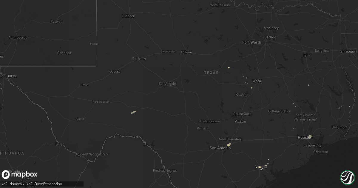
Hail Map in Texas on July 15, 2017
Get this storm
July 15 map
$229
one time, instant access
Download today. No call, no setup
Keep the $229
Bought the map and want the full workflow? Apply the entire $229 to a subscription within 7 days. None of it is wasted.
Every map, not just this one
This buys you this map. Subscription and you get every map we run, in the markets you choose from a few cities to whole states to nationwide. Plus real-time alerts the moment a storm fires.
Contact data
Name, contact info, occupancy, even credit band for addresses in the footprint. You go from where it hit to who to call.
Become the source they trust
Unlimited branding weather history reports on demand. You already have the documented answer ready for the property owner, and you are the one who showed up with it.
Property data and RoofTrace estimates
Pull up any address you have got, its value and the exact code rules for that jurisdiction, straight from One Click Code. Then RoofTrace estimates the squares, pitch, and roof value, priced the way you price.
Storm reports in Texas
Texas
| Date | Description |
|---|---|
| 07/15/20176:56 PM CDT | Roof damage to home near intersection of sunset rd and leisure lane |
| 07/15/20176:30 PM CDT | Sheriffs office reports trees down... Street signs blown over... And porta potties tipped over in the city of victoria. Time estimated by radar. |
| 07/15/20176:25 PM CDT | Sheriffs office reported estimated 60mph wind gusts in downtown victoria. |
| 07/15/20176:15 PM CDT | Reports of downed tree limbs and power lines along fm 766 just south of the rivercrest lane intersection. |
| 07/15/20175:25 PM CDT | Social media reports a powerpole down and tree damge at the intersection of s navarro street and e forest street. |
| 07/15/20174:57 PM CDT | Reports of tree damage near highway 183 and duval road in northwest austin. |
| 07/15/20174:15 PM CDT | Williamson county em reports damage to the southwest side of the roof on 6 to 8 homes along caldwell palm circle. |
| 07/15/20173:28 PM CDT | Tornado was spotted off of 190 west of livingston. There was reported damage to storage facility roofs. |
All States Impacted by Hail Map on July 15, 2017
Cities Impacted by Hail Map on July 15, 2017
- East Troy, WI
- Elkhorn, WI
- Kewanee, IL
- Neponset, IL
- Annawan, IL
- Toulon, IL
- Sheffield, IL
- Coloma, WI
- Friendship, WI
- Kirbyville, TX
- Nathrop, CO
- Buena Vista, CO
- Maricopa, AZ
- Whitehall, WI
- Blair, WI
- Juda, WI
- Freeport, IL
- Dakota, IL
- Ridott, IL
- Mount Morris, IL
- Leaf River, IL
- Byron, IL
- Davis, IL
- Rock City, IL
- Oregon, IL
- German Valley, IL
- Monroe, WI
- Orangeville, IL
- Pecatonica, IL
- Cimarron, KS
- Viola, WI
- Viroqua, WI
- La Farge, WI
- Burnett, WI
- Seiling, OK
- Ozona, TX
- Dryden, TX
- Kanorado, KS
- Oakfield, WI
- Poulan, GA
- Sylvester, GA
- Washington Island, WI
- Eldorado, OK
- Quanah, TX
- Oakwood, OK
- Canton, OK
- Clintonville, WI
- Dousman, WI
- Gladstone, MI
- Escanaba, MI
- Cornell, MI
- Franklin, TN
- Fairview, TN
- Coolidge, AZ
- Cobbtown, GA
- Eagle, WI
- Aurora, NC
- Crown King, AZ
- Fletcher, OK
- Sedona, AZ
- Yukon, OK
- Berlin, WI
- Ripon, WI
- Brandon, WI
- Waupun, WI
- Goodman, WI
- Athelstane, WI
- Hockley, TX
- Enigma, GA
- Lenox, GA
- Tifton, GA
- Burlington, CO
- Fort Supply, OK
- Junction City, AR
- Walterboro, SC
- Albany, GA
- Hewitt, WI
- Auburndale, WI
- Marshfield, WI
- Gila Bend, AZ
- North Prairie, WI
- Nashotah, WI
- Hartland, WI
- Pewaukee, WI
- Oconomowoc, WI
- Delafield, WI
- Mukwonago, WI
- Okauchee, WI
- Garden City, KS
- Young, AZ
- Lamar, CO
- Crivitz, WI
- Hoxie, KS
- Monroe, NC
- Victoria, TX
- Norris, IL
- Brimfield, IL
- Glasford, IL
- La Fayette, IL
- Victoria, IL
- Galva, IL
- Canton, IL
- Dahinda, IL
- Trivoli, IL
- Laura, IL
- Yates City, IL
- Farmington, IL
- Williamsfield, IL
- Elmwood, IL
- Altona, IL
- Inez, TX
- Lake Geneva, WI
- Genoa City, WI
- Bamberg, SC
- Genoa, CO
- Pulaski, WI
- Wrightstown, WI
- Oneida, WI
- Black Creek, WI
- De Pere, WI
- Seymour, WI
- Green Bay, WI
- Sobieski, WI
- Bonduel, WI
- Kaukauna, WI
- Krakow, WI
- Greenleaf, WI
- Brillion, WI
- Prairie Du Sac, WI
- Reedsburg, WI
- Baraboo, WI
- North Freedom, WI
- Hico, TX
- Dublin, TX
- Appleton, WI
- Hortonville, WI
- Shiocton, WI
- Woodrow, CO
- Heart Butte, MT
- Arnett, OK
- Canadian, TX
- Waynesboro, GA
- Hephzibah, GA
- Tomball, TX
- Statesville, NC
- Prescott, AZ
- Edgefield, SC
- Creswell, NC
- Bayfield, CO
- Durango, CO
- Taloga, OK
- Moncks Corner, SC
- Reydon, OK
- Putnam, OK
- Custer City, OK
- Vici, OK
- Tabor City, NC
- Clarendon, NC
- Eads, CO
- Kit Carson, CO
- Arlington, CO
- Indian Trail, NC
- Mamou, LA
- Ville Platte, LA
- Oakdale, LA
- Randlett, OK
- Watertown, WI
- Dodge City, KS
- Marinette, WI
- Wisconsin Dells, WI
- Pineville, SC
- Duncan, OK
- Congress, AZ
- Mayer, AZ
- Westfield, WI
- Payson, AZ
- Olar, SC
- Ulmer, SC
- Barnwell, SC
- Eva, AL
- Hammon, OK
- Morristown, AZ
- Mustang, OK
- Collins, GA
- Ochlocknee, GA
- Meigs, GA
- Ninnekah, OK
- Boise City, OK
- New Bern, NC
- Purcell, OK
- London Mills, IL
- Maquon, IL
- Brussels, WI
- Rockingham, NC
- Wonder Lake, IL
- Fort Atkinson, WI
- Jefferson, WI
- Hartford, WI
- Theresa, WI
- Blanchard, OK
- Washington, OK
- Burlington, WI
- Ringwood, IL
- Hebron, IL
- Richmond, IL
- Whigham, GA
- Climax, GA
- New River, AZ
- Lindsay, OK
- Cross, SC
- Jetmore, KS
- Crawford, OK
- Monmouth, IL
- Kirkwood, IL
- Richlands, NC
- Chinquapin, NC
- Suring, WI
- Pound, WI
- Woodward, OK
- Amber, OK
- Chickasha, OK
- Fond Du Lac, WI
- Lomira, WI
- Brownsville, WI
- Campbellsport, WI
- Neosho, WI
- Benkelman, NE
- Kirkland, AZ
- Raeford, NC
- Longdale, OK
- Eutawville, SC
- Vance, SC
- Santee, SC
- Ashland, KS
- Minneola, KS
- Salome, AZ
- Palmyra, WI
- Helenville, WI
- Higgins, TX
- Pembine, WI
- New Glarus, WI
- Mount Horeb, WI
- Belleville, WI
- Blanchardville, WI
- Wells, MI
- Maysville, NC
- Summerville, SC
- Laverne, OK
- Arriba, CO
- Dodgeville, WI
- Akron, CO
- Yuma, CO
- Latta, SC
- McCormick, SC
- Blackstock, SC
- Winona, KS
- Sharon, OK
- Brookfield, WI
- Sussex, WI
- Lannon, WI
- Menomonee Falls, WI
- Sullivan, WI
- Rush Springs, OK
- Cameron, IL
- Jacksonville, NC
- Elloree, SC
- West Bend, WI
- Jackson, WI
- Fontana, WI
- Walworth, WI
- Black Canyon City, AZ
- Ixonia, WI
- Horicon, WI
- Iron Ridge, WI
- Hickory, NC
- Connelly Springs, NC
- Evansville, WI
- Spurger, TX
- Nichols, SC
- Fair Bluff, NC
- Lake Mills, WI
- Waterloo, WI
- Louisville, GA
- Cibolo, TX
- Marion, TX
- Seguin, TX
- Schertz, TX
- Saint Hedwig, TX
- Yemassee, SC
- Chester, SC
- Cheyenne, OK
- Beloit, WI
- Augusta, GA
- Thomas, OK
- New London, WI
- Miami, TX
- Oklahoma City, OK
- Huntsville, TX
- Grantsboro, NC
- Maysville, OK
- Lowell, NC
- Gastonia, NC
- Hustisford, WI
- Readstown, WI
- Oakley, KS
- Colby, KS
- Durham, OK
- Sahuarita, AZ
- Cortez, CO
- Warrens, WI
- Marion, SC
- Wickenburg, AZ
- Hartsville, SC
- Bishopville, SC
- Protection, KS
- Prescott Valley, AZ
- Alford, FL
- Cottondale, FL
- Stillman Valley, IL
- Ashburn, GA
- Conway, SC
- Loris, SC
- Gold Hill, NC
- Ensign, KS
- Marshville, NC
- Bethune, SC
- Somerville, AL
- Autryville, NC
- Roseboro, NC
- Plymouth, WI
- Cascade, WI
- Grover, NC
- Shelby, NC
- Clinton, OK
- Superior, AZ
- Columbia, NC
- Columbus, WI
- Arena, WI
- Barneveld, WI
- Omro, WI
- Oshkosh, WI
- Bear Creek, WI
- Alma, GA
- Hazlehurst, GA
- Rock Springs, WI
- Seven Springs, NC
- Stephenson, MI
- Fredonia, WI
- Random Lake, WI
- Kewaskum, WI
- Adell, WI
- Smyrna, SC
- Oquawka, IL
- Edna, TX
- South Beloit, IL
- Caledonia, IL
- Cochise, AZ
- Leedey, OK
- Camargo, OK
- Chadbourn, NC
- Whiteville, NC
- Mount Calvary, WI
- Cross Plains, WI
- Richfield, WI
- Daggett, MI
- Clarkton, NC
- Florence, AZ
- Delavan, WI
- El Dorado, AR
- Monticello, WI
- Briggsville, WI
- Oxford, WI
- Avoca, WI
- Laurinburg, NC
- McColl, SC
- Glenwood, GA
- McRae Helena, GA
- Lake Waccamaw, NC
- Council, NC
- Allenton, WI
- Johnson Creek, WI
- Ashippun, WI
- Rubicon, WI
- Juneau, WI
- Whitewater, WI
- Darlington, WI
- Soldiers Grove, WI
- Winslow, AZ
- Norman, OK
- Healy, KS
- Scott City, KS
- Loganville, WI
- Montello, WI
- Chino Valley, AZ
- Sycamore, GA
- Moody, TX
- Peoria, AZ
- Bird City, KS
- Alex, OK
- Sayre, OK
- Kennard, TX
- Maxton, NC
- Troutman, NC
- Stapleton, GA
- Gibson, GA
- Wallace, NC
- Springfield, WI
- Woodstock, IL
- Harvard, IL
- Fowler, KS
- Eleva, WI
- Davis Junction, IL
- Monroe Center, IL
- Rochelle, IL
- Lindenwood, IL
- Rockford, IL
- Esmond, IL
- Kirkland, IL
- Cherry Valley, IL
- Oconto Falls, WI
- Lena, WI
- Coleman, WI
- Abingdon, IL
- Menominee, MI
- Wayne, OK
- Ehrhardt, SC
- Warrenton, GA
- Chickamauga, GA
- Lavonia, GA
- Rosendale, WI
- Eldorado, WI
- Pickett, WI
- Avera, GA
- Steward, IL
- Belvidere, IL
- Chana, IL
- Shawano, WI
- Poy Sippi, WI
- Gillett, WI
- Armuchee, GA
- Valley Mills, TX
- Clifton, TX
- Hubert, NC
- Maple Hill, NC
- Amberg, WI
- Slinger, WI
- Arapaho, OK
- Newton, TX
- Spragueville, IA
- Bellevue, IA
- Ridgeway, WI
- Mazomanie, WI
- Jesup, GA
- Markesan, WI
- Agate, CO
- Osseo, WI
- Weskan, KS
- Tonopah, AZ
- Chattahoochee, FL
- Green Lake, WI
- Redgranite, WI
- Leoti, KS
- Milton, WI
- Conover, NC
- La Harpe, IL
- Mountain View, OK
- Buckeye, AZ
- Matthews, NC
- Rexford, KS
- Beaver Dam, WI
- Montezuma, KS
- Stronghurst, IL
- Lomax, IL
- Blacksburg, SC
- Manawa, WI
- Fargo, OK
- McGregor, TX
- Oglesby, TX
- Oracle, AZ
- Southard, OK
- Watonga, OK
- Okeene, OK
- Rockland, WI
- Bayboro, NC
- Hobucken, NC
- Merritt, NC
- Sturgeon Bay, WI
- Menlo, GA
- Mosinee, WI
- Valier, MT
- Selden, KS
- Thomasville, GA
- Janesville, WI
- Williston, SC
- Schlater, MS
- Goose Creek, SC
- Cuba, IL
- Lewistown, IL
- Loretto, TN
- Belmont, NC
- Green Pond, SC
- Packwaukee, WI
- Oakboro, NC
- Cedar Bluff, AL
- Richfield, NC
- Blue Mounds, WI
- Midway, GA
- Princeton, WI
- Newberry, SC
- Whitmire, SC
- Pomaria, SC
- Bradley, OK
- Anaconda, MT
- Pasadena, TX
- Galena Park, TX
- Houston, TX
- Channelview, TX
- Minco, OK
- Rio, WI
- Harrells, NC
- Ivanhoe, NC
- Summerville, GA
- Mineral Point, WI
- Jamestown, SC
- Stratton, NE
- Buffalo, OK
- La Fayette, GA
- Alamo, GA
- Mountain, WI
- Sylvania, GA
- Hallsboro, NC
- Vernon, TX
- Cassatt, SC
- Grovetown, GA
- Toccoa, GA
- Gould, OK
- Soperton, GA
- Adrian, GA
- Rockledge, GA
- Fort Stewart, GA
- Ellabell, GA
- Rock, MI
- Loves Park, IL
- Holcomb, IL
- Machesney Park, IL
- Malta, IL
- Kingston, IL
- Garland, NC
- Hubertus, WI
- Colgate, WI
- Germantown, WI
- Springfield, TN
- Bonneau, SC
- Cordesville, SC
- Chaseburg, WI
- Westby, WI
- Reeseville, WI
- Willard, NC
- Mchenry, IL


