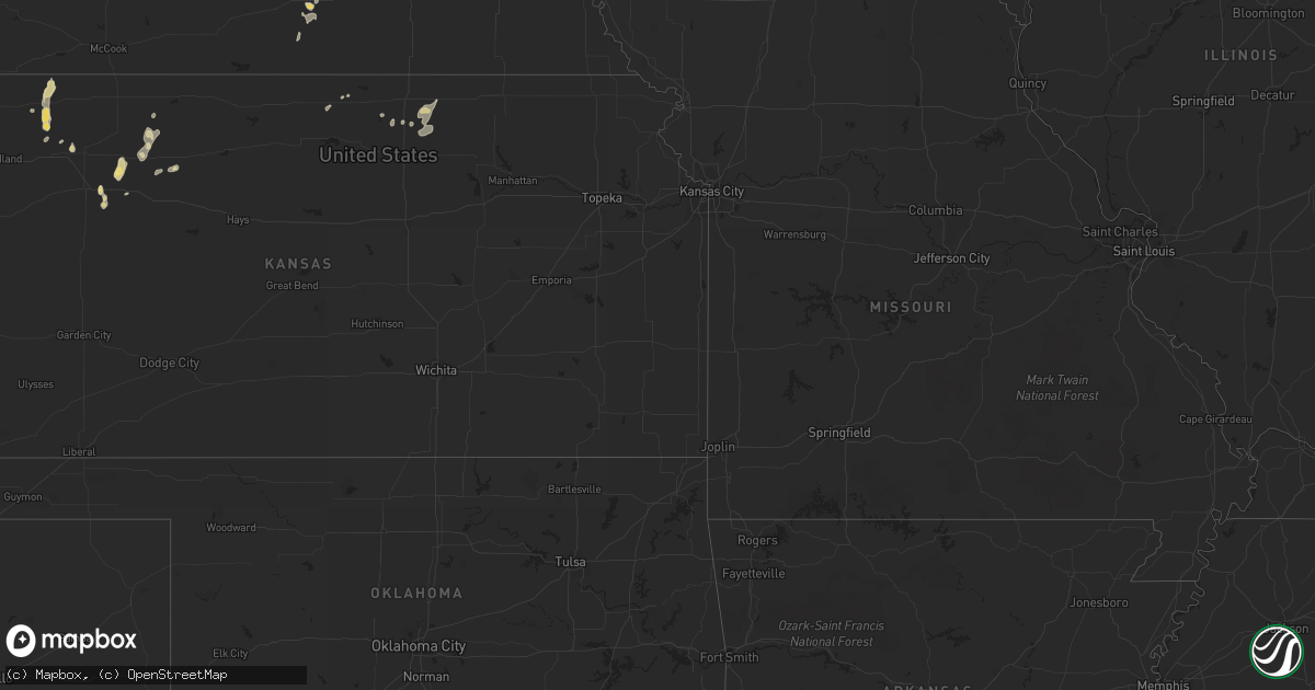
Hail Map in North Dakota on July 15, 2011
Get this storm
July 15 map
$229
one time, instant access
Download today. No call, no setup
Keep the $229
Bought the map and want the full workflow? Apply the entire $229 to a subscription within 7 days. None of it is wasted.
Every map, not just this one
This buys you this map. Subscription and you get every map we run, in the markets you choose from a few cities to whole states to nationwide. Plus real-time alerts the moment a storm fires.
Contact data
Name, contact info, occupancy, even credit band for addresses in the footprint. You go from where it hit to who to call.
Become the source they trust
Unlimited branding weather history reports on demand. You already have the documented answer ready for the property owner, and you are the one who showed up with it.
Property data and RoofTrace estimates
Pull up any address you have got, its value and the exact code rules for that jurisdiction, straight from One Click Code. Then RoofTrace estimates the squares, pitch, and roof value, priced the way you price.
Storm reports in North Dakota
North Dakota
| Date | Description |
|---|---|
| 07/15/20111:59 AM CDT | A local report indicates 58 MPH wind near 8 E ROSEGLEN |
| 07/15/20111:20 AM CDT | Two and a half foot diameter tree at the high school was broken off. Tree was approximately 30 feet tall. |
| 07/15/20111:20 AM CDT | A local report indicates 62 MPH wind near STANLEY |
| 07/14/201111:10 PM CDT | Late report from coop trees down 15 north of trotters |
All States Impacted by Hail Map on July 15, 2011
Cities Impacted by Hail Map on July 15, 2011
- Melrose, MN
- Zap, ND
- Beulah, ND
- Keenesburg, CO
- Golden Valley, ND
- Malta, MT
- Killdeer, ND
- Mandaree, ND
- Winthrop, MN
- Waseca, MN
- New Richland, MN
- Waldorf, MN
- Walnut, IA
- Cartwright, ND
- Alexander, ND
- Arnegard, ND
- Watford City, ND
- Wheaton, MN
- Northwood, IA
- Kensett, IA
- Glenville, MN
- Grafton, IA
- Emmons, MN
- Manly, IA
- Grinnell, KS
- Juniata, NE
- Roseland, NE
- Holstein, NE
- Kenesaw, NE
- Savage, MT
- Lindsay, MT
- Terry, MT
- Albany, MN
- Bloomfield, MT
- Wells, MN
- Bricelyn, MN
- Circle, MT
- Brockway, MT
- Paynesville, MN
- Mapleton, MN
- Amboy, MN
- Winter Springs, FL
- Oviedo, FL
- Stoneham, CO
- Saint Cloud, FL
- Stanley, ND
- Villard, MN
- Glenwood, MN
- Plainfield, IA
- Nashua, IA
- Greeley, CO
- Eaton, CO
- Richmond, MN
- Orchard, CO
- Wiggins, CO
- Fort Morgan, CO
- New Raymer, CO
- Weldona, CO
- Roggen, CO
- Cold Spring, MN
- Eden Valley, MN
- Watkins, MN
- Avon, MN
- Saint Martin, MN
- Freeport, MN
- Saint Joseph, MN
- Roscoe, MN
- Cleveland, MN
- Le Center, MN
- Le Sueur, MN
- Monroe, NE
- Platte Center, NE
- Columbus, NE
- Musselshell, MT
- Glendive, MT
- Brooten, MN
- Sauk Centre, MN
- Ocala, FL
- Anthony, FL
- Williston, ND
- Ute, IA
- Gaylord, MN
- Avoca, IA
- Belgrade, MN
- Lavina, MT
- Shelby, IA
- Hoxie, KS
- Roundup, MT
- Ryegate, MT
- Pemberton, MN
- Halliday, ND
- Duncan, NE
- Hordville, NE
- Clarks, NE
- Silver Creek, NE
- Polk, NE
- Osceola, NE
- Tioga, ND
- Ray, ND
- White Earth, ND
- Boston, GA
- Cohagen, MT
- Good Thunder, MN
- McDonald, KS
- Colby, KS
- Burtrum, MN
- Grey Eagle, MN
- Herman, MN
- Winnett, MT
- Silver Lake, MN
- Logan, IA
- Woodbine, IA
- Geneva, FL
- Alexandria, MN
- Osakis, MN
- Kersey, CO
- Gill, CO
- Rapelje, MT
- Broadview, MT
- Sac City, IA
- Schuyler, NE
- Lambert, MT
- Shepherd, MT
- Hoffman, MN
- Kensington, MN
- Jamestown, KS
- Concordia, KS
- Panama, IA
- Harlan, IA
- Portsmouth, IA
- Earling, IA
- Intercession City, FL
- Kissimmee, FL
- Mankato, KS
- Atwater, MN
- Orlando, FL
- Sanford, FL
- Marne, IA
- Atlantic, IA
- Saint Cloud, MN
- Rockville, MN
- Kimball, MN
- Persia, IA
- Diboll, TX
- Ingomar, MT
- Elbow Lake, MN
- Barrett, MN
- Lake Placid, FL
- Hill City, KS
- Penokee, KS
- Grassy Butte, ND
- Agenda, KS
- Ross, ND
- Saint James, MN
- Chapman, NE
- Aurora, NE
- Marquette, NE
- Grand Island, NE
- Central City, NE
- Phillips, NE
- Howells, NE
- Scribner, NE
- Belle Plaine, MN
- Henderson, MN
- Selden, KS
- Dodge, NE
- Debary, FL
- Eustis, FL
- Farmington, MN
- Elko New Market, MN
- Prior Lake, MN
- Webster, MN
- Lakeville, MN
- Northfield, MN
- Onawa, IA
- Dixie, GA
- Levant, KS
- Atwood, KS
- Genoa, NE
- Zumbrota, MN
- Wanamingo, MN
- Goodhue, MN
- Green Cove Springs, FL
- Palatka, FL
- Plato, MN
- Lester Prairie, MN
- Young America, MN
- Arlington, MN
- Farwell, MN
- Donnelly, MN
- Morris, MN
- Morland, KS
- Acton, MT
- Blencoe, IA
- Wibaux, MT
- Grainfield, KS
- Glencoe, MN
- Hutchinson, MN
- Alda, NE
- Starbuck, MN
- Blue Earth, MN
- Brandon, MN
- Evansville, MN
- Garfield, MN
- Holdingford, MN
- Hartland, MN
- Epping, ND
- Litchfield, MN
- Darwin, MN
- Westphalia, IA
- Briggsdale, CO
- Easton, MN
- Decatur, NE
- Minnesota Lake, MN
- Randolph, MN
- Hampton, MN
- Humphrey, NE
- Jennings, KS
- Florahome, FL
- Keystone Heights, FL
- Minden, IA
- Alden, MN
- Albert Lea, MN
- Hamburg, MN
- Lakeland, FL
- Ellendale, MN
- Owatonna, MN
- Mankato, MN
- Craig, NE
- Tekamah, NE
- Lyons, NE
- Oakland, NE
- Truman, MN
- Castana, IA
- West Point, NE
- Janesville, MN
- Richey, MT
- Apple Springs, TX
- Lowry, MN
- North Bend, NE
- Clarkson, NE
- Rogers, NE
- Christmas, FL
- Belleville, KS
- Clyde, KS
- Cuba, KS
- Haddam, KS
- South Haven, MN
- Kandiyohi, MN
- Willmar, MN
- Spicer, MN
- Doniphan, NE
- Mulberry, FL
- Norway, KS
- Hastings, NE
- Plant City, FL
- Carroll, IA
- Campbell, NE
- Riverton, NE
- Okeechobee, FL
- Dunn Center, ND
- Billings, MT
- Keene, ND
- Forsyth, MT
- Hancock, IA
- Oakland, IA
- Stewart, MN
- Ormsby, MN
- Trimont, MN
- Esbon, KS
- Nelson, MN
- Carlos, MN
- Kiester, MN
- Giltner, NE
- Dumont, MN
- Graceville, MN
- Missouri Valley, IA
- Pisgah, IA
- Mondamin, IA
- Soldier, IA
- Lake Lillian, MN
- New Town, ND
- Blooming Prairie, MN
- Lake Mills, IA
- Padroni, CO
- Worden, MT
- Custer, MT
- Winter Park, FL
- Dunlap, IA
- Frost, MN
- Hysham, MT
- Elmore, MN


