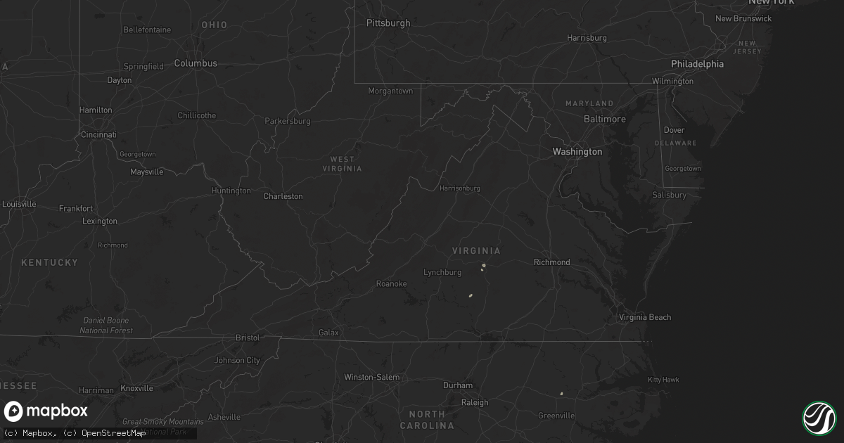
Hail Map in Virginia on July 13, 2025
Get this storm
July 13 map
$229
one time, instant access
Download today. No call, no setup
Keep the $229
Bought the map and want the full workflow? Apply the entire $229 to a subscription within 7 days. None of it is wasted.
Every map, not just this one
This buys you this map. Subscription and you get every map we run, in the markets you choose from a few cities to whole states to nationwide. Plus real-time alerts the moment a storm fires.
Contact data
Name, contact info, occupancy, even credit band for addresses in the footprint. You go from where it hit to who to call.
Become the source they trust
Unlimited branding weather history reports on demand. You already have the documented answer ready for the property owner, and you are the one who showed up with it.
Property data and RoofTrace estimates
Pull up any address you have got, its value and the exact code rules for that jurisdiction, straight from One Click Code. Then RoofTrace estimates the squares, pitch, and roof value, priced the way you price.
Storm reports in Virginia
Virginia
| Date | Description |
|---|---|
| 07/13/20256:56 PM CDT | Tree and large branches and limbs downed by thunderstorm winds in the 6300 block of jubal early highway. |
| 07/13/20256:16 PM CDT | Tree down across jubal early highway in hardy of franklin county. |
| 07/13/20256:00 PM CDT | A large tree was blown down near the 6500 block of jubal early highway by thunderstorm winds. |
| 07/13/20255:32 PM CDT | Tree down across hollins road. |
All States Impacted by Hail Map on July 13, 2025
Cities Impacted by Hail Map on July 13, 2025
- Marianna, FL
- Trenton, IL
- Monterey, LA
- Sanford, FL
- Oviedo, FL
- Winter Springs, FL
- Aviston, IL
- Breese, IL
- Edgewater, FL
- Gordon, AL
- Athens, TX
- Webb, AL
- Oak Hill, FL
- Dillwyn, VA
- Youngstown, FL
- New Caney, TX
- Liberty, MS
- Ormond Beach, FL
- Satsuma, FL
- Cameron, SC
- Splendora, TX
- Smithdale, MS
- Timberon, NM
- Orangeburg, SC
- Chipley, FL
- Cloudcroft, NM
- Welaka, FL
- Pomona Park, FL
- Bogue Chitto, MS
- Brookhaven, MS
- Charlotte Court House, VA
- Cullen, VA
- Flora, IL
- Currie, NC
- Kelly, NC
- Atkinson, NC
- Georgetown, FL
- Crescent City, FL
- Bowman, SC
- Merritt Island, FL
- Newville, AL
- La Luz, NM
- High Rolls Mountain Park, NM
- Defuniak Springs, FL
- Ponce De Leon, FL
- Hanover, NM
- Silver City, NM
- Remsen, NY
- Forestport, NY
- Clay City, IL
- Wesson, MS
- Hazlehurst, MS
- Crystal Springs, MS
- Harrisville, NY
- Louisville, IL
- Fort McCoy, FL
- Harrisville, MS
- Florence, MS
- Terry, MS
- Fort Pierce, FL
- Noble, IL
- Sailor Springs, IL
- Hartsville, SC
- Truth Or Consequences, NM
- Mescalero, NM
- Olney, IL
- Braxton, MS
- Brandon, MS
- Pelahatchie, MS
- Morton, MS
- Monticello, FL
- Robersonville, NC
- Patoka, IN
- Saint Joseph, TN
- Loretto, TN
- Forest, MS
- Pulaski, MS
- Big Rock, TN
- Bumpus Mills, TN
- Cadiz, KY
- Fort Campbell, KY
- La Fayette, KY
- Herndon, KY
- Oak Grove, KY
- Hopkinsville, KY
- Pembroke, KY
- Sapello, NM
- Spencer, NE
- Clearville, PA
- Las Vegas, NM
- Greenville, FL
- Carthage, TX
- Beckville, TX
- Stanley, NM
- Cliff, NM
- Las Cruces, NM
- Lufkin, TX
- El Paso, TX
- Fort Bliss, TX
- Canton, MS
- Oneill, NE
- Mount Vernon, IN
- Wadesville, IN
- New Harmony, IN
- Canastota, NY
- Poseyville, IN
- Waskom, TX
- Bethany, LA
- Haughton, LA
- Minden, LA
- Greenwood, LA
- De Berry, TX
- Barksdale Afb, LA
- Keithville, LA
- Marshall, TX
- Tatum, TX
- Bossier City, LA
- Shreveport, LA
- Princeton, LA
- San Augustine, TX
- Timpson, TX
- Tenaha, TX
- Center, TX
- Nacogdoches, TX
- Chireno, TX
- Garrison, TX
- Dundas, IL
- Sierra Vista, AZ
- Fort Huachuca, AZ
- Washington, IN
- Carrizozo, NM
- Whiteriver, AZ
- Monroe City, IN
- Willcox, AZ
- San Simon, AZ
- Mountainair, NM
- Siler City, NC
- Bear Creek, NC
- Gresham, SC
- Endicott, NY
- Owego, NY
- Montezuma, NM
- Rincon, NM
- Hazleton, IN
- Vaughn, NM
- Bowie, AZ
- Barry, MN
- Graceville, MN
- Duncan, AZ
- Hatch, NM
- Orrstown, PA
- Long Branch, TX
- Mount Enterprise, TX
- Gilbertown, AL
- Mora, NM
- Pleasant Hall, PA
- Fort Stewart, GA
- Dumont, MN
- Beardsley, MN
- Lake George, CO
- Ellabell, GA
- La Mesa, NM
- Arab, AL
- Cullman, AL
- Pleasanton, TX
- Campbellton, TX
- Woodville, AL
- Shelbyville, KY
- Pansey, AL
- Eagle Pass, TX
- Rocksprings, TX
- Utica, KY
- Petersburg, IN
- Hartford, KY
- Peridot, AZ
- Willard, NM
- Elgin, AZ
- Buena Vista, CO
- Paint Rock, AL
- Huachuca City, AZ
- Magdalena, NM
- Sierra Blanca, TX
- San Mateo, FL
- Louisville, KY
- Simpsonville, KY
- Bunnell, FL
- Polvadera, NM
- Cochise, AZ
- Saint David, AZ
- Tombstone, AZ
- Bisbee, AZ
- Hastings, FL
- East Palatka, FL
- Georgetown, CO
- Chambersburg, PA
- Dumont, CO
- Idaho Springs, CO
- Canutillo, TX
- Whitlash, MT
- Joplin, MT
- Inverness, MT
- Rudyard, MT
- Hingham, MT
- Havre, MT
- Gildford, MT
- Kremlin, MT
- Galata, MT
- Sweet Grass, MT
- Sunburst, MT
- Chinook, MT
- Brackettville, TX
- Zurich, MT
- Tucumcari, NM
- Melrose, NM
- Roswell, NM


