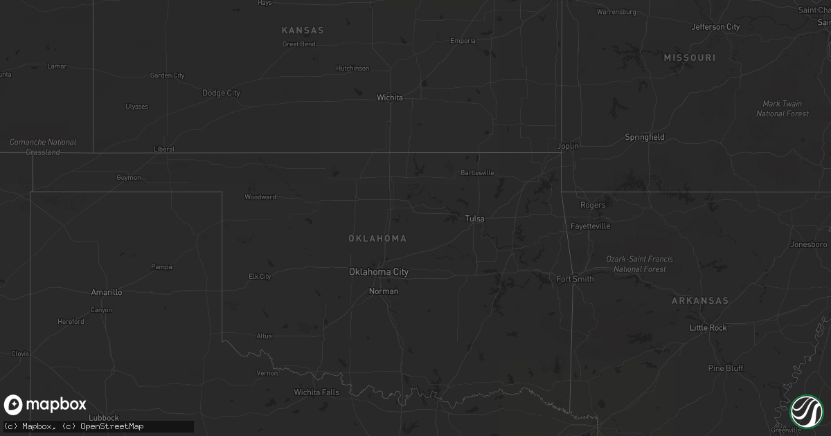
Hail Map on July 12, 2013
Get this storm
July 12 map
$229
one time, instant access
Download today. No call, no setup
Keep the $229
Bought the map and want the full workflow? Apply the entire $229 to a subscription within 7 days. None of it is wasted.
Every map, not just this one
This buys you this map. Subscription and you get every map we run, in the markets you choose from a few cities to whole states to nationwide. Plus real-time alerts the moment a storm fires.
Contact data
Name, contact info, occupancy, even credit band for addresses in the footprint. You go from where it hit to who to call.
Become the source they trust
Unlimited branding weather history reports on demand. You already have the documented answer ready for the property owner, and you are the one who showed up with it.
Property data and RoofTrace estimates
Pull up any address you have got, its value and the exact code rules for that jurisdiction, straight from One Click Code. Then RoofTrace estimates the squares, pitch, and roof value, priced the way you price.
States Impacted by Hail Map on July 12, 2013
Storm reports
Arizona
| Date | Description |
|---|---|
| 07/12/20133:00 PM CDT | *** 1 inj *** 6-7 ft high steel wall blown over on top of an individual by 60 plus mph est thunderstorm winds |
| 07/12/20132:49 PM CDT | Several 6-8 inch thick trees down. Estimate 50-60mph winds |
| 07/12/20132:40 PM CDT | 8 in. Diameter tree blown down. Est. Gust 50 mph. Vsby. Less than 0.25 mil |
| 07/12/20132:30 PM CDT | Awning blown off a house. Large tree blown over in florence gardens. |
| 07/11/20138:05 PM CDT | Wind caused a box truck to tip over. The wind also knocked over a fence. Report received via twitter. Time estimated. |
| 07/11/20137:45 PM CDT | Several areas of mohave valley lost power. An 18 foot boat was blown off a trailer and into a fence. |
North Dakota
| Date | Description |
|---|---|
| 07/12/20135:05 PM CDT | Hail of at least quarter size along hwy 2 on the north side of grand forks. |
| 07/12/20135:05 PM CDT | Measured at 55th st and 8th ave north. |
California
| Date | Description |
|---|---|
| 07/11/20138:20 PM CDT | Trees down blocking roadway in needles |
| 07/11/20137:48 PM CDT | Trees were blown down and blocked a roadway in needles |
New Jersey
| Date | Description |
|---|---|
| 07/12/20135:30 PM CDT | Damage to several structures with loss of roofing material |
Minnesota
| Date | Description |
|---|---|
| 07/12/20136:15 PM CDT | Several large tree branches and limbs were blown down in shelter belts across souther clover leaf and northern kratka townships. Nearby ndawn sensor measured peak winds |
| 07/12/20136:00 PM CDT | Significant wind damage in thief river falls. Numerous roofs damaged...motor home flipped...billboards from east side of town and out of town are bent or broken. Appear |
| 07/11/201310:16 PM CDT | Estimated large branch 6-8 inches in diameter down in town. Time estimated from radar. |
| 07/11/20139:44 PM CDT | Large cottonwood tree blown over between nashua and tintah. |
| 07/11/20139:44 PM CDT | 50 foot cottonwood tree blown over...also zero visibility in torrential rainfall |
| 07/11/20138:05 PM CDT | Spotter observed several dead trees down over roadway as well as very heavy rainfall. Time estimated from radar. |
| 07/11/20137:30 PM CDT | Numerous large 3 to 5 inch diameter tree branches broken down around the area. Also quite a bit of dime to nickel sized hail. |
West Virginia
| Date | Description |
|---|---|
| 07/12/20136:32 PM CDT | A local report indicates 1.25 inch wind near ST. ALBANS |
| 07/12/20136:24 PM CDT | Estimated 1inch hail in the southridge shopping center |
| 07/12/20136:12 PM CDT | Nickel to quarter size hail on the north side of charleston on i77. |
| 07/12/20136:05 PM CDT | Located in north charleston on palm drive. |
South Dakota
| Date | Description |
|---|---|
| 07/11/201310:30 PM CDT | Day co. Sheriff reported hail in waubay...pea size to the size of quarters. |
Wyoming
| Date | Description |
|---|---|
| 07/12/20134:45 PM CDT | Eight power poles were damaged...of which 4 were snapped off on the top half. The damage was near highway 313...about 1 mile east of the platte and goshen county line. |
| 07/12/20134:30 PM CDT | Farmers reported 16 power poles snapped. |
Montana
| Date | Description |
|---|---|
| 07/12/20132:42 PM CDT | Wind gust was associated with a passing shower...no cloud-to-ground lightning was detected |
Georgia
| Date | Description |
|---|---|
| 07/12/20136:20 PM CDT | Several trees were blown down across the county. |
| 07/12/20135:41 PM CDT | Tree down and other large branchs of trees near by in yards |
| 07/12/20135:27 PM CDT | Tree down and other large branchs of trees near by in yards |
| 07/12/20135:10 PM CDT | Numerous trees and power lines were blown down across the county. Power lines were downed on highway 85 in riverdale causing the road to be shut down. |
| 07/12/20134:20 PM CDT | A tree fell onto a car at the intersection of glenwood drive and derrill drive. |
| 07/12/20134:07 PM CDT | Trees were blown down along cypress pond road. The time of damage was based on radar imagery. |
| 07/12/20134:05 PM CDT | A tree was blown down on presidential drive. |
| 07/12/20134:00 PM CDT | Public reported quarter sized hail. |
| 07/12/20134:00 PM CDT | One tree was blown down at plantation lane. Another tree was blown down onto sterling road. |
| 07/12/20133:10 PM CDT | A tree was blown down across mount zion road at the intersection of vaughn road. |
Mississippi
| Date | Description |
|---|---|
| 07/12/20135:25 PM CDT | Winds measured 69 mph by storm spotter on north flank of storm near shell gas station in saucier. |
| 07/12/20134:35 PM CDT | Reported in the big point community. |
Louisiana
| Date | Description |
|---|---|
| 07/11/20137:09 PM CDT | Along highway 45 between jean lafitte and marrero. Time estimated by radar. |
North Carolina
| Date | Description |
|---|---|
| 07/12/20134:10 PM CDT | Reports of a few trees down from tryon to green creek. |
| 07/12/20134:10 PM CDT | Several reports of trees down along baber...big island and coxe roads. |
| 07/12/20133:47 PM CDT | Trees down along hudlow rd and hwy 74 |
| 07/12/20133:47 PM CDT | Trees down along hwy 221 and shepards creek rd |
| 07/12/20133:40 PM CDT | Tree down and gas line rupture on oscar justice rd. |
| 07/12/20132:17 PM CDT | Downed trees on powerlines along hwy 70 |
| 07/12/20132:15 PM CDT | A local report indicates 1.00 inch wind near 2 E GLEN ALPINE |
| 07/11/20139:33 PM CDT | Observed along jenkins road |
| 07/11/20139:20 PM CDT | Public report of quarter size hail. |
| 07/11/20139:05 PM CDT | Spotter relayed reports of multiple trees down on eastern half of byrd road from last friday evenings storm and a few trees fell on homes along the road. |
| 07/11/20138:52 PM CDT | Observed along kathy road. |
| 07/11/20138:52 PM CDT | Trees and powerlines down along kathy road. |
| 07/11/20138:45 PM CDT | Trees down along interstate 40 |
| 07/11/20138:10 PM CDT | Half dollar size hail reported in lenoir. |
| 07/11/20137:55 PM CDT | Emergency manager reports quarter size hail. |
| 07/11/20137:55 PM CDT | County eoc reports numerous trees down around collettsville. |
| 07/11/20137:55 PM CDT | Trees down on power lines. |
| 07/11/20137:40 PM CDT | County emergency services reports widespread trees and power lines down throughout the collettsville area. One downed line caused a fire with considerable structural da |
Florida
| Date | Description |
|---|---|
| 07/12/20132:00 PM CDT | A large oak tree was blown down along coopers cove road. The time of damage was based on radar imagery. |
| 07/12/20132:00 PM CDT | A 15 ft boat was capsized by thunderstorm winds. The vessel had 1 soul on board...and the person was rescued. The event occurred in the intracoastal waterway of guana r |
South Carolina
| Date | Description |
|---|---|
| 07/12/20136:20 PM CDT | Trees down in road duncan reidville rd |
| 07/12/20135:23 PM CDT | Schp reports tree down along danzler rd and hwy 290 |
| 07/12/20135:20 PM CDT | Large limbs and at least one powerline down...scattered power outages. |
| 07/12/20135:05 PM CDT | Trees down along highway 247 anderson county side |
| 07/12/20134:36 PM CDT | Schp reports tree down along midway rd |
| 07/12/20134:23 PM CDT | Schp reports tree down near hwy 9 |
| 07/12/20134:13 PM CDT | Schp reports tree down along n shamrock ave |
| 07/12/20133:56 PM CDT | Tree down and several large limbs down around the house off of hunt road. |
| 07/12/20133:55 PM CDT | Strong wind gusts also observed. |
| 07/12/20133:40 PM CDT | A local report indicates 1.00 inch wind near BEREA |
| 07/12/20133:40 PM CDT | Schp reports tree down along hwy 124 |
| 07/12/20133:40 PM CDT | Relayed report of fd responding to tree on a house. |
| 07/12/20133:25 PM CDT | Schp reports trees down along highway 76. |
| 07/12/20133:07 PM CDT | Observed near hwys 133/123 |
Cities Impacted by Hail Map on July 12, 2013
- Grady, AL
- Becker, MN
- Rutland, ND
- Forman, ND
- Box Springs, GA
- Mauk, GA
- Buena Vista, GA
- Gregory, SD
- Winner, SD
- Dallas, SD
- Camp Hill, AL
- Butte, NE
- Fairfax, SD
- Collettsville, NC
- Lenoir, NC
- Jay, FL
- Hull, GA
- Colbert, GA
- Suwanee, GA
- Calhoun Falls, SC
- Beaumont, TX
- Sour Lake, TX
- Brewton, AL
- Amherstdale, WV
- Moss Point, MS
- Grygla, MN
- Easley, SC
- Piedmont, SC
- Albany, GA
- Waubay, SD
- Webster, SD
- Lidgerwood, ND
- Baconton, GA
- Marrero, LA
- Sylvester, GA
- Hope Hull, AL
- Mizpah, MN
- Northome, MN
- Thief River Falls, MN
- Alapaha, GA
- Colome, SD
- Clermont, GA
- Lula, GA
- Cleveland, GA
- Clarkesville, GA
- Roslyn, SD
- Navarre, FL
- Gulf Breeze, FL
- South Charleston, WV
- Alum Creek, WV
- Potter, NE
- Gurley, NE
- Dalton, NE
- Bowersville, GA
- Hartwell, GA
- Lavonia, GA
- Ponemah, MN
- Goodridge, MN
- Kenna, WV
- Lafitte, LA
- Naper, NE
- White Castle, LA
- Fairmount, ND
- Charleston, WV
- Elkview, WV
- Walton, WV
- Morganton, NC
- Grand Forks, ND
- Saint Augustine, FL
- Colquitt, GA
- Tintah, MN
- Lodgepole, NE
- Chappell, NE
- Grenville, SD
- Pierpont, SD
- Lockport, LA
- Vancleave, MS
- Le Sueur, MN
- Le Center, MN
- Michigan, ND
- Mcville, ND
- Lakota, ND
- Sarah Ann, WV
- Omar, WV
- Fort Morgan, CO
- Pass Christian, MS
- Anderson, SC
- Florala, AL
- Semmes, AL
- Mobile, AL
- Ambrose, GA
- Broxton, GA
- Belleville, WV
- Cut Off, LA
- Grove Hill, AL
- Jackson, AL
- Old Fort, NC
- Marion, NC
- Riverdale, GA
- Atlanta, GA
- Gilbert, WV
- Delbarton, WV
- Bonifay, FL
- Elba, AL
- Junction City, GA
- Gulfport, MS
- Kilgore, NE
- Gold Canyon, AZ
- Saucier, MS
- Vidor, TX
- Clio, AL
- Goshen, AL
- Glenwood, AL
- Troy, AL
- Liberty, SC
- Florence, AZ
- Union Mills, NC
- Rutherfordton, NC
- Forest City, NC
- Bim, WV
- Honoraville, AL
- Luverne, AL
- Highland Home, AL
- Banks, AL
- Union Springs, AL
- Clemson, SC
- Pendleton, SC
- Biloxi, MS
- Merino, CO
- Snyder, CO
- Emerado, ND
- East Grand Forks, MN
- Mission, SD
- Manvel, ND
- Hillrose, CO
- Akron, CO
- Kelliher, MN
- Lagrange, GA
- Tifton, GA
- Lilburn, GA
- Tucker, GA
- Clarkston, GA
- Norcross, GA
- Stone Mountain, GA
- Senoia, GA
- Green Cove Springs, FL
- Omega, GA
- Byers, CO
- Deer Trail, CO
- Wilmer, AL
- Sod, WV
- Saint Albans, WV
- Sumerco, WV
- Crestview, FL
- Baker, FL
- Saint Hilaire, MN
- Fort Mitchell, AL
- Pittsview, AL
- Belle Plaine, MN
- Pekin, ND
- Tolna, ND
- Oak Hill, FL
- Lake Charles, LA
- Conley, GA
- Ellenwood, GA
- Cayuga, ND
- Spring, TX
- Cleveland, MN
- Norcross, MN
- Elbow Lake, MN
- Barrett, MN
- Placitas, NM
- Brush, CO
- Barnesville, GA
- Fayetteville, GA
- Gainesville, GA
- Advent, WV
- Newfolden, MN
- Middle River, MN
- Wray, GA
- Pine Apple, AL
- Minter, AL
- Cusseta, AL
- Campbellton, FL
- Graceville, FL
- Chipley, FL
- Demorest, GA
- Wetumpka, AL
- Brooks, GA
- Concord, GA
- Griffin, GA
- Williamson, GA
- Zionville, NC
- Trade, TN
- Vilas, NC
- Monticello, MN
- Kilkenny, MN
- Palm City, FL
- Long Beach, MS
- Cottondale, FL
- Dadeville, AL
- Summersville, WV
- Picayune, MS
- Preston, GA
- Eden, SD
- Hastings, FL
- Enigma, GA
- Dothan, AL
- Cumming, GA
- Dawsonville, GA
- Hankinson, ND
- Lucedale, MS
- Franklin, LA
- Darrow, LA
- Gonzales, LA
- Sorrento, LA
- Jordan, MN
- Northwood, ND
- Arvilla, ND
- Omaha, GA
- Waterville, MN
- Eatonton, GA
- Greenville, SC
- Doerun, GA
- Clear Lake, MN
- Madison Lake, MN
- Coffee Springs, AL
- Geneva, AL
- Chancellor, AL
- Opelika, AL
- Brinson, GA
- Hernshaw, WV
- Molena, GA
- Campbell, MN
- Salem, SC
- Sunset, SC
- Cologne, MN
- Carver, MN
- Butler, GA
- Scottdale, GA
- Duluth, GA
- Avondale Estates, GA
- Pine Lake, GA
- Lawrenceville, GA
- Decatur, GA
- Forest Park, GA
- Cogswell, ND
- Port Orange, FL
- Blackduck, MN
- Magnolia, TX
- Athens, GA
- Norman Park, GA
- Moultrie, GA
- Georgetown, GA
- Tallassee, AL
- Murrayville, GA
- Henderson, MN
- Monroeville, AL
- Marianna, FL
- Wellford, SC
- Lyman, SC
- Louisville, AL
- Royston, GA
- Danielsville, GA
- Jeanerette, LA
- Morgan City, LA
- Freeport, MN
- Albany, MN
- Iron City, GA
- Donalsonville, GA
- Larimore, ND
- Westwego, LA
- Mekinock, ND
- Auburn, AL
- Shiloh, GA
- Manchester, GA
- Arlington, GA
- Seneca, SC
- Bainbridge, GA
- Elysian, MN
- Lenox, GA
- Nashville, GA