Hail Map in Arkansas on July 11, 2013
Get this storm
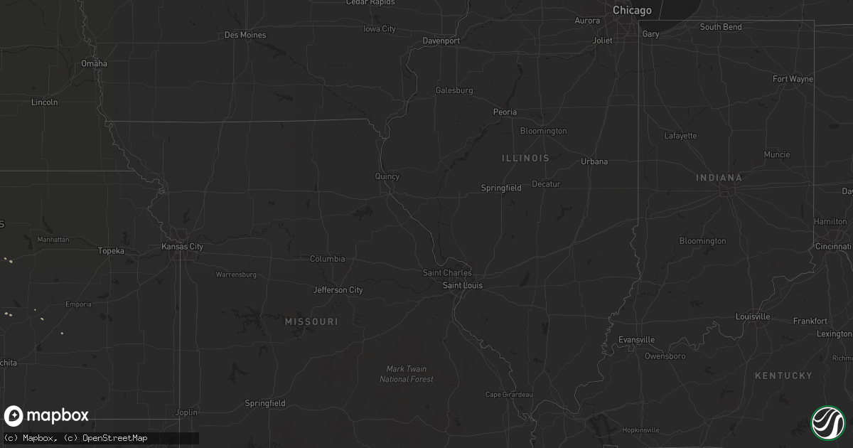
July 11 map
$229
one time, instant access
Download today. No call, no setup
Keep the $229
Bought the map and want the full workflow? Apply the entire $229 to a subscription within 7 days. None of it is wasted.
Every map, not just this one
This buys you this map. Subscription and you get every map we run, in the markets you choose from a few cities to whole states to nationwide. Plus real-time alerts the moment a storm fires.
Contact data
Name, contact info, occupancy, even credit band for addresses in the footprint. You go from where it hit to who to call.
Become the source they trust
Unlimited branding weather history reports on demand. You already have the documented answer ready for the property owner, and you are the one who showed up with it.
Property data and RoofTrace estimates
Pull up any address you have got, its value and the exact code rules for that jurisdiction, straight from One Click Code. Then RoofTrace estimates the squares, pitch, and roof value, priced the way you price.
Storm reports in Arkansas
Arkansas
| Date | Description |
|---|---|
| 07/11/20135:30 PM CDT | Tree down 2 north of nashville |
| 07/11/20135:30 PM CDT | A shop was damaged on mount pleasant drive from thunderstorm wind gusts. |
| 07/11/20135:30 PM CDT | Tree down in center point... Ar |
| 07/11/20135:30 PM CDT | A 300 foot section of a roof from a chicken house was torn off on boyd road in the center point community. Trees down on several county roads throughout central howard |
| 07/11/20135:25 PM CDT | A radio tower was downed onto a fire station. |
| 07/11/20133:05 PM CDT | 6-7 trees down... Power out west side of town |
| 07/10/20139:54 PM CDT | Multiple trees down on power lines all around hamburg. Several trees also fell on homes in the area. |
All States Impacted by Hail Map on July 11, 2013
Cities Impacted by Hail Map on July 11, 2013
- Tecumseh, OK
- Macomb, OK
- Maud, OK
- Tutwiler, MS
- Lordsburg, NM
- Animas, NM
- Kinston, NC
- Dover, NC
- Gilbert, LA
- Winnsboro, LA
- Cartwright, ND
- Charleston, MS
- Minter City, MS
- Jefferson, TX
- Karnack, TX
- Leland, MS
- Indianola, MS
- Dubach, LA
- Rohwer, AR
- Benoit, MS
- Lindale, TX
- Tyler, TX
- Evergreen, CO
- Grand Saline, TX
- Bastrop, LA
- Mount Pleasant, TX
- Kingston, OK
- Sulphur Springs, TX
- De Queen, AR
- Dierks, AR
- Bivins, TX
- Ida, LA
- Vivian, LA
- Pikeville, KY
- Arthur City, TX
- Sumner, TX
- Booneville, MS
- Mount Vernon, TX
- Colorado City, AZ
- Detroit, TX
- Eros, LA
- West Monroe, LA
- North Rim, AZ
- Ruston, LA
- Foss, OK
- Brownsboro, TX
- Chandler, TX
- Ben Wheeler, TX
- Drew, MS
- Benton, AR
- Pickton, TX
- Saltillo, TX
- Haworth, OK
- Ray, ND
- Tioga, ND
- Hillsboro, KS
- Wibaux, MT
- Dickinson, ND
- Manning, ND
- Traskwood, AR
- Hamburg, AR
- Wildrose, ND
- Crossett, AR
- Lake Charles, LA
- Hackberry, LA
- Sulphur, LA
- Alexander, ND
- Bristow, OK
- Depew, OK
- La Fayette, GA
- Rock Spring, GA
- Chickamauga, GA
- Valliant, OK
- Garvin, OK
- Abbeville, MS
- Crenshaw, MS
- Malvern, AR
- Lindsay, OK
- Wanette, OK
- Epping, ND
- Williston, ND
- Buckhorn, NM
- Oxford, MS
- Oakland, MS
- Five Points, TN
- Asher, OK
- Homer, LA
- Foster, OK
- Cedar Point, KS
- Winona, TX
- Dunnellon, FL
- Castle, OK
- Okemah, OK
- Lisbon, LA
- Summerfield, LA
- Haynesville, LA
- Blue Springs, MS
- Chandler, OK
- Meeker, OK
- Shawnee, OK
- Earlsboro, OK
- Prospect, TN
- Ardmore, TN
- Pulaski, TN
- Dermott, AR
- Watford City, ND
- Annona, TX
- Clarksville, TX
- Okolona, AR
- Plain Dealing, LA
- Chatham, LA
- Edgewood, TX
- Heflin, LA
- Pontotoc, MS
- Newcastle, WY
- Waskom, TX
- Canton, KS
- Jackson, LA
- Ethel, LA
- Bushnell, FL
- Solomon, KS
- Abilene, KS
- Celina, TX
- Prosper, TX
- Tuscumbia, AL
- Wayne, OK
- Byars, OK
- Bailey, CO
- Medora, ND
- Jasper, TX
- Van Buren, AR
- Amity, AR
- Delight, AR
- Carney, OK
- Ecru, MS
- Farmerville, LA
- Montrose, AR
- Halliday, ND
- Taylor, ND
- Scobey, MS
- Tillatoba, MS
- Naples, TX
- Greenville, MS
- Dallas, TX
- Richardson, TX
- Plano, TX
- New Cambria, KS
- Thoreau, NM
- Dubberly, LA
- Fruitvale, TX
- Sentinel Butte, ND
- Vardaman, MS
- Hollandale, MS
- Silver City, NM
- White Earth, ND
- Corinth, MS
- Stroud, OK
- Frankewing, TN
- Pine Grove, LA
- Van, TX
- Avery, TX
- Jonesboro, LA
- Town Creek, AL
- Moulton, AL
- Mount Hope, AL
- Lockesburg, AR
- Loxahatchee, FL
- Nashville, AR
- Lindsborg, KS
- Marietta, TX
- Sparks, OK
- Bernice, LA
- Sapulpa, OK
- Butler, OK
- Vance, MS
- Sumner, MS
- Kenefic, OK
- Grand Chenier, LA
- Omaha, TX
- Dike, TX
- Big Sandy, TX
- Hawkins, TX
- Schlater, MS
- Madill, OK
- De Kalb, TX
- Belfield, ND
- Russellville, AL
- Red Bay, AL
- Lumberton, NC
- Paoli, OK
- Mountain View, OK
- Lake Panasoffkee, FL
- Cordell, OK
- Purcell, OK
- Batesville, MS
- Clinton, OK
- Holcomb, MS
- Greenwood, MS
- Carrollton, MS
- Atlanta, TX
- Bogata, TX
- Clinton, LA
- Pope, MS
- Lambert, MS
- Enid, MS
- Calhoun, LA
- Eureka, KS
- Maud, TX
- Linden, TX
- Newellton, LA
- Slaughter, LA
- Pauls Valley, OK
- Hardeeville, SC
- Rufe, OK
- Fort Towson, OK
- Shaw, MS
- Doddsville, MS
- Sheffield, AL
- Muscle Shoals, AL
- Conifer, CO
- Como, TX
- Randolph, MS
- Ruleville, MS
- Huttig, AR
- Dill City, OK
- Tolley, ND
- Crockett, TX
- Vina, AL
- Gladstone, ND
- Bagwell, TX
- Baskin, LA
- Kellyville, OK
- Lulu, FL
- Simsboro, LA
- Marion, KS
- Grambling, LA
- Courtland, MS
- Kenmare, ND
- Powers Lake, ND
- McGehee, AR
- Rienzi, MS
- Arnegard, ND


