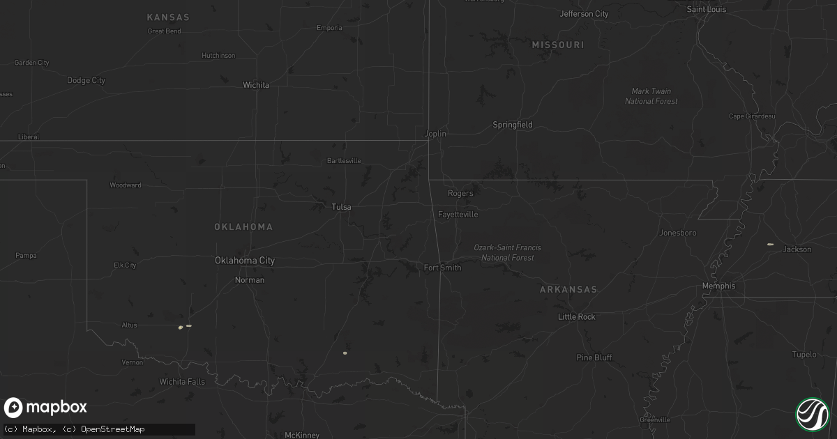
Hail Map on July 10, 2012
Get this storm
July 10 map
$229
one time, instant access
Download today. No call, no setup
Keep the $229
Bought the map and want the full workflow? Apply the entire $229 to a subscription within 7 days. None of it is wasted.
Every map, not just this one
This buys you this map. Subscription and you get every map we run, in the markets you choose from a few cities to whole states to nationwide. Plus real-time alerts the moment a storm fires.
Contact data
Name, contact info, occupancy, even credit band for addresses in the footprint. You go from where it hit to who to call.
Become the source they trust
Unlimited branding weather history reports on demand. You already have the documented answer ready for the property owner, and you are the one who showed up with it.
Property data and RoofTrace estimates
Pull up any address you have got, its value and the exact code rules for that jurisdiction, straight from One Click Code. Then RoofTrace estimates the squares, pitch, and roof value, priced the way you price.
States Impacted by Hail Map on July 10, 2012
Storm reports
Wyoming
| Date | Description |
|---|---|
| 07/10/20126:16 PM CDT | A local report indicates 77 MPH wind near 2 NNW GREYBULL |
| 07/10/20124:50 PM CDT | No damage reported |
South Carolina
| Date | Description |
|---|---|
| 07/10/20125:39 PM CDT | Trees down on i-26 at exit 97. |
| 07/10/20125:20 PM CDT | Schp reported trees in roadway at island trail and indian fork road. Time estimated based on radar. |
| 07/10/20125:10 PM CDT | Schp reported trees in roadway at lester keisler road and campground road. Time estimated based on radar. |
| 07/10/20125:02 PM CDT | Schp reported trees in roadway at sc-245 and us-178. Time estimated based on radar. |
| 07/10/20124:45 PM CDT | The south carolina highway patrol reported a tree down near the intersection of folly creek lane and green pond highway. |
| 07/10/20124:40 PM CDT | Report of tree down at crossroad of center road and honda way. |
| 07/10/20124:36 PM CDT | Sc highway patrol reports a tree down on hendersonville highway. |
| 07/10/20124:06 PM CDT | Schp reported trees in roadway at beaver dam creek rd and bush river rd. Time estimated. |
| 07/10/20123:50 PM CDT | Schp reported tree in roadway at jalapa rd and cromer rd. |
| 07/10/20123:32 PM CDT | *** 1 inj *** a person was taken to the hospital after being hit by a falling tree on mechanic street in pendleton. Extent of injuries unknown at this time. |
| 07/10/20123:30 PM CDT | Lee county sheriffs office reported multiple powerlines down in bishopville. Time estimated based on radar. |
| 07/10/20123:08 PM CDT | Sc highway patrol reports a tree down along route 41. |
| 07/10/20123:04 PM CDT | Berkeley 911 center reports a tree down on branch road near route 17a. |
| 07/10/20122:48 PM CDT | Berkeley 911 center reports a tree down on branch road near route 17a. |
| 07/10/20122:47 PM CDT | Sheriff dispatch reported trees down in the city of camden. |
| 07/10/20122:45 PM CDT | Power lines down at jct of anderson rd and white horse rd. Time estimated with radar. |
| 07/10/20122:39 PM CDT | Several trees down near the intersection of hwy 290 and milford church road. |
| 07/10/20122:38 PM CDT | Tree down on west gap creek rd near highway 101. |
| 07/10/20122:36 PM CDT | County warning point reports a large tree down and blocking the road. The tree came down as a result from the outflow boundary in advance of the thunderstorms. |
| 07/10/20122:30 PM CDT | The colleton county warning point reported trees and powerlines down in the 12000 block of bells crossroads. |
| 07/10/20122:27 PM CDT | Tree with power lines down on frank clinton rd and asheville hwy. Wspa facebook. Time estimated with radar. |
| 07/10/20122:27 PM CDT | Tree in roadway at w georgia rd and garrison rd. Schp. Time estimated with radar. |
| 07/10/20122:23 PM CDT | Tri county electric coop reported trees and power lines down near lone star. |
| 07/10/20122:02 PM CDT | Powerlines down on table rock road. |
| 07/10/20122:00 PM CDT | Blythewood fire department reported a tree on a powerline at branham rd and claude bundrick rd. Time estimated based on radar. |
| 07/10/20121:55 PM CDT | Sc highway patrol reports a tree down at the intersection of us-15 and indian field circle. |
| 07/10/20121:42 PM CDT | Sheriff reported trees and powerlines down in bamberg with power outages around town. |
| 07/10/20121:40 PM CDT | Sheriff reported trees down on ehrhardt between hwy 301 and olar. |
| 07/10/20121:16 PM CDT | Highway patrol reported power lines down at the intersection of syrup mill road and peach road. |
| 07/10/201212:55 PM CDT | Dot reports a few trees down in the bamberg area over to denmark. |
Alabama
| Date | Description |
|---|---|
| 07/10/20126:19 PM CDT | A tree was blown down and blocking mountain view road. |
| 07/10/20126:19 PM CDT | A tree was blown down on interstate 20 near exit 162. One lane was blocked. |
| 07/10/20126:16 PM CDT | A tree was blown down and blocking a road in woodhaven just east of highway 75. |
| 07/10/20126:05 PM CDT | One tree blown down in sycamore. |
| 07/10/20126:02 PM CDT | A tree was blown down on fish hatchery road. |
| 07/10/20126:00 PM CDT | A few trees blown down near cook springs. |
| 07/10/20125:55 PM CDT | A tree was blown down on renfroe road and plant road. |
| 07/10/20125:55 PM CDT | A few trees were blown down in several locations across lee county. |
| 07/10/20125:40 PM CDT | Large 36 inch diameter oak tree snapped at the base in wilsonville at the intersection of hebb road and county road 61. |
| 07/10/20125:39 PM CDT | Power lines down on vehicles. |
| 07/10/20125:25 PM CDT | A large tree was blown down on highway 55 and was blocking the roadway. |
| 07/10/20125:25 PM CDT | A large tree was blown down on highway 32 and was blocking the roadway. |
| 07/10/20125:22 PM CDT | Trees and power lines blown down near the dollar general in columbiana. |
| 07/10/20125:12 PM CDT | A tree was blown down on highway 13. |
| 07/10/20125:11 PM CDT | A tree was blown down in the friendship community. |
| 07/10/20125:10 PM CDT | Trees and power lines down on independence drive. |
| 07/10/20125:09 PM CDT | One tree blown down in eclectic. |
| 07/10/20124:35 PM CDT | A few trees were blown down near the tuscaloosa and fayette county line on highway 171. |
| 07/10/20124:34 PM CDT | Several trees and power lines were blown down in and around clanton. |
| 07/10/20124:25 PM CDT | Several trees were blown down on the university of alabama campus. |
| 07/10/20124:23 PM CDT | Several trees and power lines blown down in tuscaloosa and in other parts of the county. |
| 07/10/20124:18 PM CDT | One tree down on a home in millbrook. Several reports of winds around 45 mph. |
| 07/10/20124:17 PM CDT | A few small trees were blown down in northport. |
| 07/10/20124:13 PM CDT | A few trees were blown down in and around cottondale. |
| 07/10/20124:13 PM CDT | Trees and power lines were blown down in and around wetumpka. Winds estimated at 45 mph. A few roads were closed. |
| 07/10/20124:08 PM CDT | *** 1 inj *** a patio cover was blown down and injured the resident. Minor damage to the home. Winds estimated at 45 mph. |
| 07/10/20124:08 PM CDT | A small tree was blown down and smashed a fence. |
| 07/10/20124:03 PM CDT | A few trees blown down on the east side of tuscaloosa. |
| 07/10/20124:03 PM CDT | Trees blown down and blocking the roadway at highway 69 and tierce road. |
| 07/10/20123:58 PM CDT | A few trees were blown down on hackberry lane and a vehicle was damaged. |
| 07/10/20123:57 PM CDT | A local report indicates 59 MPH wind near TUSCALOOSA |
| 07/10/20123:35 PM CDT | Several trees and power lines blown down in hale county. Some of these trees were blocking roadways. |
| 07/10/20123:11 PM CDT | A sign was blown over at a jet-pep gas station. |
| 07/10/20123:11 PM CDT | A tree was blown down. |
| 07/10/20123:02 PM CDT | Hand held anemometer measured 65 mph winds on hackberry lane. |
Florida
| Date | Description |
|---|---|
| 07/10/20124:45 PM CDT | Baker county 911 dispatch reports a tree downed by strong wind gusts across the intersection of us highway 90 and cow pen road in the vicinity of sanderson. Time of inc |
| 07/10/20124:45 PM CDT | Baker county 911 dispatch reports a tree downed by strong wind gusts across turner cemetery road in the vicinity of sanderson. Time of incident based on radar imagery. |
| 07/10/20124:12 PM CDT | Law enforcement relayed a report of trees down on power lines near the intersection of spring lake highway and old spring lake road. |
| 07/10/20123:56 PM CDT | Trees down causing road closure on old pasco road in wesley chapel. Time is estimated from radar. |
| 07/10/20123:42 PM CDT | The public reported golf ball sized hail on sheldon road. |
| 07/10/20123:35 PM CDT | Trees reported down on county road 235 and nickel-size hail. Time of report estimated from radar. |
| 07/10/20123:25 PM CDT | Emergency management reported a tree down blocking state route 100 in andalusia. |
| 07/10/20123:15 PM CDT | Power poles snapped in half near the intersection of falkenburg road and highway 60 in brandon. |
| 07/10/20122:45 PM CDT | Powers lines down in keystone heights |
| 07/10/20122:15 PM CDT | A powerline was reported down on county road 315 near florahome. |
Tennessee
| Date | Description |
|---|---|
| 07/10/20125:30 PM CDT | Dispatch reported a few trees down. |
| 07/10/20124:20 PM CDT | Dispatch reported several trees down. |
| 07/10/20123:20 PM CDT | Dispatch reported several trees down. |
| 07/10/20122:25 PM CDT | Several trees down. |
| 07/10/20122:12 PM CDT | Several trees down |
| 07/10/20121:42 PM CDT | A local report indicates 1.00 inch wind near CLEVELAND |
| 07/10/20121:40 PM CDT | A tree was blown down. Time estimated from radar. |
| 07/10/20121:03 PM CDT | Few trees down. |
| 07/10/201212:25 PM CDT | Couple of trees down. |
Utah
| Date | Description |
|---|---|
| 07/10/201212:45 PM CDT | Wind gust of 63 mph damaged windows on 7 cars at the utah test and training range. |
Georgia
| Date | Description |
|---|---|
| 07/10/20126:25 PM CDT | The media reported three trees down off river road near the muscogee and harris county line. |
| 07/10/20126:09 PM CDT | Gwinnett police relayed a report of many trees down in the suwanee area. Time is based on radar. |
| 07/10/20126:07 PM CDT | The media reported a few trees down resulting in power pole damage off lockwood avenue. |
| 07/10/20125:52 PM CDT | Dekalb 911 relayed a report of multiple powerlines down in the redan area. Time is based on radar. |
| 07/10/20125:37 PM CDT | Gwinnett police relayed a report of numerous trees down in norcross. More than 6 trees were down for sure. |
| 07/10/20125:20 PM CDT | A local report indicates 1.00 inch wind near 2 W SANDY SPRINGS |
| 07/10/20125:18 PM CDT | Haralson county 911 relayed a report of numerous trees down across western haralson county. |
| 07/10/20125:00 PM CDT | A local report indicates 1.00 inch wind near SMYRNA |
| 07/10/20125:00 PM CDT | A local report indicates 1.00 inch wind near 2 W SANDY SPRINGS |
| 07/10/20124:30 PM CDT | Noaa research team relayed a report of quarter sized hail. |
| 07/10/20124:20 PM CDT | Several trees were reported down across the county including gillsville road and highway 98. |
| 07/10/20124:10 PM CDT | Noaa research team relayed a report of quarter sized hail. |
| 07/10/20124:00 PM CDT | Four trees down across northwestern portions of the county including thomas road and price road. |
| 07/10/20124:00 PM CDT | Multiple trees were reported down near highway 9. |
| 07/10/20122:05 PM CDT | Several trees down...fd was dispcthed to remove. |
| 07/09/20128:00 PM CDT | 6 to 8 trees down...mainly in the eastman area. |
| 07/09/20127:45 PM CDT | Bacon county 911 dispatch reports trees and powerlines down along johnsons lake road in the vicnity of rockingham. Time of incident based on radar imagery. |
| 07/09/20127:25 PM CDT | The emergency manager reported at least 30 trees down in the shannon area. |
Montana
| Date | Description |
|---|---|
| 07/10/20124:45 PM CDT | 64 mph wind gust reported from a thunderstorm near big hole pass. |
| 07/09/201210:09 PM CDT | A local report indicates 59 MPH wind near 7 E COLUMBUS |
| 07/09/20128:22 PM CDT | A local report indicates 58 MPH wind near LIVINGSTON |
| 07/09/20127:55 PM CDT | 59 mph thunderstorm wind gust reported at bozeman pass. |
North Carolina
| Date | Description |
|---|---|
| 07/10/20126:35 PM CDT | Report of trees down at intersection of little marsh road and us 301 n. Time estimated by radar. |
| 07/10/20126:30 PM CDT | Report of tree down at intersection of us 71 n and quick road. Time estimated by radar. |
| 07/10/20126:30 PM CDT | Report of trees down at intersection of carolina church rd and shaw rd. Time estimated by radar. |
| 07/10/20126:16 PM CDT | Tree down on club pond road |
| 07/10/20125:59 PM CDT | Tree down on red springs road |
| 07/10/20125:55 PM CDT | Tree down on st pauls road |
| 07/10/20125:55 PM CDT | Tree down on pittman grove church road |
| 07/10/20125:34 PM CDT | Public reported 18 or more pear trees and large limbs down in the blakeney area. Time based on radar data. Report received through social media. |
| 07/10/20125:05 PM CDT | Trees snapped in south charlotte. |
| 07/10/20125:05 PM CDT | Several trees down in 8000 block of newton lane |
| 07/10/20124:34 PM CDT | Tree down on bensalem church road... Time estimated by radar |
| 07/10/20124:22 PM CDT | Tree on house and power lines down on jackson rd. |
| 07/10/20124:21 PM CDT | Tree down on private property. Time based on radar data. Report received through social media. |
| 07/10/20121:30 PM CDT | Several bradford pear trees split off hwy 158 in the oak valley community. |
Cities Impacted by Hail Map on July 10, 2012
- Madisonville, TN
- Salida, CO
- Kenansville, FL
- Buchanan, GA
- Tallapoosa, GA
- Cedartown, GA
- Newberry, SC
- Silverstreet, SC
- Pomaria, SC
- New Zion, SC
- Hesperus, CO
- Waxhaw, NC
- Brooksville, FL
- Lugoff, SC
- Columbia, SC
- Chester, MT
- Whitlash, MT
- Turbeville, SC
- Reevesville, SC
- Bowman, SC
- Saint George, SC
- Lawton, OK
- Wesley Chapel, FL
- Glen Saint Mary, FL
- Sanderson, FL
- Saint George, GA
- Currie, NC
- Walterboro, SC
- Yemassee, SC
- Homosassa, FL
- Mills, NE
- Gregory, SD
- Antonito, CO
- Lane, SC
- Salters, SC
- Cut Bank, MT
- Green Pond, SC
- Myrtle Beach, SC
- Pinellas Park, FL
- Saint Petersburg, FL
- Axson, GA
- Cache, OK
- Kinards, SC
- Joanna, SC
- Bunnell, FL
- Kingstree, SC
- Sweet Grass, MT
- Sunburst, MT
- Ruffin, SC
- Thermopolis, WY
- Shelby, MT
- Georgetown, SC
- Marietta, GA
- Gastonia, NC
- Hiram, GA
- Tampa, FL
- Clewiston, FL
- Gainesville, FL
- Monroe, NC
- Fort Stockton, TX
- Gainesville, GA
- Grantsboro, NC
- New Bern, NC
- Dallas, GA
- Bishopville, SC
- Fairfax, SC
- Allendale, SC
- Alamosa, CO
- Charlotte, NC
- Pineville, NC
- Matthews, NC
- Fort Mill, SC
- Whitewater, MT
- Hawthorne, FL
- Interlachen, FL
- Jenkinsville, SC
- Chapin, SC
- Little Mountain, SC
- Irmo, SC
- Andrews, SC
- Bristol, FL
- Whitmire, SC
- Atlanta, GA
- Dahlonega, GA
- Dawsonville, GA
- Murrayville, GA
- Dillon, SC
- Pierson, FL
- Saint Stephen, SC
- Jamestown, SC
- Bonneau, SC
- Waycross, GA
- Ridgeway, SC
- Winnsboro, SC
- Reliance, TN
- Old Fort, TN
- Seagrove, NC
- Robbins, NC
- Star, NC
- Dryden, TX
- Biscoe, NC
- Troy, NC
- Eagle Springs, NC
- New Port Richey, FL
- Odessa, FL
- Elgin, SC
- Decatur, GA
- Blackwell, TX
- Lutz, FL
- East Palatka, FL
- Brooker, FL
- Aberdeen, NC
- Riceville, TN
- Calhoun, TN
- Etowah, TN
- Athens, TN
- Charleston, TN
- Delano, TN
- Galata, MT
- Towaoc, CO
- Maryville, TN
- Polkton, NC
- Wadesboro, NC
- Bamberg, SC
- Comer, GA
- Danielsville, GA
- Aiken, SC
- Belmont, NC
- Harrison, TN
- Ooltewah, TN
- Magnolia, NC
- Rose Hill, NC
- Ellerbe, NC
- Marston, NC
- Pendleton, SC
- Florahome, FL
- Mableton, GA
- Oldsmar, FL
- Millwood, GA
- Marietta, SC
- Castle Hayne, NC
- Timmonsville, SC
- Abilene, TX
- Hastings, FL
- Dripping Springs, TX
- Johnson City, TX
- Round Mountain, TX
- Branchville, SC
- Beulaville, NC
- Barksdale, TX
- Mosca, CO
- Brownsville, TN
- Oriental, NC
- Arapahoe, NC
- Polson, MT
- Cassatt, SC
- Bethune, SC
- Sula, MT
- Elloree, SC
- Cameron, SC
- Lithonia, GA
- Stone Mountain, GA
- Scranton, SC
- Olanta, SC
- Quincy, FL
- Chattahoochee, FL
- Punta Gorda, FL
- Ocala, FL
- Ehrhardt, SC
- Venice, FL
- Santee, SC
- Pickens, SC
- Gunnison, CO
- Clayton, AL
- Alma, GA
- Nicholls, GA
- Dade City, FL
- San Antonio, FL
- Easley, SC
- Sunset, SC
- Lynchburg, SC
- Conway, SC
- Webster, FL
- Palmetto, FL
- Denmark, SC
- Olar, SC
- Gatlinburg, TN
- Cosby, TN
- Cape Coral, FL
- Pipe Creek, TX
- Bandera, TX
- Round O, SC
- Atoka, OK
- Lane, OK
- Hemingway, SC
- Medicine Bow, WY
- Anderson, SC
- Ledger, MT
- Riverview, FL
- Hubert, NC
- Havelock, NC
- Temple, GA
- Peachtree Corners, GA
- Smyrna, GA
- Lakemont, GA
- Tiger, GA
- Lexington, SC
- Clayton, GA
- Camden, SC
- Dalzell, SC
- Sumter, SC
- Rembert, SC
- Estero, FL
- Fort Myers, FL
- Wilmington, NC
- Candor, NC
- Duluth, GA
- Camp Wood, TX
- Loris, SC
- Lamar, SC
- Effingham, SC
- Lehigh Acres, FL
- Early Branch, SC
- Varnville, SC
- Macclenny, FL
- Blythewood, SC
- Girard, GA
- Clinton, SC
- Little Rock, SC
- Manning, SC
- Austell, GA
- McDonald, TN
- Cleveland, SC
- Blanding, UT
- Bremen, GA
- Union, SC
- Brevard, NC
- Rochelle, GA
- Abbeville, GA