Hail Map in South Dakota on July 8, 2013
Get this storm
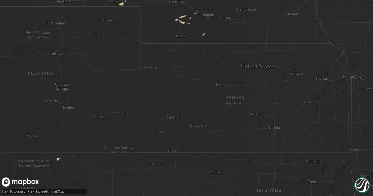
July 8 map
$229
one time, instant access
Download today. No call, no setup
Keep the $229
Bought the map and want the full workflow? Apply the entire $229 to a subscription within 7 days. None of it is wasted.
Every map, not just this one
This buys you this map. Subscription and you get every map we run, in the markets you choose from a few cities to whole states to nationwide. Plus real-time alerts the moment a storm fires.
Contact data
Name, contact info, occupancy, even credit band for addresses in the footprint. You go from where it hit to who to call.
Become the source they trust
Unlimited branding weather history reports on demand. You already have the documented answer ready for the property owner, and you are the one who showed up with it.
Property data and RoofTrace estimates
Pull up any address you have got, its value and the exact code rules for that jurisdiction, straight from One Click Code. Then RoofTrace estimates the squares, pitch, and roof value, priced the way you price.
Storm reports in South Dakota
South Dakota
| Date | Description |
|---|---|
| 07/08/20136:55 PM CDT | A local report indicates 2.75 inch wind near HAYWARD |
| 07/08/20136:40 PM CDT | A local report indicates 1.00 inch wind near 2 NE ROCKERVILLE |
| 07/08/20136:20 PM CDT | A local report indicates 1.00 inch wind near 9 WSW DOWNTOWN RAPID CI |
| 07/08/20135:25 PM CDT | 50 mph winds also |
| 07/08/20135:25 PM CDT | A local report indicates 1.00 inch wind near 8 S DEADWOOD |
| 07/08/20135:15 PM CDT | A local report indicates 1.00 inch wind near 3 NE WEWELA |
| 07/08/20132:00 AM CDT | A local report indicates 60 MPH wind near 1 N PIERRE |
| 07/08/20131:50 AM CDT | Tolstoy rwis measured a 71 mph wind gust. |
| 07/08/20131:25 AM CDT | Sheriff on duty estimated 50-60 mph winds 1 west of gettysburg |
| 07/08/20131:15 AM CDT | A local report indicates 60 MPH wind near 13 NNW AGAR |
| 07/08/201312:56 AM CDT | Peak wind measured at kmbg |
| 07/08/201312:30 AM CDT | Bear creek mesonet measured a 60 mph wind gust as storms pushed through. |
| 07/08/201312:20 AM CDT | Trees down in timber lake on homes and cars |
| 07/08/201312:15 AM CDT | Peak wind gust measured from the grand river raws. Time estimated by radar. |
| 07/08/201312:15 AM CDT | Peak wind from the timber lake sdsu mesonet site. |
| 07/08/201312:10 AM CDT | A local report indicates 61 MPH wind near 2 SW BRIDGER |
| 07/07/201311:45 PM CDT | Time approximate... Estimated from radar. |
| 07/07/201311:28 PM CDT | 65 mph wind gust measured at athboy mesonet station |
| 07/07/201311:20 PM CDT | A local report indicates 68 MPH wind near 7 SSE MEADOW |
| 07/07/201311:20 PM CDT | Winds estimated... Quite a bit of tree damage to shelter belt |
| 07/07/201311:20 PM CDT | Wind gust from thunderstorm outflow boundary. |
| 07/07/201311:15 PM CDT | Time approximate... Estimated from radar. |
| 07/07/201311:00 PM CDT | Relayed from nws abr |
| 07/07/201311:00 PM CDT | A local report indicates 80 MPH wind near 1 NE MUD BUTTE |
| 07/07/201311:00 PM CDT | Numerous large branches down. Winds estimated over 70 mph. Dime sized hail as well. |
| 07/07/201310:55 PM CDT | A local report indicates 60 MPH wind near 6 ENE LODGEPOLE |
| 07/07/201310:55 PM CDT | A local report indicates 60 MPH wind near BISON |
| 07/07/201310:50 PM CDT | A local report indicates 63 MPH wind near 1 NE MUD BUTTE |
| 07/07/201310:46 PM CDT | A local report indicates 1.00 inch wind near 2 W RIDGEVIEW |
| 07/07/201310:15 PM CDT | A local report indicates 60 MPH wind near 3 SSE LUDLOW |
| 07/07/201310:00 PM CDT | A local report indicates 72 MPH wind near 4 N LUDLOW |
| 07/07/201310:00 PM CDT | A local report indicates 64 MPH wind near 32 N DOWNTOWN BELLE FOU |
| 07/07/20139:56 PM CDT | A local report indicates 65 MPH wind near 2 N LUDLOW |
| 07/07/20139:56 PM CDT | A local report indicates 65 MPH wind near 4 N LUDLOW |
| 07/07/20139:52 PM CDT | A local report indicates 85 MPH wind near 1 N BUFFALO |
| 07/07/20139:30 PM CDT | A local report indicates 60 MPH wind near 14 WNW LADNER |
| 07/07/20138:47 PM CDT | Tennis ball size hail. Hail started out nickel to quarter size and slowly got bigger. |
| 07/07/20138:20 PM CDT | A local report indicates 1.00 inch wind near 6 NW MURDO |
| 07/07/20138:00 PM CDT | Heavy rain with gusts of 60 mph. |
| 07/07/20138:00 PM CDT | Heavy rain and ping-pong ball size hail. |
| 07/07/20137:20 PM CDT | Pea hail with 0.40 in. Rain. 60-75 mph wind gusts between 620 pm and 630 pm |
| 07/07/20137:15 PM CDT | Plants and trees damaged |
| 07/07/20137:10 PM CDT | A local report indicates 2.25 inch wind near 1 W HERMOSA |
| 07/07/20137:10 PM CDT | A local report indicates 1.25 inch wind near HERMOSA |
| 07/07/20137:00 PM CDT | A local report indicates 1.75 inch wind near 2 ESE HAYWARD |
| 07/07/20137:00 PM CDT | Golfball hail and heavy rain. |
All States Impacted by Hail Map on July 8, 2013
Cities Impacted by Hail Map on July 8, 2013
- Ingomar, MT
- Glendive, MT
- Bloomfield, MT
- Circle, MT
- Richey, MT
- Clearwater, FL
- Seeley Lake, MT
- Condon, MT
- Grassy Butte, ND
- Harrison, NE
- Custer, MT
- Forsyth, MT
- Jordan, MT
- Terry, MT
- Lindsay, MT
- Zortman, MT
- Brockway, MT
- Brusett, MT
- Cohagen, MT
- Fallon, MT
- Oacoma, SD
- Chamberlain, SD
- Ryegate, MT
- Kalispell, MT
- Two Dot, MT
- Grass Range, MT
- Roundup, MT
- Forest Grove, MT
- Rapid City, SD
- Box Elder, SD
- Shawmut, MT
- White Sulphur Springs, MT
- Maywood, NE
- Curtis, NE
- Wellfleet, NE
- Carter, MT
- Fort Benton, MT
- Floweree, MT
- Gillette, WY
- Wibaux, MT
- Amidon, ND
- Monticello, FL
- Melvin, MI
- Brown City, MI
- Melville, MT
- Winifred, MT
- Keystone, SD
- Conrad, MT
- Pendroy, MT
- Choteau, MT
- Bynum, MT
- Springview, NE
- Park City, MT
- Molt, MT
- Townsend, MT
- Martinsdale, MT
- Rosebud, MT
- Harlowton, MT
- Hermosa, SD
- Winnett, MT
- Cedar Key, FL
- Alexander, ND
- Boulder, MT
- Fort Pierre, SD
- Draper, SD
- Murdo, SD
- Okaton, SD
- Havre, MT
- Bowdle, SD
- Roscoe, SD
- Cut Bank, MT
- Hinsdale, MT
- Whitewater, MT
- Geyser, MT
- Eagle Butte, SD
- Glenham, SD
- Ridgeview, SD
- Hobson, MT
- Watford City, ND
- Lewistown, MT
- Churchs Ferry, ND
- Penn, ND
- Brady, MT
- Dutton, MT
- Rhame, ND
- Valier, MT
- Leeds, ND
- York, ND
- Geraldine, MT
- Shepherd, MT
- Cartwright, ND
- Sidney, MT
- Cody, NE
- Merriman, NE
- Marcus, WA
- Evans, WA
- Kettle Falls, WA
- Volborg, MT
- Miles City, MT
- Nemo, SD
- Deadwood, SD
- Lead, SD
- Manhattan, MT
- Three Forks, MT
- Worden, MT
- Lavina, MT
- Oshkosh, NE
- Lakeside, NE
- Ellsworth, NE
- Louisville, GA
- Colome, SD
- Winner, SD
- Ringling, MT
- Hathaway, MT
- Santa Fe, NM
- Wood Lake, NE
- Johnstown, NE
- Kamiah, ID
- Chinook, MT
- Lloyd, MT
- Grafton, IA
- West Yellowstone, MT
- Winston, MT
- Big Sandy, MT
- Kremlin, MT
- Gildford, MT
- Buffalo, MT
- Moore, MT
- Spencerville, OH
- Marsland, NE
- Warwick, ND
- Saint Michael, ND
- Toston, MT
- Lodgepole, NE
- Rudolph, OH
- Fairburn, SD
- Virginia Beach, VA
- Knotts Island, NC
- Philipsburg, MT
- Sula, MT
- Alden, IA
- Mobridge, SD
- Norman Park, GA
- Moultrie, GA
- New Underwood, SD
- Charlo, MT
- Pine Ridge, SD
- Laurel Hill, NC
- Jacksonville, GA
- Beulah, ND
- West Mansfield, OH
- Ridgeway, OH
- Rushsylvania, OH
- Ismay, MT
- Garrison, ND
- Wapakoneta, OH
- Albuquerque, NM
- Greeley, IA
- Edgewood, IA
- Bridgeport, NE
- Saint Regis, MT
- Loma, MT
- Arapahoe, CO
- Randolph, NE
- Ellsworth Afb, SD
- Stanford, MT
- Kooskia, ID
- Saint Ignatius, MT
- Dupree, SD
- Belgrade, MT
- Fairfield, ND
- Hornick, IA
- Whiting, IA
- Buffalo, WY
- Kaycee, WY
- Cathay, ND
- Power, MT
- Dunn Center, ND
- Ainsworth, NE
- Laurel, MT
- Columbus, MT
- Musselshell, MT
- Rockledge, GA
- East Dublin, GA
- Attica, OH
- New Washington, OH
- Broadview, MT
- Hayes Center, NE
- Iliff, CO
- Robinson, ND
- Malta, MT
- Sloan, IA
- Manning, ND
- Lima, OH
- Jackson Center, OH
- Uniopolis, OH
- Bowdon, ND
- Sykeston, ND
- Wasta, SD
- Owanka, SD
- Strasburg, ND
- Hartwell, GA
- Tulare, SD
- Crawford, NE
- Meadow, SD
- Keldron, SD
- Bighorn, MT
- Denton, MT
- Babb, MT
- Livingston, MT
- Roy, MT
- Eureka, MT
- Valentine, NE
- Cozad, NE
- Kilgore, NE
- Glendo, WY
- Hysham, MT
- Hardin, MT
- Wakpala, SD
- Chappell, NE
- Belvidere, SD
- Kitty Hawk, NC
- Maxwell, NE
- Wagener, SC
- Salley, SC
- Sparks, GA
- Batesland, SD
- Dunn, NC
- Newton Grove, NC
- Arnegard, ND
- Mills, NE
- Starkweather, ND
- Gilmore City, IA
- Edison, NE
- Billings, MT
- Big Timber, MT
- Carrington, ND
- Cimarron, NM
- Melstone, MT
- Weston, CO
- Osmond, NE
- Dunedin, FL
- Lemmon, SD
- Halliday, ND
- Anderson, SC
- Killdeer, ND
- Dixie, GA
- Pavo, GA
- Hazen, ND
- Zap, ND
- Sidney, NE
- Cando, ND
- Montevideo, MN
- Winnebago, NE
- Victor, MT
- Stevensville, MT
- Stockville, NE
- Golden Valley, ND
- Hays, MT
- Mound City, SD
- Shannon, NC
- Saint Pauls, NC
- Judith Gap, MT
- Leola, SD
- Bassett, NE
- Lordsburg, NM
- Rugby, ND
- Timber Lake, SD
- Fitzgerald, GA
- Omega, GA
- Lenox, GA
- Lewistown, OH
- Conde, SD
- Stratford, SD
- Moorefield, NE
- Aguilar, CO
- Moccasin, MT
- Newport, NE
- Pinetta, FL
- Madison, FL
- Cuba City, WI
- Webster City, IA
- Maxton, NC
- Taylor, ND
- Selby, SD
- Goldsboro, NC
- Sand Springs, MT
- Milan, GA
- Rhine, GA
- Palmer, IA
- San Simon, AZ
- Mclean, NE
- Magnet, NE
- Hephzibah, GA
- Blythe, GA
- Groton, SD
- Hemingford, NE
- Red Springs, NC
- Soperton, GA
- Tarrytown, GA
- Atwater, MN
- Lena, IL
- Crookston, NE
- Mud Butte, SD
- Iowa Falls, IA
- Banner, WY
- Jackson, WY
- Dixon, MT
- Island Park, ID
- Savage, MT
- Clancy, MT
- Jefferson City, MT
- East Helena, MT
- Sentinel Butte, ND
- Beach, ND
- Plevna, MT
- Baker, MT
- Marmarth, ND
- Golva, ND


