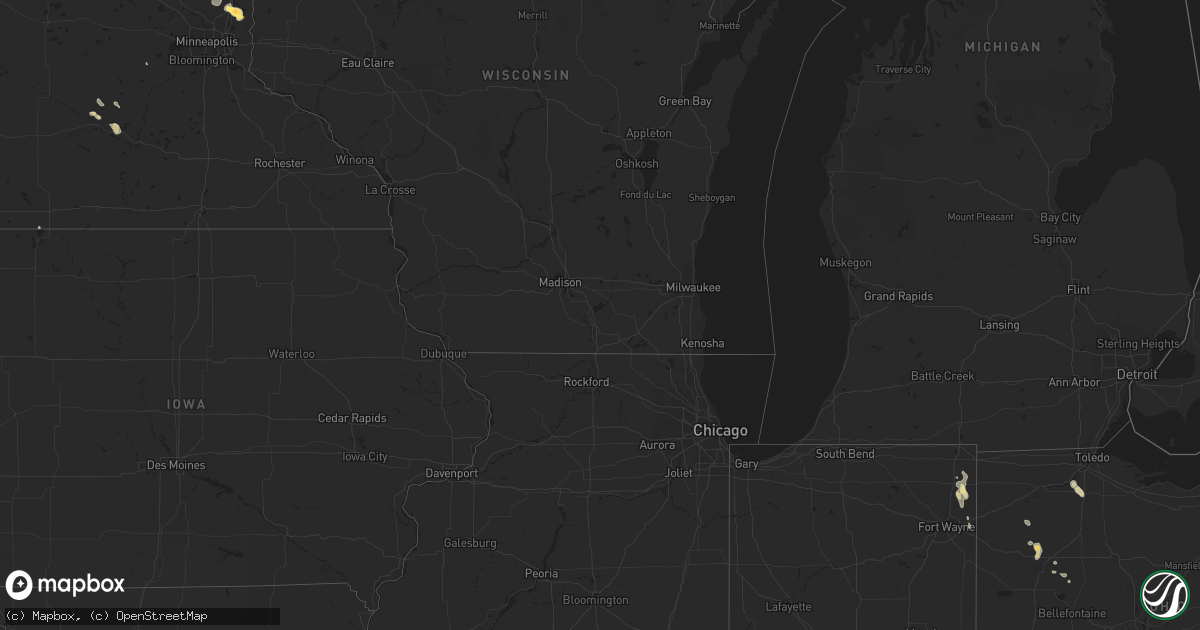
Hail Map in Nebraska on July 7, 2013
Get this storm
July 7 map
$229
one time, instant access
Download today. No call, no setup
Keep the $229
Bought the map and want the full workflow? Apply the entire $229 to a subscription within 7 days. None of it is wasted.
Every map, not just this one
This buys you this map. Subscription and you get every map we run, in the markets you choose from a few cities to whole states to nationwide. Plus real-time alerts the moment a storm fires.
Contact data
Name, contact info, occupancy, even credit band for addresses in the footprint. You go from where it hit to who to call.
Become the source they trust
Unlimited branding weather history reports on demand. You already have the documented answer ready for the property owner, and you are the one who showed up with it.
Property data and RoofTrace estimates
Pull up any address you have got, its value and the exact code rules for that jurisdiction, straight from One Click Code. Then RoofTrace estimates the squares, pitch, and roof value, priced the way you price.
Storm reports in Nebraska
Nebraska
| Date | Description |
|---|---|
| 07/07/20136:50 PM CDT | Deputy reported car windshield broken by ping pong size hail 12 miles south of mullen near mile marker 55. |
| 07/06/201310:15 PM CDT | Estimated 60 mph wind gust blew down and damaged corn crops. |
| 07/06/201310:01 PM CDT | Mostly nickel and dime hail with some quarters in some sections of ord. Golf ball hail reported near the hospital. |
| 07/06/20139:37 PM CDT | A local report indicates 1.00 inch wind near 3 SW HERSHEY |
| 07/06/20139:20 PM CDT | A local report indicates 2.00 inch wind near 3 W HERSHEY |
| 07/06/20139:07 PM CDT | Several mature trees toppled around town. |
| 07/06/20138:50 PM CDT | A local report indicates 60 MPH wind near ST. HELENA |
| 07/06/20138:50 PM CDT | Tree limbs blown onto power lines. Some power outages in wynot and also st. Helena. |
| 07/06/20138:35 PM CDT | A local report indicates 1.25 inch wind near 13 NE BURWELL |
| 07/06/20138:30 PM CDT | Very large trees blown down in the tailwaters campground. |
| 07/06/20138:15 PM CDT | A local report indicates 1.00 inch wind near S SUTHERLAND |
| 07/06/20138:06 PM CDT | A local report indicates 2.75 inch wind near 4 NE NORTH PLATTE |
| 07/06/20138:01 PM CDT | A local report indicates 1.75 inch wind near 12 NE NORTH PLATTE |
| 07/06/20137:52 PM CDT | A local report indicates 1.00 inch wind near 13 NE RINGGOLD |
| 07/06/20137:15 PM CDT | State trooper reported baseball size hail on the ground between mile markers 46 to 48 on hwy 97. |
| 07/06/20137:10 PM CDT | A local report indicates 1.00 inch wind near 12 N ONEILL |
| 07/06/20137:10 PM CDT | A local report indicates 1.00 inch wind near 20 N ONEILL |
All States Impacted by Hail Map on July 7, 2013
Cities Impacted by Hail Map on July 7, 2013
- Moorcroft, WY
- Gillette, WY
- Rozet, WY
- Carr, CO
- Nunn, CO
- Cascade, MT
- Dillon, MT
- Hobson, MT
- Lewistown, MT
- Manderson, SD
- Pine Ridge, SD
- Weston, WY
- Naper, NE
- Mullen, NE
- Platteville, CO
- Milliken, CO
- Johnstown, CO
- Mount Pleasant, UT
- Tryon, NE
- Seneca, NE
- Whitman, NE
- Succasunna, NJ
- Flanders, NJ
- Great Falls, MT
- Chatham, NY
- Austerlitz, NY
- East Chatham, NY
- Yankton, SD
- Alzada, MT
- Bruceton Mills, WV
- Albright, WV
- Copake Falls, NY
- Ancramdale, NY
- Copake, NY
- Crystal Falls, MI
- Wray, CO
- Lafayette, MN
- Gibbon, MN
- New Ulm, MN
- Lavina, MT
- Estherville, IA
- Terril, IA
- Berthoud, CO
- Two Dot, MT
- Marine On Saint Croix, MN
- Stillwater, MN
- Hugo, MN
- Forest Lake, MN
- Cut Bank, MT
- Hulett, WY
- Alva, WY
- Sutherland, NE
- Hershey, NE
- West Hartford, CT
- Ord, NE
- Scotia, NE
- Ericson, NE
- Rio, WV
- Baker, WV
- Tabor, SD
- Avon, SD
- Tyndall, SD
- Lodge Grass, MT
- Hot Springs, SD
- Edgemont, SD
- Custer, SD
- Crook, CO
- Newcastle, WY
- Wounded Knee, SD
- Porcupine, SD
- Oral, SD
- Buffalo Gap, SD
- North Platte, NE
- Woodburn, IN
- Burke, SD
- Platte, SD
- Cloverdale, OH
- Columbus Grove, OH
- Fort Jennings, OH
- Elk Point, SD
- Terreton, ID
- Mills, NE
- Gregory, SD
- Herrick, SD
- Marsland, NE
- Harrod, OH
- Spencer, NE
- Page, NE
- Pulaski, VA
- Stanchfield, MN
- Embarrass, WI
- Clintonville, WI
- Shawano, WI
- Champion, NE
- Venango, NE
- Larslan, MT
- Brady, NE
- Judith Gap, MT
- Shawmut, MT
- Briggsdale, CO
- Amherst, MA
- Shutesbury, MA
- Wynot, NE
- Saint Helena, NE
- Sheridan, WY
- Wyola, MT
- Pierre, SD
- Wolf Point, MT
- Vaughnsville, OH
- Weston, OH
- Tontogany, OH
- Portage, OH
- Bowling Green, OH
- White Sulphur Springs, MT
- Sundance, WY
- Stapleton, NE
- Snyder, CO
- Decker, MT
- Callaway, NE
- Merna, NE
- Peetz, CO
- Batesland, SD
- Buskirk, NY
- Schaghticoke, NY
- Valley Falls, NY
- Johnsonville, NY
- Rice, MN
- New Raymer, CO
- Padroni, CO
- Sterling, CO
- Burwell, NE
- Lima, OH
- Grover, CO
- Alger, OH
- Upton, WY
- Lima, MT
- Avon, CT
- Holyoke, CO
- Bridger, MT
- Pocatello, ID
- Kimball, NE
- Flagstaff, AZ
- Selkirk, NY
- Ravena, NY
- Fleming, CO
- Pine City, MN
- Sargent, NE
- Elyria, NE
- Aladdin, WY
- Bonesteel, SD
- Kevin, MT
- South Egremont, MA
- Red Hook, NY
- Pine Plains, NY
- Millerton, NY
- Elizaville, NY
- Ancram, NY
- Cold Spring, MN
- Burns, WY
- Kirkwood, PA
- Chadron, NE
- Winona, KS
- Phillips, WI
- Wolf Creek, MT
- Comstock, NE
- Poplar, MT
- Wurtsboro, NY
- Hopkinton, IA
- Cascade, IA
- Worthington, IA
- Norfolk, CT
- Ingomar, MT
- Easthampton, MA
- Augusta, WV
- Long Valley, NJ
- Kenvil, NJ
- Hackettstown, NJ
- Ledgewood, NJ
- Budd Lake, NJ
- Whitehall, MT
- Saint Joe, IN
- Waterloo, IN
- Butler, IN
- Auburn, IN
- Moccasin, MT
- Denton, MT
- Forest Grove, MT
- Newcastle, NE
- Martinsdale, MT
- Atkinson, NE
- Germantown, NY
- Oneill, NE
- White Lake, WI
- Stoneham, CO
- Shelby, MT
- Castleton, VT
- Wessington Springs, SD
- Fort Benton, MT
- Otis, CO
- Wytheville, VA
- Kennebec, SD
- Rockland, ID
- Eagle Bridge, NY
- Cambridge, NY
- Boulder, MT
- Atwood, CO
- Lynch, NE
- Tucson, AZ
- Orchard, NE
- Fordyce, NE
- Crofton, NE
- West Rutland, VT
- Alliance, NE
- Courtland, MN
- Brady, MT
- Ware, MA
- Belchertown, MA
- Mission, SD
- Canton, MA
- Iliff, CO
- Geddes, SD
- Nicollet, MN
- Fairfax, SD
- Windsor, NY
- Cedar, MN
- Bethel, MN
- Hinsdale, MT
- Quarryville, PA
- Foley, MN
- Pierz, MN
- Whitewater, MT
- Isanti, MN
- Huguenot, NY
- Bloomingburg, NY
- Middletown, NY
- Cuddebackville, NY
- Westbrookville, NY
- Kersey, CO
- West Warren, MA
- Bondsville, MA
- Palmer, MA
- Winner, SD
- Kimball, MN
- Saint Cloud, MN
- Hudson, NY
- Hollowville, NY
- Claverack, NY
- Craryville, NY
- Sherburne, NY
- Lakefield, MN
- Spirit Lake, IA
- Brimfield, MA
- Broken Bow, NE
- Sunderland, MA
- Halifax, MA
- Greeley, NE
- Westtown, NY
- Unionville, NY
- Altamont, NY
- Berne, NY
- Vivian, SD
- Clifton Park, NY
- Mechanicville, NY
- Winthrop, MN
- Gaylord, MN
- Pukwana, SD
- Leverett, MA
- Fort Pierre, SD
- Richland, MT
- Cochranville, PA
- Hillrose, CO
- Las Vegas, NM
- Lower Brule, SD
- Reliance, SD
- Spencerville, IN
- Saint Joseph, MN
- Sartell, MN
- Strawberry Point, IA
- Grantsburg, WI
- Valatie, NY
- West Stockbridge, MA
- Ghent, NY
- Old Chatham, NY
- Canaan, NY
- Stuart, NE
- Julesburg, CO
- Sheffield, MA
- Catskill, NY
- Tivoli, NY
- Saugerties, NY
- Salisbury, CT
- West Camp, NY
- Malden On Hudson, NY
- Anton, CO
- Colby, KS
- Mead, CO
- Longmont, CO
- Sussex, NJ
- Burbank, SD
- Belle Center, OH
- Kenton, OH
- Pine Bluffs, WY
- Hedgesville, WV
- Sioux City, IA
- South Deerfield, MA
- Hadley, MA
- Hatfield, MA
- Young America, MN
- Norwood Young America, MN
- Loring, MT
- Anselmo, NE
- New Haven, IN
- Presho, SD
- Saint Louisville, OH
- Newark, OH
- Witten, SD
- Continental, OH
- Malta, ID
- Greenwich, NY
- Canaan, CT
- Southfield, MA
- East Canaan, CT
- Ashley Falls, MA
- Martinsburg, WV
- Grant, NE
- Colorado City, AZ
- Sharon, CT
- Athens, NY
- Stuyvesant, NY
- Hamilton, IN
- Grabill, IN
- Royal, NE
- Arnold, NE
- Butte, NE
- Wyoming, MN
- Andover, MN
- Saratoga Springs, NY
- Stillwater, NY
- Richmond, MN
- Ponca, NE
- Merino, CO
- Prentice, WI
- Holyoke, MA
- South Hadley, MA
- Monroeville, IN
- Stanley, ND
- White Earth, ND
- Ross, ND
- Hamer, ID
- Kimball, SD
- Montague, NJ
- Ludlow, MA
- Three Rivers, MA
- Granby, MA
- Wilbraham, MA
- Madrid, NE
- Wallace, KS
- Vermillion, SD
- Gayville, SD
- Coggon, IA
- Central City, IA
- Colebrook, CT
- Warren, MA
- Richmond, MA


