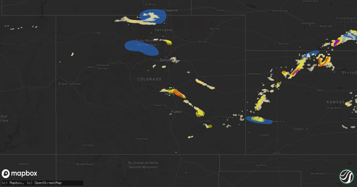
Hail Map on July 4, 2023
Get this storm
July 4 map
$229
one time, instant access
Download today. No call, no setup
Keep the $229
Bought the map and want the full workflow? Apply the entire $229 to a subscription within 7 days. None of it is wasted.
Every map, not just this one
This buys you this map. Subscription and you get every map we run, in the markets you choose from a few cities to whole states to nationwide. Plus real-time alerts the moment a storm fires.
Contact data
Name, contact info, occupancy, even credit band for addresses in the footprint. You go from where it hit to who to call.
Become the source they trust
Unlimited branding weather history reports on demand. You already have the documented answer ready for the property owner, and you are the one who showed up with it.
Property data and RoofTrace estimates
Pull up any address you have got, its value and the exact code rules for that jurisdiction, straight from One Click Code. Then RoofTrace estimates the squares, pitch, and roof value, priced the way you price.
States Impacted by Hail Map on July 4, 2023
Storm reports
Nebraska
| Date | Description |
|---|---|
| 07/04/20236:58 PM CDT | A local report indicates 70 MPH wind near Weston |
| 07/04/20236:55 PM CDT | Spotter reports ping pong ball sized hail 4 miles ne of waco. |
| 07/04/20236:55 PM CDT | Amateur radio operator reports 60 mph winds in bladen. |
| 07/04/20236:50 PM CDT | Report of tree damage across weston ranging from snapped branches to uprooted trees. Power poles snapped and power lines down. One estimate of 70-80 mph... And the dama |
| 07/04/20236:45 PM CDT | Tree branches down and roof shingles torn off chicken house. Time estimated based on radar and nearby reports. |
| 07/04/20236:45 PM CDT | Storm chaser shared a photo via social media of golfball size hail. |
| 07/04/20236:45 PM CDT | A local report indicates 1.00 inch wind near Utica |
| 07/04/20236:45 PM CDT | From a personal weather station. |
| 07/04/20236:41 PM CDT | Delayed report. Time estimated from radar. |
| 07/04/20236:40 PM CDT | A local report indicates 60 MPH wind near 1 NNW Prague |
| 07/04/20236:39 PM CDT | Large tree snapped off. Photo received via social media. Time estimated based on radar. |
| 07/04/20236:36 PM CDT | Report of half dollar size hail 5 n gresham. |
| 07/04/20236:27 PM CDT | Report relayed through social media. Time estimated from radar. |
| 07/04/20236:27 PM CDT | Social media report of tennis ball size hail. |
| 07/04/20236:17 PM CDT | Measured on personal weather station. |
| 07/04/20236:15 PM CDT | Reported hail up to the size of quarters. |
| 07/04/20236:10 PM CDT | A local report indicates 1.75 inch wind near Grafton |
| 07/04/20236:03 PM CDT | Relayed via social media. Measured on personal weather station. |
| 07/04/20235:56 PM CDT | Report relayed via social media. Time estimated based on radar. |
| 07/04/20235:54 PM CDT | Delayed report. Photo relayed via social media. Golf ball sized hail lasted a minute or two. Some damage to vehicles... Crops... And flowers. |
| 07/04/20235:49 PM CDT | Report from mping: quarter |
| 07/04/20235:45 PM CDT | Dime to quarter size hail falling in silver creek. |
| 07/04/20235:32 PM CDT | Tree limbs up to 3 inches in diameter broken. |
| 07/04/20235:30 PM CDT | Photo received via social media. Time estimated based on radar. |
| 07/04/20235:22 PM CDT | A local report indicates 1.75 inch wind near Monroe |
| 07/04/20235:16 PM CDT | Photo received via social media. Time estimated based on radar. |
| 07/04/20235:09 PM CDT | Tree limbs up to 2 inch diameter down. |
| 07/04/20235:07 PM CDT | Photo received via social media. Time estimated based on radar. |
| 07/04/20234:58 PM CDT | From spotter network. |
| 07/04/20234:57 PM CDT | Report from mping. |
| 07/04/20234:48 PM CDT | Correction to time. Photo received via social media. Time estimated based on radar. |
| 07/04/20234:45 PM CDT | Public reported hail lasting approximately 20-25 minutes. First started as pea size and got progressively larger. The largest stones were baseball sized. It destroyed c |
| 07/04/20234:45 PM CDT | Public reported hail lasting approximately 20-25 minutes. First started as pea size and got progressively larger. The largest stones were baseball sized. It destroyed c |
| 07/04/20234:45 PM CDT | Relayed via social media. |
| 07/04/20234:36 PM CDT | Report from mping: half dollar |
| 07/04/20234:24 PM CDT | Social media photo of hail stone in humphrey. |
| 07/04/20234:24 PM CDT | A local report indicates 1.25 inch wind near 1 ENE Humphrey |
| 07/04/20234:21 PM CDT | Photo received via social media. Time estimated based on radar. |
| 07/04/20234:15 PM CDT | A local report indicates 1.00 inch wind near Humphrey |
| 07/04/20234:07 PM CDT | A local report indicates 1.00 inch wind near Lyman |
| 07/04/20233:48 PM CDT | A local report indicates 60 MPH wind near 6 S Lindsay |
| 07/04/20233:36 PM CDT | Photo received via social media. Time estimated based on radar. |
| 07/04/20233:16 PM CDT | A local report indicates 1.00 inch wind near 5 N Tilden |
| 07/03/20239:13 PM CDT | A local report indicates 60 MPH wind near 3 S Dawson |
| 07/03/20238:50 PM CDT | 60 mph wind gusts also reported. |
| 07/03/20238:45 PM CDT | Measured by personal weather station. |
| 07/03/20238:45 PM CDT | A local report indicates 61 MPH wind near 7 SE Ohiowa |
| 07/03/20238:30 PM CDT | Mesonet reports 58mph wind gust at 8:30pm. |
| 07/03/20238:17 PM CDT | Measured on personal weather station. |
| 07/03/20238:12 PM CDT | 3 inch tree limbs down. |
| 07/03/20238:06 PM CDT | Report from mping: 3-inch tree limbs broken. |
| 07/03/20238:01 PM CDT | Report from mping: 3-inch tree limbs broken. |
| 07/03/20237:55 PM CDT | Power pole broken. |
| 07/03/20237:55 PM CDT | Photo via social media. 8 inch diameter mature... Healthy maple tree snapped between 750 and 800 pm near 84th and adams. |
| 07/03/20237:55 PM CDT | Delayed report from mping: trees uprooted or snapped; roof blown off. Time estimated from radar and other nearby reports. |
| 07/03/20237:55 PM CDT | Personal weather station. |
| 07/03/20237:53 PM CDT | Treen snapped. |
| 07/03/20237:52 PM CDT | Campers and fireworks tent blown over. No injuries reported. Source lincolnscanner on twitter. |
| 07/03/20237:50 PM CDT | Mesonet reports 59mph wind gust at 7:50pm. |
| 07/03/20237:50 PM CDT | Semi overturned. |
| 07/03/20237:49 PM CDT | Measured by personal weather station. |
| 07/03/20237:48 PM CDT | Some branches down. |
| 07/03/20237:47 PM CDT | Mesonet reports a 66mph wind gust at 7:47pm. |
| 07/03/20237:47 PM CDT | Mesonet reports 60mph wind gust at 7:47pm. |
| 07/03/20237:44 PM CDT | Social media report of hail ranging in size from ping pong ball to tennis ball. Time estimated based on report and radar. |
| 07/03/20237:43 PM CDT | A local report indicates 59 MPH wind near Bennet |
| 07/03/20237:42 PM CDT | Damage to large sections of grand stand at eagle raceway. Time estimated from radar. |
| 07/03/20237:41 PM CDT | Emergency manager reports 60mph winds in deweese. |
| 07/03/20237:34 PM CDT | Personal weather station. |
| 07/03/20237:34 PM CDT | Personal weather station. |
| 07/03/20237:32 PM CDT | Measured by personal weather station. |
| 07/03/20237:30 PM CDT | Corrects time of previous hail report from 3 s shickley. Time estimated from radar. |
| 07/03/20237:30 PM CDT | Social media report of golfball size hail in sutton. |
| 07/03/20237:29 PM CDT | Emergency management reports hail ranging in size from quarters to golf balls. |
| 07/03/20237:28 PM CDT | Corrects time of previous hail report from sutton. Report relayed via social media. Time estimated based on lowest cc and zdr on radar as well as other nearby reports. |
| 07/03/20237:24 PM CDT | Part of downed large tree blocking 2 lanes of traffic near 70th and holdrege. Time estimated from radar. |
| 07/03/20237:24 PM CDT | Photo on social media of large tree limb down and downed tree near 90th and adams. Time estimated from radar. |
| 07/03/20237:20 PM CDT | Tree limb damage and blown over debris. Time estimated based on radar. |
| 07/03/20237:15 PM CDT | A local report indicates 60 MPH wind near 4 WNW Lincoln |
| 07/03/20237:15 PM CDT | A local report indicates 60 MPH wind near 4 WNW Lincoln |
| 07/03/20237:15 PM CDT | Time estimated from radar. |
| 07/03/20237:11 PM CDT | Personal weather station. |
| 07/03/20237:10 PM CDT | Time estimated based on radar. |
Alabama
| Date | Description |
|---|---|
| 07/04/20235:22 PM CDT | A farm building was knocked down by downburst winds. Time estimated. |
Missouri
| Date | Description |
|---|---|
| 07/04/20231:29 AM CDT | Trees blown down blocking one lane of highway d near lawson. |
| 07/04/20231:25 AM CDT | Report from mping: 3-in |
| 07/04/20231:25 AM CDT | Report from mping: 3-inch tree limbs broken. |
| 07/04/20231:12 AM CDT | Large tree branch across the road. ( |
| 07/04/20231:12 AM CDT | Large tree branch across the road. |
| 07/04/20231:10 AM CDT | A local report indicates 60 MPH wind near Independence |
| 07/04/202312:55 AM CDT | Delayed report of tree damage at ward parkway and 68th street. |
| 07/04/202312:55 AM CDT | Delayed report of tree damage at 49th street in west plaza. |
| 07/04/202312:46 AM CDT | 11 inch diameter limb broken. |
| 07/04/202312:46 AM CDT | Mkc asos measurement. |
| 07/04/202312:40 AM CDT | Reported via social media. |
| 07/04/202312:27 AM CDT | A local report indicates 63 MPH wind near 1 NW Kansas City Intl A |
| 07/04/202312:26 AM CDT | A local report indicates 61 MPH wind near 1 NW Kansas City Intl A |
| 07/04/202312:13 AM CDT | From personal weather station. Reported via social media. Time estimated by radar. |
| 07/04/202312:13 AM CDT | A local report indicates 63 MPH wind near 6 ENE Iatan |
| 07/04/202312:05 AM CDT | Report from mping: 1-inch tree limbs broken; timing estimated via radar. |
| 07/03/202311:55 PM CDT | A local report indicates 66 MPH wind near 1 NNE Saint Joseph Airp |
| 07/03/202311:47 PM CDT | A local report indicates 60 MPH wind near Atchison |
South Carolina
| Date | Description |
|---|---|
| 07/04/20236:56 PM CDT | Tree down on a house in blenheim. Story seen on wpde website. Time estimated by radar. |
| 07/04/20236:33 PM CDT | Trees down on kmart plaza at marue drive. |
| 07/04/20236:30 PM CDT | A few trees reported down between walhalla and westminster. Time is approximate based on radar data. |
| 07/04/20236:28 PM CDT | Tree down on roadway. |
| 07/04/20236:00 PM CDT | Trees down off emory drive. |
| 07/04/20236:00 PM CDT | Tree down on perry hill road. |
| 07/04/20236:00 PM CDT | Trees on roadway of old easley highway in front of greenville pickens speedway. |
| 07/04/20235:05 PM CDT | One tree reported down in pimlico... Sc. Time estimated from radar. |
| 07/04/20234:02 PM CDT | 1 tree down at wild turkey ln and cottageville hwy. |
| 07/04/20233:47 PM CDT | Beaufort marine corps air station gusted to 50 knots |
| 07/03/20237:13 PM CDT | Tree down near the intersection of nichols highway and joyner swamp rd. Time estimated based on radar. |
Mississippi
| Date | Description |
|---|---|
| 07/04/20233:13 PM CDT | Tree down on grady road. |
Rhode Island
| Date | Description |
|---|---|
| 07/04/20231:50 PM CDT | Tree down near park plaza apartments in johnston. Police and ems on scene as injuries were reported though unclear how many were injured or the extent of injuries. Time |
| 07/04/20231:50 PM CDT | *** 2 inj *** update from previous tstm wnd dmg report from 1 sw johnston. Tree down near park plaza apartments in johnston with 2 injuries. Time estimated from radar. |
| 07/04/20231:14 PM CDT | Multiple trees downed on paris olney hopkins road. Time estimated from radar. |
Wisconsin
| Date | Description |
|---|---|
| 07/04/20236:55 PM CDT | Facebook photo of an uprooted tree in durand. |
| 07/04/202311:30 AM CDT | Trained spotter reported large tree branches down causing damage to fence. |
Wyoming
| Date | Description |
|---|---|
| 07/04/20234:05 PM CDT | A local report indicates 1.75 inch wind near 5 W Lyman |
| 07/04/20233:58 PM CDT | Emergency manager reports quarter sized hail. |
| 07/04/20233:48 PM CDT | Emergency manager reports wind driven hail knocked out windows in yoder... Wy. Estimated size is 1.5. |
| 07/04/20233:43 PM CDT | Emergency managers reports flipped pivot at wy 154 and rd 60. |
| 07/04/20233:43 PM CDT | Emergency manager reports hail on ground measured 1.25 to 1.5 inches. Same location as flipped pivot. |
| 07/04/20233:40 PM CDT | Emergency manager reports structure and tree damage at road 60 and road 33. |
| 07/04/20233:26 PM CDT | Emergency manager reported golf ball sized hail. |
| 07/04/20239:46 AM CDT | Mesonet station wy8 2.2 w church buttes |
New Jersey
| Date | Description |
|---|---|
| 07/04/20235:30 PM CDT | Tree down on highland ave. Time estimated by radar. |
| 07/04/20235:18 PM CDT | Tree down on cedar ave. Time estimated by radar. |
| 07/04/20235:14 PM CDT | Trees... Wires... And numerous large branches down; street flooding; navigation difficult. |
| 07/04/20235:12 PM CDT | Estimated 50 to 60 mph wind gusts on interstate 295 southbound by woodcrest station. Small branches flying onto the roadway. Time estimated from radar. |
| 07/04/20235:10 PM CDT | A downburst occurred around mt. Ephraim... Brooklawn... And westville... Nj on tuesday... July 4... 2023... Resulting in severe winds and downed trees across the area. |
| 07/04/20235:05 PM CDT | Tree across roadway. Time estimated by radar. |
| 07/04/20235:05 PM CDT | Estimated 60 mph wind gust. Time estimated from radar. |
| 07/04/20235:02 PM CDT | Power line down... Pole on house. Time estimated by radar. |
| 07/04/20235:00 PM CDT | Multiple trees down on homes. Time estimated by radar. |
| 07/04/20235:00 PM CDT | Numerous downed trees... Poles... And power lines across the neighborhood between downtown haddonfield and mountwell park. |
| 07/04/20235:00 PM CDT | A downburst occurred in the area of haddonfield... Nj on tuesday... July 4... 2023 resulting in widespread wind damage with numerous large trees uprooted or snapped at |
| 07/04/20235:00 PM CDT | Multiple trees down along kings hwy e and sylvan lake ave at haddonfield memorial high school and haddonfield baptist cemetery. Sylvan lake ave closed due to tree and p |
| 07/04/20235:00 PM CDT | Multiple roads closed due to downed trees... Power lines... And flooding. Time estimated by radar. |
| 07/04/20235:00 PM CDT | Tree and power lines down across centre street at ellis street. Road closed. Time estimated by radar. |
| 07/04/20234:50 PM CDT | Some trees down. Time estimated from radar. |
| 07/04/20234:50 PM CDT | Trees down at marlton parkway and sagemore drive. Time estimated from radar. |
| 07/04/20234:40 PM CDT | A series of downbursts occurred in the area of cherry hill... Evesham township... And marlton... Nj on tuesday... July 4... 2023 resulting in multiple downed trees acro |
| 07/04/20234:25 PM CDT | A downburst occurred in mount laurel... Nj on tuesday... July 4... 2023 resulting in multiple downed trees in the area surrounding union mill rd. Time estimated by rada |
| 07/04/20234:25 PM CDT | Trees down around indigo drive with damage to siding on homes. Time estimated by radar. |
| 07/04/20234:10 PM CDT | Tree down onto wires near union mill road. Time estimated from radar. |
| 07/04/20233:55 PM CDT | Tree down on landing street in lumberton. Time estimated from radar. |
| 07/04/20233:47 PM CDT | Hail estimated to be quarter size in westampton township in the deerwood area. Time estimated from radar. |
| 07/04/20233:20 PM CDT | Couple of trees down in the springfield township and jobstown areas. Time estimated from radar. |
| 07/04/20233:05 PM CDT | Tree onto power lines on west millstream road. Power outages reported. Time estimated from radar. |
| 07/04/20232:40 PM CDT | Poles and wires down in parts of upper freehold. Power outages. Time estimated from radar. |
| 07/04/20231:40 PM CDT | Picture shared on social media of a gas station canopy blown over on route 22 near rock avenue in north plainfield. Time estimated from radar. |
Iowa
| Date | Description |
|---|---|
| 07/04/20235:56 PM CDT | Older tree down across the road near the intersection of dogwood trail and port neal road. |
| 07/04/20233:02 PM CDT | Several large tree branches snapped off. One section of tree branch was thrown into house. |
| 07/04/20232:50 PM CDT | Social media photo of several large limbs broken off trees. |
New York
| Date | Description |
|---|---|
| 07/04/20236:48 PM CDT | Large branches down near the corner of regina lane and bylina lane in the city of amsterdam |
| 07/04/20236:25 PM CDT | Multiple trees downed on route 147 between galway and glenville |
| 07/04/20236:18 PM CDT | 100 foot pine tree down on a house on route 67 moving eastbound just passed buskirk seventh-day adventist church |
| 07/04/20236:14 PM CDT | Downed trees and wires on king road and route 67 |
| 07/04/20235:05 PM CDT | Powerlines down. |
| 07/04/20234:50 PM CDT | Trees down |
| 07/04/20233:47 PM CDT | Tree down and branches on power lines. Power out. Corrected report after additional radar review of downburst signature occurring near point au roche. |
| 07/04/20233:38 PM CDT | Tree down and branches on power lines. Power out |
| 07/04/20233:30 PM CDT | Powerlines down |
| 07/04/20233:06 PM CDT | Trees and powerlines down |
| 07/03/20238:24 PM CDT | Wires down on orchard road |
| 07/03/20238:14 PM CDT | Trees downed on george road in the town of ghent |
| 07/03/20238:05 PM CDT | Tree limbs downed on route 9h |
| 07/03/20238:02 PM CDT | Multiple trees down in kinderhook |
| 07/03/20237:57 PM CDT | Trees downed on hollow road |
| 07/03/20237:56 PM CDT | Trees downed at the intesection of ridge road and state route 9j. State route 9j closed due to downed trees from the rensselaer county border down to state route 9 in s |
| 07/03/20237:56 PM CDT | Multiple trees and wires down on roadways |
| 07/03/20237:56 PM CDT | Tree down at 1094 route 9j |
| 07/03/20237:55 PM CDT | Trees downed on eichybush road |
| 07/03/20237:45 PM CDT | Route 144 closed on the albany/greene county line due to multiple downed trees. |
| 07/03/20237:42 PM CDT | Tree leaning on wires in oakbrook manor on route 9w |
| 07/03/20237:40 PM CDT | Route 9j and knickerbocker road closed due to multiple downed trees. |
| 07/03/20237:40 PM CDT | Tree and wires downed on biechman road |
| 07/03/20237:40 PM CDT | Multiple trees down on main street |
| 07/03/20237:12 PM CDT | Wires donw on a shed on 5 velina drive in guilderland |
Texas
| Date | Description |
|---|---|
| 07/04/20233:23 PM CDT | Quarter size hail reported near sanger. |
Vermont
| Date | Description |
|---|---|
| 07/04/20235:09 PM CDT | Additional trees down from second line of storms... South of east hardwick per certified spotter. |
| 07/04/20235:06 PM CDT | Trees down |
| 07/04/20234:50 PM CDT | Dime to quarter sized hail |
| 07/04/20234:40 PM CDT | Dime to quarter sized hail |
| 07/04/20233:54 PM CDT | One tree down in the park... Multiple trees down on east shore road |
| 07/04/20233:30 PM CDT | A local report indicates 1.00 inch wind near Alburg |
| 07/04/20231:53 PM CDT | Multiple trees down across the town of east hardwick |
| 07/04/20231:53 PM CDT | Tree down on route 16 and tree down on cedar street in east hardwick |
| 07/03/20237:30 PM CDT | Time estimated by radar. |
| 07/03/20237:15 PM CDT | Tree on powerline... Time confirmed by radar. |
Utah
| Date | Description |
|---|---|
| 07/03/20237:15 PM CDT | Delayed report from 07/04/23. |
North Carolina
| Date | Description |
|---|---|
| 07/04/20236:40 PM CDT | Delayed report: tree down in clinton. Time estimated based on radar. |
| 07/04/20236:22 PM CDT | Report of a tree down in autryville. Time based on radar. |
| 07/04/20236:20 PM CDT | Delayed report: tree down at stedman-cedar creek rd and beaver dam rd. |
| 07/04/20232:57 PM CDT | One tree down. |
Colorado
| Date | Description |
|---|---|
| 07/04/20236:40 PM CDT | A local report indicates 74 MPH wind near 9 NE Four Corners |
| 07/04/20236:14 PM CDT | A local report indicates 1.00 inch wind near 2 SE Higbee |
| 07/04/20235:40 PM CDT | A local report indicates 1.00 inch wind near Manitou Springs |
| 07/04/20235:28 PM CDT | A local report indicates 1.00 inch wind near Sugar City |
| 07/04/20233:30 PM CDT | A local report indicates 1.00 inch wind near 4 SSE Schriever AFB |
| 07/04/20232:55 PM CDT | A local report indicates 1.00 inch wind near 4 NNW Peterson AFB |
| 07/04/20232:54 PM CDT | A local report indicates 1.75 inch wind near 3 NNW Peterson AFB |
| 07/04/20232:53 PM CDT | A local report indicates 1.00 inch wind near 2 NW Peterson AFB |
| 07/04/20232:53 PM CDT | A local report indicates 1.00 inch wind near 2 NNW Peterson AFB |
| 07/03/20239:26 PM CDT | Mesonet station ur415 aurora i-70/gun club rd. |
| 07/03/20239:23 PM CDT | Report from mping: 1-inch tree limbs broken; shingles blown off. |
| 07/03/20239:20 PM CDT | Mesonet station e470i smith road. |
| 07/03/20239:17 PM CDT | Mesonet station co218 aurora i-70/tower rd. |
| 07/03/20237:47 PM CDT | A local report indicates 1.00 inch wind near 2 SW Colorado Springs |
| 07/03/20237:46 PM CDT | Mesonet station gspc2 gunsight. |
| 07/03/20237:05 PM CDT | Corrects time of previous tstm wnd gst report from 11 nne kremmling. Mesonet station gspc2 gunsight. |
Kansas
| Date | Description |
|---|---|
| 07/04/20236:59 PM CDT | Very heavy rain as well. |
| 07/04/20236:58 PM CDT | Quarter to half dollar size hail has been falling for approximately the last 15 minutes in phillipsburg. |
| 07/04/20236:56 PM CDT | Report from mping: half dollar |
| 07/04/20236:54 PM CDT | Delayed report of 60 mph winds with video. Time estimated from radar. |
| 07/04/20236:52 PM CDT | Report from mping: quarter |
| 07/04/20236:52 PM CDT | Mesonet recorded 58mph thunderstorm wind gust at 6:52pm. |
| 07/04/20236:50 PM CDT | Spotter reported quarter inch hail began at location at 6:40p ct... Increased to 1.25 inch hail at 6:44p ct... And still ongoing at time of report. |
| 07/04/20236:48 PM CDT | Spotter reports quarter to ping pong ball sized hail falling in phillipsburg. |
| 07/04/20236:45 PM CDT | Spotter reported estimated 60-70 mph wind gusts with storm at location. Trees bending with leaves blowing. No notable wind damage at the time. |
| 07/04/20236:30 PM CDT | Hail up to 1.25 inches reported at location. Time is radar estimated. |
| 07/04/20236:19 PM CDT | A local report indicates 71 MPH wind near 4 S Glade |
| 07/04/20236:10 PM CDT | 2 rounds of hail reported at location via social media with hail ranging up to quarter size. |
| 07/04/20236:00 PM CDT | Report received via social media of estimated ping pong ball sized hail at location. Time is radar estimated. |
| 07/04/20236:00 PM CDT | Delayed facebook report of heavy quarter size hail. Time estimated from radar. |
| 07/04/20235:30 PM CDT | A local report indicates 1.00 inch wind near 10 NNW Leoti |
| 07/04/20235:30 PM CDT | Reported via social media. Golf ball to some bigger near egg/lime size. |
| 07/04/20235:16 PM CDT | Time estimated via radar and ongoing for 5 minutes as of 4:22 pm mt. |
| 07/04/20235:00 PM CDT | Ping pong ball sized hail falling in kensington. |
| 07/04/20235:00 PM CDT | Delayed social media report of hail ranging in size from peas to golf balls. |
| 07/04/20234:45 PM CDT | Photo from facebook of golf ball size hail in kensington. |
| 07/04/20231:05 AM CDT | Co-op observer reported a tree had fallen on a house in la harpe. |
| 07/04/20231:02 AM CDT | Large tree fell onto car parked on street. |
| 07/04/202312:47 AM CDT | Report from mping: 1-inch tree limbs broken; time estimated via radar. |
| 07/04/202312:41 AM CDT | Report from mping: 1-inch tree limbs broken; timing estimated via radar. |
| 07/04/202312:22 AM CDT | Several 1 to 2 inch tree limbs downed. Time estimated via radar. |
| 07/04/202312:22 AM CDT | Measured via personal weather station. Time estimated via radar. |
| 07/04/202312:22 AM CDT | Two 16 inch tree branches broken... One fell into an electrical line. |
| 07/04/202312:10 AM CDT | 67 mph wind gust on personal weather station. |
| 07/04/202312:01 AM CDT | Corrects previous non-tstm wnd dmg report from baldwin city. Delayed report via social media of broken patio furniture and planters... A bent metal basketball pole and |
| 07/04/202312:00 AM CDT | Downed tree at 2nd and spruce in downtown leavenworth. Unknown tree size. Time estimated via radar. |
| 07/03/202311:55 PM CDT | Klwc asos. |
| 07/03/202311:52 PM CDT | A local report indicates 60 MPH wind near 1 ENE Lawrence |
| 07/03/202311:47 PM CDT | Corrects previous non-tstm wnd dmg report from mclouth. Delayed report via social media of a large tree limb about 8 inches in diameter down. Winds estimated between 60 |
| 07/03/202311:46 PM CDT | Personal weather station. |
| 07/03/202311:44 PM CDT | Personal weather station. |
| 07/03/202311:43 PM CDT | Estimated wind gust with visibility of 100 feet in the rain. |
| 07/03/202311:43 PM CDT | A local report indicates 58 MPH wind near 5 NNW Olpe |
| 07/03/202311:38 PM CDT | Estimate from em. |
| 07/03/202311:35 PM CDT | 72 mph gust measured on mesonet... On ks 99. |
| 07/03/202311:33 PM CDT | Quarter size hail per em. |
| 07/03/202311:26 PM CDT | A local report indicates 64 MPH wind near Elmdale |
| 07/03/202311:24 PM CDT | Personal weather station. |
| 07/03/202311:23 PM CDT | A local report indicates 58 MPH wind near 1 ENE Elmdale |
| 07/03/202311:18 PM CDT | Report from mping: 1-inch tree limbs broken; shingles blown off. |
| 07/03/202311:11 PM CDT | Corrects previous non-tstm wnd gst report from 4 n auburn. Delayed report via social media of estimated 75 to 80 mph wind gusts. |
| 07/03/202311:01 PM CDT | Personal weather station. |
| 07/03/202311:00 PM CDT | Pea size hail also fell. Delayed report. Time verified by radar. |
| 07/03/202310:47 PM CDT | A local report indicates 64 MPH wind near Galva |
| 07/03/202310:45 PM CDT | 86 mph wind measured on mobile mesonet along us 24. |
| 07/03/202310:45 PM CDT | 86 mph wind measured on mobile mesonet along us 24. |
| 07/03/202310:45 PM CDT | Corrects previous non-tstm wnd dmg report from 5 wnw mayetta. Delayed report of 6 inch tree limbs broken from healthy tree. Winds estimated at 75 to 80 mph. |
| 07/03/202310:34 PM CDT | Report from mping: quarter |
| 07/03/202310:32 PM CDT | A local report indicates 72 MPH wind near 2 SW Salina |
| 07/03/202310:32 PM CDT | Personal weather station. |
| 07/03/202310:25 PM CDT | 2 inch limb down... Estimated 55 to 60 mph. |
| 07/03/202310:25 PM CDT | 2 inch tree limbs down on w side of abilene. Time estimated from radar. |
| 07/03/202310:21 PM CDT | A local report indicates 73 MPH wind near Havensville |
| 07/03/202310:20 PM CDT | Corrects previous non-tstm wnd dmg report from 1 w manhattan. Picture via social media showing a large tree limb... Around a foot in diameter... Broken from a healthy t |
| 07/03/202310:18 PM CDT | Personal weather station. |
| 07/03/202310:10 PM CDT | A local report indicates 68 MPH wind near Frankfort |
| 07/03/202310:10 PM CDT | Trained spotter estimates 70 mph wind gust. |
| 07/03/20239:54 PM CDT | Kansas state mesonet reports gust to 62 mph. |
| 07/03/20239:43 PM CDT | Kansas state mesonet reported gust to 61 mph. |
| 07/03/20239:40 PM CDT | Unio and pacific station reported gusts to 65 mph. |
| 07/03/20239:25 PM CDT | Public weather station. |
| 07/03/20238:25 PM CDT | Social media report of an enclosed trailer flipped and a center pivot down. |
| 07/03/20238:19 PM CDT | Social media reports of power out and tree limbs down in the city of lakin. |
| 07/03/20238:00 PM CDT | A local report indicates 70 MPH wind near 5 N Almena |
| 07/03/20237:57 PM CDT | Mesonet reports wind gust of 68 mph at 7:57pm se of long island. |
| 07/03/20237:56 PM CDT | A local report indicates 70 MPH wind near 1 NNW Lakin |
| 07/03/20237:55 PM CDT | Corrects previous non-tstm wnd gst report from 5 wsw norton. Mesonet station nrrk1 norton 4sw. 10m wind speed measurement. |
| 07/03/20237:50 PM CDT | Kksnorto3 mesonet station reported 64 mph gust. |
| 07/03/20237:42 PM CDT | Estimated 50-60 mph wind gusts at location reported causing rain to fall sideways briefly. |
| 07/03/20237:42 PM CDT | Corrects previous tstm wnd gst report from almena. Estimated 50-60 mph wind gusts at location reported causing rain to fall sideways briefly. Time is radar estimated. |
| 07/03/20237:15 PM CDT | Estimated 60 mph strong wind gust at location with 1.5 inches of storm total rainfall so far. |
| 07/03/20237:13 PM CDT | Spotter reported wind blowing cabin roof blown off at location with an estimated 70+ mph wind gust. Power also lost at location. Time is radar estimated. |
| 07/03/20237:04 PM CDT | Estimated 60 mph wind gust reported at location. Spotter also reported that equipment needed to be tied down just in case it blew harder... But trees were bending a bit |
| 07/03/20237:00 PM CDT | Delayed report from mping: ping pong ball |
Florida
| Date | Description |
|---|---|
| 07/04/20234:56 PM CDT | Corrects previous tstm wnd dmg report from 2 n spuds. Tree fell on a power line off of county road 13s. Time estimated by radar. |
| 07/04/20234:35 PM CDT | Tree fell on a power line off of county road 210w. Time estimated by radar. |
| 07/04/20233:50 PM CDT | Tree fell on a power line off county road 210. Time estimated by radar. |
| 07/04/202312:03 PM CDT | Tree down partially across the road on highway 69. |
Illinois
| Date | Description |
|---|---|
| 07/04/20234:50 PM CDT | Large tree branch torn off... Crushing a ham radio tower on the way down. Time estimated. Relayed by wcia-tv. |
| 07/03/20237:20 PM CDT | Trees down in hardin from strong winds. Time estimated. |
| 07/03/20237:10 PM CDT | Corrects previous tstm wnd dmg report from 1 e hamburg. Trees down on hamburger michael rd. Time estimated. |
New Hampshire
| Date | Description |
|---|---|
| 07/04/20232:30 PM CDT | Reported by amateur radio. Reports of a few downed trees and large branches on north side of colebrook. Tree down on hughes road near the iga. Time estimated by radar. |
| 07/04/202312:45 PM CDT | Reported by amateur radio. Social media photos of a tree down on the parking lot of dollar general and a tree that was partially blocking route 3 near north country pow |
| 07/03/20237:43 PM CDT | Observed trees down on nh highway 114. Time estimated by radar. |
| 07/03/20237:35 PM CDT | Reported by weather spotter. |
| 07/03/20237:30 PM CDT | Reported by amateur radio. |
Cities Impacted by Hail Map on July 4, 2023
- Scenic, SD
- Kyle, SD
- Interior, SD
- Pine Ridge, SD
- Caputa, SD
- Wall, SD
- New Underwood, SD
- Kadoka, SD
- Wasta, SD
- Owanka, SD
- Wanblee, SD
- Somerville, AL
- Union Grove, AL
- Arab, AL
- Hudson, WI
- River Falls, WI
- Roberts, WI
- Hastings, MN
- Cottage Grove, MN
- Saint Paul, MN
- Stillwater, MN
- Renville, MN
- Sacred Heart, MN
- Lake Andes, SD
- Wagner, SD
- Hurley, SD
- Bird Island, MN
- Honey Grove, TX
- Freeman, SD
- Viborg, SD
- Saint Paul Park, MN
- Inver Grove Heights, MN
- Mount Vernon, SD
- Mitchell, SD
- Buffalo Lake, MN
- Hector, MN
- Olivia, MN
- Danube, MN
- Utica, SD
- Lesterville, SD
- Avon, SD
- Irene, SD
- Tyndall, SD
- Sumner, TX
- Telephone, TX
- Scotland, SD
- Menno, SD
- Yankton, SD
- Tabor, SD
- Festus, MO
- Beldenville, WI
- Ellsworth, WI
- Afton, MN
- Colorado Springs, CO
- Peyton, CO
- Wheatland, WY
- Guernsey, WY
- Fort Laramie, WY
- Lingle, WY
- Yoder, WY
- Sanger, TX
- Calhan, CO
- Yoder, CO
- Humphrey, NE
- Lindsay, NE
- Genoa, NE
- Saint Edward, NE
- Platte Center, NE
- Monroe, NE
- Norfolk, NE
- Meadow Grove, NE
- Battle Creek, NE
- Pierce, NE
- Grinnell, KS
- Oakley, KS
- Columbus, NE
- Creston, NE
- Kensington, KS
- Agra, KS
- Cedar, KS
- Gaylord, KS
- Kirwin, KS
- Veteran, WY
- Torrington, WY
- Lyman, NE
- Gering, NE
- Morrill, NE
- Hoxie, KS
- Leoti, KS
- Manitou Springs, CO
- Cascade, CO
- Ordway, CO
- Manzanola, CO
- Sugar City, CO
- Rocky Ford, CO
- Olney Springs, CO
- Crowley, CO
- Selden, KS
- Morland, KS
- Campbell, NE
- Riverton, NE
- Inavale, NE
- Bladen, NE
- Sutton, NE
- Grafton, NE
- Henderson, NE
- Silver Creek, NE
- Duncan, NE
- Shelby, NE
- Osceola, NE
- Ponca, NE
- Dixon, NE
- Waterbury, NE
- Allen, NE
- Jackson, NE
- Sioux City, IA
- North Sioux City, SD
- Dakota City, NE
- South Sioux City, NE
- Lawton, IA
- Jefferson, SD
- Salix, IA
- Sergeant Bluff, IA
- Homer, NE
- Hubbard, NE
- Bronson, IA
- Emerson, NE
- Madison, NE
- Cherry Hill, NJ
- Ridgeville, SC
- Adams Run, SC
- Cottageville, SC
- Plattsburgh, NY
- West Chazy, NY
- Tunica, MS
- Fremont, MO
- Van Buren, MO
- Taylor, AR
- Hamilton, KS
- Mansfield, MO
- Irondale, MO
- Bismarck, MO
- Caledonia, MO
- Ironton, MO
- Brundidge, AL
- Banks, AL
- Sikes, LA
- Newcastle, NE
- Chester, IL
- Gillette, NJ
- Berkeley Heights, NJ
- Warren, NJ
- Watchung, NJ
- Alton, IA
- Hospers, IA
- Ellington, MO
- Leigh, NE
- Bunker Hill, IL
- Shipman, IL
- Osseo, WI
- Hixton, WI
- East Hardwick, VT
- Troy, AL
- Winona, KS
- Wrightstown, NJ
- Trenton, NJ
- Allentown, NJ
- Chesterfield, NJ
- Bellwood, NE
- La Junta, CO
- Saint Mary, MO
- Hartington, NE
- Jacksonville, FL
- Pemberton, NJ
- Benedict, NE
- Stromsburg, NE
- De Soto, MO
- Durant, MS
- Peru, NY
- Morgan, VT
- Usaf Academy, CO
- Alton, MO
- Model, CO
- Lamar, CO
- Water Valley, MS
- Batesville, MS
- Oxford, MS
- Columbus, NJ
- Jobstown, NJ
- Cream Ridge, NJ
- Stewart, MS
- Eupora, MS
- Wallace, KS
- Hinton, IA
- Doniphan, MO
- Fleming, GA
- Richmond Hill, GA
- Rouses Point, NY
- Yorktown, AR
- Gould, AR
- Star City, AR
- Sainte Genevieve, MO
- Perryville, MO
- Philipp, MS
- Doe Run, MO
- Park Hills, MO
- Elizabethtown, NY
- Warren, TX
- Tilden, NE
- Conway, MO
- Long Lane, MO
- Boone, CO
- Le Mars, IA
- Merrill, IA
- Mellwood, AR
- Taylor, MS
- Courtland, MS
- Stumpy Point, NC
- Newman Grove, NE
- Schuyler, NE
- Joint Base Mdl, NJ
- Robbinsville, NJ
- Forkland, AL
- West Helena, AR
- Greenback, TN
- Orlando, FL
- Hardeeville, SC
- Eminence, MO
- Salem, MO
- Sicily Island, LA
- Rising Star, TX
- Cisco, TX
- Carbon, TX
- Myrtle, MO
- Kountze, TX
- Charleston, MS
- Clarkson, NE
- Gatewood, MO
- Saint Johns, FL
- Orange City, IA
- Belvidere Center, VT
- Thomasville, AL
- Winona, MO
- Marion, IL
- Pittsburg, IL
- Summerville, SC
- Memphis, TN
- Germantown, TN
- Pueblo, CO
- Fouke, AR
- Winter, WI
- Clarksdale, MS
- Alligator, MS
- Alburgh, VT
- Champlain, NY
- Bolton, NC
- Crown Point, NY
- Ticonderoga, NY
- Tabor City, NC
- East Dublin, GA
- Wrightsville, GA
- Saint Augustine, FL
- Couch, MO
- Saint Cloud, FL
- Rentz, GA
- Morrisonville, NY
- Altona, NY
- Lake Waccamaw, NC
- Divide, CO
- Wakefield, NE
- Warm Springs, AR
- Boligee, AL
- Bound Brook, NJ
- Dunellen, NJ
- Martinsville, NJ
- Middlesex, NJ
- Mount Laurel, NJ
- Marlton, NJ
- Kingsley, IA
- Gilman, WI
- Mount Holly, NJ
- Bordentown, NJ
- Hainesport, NJ
- Vincentown, NJ
- Burlington, NJ
- Lumberton, NJ
- Medford, NJ
- Cookstown, NJ
- Hightstown, NJ
- New Egypt, NJ
- Glendora, MS
- Philadelphia, TN
- Loudon, TN
- Charleston, SC
- Goose Creek, SC
- Geneva, NE
- Glade, KS
- New London, MO
- Winter Park, FL
- Lyons, CO
- Fort Lupton, CO
- Longmont, CO
- Platteville, CO
- Mead, CO
- Johnstown, CO
- Milliken, CO
- Eureka, KS
- Hill City, KS
- Penokee, KS
- Lenora, KS
- Norton, KS
- Stockton, KS
- Phillipsburg, KS
- Tribune, KS
- Syracuse, KS
- Ayr, NE
- Blue Hill, NE
- Roseland, NE
- Fairfield, NE
- Glenvil, NE
- Lawrence, NE
- Clay Center, NE
- Deweese, NE
- Edgar, NE
- Nelson, NE
- Fairmont, NE
- McCool Junction, NE
- Shickley, NE
- Bruning, NE
- Strang, NE
- Carleton, NE
- Ong, NE
- Dwight, NE
- Valparaiso, NE
- Malmo, NE
- Bruno, NE
- Abie, NE
- Colon, NE
- Ulysses, NE
- Rising City, NE
- Linwood, NE
- Wahoo, NE
- Prague, NE
- Brainard, NE
- Weston, NE
- David City, NE
- Ceresco, NE
- Ithaca, NE
- Ashland, NE
- Waverly, NE
- Raymond, NE
- Memphis, NE
- Greenwood, NE
- Seward, NE
- Davey, NE
- Alvo, NE
- Elmwood, NE
- Eagle, NE
- Lincoln, NE
- Garland, NE
- Avoca, NE
- Bee, NE
- Weeping Water, NE
- Murdock, NE
- Palmyra, NE
- Pleasant Dale, NE
- Unadilla, NE
- Walton, NE
- Staplehurst, NE
- Bennet, NE
- Malcolm, NE
- Denton, NE
- Martell, NE
- Crete, NE
- Hickman, NE
- Adams, NE
- Roca, NE
- Milford, NE
- Surprise, NE
- Gresham, NE
- Waco, NE
- Utica, NE
- Goehner, NE
- Beaver Crossing, NE
- Kendall, KS
- Lakin, KS
- Coolidge, KS
- Oak, NE
- Davenport, NE
- Long Island, KS
- Almena, KS
- Prairie View, KS
- Deerfield, KS
- Holcomb, KS
- Granby, CO
- Parshall, CO
- Kremmling, CO
- Grand Lake, CO
- Hot Sulphur Springs, CO
- Rollinsville, CO
- Nederland, CO
- Tabernash, CO
- Winter Park, CO
- Ward, CO
- Fraser, CO
- Sprague, NE
- Hallam, NE
- Cook, NE
- Douglas, NE
- Firth, NE
- Syracuse, NE
- Burr, NE
- Panama, NE
- Sterling, NE
- Johnson, NE
- Tecumseh, NE
- Filley, NE
- Beatrice, NE
- Lewiston, NE
- Pickrell, NE
- Liberty, NE
- Clatonia, NE
- Cortland, NE
- Steinauer, NE
- Virginia, NE
- Elk Creek, NE
- Crab Orchard, NE
- Burchard, NE
- Jamestown, CO
- Central City, CO
- Boulder, CO
- Golden, CO
- Black Hawk, CO
- Eldorado Springs, CO
- Humboldt, NE
- Auburn, NE
- Table Rock, NE
- Pawnee City, NE
- Harvard, NE
- Saronville, NE
- Wilsey, KS
- Council Grove, KS
- Du Bois, NE
- Bern, KS
- Dawson, NE
- Salem, NE
- Baileyville, KS
- Seneca, KS
- Oneida, KS
- Sabetha, KS
- Buford, WY
- Tie Siding, WY
- Laramie, WY
- Cheyenne, WY
- Livermore, CO
- Red Feather Lakes, CO
- Granite Canon, WY
- Wellington, CO
- Laporte, CO
- Fort Collins, CO
- Verdon, NE
- Hiawatha, KS
- Morrill, KS
- Fairview, KS
- Powhattan, KS
- Horton, KS
- Soldier, KS
- Corning, KS
- Centralia, KS
- Vermillion, KS
- Frankfort, KS
- Wetmore, KS
- Circleville, KS
- Onaga, KS
- Netawaka, KS
- Axtell, KS
- Havensville, KS
- Goff, KS
- Westmoreland, KS
- Whiting, KS
- Oketo, KS
- Home, KS
- Summerfield, KS
- Wymore, NE
- Beattie, KS
- Blue Springs, NE
- Clay Center, KS
- Morganville, KS
- Green, KS
- Randolph, KS
- Leonardville, KS
- Riley, KS
- Manhattan, KS
- Milford, KS
- Wakefield, KS
- Junction City, KS
- Gypsum, KS
- Assaria, KS
- New Cambria, KS
- Lindsborg, KS
- Hope, KS
- Salina, KS
- Solomon, KS
- Abilene, KS
- Herington, KS
- Burdick, KS
- Woodbine, KS
- Enterprise, KS
- Chapman, KS
- Lost Springs, KS
- Ramona, KS
- White City, KS
- Tampa, KS
- Lincolnville, KS
- Durham, KS
- Everest, KS
- Robinson, KS
- Muscotah, KS
- Holton, KS
- Lancaster, KS
- Atchison, KS
- Effingham, KS
- Denton, KS
- Delia, KS
- Emmett, KS
- Hoyt, KS
- Saint Marys, KS
- Mayetta, KS
- Meriden, KS
- Valley Falls, KS
- Silver Lake, KS
- Nortonville, KS
- Topeka, KS
- Cummings, KS
- Denison, KS
- Rossville, KS
- Ozawkie, KS
- Maple Hill, KS
- Alma, KS
- Belvue, KS
- Wamego, KS
- Paxico, KS
- McFarland, KS
- Olsburg, KS
- Saint George, KS
- Auburn, KS
- Eskridge, KS
- Harveyville, KS
- Wakarusa, KS
- Carbondale, KS
- Burlingame, KS
- Tecumseh, KS
- Berryton, KS
- Grantville, KS
- Oskaloosa, KS
- Winchester, KS
- McLouth, KS
- Perry, KS
- Lecompton, KS
- Allen, KS
- Alta Vista, KS
- Dwight, KS
- Admire, KS
- Reading, KS
- Emporia, KS
- Americus, KS
- Strong City, KS
- Marion, KS
- Elmdale, KS
- Cottonwood Falls, KS
- Fairlee, VT
- Windsor, VT
- Franklin, NE
- Winnebago, NE
- Walthill, NE
- Macy, NE
- Upland, NE
- Sloan, IA
- Whiting, IA
- Tekamah, NE
- Craig, NE
- Stowe, VT
- Little Sioux, IA
- Blencoe, IA
- Onawa, IA
- Florissant, CO
- Minneapolis, KS
- Mason, TN
- Walden, CO
- Berthoud, CO
- Fort Edward, NY
- Argyle, NY
- Marienthal, KS
- Byhalia, MS
- Durand, WI
- Kinderhook, NY
- Stuyvesant, NY
- Selkirk, NY
- Castleton On Hudson, NY
- Valatie, NY
- Schodack Landing, NY
- Maynard, AR
- Pocahontas, AR
- Ravenden Springs, AR
- Rolla, MO
- Saint James, MO
- Bennington, KS
- Republican City, NE
- Schenectady, NY
- Ballston Lake, NY
- Amsterdam, NY
- Galway, NY
- Hernando, MS
- Clinton, NC
- Turkey, NC
- Monument, KS
- Mapleton, IA
- Glenmont, NY
- Ghent, NY
- Hudson, NY
- Ravena, NY
- Coeymans, NY
- Delmar, NY
- South Bethlehem, NY
- York, NE
- Punta Gorda, FL
- Maiden Rock, WI
- Bay City, WI
- Olive Branch, MS
- Colby, KS
- Athol, KS
- Morton, MS
- Pelahatchie, MS
- Brandon, MS
- Mendenhall, MS
- Greenwich, NY
- Schuylerville, NY
- Kingston, GA
- Taylorsville, GA
- Saint Pauls, NC
- Ellsworth, KS
- Clayton, LA
- Castana, IA
- Smithland, IA
- Rodney, IA
- Wasola, MO
- Exeter, NE
- Nelson, WI
- Mondovi, WI
- Stockholm, WI
- Plum City, WI
- Arkansaw, WI
- Holstein, NE
- Denton, TX
- Autryville, NC
- Stedman, NC
- Marion, SC
- Aynor, SC
- Nichols, SC
- Galivants Ferry, SC
- Mullins, SC
- Moville, IA
- Hornick, IA
- Rifle, CO
- Tipton, KS
- Longford, KS
- Duanesburg, NY
- Bloomington, NE
- Naponee, NE
- Hagaman, NY
- Portis, KS
- Pender, NE
- Bushton, KS
- Inland, NE
- Fredericktown, MO
- Potosi, MO
- Belgrade, MO
- Farmington, MO
- Parsons, TN
- Ireton, IA
- Rogers, NE
- Clarks, NE
- Morse Bluff, NE
- Walhalla, SC
- Thornfield, MO
- Squires, MO
- Drury, MO
- Norwood, MO
- Ava, MO
- Miltonvale, KS
- Osage City, KS
- Somerville, TN
- Oakland, TN
- Alton, KS
- Lake Placid, FL
- Bellvue, CO
- Rosalie, NE
- Bancroft, NE
- Pinson, AL
- Logan, KS
- Lyons, NE
- Barnes, KS
- Greenleaf, KS
- Luray, TN
- Huron, TN
- Henderson, TN
- Jacks Creek, TN
- Evergreen, CO
- Clifton, KS
- Palmer, KS
- Holly, CO
- Bogue, KS
- Cambridge, VT
- Smith Center, KS
- Woodbine, IA
- Logan, IA
- Elsberry, MO
- Osborne, KS
- Ballston Spa, NY
- Myakka City, FL
- Clayton, KS
- Jennings, KS
- Henning, TN
- Hillsboro, MO
- Warsaw, NC
- Decatur, NE
- Lonedell, MO
- Saint Clair, MO
- Batchtown, IL
- Hamburg, IL
- Mountain Grove, MO
- Bourbon, MO
- Fieldon, IL
- Hardin, IL
- Belvidere, NE
- Medon, TN
- Pinson, TN
- Fairbury, NE
- Dillon, SC
- Anthon, IA
- Toone, TN
- Hyde Park, VT
- Johnson, VT
- Waynesboro, TN
- Collinwood, TN
- Lake Cormorant, MS
- South Fulton, TN
- Remlap, AL
- Ladson, SC
- North Charleston, SC
- East Greenbush, NY
- Rensselaer, NY
- Concordia, KS
- Pine, CO
- Hendley, NE
- Fork, SC
- Stanton, TN
- Geneseo, KS
- Bolivar, TN
- Hildreth, NE
- Woodston, KS
- Slingerlands, NY
- Delphos, KS
- Cordova, NE
- Friend, NE
- Agency, MO
- Weston, MO
- Saint Joseph, MO
- Faucett, MO
- Bendena, KS
- Leavenworth, KS
- Highland, KS
- Wathena, KS
- Dearborn, MO
- Rushville, MO
- Troy, KS
- De Kalb, MO
- Easton, KS
- Camden Point, MO
- Liberty, MO
- Platte City, MO
- Kearney, MO
- Holt, MO
- Kansas City, MO
- Lathrop, MO
- Trimble, MO
- Farley, MO
- Fort Leavenworth, KS
- Edgerton, MO
- Gower, MO
- Lawson, MO
- Excelsior Springs, MO
- Plattsburg, MO
- Smithville, MO
- Lansing, KS
- Bonner Springs, KS
- Overland Park, KS
- Linwood, KS
- Prairie Village, KS
- Tonganoxie, KS
- Lenexa, KS
- Waldron, MO
- Kansas City, KS
- Riverside, MO
- De Soto, KS
- Basehor, KS
- Lawrence, KS
- Mission, KS
- Gardner, KS
- Shawnee, KS
- Olathe, KS
- Eudora, KS
- New Century, KS
- Lebo, KS
- Melvern, KS
- Le Roy, KS
- Garnett, KS
- Matfield Green, KS
- Olpe, KS
- Westphalia, KS
- Neosho Rapids, KS
- Welda, KS
- Gridley, KS
- Hartford, KS
- Madison, KS
- Waverly, KS
- Burlington, KS
- Morrisville, VT
- Cornish, NH
- Claremont, NH
- Lees Summit, MO
- Independence, MO
- Sibley, MO
- Oak Grove, MO
- Rayville, MO
- Leawood, KS
- Missouri City, MO
- Belton, MO
- Richmond, MO
- Bates City, MO
- Bucyrus, KS
- Napoleon, MO
- Camden, MO
- Blue Springs, MO
- Raymore, MO
- Stilwell, KS
- Greenwood, MO
- Grain Valley, MO
- Grandview, MO
- Orrick, MO
- Levasy, MO
- Lone Jack, MO
- Buckner, MO
- Iola, KS
- Kincaid, KS
- Neosho Falls, KS
- Colony, KS
- Yates Center, KS
- Piqua, KS
- La Harpe, KS
- Virgil, KS
- Humboldt, KS
- Toronto, KS
- Neal, KS
- Lyons, KS
- Chase, KS
- Lorraine, KS
- Inman, KS
- Little River, KS
- Linn, KS
- Sterling, KS
- Kanopolis, KS
- Cambridge, KS
- Latham, KS
- Denver, CO
- Pisgah, IA
- Littleton, CO
- Washington, KS
- Watkins, CO
- Aurora, CO
- Goddard, KS
- Garden Plain, KS
- Morrowville, KS
- Matheson, CO
- Limon, CO
- Hugo, CO
- Hutchinson, KS
- Buhler, KS
- Burrton, KS
- Cassoday, KS
- El Dorado, KS
- Burden, KS
- Karval, CO
- Marquette, KS
- Bentley, KS
- Maize, KS
- Colwich, KS
- Wichita, KS
- Kechi, KS
- Sedgwick, KS
- Valley Center, KS
- Newton, KS
- Greenwich, KS
- Mount Hope, KS
- Cedar Point, KS
- Bennett, CO
- Strasburg, CO
- Lehigh, KS
- Goessel, KS
- Hillsboro, KS
- Strum, WI
- Conifer, CO
- Brookville, KS
- Clark, CO
- Windom, KS
- Florence, KS
- Leon, KS
- Rosalia, KS
- Levant, KS
- Loveland, CO
- Fall River, KS
- Noble, MO
- Pollocksville, NC
- Deer Trail, CO
- Soldier, IA
- Halstead, KS
- Baldwin City, KS
- Estes Park, CO
- Atlanta, KS
- Kit Carson, CO
- Wild Horse, CO
- Loris, SC
- Turon, KS
- Stafford, KS
- Cunningham, KS
- Forestburg, TX
- Cheney, KS
- Wausau, WI
- Merrill, WI
- Antigo, WI
- Agate, CO
- Andale, KS
- Haven, KS
- Benton, KS
- Whitewater, KS
- Syracuse, MO
- Fortuna, MO
- Quenemo, KS
- Kingman, KS
- Pretty Prairie, KS
- Arlington, KS