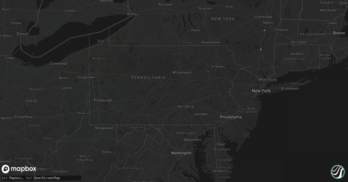
Hail Map in Pennsylvania on July 1, 2026
Get this storm
July 1 map
$229
one time, instant access
Download today. No call, no setup
Keep the $229
Bought the map and want the full workflow? Apply the entire $229 to a subscription within 7 days. None of it is wasted.
Every map, not just this one
This buys you this map. Subscription and you get every map we run, in the markets you choose from a few cities to whole states to nationwide. Plus real-time alerts the moment a storm fires.
Contact data
Name, contact info, occupancy, even credit band for addresses in the footprint. You go from where it hit to who to call.
Become the source they trust
Unlimited branding weather history reports on demand. You already have the documented answer ready for the property owner, and you are the one who showed up with it.
Property data and RoofTrace estimates
Pull up any address you have got, its value and the exact code rules for that jurisdiction, straight from One Click Code. Then RoofTrace estimates the squares, pitch, and roof value, priced the way you price.
Storm reports in Pennsylvania
Pennsylvania
| Date | Description |
|---|---|
| 07/01/20265:30 PM CDT | A report of a tree down and wires down. Time estimated from radar. |
| 07/01/20265:13 PM CDT | Report of a tree down and wires down. Time estimated from radar. |
| 07/01/202612:44 PM CDT | Tree down over route 29. |
| 06/30/20268:30 PM CDT | 2 trees down on roadway. Route 92 and turnpike street as per dispatch feed. Radar-estimated time. |
| 06/30/20268:18 PM CDT | Trees down on brushfield road as per dispatch feed. Radar-estimated time. |
| 06/30/20268:05 PM CDT | Numerous trees and wires down southeast of tunkhannock to the county border along and near the pa 307 corridor with first storm. Radar-estimated time. |
| 06/30/20267:58 PM CDT | Tree down blocking lane of state route 29 as per dispatch feed. Radar-estimated time. |
| 06/30/20267:58 PM CDT | Road closures by liberty township building due to downed trees as per dispatch feed. Radar-estimated time. |
All States Impacted by Hail Map on July 1, 2026
Cities Impacted by Hail Map on July 1, 2026
- Pine River, WI
- Poy Sippi, WI
- Fremont, WI
- Berlin, WI
- Winneconne, WI
- Northwood, IA
- Saint Ansgar, IA
- Lyle, MN
- Glenville, MN
- Neshkoro, WI
- Chatfield, MN
- Dover, MN
- Princeton, WI
- Spring Valley, MN
- Stewartville, MN
- Saint Charles, MN
- Utica, MN
- Eyota, MN
- Lewiston, MN
- Rushford, MN
- Winona, MN
- Omro, WI
- Green Lake, WI
- Austin, MN
- Montello, WI
- Larsen, WI
- Neenah, WI
- Hortonville, WI
- New London, WI
- Ripon, WI
- Pickett, WI
- Appleton, WI
- Shiocton, WI
- Black Creek, WI
- Oshkosh, WI
- Greenville, WI
- Markesan, WI
- Hilbert, WI
- Chilton, WI
- Stockbridge, WI
- Fairwater, WI
- Brandon, WI
- Waupun, WI
- Greenleaf, WI
- Little Chute, WI
- Kaukauna, WI
- Seymour, WI
- De Pere, WI
- Wrightstown, WI
- Elma, IA
- Oneida, WI
- Green Bay, WI
- New Franken, WI
- Luxemburg, WI
- Suamico, WI
- Casco, WI
- Algoma, WI
- Brussels, WI
- Kewaunee, WI
- Forestville, WI
- Combined Locks, WI
- Kimberly, WI
- Menasha, WI
- Denmark, WI
- Manitowoc, WI
- Whitelaw, WI
- Francis Creek, WI
- Cresco, IA
- Ridgeway, IA
- Lime Springs, IA
- Mishicot, WI
- Maribel, WI
- Decorah, IA
- Sturgeon Bay, WI
- Mount Calvary, WI
- Malone, WI
- Saint Cloud, WI
- Two Rivers, WI
- Fond Du Lac, WI
- Dorchester, IA
- Spring Grove, MN
- New Albin, IA
- Elkhart Lake, WI
- New Holstein, WI
- Caledonia, MN
- Eitzen, MN
- Glenbeulah, WI
- Genoa, WI
- Cleveland, WI
- Ferryville, WI
- De Soto, WI
- Sheboygan, WI
- Viroqua, WI
- Westby, WI
- Chaseburg, WI
- Soldiers Grove, WI
- Gays Mills, WI
- La Farge, WI
- Viola, WI
- Richland Center, WI
- Stoddard, WI
- Hillsboro, WI
- Cazenovia, WI
- Thompsonville, MI
- La Valle, WI
- Reedsburg, WI
- Hillpoint, WI
- Lime Ridge, WI
- Lyndon Station, WI
- Manistee, MI
- Wisconsin Dells, WI
- Loganville, WI
- Traverse City, MI
- Interlochen, MI
- Buckley, MI
- Lake Leelanau, MI
- Kewadin, MI
- Williamsburg, MI
- Cedar, MI
- Elk Rapids, MI
- Northport, MI
- Suttons Bay, MI
- Maple City, MI
- Wellston, MI
- Brethren, MI
- Kingsley, MI
- Baraboo, WI
- Ludington, MI
- Rapid City, MI
- Scottville, MI
- Free Soil, MI
- Oxford, WI
- Portage, WI
- Briggsville, WI
- Endeavor, WI
- Dalton, WI
- Mancelona, MI
- Alden, MI
- Elmira, MI
- Bellaire, MI
- Frederic, MI
- Gaylord, MI
- Custer, MI
- Fountain, MI
- Johannesburg, MI
- Marquette, WI
- Kingston, WI
- Branch, MI
- Grayling, MI
- Pardeeville, WI
- Hillman, MI
- Atlanta, MI
- Lewiston, MI
- Rosendale, WI
- Eldorado, WI
- Oakfield, WI
- Hubbard Lake, MI
- Harrison, MI
- Curran, MI
- Reed City, MI
- Leroy, MI
- Ossineke, MI
- Spruce, MI
- Black River, MI
- Lincoln, MI
- Evart, MI
- Dallas, PA
- Shavertown, PA
- Eden, WI
- Hunlock Creek, PA
- Birmingham, AL
- Joppa, AL
- Baileyton, AL
- Plymouth, WI
- Gladwin, MI
- Adamsville, AL
- Mulga, AL
- Rhodes, MI
- Beaverton, MI
- Dutton, AL
- Graysville, AL
- Sheboygan Falls, WI
- Kohler, WI
- Sterling, MI
- Standish, MI
- Bentley, MI
- Random Lake, WI
- Adell, WI
- Waldo, WI
- Cascade, WI
- Kiel, WI
- Dora, AL
- Quinton, AL
- Bessemer, AL
- Cordova, AL
- Section, AL
- Hahnville, LA
- Vinemont, AL
- Danville, AL
- Oostburg, WI
- Talking Rock, GA
- Ellijay, GA
- Dawson, AL
- Addison, AL
- Parrish, AL
- Eva, AL
- Fyffe, AL
- Groveoak, AL
- Blairsville, GA
- Jasper, AL
- Childersburg, AL
- Beaverton, AL
- Moulton, AL
- Collinsville, AL
- Coeymans Hollow, NY
- Hannacroix, NY
- Columbiana, AL
- Wilsonville, AL
- Haleyville, AL
- Winfield, AL
- Houston, AL
- Suches, GA
- Gardendale, AL
- Marion, AL
- Hamilton, AL
- Buhl, AL
- Nauvoo, AL
- Carbon Hill, AL
- Double Springs, AL
- Echola, AL
- Eldridge, AL
- Phil Campbell, AL
- Brilliant, AL
- Selma, AL
- West Coxsackie, NY
- Marksville, LA
- Atlanta, GA
- Guin, AL
- Kingston, NY
- Pinellas Park, FL
- Seminole, FL
- Fayette, AL
- Mount Hope, AL
- Elrod, AL
- Coker, AL
- Town Creek, AL
- Greenwood Springs, MS
- Ulster Park, NY
- Port Ewen, NY
- Saint Petersburg, FL
- Gordo, AL
- Russellville, AL
- Fairburn, GA
- Douglasville, GA
- Calera, AL
- Hodges, AL
- Hackleburg, AL
- Vina, AL
- Sulligent, AL
- Vernon, AL
- Marble, NC
- Murphy, NC
- Laceys Spring, AL
- Golden, MS
- Moundville, AL
- Falkville, AL
- Hayden, AL
- Warrior, AL
- Millport, AL
- Red Bay, AL
- Homestead, FL
- Hillsboro, AL
- Townsend, MT
- Broadview, NM
- Somerville, AL
- Palmetto, GA
- Lake Charles, LA
- Westlake, LA
- Sulphur, LA
- Pollock, LA
- Trafford, AL
- Deville, LA
- Morris, AL
- Valhermoso Springs, AL
- Tremont, MS
- Cisco, GA
- Chatsworth, GA
- Huntsville, AL
- Plant City, FL
- Kimberly, AL
- Whitesburg, GA
- Fosters, AL
- Ralph, AL
- Eastaboga, AL
- Lincoln, AL
- Madison, AL
- Darlington, WI
- Vidalia, LA
- Fulton, MS
- Aberdeen, MS
- Riverside, AL
- Plantersville, MS
- Nettleton, MS
- Lakeland, FL
- Pell City, AL
- Central Bridge, NY
- Delta, AL
- Lineville, AL
- Tupelo, MS
- Amory, MS
- Jena, LA
- Wedowee, AL
- Ragland, AL
- Esperance, NY
- Sloansville, NY
- Columbus, MS
- Colfax, LA
- Dry Prong, LA
- Tallapoosa, GA
- Lansing, NY
- Merryville, LA
- Verona, MS
- Smithville, MS
- Tanner, AL
- Talladega, AL
- Tuscaloosa, AL
- Argyle, WI
- Belmont, MS
- Dennis, MS
- Vega, TX
- Ohatchee, AL
- Alexandria, AL
- Wellington, AL
- Ragley, LA
- Anniston, AL
- Ferriday, LA
- Dequincy, LA
- Quitman, MS
- Redfield, NY
- Camden, NY
- Woodland, AL
- Heflin, AL
- Westdale, NY
- Williamstown, NY
- Altmar, NY
- Athens, AL
- Jonesville, LA
- Prairie, MS
- West Point, MS
- Booneville, MS
- Glen, MS
- Corinth, MS
- Macon, MS
- Newton, TX
- Jacksonville, AL
- Gadsden, AL
- Brooksville, MS
- Springville, AL
- Ashville, AL
- Philadelphia, MS
- Coopersburg, PA
- Quakertown, PA
- Richlandtown, PA
- Crawford, MS
- Alexander City, AL
- Piedmont, AL
- Decatur, AL
- Okolona, MS
- Cleveland, NY
- Houston, MS
- Woodland, MS
- Taberg, NY
- West Leyden, NY
- Eclectic, AL
- Equality, AL
- Rainsville, AL
- Sicily Island, LA
- Sylacauga, AL
- Ripley, MS
- Natchez, MS
- Randolph, MS
- Grady, NM
- Melrose, NM
- Rainbow City, AL
- Rogersville, AL
- Clayton, LA
- Waterproof, LA
- Elkmont, AL
- Blue Mountain, MS
- New Albany, MS
- Jones, AL
- Toney, AL
- Harvest, AL
- Kintnersville, PA
- Trout, LA
- Delanson, NY
- Starkville, MS
- Fultonville, NY
- Amsterdam, NY
- Daleville, MS
- Anderson, AL
- Lester, AL
- Mantee, MS
- Pheba, MS
- Maben, MS
- Ashland, AL
- Adamsville, TN
- Bethel Springs, TN
- Schenectady, NY
- Franklinton, LA
- Tylertown, MS
- Steele, AL
- Wadley, AL
- Cragford, AL
- Goodwater, AL
- Deweyville, TX
- Alpine, AL
- Elida, NM
- Hereford, TX
- Friona, TX
- Banner, MS
- Water Valley, MS
- Bruce, MS
- Mathiston, MS
- Oneonta, AL
- Floyd, NM
- Greenwood, MS
- Call, TX
- Kirbyville, TX
- Dumas, TX
- Verona, NY
- Rome, NY
- Rockford, AL
- Keeseville, NY
- Altoona, AL
- Bailey, MS
- Itta Bena, MS
- Vicksburg, MS
- Henderson, TN
- Jasper, TX
- Vaughan, MS
- Attalla, AL
- Tallassee, AL
- Saint Joseph, LA
- Buhl, ID
- Castleford, ID
- Carthage, MS
- Benton, MS
- Yazoo City, MS
- Lakeview, TX
- Coffeeville, MS
- Colchester, VT
- Westford, VT
- Essex Junction, VT
- Whiteville, TN
- Bolivar, TN
- Boaz, AL
- Moorhead, MS
- Verbena, AL
- Sumrall, MS
- Guntersville, AL
- Grant, AL
- Pinson, TN
- Brookhaven, MS
- Weogufka, AL
- Crossville, AL
- Albertville, AL
- South Burlington, VT
- Ballston Lake, NY
- Waynesboro, TN
- Lawrenceburg, TN
- Moscow, TN
- Oneida, NY
- Durhamville, NY
- Holly Springs, MS
- Rolling Fork, MS
- Tillatoba, MS
- Mercer, TN
- Medon, TN
- Wesson, MS
- Williston, VT
- Lexington, MS
- Underhill, VT
- Jericho, VT
- Broaddus, TX
- Lorman, MS
- Silver City, MS
- Oakland, MS
- Newellton, LA
- Perkinston, MS
- Vancleave, MS
- Lucedale, MS
- Langston, AL
- Pattison, MS
- Duck Hill, MS
- Vernon Center, NY
- Clinton, NY
- Vernon, NY
- Carson, MS
- Oak Vale, MS
- Prentiss, MS
- Cascilla, MS
- Charleston, MS
- Clarendon, TX
- Scobey, MS
- Fairfax, VT
- Richmond, VT
- Clanton, AL
- Munnsville, NY
- Canastota, NY
- Spencerport, NY
- Rochester, NY
- Isola, MS
- West Winfield, NY
- Jemison, AL
- Oriskany Falls, NY
- Deansboro, NY
- Cape Vincent, NY
- Hedley, TX
- Panhandle, TX
- Osage, IA
- Fayette, MS
- Batesville, MS
- Sugar Run, PA
- Belzoni, MS
- Mansfield, LA
- Rapid City, SD
- Clayton, NY
- Humboldt, TN
- Winnsboro, LA
- Hartwick, NY
- Burlington Flats, NY
- Ogdensburg, NY
- Freeville, NY
- Woodville, AL
- New Hope, AL
- Rayville, LA
- Hammond, NY
- Grand Cane, LA
- Little Cedar, IA
- Waterville, NY
- Madison, NY
- Depauville, NY
- Chaumont, NY
- La Fargeville, NY
- Etoile, TX
- Spring Hill, TN
- Carthage, NY
- Ithaca, NY
- Elkton, MN
- Adams, MN
- Edwards, MS
- Theresa, NY
- Watertown, NY
- Dexter, NY
- Trenton, GA
- Heuvelton, NY
- Stacyville, IA
- Tutwiler, MS
- Black Hawk, SD
- Hinsdale, MT
- Groom, TX
- West Burlington, NY
- Philadelphia, NY
- Evans Mills, NY
- Box Elder, SD
- Rochester, MN
- Owens Cross Roads, AL
- Delhi, LA
- Tunkhannock, PA
- Claude, TX
- Fort Drum, NY
- Black River, NY
- Brownville, NY
- Calcium, NY
- Riceville, IA
- Edwards, NY
- Dows, IA
- Popejoy, IA
- Alden, IA
- Bastrop, LA
- Grand Meadow, MN
- Racine, MN
- Iowa Falls, IA
- Wallace, KS
- Grass Range, MT
- Hallstead, PA
- Sparta, WI
- Latimer, IA
- Inverness, MS
- Syracuse, KS
- Chester, IA
- McIntire, IA
- Hampton, IA
- Lowville, NY
- Coulter, IA
- Pattersonville, NY
- Marion, LA
- Copenhagen, NY
- Mankato, MN
- Good Thunder, MN
- Spearfish, SD
- Whitewood, SD
- Colby, KS
- Lelia Lake, TX
- Amarillo, TX
- Quimby, IA
- Holstein, IA
- Tomah, WI
- Warrens, WI
- Canton, MS
- Walsh, CO
- Two Buttes, CO
- Washta, IA
- Tribune, KS
- Rexford, NY
- Canyon, TX
- Camden, MS
- Alplaus, NY
- Albany, NY
- Saratoga Springs, NY
- Stillwater, NY
- Slingerlands, NY
- Alta, IA
- Aurelia, IA
- Cherokee, IA
- Melrose, WI
- Clifton Park, NY
- Delmar, NY
- Winona, KS
- Latham, NY
- Rexford, KS
- Owls Head, NY
- Ostrander, MN
- Coolidge, KS
- Altura, MN
- Levant, KS
- Lloyd, MT
- Chinook, MT
- Hays, MT
- Selden, KS
- Lyon Mountain, NY
- Ellenburg Center, NY
- Saranac, NY
- Chateaugay, NY
- Averill Park, NY
- Petersburg, NY
- Cropseyville, NY
- Linn Grove, IA
- Gem, KS
- Hoxie, KS
- Glenmont, NY
- Le Roy, MN
- Waseca, MN
- Janesville, MN
- Kendall, KS
- Lakin, KS
- Leoti, KS
- North Creek, NY
- Bakers Mills, NY
- Cadyville, NY
- Pownal, VT
- Harmony, MN
- Coxsackie, NY
- Sioux Rapids, IA
- Rembrandt, IA
- Morrisonville, NY
- Ellenburg Depot, NY
- Sand Lake, NY
- Stephentown, NY
- Rensselaer, NY
- Castleton On Hudson, NY
- Vale, SD
- Morristown, MN
- Waterville, MN
- Wells, VT
- West Pawlet, VT
- Salem, NY
- Granville, NY
- South Hero, VT
- Livingston Manor, NY
- Canton, MN
- Mabel, MN
- La Crosse, WI
- Greenville, IA
- Plattsburgh, NY
- Vergennes, VT
- Charlotte, VT
- Peru, NY
- Burlington, VT
- Shelburne, VT
- Poultney, VT
- Middletown Springs, VT
- Warrensburg, NY
- Bolton Landing, NY
- Deerfield, KS
- Pittsford, VT
- Ferrisburgh, VT
- North Ferrisburgh, VT
- Rockland, WI
- Coon Valley, WI
- Bangor, WI
- Gillett Grove, IA
- Pawlet, VT
- Willsboro, NY
- Parksville, NY
- Milton, VT
- Grand Isle, VT
- Spencer, IA
- Salisbury, VT
- Atwood, KS
- Diamond Point, NY
- Ettrick, WI
- West Rupert, VT
- Middlebury, VT
- Bridport, VT
- Ruthven, IA
- Graettinger, IA
- Cashton, WI
- Preston, MN
- Winooski, VT
- Hinesburg, VT
- Waterbury, VT
- Sheffield, MA
- Housatonic, MA
- South Egremont, MA
- Great Barrington, MA
- Rowe, MA
- Colrain, MA
- Holcomb, KS
- Wilton, WI
- Norwalk, WI
- Ontario, WI
- Canaan, CT
- Southfield, MA
- Ashley Falls, MA
- Brewster, KS
- Kendall, WI
- Camp Douglas, WI
- Dresden, KS
- Hot Springs Village, AR
- Gill, MA
- South Pomfret, VT
- North Pomfret, VT
- Lansing, IA
- Norton, KS
- Clayton, KS
- Jennings, KS
- West Lebanon, NH
- Plainfield, NH
- Sharon, VT
- Norwich, VT
- White River Junction, VT
- Hustler, WI
- Elroy, WI
- Mauston, WI
- New Lisbon, WI
- Necedah, WI
- Garden City, KS
- Scott City, KS
- Marienthal, KS
- Oberlin, KS
- Norcatur, KS
- Glennie, MI
- Mikado, MI
- Harrisville, MI
- Saint Francis, KS
- Benkelman, NE
- Friendship, WI
- Arkdale, WI
- Adams, WI
- Coloma, WI
- Plainfield, WI
- Hancock, WI
- Nekoosa, WI
- Bancroft, WI
- Greenbush, MI
- Lebanon, NH
- Lyons, CO
- Hanover, NH
- Wilder, VT
- Newport, NH
- Grantham, NH
- Webster, MA
- Parks, NE
- Grand Marsh, WI
- Westfield, WI
- Eads, CO
- Manchester, CT
- Vernon Rockville, CT
- Bolton, CT
- Lonsdale, AR
- Hot Springs National Park, AR
- Springfield, NH
- East Hartford, CT
- Douglas, MA
- Wautoma, WI
- Cheyenne Wells, CO
- Wilmot, NH
- Arapahoe, CO
- Warner, NH
- Uxbridge, MA
- Jordan, MT
- Coventry, CT
- Andover, CT
- Wonewoc, WI
- Canterbury, NH
- Morland, KS
- Kit Carson, CO
- Albert Lea, MN
- Readstown, WI
- Lenora, KS
- Hayward, MN
- West Salem, WI
- Hill City, KS
- Brownsville, MN
- Holmen, WI
- Mindoro, WI
- Fort Peck, MT
- Wolf Point, MT
- Circle, MT
- Nashua, MT
- Frazer, MT
- Vida, MT
- Logan, KS
- Lake Ann, MI
- Honor, MI
- Ault, CO
- Beulah, MI
- Milliken, CO
- Le Mars, IA
- Greeley, CO
- Windsor, CO
- Burlington, CO
- Weskan, KS
- Kanorado, KS
- Goodland, KS
- Copemish, MI
- Glade, KS
- Phillipsburg, KS
- Grawn, MI
- Reedsville, WI
- Eaton, CO
- Poplar, MT
- Sharon Springs, KS
- Kirwin, KS
- Rose Creek, MN
- Grover, CO
- Johnstown, CO
- Gaylord, KS
- Cedar, KS
- Kensington, KS
- Kaleva, MI
- Edson, KS
- Glen Arbor, MI
- Frankfort, MI
- Empire, MI
- Benzonia, MI
- Bear Lake, MI
- Arcadia, MI
- Fife Lake, MI
- South Boardman, MI
- Kalkaska, MI
- New Raymer, CO
- Ekalaka, MT
- Lucerne, CO
- Onalaska, WI
- Baker, MT
- Hammond, MT
- Comins, MI
- Lachine, MI
- Galeton, CO
- Gill, CO
- Sheldon, IA
- Briggsdale, CO
- Stoneham, CO
- Yutan, NE
- Ithaca, NE
- Mankato, KS
- Esbon, KS
- Hastings, NE
- Padroni, CO
- Loveland, CO
- Ashton, IA
- Herron, MI
- Alpena, MI
- Posen, MI
- Sterling, CO
- Merino, CO
- Rushmore, MN
- Bigelow, MN
- Sibley, IA
- Benedict, NE
- Ludlow, SD
- Bladen, NE
- Sutton, NE
- Worthington, MN
- York, NE
- Bowman, ND
- Scranton, ND
- Peetz, CO
- Bradshaw, NE
- Mead, NE
- Quinter, KS
- Broadwater, NE
- Fremont, NE
- Healy, KS
- Dighton, KS
- Stromsburg, NE
- Gresham, NE
- Saronville, NE
- Aurora, NE
- Fountain, MN
- Sidney, NE
- Iliff, CO
- Spirit Lake, IA
- Valley, NE
- Tryon, NE
- Reading, MN
- Fulda, MN
- Brewster, MN
- Hettinger, ND
- Oshkosh, NE
- Lisco, NE
- Crook, CO
- Wykoff, MN
- Walthill, NE
- Rosalie, NE
- Henderson, NE
- Little Sioux, IA
- Macy, NE
- Cedar Bluffs, NE
- Bancroft, NE
- Wisner, NE
- Pender, NE
- Campbellsport, WI
- Lakeside, NE
- Salix, IA
- Winnebago, NE
- Kewaskum, WI
- Rollingstone, MN
- Nickerson, NE
- Hooper, NE
- Sloan, IA
- Ames, NE
- Chappell, NE
- Minnesota City, MN
- Lemmon, SD
- Ellsworth, NE
- Bingham, NE
- Mott, ND
- New Leipzig, ND
- Fountain City, WI
- Elgin, ND
- Carson, ND
- Webb, IA
- Dickens, IA
- Hinton, IA
- Kingsley, IA
- Lawton, IA
- Sergeant Bluff, IA
- Morristown, SD
- Selfridge, ND
- Peterson, MN
- Lanesboro, MN
- Brownsdale, MN
- Raleigh, ND
- Flasher, ND
- Bronson, IA
- Keldron, SD
- Moville, IA
- Remsen, IA
- Homer, NE
- Watauga, SD
- Sioux City, IA
- Shields, ND
- McIntosh, SD
- Goldfield, IA
- Emmetsburg, IA
- Solen, ND
- Terril, IA
- Cannon Ball, ND
- Fort Yates, ND
- Mandan, ND
- McLaughlin, SD
- Jackson, MN
- Kanawha, IA
- Milford, IA
- Goodell, IA
- Meservey, IA
- Arnolds Park, IA
- Ocheyedan, IA
- Belmond, IA
- Linton, ND
- Alexander, IA
- Thornton, IA
- Swaledale, IA
- Rockwell, IA
- Clarion, IA
- Estherville, IA
- Lu Verne, IA
- Livermore, IA
- Renwick, IA
- Charles City, IA
- Bloomfield, NE
- Colon, NE


