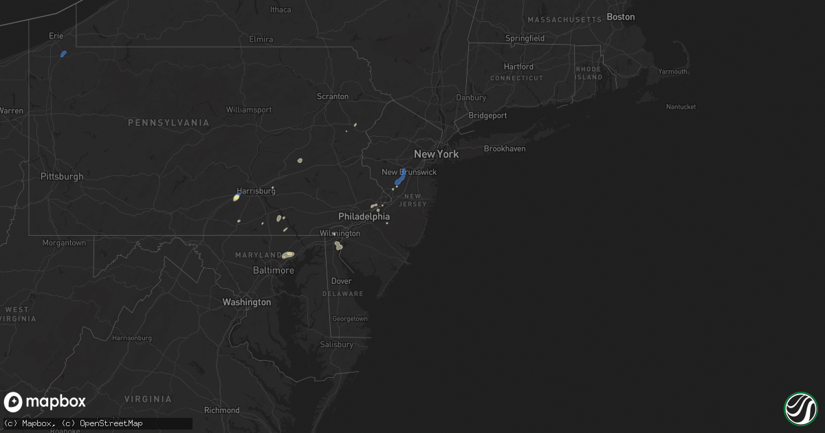
Hail Map in New Jersey on June 30, 2025
Get this storm
June 30 map
$229
one time, instant access
Download today. No call, no setup
Keep the $229
Bought the map and want the full workflow? Apply the entire $229 to a subscription within 7 days. None of it is wasted.
Every map, not just this one
This buys you this map. Subscription and you get every map we run, in the markets you choose from a few cities to whole states to nationwide. Plus real-time alerts the moment a storm fires.
Contact data
Name, contact info, occupancy, even credit band for addresses in the footprint. You go from where it hit to who to call.
Become the source they trust
Unlimited branding weather history reports on demand. You already have the documented answer ready for the property owner, and you are the one who showed up with it.
Property data and RoofTrace estimates
Pull up any address you have got, its value and the exact code rules for that jurisdiction, straight from One Click Code. Then RoofTrace estimates the squares, pitch, and roof value, priced the way you price.
Storm reports in New Jersey
New Jersey
| Date | Description |
|---|---|
| 06/30/20254:11 PM CDT | Multiple trees down. Time estimated from radar. |
| 06/30/20254:06 PM CDT | Multiple trees down. Time estimated from radar. |
| 06/30/20253:59 PM CDT | Trees and wires down. Time estimated from radar. |
| 06/30/20253:55 PM CDT | Trees and wires down at the intersection of raritan ave and ashland road. Time estimated from radar. |
| 06/30/20253:54 PM CDT | Multiple trees down. Time estimated from radar. |
| 06/30/20253:25 PM CDT | Trees and wires down at the intersection of schalks crossing road and wyndhurst drive. Time estimated from radar. |
| 06/30/20253:25 PM CDT | Trees and wires down at the intersection of schalks crossing road and research way. Time estimated from radar. |
| 06/30/20253:23 PM CDT | Multiple trees down at intersection of schalks crossing road and scudders mill road. Time estimated from radar. |
| 06/30/20253:23 PM CDT | Multiple trees uprooted and large tree branches snapped. Time estimated from radar. |
| 06/30/20253:15 PM CDT | Multiple reports of trees and wires down. Time estimated from radar. |
| 06/30/20253:04 PM CDT | Multiple reports of trees and wires down. Time estimated from radar. |
| 06/30/20253:04 PM CDT | Multiple reports of trees and wires down. Time estimated from radar. |
| 06/30/20253:04 PM CDT | Multiple reports of trees and wires down. Time estimated from radar. |
All States Impacted by Hail Map on June 30, 2025
Cities Impacted by Hail Map on June 30, 2025
- Lyman, NE
- Harrisburg, NE
- Hawk Springs, WY
- Lagrange, WY
- Morrill, NE
- Scottsbluff, NE
- Torrington, WY
- Gering, NE
- Yoder, WY
- Mitchell, NE
- Brookfield, WI
- Elm Grove, WI
- Milwaukee, WI
- Butler, WI
- Menomonee Falls, WI
- Mequon, WI
- Saint Helen, MI
- Ordway, CO
- Corona, NM
- Lincoln, MI
- Laingsburg, MI
- Owosso, MI
- Santa Fe, NM
- West Chester, PA
- Stanley, NM
- Hershey, PA
- Palmyra, PA
- Durand, MI
- Crystal Falls, MI
- Medford, NJ
- Hudson, WI
- New Richmond, WI
- Schuylkill Haven, PA
- Moriarty, NM
- Philadelphia, PA
- Cressona, PA
- Auburn, PA
- Pottsville, PA
- Socorro, NM
- Moorestown, NJ
- Riverside, NJ
- Ackerly, TX
- Lamesa, TX
- Woodville, WI
- Wilson, WI
- Fort Davis, TX
- Belleville, AR
- Seminole, TX
- Willingboro, NJ
- Beverly, NJ
- Andrews, TX
- Polo, MO
- Lamy, NM
- Tijeras, NM
- Albuquerque, NM
- Burlington, NJ
- Bensalem, PA
- Wilmington, DE
- Baldwin, WI
- Glenwood City, WI
- Downing, WI
- Bristol, PA
- Westcliffe, CO
- Everglades City, FL
- Spring Valley, WI
- Trenton, NJ
- Lawrence Township, NJ
- Plainsboro, NJ
- Princeton, NJ
- Monmouth Junction, NJ
- Kingston, NJ
- Kendall Park, NJ
- Clines Corners, NM
- Estancia, NM
- Pennsville, NJ
- Tecumseh, NE
- Johnson, NE
- Willard, NM
- Princeton Junction, NJ
- Middletown, DE
- Salem, NJ
- New Castle, DE
- Delaware City, DE
- Franklin Park, NJ
- North Brunswick, NJ
- Somerset, NJ
- Mountainair, NM
- Clinton, AR
- Bee Branch, AR
- Holloman Air Force Base, NM
- Alamogordo, NM
- Hermleigh, TX
- Tularosa, NM
- Snyder, TX
- Glenwood, NM
- Torreon, NM
- Kingsville, MD
- Datil, NM
- Ribera, NM
- Ira, TX
- Carlisle, PA
- Balmorhea, TX
- Jefferson, CO
- Fairplay, CO
- Asher, OK
- Wanette, OK
- Vermont, IL
- Waterford, PA
- Lindsay, OK
- Byars, OK
- Bailey, CO
- Kermit, TX
- Red Lion, PA
- Windsor, PA
- Felton, PA
- Rule, TX
- Plainville, IL
- Liberty, IL
- Effort, PA
- Henryville, PA
- East Stroudsburg, PA
- Tannersville, PA
- Lawton, OK
- Geronimo, OK
- Lake George, CO
- Sedalia, CO
- Ada, OK
- Payson, IL
- Pauls Valley, OK
- Silver City, NM
- Wanatah, IN
- Hanna, IN
- Bruce Crossing, MI
- Mule Creek, NM
- Paoli, OK
- Munday, TX
- Magdalena, NM
- Fittstown, OK
- Fitzhugh, OK
- Fisk, MO
- Atoka, TN
- Millington, TN
- Cubero, NM
- Glen Arm, MD
- Prudenville, MI
- Brighton, TN
- Kiowa, OK
- Pittsburg, OK
- Wrightsville, PA
- Lacombe, LA
- Stonewall, OK
- Maysville, OK
- Stratford, OK
- Haskell, TX
- Poplar Bluff, MO
- Weinert, TX
- Dudley, MO
- Safford, AZ
- Blanco, OK
- Fork, MD
- Hydes, MD
- Seven Valleys, PA
- Baldwin, MD
- Fallston, MD
- Aspermont, TX
- Grandfield, OK
- Roosevelt, OK
- Coalgate, OK
- Seymour, TX
- Morenci, AZ
- Clifton, AZ
- Indiahoma, OK
- Wardville, OK
- Rush Springs, OK
- Joppa, MD
- Zenia, CA
- Hollister, OK
- Elgin, OK
- Fort Sill, OK
- Deming, NM
- Hurley, NM
- Woodland Park, CO
- Davidson, OK
- Cache, OK
- Abingdon, MD
- Bel Air, MD
- Loveland, OK
- Electra, TX
- Harrold, TX
- Walters, OK
- Atoka, OK
- Faxon, OK
- Wynnewood, OK
- Aliceville, AL
- Sylvester, GA
- Bonnerdale, AR
- Honobia, OK
- Marlow, OK
- Boligee, AL
- Edgewood, MD
- Upper Falls, MD
- Perry Hall, MD
- Kendall, WI
- Colorado Springs, CO
- Duncan, OK
- Florissant, CO
- Wilton, WI
- Guffey, CO
- Crowell, TX
- Bethel, OK
- Tomah, WI
- Fort Klamath, OR
- Vernon, TX
- Opelousas, LA
- Forks Of Salmon, CA
- Elroy, WI
- Gettysburg, PA
- New Oxford, PA
- Larkspur, CO
- Cass City, MI
- Port Barre, LA
- Washington, LA
- Healdton, OK
- Havana, AR
- Usaf Academy, CO
- Graham, OK
- Tupelo, OK
- Wapanucka, OK
- Lockney, TX
- Airville, PA
- Fawn Grove, PA
- Wilson, OK
- Gagetown, MI
- Lone Grove, OK
- Arlington, TN
- Saylorsburg, PA
- Montoursville, PA
- Williamsport, PA
- Cogan Station, PA
- Conestoga, PA
- Bartonsville, PA
- Hockessin, DE
- Franklin, MO
- Glasgow, MO
- Fayette, MO
- Armstrong, MO
- Clark, MO
- Rocheport, MO
- New Franklin, MO
- Harrisburg, MO
- Higbee, MO
- Sturgeon, MO
- Columbia, MO
- North Little Rock, AR
- Mayflower, AR
- Maumelle, AR
- Sherwood, AR
- Jacksonville, AR
- Carrizozo, NM
- Truth Or Consequences, NM


