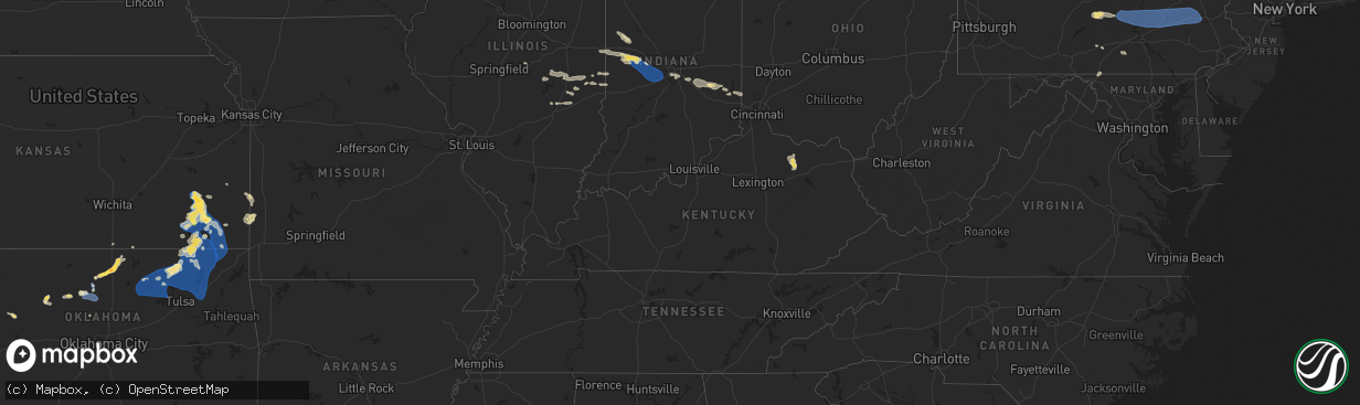
Hail Map in Kentucky on June 29, 2024
The weather event in Kentucky on June 29, 2024 includes Hail, Wind, and Tornado maps. 20 states and 445 cities were impacted and suffered possible damage. The total estimated number of properties impacted is 0.
Want more than just the map?
Turn this storm into a full workflow.
- Owner + property data so you know who to knock
- OnDemand branded weather history reports to win the "did we even have hail?" argument
- RoofTrace estimate so reps stop guessing numbers at the door
Bought this map? Upgrade within 7 days and we'll credit the $230. (10-15 min setup call)
Hail
Wind
Tornado
0
Estimated number of impacted properties by a 1.00" hail or larger0
Estimated number of impacted properties by a 1.75" hail or larger0
Estimated number of impacted properties by a 2.50" hail or largerStorm reports in Kentucky
Kentucky
| Date | Description |
|---|---|
| 06/28/20248:33 PM CDT | Trees down at railroad st. Time estimated from radar. |
| 06/28/20248:32 PM CDT | Tree down along mound st. Power lines involved. Time estimated from radar. |
| 06/28/20248:32 PM CDT | Large tree limbs down along boy scout rd.... Blocking one lane. Time estimated from radar. |
| 06/28/20248:32 PM CDT | Power lines down and arcing along main street. Time estimated from radar. |
| 06/28/20248:31 PM CDT | Trees down at bellefonte princess rd and country club dr. Time estimated from radar. |
| 06/28/20248:31 PM CDT | Tree down blocking road. Time estimated from radar. |
| 06/28/20247:53 PM CDT | Trees and power lines down in south portsmouth. |
| 06/28/20247:39 PM CDT | Fleming county dispatch received reports of 3 downed trees from the county highway garage foreman. The trees were located on mudsock road... Pecks ridge road... And thr |
All States Impacted by Hail Map on June 29, 2024
Cities Impacted by Hail Map on June 29, 2024
- Brady, NE
- Maxwell, NE
- Brocton, IL
- Oakland, IL
- Chrisman, IL
- Clinton, IN
- Warrensburg, IL
- Decatur, IL
- Lovington, IL
- Arthur, IL
- Toledo, IL
- Neoga, IL
- Tuscola, IL
- Arcola, IL
- Bethany, IL
- Deerton, MI
- Westville, IL
- Danville, IL
- Au Train, MI
- Sullivan, IL
- Hindsboro, IL
- Charleston, IL
- Humboldt, IL
- Perrysville, IN
- Veedersburg, IN
- Kingman, IN
- Covington, IN
- Paris, IL
- Wesley Chapel, FL
- Cairo, WV
- Seney, MI
- Manistique, MI
- Land O'Lakes, FL
- Hillsboro, IN
- Crawfordsville, IN
- West Terre Haute, IN
- Waynetown, IN
- Alamo, IN
- McMillan, MI
- Marshall, IN
- Waveland, IN
- Bloomingdale, IN
- New Market, IN
- Ladoga, IN
- Germfask, MI
- Newberry, MI
- New Ross, IN
- Ravenswood, WV
- Jamestown, IN
- Roachdale, IN
- Russellville, IN
- Bainbridge, IN
- Greencastle, IN
- Fillmore, IN
- Coatesville, IN
- North Salem, IN
- Danville, IN
- Avon, IN
- Engadine, MI
- Curtis, MI
- Belleville, WV
- Rockport, WV
- Clayton, IN
- Amo, IN
- Stilesville, IN
- Plainfield, IN
- Mooresville, IN
- Dunnellon, FL
- Fort Myers, FL
- Pullman, WV
- Harrisville, WV
- Pennsboro, WV
- Fort Myers Beach, FL
- West Union, WV
- Huntingdon, PA
- Indianapolis, IN
- Belleville, PA
- Boalsburg, PA
- Petersburg, PA
- Beech Grove, IN
- Yeagertown, PA
- Reedsville, PA
- Burnham, PA
- Lewistown, PA
- McVeytown, PA
- Shelbyville, IN
- Fountaintown, IN
- Fairland, IN
- Rushville, IN
- Manilla, IN
- Homer, IN
- Arlington, IN
- Waldron, IN
- Morristown, IN
- Mifflintown, PA
- McClure, PA
- Winter Park, FL
- Orlando, FL
- Milroy, IN
- Yates Center, KS
- Las Cruces, NM
- Panhandle, TX
- Glenwood, IN
- Laurel, IN
- Connersville, IN
- Metamora, IN
- Chanute, KS
- Benedict, KS
- Buffalo, KS
- Spring Run, PA
- Piqua, KS
- McAlisterville, PA
- Oakland Mills, PA
- Richfield, PA
- Newport, PA
- Millerstown, PA
- Thompsontown, PA
- Liverpool, PA
- Cocolamus, PA
- Duncannon, PA
- Mount Pleasant Mills, PA
- Halifax, PA
- Elizabethville, PA
- Millersburg, PA
- Dalmatia, PA
- Spring Glen, PA
- Gratz, PA
- Berrysburg, PA
- Williamstown, PA
- Wiconisco, PA
- Lykens, PA
- Annville, PA
- Jonestown, PA
- Grantville, PA
- Pine Grove, PA
- Tower City, PA
- Fredericksburg, PA
- Muir, PA
- Tremont, PA
- Hegins, PA
- Rehrersburg, PA
- Womelsdorf, PA
- Schuylkill Haven, PA
- Lebanon, PA
- Myerstown, PA
- Bethel, PA
- Richland, PA
- Cedar Grove, IN
- Brookville, IN
- Bronson, KS
- Lamar, MO
- Jerico Springs, MO
- Orrstown, PA
- Lurgan, PA
- Newburg, PA
- Altoona, KS
- Thayer, KS
- Bernville, PA
- Herndon, PA
- Sacramento, PA
- Pillow, PA
- Port Trevorton, PA
- Dornsife, PA
- Valley View, PA
- Klingerstown, PA
- Pitman, PA
- Branchdale, PA
- Pottsville, PA
- Ashland, PA
- Mar Lin, PA
- New Ringgold, PA
- Tamaqua, PA
- Orwigsburg, PA
- Seltzer, PA
- Cressona, PA
- Minersville, PA
- Saint Clair, PA
- Cumbola, PA
- New Philadelphia, PA
- Port Carbon, PA
- Auburn, PA
- Strausstown, PA
- Liberal, MO
- Mindenmines, MO
- Pittsburg, KS
- Mulberry, KS
- McCune, KS
- Neodesha, KS
- Humboldt, KS
- Okeana, OH
- Oxford, OH
- Fredonia, KS
- Thomasville, GA
- Shippensburg, PA
- Eldon, MO
- Barnett, MO
- Galesburg, KS
- Shoemakersville, PA
- Port Clinton, PA
- Mohrsville, PA
- Shartlesville, PA
- Hamburg, PA
- Kempton, PA
- Lenhartsville, PA
- Parsons, KS
- Carlisle, PA
- Gardners, PA
- Kingfisher, OK
- Elk City, KS
- Berea, WV
- Frontenac, KS
- Independence, KS
- Hunter, OK
- Garber, OK
- Smithville, WV
- Dennis, KS
- Stockton, MO
- Enid, OK
- Roswell, NM
- Stewardson, IL
- Sigel, IL
- York Springs, PA
- Fritch, TX
- Mound Valley, KS
- Cherryvale, KS
- North Fort Myers, FL
- Coffeyville, KS
- Mattoon, IL
- Lerna, IL
- West Chester, OH
- Cincinnati, OH
- Mason, OH
- Liberty, KS
- Altamont, KS
- Edna, KS
- Bartlett, KS
- Oswego, KS
- Fairmont, OK
- Corona, NM
- Asbury, MO
- Billings, OK
- Tonkawa, OK
- Kansas, IL
- Fort Scott, KS
- Caney, KS
- Dearing, KS
- Waukomis, OK
- Amarillo, TX
- Ashmore, IL
- Borger, TX
- Stinnett, TX
- Bison, OK
- Copan, OK
- Wann, OK
- S Coffeyville, OK
- Welch, OK
- Chetopa, KS
- Deerfield, MO
- Havana, KS
- Sedan, KS
- Franklin, KS
- Kutztown, PA
- Andreas, PA
- Breinigsville, PA
- Fleetwood, PA
- Fogelsville, PA
- New Tripoli, PA
- Topton, PA
- Mertztown, PA
- Lenapah, OK
- Dewey, OK
- Bartlesville, OK
- Delaware, OK
- Vinita, OK
- Hagerstown, MD
- Maugansville, MD
- Bronaugh, MO
- Drummond, OK
- Ewing, KY
- Flemingsburg, KY
- Douglas, OK
- Marshall, OK
- Morse, TX
- Moundville, MO
- Waynesboro, PA
- Capitan, NM
- Isabella, OK
- Ames, OK
- Reading, MI
- Blackwell, OK
- Nowata, OK
- Bluejacket, OK
- Chelsea, OK
- Hillsboro, KY
- Ponca City, OK
- Williamsport, IN
- Attica, IN
- Moorefield, KY
- Greencastle, PA
- Longdale, OK
- Sheldon, MO
- Hillsdale, MI
- Ochelata, OK
- Seiling, OK
- Richland, MO
- Barnsdall, OK
- Owingsville, KY
- Ramona, OK
- Talala, OK
- Claremore, OK
- Oologah, OK
- Collinsville, OK
- Skiatook, OK
- Pawhuska, OK
- Okeene, OK
- Cerrillos, NM
- La Mesa, NM
- San Jon, NM
- Bard, NM
- Wingate, IN
- Westpoint, IN
- New Richmond, IN
- Deming, NM
- Fairview, OK
- Newkirk, OK
- Melrose, NM
- Humansville, MO
- Encino, NM
- Vera, OK
- Inola, OK
- Owasso, OK
- Fairfax, OK
- Wynona, OK
- Hominy, OK
- Ralston, OK
- Pawnee, OK
- Golden, CO
- Belen, NM
- Leedey, OK
- Buffalo, MO
- Veguita, NM
- Denver, CO
- Wheat Ridge, CO
- Arvada, CO
- Hennessey, OK
- Tunas, MO
- Windyville, MO
- Socorro, NM
- Catoosa, OK
- Prue, OK
- Osage, OK
- Sand Springs, OK
- Cleveland, OK
- Maramec, OK
- Jennings, OK
- Terlton, OK
- Yale, OK
- Mannford, OK
- Fort Sumner, NM
- Dry Run, PA
- Arkansas City, KS
- South Haven, KS
- Mountainair, NM
- Estancia, NM
- Geuda Springs, KS
- Albuquerque, NM
- Ava, MO
- Tijeras, NM
- Santa Rosa, NM
- Arnett, OK
- Sharpsburg, KY
- Maple City, KS
- Dexter, KS
- Oxford, KS
- Winfield, KS
- Isleta, NM
- Kirtland Afb, NM
- Bernalillo, NM
- Rio Rancho, NM
- Corrales, NM
- Algodones, NM
- Placitas, NM
- Edgewood, NM
- Drumright, OK
- Wellington, KS
- Cuervo, NM
- Gamaliel, AR
- Clarkridge, AR
- Bristow, OK
- Henderson, AR
- Burden, KS
- Cambridge, KS
- Bakersfield, MO
- Las Vegas, NM
- Depew, OK
- Wagon Mound, NM
- Grenola, KS
- Trementina, NM
- Moriarty, NM
- Moline, KS
- Pretty Prairie, KS
- Springer, NM
- Conway Springs, KS
- Kingman, KS
- Arlington, KS
- Gladstone, NM
- Des Moines, NM
- Livonia, NY
- Hemlock, NY
- Glenallen, MO
- Geneseo, NY
- Clearwater, KS
- Kismet, KS
- Scott City, MO
- Bloomfield, NY
- Honeoye, NY
- Canandaigua, NY
- Whitewater, MO
- Cape Girardeau, MO
- Campo, CO
- Walsh, CO
- Cairo, IL
- Chaffee, MO
- Lacona, NY
- Conchas Dam, NM
- Mounds, IL
- Turon, KS
- Tamms, IL
- Cunningham, KS
- Pratt, KS
- Pulaski, IL
- Clinton, KY
- Sandy Creek, NY
- Pulaski, NY
- Arlington, KY
- Villa Ridge, IL
- Fancy Farm, KY
- Bardwell, KY
- Clarksville, TN
- Solano, NM
- Guthrie, KY
- Medford, OK
- Crofton, KY
- Elkton, KY
- Ambia, IN


