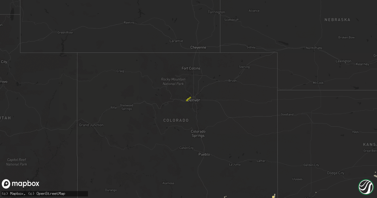
Hail Map on June 29, 2024
Get this storm
June 29 map
$229
one time, instant access
Download today. No call, no setup
Keep the $229
Bought the map and want the full workflow? Apply the entire $229 to a subscription within 7 days. None of it is wasted.
Every map, not just this one
This buys you this map. Subscription and you get every map we run, in the markets you choose from a few cities to whole states to nationwide. Plus real-time alerts the moment a storm fires.
Contact data
Name, contact info, occupancy, even credit band for addresses in the footprint. You go from where it hit to who to call.
Become the source they trust
Unlimited branding weather history reports on demand. You already have the documented answer ready for the property owner, and you are the one who showed up with it.
Property data and RoofTrace estimates
Pull up any address you have got, its value and the exact code rules for that jurisdiction, straight from One Click Code. Then RoofTrace estimates the squares, pitch, and roof value, priced the way you price.
States Impacted by Hail Map on June 29, 2024
Storm reports
Michigan
| Date | Description |
|---|---|
| 06/29/20246:15 PM CDT | Power lines down over road led to road closure. |
| 06/29/20242:25 PM CDT | Picture on facebook of a fireworks canopy blown over 25-50 ft |
| 06/29/20242:25 PM CDT | Report on facebook with pictures of a tree down in front of a house. |
| 06/29/20242:25 PM CDT | Report on facebook of a tree down on m-28. Picture shows it blocking part of the road. |
| 06/29/20242:23 PM CDT | Report on facebook with video showing the falling hail. Noted wide range of hailstones between pea size and half dollar. |
| 06/29/20242:20 PM CDT | Newberry country club / woodland grill shared a statement on their facebook page with a handful of pictures documenting the numerous trees down across the golf course. |
| 06/29/20242:20 PM CDT | Report on facebook with pictures. Noted the size range of hailstones was 1 to 1.5 inches. |
| 06/29/20242:20 PM CDT | Report provided on facebook with picture. |
| 06/29/20242:20 PM CDT | Multiple reports of trees down near m-28 and m-123 intersection. Power pole damaged by tree on line. Around 1300 people without power for roughly 3 to 5 hours. |
| 06/29/20242:20 PM CDT | Report on facebook provided two pictures of tree damage from the winds. One fairly large tree was knocked down close to a home. The other was of a larger branch broken |
| 06/29/20242:15 PM CDT | Report on facebook with picture. |
| 06/29/20242:10 PM CDT | Report called in for half dollar size hail observed at around 3:10 pm edt. Also noted the power was out from around 3:30 pm to 8 pm edt. |
Indiana
| Date | Description |
|---|---|
| 06/29/20246:32 PM CDT | [landspout] approximate end location of a landspout that began in far eastern illinois. Photo received via social media. |
| 06/29/20244:53 PM CDT | A 10 inch tree was downed onto mcconaha road. Time estimated from radar. |
| 06/29/20244:37 PM CDT | A tree was down near the intersection of state road 121 and alpine road. Time estimated from radar. |
| 06/29/20244:20 PM CDT | Large trees down. Time estimated from radar. |
| 06/29/20244:15 PM CDT | Large tree downed. Time estimated from radar. |
| 06/29/20243:54 PM CDT | Tree down across us52 near morristown. Power out across town. Time estimated from radar. |
| 06/29/20243:32 PM CDT | Several large and mature trees snapped or uprooted with power pole damage also noted. Time estimated from radar. |
| 06/29/20243:22 PM CDT | Numerous trees downed with roof damage also noted in a localized area near edgewood and emerson. Time estimated from radar. |
| 06/29/20243:22 PM CDT | Several large trees downed across beech grove. Time estimated from radar. |
| 06/29/20242:56 PM CDT | Large maple tree limb snapped. Time estimated from radar. |
| 06/29/20242:51 PM CDT | Three trees about 6 inches in diameter across the road... Time estimated from radar. |
| 06/29/20242:49 PM CDT | Trees down blocking both westbound lanes of us40. Time estimated from radar. |
| 06/29/20242:47 PM CDT | Power lines downed. |
| 06/29/20242:20 PM CDT | Several reports of trees down across the northeastern portions of the county. Time estimated from radar. |
| 06/29/20242:15 PM CDT | Awos station kcfj crawfordsville. |
| 06/29/20242:04 PM CDT | Multiple trees down. Time estimated from radar. |
Texas
| Date | Description |
|---|---|
| 06/29/20246:56 PM CDT | A local report indicates 1.50 inch wind near 1 NNW Stinnett |
| 06/29/20246:50 PM CDT | A local report indicates 1.50 inch wind near 2 WNW Stinnett |
| 06/29/20246:05 PM CDT | 9 power poles snapped along highway 207 about 6 miles south of borger. |
Kansas
| Date | Description |
|---|---|
| 06/29/20246:31 PM CDT | Asos station kcfv coffeyville municipal airpt. |
| 06/29/20246:26 PM CDT | Report from mping: 3-inch tree limbs broken. Power poles broken. Time estimated from radar. |
| 06/29/20246:25 PM CDT | A local report indicates 60 MPH wind near Coffeyville |
| 06/29/20246:22 PM CDT | Trees down blocking the roadway. |
| 06/29/20246:17 PM CDT | Asos station kcfv coffeyville municipal airpt. |
| 06/29/20246:02 PM CDT | Also had 70 mph winds with the hail. |
| 06/29/20245:57 PM CDT | Large tree branches down. Report came in via social media. |
| 06/29/20245:56 PM CDT | Report from mping: 1-inch tree limbs broken; shingles blown off. |
| 06/29/20245:45 PM CDT | A local report indicates 70 MPH wind near 3 SE Altoona |
| 06/29/20245:31 PM CDT | A local report indicates 75 MPH wind near 4 W Altoona |
| 06/29/20244:40 PM CDT | A local report indicates 1.50 inch wind near Rose |
| 06/29/20244:26 PM CDT | Report from mping: 3-inch tree limbs broken; power poles broken. |
| 06/29/20244:25 PM CDT | [landspout] brief landspout reported by fire department... And also from the public on social media. Location estimated from radar. |
| 06/29/20244:25 PM CDT | Reports of power poles down in yates center. |
| 06/28/202410:44 PM CDT | Dispatch reports larger than quarter-sized hail south of winfield city lake. |
| 06/28/202410:40 PM CDT | A local report indicates 2.75 inch wind near 5 NE Winfield |
| 06/28/202410:20 PM CDT | Delayed report received via social media. A goat shelter... Sheep shelter... Chicken coop... And pole barn were destroyed... With several animals lost. Time estimated. |
Illinois
| Date | Description |
|---|---|
| 06/29/20246:21 PM CDT | [landspout] picture obtained through social media. |
| 06/29/20246:15 PM CDT | [landspout] corrects previous landspout report from 3 se hoopeston. Picture obtained through social media. Start time of landspout updated to 6:15 pm cdt. Landspout re |
| 06/29/202412:25 PM CDT | Large tree branches less than 6 inch diameter blown down. |
| 06/29/202412:25 PM CDT | Tree fell on a car and injured 1 person. |
Missouri
| Date | Description |
|---|---|
| 06/29/20245:46 PM CDT | Tree down at intersection of hwy 87 and northridge dr. |
| 06/29/20245:37 PM CDT | Tree down on champain st in eldon and fell on a power pole. |
Ohio
| Date | Description |
|---|---|
| 06/29/20246:10 PM CDT | Multiple large trees blown down at cub world. Time estimated from radar data. |
| 06/29/20246:00 PM CDT | Tree down near the monkey bar & grill. Time estimated from radar. |
| 06/29/20245:58 PM CDT | Tree down on carriage gate lane near landen lake. Time estimated from radar data. |
| 06/29/20245:49 PM CDT | Two trees down near solid rock church. Time estimated from radar. |
| 06/29/202411:55 AM CDT | 2 trees down in ashtabula county... Including one on n spruce street in jefferson township. Time estimated from radar. |
| 06/29/202411:48 AM CDT | 1 tree down. Time estimated from radar. |
| 06/29/202411:18 AM CDT | Tree down on route 87 east of route 306. |
| 06/29/202411:14 AM CDT | One power line down. Time estimated from radar. |
| 06/29/202411:10 AM CDT | A tree limb took power lines off of a house. Time estimated from radar. |
| 06/29/202411:05 AM CDT | One power line down. Time estimated from radar. |
| 06/29/202411:03 AM CDT | Several trees down. Time estimated via radar. |
| 06/29/202410:40 AM CDT | Tree down at the corner of grafton road and route 83. Time estimated from radar. |
| 06/29/202410:35 AM CDT | Tree down at the corner of indian hollow road and route 303. |
| 06/29/202410:01 AM CDT | Multiple large limbs down. |
| 06/28/20248:33 PM CDT | Trees down with lines across road in scottown. Time estimated from radar based on gust front. |
| 06/28/20248:32 PM CDT | Trees down... Some blocking all or part of road. Time estimated from radar. |
| 06/28/20248:30 PM CDT | Trees and power lines down... Some blocking roadways. Time estimated from radar. |
| 06/28/20248:29 PM CDT | Trees down in pedro... Some blocking part of roadway. Time estimated from radar. |
Kentucky
| Date | Description |
|---|---|
| 06/28/20248:33 PM CDT | Trees down at railroad st. Time estimated from radar. |
| 06/28/20248:32 PM CDT | Power lines down and arcing along main street. Time estimated from radar. |
| 06/28/20248:32 PM CDT | Large tree limbs down along boy scout rd.... Blocking one lane. Time estimated from radar. |
| 06/28/20248:32 PM CDT | Tree down along mound st. Power lines involved. Time estimated from radar. |
| 06/28/20248:31 PM CDT | Tree down blocking road. Time estimated from radar. |
| 06/28/20248:31 PM CDT | Trees down at bellefonte princess rd and country club dr. Time estimated from radar. |
| 06/28/20247:53 PM CDT | Trees and power lines down in south portsmouth. |
| 06/28/20247:39 PM CDT | Fleming county dispatch received reports of 3 downed trees from the county highway garage foreman. The trees were located on mudsock road... Pecks ridge road... And thr |
Oklahoma
| Date | Description |
|---|---|
| 06/29/20246:50 PM CDT | A local report indicates 1.25 inch wind near 3 SW Tonkawa |
| 06/29/20246:05 PM CDT | A local report indicates 64 MPH wind near 3 SE Breckenridge |
| 06/28/20248:54 PM CDT | Strong thunderstorm wind snapped large tree limbs. |
| 06/28/20248:52 PM CDT | Tree down. |
| 06/28/20248:40 PM CDT | A local report indicates 59 MPH wind near 3 ENE Pawnee |
| 06/28/20248:22 PM CDT | Secondary gust front. |
| 06/28/20248:12 PM CDT | Reported near barnsdall with onboard instruments. |
| 06/28/20248:05 PM CDT | A local report indicates 65 MPH wind near Tiawah |
| 06/28/20247:50 PM CDT | Gust was followed by a 10 degree temp drop. |
| 06/28/20247:25 PM CDT | A local report indicates 58 MPH wind near 4 SSE Blackwell |
| 06/28/20247:10 PM CDT | A local report indicates 1.75 inch wind near Tonkawa |
| 06/28/20247:08 PM CDT | Picture submitted by a resident via social media. |
Arizona
| Date | Description |
|---|---|
| 06/29/20241:42 AM CDT | Pioneer air field. |
Colorado
| Date | Description |
|---|---|
| 06/28/20247:29 PM CDT | A local report indicates 1.00 inch wind near Arvada |
| 06/28/20247:14 PM CDT | Report from mping: quarter |
New York
| Date | Description |
|---|---|
| 06/29/20242:30 AM CDT | Power lines down in roadway. Time estimated from radar. |
| 06/29/20242:25 AM CDT | Tree down in roadway. Time estimated from radar. |
| 06/29/20242:22 AM CDT | Numerous large tree branches in trees snapped off. |
| 06/29/20242:22 AM CDT | Trees down. Time estimated from radar. |
| 06/29/20242:21 AM CDT | Delayed report. Home weather station recorded a wind gust of 86mph consistent with radar velocities at the time. Downed trees reported in a nearby yard. |
| 06/29/20242:18 AM CDT | Tree uprooted... Another tree snapped. |
| 06/29/20242:18 AM CDT | Tree down and power lines... Along with debris. |
| 06/29/20242:17 AM CDT | Tree and wires down. Time estimated from radar. |
| 06/29/202412:42 AM CDT | Delayed report... Time estimated based on radar. Tree with wires down in the town of richland. |
| 06/29/202412:27 AM CDT | Delayed report... Time estimated based on radar. Trees and wires down in the town of mexico. |
| 06/29/202412:17 AM CDT | Delayed report... Time estimated based on radar. Tree down on south centenary rd in sodus. |
| 06/29/202412:17 AM CDT | Delayed report... Time estimated based on radar. Trees down at the intersection of sterling station road and fintches corners rd. |
Maryland
| Date | Description |
|---|---|
| 06/28/20248:20 PM CDT | Multiple trees down north of jefferson... Md |
Pennsylvania
| Date | Description |
|---|---|
| 06/29/20246:20 PM CDT | Trees and wires down in longswamp twp on cook street and mariann drive. Time estimated from radar. |
| 06/29/20246:20 PM CDT | Report of a tree down on a house in longswamp township. Time estimated from radar. |
| 06/29/20246:18 PM CDT | Trees down on wires on boris rd in rockland twp. Time estimated from radar. |
| 06/29/20246:13 PM CDT | Multiple trees downed along and across roads near dover. |
| 06/29/20246:12 PM CDT | Report of power poles down near slatington. Time estimated from radar. |
| 06/29/20245:47 PM CDT | Tree down at the intersection onto carlisle pike near the intersection of goodyear road and latimore road. |
| 06/29/20245:44 PM CDT | Trees and wires down in jefferson twp. Time estimated from radar. |
| 06/29/20245:25 PM CDT | Trees down on the roadway blocking one lane of trafffic. The period of the tstm wnd dmg event was 5 minutes. |
| 06/29/20245:25 PM CDT | Trees down on the roadway blocking one lane of trafffic. |
| 06/29/20245:25 PM CDT | Downed trees resulted in power outages. Timed estimated from radar. |
| 06/29/20245:20 PM CDT | Trees uprooted. |
| 06/29/20245:20 PM CDT | Multiple trees down blocking the roadway. |
| 06/29/20245:20 PM CDT | Multiple trees down blocking the roadway. The period of the tstm wnd dmg event was 5 minutes. |
| 06/29/20245:20 PM CDT | Trees uprooted. The period of the tstm wnd dmg event was 5 minutes. |
| 06/29/20244:55 PM CDT | Corrects previous tstm wnd dmg report from 2 e montgomery ferry. 2 medium sized tress snapped off blocking the north bound lanes of rt 147. |
| 06/29/20244:55 PM CDT | Tree down blocking one lane of west market street. |
| 06/29/20244:55 PM CDT | Medium diameter tree down on power lines. |
| 06/29/20244:55 PM CDT | Multiple trees down... Some blocking the roadway on quarry road. |
| 06/29/20244:52 PM CDT | Tree down across route 36 in the vicinity of north crossroads road. |
| 06/29/20244:52 PM CDT | A local report indicates 65 MPH wind near 2 ENE Elizabethville |
| 06/29/20244:45 PM CDT | Large tree and wires down. |
| 06/29/20244:40 PM CDT | Numerous large branches striped out of two walnut trees 24 inches - 30 inches in diameter along sunbury st. Some branch main stems 5 - 6 inches in diameter. Fell on and |
| 06/29/20244:40 PM CDT | Trees down blocking the north bound lanes of rt 147 and driveways alongside the roadway north of the small town of herndon. |
| 06/29/20244:39 PM CDT | Multiple trees and wires down on route 25 in the rising sun road and shaffer road corridor. |
| 06/29/20244:38 PM CDT | Tree down onto savidge road. |
| 06/29/20244:30 PM CDT | Tree and wires down across spriggs hill road near the intersection between turkey valley road and dresslers ridge road. |
| 06/29/20244:30 PM CDT | Multiple trees and large branches down on club road. |
| 06/29/20244:20 PM CDT | Multiple trees down blocking both lanes of traffic along a 300 yd stretch of rt 147 just north of hummels wharf. |
| 06/29/20244:07 PM CDT | Reports of trees down in and around mcalisterville along town ridge road. |
| 06/29/20243:59 PM CDT | Tree down blocking the roadway on butchershop road near william penn highway. |
| 06/29/20243:58 PM CDT | Tree down blocking horningtown road near the intersection of rawhide drive. |
| 06/29/20243:26 PM CDT | Reports of trees down in huntingdon borough. |
| 06/29/20243:20 PM CDT | Multiple trees down along state route 305 and guyer road. |
| 06/29/20243:10 PM CDT | Trees down at the intersection of state route 305 and eberle road. |
| 06/29/20242:55 PM CDT | Trees and wires downed across the eldorado section of altoona - many on 6th avenue and cross streets. The period of the tstm wnd dmg event was 10 minutes. |
| 06/29/20242:45 PM CDT | Tree down on wires with wires on fire. |
| 06/29/20242:40 PM CDT | Tree down blocking both lanes of traffic on moose run rd on a blind curve. The period of the tstm wnd dmg event was 5 minutes. |
| 06/29/20242:40 PM CDT | Tree down blocking both lanes of traffic on moose run rd on a blind curve. |
| 06/29/20242:30 PM CDT | Tree down on wires hindering travel on pondarosa dr. Southeast of philipsburg. The period of the tstm wnd dmg event was 10 minutes. |
| 06/29/20242:30 PM CDT | Tree down on wires hindering travel on pondarosa dr. Southeast of philipsburg. |
| 06/29/20242:10 PM CDT | Tree down on a house |
| 06/29/20242:01 PM CDT | Tree and wires down |
| 06/29/20241:47 PM CDT | Trees and wires down |
| 06/29/202412:47 PM CDT | Several trees down in vernon township and meadville. Time estimated from radar. |
New Mexico
| Date | Description |
|---|---|
| 06/29/20245:30 PM CDT | Report forwarded by catron county emergency manager / fire chief. High thunderstorm outflow winds destroyed two out-buildings... One large wooden barn... One steel |
| 06/29/20244:53 PM CDT | Several power poles blown down via social media post. |
| 06/28/202410:45 PM CDT | Mesonet station nm011 i-25 at la bajada. |
| 06/28/202410:40 PM CDT | Mesonet station hhrn5 hachita valley. |
| 06/28/202410:05 PM CDT | Report from mping: 3-inch tree limbs broken; power poles broken. |
| 06/28/20249:31 PM CDT | Asos station kabq albuquerque intl sunport. |
| 06/28/20249:30 PM CDT | A local report indicates 60 MPH wind near 4 E Alameda |
West Virginia
| Date | Description |
|---|---|
| 06/29/20246:19 PM CDT | Trees down along clark farm rd. Time estimated from radar. |
| 06/29/20246:07 PM CDT | Large limb blocking half the roadway on rock run rd. |
| 06/29/20243:48 PM CDT | Tree down on goff hill road. |
| 06/29/20243:10 PM CDT | Corrects previous tstm wnd dmg report time from 3 ssw salem. Trees down along clark farm rd. Time estimated from radar. |
| 06/29/20243:07 PM CDT | Tree down with power lines on smiths run rd. In harrisville. Time estimated from radar. |
| 06/29/20243:00 PM CDT | Corrects previous tstm wnd dmg report time from 1 ene west union. Large limb blocking half the roadway on rock run rd. |
| 06/29/20242:55 PM CDT | Two trees down |
| 06/29/20242:40 PM CDT | Multiple trees down at th |
| 06/29/20242:40 PM CDT | Multiple trees down at the intersection of pond creek road and joshus fork road in rockport. |
| 06/29/20242:10 PM CDT | Tree and wires down |
| 06/29/20242:05 PM CDT | Tree and limbs down |
| 06/29/20241:49 PM CDT | One downed tree blocking both lanes of pennsboro industrial park road. |
| 06/28/20249:08 PM CDT | Tree down on hurricane creek rd. Time estimated from radar based on gust front. |
Cities Impacted by Hail Map on June 29, 2024
- Brady, NE
- Maxwell, NE
- Brocton, IL
- Oakland, IL
- Chrisman, IL
- Clinton, IN
- Warrensburg, IL
- Decatur, IL
- Lovington, IL
- Arthur, IL
- Toledo, IL
- Neoga, IL
- Tuscola, IL
- Arcola, IL
- Bethany, IL
- Deerton, MI
- Westville, IL
- Danville, IL
- Au Train, MI
- Sullivan, IL
- Hindsboro, IL
- Charleston, IL
- Humboldt, IL
- Perrysville, IN
- Veedersburg, IN
- Kingman, IN
- Covington, IN
- Paris, IL
- Wesley Chapel, FL
- Cairo, WV
- Seney, MI
- Manistique, MI
- Land O'Lakes, FL
- Hillsboro, IN
- Crawfordsville, IN
- West Terre Haute, IN
- Waynetown, IN
- Alamo, IN
- McMillan, MI
- Marshall, IN
- Waveland, IN
- Bloomingdale, IN
- New Market, IN
- Ladoga, IN
- Germfask, MI
- Newberry, MI
- New Ross, IN
- Ravenswood, WV
- Jamestown, IN
- Roachdale, IN
- Russellville, IN
- Bainbridge, IN
- Greencastle, IN
- Fillmore, IN
- Coatesville, IN
- North Salem, IN
- Danville, IN
- Avon, IN
- Engadine, MI
- Curtis, MI
- Belleville, WV
- Rockport, WV
- Clayton, IN
- Amo, IN
- Stilesville, IN
- Plainfield, IN
- Mooresville, IN
- Dunnellon, FL
- Fort Myers, FL
- Pullman, WV
- Harrisville, WV
- Pennsboro, WV
- Fort Myers Beach, FL
- West Union, WV
- Huntingdon, PA
- Indianapolis, IN
- Belleville, PA
- Boalsburg, PA
- Petersburg, PA
- Beech Grove, IN
- Yeagertown, PA
- Reedsville, PA
- Burnham, PA
- Lewistown, PA
- McVeytown, PA
- Shelbyville, IN
- Fountaintown, IN
- Fairland, IN
- Rushville, IN
- Manilla, IN
- Homer, IN
- Arlington, IN
- Waldron, IN
- Morristown, IN
- Mifflintown, PA
- McClure, PA
- Winter Park, FL
- Orlando, FL
- Milroy, IN
- Yates Center, KS
- Las Cruces, NM
- Panhandle, TX
- Glenwood, IN
- Laurel, IN
- Connersville, IN
- Metamora, IN
- Chanute, KS
- Benedict, KS
- Buffalo, KS
- Spring Run, PA
- Piqua, KS
- McAlisterville, PA
- Oakland Mills, PA
- Richfield, PA
- Newport, PA
- Millerstown, PA
- Thompsontown, PA
- Liverpool, PA
- Cocolamus, PA
- Duncannon, PA
- Mount Pleasant Mills, PA
- Halifax, PA
- Elizabethville, PA
- Millersburg, PA
- Dalmatia, PA
- Spring Glen, PA
- Gratz, PA
- Berrysburg, PA
- Williamstown, PA
- Wiconisco, PA
- Lykens, PA
- Annville, PA
- Jonestown, PA
- Grantville, PA
- Pine Grove, PA
- Tower City, PA
- Fredericksburg, PA
- Muir, PA
- Tremont, PA
- Hegins, PA
- Rehrersburg, PA
- Womelsdorf, PA
- Schuylkill Haven, PA
- Lebanon, PA
- Myerstown, PA
- Bethel, PA
- Richland, PA
- Cedar Grove, IN
- Brookville, IN
- Bronson, KS
- Lamar, MO
- Jerico Springs, MO
- Orrstown, PA
- Lurgan, PA
- Newburg, PA
- Altoona, KS
- Thayer, KS
- Bernville, PA
- Herndon, PA
- Sacramento, PA
- Pillow, PA
- Port Trevorton, PA
- Dornsife, PA
- Valley View, PA
- Klingerstown, PA
- Pitman, PA
- Branchdale, PA
- Pottsville, PA
- Ashland, PA
- Mar Lin, PA
- New Ringgold, PA
- Tamaqua, PA
- Orwigsburg, PA
- Seltzer, PA
- Cressona, PA
- Minersville, PA
- Saint Clair, PA
- Cumbola, PA
- New Philadelphia, PA
- Port Carbon, PA
- Auburn, PA
- Strausstown, PA
- Liberal, MO
- Mindenmines, MO
- Pittsburg, KS
- Mulberry, KS
- McCune, KS
- Neodesha, KS
- Humboldt, KS
- Okeana, OH
- Oxford, OH
- Fredonia, KS
- Thomasville, GA
- Shippensburg, PA
- Eldon, MO
- Barnett, MO
- Galesburg, KS
- Shoemakersville, PA
- Port Clinton, PA
- Mohrsville, PA
- Shartlesville, PA
- Hamburg, PA
- Kempton, PA
- Lenhartsville, PA
- Parsons, KS
- Carlisle, PA
- Gardners, PA
- Kingfisher, OK
- Elk City, KS
- Berea, WV
- Frontenac, KS
- Independence, KS
- Hunter, OK
- Garber, OK
- Smithville, WV
- Dennis, KS
- Stockton, MO
- Enid, OK
- Roswell, NM
- Stewardson, IL
- Sigel, IL
- York Springs, PA
- Fritch, TX
- Mound Valley, KS
- Cherryvale, KS
- North Fort Myers, FL
- Coffeyville, KS
- Mattoon, IL
- Lerna, IL
- West Chester, OH
- Cincinnati, OH
- Mason, OH
- Liberty, KS
- Altamont, KS
- Edna, KS
- Bartlett, KS
- Oswego, KS
- Fairmont, OK
- Corona, NM
- Asbury, MO
- Billings, OK
- Tonkawa, OK
- Kansas, IL
- Fort Scott, KS
- Caney, KS
- Dearing, KS
- Waukomis, OK
- Amarillo, TX
- Ashmore, IL
- Borger, TX
- Stinnett, TX
- Bison, OK
- Copan, OK
- Wann, OK
- S Coffeyville, OK
- Welch, OK
- Chetopa, KS
- Deerfield, MO
- Havana, KS
- Sedan, KS
- Franklin, KS
- Kutztown, PA
- Andreas, PA
- Breinigsville, PA
- Fleetwood, PA
- Fogelsville, PA
- New Tripoli, PA
- Topton, PA
- Mertztown, PA
- Lenapah, OK
- Dewey, OK
- Bartlesville, OK
- Delaware, OK
- Vinita, OK
- Hagerstown, MD
- Maugansville, MD
- Bronaugh, MO
- Drummond, OK
- Ewing, KY
- Flemingsburg, KY
- Douglas, OK
- Marshall, OK
- Morse, TX
- Moundville, MO
- Waynesboro, PA
- Capitan, NM
- Isabella, OK
- Ames, OK
- Reading, MI
- Blackwell, OK
- Nowata, OK
- Bluejacket, OK
- Chelsea, OK
- Hillsboro, KY
- Ponca City, OK
- Williamsport, IN
- Attica, IN
- Moorefield, KY
- Greencastle, PA
- Longdale, OK
- Sheldon, MO
- Hillsdale, MI
- Ochelata, OK
- Seiling, OK
- Richland, MO
- Barnsdall, OK
- Owingsville, KY
- Ramona, OK
- Talala, OK
- Claremore, OK
- Oologah, OK
- Collinsville, OK
- Skiatook, OK
- Pawhuska, OK
- Okeene, OK
- Cerrillos, NM
- La Mesa, NM
- San Jon, NM
- Bard, NM
- Wingate, IN
- Westpoint, IN
- New Richmond, IN
- Deming, NM
- Fairview, OK
- Newkirk, OK
- Melrose, NM
- Humansville, MO
- Encino, NM
- Vera, OK
- Inola, OK
- Owasso, OK
- Fairfax, OK
- Wynona, OK
- Hominy, OK
- Ralston, OK
- Pawnee, OK
- Golden, CO
- Belen, NM
- Leedey, OK
- Buffalo, MO
- Veguita, NM
- Denver, CO
- Wheat Ridge, CO
- Arvada, CO
- Hennessey, OK
- Tunas, MO
- Windyville, MO
- Socorro, NM
- Catoosa, OK
- Prue, OK
- Osage, OK
- Sand Springs, OK
- Cleveland, OK
- Maramec, OK
- Jennings, OK
- Terlton, OK
- Yale, OK
- Mannford, OK
- Fort Sumner, NM
- Dry Run, PA
- Arkansas City, KS
- South Haven, KS
- Mountainair, NM
- Estancia, NM
- Geuda Springs, KS
- Albuquerque, NM
- Ava, MO
- Tijeras, NM
- Santa Rosa, NM
- Arnett, OK
- Sharpsburg, KY
- Maple City, KS
- Dexter, KS
- Oxford, KS
- Winfield, KS
- Isleta, NM
- Kirtland Afb, NM
- Bernalillo, NM
- Rio Rancho, NM
- Corrales, NM
- Algodones, NM
- Placitas, NM
- Edgewood, NM
- Drumright, OK
- Wellington, KS
- Cuervo, NM
- Gamaliel, AR
- Clarkridge, AR
- Bristow, OK
- Henderson, AR
- Burden, KS
- Cambridge, KS
- Bakersfield, MO
- Las Vegas, NM
- Depew, OK
- Wagon Mound, NM
- Grenola, KS
- Trementina, NM
- Moriarty, NM
- Moline, KS
- Pretty Prairie, KS
- Springer, NM
- Conway Springs, KS
- Kingman, KS
- Arlington, KS
- Gladstone, NM
- Des Moines, NM
- Livonia, NY
- Hemlock, NY
- Glenallen, MO
- Geneseo, NY
- Clearwater, KS
- Kismet, KS
- Scott City, MO
- Bloomfield, NY
- Honeoye, NY
- Canandaigua, NY
- Whitewater, MO
- Cape Girardeau, MO
- Campo, CO
- Walsh, CO
- Cairo, IL
- Chaffee, MO
- Lacona, NY
- Conchas Dam, NM
- Mounds, IL
- Turon, KS
- Tamms, IL
- Cunningham, KS
- Pratt, KS
- Pulaski, IL
- Clinton, KY
- Sandy Creek, NY
- Pulaski, NY
- Arlington, KY
- Villa Ridge, IL
- Fancy Farm, KY
- Bardwell, KY
- Clarksville, TN
- Solano, NM
- Guthrie, KY
- Medford, OK
- Crofton, KY
- Elkton, KY
- Ambia, IN