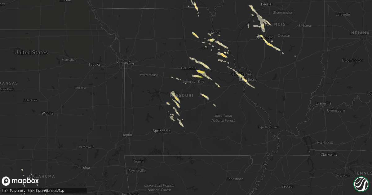
Hail Map in Missouri on June 28, 2015
Get this storm
June 28 map
$229
one time, instant access
Download today. No call, no setup
Keep the $229
Bought the map and want the full workflow? Apply the entire $229 to a subscription within 7 days. None of it is wasted.
Every map, not just this one
This buys you this map. Subscription and you get every map we run, in the markets you choose from a few cities to whole states to nationwide. Plus real-time alerts the moment a storm fires.
Contact data
Name, contact info, occupancy, even credit band for addresses in the footprint. You go from where it hit to who to call.
Become the source they trust
Unlimited branding weather history reports on demand. You already have the documented answer ready for the property owner, and you are the one who showed up with it.
Property data and RoofTrace estimates
Pull up any address you have got, its value and the exact code rules for that jurisdiction, straight from One Click Code. Then RoofTrace estimates the squares, pitch, and roof value, priced the way you price.
Storm reports in Missouri
Missouri
| Date | Description |
|---|---|
| 06/28/20156:59 PM CDT | Spotter reported nickel and quarter sized hail. |
| 06/28/20156:30 PM CDT | On us hwy 61 south of hwy ww...rain wrapped tornado...tractor trailers blown off the road |
| 06/28/20156:30 PM CDT | 3 touchdowns...tree damage...no other information at this time. |
| 06/28/20156:30 PM CDT | A local report indicates 1.75 inch wind near 3 NW EOLIA |
| 06/28/20156:26 PM CDT | Tornado on the ground...but has become rain wrapped. Spotter was near intersection of highways hh and z in northern lincoln county looking to the north. |
| 06/28/20156:13 PM CDT | Also nickel size hail |
| 06/28/20155:55 PM CDT | Ongoing |
| 06/28/20155:47 PM CDT | Tornado on the ground with some debris in air. West of us highway 54. |
| 06/28/20155:47 PM CDT | Tornado on the ground with some debris in air. West of us highway 54. |
| 06/28/20155:10 PM CDT | A local report indicates 1.00 inch wind near FULTON |
| 06/28/20154:30 PM CDT | Local law enforcement reports trees and power lines down around town |
| 06/28/20154:06 PM CDT | A local report indicates 1.25 inch wind near 5 W HANNIBAL |
| 06/27/20159:05 PM CDT | Tower grove park |
| 06/27/20158:58 PM CDT | Arsenal and hampton |
| 06/27/20158:54 PM CDT | Highway 40 and mccausland. |
| 06/27/20158:51 PM CDT | A local report indicates 1.00 inch wind near 1 S BRENTWOOD |
| 06/27/20158:50 PM CDT | One large tree and several smaller trees blown down one to two miles south southeast of grovespring. All trees were laying to the southwest. Time estimated by radar. |
| 06/27/20158:50 PM CDT | Brentwood forest area. |
| 06/27/20158:50 PM CDT | A local report indicates 1.00 inch wind near BRENTWOOD |
| 06/27/20158:46 PM CDT | A couple of trees down and a hay barn damaged in the vicinity of highway m/h and parks creek road. |
| 06/27/20158:45 PM CDT | 3 to 4 sycamore trees down on parks creek rd. Time estimated by radar |
| 06/27/20158:14 PM CDT | I70 near missouri river |
| 06/27/20158:09 PM CDT | At hwy 370 and harry truman. |
| 06/27/20158:07 PM CDT | Debris seen north of arrowhead industrial blvd...just west northwest of hwy 370. |
| 06/27/20158:05 PM CDT | Large trees and power lines down. Roof damage reported to homes. |
All States Impacted by Hail Map on June 28, 2015
Cities Impacted by Hail Map on June 28, 2015
- Erie, KS
- Chanute, KS
- Belle Fourche, SD
- Auxvasse, MO
- Colorado Springs, CO
- Strasburg, CO
- Bennett, CO
- Shoshoni, WY
- Shelbyville, MO
- Leonard, MO
- Camdenton, MO
- Osage Beach, MO
- Linn Creek, MO
- Sunrise Beach, MO
- Eolia, MO
- Clarksville, MO
- Louisiana, MO
- Bowling Green, MO
- Belle, MO
- Saint James, MO
- Vichy, MO
- Vienna, MO
- Macomb, OK
- Tecumseh, OK
- Custer, SD
- Grovespring, MO
- Lebanon, MO
- Fort Lupton, CO
- Hudson, CO
- Brighton, CO
- Pueblo, CO
- Thoreau, NM
- Arbela, MO
- Memphis, MO
- Cantril, IA
- Taylor, MO
- Hermann, MO
- Calumet, OK
- Douglas, WY
- Forest City, IL
- Manito, IL
- San Jose, IL
- Kincaid, IL
- Pawnee, IL
- Taylorville, IL
- Edinburg, IL
- Bulpitt, IL
- Tovey, IL
- Grover, CO
- Hereford, CO
- Carpenter, WY
- Burns, WY
- Bushnell, NE
- Millwood, GA
- Saint Louis, MO
- Milton, IA
- Fulton, MO
- Steedman, MO
- Rochester, IL
- Springfield, IL
- Chatham, IL
- Limon, CO
- Agate, CO
- Watkins, CO
- Fremont, IA
- Greenview, IL
- Mason City, IL
- Athens, IL
- Canton, IL
- Larkspur, CO
- Hartsburg, IL
- New Holland, IL
- Lincoln, IL
- Ramah, CO
- Saint Charles, MO
- Chesterfield, MO
- Maryland Heights, MO
- Saint Peters, MO
- Spearfish, SD
- Lead, SD
- Fairview, IL
- Montgomery City, MO
- Williamsburg, MO
- Paducah, TX
- Montreal, MO
- Versailles, MO
- Stover, MO
- Gravois Mills, MO
- Rush, CO
- New Bloomfield, MO
- Leslie, MO
- Gerald, MO
- Long Lane, MO
- Phillipsburg, MO
- La Salle, CO
- Centralia, MO
- Mexico, MO
- Thompson, MO
- Le Sueur, MN
- Belle Plaine, MN
- Henderson, MN
- Buffalo, MO
- Mora, NM
- Chamisal, NM
- Mountain View, OK
- Owaneco, IL
- Pana, IL
- Pleasant Plains, IL
- Calhan, CO
- Payson, IL
- Macks Creek, MO
- Toledo, IA
- Clutier, IA
- Kinderhook, IL
- New London, MO
- New Canton, IL
- Willow, OK
- Curryville, MO
- Elsberry, MO
- Troy, MO
- Lexington, OK
- Noble, OK
- Elbert, CO
- Eldridge, MO
- Mangum, OK
- Hannibal, MO
- California, MO
- Socorro, NM
- Havana, IL
- Elizabeth, CO
- Choctaw, OK
- Petersburg, IL
- Farmington, IL
- New Haven, MO
- Owensville, MO
- Parker, CO
- Sigel, IL
- Neoga, IL
- Stewardson, IL
- Medicine Lodge, KS
- New Berlin, IL
- Assumption, IL
- Chamois, MO
- Morrison, MO
- Oklahoma City, OK
- Norman, OK
- Newalla, OK
- Hill City, SD
- Hugo, CO
- Briggsdale, CO
- Niangua, MO
- Hartville, MO
- Conway, MO
- Monroe City, MO
- Georgetown, TX
- Pleasant Hill, IL
- Palmyra, MO
- Rhineland, MO
- Portland, MO
- Norwood, MO
- Shelbina, MO
- Moscow Mills, MO
- Roach, MO
- Stoutland, MO
- Eldorado, OK
- Mountainair, NM
- Commerce City, CO
- Millstadt, IL
- Manor, GA
- Byers, CO
- Hennessey, OK
- Buffalo, SD
- Piedmont, KS
- Peyton, CO
- Waterloo, IA
- Quanah, TX
- Woodland Park, CO
- Mokane, MO
- Oakford, IL
- Steelville, MO
- Martinsburg, MO
- Benton City, MO
- Hinton, OK
- Minco, OK
- Old Monroe, MO
- Selma, IA
- Crownpoint, NM
- Tierra Amarilla, NM
- Tunas, MO
- Argonia, KS
- Danville, KS
- Kingfisher, OK
- Pine Island, MN
- Hobart, OK
- Sturgis, SD
- Washington, OK
- Carnegie, OK
- Rockport, IL
- Syracuse, MO
- Otterville, MO
- Clarksburg, MO
- Tipton, MO
- Lingle, WY
- Tower Hill, IL
- O'Fallon, MO
- Round Mountain, TX
- Alzada, MT
- Center, MO
- Emden, IL
- Frankford, MO
- Cordell, OK
- Belleville, IL
- Smithton, IL
- Bridgeton, MO
- Columbia, IL
- East Carondelet, IL
- Freeburg, IL
- Saint Ann, MO
- Dupo, IL
- Cross Timbers, MO
- Preston, MO
- Tijeras, NM
- Vandalia, MO
- Casper, WY
- Russellville, MO
- Lohman, MO
- Gorin, MO
- Bloomfield, IA
- Floris, IA
- Liverpool, IL
- Lewistown, IL
- Tererro, NM
- Chandlerville, IL
- Bath, IL
- Garrett, WY
- Cheyenne, WY
- Traer, IA
- Tama, IA
- Macomb, IL
- Tebbetts, MO
- Piedmont, OK
- Yukon, OK
- Cantrall, IL
- Kilbourne, IL
- Sherman, IL
- Williamsville, IL
- Topeka, IL
- Easton, IL
- Okeene, OK
- Liberty, IL
- Hull, IL
- Williams, AZ
- Pine Bluffs, WY
- Brunswick, GA
- Bluff City, KS
- Silex, MO
- Middletown, MO
- Hollywood, SC
- Sturgeon, MO
- Maywood, MO
- New Florence, MO
- Ashland, MO
- Okarche, OK
- Duke, OK
- Spencer, OK


