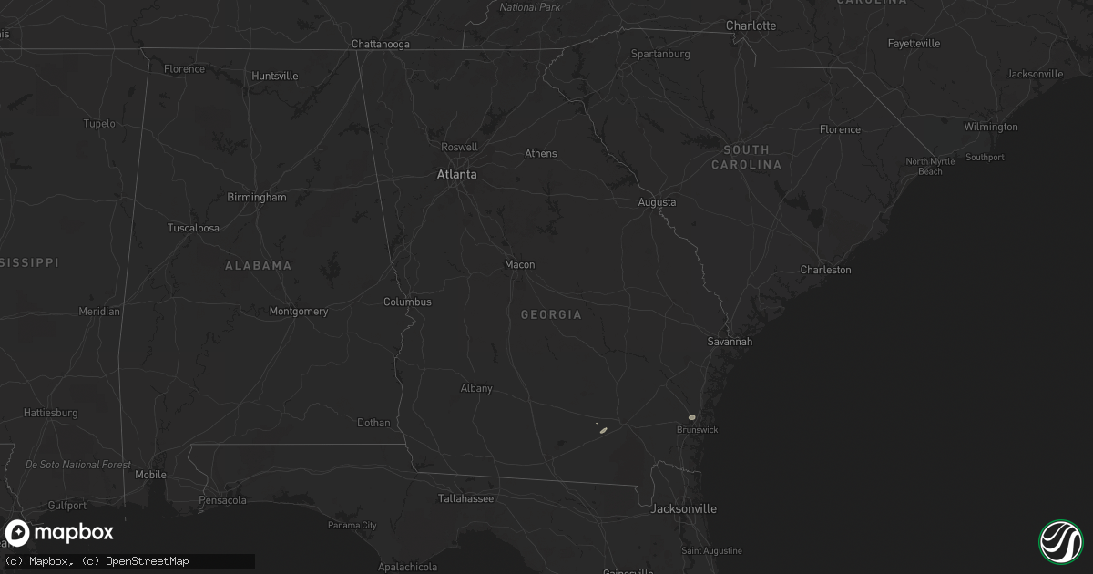
Hail Map in Georgia on June 28, 2015
Get this storm
June 28 map
$229
one time, instant access
Download today. No call, no setup
Keep the $229
Bought the map and want the full workflow? Apply the entire $229 to a subscription within 7 days. None of it is wasted.
Every map, not just this one
This buys you this map. Subscription and you get every map we run, in the markets you choose from a few cities to whole states to nationwide. Plus real-time alerts the moment a storm fires.
Contact data
Name, contact info, occupancy, even credit band for addresses in the footprint. You go from where it hit to who to call.
Become the source they trust
Unlimited branding weather history reports on demand. You already have the documented answer ready for the property owner, and you are the one who showed up with it.
Property data and RoofTrace estimates
Pull up any address you have got, its value and the exact code rules for that jurisdiction, straight from One Click Code. Then RoofTrace estimates the squares, pitch, and roof value, priced the way you price.
Storm reports in Georgia
Georgia
| Date | Description |
|---|---|
| 06/28/20152:00 PM CDT | Trees were blown down along chester mattox road. |
| 06/28/20151:45 PM CDT | Tree down in the clyattville area |
| 06/28/20151:41 PM CDT | Power line down on the north side of valdosta |
| 06/28/201512:38 PM CDT | Tree down across railroad tracks 4 miles east of homerville. |
| 06/28/201512:32 PM CDT | Powerline down on sand hill road in homerville. |
All States Impacted by Hail Map on June 28, 2015
Cities Impacted by Hail Map on June 28, 2015
- Erie, KS
- Chanute, KS
- Belle Fourche, SD
- Auxvasse, MO
- Colorado Springs, CO
- Strasburg, CO
- Bennett, CO
- Shoshoni, WY
- Shelbyville, MO
- Leonard, MO
- Camdenton, MO
- Osage Beach, MO
- Linn Creek, MO
- Sunrise Beach, MO
- Eolia, MO
- Clarksville, MO
- Louisiana, MO
- Bowling Green, MO
- Belle, MO
- Saint James, MO
- Vichy, MO
- Vienna, MO
- Macomb, OK
- Tecumseh, OK
- Custer, SD
- Grovespring, MO
- Lebanon, MO
- Fort Lupton, CO
- Hudson, CO
- Brighton, CO
- Pueblo, CO
- Thoreau, NM
- Arbela, MO
- Memphis, MO
- Cantril, IA
- Taylor, MO
- Hermann, MO
- Calumet, OK
- Douglas, WY
- Forest City, IL
- Manito, IL
- San Jose, IL
- Kincaid, IL
- Pawnee, IL
- Taylorville, IL
- Edinburg, IL
- Bulpitt, IL
- Tovey, IL
- Grover, CO
- Hereford, CO
- Carpenter, WY
- Burns, WY
- Bushnell, NE
- Millwood, GA
- Saint Louis, MO
- Milton, IA
- Fulton, MO
- Steedman, MO
- Rochester, IL
- Springfield, IL
- Chatham, IL
- Limon, CO
- Agate, CO
- Watkins, CO
- Fremont, IA
- Greenview, IL
- Mason City, IL
- Athens, IL
- Canton, IL
- Larkspur, CO
- Hartsburg, IL
- New Holland, IL
- Lincoln, IL
- Ramah, CO
- Saint Charles, MO
- Chesterfield, MO
- Maryland Heights, MO
- Saint Peters, MO
- Spearfish, SD
- Lead, SD
- Fairview, IL
- Montgomery City, MO
- Williamsburg, MO
- Paducah, TX
- Montreal, MO
- Versailles, MO
- Stover, MO
- Gravois Mills, MO
- Rush, CO
- New Bloomfield, MO
- Leslie, MO
- Gerald, MO
- Long Lane, MO
- Phillipsburg, MO
- La Salle, CO
- Centralia, MO
- Mexico, MO
- Thompson, MO
- Le Sueur, MN
- Belle Plaine, MN
- Henderson, MN
- Buffalo, MO
- Mora, NM
- Chamisal, NM
- Mountain View, OK
- Owaneco, IL
- Pana, IL
- Pleasant Plains, IL
- Calhan, CO
- Payson, IL
- Macks Creek, MO
- Toledo, IA
- Clutier, IA
- Kinderhook, IL
- New London, MO
- New Canton, IL
- Willow, OK
- Curryville, MO
- Elsberry, MO
- Troy, MO
- Lexington, OK
- Noble, OK
- Elbert, CO
- Eldridge, MO
- Mangum, OK
- Hannibal, MO
- California, MO
- Socorro, NM
- Havana, IL
- Elizabeth, CO
- Choctaw, OK
- Petersburg, IL
- Farmington, IL
- New Haven, MO
- Owensville, MO
- Parker, CO
- Sigel, IL
- Neoga, IL
- Stewardson, IL
- Medicine Lodge, KS
- New Berlin, IL
- Assumption, IL
- Chamois, MO
- Morrison, MO
- Oklahoma City, OK
- Norman, OK
- Newalla, OK
- Hill City, SD
- Hugo, CO
- Briggsdale, CO
- Niangua, MO
- Hartville, MO
- Conway, MO
- Monroe City, MO
- Georgetown, TX
- Pleasant Hill, IL
- Palmyra, MO
- Rhineland, MO
- Portland, MO
- Norwood, MO
- Shelbina, MO
- Moscow Mills, MO
- Roach, MO
- Stoutland, MO
- Eldorado, OK
- Mountainair, NM
- Commerce City, CO
- Millstadt, IL
- Manor, GA
- Byers, CO
- Hennessey, OK
- Buffalo, SD
- Piedmont, KS
- Peyton, CO
- Waterloo, IA
- Quanah, TX
- Woodland Park, CO
- Mokane, MO
- Oakford, IL
- Steelville, MO
- Martinsburg, MO
- Benton City, MO
- Hinton, OK
- Minco, OK
- Old Monroe, MO
- Selma, IA
- Crownpoint, NM
- Tierra Amarilla, NM
- Tunas, MO
- Argonia, KS
- Danville, KS
- Kingfisher, OK
- Pine Island, MN
- Hobart, OK
- Sturgis, SD
- Washington, OK
- Carnegie, OK
- Rockport, IL
- Syracuse, MO
- Otterville, MO
- Clarksburg, MO
- Tipton, MO
- Lingle, WY
- Tower Hill, IL
- O'Fallon, MO
- Round Mountain, TX
- Alzada, MT
- Center, MO
- Emden, IL
- Frankford, MO
- Cordell, OK
- Belleville, IL
- Smithton, IL
- Bridgeton, MO
- Columbia, IL
- East Carondelet, IL
- Freeburg, IL
- Saint Ann, MO
- Dupo, IL
- Cross Timbers, MO
- Preston, MO
- Tijeras, NM
- Vandalia, MO
- Casper, WY
- Russellville, MO
- Lohman, MO
- Gorin, MO
- Bloomfield, IA
- Floris, IA
- Liverpool, IL
- Lewistown, IL
- Tererro, NM
- Chandlerville, IL
- Bath, IL
- Garrett, WY
- Cheyenne, WY
- Traer, IA
- Tama, IA
- Macomb, IL
- Tebbetts, MO
- Piedmont, OK
- Yukon, OK
- Cantrall, IL
- Kilbourne, IL
- Sherman, IL
- Williamsville, IL
- Topeka, IL
- Easton, IL
- Okeene, OK
- Liberty, IL
- Hull, IL
- Williams, AZ
- Pine Bluffs, WY
- Brunswick, GA
- Bluff City, KS
- Silex, MO
- Middletown, MO
- Hollywood, SC
- Sturgeon, MO
- Maywood, MO
- New Florence, MO
- Ashland, MO
- Okarche, OK
- Duke, OK
- Spencer, OK


