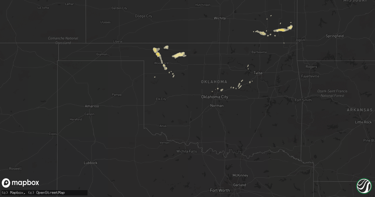
Hail Map in Oklahoma on June 28, 2014
Get this storm
June 28 map
$229
one time, instant access
Download today. No call, no setup
Keep the $229
Bought the map and want the full workflow? Apply the entire $229 to a subscription within 7 days. None of it is wasted.
Every map, not just this one
This buys you this map. Subscription and you get every map we run, in the markets you choose from a few cities to whole states to nationwide. Plus real-time alerts the moment a storm fires.
Contact data
Name, contact info, occupancy, even credit band for addresses in the footprint. You go from where it hit to who to call.
Become the source they trust
Unlimited branding weather history reports on demand. You already have the documented answer ready for the property owner, and you are the one who showed up with it.
Property data and RoofTrace estimates
Pull up any address you have got, its value and the exact code rules for that jurisdiction, straight from One Click Code. Then RoofTrace estimates the squares, pitch, and roof value, priced the way you price.
Storm reports in Oklahoma
Oklahoma
| Date | Description |
|---|---|
| 06/28/20143:50 PM CDT | Large tree down |
| 06/28/20143:24 PM CDT | Early reports of homes damaged and power lines down. Additional details to be provided later. |
| 06/28/20143:24 PM CDT | The track and intensity of the tornado has yet to be determined. This information will be made available on monday. |
| 06/28/20142:45 PM CDT | A local report indicates 63 MPH wind near 3 W VERDIGRIS |
| 06/28/20142:38 PM CDT | Debris blow 100 yards. Fence blown down. |
| 06/28/201411:30 AM CDT | Numerous tree limbs up to five inches in diameter snapped of trees. |
| 06/28/201411:25 AM CDT | Awning covering gas pumps blown away at the i-35 / state hwy 11 interchange. |
| 06/28/201411:20 AM CDT | A local report indicates 58 MPH wind near 6 W BLACKWELL |
| 06/28/201410:45 AM CDT | A local report indicates 60 MPH wind near POND CREEK |
| 06/28/201410:25 AM CDT | A local report indicates 65 MPH wind near RINGWOOD |
| 06/28/201410:00 AM CDT | Reported at great salt plains park office. |
| 06/28/20149:35 AM CDT | A local report indicates 71 MPH wind near 1 SSW CHEROKEE |
| 06/28/20149:00 AM CDT | A local report indicates 60 MPH wind near HOPETON |
| 06/28/20148:55 AM CDT | A local report indicates 61 MPH wind near 7 SSW ALVA |
| 06/28/20148:40 AM CDT | A local report indicates 60 MPH wind near 7 E WAYNOKA |
| 06/28/20148:15 AM CDT | A local report indicates 59 MPH wind near 3 SSW FREEDOM |
| 06/28/20147:58 AM CDT | A local report indicates 60 MPH wind near 12 SSE SELMAN |
All States Impacted by Hail Map on June 28, 2014
Cities Impacted by Hail Map on June 28, 2014
- Winnsboro, LA
- Broken Bow, NE
- Callaway, NE
- Goodland, KS
- Ewing, NE
- Buffalo, OK
- Bridger, MT
- Chiefland, FL
- Bellevue, NE
- Council Bluffs, IA
- Springfield, SD
- Niobrara, NE
- Lynch, NE
- Verdigre, NE
- Tuthill, SD
- Saint Francis, SD
- Stuart, NE
- Atkinson, NE
- Wewahitchka, FL
- Winona, KS
- Wallace, KS
- Cedar Lake, IN
- Alford, FL
- Dunnellon, FL
- Humboldt, IA
- Fort Dodge, IA
- Brinkley, AR
- Cotton Plant, AR
- Beebe, AR
- Ottosen, IA
- Rolfe, IA
- Yankton, SD
- Tilden, NE
- Battle Creek, NE
- Meadow Grove, NE
- Sarasota, FL
- Richton, MS
- Columbia, MS
- Oklahoma City, OK
- Edmond, OK
- Sanborn, IA
- Primghar, IA
- Archer, IA
- Larrabee, IA
- Meriden, IA
- Cleghorn, IA
- Cherokee, IA
- Paullina, IA
- Peterson, IA
- Sutherland, IA
- Howells, NE
- Fremont, NE
- Scribner, NE
- Clarkson, NE
- Crescent, IA
- Wisner, NE
- Bennington, NE
- North Bend, NE
- Hoskins, NE
- Hooper, NE
- Boys Town, NE
- Schuyler, NE
- Stanton, NE
- Pilger, NE
- Cedar Bluffs, NE
- Kennard, NE
- Dodge, NE
- Arlington, NE
- Ames, NE
- Elkhorn, NE
- Rogers, NE
- Omaha, NE
- Blair, NE
- Nickerson, NE
- Fort Calhoun, NE
- Valley, NE
- Marion, AL
- Utica, KS
- Ransom, KS
- Mills, NE
- Grinnell, KS
- Gove, KS
- Quinter, KS
- Craig, NE
- Herman, NE
- Tekamah, NE
- Punta Gorda, FL
- Goldfield, IA
- Renwick, IA
- Burlington, CO
- Clearwater, NE
- Oakdale, NE
- West Point, NE
- Albion, NE
- Meridian, MS
- Oakland, NE
- Depew, OK
- Drumright, OK
- Bristow, OK
- Osyka, MS
- Kentwood, LA
- Orland Park, IL
- Oak Forest, IL
- Tinley Park, IL
- Becker, MN
- Alton, IA
- Remsen, IA
- Marcus, IA
- Fayette, MS
- Corning, IA
- Prescott, IA
- Gravity, IA
- Lenox, IA
- Smithland, IA
- Mutual, OK
- Vermillion, SD
- Merrill, IA
- Hinton, IA
- Burbank, SD
- Elk Point, SD
- Akron, IA
- Kingsley, IA
- Le Mars, IA
- Westfield, IA
- State Line, MS
- Woodward, OK
- Kiron, IA
- Forest Lake, MN
- Norfolk, NE
- Pierce, NE
- Hoisington, KS
- Great Bend, KS
- Collyer, KS
- Wakeeney, KS
- Mount Olive, MS
- York, AL
- Cuba, AL
- Petersburg, NE
- Minneapolis, MN
- Parsons, KS
- Marvell, AR
- Westerville, NE
- Arcadia, NE
- Gothenburg, NE
- Ansley, NE
- Alva, OK
- Waynoka, OK
- Dacoma, OK
- Fontanelle, IA
- McCune, KS
- Grant Park, IL
- Beecher, IL
- Oneill, NE
- Center, NE
- Pawnee Rock, KS
- Larned, KS
- Albert, KS
- Otis, KS
- Bison, KS
- Olmitz, KS
- Springview, NE
- Bassett, NE
- Humphrey, NE
- Genoa, WI
- De Soto, WI
- Elgin, NE
- Newman Grove, NE
- Primrose, NE
- Bartlett, NE
- Freeman, SD
- Bassfield, MS
- Claflin, KS
- Dighton, KS
- Healy, KS
- Monument, KS
- Oakley, KS
- Mission Hill, SD
- Beresford, SD
- Alcester, SD
- West Monroe, LA
- West Bend, IA
- Longton, KS
- Sharon Springs, KS
- Kanorado, KS
- Mason City, NE
- Oconto, NE
- Independence, KS
- Elk City, KS
- Bagley, IA
- Jamaica, IA
- Yale, IA
- Wyoming, MN
- Andover, MN
- Freedom, OK
- Martin, SD
- Newport, NE
- England, AR
- Newellton, LA
- Bloomfield, NE
- Washington, NE
- Wakonda, SD
- Volin, SD
- Avon, SD
- Fort Supply, OK
- Wynot, NE
- Gayville, SD
- Saint Helena, NE
- Irene, SD
- Menno, SD
- Utica, SD
- Eads, TN
- Belmond, IA
- Port Charlotte, FL
- Louin, MS
- Allen, NE
- Wakefield, NE
- Emerson, NE
- Jefferson, IA
- Paton, IA
- Bristow, NE
- Laurens, IA
- Webb, IA
- Curlew, IA
- Davenport, OK
- Chandler, OK
- Crofton, NE
- Mallard, IA
- Naples, FL
- Edson, KS
- Weskan, KS
- Brewster, KS
- Creston, NE
- Columbus, NE
- Story City, IA
- Jewell, IA
- Fordyce, NE
- Ellsworth, IA
- Cape Coral, FL
- Linn Grove, IA
- Jackson, AL
- Enterprise, LA
- Harrisonburg, LA
- Columbia, LA
- Saint Paul, MN
- Brookhaven, MS
- Hawarden, IA
- Ireton, IA
- Blue Earth, MN
- Silas, AL
- Stuttgart, AR
- Creighton, NE
- Winnetoon, NE
- Ruleville, MS
- Minter City, MS
- Storm Lake, IA
- Albert City, IA
- Stroud, OK
- Vicksburg, MS
- Rush Center, KS
- Hugo, MN
- Tabor, SD
- Chunky, MS
- Sharon, OK
- Welch, OK
- Ward, AR
- Olla, LA
- Mapleton, IA
- Oto, IA
- Moville, IA
- Anthon, IA
- Hornick, IA
- Kanawha, IA
- Garner, IA
- Tyndall, SD
- McCracken, KS
- Sweet Water, AL
- Gould, AR
- Bay Minette, AL
- Vici, OK
- Wall, SD
- Charter Oak, IA
- Battle Creek, IA
- Denison, IA
- Danbury, IA
- Schleswig, IA
- Sloan, IA
- Salix, IA
- Hartley, IA
- Wagner, SD
- Buffalo, KS
- Benedict, KS
- Orange City, IA
- Maurice, IA
- Burwell, NE
- Sergeant Bluff, IA
- Orchard, NE
- Somers, IA
- Coleridge, NE
- Wallace, NE
- Northwood, IA
- Lake Mills, IA
- Joice, IA
- Mountain, WI
- Ridgeway, IA
- Colby, KS
- Almyra, AR
- Crocketts Bluff, AR
- Casscoe, AR
- Shuqualak, MS
- Deerwood, MN
- Scotland, SD
- Clutier, IA
- Jonesville, LA
- Aimwell, LA
- Momence, IL
- Emery, SD
- Bridgewater, SD
- Hull, IA
- Crenshaw, MS
- Gillett, AR
- De Witt, AR
- Pittsburg, KS
- Girard, KS
- Kellyville, OK
- Stacy, MN
- North Branch, MN
- Saint Paul, KS
- Midland, SD
- Moorland, IA
- Roxie, MS
- Fairfax, SD
- Spencer, NE
- Delhi, LA
- Searcy, AR
- Cherokee, KS
- Dunkerton, IA
- Waterloo, IA
- Tulsa, OK
- McRae, AR
- Lesterville, SD
- Olivet, SD
- Sioux Center, IA
- Sledge, MS
- Page, NE
- Bogue Chitto, MS
- Circle Pines, MN
- Paulding, MS
- Myakka City, FL
- Collinsville, MS
- Lowell, IN
- Crown Point, IN
- Carroll, NE
- Granville, IA
- La Porte City, IA
- Vilonia, AR
- El Paso, AR
- Waynesboro, MS
- Middleton, TN
- Mayer, MN
- Marion Junction, AL
- Centerville, SD
- Swatara, MN
- Brooksville, FL
- Collins, MS
- Clare, IA
- Hudson, SD
- Lyon, MS
- Clarksdale, MS
- Enid, MS
- Mount Hermon, LA
- Arcadia, OK
- Luther, OK
- Jones, OK
- La Crosse, KS
- Madison, NE
- Fonda, IA
- Pocahontas, IA
- Palmer, IA
- Miami, FL
- Trout, LA
- Leakesville, MS
- Marianna, FL
- Fountain, FL
- Spalding, NE
- Vona, CO
- Winside, NE
- Marks, MS
- Little Rock, AR
- Osage, OK
- Sheridan, AR
- Jefferson, AR
- Redfield, AR
- Hensley, AR
- Parrish, FL
- Brownell, KS
- Uniontown, AL
- Seiling, OK
- Humboldt, KS
- Quinn, SD
- Rembrandt, IA
- Lindstrom, MN
- Dennis, KS
- Amboy, MN
- Cherryvale, KS
- Lake Andes, SD
- De Kalb, MS
- Hominy, OK
- Taloga, OK
- Vredenburgh, AL
- Bonesteel, SD
- Frankville, AL
- Twin Lakes, MN
- Hospers, IA
- Alden, IA
- Radcliffe, IA
- Williams, IA
- Lorman, MS
- Port Gibson, MS
- Alma, WI
- Boligee, AL
- Koshkonong, MO
- Chicago, IL
- Starkville, MS
- Mississippi State, MS
- Holly Grove, AR
- Ovett, MS
- Gowrie, IA
- Viroqua, WI
- Clarion, IA
- Havelock, IA
- Sioux Rapids, IA
- Newcastle, NE
- Calumet, IA
- Royal, IA
- Inman, NE
- Aurelia, IA
- Young America, MN
- Norwood Young America, MN
- Almena, WI
- Bay Springs, MS
- Osprey, FL
- Callender, IA
- Scott, AR
- Canton, MS
- Alta, IA
- River Falls, WI
- Scandia, MN
- Chisago City, MN
- Mound Valley, KS
- Altamont, KS
- Marshalltown, IA
- Gilman, IA
- Arnett, OK
- Elberon, IA
- Wayne, NE
- Senatobia, MS
- Coldwater, MS
- Pickens, MS
- Camden, MS
- Ames, IA
- Mooreland, OK
- Randolph, NE


