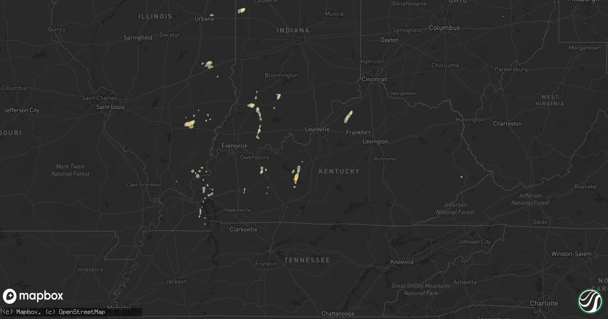
Hail Map in Kentucky on June 23, 2014
Get this storm
June 23 map
$229
one time, instant access
Download today. No call, no setup
Keep the $229
Bought the map and want the full workflow? Apply the entire $229 to a subscription within 7 days. None of it is wasted.
Every map, not just this one
This buys you this map. Subscription and you get every map we run, in the markets you choose from a few cities to whole states to nationwide. Plus real-time alerts the moment a storm fires.
Contact data
Name, contact info, occupancy, even credit band for addresses in the footprint. You go from where it hit to who to call.
Become the source they trust
Unlimited branding weather history reports on demand. You already have the documented answer ready for the property owner, and you are the one who showed up with it.
Property data and RoofTrace estimates
Pull up any address you have got, its value and the exact code rules for that jurisdiction, straight from One Click Code. Then RoofTrace estimates the squares, pitch, and roof value, priced the way you price.
Storm reports in Kentucky
Kentucky
| Date | Description |
|---|---|
| 06/23/20146:45 PM CDT | Roof damage to the water treatment plant... The southern states building... And trees downed on power lines. |
| 06/23/20146:34 PM CDT | Roofing peeled off a garage. Numerous small branches and a couple trees down in the area. Time estimated. |
| 06/23/20146:06 PM CDT | Trees down across the county |
| 06/23/20145:48 PM CDT | Trees down in the river road... Bethlehem road area around drennon springs. |
| 06/23/20144:30 PM CDT | Trees down...roof damage to a barn. Relayed by media. |
| 06/23/20144:23 PM CDT | Also reported high winds |
| 06/23/20144:17 PM CDT | Tree uprooted. Also had nickel size hail. |
| 06/22/20148:55 PM CDT | Half of a tree downed by strong winds. |
| 06/22/20148:35 PM CDT | Tree down on clay lane. |
| 06/22/20148:30 PM CDT | Trees down on cartersville road. |
| 06/22/20148:15 PM CDT | Trees down sw of cynthiana starting at hicks pike |
| 06/22/20148:07 PM CDT | Trees down over eastern parts of lincoln county. |
| 06/22/20147:45 PM CDT | Wooden swing set toppled and twisted...estimated wind speeds of 50-60 mph |
| 06/22/20147:44 PM CDT | Trees down across the county |
| 06/22/20147:40 PM CDT | Numerous trees downed along j n lee road near perry park. |
| 06/22/20147:12 PM CDT | A local report indicates 62 MPH wind near PLEASUREVILLE |
All States Impacted by Hail Map on June 23, 2014
Cities Impacted by Hail Map on June 23, 2014
- Lake Arthur, NM
- Fort Lupton, CO
- Brighton, CO
- Fort Morgan, CO
- Washington, IN
- Junction, TX
- Bedford, IN
- Williams, IN
- Akron, CO
- Logan, NM
- Nara Visa, NM
- Commerce City, CO
- Lake Odessa, MI
- Marathon, TX
- Alpine, TX
- Anton, CO
- Cope, CO
- Clayton, NM
- Napoleon, OH
- Liberty Center, OH
- Wauseon, OH
- Archbold, OH
- Mayhill, NM
- Buford, WY
- Laramie, WY
- Kermit, TX
- Otis, CO
- Haxtun, CO
- Brush, CO
- Fairfield, IL
- Sims, IL
- Waterloo, IN
- Ashley, IN
- Lima, OH
- Hartford, KY
- Utica, KY
- Whitesville, KY
- Yuma, CO
- Seminole, TX
- Odessa, TX
- Comstock, TX
- Carthage, TX
- Denver, CO
- Lincoln, NM
- Vega, TX
- Milford, IL
- Earl Park, IN
- Kentland, IN
- Ambia, IN
- Fowler, IN
- Goshen, IN
- Bristol, IN
- Goldsmith, TX
- Cedar Lake, IN
- Beecher, IL
- Lowell, IN
- Campbellsburg, KY
- Perry Park, KY
- Lockport, KY
- Owenton, KY
- Churubusco, IN
- Deer Trail, CO
- Agate, CO
- Snyder, CO
- Ribera, NM
- Anton Chico, NM
- Dowagiac, MI
- Crown Point, IN
- Rocky Ford, CO
- Fort Stockton, TX
- Iraan, TX
- Erin, TN
- Vanleer, TN
- Greeley, CO
- State Line, MS
- Buckatunna, MS
- Imperial, TX
- Ashland City, TN
- Clarksville, TN
- Arriba, CO
- Albion, IN
- Warren, IN
- Huntington, IN
- Hudson, CO
- Valparaiso, IN
- Wanatah, IN
- Garita, NM
- Beulah, CO
- Pueblo, CO
- Acworth, GA
- Dallas, GA
- Powder Springs, GA
- Kennesaw, GA
- La Junta, CO
- Carr, CO
- Wellington, CO
- Fort McCoy, FL
- Tie Siding, WY
- Sierra Blanca, TX
- Dexter, KY
- Des Moines, NM
- Capulin, NM
- Trementina, NM
- Wellington, FL
- Loxahatchee, FL
- Marietta, GA
- Leitchfield, KY
- Clarkson, KY
- Frankfort, KS
- Beattie, KS
- Momence, IL
- Joes, CO
- Vona, CO
- Stratton, CO
- Lindon, CO
- Montgomery, IN
- Oblong, IL
- Texline, TX
- Brook, IN
- Morocco, IN
- Cheyenne, WY
- Fleming, CO
- Cassopolis, MI
- West Salem, IL
- Albion, IL
- Watkins, CO
- Peotone, IL
- Manteno, IL
- Mountain Home, TX
- Mosquero, NM
- Melrose, NM
- Crane, TX
- Union Pier, MI
- New Buffalo, MI
- Lakeside, MI
- Hondo, NM
- Tinnie, NM
- Salt Flat, TX
- Big Clifty, KY
- Eastview, KY
- Mammoth Cave, KY
- Ozona, TX
- Eglin Afb, FL
- Keenes, IL
- Canyon, TX
- Stanton, TX
- Midland, TX
- Vaughn, NM
- Lucedale, MS
- Kim, CO
- Turners Station, KY
- Bethlehem, KY
- Eminence, KY
- Pleasureville, KY
- New Castle, KY
- Elkhart, IN
- Artesia, NM
- Hartley, TX
- Florence, AL
- Cecilia, KY
- Chattanooga, TN
- Kimbolton, OH
- Montezuma, NM
- Las Vegas, NM
- Pecos, TX
- Granite Canon, WY
- Cave In Rock, IL
- Clay City, IL
- Holyoke, CO
- Richton, MS
- New Augusta, MS
- Rossford, OH
- Toledo, OH
- Northwood, OH
- Millbury, OH
- Perrysburg, OH
- Walbridge, OH
- Hebron, IN
- Roswell, NM
- Kuttawa, KY
- Haviland, OH
- Raton, NM
- Lawrenceburg, TN
- Fort Davis, TX
- Rye, CO
- Orlando, FL
- Christmas, FL
- Burlington, CO
- Floyd, NM
- Searcy, AR
- Melbourne, FL
- Fostoria, OH
- Byers, CO
- Bryan, OH
- Stryker, OH
- Reliance, TN
- Paris, TN
- Cottage Grove, TN
- Lowndesboro, AL
- Big Lake, TX
- Morgantown, KY
- Lewisburg, KY
- Rosiclare, IL
- Saint Joseph, IL
- Weldona, CO
- Greenup, IL
- Casey, IL
- Charleston, IL
- La Salle, CO
- Maxwell, NM
- Maumee, OH
- Herod, IL
- Wayne City, IL
- Berrien Springs, MI
- Baroda, MI
- Buchanan, MI
- Odon, IN
- Plainville, IN
- Menard, TX
- Lerna, IL
- Toledo, IL
- Macon, GA
- Rocksprings, TX
- Marion, KY
- Grant Park, IL
- Westfield, IL
- Paulding, OH
- Grover Hill, OH
- Conchas Dam, NM
- Hickory, MS
- Solano, NM
- Williamsport, IN
- West Lebanon, IN
- Platteville, CO
- Medicine Lodge, KS
- Dale, IN
- Gentryville, IN
- Defiance, OH
- Ridgeville Corners, OH
- Jasper, IN
- Greenback, TN
- Loudon, TN
- Colorado Springs, CO
- Remington, IN
- Geff, IL
- Cisne, IL
- Log Lane Village, CO
- Fredonia, KY
- Rockledge, FL
- Edwardsburg, MI
- Nunn, CO
- Salem, KY
- Wiggins, CO
- Amistad, NM
- Elbert, CO
- Elizabethtown, IL
- Mitchell, IN
- Sweeden, KY
- Trinidad, CO
- Whitman, NE
- Navarre, FL
- Mary Esther, FL
- Hereford, TX
- Cocoa, FL
- Elnora, IN
- Markle, IN
- Sevierville, TN
- Bourbonnais, IL
- Buffalo Creek, CO
- Conifer, CO
- Larkspur, CO
- Huntingburg, IN
- Logansport, IN
- Fort Wayne, IN
- Otwell, IN
- Cannelburg, IN
- Adrian, TX
- Eddyville, KY
- Murray, KY
- Valley City, OH
- Pembroke Township, IL
- Orchard, CO
- Idaville, IN
- Royal Center, IN
- Burnettsville, IN
- Monticello, IN
- Mentor, OH
- Gilbertsville, KY
- Medina, OH
- Allegan, MI
- Forsyth, GA
- Wellington, IL
- Donovan, IL
- Sheldon, IL
- Avilla, IN
- Barnhill, IL
- Saint Anne, IL
- Harold, KY
- Holland, IN
- Bennett, CO
- Roggen, CO
- Madisonville, TN
- West Baden Springs, IN
- Shoals, IN
- Rock Creek, OH
- Rome, OH
- Jefferson, OH
- Tucumcari, NM
- Marion, IN
- Milliken, CO
- Hinckley, OH
- Hilliard, FL
- Benton, KY
- Golden Gate, IL
- Woodrow, CO
- Graham, KY
- White Plains, KY
- Grand Rivers, KY
- Flagler, CO
- Merino, CO
- Hillrose, CO
- Schneider, IN
- Lake Village, IN
- Clayton, AL
- Sheffield, TX
- Dryden, TX
- Oviedo, FL
- Van Horn, TX
- Sweetwater, TN
- Hardin, KY
- Almo, KY
- Seibert, CO
- Ringgold, LA
- Hagerman, NM
- Musella, GA
- Paoli, CO
- Fair Oaks, IN
- Fowler, KS
- Port Saint Lucie, FL
- Middlebury, IN
- Bluffton, IN
- Grantsburg, IL
- Vienna, IL
- Tiline, KY
- Hamilton, IN
- Butler, IN


