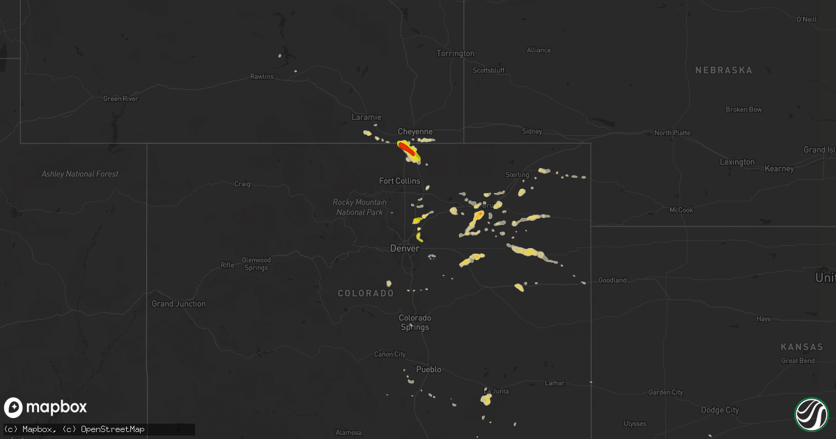
Hail Map on June 23, 2014
Get this storm
June 23 map
$229
one time, instant access
Download today. No call, no setup
Keep the $229
Bought the map and want the full workflow? Apply the entire $229 to a subscription within 7 days. None of it is wasted.
Every map, not just this one
This buys you this map. Subscription and you get every map we run, in the markets you choose from a few cities to whole states to nationwide. Plus real-time alerts the moment a storm fires.
Contact data
Name, contact info, occupancy, even credit band for addresses in the footprint. You go from where it hit to who to call.
Become the source they trust
Unlimited branding weather history reports on demand. You already have the documented answer ready for the property owner, and you are the one who showed up with it.
Property data and RoofTrace estimates
Pull up any address you have got, its value and the exact code rules for that jurisdiction, straight from One Click Code. Then RoofTrace estimates the squares, pitch, and roof value, priced the way you price.
States Impacted by Hail Map on June 23, 2014
Storm reports
Florida
| Date | Description |
|---|---|
| 06/23/20144:15 PM CDT | Reports from rockledge pd and wftv channel 9 orlando of concrete entrance sign destroyed... Multiple large tree limbs down...some on vehicles... Porch awnings and carport roo |
Louisiana
| Date | Description |
|---|---|
| 06/23/20146:10 PM CDT | Tree down on home on chatsworth drive. Another tree in the street on 1900 block of williamsburg drive. Power lines fell into a tree and caught it on fire on 2000 block |
| 06/23/20145:26 PM CDT | Measured 50 mph gust. |
Indiana
| Date | Description |
|---|---|
| 06/23/20145:15 PM CDT | Two trees blocking roads... One in madison... Another in the northern part of the county near ripley county. |
| 06/23/20144:35 PM CDT | Damage to a barn and trees. Public report relayed via wfft. |
| 06/23/20144:25 PM CDT | Large tree limbs and branches down |
| 06/23/20144:15 PM CDT | Numerous reports of tree limbs down across northeast portion of city |
| 06/23/20144:08 PM CDT | A local report indicates 60 MPH wind near 2 NE INDIANAPOLIS |
| 06/23/20143:50 PM CDT | Microburst in jasper caused fiberglass panel to be blown off of the side of jasper middle school...loose roofing construction materials blown off of jasper high school. |
| 06/23/20143:43 PM CDT | Large tree limb and other scattered limbs down. Time estimated from radar. |
| 06/23/20141:59 PM CDT | Top of a tree blew down... Taking out a power line and damaging a car. |
Arkansas
| Date | Description |
|---|---|
| 06/23/20145:59 PM CDT | Interstate 40 ramp near mile marker 142. Some trees down. |
Michigan
| Date | Description |
|---|---|
| 06/23/20146:15 PM CDT | One large tree down across keefer highway south of david highway. A couple large branches scattered on road. |
| 06/23/20145:25 PM CDT | Report of a branch down onto wires on us 12 near klinger lake. |
| 06/23/20145:20 PM CDT | Report of power lines down in white pigeon. Time estimated from radar. |
| 06/23/20144:45 PM CDT | Reports of trees down throughout the eastern part of the county. Many flooded roadways as well. |
| 06/23/20144:38 PM CDT | Reports of trees down throughout the county. |
| 06/23/20144:38 PM CDT | A local report indicates 65 MPH wind near DOWAGIAC |
| 06/23/20144:10 PM CDT | Several 6 inch diameter limbs down |
Texas
| Date | Description |
|---|---|
| 06/23/20147:15 AM CDT | Tree blown over and was blocking left lane of northbound zang blvd south of davis street |
| 06/22/20148:14 PM CDT | 55 kts in 0127z speci pk wnd |
New Mexico
| Date | Description |
|---|---|
| 06/23/20146:15 PM CDT | A local report indicates 1.00 inch wind near LINCOLN |
| 06/23/20144:49 PM CDT | A local report indicates 58 MPH wind near 7 ESE WHITE SANDS MAIN |
| 06/23/20142:55 AM CDT | A local report indicates 1.00 inch wind near RATON |
Tennessee
| Date | Description |
|---|---|
| 06/23/20143:35 PM CDT | 1 tree down near w beaver creek and clinton hwy. |
| 06/23/20143:02 PM CDT | 1 tree down near john sevier hwy. |
| 06/23/20143:00 PM CDT | Several trees down in and around sevierville. |
| 06/23/20142:30 PM CDT | Couple of trees down |
| 06/23/20142:00 PM CDT | One tree down |
| 06/23/20141:50 PM CDT | Couple of trees down across county |
| 06/23/20141:35 PM CDT | 1 tree down on mayo rd. |
| 06/23/20141:00 PM CDT | Roof torn off a barn on taylor chapel road |
| 06/23/201412:56 PM CDT | Trees were reported down on gandy road near the lawrence and lewis county line. |
| 06/22/20147:40 PM CDT | Delayed report from monday june 23 2014. Trees blown down on hickory valley road around old union road. |
Kentucky
| Date | Description |
|---|---|
| 06/23/20146:45 PM CDT | Roof damage to the water treatment plant... The southern states building... And trees downed on power lines. |
| 06/23/20146:34 PM CDT | Roofing peeled off a garage. Numerous small branches and a couple trees down in the area. Time estimated. |
| 06/23/20146:06 PM CDT | Trees down across the county |
| 06/23/20145:48 PM CDT | Trees down in the river road... Bethlehem road area around drennon springs. |
| 06/23/20144:30 PM CDT | Trees down...roof damage to a barn. Relayed by media. |
| 06/23/20144:23 PM CDT | Also reported high winds |
| 06/23/20144:17 PM CDT | Tree uprooted. Also had nickel size hail. |
| 06/22/20148:55 PM CDT | Half of a tree downed by strong winds. |
| 06/22/20148:35 PM CDT | Tree down on clay lane. |
| 06/22/20148:30 PM CDT | Trees down on cartersville road. |
| 06/22/20148:15 PM CDT | Trees down sw of cynthiana starting at hicks pike |
| 06/22/20148:07 PM CDT | Trees down over eastern parts of lincoln county. |
| 06/22/20147:45 PM CDT | Wooden swing set toppled and twisted...estimated wind speeds of 50-60 mph |
| 06/22/20147:44 PM CDT | Trees down across the county |
| 06/22/20147:40 PM CDT | Numerous trees downed along j n lee road near perry park. |
| 06/22/20147:12 PM CDT | A local report indicates 62 MPH wind near PLEASUREVILLE |
Ohio
| Date | Description |
|---|---|
| 06/23/20146:10 PM CDT | A tornado touched down in brunswick along andrea and royal oak drive. At least 10 homes were damaged... Some suffering significant damage and are uninhabitable. A preli |
| 06/23/20145:13 PM CDT | Two large trees down near intersection of woodman dr and eastman ave...partially blocking road. Time estimated from radar. |
| 06/23/20145:09 PM CDT | One large limb down on wyoming st. Time estimated from radar. |
| 06/23/20145:08 PM CDT | One large limb down. |
| 06/23/20145:02 PM CDT | 3 inch diameter healthy limb down just south of intersection of shroyer rd and forrer blvd. Time estimated from radar. Also pea size hail. |
| 06/23/20144:43 PM CDT | Tree damage across northwest parts of the county. Time corrected. |
| 06/23/20142:12 PM CDT | A few large tree limbs down. |
| 06/23/20141:50 PM CDT | 5 to 12 inch diameter tree limbs blown down. Lawn furniture lifted roughly 30 yards over outbuilding. |
| 06/23/20141:25 PM CDT | Trees down around co rd v and co rd 13 |
| 06/23/20141:25 PM CDT | Trees down around co rd t and st rd 108 |
| 06/23/201412:58 PM CDT | Multiple 6-8 utility poles down on sr-15 |
| 06/23/201412:45 PM CDT | A local report indicates 58 MPH wind near BRYAN |
| 06/23/201412:45 PM CDT | Multiple 6-8 utility poles down on sr-15 |
| 06/23/20144:43 AM CDT | Tree damage across northwest parts of the county. Time estimated |
| 06/22/201410:33 PM CDT | Two semi trailers blown over near oregon rd/wales rd |
| 06/22/20149:36 PM CDT | Large tree limb down on house on walmar dr. Time estimated from radar. |
| 06/22/20149:36 PM CDT | A few large limbs down in the area |
| 06/22/20149:35 PM CDT | Numerous trees and power lines down in neighborhoods near cooke road... Cleveland avenue and morse road |
| 06/22/20147:39 PM CDT | One large limb down on car near intersection of oakdale ave and white oak dr. |
| 06/22/20147:29 PM CDT | Tree down on shroyer rd and wonderly ave. |
Georgia
| Date | Description |
|---|---|
| 06/23/20145:13 PM CDT | Media relayed a report of damage to a bus stop awning at snelson golden middle school. Time estimated by radar. |
| 06/23/20143:00 PM CDT | Trees were blown down near the st marys river west of kingsland. |
| 06/23/20141:05 PM CDT | Forsyth ema relayed a report of a metal structure destroyed by a downburst. |
Pennsylvania
| Date | Description |
|---|---|
| 06/23/20146:43 PM CDT | Many trees down in stoneboro and sandy lake |
| 06/23/20146:35 PM CDT | Trees blown down in several communities northeast of butler. Along us route 19 |
Colorado
| Date | Description |
|---|---|
| 06/23/20146:25 PM CDT | A local report indicates 1.50 inch wind near 3 WNW CARR |
| 06/22/20147:58 PM CDT | A local report indicates 1.00 inch wind near 2 E OTIS |
| 06/22/20147:53 PM CDT | A local report indicates 1.00 inch wind near 1 S OTIS |
| 06/22/20147:35 PM CDT | A local report indicates 1.00 inch wind near 8 SW AKRON |
| 06/22/20147:35 PM CDT | A local report indicates 1.00 inch wind near 5 W WIGGINS |
| 06/22/20147:24 PM CDT | A local report indicates 1.75 inch wind near 5 S FORT MORGAN |
| 06/22/20147:21 PM CDT | A local report indicates 1.50 inch wind near FORT LUPTON |
| 06/22/20147:08 PM CDT | A local report indicates 1.00 inch wind near COMMERCE CITY |
Illinois
| Date | Description |
|---|---|
| 06/23/20145:22 PM CDT | Late report. Law enforcement witnessed land spout southwest of community. Agricultural debris seen. Mainly dirt and plants. Em reported that a tree snapped and fell int |
| 06/23/20143:30 PM CDT | Two trees blown down. Couple of power lines blown down in town. |
Utah
| Date | Description |
|---|---|
| 06/23/20145:10 PM CDT | Utstv us-40 at starvation 5720 ft. |
| 06/23/20143:53 PM CDT | Price asos |
Cities Impacted by Hail Map on June 23, 2014
- Lake Arthur, NM
- Fort Lupton, CO
- Brighton, CO
- Fort Morgan, CO
- Washington, IN
- Junction, TX
- Bedford, IN
- Williams, IN
- Akron, CO
- Logan, NM
- Nara Visa, NM
- Commerce City, CO
- Lake Odessa, MI
- Marathon, TX
- Alpine, TX
- Anton, CO
- Cope, CO
- Clayton, NM
- Napoleon, OH
- Liberty Center, OH
- Wauseon, OH
- Archbold, OH
- Mayhill, NM
- Buford, WY
- Laramie, WY
- Kermit, TX
- Otis, CO
- Haxtun, CO
- Brush, CO
- Fairfield, IL
- Sims, IL
- Waterloo, IN
- Ashley, IN
- Lima, OH
- Hartford, KY
- Utica, KY
- Whitesville, KY
- Yuma, CO
- Seminole, TX
- Odessa, TX
- Comstock, TX
- Carthage, TX
- Denver, CO
- Lincoln, NM
- Vega, TX
- Milford, IL
- Earl Park, IN
- Kentland, IN
- Ambia, IN
- Fowler, IN
- Goshen, IN
- Bristol, IN
- Goldsmith, TX
- Cedar Lake, IN
- Beecher, IL
- Lowell, IN
- Campbellsburg, KY
- Perry Park, KY
- Lockport, KY
- Owenton, KY
- Churubusco, IN
- Deer Trail, CO
- Agate, CO
- Snyder, CO
- Ribera, NM
- Anton Chico, NM
- Dowagiac, MI
- Crown Point, IN
- Rocky Ford, CO
- Fort Stockton, TX
- Iraan, TX
- Erin, TN
- Vanleer, TN
- Greeley, CO
- State Line, MS
- Buckatunna, MS
- Imperial, TX
- Ashland City, TN
- Clarksville, TN
- Arriba, CO
- Albion, IN
- Warren, IN
- Huntington, IN
- Hudson, CO
- Valparaiso, IN
- Wanatah, IN
- Garita, NM
- Beulah, CO
- Pueblo, CO
- Acworth, GA
- Dallas, GA
- Powder Springs, GA
- Kennesaw, GA
- La Junta, CO
- Carr, CO
- Wellington, CO
- Fort McCoy, FL
- Tie Siding, WY
- Sierra Blanca, TX
- Dexter, KY
- Des Moines, NM
- Capulin, NM
- Trementina, NM
- Wellington, FL
- Loxahatchee, FL
- Marietta, GA
- Leitchfield, KY
- Clarkson, KY
- Frankfort, KS
- Beattie, KS
- Momence, IL
- Joes, CO
- Vona, CO
- Stratton, CO
- Lindon, CO
- Montgomery, IN
- Oblong, IL
- Texline, TX
- Brook, IN
- Morocco, IN
- Cheyenne, WY
- Fleming, CO
- Cassopolis, MI
- West Salem, IL
- Albion, IL
- Watkins, CO
- Peotone, IL
- Manteno, IL
- Mountain Home, TX
- Mosquero, NM
- Melrose, NM
- Crane, TX
- Union Pier, MI
- New Buffalo, MI
- Lakeside, MI
- Hondo, NM
- Tinnie, NM
- Salt Flat, TX
- Big Clifty, KY
- Eastview, KY
- Mammoth Cave, KY
- Ozona, TX
- Eglin Afb, FL
- Keenes, IL
- Canyon, TX
- Stanton, TX
- Midland, TX
- Vaughn, NM
- Lucedale, MS
- Kim, CO
- Turners Station, KY
- Bethlehem, KY
- Eminence, KY
- Pleasureville, KY
- New Castle, KY
- Elkhart, IN
- Artesia, NM
- Hartley, TX
- Florence, AL
- Cecilia, KY
- Chattanooga, TN
- Kimbolton, OH
- Montezuma, NM
- Las Vegas, NM
- Pecos, TX
- Granite Canon, WY
- Cave In Rock, IL
- Clay City, IL
- Holyoke, CO
- Richton, MS
- New Augusta, MS
- Rossford, OH
- Toledo, OH
- Northwood, OH
- Millbury, OH
- Perrysburg, OH
- Walbridge, OH
- Hebron, IN
- Roswell, NM
- Kuttawa, KY
- Haviland, OH
- Raton, NM
- Lawrenceburg, TN
- Fort Davis, TX
- Rye, CO
- Orlando, FL
- Christmas, FL
- Burlington, CO
- Floyd, NM
- Searcy, AR
- Melbourne, FL
- Fostoria, OH
- Byers, CO
- Bryan, OH
- Stryker, OH
- Reliance, TN
- Paris, TN
- Cottage Grove, TN
- Lowndesboro, AL
- Big Lake, TX
- Morgantown, KY
- Lewisburg, KY
- Rosiclare, IL
- Saint Joseph, IL
- Weldona, CO
- Greenup, IL
- Casey, IL
- Charleston, IL
- La Salle, CO
- Maxwell, NM
- Maumee, OH
- Herod, IL
- Wayne City, IL
- Berrien Springs, MI
- Baroda, MI
- Buchanan, MI
- Odon, IN
- Plainville, IN
- Menard, TX
- Lerna, IL
- Toledo, IL
- Macon, GA
- Rocksprings, TX
- Marion, KY
- Grant Park, IL
- Westfield, IL
- Paulding, OH
- Grover Hill, OH
- Conchas Dam, NM
- Hickory, MS
- Solano, NM
- Williamsport, IN
- West Lebanon, IN
- Platteville, CO
- Medicine Lodge, KS
- Dale, IN
- Gentryville, IN
- Defiance, OH
- Ridgeville Corners, OH
- Jasper, IN
- Greenback, TN
- Loudon, TN
- Colorado Springs, CO
- Remington, IN
- Geff, IL
- Cisne, IL
- Log Lane Village, CO
- Fredonia, KY
- Rockledge, FL
- Edwardsburg, MI
- Nunn, CO
- Salem, KY
- Wiggins, CO
- Amistad, NM
- Elbert, CO
- Elizabethtown, IL
- Mitchell, IN
- Sweeden, KY
- Trinidad, CO
- Whitman, NE
- Navarre, FL
- Mary Esther, FL
- Hereford, TX
- Cocoa, FL
- Elnora, IN
- Markle, IN
- Sevierville, TN
- Bourbonnais, IL
- Buffalo Creek, CO
- Conifer, CO
- Larkspur, CO
- Huntingburg, IN
- Logansport, IN
- Fort Wayne, IN
- Otwell, IN
- Cannelburg, IN
- Adrian, TX
- Eddyville, KY
- Murray, KY
- Valley City, OH
- Pembroke Township, IL
- Orchard, CO
- Idaville, IN
- Royal Center, IN
- Burnettsville, IN
- Monticello, IN
- Mentor, OH
- Gilbertsville, KY
- Medina, OH
- Allegan, MI
- Forsyth, GA
- Wellington, IL
- Donovan, IL
- Sheldon, IL
- Avilla, IN
- Barnhill, IL
- Saint Anne, IL
- Harold, KY
- Holland, IN
- Bennett, CO
- Roggen, CO
- Madisonville, TN
- West Baden Springs, IN
- Shoals, IN
- Rock Creek, OH
- Rome, OH
- Jefferson, OH
- Tucumcari, NM
- Marion, IN
- Milliken, CO
- Hinckley, OH
- Hilliard, FL
- Benton, KY
- Golden Gate, IL
- Woodrow, CO
- Graham, KY
- White Plains, KY
- Grand Rivers, KY
- Flagler, CO
- Merino, CO
- Hillrose, CO
- Schneider, IN
- Lake Village, IN
- Clayton, AL
- Sheffield, TX
- Dryden, TX
- Oviedo, FL
- Van Horn, TX
- Sweetwater, TN
- Hardin, KY
- Almo, KY
- Seibert, CO
- Ringgold, LA
- Hagerman, NM
- Musella, GA
- Paoli, CO
- Fair Oaks, IN
- Fowler, KS
- Port Saint Lucie, FL
- Middlebury, IN
- Bluffton, IN
- Grantsburg, IL
- Vienna, IL
- Tiline, KY
- Hamilton, IN
- Butler, IN