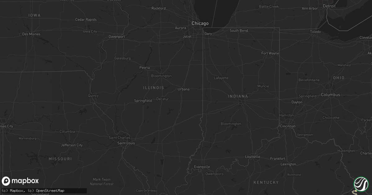
Hail Map in Nebraska on June 22, 2012
Get this storm
June 22 map
$229
one time, instant access
Download today. No call, no setup
Keep the $229
Bought the map and want the full workflow? Apply the entire $229 to a subscription within 7 days. None of it is wasted.
Every map, not just this one
This buys you this map. Subscription and you get every map we run, in the markets you choose from a few cities to whole states to nationwide. Plus real-time alerts the moment a storm fires.
Contact data
Name, contact info, occupancy, even credit band for addresses in the footprint. You go from where it hit to who to call.
Become the source they trust
Unlimited branding weather history reports on demand. You already have the documented answer ready for the property owner, and you are the one who showed up with it.
Property data and RoofTrace estimates
Pull up any address you have got, its value and the exact code rules for that jurisdiction, straight from One Click Code. Then RoofTrace estimates the squares, pitch, and roof value, priced the way you price.
Storm reports in Nebraska
Nebraska
| Date | Description |
|---|---|
| 06/22/20126:50 AM CDT | Nickel to quarter size hail lasted for about 5 minutes. |
| 06/22/201212:55 AM CDT | A local report indicates 58 MPH wind near LEXINGTON |
| 06/22/201212:55 AM CDT | Custer county em reports numerous 3-4 inch branches covering highway two from ansley to broken bow. Highway crews have partially closed the highway. |
| 06/21/201211:42 PM CDT | Power is out over half of the city and extensive tree damage has occurred.wind was outflow from collapsing storms in southern custer county. No storms were in broken bo |
| 06/21/20129:55 PM CDT | A local report indicates 1.00 inch wind near 15 ENE CHAPPELL |
| 06/21/20129:42 PM CDT | A local report indicates 1.50 inch wind near 11 NE CHAPPELL |
| 06/21/20129:06 PM CDT | A local report indicates 1.50 inch wind near 7 NW CHAPPELL |
| 06/21/20128:56 PM CDT | A local report indicates 1.00 inch wind near 7 SE OGALLALA |
All States Impacted by Hail Map on June 22, 2012
Cities Impacted by Hail Map on June 22, 2012
- Ceresco, NE
- Fort Gay, WV
- Palmyra, VA
- Black Mountain, NC
- Clendenin, WV
- Newton, WV
- Procious, WV
- Amma, WV
- Wallback, WV
- Chesapeake, VA
- Great Falls, VA
- Fairless Hills, PA
- Lance Creek, WY
- Pulaski, WI
- Suamico, WI
- Green Bay, WI
- Chloe, WV
- Gaston, NC
- Ogallala, NE
- Lodgepole, NE
- Chevy Chase, MD
- Bethesda, MD
- Finksburg, MD
- Westminster, MD
- Sykesville, MD
- Bridgeton, NJ
- Middletown, DE
- Alloway, NJ
- Woodstown, NJ
- New Castle, DE
- Newark, DE
- Pennsville, NJ
- Delaware City, DE
- Saint Georges, DE
- Bear, DE
- Salem, NJ
- Moorcroft, WY
- Osage, WY
- Rozet, WY
- Upton, WY
- Newcastle, WY
- Shipman, VA
- Wingina, VA
- Gladstone, VA
- Charlottesville, VA
- Haigler, NE
- Fredericksburg, VA
- Manahawkin, NJ
- Barnegat, NJ
- West Creek, NJ
- Elkton, VA
- Stanardsville, VA
- Hood, VA
- Madison, VA
- Waco, NE
- Bradshaw, NE
- Benedict, NE
- York, NE
- Gresham, NE
- Polk, NE
- Hampton, NE
- Stromsburg, NE
- Utica, SD
- Gold Hill, NC
- Casar, NC
- Lawndale, NC
- Portsmouth, VA
- Hop Bottom, PA
- Gatesville, NC
- Hobbsville, NC
- Maywood, NE
- Hayes Center, NE
- McCook, NE
- Gates, NC
- Pine Ridge, SD
- Tuthill, SD
- Martin, SD
- Waldo, WI
- Cedar Grove, WI
- Random Lake, WI
- Cascade, WI
- Adell, WI
- Danville, PA
- Germantown, NY
- Frankford, DE
- Edgemont, SD
- Bel Air, MD
- Street, MD
- Darlington, MD
- Whiteford, MD
- Pylesville, MD
- Java, VA
- Holyoke, CO
- Wray, CO
- Albion, ME
- Denmark, WI
- De Pere, WI
- Greenleaf, WI
- Big Springs, NE
- Brule, NE
- Chappell, NE
- Elizabeth City, NC
- Staten Island, NY
- Sewaren, NJ
- Woodbridge, NJ
- Perth Amboy, NJ
- Amherst, VA
- Sterling, CO
- Chapel Hill, NC
- Hillsborough, NC
- Durham, NC
- Arnoldsburg, WV
- Millstone, WV
- Grantsville, WV
- Newton, NC
- Maiden, NC
- Hildreth, NE
- Hendersonville, NC
- Springview, NE
- Glenvil, NE
- Inland, NE
- Kenesaw, NE
- Hastings, NE
- Juniata, NE
- Merriman, NE
- Wood Lake, NE
- Cody, NE
- Kilgore, NE
- Saint Francis, SD
- Nenzel, NE
- Crookston, NE
- Valentine, NE
- Allen, SD
- Capitol, MT
- Lancaster, VA
- Heathsville, VA
- Waterville, ME
- Oakland, ME
- Fairfield, ME
- Scottsville, VA
- Bremo Bluff, VA
- Goshen, CT
- Torrington, CT
- Pittston, PA
- Chatsworth, NJ
- Dalton, NE
- Gurley, NE
- Tarboro, NC
- Pinetops, NC
- Highland Lakes, NJ
- Stockholm, NJ
- Hamburg, NJ
- Vernon, NJ
- Kyle, SD
- Hot Springs, SD
- Corapeake, NC
- Sunbury, NC
- Crofton, NE
- Fordyce, NE
- Saint Helena, NE
- Benkelman, NE
- Max, NE
- Stratton, NE
- Hyde Park, NY
- Poughkeepsie, NY
- Leonardtown, MD
- Hollywood, MD
- Mission, SD
- Blue Ridge, VA
- Shavertown, PA
- Wyoming, PA
- Dallas, PA
- Kingston, PA
- Moscow, PA
- Luzerne, PA
- Wilkes Barre, PA
- Deweese, NE
- Belle Fourche, SD
- Greenwood, VA
- Afton, VA
- Hancock, NY
- Long Eddy, NY
- Le Roy, WV
- Stanfordville, NY
- Clinton Corners, NY
- Tolland, CT
- Vernon Rockville, CT
- Oelrichs, SD
- Orlando, FL
- Ocoee, FL
- Windermere, FL
- Cleveland, WI
- Newton, WI
- Reedsville, WI
- Manitowoc, WI
- Whitelaw, WI
- Maribel, WI
- Lebanon, CT
- Coventry, CT
- Willimantic, CT
- Windham, CT
- Columbia, CT
- Suffolk, VA
- Littleton, NC
- Emporia, VA
- Highlands, NJ
- Yuma, CO
- Wood River, NE
- Elkhart Lake, WI
- Plymouth, WI
- Sheboygan Falls, WI
- Sheboygan, WI
- Salt Point, NY
- Millbrook, NY
- Pleasant Valley, NY
- Winston Salem, NC
- Berryville, VA
- Bluemont, VA
- Waverly, NE
- Deep Gap, NC
- Eagle Lake, ME
- Hudson, NY
- Keysville, VA
- Indianola, NE
- Curtis, NE
- Stockville, NE
- Coventry, RI
- Manderson, SD
- Camp Crook, SD
- Norridgewock, ME
- North Garden, VA
- Milton, PA
- Lenoir, NC
- Gillette, WY
- Johnstown, NE
- Hamptonville, NC
- Port Royal, VA
- Belvidere, NC
- Scenic, SD
- Buffalo Gap, SD
- Orma, WV
- Rosedale, WV
- Ravenna, NE
- Wakefield, VA
- Ranger, WV
- Branchland, WV
- Potter, NE
- Sidney, NE
- Dix, NE
- Charleston, WV
- Lincoln, NE
- Holdrege, NE
- Atlanta, NE
- Davenport, NE
- Carleton, NE
- Hampton, VA
- Asheville, NC
- Arden, NC
- Roanoke, VA
- Montvale, VA
- Thaxton, VA
- Waretown, NJ
- Port Deposit, MD
- Colora, MD
- Conowingo, MD
- Cozad, NE
- Clear Creek, WV
- Scarbro, WV
- Mount Hope, WV
- Valders, WI
- Smithfield, PA
- Bruceton Mills, WV
- Gibbon Glade, PA
- Farmington, PA
- Vass, NC
- Cameron, NC
- Southern Pines, NC
- Pinehurst, NC
- Carthage, NC
- Seward, NE
- Hyattsville, MD
- Washington, DC
- Brentwood, MD
- Mount Rainier, MD
- Norfolk, VA
- Catskill, NY
- Chatham, NY
- Ghent, NY
- West Camp, NY
- East Chatham, NY
- Saugerties, NY
- Valatie, NY
- Malden On Hudson, NY
- Lenoxville, PA
- Union Dale, PA
- Forest City, PA
- Kingsley, PA
- Nicholson, PA
- Central City, NE
- Chapman, NE
- Geddes, SD
- Padroni, CO
- Peetz, CO
- Fort Kent, ME
- Wallagrass, ME
- Mocksville, NC
- Lexington, NC
- Advance, NC
- Parks, NE
- Joint Base Mdl, NJ
- Chesterfield, NJ
- Wrightstown, NJ
- Eustis, NE
- Hulett, WY
- Looneyville, WV
- Grundy, VA
- Burlington, CT
- Wymore, NE
- Wessington, SD
- Wanblee, SD
- Arapahoe, NE
- Elwood, NE
- Holbrook, NE
- Hershey, NE
- North Platte, NE
- Dagsboro, DE
- Elm City, NC
- Nashville, NC
- Rocky Mount, NC
- Grand Island, NE
- Alda, NE
- Doniphan, NE
- Valley Cottage, NY
- Blauvelt, NY
- Nanuet, NY
- New City, NY
- Nyack, NY
- Pearl River, NY
- Monsey, NY
- Orangeburg, NY
- Spring Valley, NY
- West Nyack, NY
- Columbus, NJ
- Jobstown, NJ
- Browns Mills, NJ
- Lakehurst, NJ
- Pine Beach, NJ
- Seaside Heights, NJ
- Ocean Gate, NJ
- Lanoka Harbor, NJ
- Forked River, NJ
- Toms River, NJ
- Lakewood, NJ
- Bayville, NJ
- Lavallette, NJ
- Seaside Park, NJ
- Island Heights, NJ
- Beachwood, NJ
- Pleasanton, NE
- Disputanta, VA
- Petersburg, VA
- Elmer, NJ
- Chesapeake City, MD
- Perryville, MD
- Elkton, MD
- Charlestown, MD
- North East, MD
- Perry Point, MD
- Havre De Grace, MD
- Lewisville, NC
- Miller, NE
- Sumner, NE
- West Point, VA
- Taylorsville, NC
- Kiel, WI
- Kingston, NY
- Hurley, NY
- Haxtun, CO
- Macclesfield, NC
- Fountain, NC
- Little Neck, NY
- Great Neck, NY
- Rhinebeck, NY
- Porcupine, SD
- West Cornwall, CT
- Wassaic, NY
- Amenia, NY
- Sharon, CT
- Kent, CT
- Cornwall Bridge, CT
- Minden, NE
- Holstein, NE
- Roseland, NE
- Fairfield, NE
- Ayr, NE
- Penns Grove, NJ
- Keeling, VA
- Vernon Hill, VA
- South Boston, VA
- Burgess, VA
- Reedy, WV
- Bee, NE
- Garland, NE
- Skippers, VA
- Otis, CO
- Fleming, CO
- Pemberton, NJ
- Sweet Valley, PA
- Campobello, SC
- Kernersville, NC
- Columbia, NC
- Tad, WV
- Parkston, SD
- Tripp, SD
- Battleboro, NC
- Nora, VA
- Clinchco, VA
- Dante, VA
- Burke, SD
- Newcastle, NE
- Mitchell, SD
- Garysburg, NC
- Roanoke Rapids, NC
- Vincentown, NJ
- North Windham, CT
- Mansfield Center, CT
- Abingdon, VA
- Bristol, VA
- Amherst, NE
- Slatington, PA
- Walnutport, PA
- Gretna, VA
- Davidson, NC
- Henrico, VA
- Richmond, VA
- Louisa, KY
- Scotland, CT
- Baltic, CT
- Hampton, CT
- Canterbury, CT
- Buckingham, VA
- Reisterstown, MD
- Burnsville, NC
- Lexington, VA
- Buena Vista, VA
- Scotland, SD
- Shelton, NE
- Gibbon, NE
- Lesterville, SD
- Waverly, VA
- Spring Grove, VA
- Rockbridge Baths, VA
- Spearfish, SD
- Harpers Ferry, WV
- Round Hill, VA
- Phenix, VA
- Saint Onge, SD
- Nisland, SD
- Whitewood, SD
- Alum Bridge, WV
- Glenville, WV
- Troy, WV
- Linn, WV
- Coxs Mills, WV
- Stoneham, CO
- Topping, VA
- Lewellen, NE
- Wahoo, NE
- Ithaca, NE
- Left Hand, WV
- Duck, WV
- Shock, WV
- Paxton, NE
- Bristol, TN
- Catlettsburg, KY
- Prichard, WV
- Gregory, SD
- Sedley, VA
- Troy, NC
- Culloden, WV
- Hurricane, WV
- Sandston, VA
- Akron, CO
- Lexington, NE
- Delmont, SD
- Armour, SD
- Smithfield, ME
- West Milton, PA
- Lewisburg, PA
- Enders, NE
- Kilmarnock, VA
- Farnham, VA
- Norwood, VA
- Arrington, VA
- Lovingston, VA
- Crozier, VA
- Goochland, VA
- Columbia, VA
- Maidens, VA
- State Farm, VA
- Powhatan, VA
- Fork Union, VA
- Lake Lure, NC
- Poland, ME
- Ayden, NC
- Vanceboro, NC
- Grifton, NC
- Winner, SD
- Cottekill, NY
- Litchfield, CT
- New Hartford, CT
- Red Hook, NY
- Staatsburg, NY
- Pine Plains, NY
- Ulster Park, NY
- Port Ewen, NY
- Upland, NE
- Cumberland, VA
- Pittsboro, NC
- Siler City, NC
- Bear Creek, NC
- Smithfield, VA
- Surry, VA
- Elberon, VA
- Woodstock, NY
- West Hurley, NY
- Whitney, NE
- Chadron, NE
- Stone Ridge, NY
- Bloomington, NY
- Cornwall, CT
- Winsted, CT
- Bolton, CT
- Hebron, CT
- Andover, CT
- Plainfield, CT
- South Windham, CT
- Manchester, CT
- Glastonbury, CT
- East Hartford, CT
- Blowing Rock, NC
- Collettsville, NC
- Aberdeen, NC
- Pinebluff, NC
- Windsor, VA
- Carrsville, VA
- Zuni, VA
- Hardyville, VA
- White Stone, VA
- Locust Hill, VA
- Wake, VA
- Deltaville, VA
- Saluda, VA
- Union Bridge, MD
- New Windsor, MD
- Oak, NE
- Grayson, KY
- Denton, KY
- Newport News, VA
- Ashland, ME
- Mapleton, ME
- Farnam, NE
- Wall, SD
- Accident, MD
- Friendsville, MD
- Grantsville, MD
- Bertrand, NE
- Campbell, NE
- Vale, NC
- Overton, NE
- Newport, NE
- Bassett, NE
- Marquette, NE
- Phillips, NE
- Haddam, KS
- Banner Elk, NC
- Oral, SD
- Champion, NE
- Allentown, NJ
- Trenton, NJ
- Robbinsville, NJ
- Cream Ridge, NJ
- New Egypt, NJ
- Cookstown, NJ
- Bordentown, NJ
- Summit Point, WV
- Terrell, NC
- Denver, NC
- Sherrills Ford, NC
- Bowling Green, VA
- Woodford, VA
- Caret, VA
- Sanford, NC
- Batesland, SD
- Rhoadesville, VA
- Unionville, VA
- Milford, DE
- Ashland, NE
- Appomattox, VA
- Pukwana, SD
- Keystone, NE
- Sutherland, NE
- Hebron, NE
- Sterling, VA
- Fort Lee, VA
- Prince George, VA
- Church View, VA
- Urbanna, VA
- Ararat, NC
- Dobson, NC
- Shelby, NC
- Huntingtown, MD
- Prince Frederick, MD
- Norton, VA
- Wise, VA
- Potomac, MD
- Anson, ME
- Mount Airy, NC
- Cornelius, NC
- Burchard, NE
- Duffield, VA
- Hartfield, VA
- Berlin, MD
- Newark, MD
- Kearney, NE
- Parmelee, SD
- Saint Nazianz, WI
- Staplehurst, NE
- Ivor, VA
- Leesburg, VA
- Fairbury, NE
- Moorefield, NE
- Highland, NY
- New Paltz, NY
- Brush, CO
- Takoma Park, MD
- Glen Echo, MD
- Bladensburg, MD
- Youngsville, NC
- Wake Forest, NC
- West Hartford, CT
- Farmington, CT
- Unionville, CT
- Avon, CT
- Kannapolis, NC
- Vansant, VA
- Haysi, VA
- Bartlett, NE
- Wilcox, NE
- Lake Andes, SD
- Mount Holly, NJ
- Branchville, NJ
- Layton, NJ
- Montague, NJ
- Dingmans Ferry, PA
- Canadensis, PA
- Sussex, NJ
- Dunn, NC
- Moon, VA
- Mathews, VA
- Cobbs Creek, VA
- Hudgins, VA
- Hopewell, VA
- Wounded Knee, SD
- Woodsboro, MD
- Narka, KS
- Belleville, KS
- Mooresville, NC
- Poquoson, VA
- Yorktown, VA
- Manhasset, NY
- Bayside, NY
- Cabin John, MD
- Raeford, NC
- Platte, SD
- Fayetteville, NC
- Linden, NC
- Vinton, VA
- Bladen, NE
- Amston, CT
- Marlborough, CT
- Culbertson, NE
- Forest Hill, MD
- Lake Lynn, PA
- Yankton, SD
- Grant, NE
- Fort Fairfield, ME
- Easton, ME
- Presque Isle, ME
- Egg Harbor City, NJ
- Tuckerton, NJ
- New Gretna, NJ
- Beach Haven, NJ
- Boonville, NC
- Fort Blackmore, VA
- McLaughlin, SD
- Edison, NE
- Cuba, KS
- Auburn, ME
- Walkersville, MD
- Rocky Ridge, MD
- Frederick, MD
- Thurmont, MD
- Keymar, MD
- Ewing, NE
- Charles City, VA
- Bethany Beach, DE
- Ocean View, DE
- Williamsburg, VA
- Lincolnton, NC
- Glenbeulah, WI
- Alton, VA
- Julesburg, CO
- Warwick, MD
- Cairo, NE
- Tabor, SD
- Maxwell, NE
- Olive Hill, KY
- Castalia, NC
- Lafayette, NJ
- Franklin, NJ
- California, MD
- Great Mills, MD
- Wilson, NC
- Germanton, NC
- Palisade, NE
- Gouldsboro, PA
- West Greenwich, RI
- Spring Hope, NC
- Carbondale, PA
- Springville, PA
- Wallace, NE
- Toano, VA
- Patten, ME
- Salisbury, NC
- Winter Garden, FL
- Trenton, NE
- Riverdale, NE
- Eddyville, NE
- Lumberton, NJ
- Goldston, NC
- Rural Hall, NC
- Sandy Hook, KY
- Spencer, WV
- Sandyville, WV
- Clemmons, NC
- Brillion, WI
- Nogal, NM
- Ellenboro, NC
- Bostic, NC
- Charles Town, WV
- Wauneta, NE
- Warrenton, NC
- Fincastle, VA
- Buchanan, VA
- Munden, KS
- Jackson, NJ
- Millstone Township, NJ
- Ferguson, NC
- Fort Eustis, VA
- Concordia, KS
- Hillburn, NY
- Suffern, NY
- Sloatsburg, NY
- Mahwah, NJ
- Portage, ME
- Olivet, SD
- Medford, NJ
- Manchester Township, NJ
- Victoria, VA
- Blue Hill, NE
- Hayes, VA
- Kenbridge, VA
- Long Valley, SD
- Norris, SD
- Sterling, CT
- Moosup, CT
- Greene, RI
- Huron, SD
- Wolsey, SD
- Purcellville, VA
- Hamilton, VA
- Farmingdale, NY
- Wyandanch, NY
- Blount, WV
- South Sterling, PA
- Tobyhanna, PA
- Cresco, PA
- Newfoundland, PA
- Leeds, NY
- Earlton, NY
- Dema, KY
- Plankinton, SD
- Wessington Springs, SD
- Belvidere, NE
- Palmer, KS
- Linn, KS
- Elizabethport, NJ
- Elizabeth, NJ
- Rahway, NJ
- Clark, NJ
- Linden, NJ
- Riverdale, MD
- Iron Station, NC
- Skowhegan, ME
- Diggs, VA
- Bethlehem, PA
- Northampton, PA
- Bath, PA
- Snow Hill, MD


