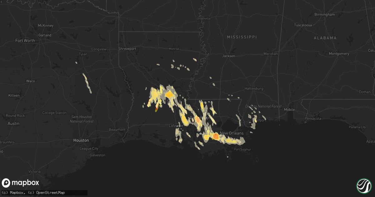
Hail Map in Louisiana on June 20, 2023
Get this storm
June 20 map
$229
one time, instant access
Download today. No call, no setup
Keep the $229
Bought the map and want the full workflow? Apply the entire $229 to a subscription within 7 days. None of it is wasted.
Every map, not just this one
This buys you this map. Subscription and you get every map we run, in the markets you choose from a few cities to whole states to nationwide. Plus real-time alerts the moment a storm fires.
Contact data
Name, contact info, occupancy, even credit band for addresses in the footprint. You go from where it hit to who to call.
Become the source they trust
Unlimited branding weather history reports on demand. You already have the documented answer ready for the property owner, and you are the one who showed up with it.
Property data and RoofTrace estimates
Pull up any address you have got, its value and the exact code rules for that jurisdiction, straight from One Click Code. Then RoofTrace estimates the squares, pitch, and roof value, priced the way you price.
Storm reports in Louisiana
Louisiana
| Date | Description |
|---|---|
| 06/20/20236:50 PM CDT | Golf ball sized hail reported via social media. |
| 06/20/20236:10 PM CDT | Picture of hail at least 2 inches in diameter... Possibly larger... In labadieville. Relayed via social media. |
| 06/20/20236:09 PM CDT | Golf ball hail reported in labedieville. Relayed via social media. |
| 06/20/20236:08 PM CDT | Golf ball sized hail reported through social media. |
| 06/20/20235:30 PM CDT | Corrects previous hail report from addis. Hail 2 to 2.25 in the town of addis. Relayed via social media. |
| 06/20/20235:28 PM CDT | Hail stone measured around 3.25 inches after some melting in the riverbend area. Relayed via social media. |
| 06/20/20235:27 PM CDT | Reported by public through social media south of baton rouge. |
| 06/20/20235:27 PM CDT | Corrects previous hail report from 3 ese brusly. Numerous reports and pictures of hail 2.5 to 3 around the riverbend subdivision. Relayed via social media. |
| 06/20/20235:27 PM CDT | A local report indicates 3.75 inch wind near 3 ESE Brusly |
| 06/20/20235:25 PM CDT | Larger than golf ball hail reported around the riverbend area. Relayed via social media. |
| 06/20/20235:25 PM CDT | Corrects previous hail report from 3 e brusly. Larger than golf ball hail reported around the riverbend area. Relayed via social media. |
| 06/20/20235:22 PM CDT | Golfball sized hail reported by public. |
| 06/20/20235:20 PM CDT | 1 inch hail reported through social media. |
| 06/20/20235:20 PM CDT | Corrects previous hail report from brusly. Hail 2 to 2.25 inches in diameter near brusly. Relayed via social media. |
| 06/20/20234:48 PM CDT | Large hail reported by public via social media near kraemer. |
| 06/20/20234:48 PM CDT | Corrects previous hail report from 5 nne thibodaux. Large hail reported by public via social media near kraemer. |
| 06/20/20234:30 PM CDT | Media tweet showed picture of public reporting quarter sized hail. |
| 06/20/20234:30 PM CDT | Hail 2 to 2.25 in the town of addis. Relayed via social media. |
| 06/20/20234:28 PM CDT | Multiple reports and pictures of large hail possibly up to softball size near the community of kraemer. Relayed via social media. |
| 06/20/20234:27 PM CDT | Numerous reports and pictures of hail 2.5 to 3 around the riverbend subdivision. Relayed via social media. |
| 06/20/20234:20 PM CDT | Hail 2 to 2.25 inches in diameter near brusly. Relayed via social media. |
| 06/20/20233:18 PM CDT | Quarter size hail in the jesuit bend area. Event time estimated by radar. |
| 06/20/20231:23 AM CDT | Golf ball size hail reported by 911 call center employee. |
| 06/20/202312:02 AM CDT | Report from mping: quarter |
| 06/19/20237:12 PM CDT | Multiple reports in the poland-echo area of softball sized hail. Large hail observed through multiple videos posted to local meteorologists social media. |
| 06/19/20237:05 PM CDT | Baseball sized hail reported through social media in echo. |
All States Impacted by Hail Map on June 20, 2023
Cities Impacted by Hail Map on June 20, 2023
- Long Beach, MS
- Pass Christian, MS
- Newellton, LA
- Kenansville, FL
- McHenry, MS
- Perkinston, MS
- Clayton, LA
- Sicily Island, LA
- Gilbert, LA
- Oviedo, FL
- Saint Bernard, LA
- Dodson, LA
- Gulfport, MS
- Alto, TX
- Rusk, TX
- Saucier, MS
- Kennard, TX
- Poplarville, MS
- Winnsboro, LA
- Wisner, LA
- Grayson, LA
- Kelly, LA
- Geneva, FL
- Tylertown, MS
- Franklinton, LA
- Meadville, MS
- McCall Creek, MS
- New Smyrna Beach, FL
- Smithdale, MS
- Edgewater, FL
- Grapeland, TX
- Osteen, FL
- Fort Necessity, LA
- Apple Springs, TX
- Groveton, TX
- Columbia, LA
- Frankston, TX
- Sandy Hook, MS
- Biloxi, MS
- Diberville, MS
- Harrisonburg, LA
- Enterprise, LA
- Ocala, FL
- Summerfield, FL
- Belleview, FL
- Belle Chasse, LA
- Braithwaite, LA
- Port Sulphur, LA
- Hahnville, LA
- Des Allemands, LA
- Thibodaux, LA
- Wilson, LA
- Ethel, LA
- Boyce, LA
- Otis, LA
- Slaughter, LA
- Saint James, LA
- Napoleonville, LA
- Port Allen, LA
- Elmer, LA
- Hineston, LA
- Sieper, LA
- Brusly, LA
- Zachary, LA
- Addis, LA
- Pride, LA
- Plaquemine, LA
- Baton Rouge, LA
- Sunshine, LA
- Ridgeview, SD
- Eagle Butte, SD
- McLaughlin, SD
- Labadieville, LA
- Glenmora, LA
- Timber Lake, SD
- Kiln, MS
- Casper, WY
- Jeffrey City, WY
- Slidell, LA
- Bradley, SC
- Greenwood, SC
- Pine Grove, LA
- Mount Hermon, LA
- Fort Lauderdale, FL
- Mountain Home, TX
- Leakey, TX
- Rocksprings, TX
- Donaldsonville, LA
- Darrow, LA
- Mayville, NY
- Sherman, NY
- Calvin, ND
- Egeland, ND
- Rocklake, ND
- Munich, ND
- Greensburg, LA
- Glenwood, GA
- Rockledge, GA
- Dublin, GA
- Vacherie, LA
- East Dublin, GA
- Jackson, LA
- Okeechobee, FL
- Lockport, LA
- Ama, LA
- Raceland, LA
- Murdo, SD
- Norwood, LA
- Clinton, LA
- Moore Haven, FL
- Gray Court, SC
- Lake Placid, FL
- Pearl River, LA
- Abita Springs, LA
- Union Church, MS
- Lafitte, LA
- Marrero, LA
- Barataria, LA
- Edgard, LA
- West Palm Beach, FL
- Convent, LA
- Louisville, GA
- Loxahatchee, FL
- Lorida, FL
- Bay Saint Louis, MS
- Waveland, MS
- Boynton Beach, FL
- Saint Francisville, LA
- Winter Springs, FL
- Picayune, MS
- Lake Wales, FL
- Bowling Green, KY
- Alvaton, KY
- Westwego, LA
- Luling, LA
- Boutte, LA
- Cut Off, LA
- Gheens, LA
- Paulina, LA
- Belle Rose, LA
- Paradis, LA
- Harvey, ND
- Pineville, LA
- Center Point, LA
- Marksville, LA
- Lecompte, LA
- Hessmer, LA
- Alexandria, LA
- Saint Gabriel, LA
- Esmond, ND
- Maddock, ND
- Port Barre, LA
- Lottie, LA
- Krotz Springs, LA
- Saint Martinville, LA
- Breaux Bridge, LA
- Natrona, WY
- Washburn, ND
- Center, ND
- Bottineau, ND
- Harrison, NE
- Dunseith, ND
- White Castle, LA
- Carville, LA
- Gillette, WY
- Rugby, ND
- Drake, ND
- Towner, ND
- Balta, ND
- Willow City, ND
- Rolette, ND
- Douglas, WY
- Kramer, ND
- Belcourt, ND
- Saint John, ND
- Souris, ND
- Upton, WY
- Newcastle, WY
- Rozet, WY
- Moorcroft, WY
- Osage, WY
- Woodworth, LA
- Kilgore, NE
- Fort Pierre, SD
- Arcadia, FL
- Venus, FL
- Punta Gorda, FL
- White River, SD
- Deville, LA
- Baldwin, ND
- Wilton, ND
- Saint Anthony, ND
- Solen, ND
- Mandan, ND
- Wakpala, SD
- Morgan City, LA
- Berwick, LA
- Patterson, LA
- Theriot, LA
- Glennville, GA
- Plaucheville, LA
- Simmesport, LA
- Draper, SD
- Baker, LA
- Greenwell Springs, LA
- Denham Springs, LA
- Selfridge, ND
- Fort Yates, ND
- Dundee, KY
- Fordsville, KY
- Horse Branch, KY
- Olaton, KY
- Dawson, GA
- Batchelor, LA
- Yuma, CO
- Hartford, KY
- Geismar, LA
- Saint Francis, SD
- Prairieville, LA
- Gonzales, LA
- Livingston, LA
- Maurepas, LA
- Franklin, LA
- New Iberia, LA
- Bunkie, LA
- Marsland, NE
- Lettsworth, LA
- Hayes Center, NE
- Fordoche, LA
- Walker, LA
- Wright, WY
- Cheneyville, LA
- Milledgeville, GA
- Grosse Tete, LA
- Maringouin, LA
- Sylvester, GA
- Selma, AL
- Cando, ND
- Trail City, SD
- Golden Meadow, LA
- Clewiston, FL
- Jeanerette, LA
- Baldwin, LA
- Mcclusky, ND
- Bush, LA
- New Orleans, LA
- Ray City, GA
- Valdosta, GA
- Erwinville, LA
- Lakeland, LA
- Amite, LA
- Holden, LA
- Pitkin, LA
- Hill City, SD
- Nashville, GA
- Lakeland, GA
- Moody Afb, GA
- Naylor, GA
- Cottonport, LA
- Barksdale, TX
- Youngsville, LA
- Abbeville, LA
- Erath, LA
- Mansura, LA
- Jarreau, LA
- Custer, SD
- Lafayette, LA
- Broussard, LA
- Reidsville, GA
- Camp Wood, TX
- Lake Park, GA
- Okaton, SD
- Forest Hill, LA
- Effie, LA
- Sorrento, LA
- New Roads, LA
- Morganza, LA
- Ventress, LA
- Coosada, AL
- Evergreen, LA
- Gibson, LA
- Independence, LA
- Butte, ND
- Little Eagle, SD
- Parmelee, SD
- Moreauville, LA
- Labelle, FL
- Pierre Part, LA
- Maywood, NE
- Vivian, SD
- Albany, LA
- Washington, LA
- Augusta, GA
- Hephzibah, GA
- French Settlement, LA
- Saint Amant, LA
- Delcambre, LA
- Norris, SD
- Boca Raton, FL
- Rosedale, LA
- Morrow, LA
- Montgomery, AL
- Edgefield, SC
- Pompano Beach, FL
- Catherine, AL
- Delray Beach, FL
- Statesboro, GA
- Oakdale, LA
- Leesville, LA
- Donner, LA
- Schriever, LA
- Oscar, LA
- Plattenville, LA
- Livonia, LA
- Ville Platte, LA
- Glendo, WY
- Jay Em, WY
- Lusk, WY
- Oberlin, LA
- Rosebud, SD
- Hot Springs, SD
- Buffalo Gap, SD
- Fairburn, SD
- Grant, LA
- Sugartown, LA
- Dry Creek, LA
- Westhope, ND
- Bismarck, ND
- Bantry, ND
- Granville, ND
- Sarles, ND
- Evergreen, AL
- Troy, AL
- Warwick, GA
- Ashburn, GA
- Newburg, ND
- Upham, ND
- Rolla, ND
- Deering, ND
- Manville, WY
- Hanston, KS
- Wetumpka, AL
- Glencross, SD
- Hayes, SD
- Saint Landry, LA
- Springfield, LA
- Melville, LA
- Palmetto, LA
- Keystone, SD
- Lance Creek, WY
- Shawnee, WY
- Anamoose, ND
- Cuthbert, GA
- Deridder, LA
- Wray, GA
- Jacksonville, GA
- Letohatchee, AL
- Hayneville, AL
- Abbeville, GA
- Minot, ND
- Sawyer, ND
- Edgemont, SD
- Sarasota, FL
- Hermosa, SD
- Fitzgerald, GA
- Oconto, NE
- Tallassee, AL
- Camden, AL
- Ness City, KS
- Tyler, AL
- Lena, LA
- Elizabeth, LA
- Colfax, LA
- Dry Prong, LA
- Opelousas, LA
- Rougon, LA
- Iuka, KS
- Pratt, KS
- Turon, KS
- Cunningham, KS
- Arlington, KS
- Kingman, KS
- Johnstown, NE
- Lexington, NE
- Hill City, KS
- Chase, KS
- Ellinwood, KS
- Long Pine, NE
- Ainsworth, NE
- Little River, KS
- Geneseo, KS
- Burdett, KS
- Loomis, NE
- Bertrand, NE
- Oxford, NE
- Miller, NE
- Amherst, NE
- Elwood, NE
- Larned, KS
- Lyons, KS
- Edison, NE
- Penokee, KS
- Hoisington, KS
- Claflin, KS
- Lorraine, KS
- Ellsworth, KS
- Bazine, KS
- Olmitz, KS
- Great Bend, KS
- Albert, KS
- Victoria, KS
- Russell, KS
- Walker, KS
- Gorham, KS
- Hays, KS
- Arapahoe, NE
- Glade, KS
- Stockton, KS
- Phillipsburg, KS
- Sylvan Grove, KS
- Mason City, NE
- Beverly, KS
- Lincoln, KS
- Rozel, KS
- Ravenna, NE
- Elm Creek, NE
- Holdrege, NE
- Smithfield, NE
- Roseland, NE
- Luray, KS
- Otis, KS
- Bison, KS
- Bradenton, FL
- Long Valley, SD
- Terra Ceia, FL
- Anna Maria, FL
- Palmetto, FL
- Bradenton Beach, FL
- Kinsley, KS
- Miami, FL
- Hialeah, FL
- Gibbon, NE
- Haviland, KS
- Belpre, KS
- Lewis, KS
- Windom, KS
- Holyrood, KS
- Greensburg, KS
- Garfield, KS


