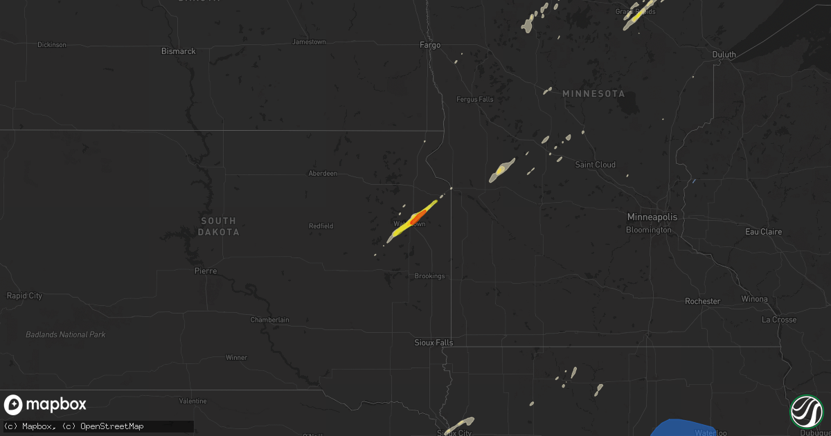
Hail Map on June 18, 2024
Get this storm
June 18 map
$229
one time, instant access
Download today. No call, no setup
Keep the $229
Bought the map and want the full workflow? Apply the entire $229 to a subscription within 7 days. None of it is wasted.
Every map, not just this one
This buys you this map. Subscription and you get every map we run, in the markets you choose from a few cities to whole states to nationwide. Plus real-time alerts the moment a storm fires.
Contact data
Name, contact info, occupancy, even credit band for addresses in the footprint. You go from where it hit to who to call.
Become the source they trust
Unlimited branding weather history reports on demand. You already have the documented answer ready for the property owner, and you are the one who showed up with it.
Property data and RoofTrace estimates
Pull up any address you have got, its value and the exact code rules for that jurisdiction, straight from One Click Code. Then RoofTrace estimates the squares, pitch, and roof value, priced the way you price.
States Impacted by Hail Map on June 18, 2024
Storm reports
Nebraska
| Date | Description |
|---|---|
| 06/18/20246:24 PM CDT | Mostly nickel to quarter. |
| 06/18/20246:16 PM CDT | Delayed report. Tree blown down near 84th and waverly road. Trunk was 35 inches in diameter and split. Time estimated from radar. |
| 06/18/20246:04 PM CDT | A local report indicates 1.00 inch wind near Alma |
| 06/18/20245:39 PM CDT | La |
| 06/18/20245:39 PM CDT | Lawn furniture blown around. |
| 06/18/20245:06 PM CDT | Semi flipped along interstate 80 near the utica exit. |
| 06/18/20244:50 PM CDT | 6-8 inch in diameter tree branch snapped. |
| 06/18/20244:00 PM CDT | Mostly nickel & dime... A few up to quarters. |
| 06/18/20243:59 PM CDT | Minor roof damage reported by storm chaser 2e of fairfield. |
| 06/18/20243:52 PM CDT | A local report indicates 1.00 inch wind near 2 SSW Hastings |
| 06/18/20243:52 PM CDT | Corrects previous hail report from 2 ssw hastings. Corrected location. |
| 06/18/20243:52 PM CDT | This report reflects a corrected latitude longitude from initial report. At adams county eoc. |
| 06/18/20243:52 PM CDT | A local report indicates 1.00 inch wind near 2 ENE Hastings |
| 06/18/20243:44 PM CDT | Corrects previous hail report from 5 nne ayr. Mostly nickel & dime... A few up to quarters. -corrected for time. |
Pennsylvania
| Date | Description |
|---|---|
| 06/18/20246:23 PM CDT | Trees down on balltown road |
| 06/18/20245:46 PM CDT | Trees down. |
| 06/18/20245:30 PM CDT | Delayed report of several trees uprooted along maryland avenue near franklin avenue. Time estimated via radar. |
| 06/18/20245:30 PM CDT | Trees and power lines down. Power is out. |
| 06/18/20245:28 PM CDT | Report from mping: trees uprooted or snapped. |
| 06/18/20245:20 PM CDT | At least 6 trees uprooted... Including a large sycamore tree. |
| 06/18/20245:13 PM CDT | Spotter reported numerous large limbs down and uprooted trees between south new castle and ellwood city. |
| 06/18/20243:28 PM CDT | A local report indicates 1.00 inch wind near California |
| 06/18/20243:28 PM CDT | Over 100 reports of tree damage in washington county... Generally worst in the mon valley area |
| 06/18/20243:26 PM CDT | A local report indicates 1.00 inch wind near 1 S California |
| 06/18/20243:22 PM CDT | A local report indicates 1.00 inch wind near Roscoe |
| 06/18/20243:15 PM CDT | Fire department dealt with at least 15 damaged trees. Fire station pavilion metal ridge vent blown off and pvc fence sections removed. Video of siding from an unknown s |
| 06/18/20243:15 PM CDT | Trees down on fayette city road |
| 06/18/20243:15 PM CDT | Trees down on troytown road. |
| 06/18/20243:15 PM CDT | Power lines down and power is out. Roof was blown off a house. |
| 06/18/20243:01 PM CDT | Trees down on brownsville road. |
| 06/18/20242:58 PM CDT | Trees down on brownsville road |
| 06/18/20242:36 PM CDT | Multiple reports of trees down in plum boro. Tree on to a house on cassius street. |
| 06/18/20242:36 PM CDT | Tree down on house on ohiopyle drive |
| 06/18/20241:00 PM CDT | Numerous large limbs snapped between back rd and deveaux st. |
| 06/18/20241:00 PM CDT | Tree and wires on back road west of carrolltown. |
| 06/18/202412:32 PM CDT | Tree down on hartford road. |
| 06/18/202412:13 PM CDT | Tree down and blocking the road on east lake road. |
Indiana
| Date | Description |
|---|---|
| 06/18/20242:56 PM CDT | Estimated 65 mph outflow winds with healthy 2 inch diamater tree limbs snapped near washington and vann in evansville. |
Kentucky
| Date | Description |
|---|---|
| 06/18/20243:27 PM CDT | A local report indicates 60 MPH wind near 3 SSE Henderson |
West Virginia
| Date | Description |
|---|---|
| 06/18/20246:54 PM CDT | Tree and lines down on alley addition st. |
| 06/18/20246:22 PM CDT | Tree reported down obstructing rush run road. |
| 06/18/20246:14 PM CDT | Tree reported down obstructing flinderation road. |
| 06/18/20245:56 PM CDT | Tree reported down obstructing lake floyd circle. |
| 06/18/20244:54 PM CDT | Downed trees reported. |
| 06/18/20244:54 PM CDT | Downed trees reported. |
| 06/18/20244:50 PM CDT | Downed trees reported. |
| 06/18/20242:15 PM CDT | Trees down on ohio avenue |
| 06/18/20242:12 PM CDT | Trees down at intersection of richwood avenue and fortney street |
| 06/18/20242:12 PM CDT | Multiple trees down on river road |
| 06/18/20242:03 PM CDT | Wires down on earl l core road near county schools administrative office. |
| 06/18/20242:02 PM CDT | Tree on house on eljadid street. Time estimated. |
| 06/18/20242:02 PM CDT | Wires down on eljadid street near kfc. |
| 06/18/20242:02 PM CDT | Wires down on eljadid |
| 06/18/20241:59 PM CDT | A local report indicates 59 MPH wind near Morgantown Airport |
| 06/18/20241:56 PM CDT | Number of trees down on brookhaven road. |
Kansas
| Date | Description |
|---|---|
| 06/18/20246:47 PM CDT | Corrects time on previous tornado report from 1 ese ensign. A tornado crossed the county line from gray to ford. No damage reported but several sightings of the tornado |
| 06/18/20246:35 PM CDT | A local report indicates 83 MPH wind near Satanta |
| 06/18/20246:33 PM CDT | Delayed report. |
| 06/18/20246:20 PM CDT | A local report indicates 1.00 inch wind near Copeland |
| 06/18/20246:02 PM CDT | A local report indicates 78 MPH wind near 3 NE Bunker Hill |
| 06/18/20245:56 PM CDT | A local report indicates 69 MPH wind near Russell Airport |
| 06/18/20245:48 PM CDT | Relayed report from gld. Time estimated from radar. |
| 06/18/20245:45 PM CDT | A local report indicates 1.00 inch wind near Sublette |
| 06/18/20245:31 PM CDT | Report from mping: quarter |
| 06/18/20245:30 PM CDT | Mping report. |
| 06/18/20245:26 PM CDT | Report from mping: quarter |
| 06/18/20245:20 PM CDT | [landspout] |
| 06/18/20245:18 PM CDT | Mostly nickels with a few quarters. |
| 06/18/20245:10 PM CDT | Hail ranged from dime to half dollar in size. |
| 06/18/20244:47 PM CDT | Lasted 3-4 minutes. |
| 06/18/20244:46 PM CDT | [landspout] |
| 06/18/20244:25 PM CDT | A local report indicates 1.75 inch wind near 1 SW Ellis |
| 06/18/20243:46 PM CDT | Numerous photos and video evidence of a tornado. Report of the tornado persistent for 10 mins. Rating efu due to no damage reported. |
| 06/18/20243:45 PM CDT | A local report indicates 2.00 inch wind near Ellis |
| 06/18/20243:42 PM CDT | A local report indicates 1.75 inch wind near Ellis |
| 06/18/20243:42 PM CDT | A local report indicates 1.50 inch wind near 1 S Riga |
| 06/18/20243:02 PM CDT | [landspout] |
| 06/17/202410:06 PM CDT | Estimated 60mph with 3-4 inch limbs down. |
| 06/17/20248:40 PM CDT | Lots of dust getting kicked up into the air as well. Delayed report. Time estimated by radar. |
| 06/17/20248:35 PM CDT | A local report indicates 70 MPH wind near 2 NE Kanopolis |
| 06/17/20248:30 PM CDT | A local report indicates 1.00 inch wind near Liberal |
| 06/17/20248:25 PM CDT | A local report indicates 1.00 inch wind near Liberal |
| 06/17/20248:10 PM CDT | Strong winds making for difficult driving conditions. Winds estimated around 60 mph. |
| 06/17/20248:09 PM CDT | Estimated 55-60 mph. |
| 06/17/20247:50 PM CDT | A local report indicates 74 MPH wind near 1 S Claflin |
| 06/17/20247:47 PM CDT | A tornado crossed the county line from gray to ford. No damage reported but several sightings of the tornado and photo evidence. Tornado estimated efu. Time is radar es |
| 06/17/20247:35 PM CDT | Estimated 50 to 60 mph wind gusts west of great bend. |
| 06/17/20247:31 PM CDT | A local report indicates 63 MPH wind near 2 E Pawnee Rock |
| 06/17/20247:25 PM CDT | A local report indicates 1.00 inch wind near 2 NW Ft. Dodge |
| 06/17/20247:20 PM CDT | A local report indicates 1.00 inch wind near 1 SE Dodge City |
| 06/17/20247:20 PM CDT | A local report indicates 1.50 inch wind near 2 SSW Dodge City |
| 06/17/20247:00 PM CDT | A local report indicates 1.75 inch wind near 7 WNW Plains City |
New York
| Date | Description |
|---|---|
| 06/18/20246:46 PM CDT | Trees and wires down. Time radar estimated. |
| 06/18/20246:17 PM CDT | Trees and wires down. Time radar estimated. |
| 06/18/20246:10 PM CDT | Trees and wires down. Time radar estimated. |
| 06/17/20249:20 PM CDT | Multiple trees down on road. |
| 06/17/20249:17 PM CDT | Pictures of several trees down in the yard as well as tree leaning on house. |
| 06/17/20249:15 PM CDT | Tree and wires down blocking the road. |
| 06/17/20248:39 PM CDT | Large tree limb fell on car. |
| 06/17/20248:34 PM CDT | Tree fell on house. |
| 06/17/20248:31 PM CDT | Report of tree down near house that took down wires on havens corners rd... Time estimated from radar. |
| 06/17/20248:29 PM CDT | Tree fell blocking roadway. |
| 06/17/20248:23 PM CDT | Tree and wires down. |
| 06/17/20248:20 PM CDT | Tree and wires down. |
| 06/17/20248:20 PM CDT | Tree fell blocking roadway. |
| 06/17/20248:20 PM CDT | Tree fell blocking roadway. |
| 06/17/20248:15 PM CDT | Trees and wires down. Time radar estimated. |
| 06/17/20248:15 PM CDT | Call from em of yates co reporting 65 mph winds just north of penn yan. Time estimated from radar just before the call received. |
| 06/17/20248:15 PM CDT | Trees and wires down. Time radar estimated. |
| 06/17/20248:15 PM CDT | Trees and wires down. Time radar estimated. |
| 06/17/20248:15 PM CDT | Tree fell blocking roadway. |
| 06/17/20248:13 PM CDT | Tree fell blocking roadway. |
| 06/17/20248:09 PM CDT | Tree fell blocking roadway. |
| 06/17/20248:09 PM CDT | Large tree fell on wires. |
| 06/17/20248:08 PM CDT | Trees and wires down. Time radar estimated. |
| 06/17/20248:07 PM CDT | Power pole down across roadway. |
| 06/17/20248:02 PM CDT | Tree fell on powerlines and house. |
Oklahoma
| Date | Description |
|---|---|
| 06/18/20241:00 AM CDT | Emergency manager relayed report via slack. Dispatchers report large near baseball size hail on highway 54 between goodwell and texhoma. Said it stopped before goodwell |
| 06/18/202412:00 AM CDT | Picture of 2 inch diameter hail next to a ruler received via social media. |
| 06/17/202411:51 PM CDT | Report of at least estimated quarter sized hail from nws employee received via slack. |
| 06/17/202411:35 PM CDT | Corrects previous thunderstorm wind gust report from 2 ene goodwell. 61 mph maximum wind gust measured from goodwell mesonet. Storms still ongoing. |
| 06/17/202411:09 PM CDT | Estimated 1 inch hail report in hardesty received via social media. Time estimated based on radar. |
| 06/17/202410:20 PM CDT | Mostly nickel size hail with a few quarters mixed in. |
| 06/17/202410:03 PM CDT | Pictures of power poles snapped along us hwy - 64 13 miles east of hooker received via social media. Time estimated via radar. |
| 06/17/20249:40 PM CDT | A local report indicates 62 MPH wind near 1 SSW Beaver |
| 06/17/20249:30 PM CDT | A local report indicates 58 MPH wind near 1 WSW Hooker |
Wisconsin
| Date | Description |
|---|---|
| 06/17/20249:40 PM CDT | Time delayed lsr - photos of several trees down blocking roadways near the intersection of 120 ave and 198th st. Time estimated via radar. |
| 06/17/20249:17 PM CDT | Time delayed lsr - photos of a roof damage to a house and roof blown off silo near the intersection of 120th ave and 208th st. Time estimated via radar. |
Iowa
| Date | Description |
|---|---|
| 06/17/202410:18 PM CDT | Asos station kalo waterloo airport. |
| 06/17/20249:52 PM CDT | Asos station kmiw marshalltown airport. |
| 06/17/20249:38 PM CDT | Tree damage... Minor building damage. Small portion of roof removed from barn. |
| 06/17/20249:05 PM CDT | Trees down on west side of ames. Time estimated by radar. |
| 06/17/20247:23 PM CDT | Large tree branch down. |
Texas
| Date | Description |
|---|---|
| 06/18/202411:57 AM CDT | Estimated 1 inch hail report along us hwy 54. From nws employee received via slack. |
| 06/18/202412:42 AM CDT | Public mping report of half dollar size hail along 287 nw of stratford near mallett. |
South Dakota
| Date | Description |
|---|---|
| 06/18/20244:36 PM CDT | A local report indicates 1.00 inch wind near 3 SSW Troy |
| 06/18/20244:30 PM CDT | Time estimated. |
| 06/18/20244:28 PM CDT | Report from social media. |
Ohio
| Date | Description |
|---|---|
| 06/18/20243:52 PM CDT | Tree down on road. Time estimated via radar. |
| 06/18/20243:08 PM CDT | Multiple trees down in geneva. Time estimated via radar. |
| 06/18/20242:59 PM CDT | Tree down. Time estimated via radar. |
| 06/18/20242:54 PM CDT | Tree and utility lines down. Time estimated via radar. Time estimated via radar. |
| 06/18/20242:50 PM CDT | Trees and power lines down in homeworth. |
| 06/18/20242:49 PM CDT | A few trees uprooted... Many large limbs down and outdoor items blown about... And power outages. |
| 06/18/20242:12 PM CDT | Road closed due to downed tree and power pole at chillicothe road and lucerne dr. |
| 06/18/20242:07 PM CDT | State route 306 between bainbridge road and east washington street closed due to fallen tree. Time estimated via radar. |
| 06/18/20241:49 PM CDT | Trees down on bower road |
| 06/18/20241:40 PM CDT | *** 3 inj *** -delayed report- large tree fell through ranch house on the 1300 block of erieview drive causing significant damage. 3 occupants were treated for non life |
| 06/18/20241:39 PM CDT | Several large branches down around village. Time estimated via radar. |
| 06/18/20241:24 PM CDT | Approximately 20 power poles and multiple large tree branches down near capel rd and route 83. |
| 06/18/20241:23 PM CDT | A vacant building collapsed on avon belden road. |
| 06/18/20241:20 PM CDT | Asos station kbkl cleveland. |
| 06/18/20241:20 PM CDT | Several large tree branches... Utility poles and wires down. |
| 06/18/20241:15 PM CDT | Tree branch down. Time estimated via radar. |
| 06/18/20241:11 PM CDT | Several large tree branches down. Also estimated 60mph wind gust. |
| 06/18/20241:10 PM CDT | Several downed trees and powerlines in the madison and north madison area. |
| 06/18/202412:55 PM CDT | Trees down on hanover ridge road |
Minnesota
| Date | Description |
|---|---|
| 06/18/20246:27 PM CDT | Time delayed lsr - reports of trees down on dove rd and bear rd. Time estimated via radar. |
| 06/18/20246:09 PM CDT | Time delayed lsr - tree down on the 700 block of 6th st ne. Time estimated via radar. |
| 06/18/20243:45 PM CDT | Relayed report from viewer with photo. |
| 06/18/20242:50 PM CDT | Trained spotter reports widespread tree damage... Large white pine branches tossed... And power out. Location estimated. |
| 06/18/20242:30 PM CDT | Several trees snapped. One a large pine at least several feet in diameter snapped near the ground. Time estimated from radar. |
| 06/18/202412:36 PM CDT | Report via social media with photo. |
| 06/18/20247:05 AM CDT | Birch tree snapped off 10 feet above the ground. This likely occurred with the first storm to go thru around 0330 this morning. |
| 06/18/20247:00 AM CDT | Multiple pictures of tree damage. |
| 06/17/20249:31 PM CDT | Time delayed lsr - two trees down in the city of afton reported by emergency management. Time estimated via radar. |
| 06/17/20248:49 PM CDT | Time delayed lsr - two trees down in the town of hugo reported by emergency management. Time estimated via radar. |
Cities Impacted by Hail Map on June 18, 2024
- Moorcroft, WY
- Devils Tower, WY
- Hulett, WY
- Sundance, WY
- Alva, WY
- Coleharbor, ND
- Underwood, ND
- Beulah, ND
- Douglas, ND
- Garrison, ND
- Washburn, ND
- Stanton, ND
- New Salem, ND
- Riverdale, ND
- Hazen, ND
- Max, ND
- Center, ND
- Benedict, ND
- Echo, MN
- Sacred Heart, MN
- Granite Falls, MN
- Starbuck, MN
- Benson, MN
- Glenwood, MN
- Lowry, MN
- Scenic, SD
- New Underwood, SD
- Wall, SD
- Wasta, SD
- Quinn, SD
- Hermosa, SD
- Fairburn, SD
- Crane Lake, MN
- Park Rapids, MN
- Laporte, MN
- Bovey, MN
- Grand Rapids, MN
- Wellington, OH
- Side Lake, MN
- Nashwauk, MN
- Cohasset, MN
- Lagrange, OH
- Marble, MN
- Grafton, OH
- Calumet, MN
- Pengilly, MN
- Hibbing, MN
- Hill City, MN
- Perry, OH
- Hubbard, OH
- Carrolltown, PA
- Ebensburg, PA
- Angora, MN
- Chisholm, MN
- Britt, MN
- Elmora, PA
- Nicktown, PA
- Johnstown, PA
- Cook, MN
- Cleveland, OH
- Ponsford, MN
- Heartwell, NE
- Tower, MN
- Madison, OH
- Bloomington, NE
- Geneva, OH
- Lake George, MN
- Chesterland, OH
- Morgantown, WV
- Akeley, MN
- Linesville, PA
- Kenesaw, NE
- Wood River, NE
- Franklin, NE
- Holstein, NE
- Bemidji, MN
- Upland, NE
- Palco, KS
- Ellis, KS
- Painesville, OH
- Wakeeney, KS
- Campbell, NE
- Cass Lake, MN
- Phillips, NE
- Monroeville, PA
- Pittsburgh, PA
- Murrysville, PA
- Plainville, KS
- Juniata, NE
- Chapman, NE
- Marquette, NE
- Central City, NE
- Grand Island, NE
- Jefferson, OH
- Minden, NE
- Riverton, NE
- Ashtabula, OH
- Ogallah, KS
- Kensington, KS
- Agra, KS
- Collyer, KS
- Damar, KS
- Burton, OH
- North Sioux City, SD
- Sioux City, IA
- South Sioux City, NE
- Austinburg, OH
- Stockton, KS
- Bladen, NE
- Smith Center, KS
- Kingsville, OH
- Roseland, NE
- Aurora, NE
- Middlefield, OH
- Hordville, NE
- Clarks, NE
- Athol, KS
- Grindstone, PA
- Kirwin, KS
- New Salem, PA
- Allison, PA
- Smock, PA
- Brownsville, PA
- Dighton, KS
- Polk, NE
- Hastings, NE
- Ayr, NE
- Stockdale, PA
- California, PA
- Allenport, PA
- Fayette City, PA
- Gaylord, KS
- Garden City, KS
- Healy, KS
- Elco, PA
- Roscoe, PA
- Stromsburg, NE
- Hinton, IA
- Coal Center, PA
- Perryopolis, PA
- Dakota City, NE
- Homer, NE
- Newell, PA
- Charleroi, PA
- Glenvil, NE
- Bancroft, NE
- Hampton, NE
- Silver Creek, NE
- Osceola, NE
- Columbus, NE
- Beeler, KS
- Utica, KS
- McClellandtown, PA
- Blue Hill, NE
- East Millsboro, PA
- Merrill, IA
- Cimarron, KS
- Danvers, MN
- Holloway, MN
- Hancock, MN
- Springboro, PA
- Edinboro, PA
- Inland, NE
- Inavale, NE
- Red Cloud, NE
- Shelby, NE
- Fairfield, NE
- Eighty Four, PA
- Willow Lake, SD
- Le Mars, IA
- Kingsley, IA
- Robards, KY
- Henderson, KY
- Hays, KS
- Gorham, KS
- Victoria, KS
- Hazel, SD
- Clarkson, NE
- Schuyler, NE
- Vienna, OH
- Girard, OH
- Vienna, SD
- Bryant, SD
- Clay Center, NE
- Harvard, NE
- Trumbull, NE
- West Point, NE
- Beemer, NE
- Bradshaw, NE
- Clontarf, MN
- Aldrich, MN
- Verndale, MN
- Natoma, KS
- Spottsville, KY
- Evansville, IN
- Reed, KY
- Watertown, SD
- Sutton, NE
- Lake, WV
- Petersburg, NE
- Staples, MN
- Saronville, NE
- Transfer, PA
- Sharpsville, PA
- Clark, PA
- Ingalls, KS
- Keewatin, MN
- Howells, NE
- Dodge, NE
- Sublette, KS
- Satanta, KS
- Benedict, NE
- Woodston, KS
- Brookfield, OH
- Holdrege, NE
- Alexandria, SD
- Prairie View, KS
- Howard, SD
- Emery, SD
- Castlewood, SD
- Arlington, SD
- Ramona, SD
- Niobrara, NE
- Alma, NE
- Bartlett, NE
- Ewing, NE
- Olivet, SD
- Parkston, SD
- Canova, SD
- Lake Preston, SD
- Orchard, NE
- Verdigre, NE
- Hill City, KS
- Avon, SD
- Winfred, SD
- Axtell, NE
- Riverdale, NE
- Tripp, SD
- Spencer, SD
- Ravenna, NE
- Scotia, NE
- Orleans, NE
- Ashton, NE
- Ericson, NE
- Funk, NE
- Lake Norden, SD
- Tyndall, SD
- North Loup, NE
- Kearney, NE
- Badger, SD
- Springfield, SD
- Loup City, NE
- Pleasanton, NE
- Oldham, SD
- Bellwood, NE
- Ness City, KS
- Greenville, PA
- Clarks Mills, PA
- Hadley, PA
- Albion, NE
- Deweese, NE
- Pecks Mill, WV
- Hewett, WV
- Chapmanville, WV
- Rogers, NE
- Hawley, MN
- Guide Rock, NE
- Cairo, NE
- Orlando, WV
- Snyder, NE
- Scribner, NE
- Edgar, NE
- Pierceville, KS
- Bogue, KS
- Dannebrog, NE
- Beaver Falls, PA
- Sheakleyville, PA
- Penokee, KS
- Lyons, NE
- Ransom, KS
- Weston, WV
- Walkersville, WV
- Oakland, NE
- Strandburg, SD
- Stockholm, SD
- Brownell, KS
- Gresham, NE
- Rising City, NE
- Henderson, NE
- Nelson, NE
- Lenora, KS
- Logan, KS
- Milbank, SD
- Twin Brooks, SD
- Geneva, NE
- Jane Lew, WV
- Hooper, NE
- Koppel, PA
- Ellwood City, PA
- New Brighton, PA
- Wampum, PA
- Lost Creek, WV
- Grafton, NE
- Ong, NE
- Shickley, NE
- Craig, NE
- Jetmore, KS
- Almena, KS
- Copeland, KS
- Sauk Centre, MN
- New Castle, PA
- Moscow, KS
- McCracken, KS
- Paradise, KS
- Surprise, NE
- Brooten, MN
- Bazine, KS
- Volant, PA
- Ortonville, MN
- Big Stone City, SD
- Onawa, IA
- Whiting, IA
- David City, NE
- Davenport, NE
- Phillipsburg, KS
- Long Island, KS
- Melrose, MN
- Clarksburg, WV
- Mount Clare, WV
- Strang, NE
- Ulysses, NE
- Long Prairie, MN
- Osakis, MN
- Waldo, KS
- Salem, WV
- Villard, MN
- Anthon, IA
- Oto, IA
- Hornick, IA
- Burtrum, MN
- Swanville, MN
- Hugoton, KS
- Smithland, IA
- Rodney, IA
- Castana, IA
- Correctionville, IA
- Florence, SD
- South Shore, SD
- Osborne, KS
- Luray, KS
- Grey Eagle, MN
- Montezuma, KS
- Republican City, NE
- Marienville, PA
- Barnesville, MN
- Naponee, NE
- Dodge City, KS
- Liberal, KS
- Sisseton, SD
- Danbury, IA
- Youngstown, OH
- Schoenchen, KS
- Walker, KS
- Bunker Hill, KS
- Russell, KS
- Dorrance, KS
- Battle Creek, IA
- Freeport, MN
- East Hickory, PA
- Endeavor, PA
- Sheffield, PA
- Little Falls, MN
- West Union, WV
- Hildreth, NE
- Plains, KS
- Mankato, KS
- Britton, SD
- Alexander, KS
- Ellicottville, NY
- Great Valley, NY
- Wilcox, NE
- Linn Grove, IA
- Formoso, KS
- Tionesta, PA
- Wallace, WV
- Webber, KS
- Kismet, KS
- Nekoma, KS
- La Crosse, KS
- Alta, IA
- Rembrandt, IA
- Center Point, WV
- Sylvan Grove, KS
- Wilson, KS
- Lucas, KS
- Lincoln, KS
- Jewell, KS
- Rush Center, KS
- Courtland, KS
- Beloit, KS
- Ensign, KS
- Jacksonburg, WV
- Reader, WV
- Pine Grove, WV
- Sioux Rapids, IA
- Council Bluffs, IA
- Tiona, PA
- Warren, PA
- Clarendon, PA
- Doniphan, NE
- Underwood, IA
- Bison, KS
- Jamestown, KS
- Norway, KS
- Crescent, IA
- Larned, KS
- Otis, KS
- Scandia, KS
- Belleville, KS
- Hoisington, KS
- Olmitz, KS
- Alda, NE
- Emmetsburg, IA
- Zimmerman, MN
- Mallard, IA
- Wright, KS
- St John, KS
- Pawnee Rock, KS
- Cuba, KS
- Agenda, KS
- Albert, KS
- Fenton, IA
- Cylinder, IA
- Great Bend, KS
- Livermore, IA
- Lu Verne, IA
- Spearville, KS
- Ringsted, IA
- Algona, IA
- Barnum, MN
- Claflin, KS
- Wesley, IA
- Gainesville, NY
- Warsaw, NY
- Offerle, KS
- Fowler, KS
- Meade, KS
- Penn Yan, NY
- Hooker, OK
- Raymond, KS
- Ellinwood, KS
- Holyrood, KS
- Chase, KS
- Bushton, KS
- Brook Park, MN
- Tyrone, OK
- Turpin, OK
- Minneola, KS
- Kinsley, KS
- Guymon, OK
- Geneseo, KS
- Ellsworth, KS
- Lyons, KS
- Marquette, KS
- Little River, KS
- Kanopolis, KS
- Lorraine, KS
- Mcpherson, KS
- Windom, KS
- Falun, KS
- Lindsborg, KS
- Salina, KS
- Brookville, KS
- Assaria, KS
- Macksville, KS
- Ovid, NY
- Lodi, NY
- Forgan, OK
- Niles, OH
- Dunlevy, PA
- Romulus, NY
- Ford, KS
- Hardesty, OK
- Beaver, OK
- Balko, OK
- Gate, OK
- Laverne, OK
- Goodwell, OK
- Rhodes, IA
- Newton, IA
- Haverhill, IA
- Conrad, IA
- Wellsburg, IA
- New Providence, IA
- Eldora, IA
- Clemons, IA
- Ackley, IA
- Union, IA
- State Center, IA
- Melbourne, IA
- Albion, IA
- Marshalltown, IA
- Mingo, IA
- Collins, IA
- Hubbard, IA
- Baxter, IA
- Laurel, IA
- Whitten, IA
- McCallsburg, IA
- Grundy Center, IA
- Steamboat Rock, IA
- Colo, IA
- Zearing, IA
- Saint Anthony, IA
- Maxwell, IA
- Nevada, IA
- Iowa Falls, IA
- Liscomb, IA
- Montour, IA
- Gladbrook, IA
- Toledo, IA
- Aplington, IA
- Ferguson, IA
- Tama, IA
- Le Grand, IA
- Garwin, IA
- Beaman, IA
- Gilman, IA
- Holland, IA
- Austinville, IA
- Hudson, IA
- Reinbeck, IA
- New Hartford, IA
- Buckingham, IA
- Parkersburg, IA
- Dike, IA
- Morrison, IA
- Waterloo, IA
- Lincoln, IA
- Traer, IA
- Shell Rock, IA
- Stout, IA
- Cedar Falls, IA
- La Porte City, IA
- Evansdale, IA
- Clutier, IA
- Dysart, IA
- Texhoma, OK
- Texhoma, TX
- Stratford, TX
- Gruver, TX
- Texline, TX
- Clayton, NM
- Dalhart, TX
- Felt, OK
- Kenton, OK
- Boise City, OK
- Campo, CO
- Dresser, WI
- Saint Croix Falls, WI