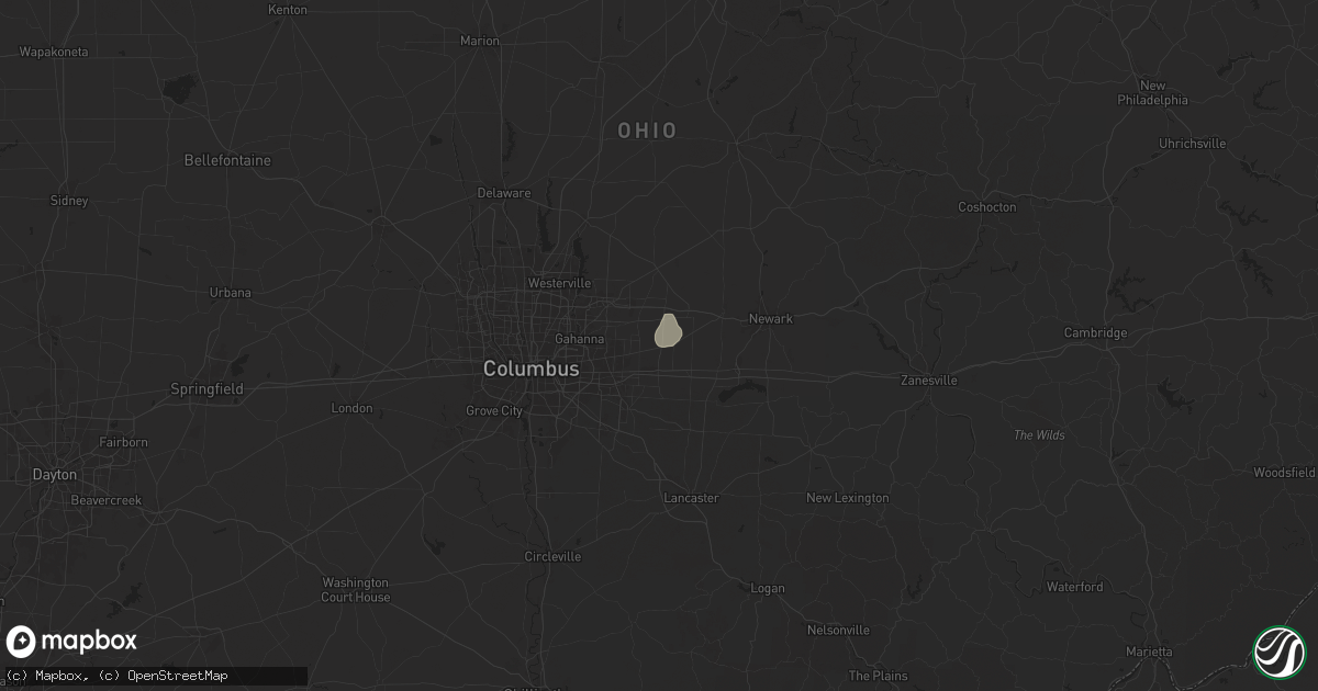
Hail Map in Pataskala, OH on June 17, 2024
Get this storm
June 17 map
$229
one time, instant access
Download today. No call, no setup
Keep the $229
Bought the map and want the full workflow? Apply the entire $229 to a subscription within 7 days. None of it is wasted.
Every map, not just this one
This buys you this map. Subscription and you get every map we run, in the markets you choose from a few cities to whole states to nationwide. Plus real-time alerts the moment a storm fires.
Contact data
Name, contact info, occupancy, even credit band for addresses in the footprint. You go from where it hit to who to call.
Become the source they trust
Unlimited branding weather history reports on demand. You already have the documented answer ready for the property owner, and you are the one who showed up with it.
Property data and RoofTrace estimates
Pull up any address you have got, its value and the exact code rules for that jurisdiction, straight from One Click Code. Then RoofTrace estimates the squares, pitch, and roof value, priced the way you price.
Storm reports in Pataskala, OH
Pataskala, OH
| Date | Description |
|---|---|
| 06/17/20243:45 PM CDT | Multiple large... Healthy... Trees were downed. |
| 06/17/20243:44 PM CDT | Corrects previous tstm wnd dmg report from 2 ssw pataskala. Tree down on refugee rd near liberty christian academy. Time estimated from radar data. |
| 06/17/20243:41 PM CDT | Reports of large tree branches downed along with broken power poles. |
| 06/17/20241:28 PM CDT | Tree down on refugee rd near liberty christian academy. Time estimated from radar data. |
All States Impacted by Hail Map on June 17, 2024
All Cities Impacted by Hail Map on June 17, 2024
- Fullerton, NE
- Belgrade, NE
- Tony, WI
- Ladysmith, WI
- Conrath, WI
- Grand Island, NE
- Sheldon, WI
- Strum, WI
- Osseo, WI
- Aurora, NE
- Phillips, NE
- Chapman, NE
- Augusta, WI
- Harvard, NE
- Westboro, WI
- Medford, WI
- Marquette, NE
- Saronville, NE
- Clay Center, NE
- Central City, NE
- Hordville, NE
- Clarks, NE
- Ogema, WI
- Thorp, WI
- Catawba, WI
- Hampton, NE
- Manitowish Waters, WI
- Lac Du Flambeau, WI
- Polk, NE
- Stanley, WI
- Sutton, NE
- Henderson, NE
- Owen, WI
- Rib Lake, WI
- York, NE
- Stromsburg, NE
- Osceola, NE
- Bradshaw, NE
- Withee, WI
- Boulder Junction, WI
- Prentice, WI
- Brantwood, WI
- Presque Isle, WI
- Woodruff, WI
- Athens, WI
- Curtiss, WI
- Tripoli, WI
- Stetsonville, WI
- Dorchester, WI
- Tomahawk, WI
- Irma, WI
- Rhinelander, WI
- Gleason, WI
- Merrill, WI
- Marenisco, MI
- Land O'Lakes, WI
- Watersmeet, MI
- Phelps, WI
- Conover, WI
- Aniwa, WI
- Antigo, WI
- Deerbrook, WI
- Iron River, MI
- Elcho, WI
- Bryant, WI
- Crystal Falls, MI
- Republic, MI
- Athelstane, WI
- Wabeno, WI
- Oconto, WI
- Wooster, OH
- Daggett, MI
- Sterling, OH
- Bark River, MI
- Perronville, MI
- Rittman, OH
- Wadsworth, OH
- Escanaba, MI
- Barberton, OH
- Rock, MI
- Cornell, MI
- Akron, OH
- Gladstone, MI
- Doylestown, OH
- Tallmadge, OH
- Kent, OH
- Dalton, OH
- Orrville, OH
- Ravenna, OH
- Nova, OH
- North Lawrence, OH
- Massillon, OH
- Clarksville, OH
- Centerville, IN
- Kouts, IN
- La Crosse, IN
- Wheatfield, IN
- Ashland, OH
- Navarre, OH
- Diamond, OH
- Newton Falls, OH
- Wanatah, IN
- Berlin Heights, OH
- Warren, OH
- Leavittsburg, OH
- Pataskala, OH
- Alexandria, OH
- Hanna, IN
- Knox, IN
- Hamlet, IN
- Seville, OH
- Westfield Center, OH
- Dayton, OH
- Granville, OH
- Oxford, WI
- Cortland, OH
- Washington Court House, OH
- Youngstown, OH
- Bliss, NY
- Leesburg, OH
- Perry, NY
- Westfield, WI
- New Holland, OH
- Farmdale, OH
- Fowler, OH
- Hubbard, OH
- Baraboo, WI
- West Middlesex, PA
- Greenfield, OH
- Montello, WI
- Girard, OH
- Hermitage, PA
- Farrell, PA
- Wheatland, PA
- Circleville, OH
- Kinsman, OH
- Mount Morris, NY
- Leicester, NY
- Ashville, OH
- North Jackson, OH
- Geneseo, NY
- Carrollton, OH
- Mercer, PA
- Heath, OH
- Wild Rose, WI
- Waupaca, WI
- Amanda, OH
- Canal Winchester, OH
- Lancaster, OH
- Chillicothe, OH
- Bergholz, OH
- Vassar, MI
- Eads, CO
- Ivanhoe, VA
- Carroll, OH
- Lamar, CO
- Kingston, OH
- Tillar, AR
- Cripple Creek, VA
- Rural Retreat, VA
- Speedwell, VA
- Beaver Falls, PA
- New Brighton, PA
- Beaver, PA
- Apple Creek, OH
- Fombell, PA
- Ellwood City, PA
- Laurelville, OH
- Pickerington, OH
- Baltimore, OH
- Sutherland, IA
- Rochester, PA
- Monaca, PA
- Cranberry Township, PA
- Bremen, OH
- Rushville, OH
- Somerset, OH
- Freedom, PA
- Peterson, IA
- Baden, PA
- Zelienople, PA
- Evans City, PA
- Rimersburg, PA
- Parker, PA
- Sligo, PA
- Junction City, OH
- Royal, IA
- New Lexington, OH
- Mars, PA
- Roseville, OH
- Templeton, PA
- Sioux Rapids, IA
- Oakmont, PA
- Bulger, PA
- Burgettstown, PA
- Imperial, PA
- Weirton, WV
- Linn Grove, IA
- New Kensington, PA
- Verona, PA
- Pittsburgh, PA
- Greenville, IA
- Spencer, IA
- Clinton, PA
- New Bethlehem, PA
- Strattanville, PA
- Apollo, PA
- Murrysville, PA
- Seymour, WI
- Dickens, IA
- Otter, MT
- Rockport, IN
- Brocton, IL
- Mineral City, OH
- Dover, OH
- Adrian, PA
- Ruthven, IA
- Bolivar, OH
- Davy, WV
- Brenton, WV
- Metcalf, IL
- Burbank, OH
- Lame Deer, MT
- Fort Stockton, TX
- Upper Sandusky, OH
- Wausau, WI
- Buffalo, WY
- Waterford, OH
- Vincent, OH
- Fleming, OH
- Rousseau, KY
- Bradford, PA
- Dorr, MI
- Maceo, KY
- Owensboro, KY
- Hillsdale, IN
- Crestline, OH
- Tiro, OH
- Lewis Run, PA
- Grandfalls, TX
- Velpen, IN
- Winslow, IN
- Stendal, IN
- Byron Center, MI
- Hudsonville, MI
- Vancleve, KY
- Bays, KY
- Karthaus, PA
- Neshkoro, WI
- Fallentimber, PA
- Coalport, PA
- Beccaria, PA
- Volborg, MT
- Lower Salem, OH
- Macksburg, OH
- Endeavor, WI
- Marion, OH
- Houtzdale, PA
- Ashley, MI
- Jerusalem, OH
- East Chicago, IN
- Blandburg, PA
- Shelby, OH
- Chester, IA
- Clarence, PA
- Orviston, PA
- Rayland, OH
- Mingo Junction, OH
- Le Roy, MN
- Ostrander, MN
- Balmorhea, TX
- Wharncliffe, WV
- Baisden, WV
- Gilbert, WV
- Cresco, IA
- Lime Springs, IA
- Lake Wilson, MN
- Harmony, MN
- Ivanhoe, MN
- Arco, MN
- Lake Benton, MN
- Slayton, MN
- Avoca, MN
- Ottawa Lake, MI
- Jasper, MI
- Blissfield, MI
- Matewan, WV
- Riga, MI
- Austin, PA
- Gaines, PA
- Palmyra, MI
- McCarr, KY
- Delbarton, WV
- Pennsboro, WV
- Taunton, MN
- Porter, MN
- Monroe, MI
- Ida, MI
- Boyd, MN
- Cross Fork, PA
- Renovo, PA
- Moorcroft, WY
- Williamson, WV
- Black River Falls, WI
- Rozet, WY
- Wabasso, MN
- Sparta, WI
- Redwood Falls, MN
- Tomah, WI
- Warrens, WI
- Devils Tower, WY
- Canby, MN
- Hulett, WY
- La Crescent, MN
- Clarkfield, MN
- Minneota, MN
- Magnolia, OH
- Madison, MN
- Adrian, MI
- Hendricks, MN
- Sundance, WY
- Alva, WY
- Richland, IN
- Dawson, MN
- Hector, MN
- Adena, OH
- Battletown, KY
- Buffalo Lake, MN
- Dillonvale, OH
- Smithfield, OH
- Marshall, MN
- Vesta, MN
- Milroy, MN
- Hutchinson, MN
- Stewart, MN
- Echo, MN
- Seaforth, MN
- Brandenburg, KY
- Mauckport, IN
- Montevideo, MN
- Corydon, IN
- Coleharbor, ND
- Beulah, ND
- Hazen, ND
- Benedict, ND
- Garrison, ND
- Stanton, ND
- New Salem, ND
- Center, ND
- Riverdale, ND
- Max, ND
- Washburn, ND
- Underwood, ND
- Wilton, ND
- Mercer, ND
- Turtle Lake, ND
- Baldwin, ND
- Mcclusky, ND
- Regan, ND
- Wood Lake, MN
- Belview, MN
- Carson, ND
- Imperial, TX
- Coyanosa, TX
- Sacred Heart, MN
- Tyler, MN
- Holland, MN
- Maynard, MN
- Benson, MN
- Meadow, SD
- Raleigh, ND
- Appleton, MN
- Watson, MN
- Ruthton, MN
- Starbuck, MN
- Hot Springs, SD
- Buffalo Gap, SD
- Clara City, MN
- Lynd, MN
- Scenic, SD
- Caputa, SD
- Murdock, MN
- Raymond, MN
- Newcastle, WY
- Hancock, MN
- Union Center, SD
- Hermosa, SD
- Russell, MN
- Morristown, SD
- Belle Fourche, SD
- Wall, SD
- New Underwood, SD
- Wasta, SD
- Fairburn, SD
- Pennock, MN
- Willmar, MN
- Ghent, MN
- Kadoka, SD
- Cottonwood, MN
- Faith, SD
- Morris, MN
- Cold Spring, MN
- Saint Joseph, MN
- Avon, MN
- Kerkhoven, MN
- Cyrus, MN
- Farwell, MN
- Hoffman, MN
- Spicer, MN
- New London, MN
- Hartland, WI
- Sunburg, MN
- Hanley Falls, MN
- Dupree, SD
- Lead, SD
- Oconomowoc, WI
- Brooten, MN
- Herman, MN
- Donnelly, MN
- Barrett, MN
- Belgrade, MN
- Okauchee, WI
- Nashotah, WI
- Granite Falls, MN
- Edgemont, SD
- Glenwood, MN
- Quinn, SD
- Ithaca, MI
- Midland, SD
- Brandon, MN
- Lowry, MN
- Alexandria, MN
- Philip, SD
- Hillman, MN
- Foley, MN
- Milesville, SD
- Cherry Creek, SD
- Spearfish, SD
- Isabel, SD
- Minneapolis, MN
- Paynesville, MN
- Delafield, WI
- Sussex, WI
- Colgate, WI
- Hartford, WI
- Richfield, WI
- Hubertus, WI
- Trail City, SD
- Eagle Butte, SD
- Melrose, MN
- Linton, ND
- Strasburg, ND
- Evansville, MN
- Sauk Centre, MN
- Elrosa, MN
- Kensington, MN
- Hague, ND
- Timber Lake, SD
- Pollock, SD
- Hayes, SD
- Coopersville, MI
- Conklin, MI
- Garfield, MN
- Sparta, MI
- Freeport, MN
- Villard, MN
- Wishek, ND
- Fort Pierre, SD
- West Union, MN
- Osakis, MN
- Glencross, SD
- Cleveland, ND
- Burtrum, MN
- Pine Ridge, SD
- Albany, MN
- Zeeland, ND
- Long Prairie, MN
- Grey Eagle, MN
- Interior, SD
- Jamestown, ND
- Bowlus, MN
- Swanville, MN
- Browerville, MN
- Pierz, MN
- Turner, MI
- Whittemore, MI
- Little Falls, MN
- Buchanan, ND
- Courtenay, ND
- Montpelier, ND
- Spiritwood, ND
- Wimbledon, ND
- Jud, ND
- Ypsilanti, ND
- Marion, ND
- Page, ND
- Pillsbury, ND
- Valley City, ND
- Rogers, ND
- Luverne, ND
- Dazey, ND
- Clifford, ND
- Hannaford, ND
- Hope, ND
- Sanborn, ND
- Mcville, ND
- Niagara, ND
- Aneta, ND
- Cooperstown, ND
- Petersburg, ND
- Binford, ND
- Jessie, ND
- Sutton, ND
- Pekin, ND
- Glenfield, ND
- Kensal, ND
- Northwood, ND
- Sharon, ND
- Grand Forks Afb, ND
- Hatton, ND
- Manvel, ND
- Larimore, ND
- Finley, ND
- Gilby, ND
- Mekinock, ND
- Arvilla, ND
- Emerado, ND
- Inkster, ND
- Michigan, ND
- Forest River, ND
- Brainerd, MN
- Owanka, SD
- Clarissa, MN
- Kathryn, ND
- Litchville, ND
- Dickey, ND
- Portland, ND
- Berlin, ND
- Lamoure, ND
- Edgeley, ND
- Gackle, ND
- Kulm, ND
- Thompson, ND
- Lisbon, ND
- Tower City, ND
- Oriska, ND
- Fingal, ND
- Ayr, ND
- Nome, ND
- Galesburg, ND
- Verona, ND
- Grand Forks, ND
- Fort Ransom, ND
- Buffalo, ND
- Reynolds, ND
- Enderlin, ND
- Cummings, ND
- Hillsboro, ND
- Hunter, ND
- Mayville, ND
- Buxton, ND
- Amenia, ND
- Grandin, ND
- Blanchard, ND
- Arthur, ND
- Absaraka, ND
- Erie, ND
- Wheatland, ND
- Warren, MN
- East Grand Forks, MN
- Climax, MN
- Fisher, MN
- Crookston, MN
- Euclid, MN
- Oslo, MN
- Red Lake Falls, MN
- Caledonia, ND
- Nielsville, MN
- Thief River Falls, MN
- Mcintosh, MN
- Staples, MN
- Erskine, MN
- Pequot Lakes, MN
- Nisswa, MN
- National City, MI
- Tawas City, MI
- Oklee, MN
- Stirum, ND
- Fullerton, ND
- Oakes, ND
- Gwinner, ND
- Casselton, ND
- Halstad, MN
- Ada, MN
- Sheldon, ND
- Milnor, ND
- Hendrum, MN
- Beltrami, MN
- Shelly, MN
- Harwood, ND
- Leonard, ND
- Argusville, ND
- Gardner, ND
- Mapleton, ND
- Motley, MN
- Deerwood, MN
- Aitkin, MN
- Bertha, MN
- Eagle Bend, MN
- East Tawas, MI
- Gary, MN
- Borup, MN
- Fertile, MN
- Perley, MN
- Fargo, ND
- Moorhead, MN
- Davenport, ND
- West Fargo, ND
- Georgetown, MN
- Kindred, ND
- Merrifield, MN
- Crosby, MN
- Crosslake, MN
- Felton, MN
- Twin Valley, MN
- Emily, MN
- Cromwell, MN
- Palisade, MN
- Kettle River, MN
- Mcleod, ND
- Wyndmere, ND
- Walcott, ND
- Horace, ND
- Glyndon, MN
- Dilworth, MN
- Ulen, MN
- Christine, ND
- Mcgregor, MN
- Sawyer, MN
- Arcade, NY
- Ogema, MN
- Callaway, MN
- Lake Park, MN
- Enning, SD
- Mahnomen, MN
- Fosston, MN
- Waubun, MN
- White Owl, SD
- Jacobson, MN
- Bagley, MN
- Payneville, KY
- Shevlin, MN
- Detroit Lakes, MN
- Frazee, MN
- Osage, MN
- Solway, MN
- Ponsford, MN
- Bemidji, MN
- Rochert, MN
- Park Rapids, MN
- Laporte, MN
- Lake George, MN
- Blackduck, MN
- Hines, MN
- Menahga, MN
- Sebeka, MN
- Cass Lake, MN
- Bena, MN
- Nashwauk, MN
- Orr, MN
- Milan, MN
- Plymouth, OH
- Galion, OH
- Mount Gilead, OH
- Edison, OH
- Mansfield, OH


