Hail Map in South Dakota on June 17, 2012
Get this storm
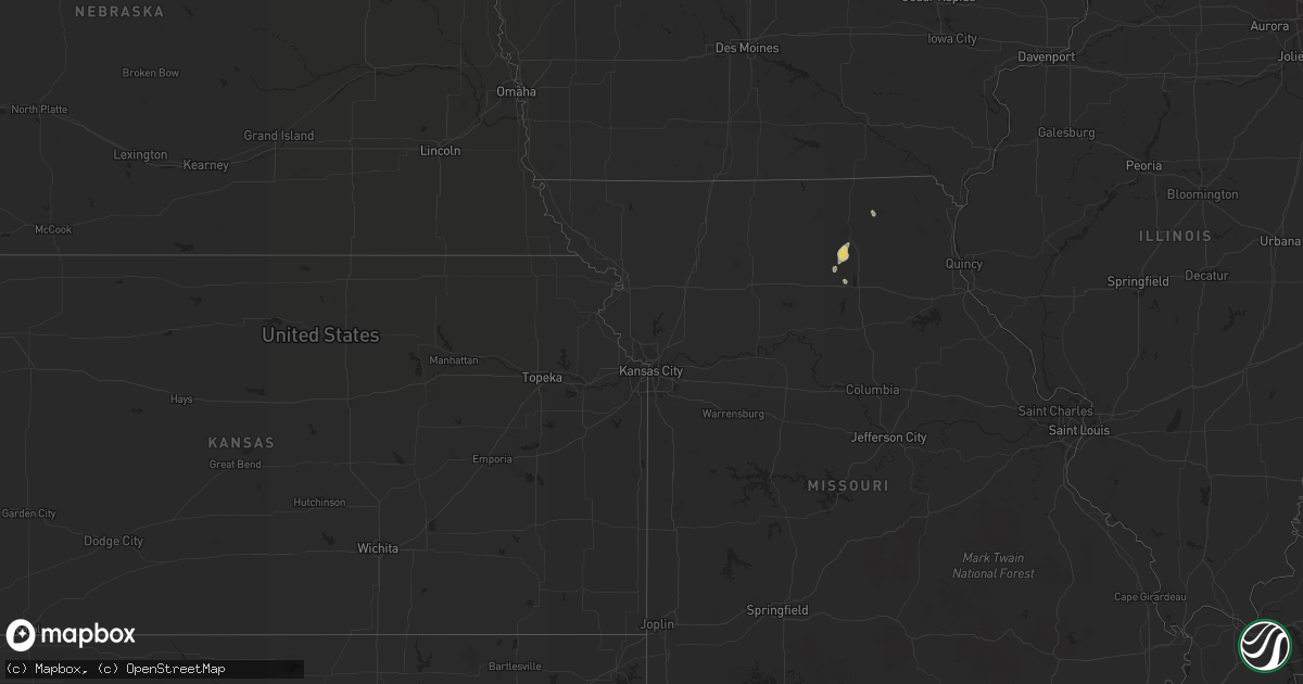
June 17 map
$229
one time, instant access
Download today. No call, no setup
Keep the $229
Bought the map and want the full workflow? Apply the entire $229 to a subscription within 7 days. None of it is wasted.
Every map, not just this one
This buys you this map. Subscription and you get every map we run, in the markets you choose from a few cities to whole states to nationwide. Plus real-time alerts the moment a storm fires.
Contact data
Name, contact info, occupancy, even credit band for addresses in the footprint. You go from where it hit to who to call.
Become the source they trust
Unlimited branding weather history reports on demand. You already have the documented answer ready for the property owner, and you are the one who showed up with it.
Property data and RoofTrace estimates
Pull up any address you have got, its value and the exact code rules for that jurisdiction, straight from One Click Code. Then RoofTrace estimates the squares, pitch, and roof value, priced the way you price.
Storm reports in South Dakota
South Dakota
| Date | Description |
|---|---|
| 06/17/20126:55 PM CDT | Pickup with trailer tipped over just west of interstate 29 near peever. |
| 06/17/20126:55 PM CDT | Pickup with trailer tipped over just west of interstate 29 near peever. |
| 06/17/20126:55 PM CDT | Pickup with trailer tipped over along i29 1 n of peever |
| 06/17/20126:45 PM CDT | A local report indicates 1.75 inch wind near 6 NW GROTON |
| 06/17/20126:15 PM CDT | A local report indicates 1.00 inch wind near 5 N GROTON |
| 06/17/20126:05 PM CDT | Mostly nickel to quarter hail but a few stones to half dollar sized. |
| 06/17/20126:05 PM CDT | Pool ball sized hail. Significant crop damage to corn and beans with hail damage to pickup truck. Small branches down. |
| 06/17/20125:55 PM CDT | A local report indicates 2.50 inch wind near 7 SW VEBLEN |
| 06/17/20125:49 PM CDT | A local report indicates 63 MPH wind near 2 E ABERDEEN |
| 06/17/20125:45 PM CDT | Very minor crop damage. |
| 06/17/20125:35 PM CDT | A local report indicates 1.00 inch wind near 10 E RICHMOND LAKE REC |
| 06/17/20125:30 PM CDT | Tennis ball sized hail fell at residence |
| 06/17/20125:29 PM CDT | A local report indicates 1.00 inch wind near RICHMOND LAKE REC AREA |
| 06/17/20125:20 PM CDT | Resident estimated ping pong ball sized hail |
| 06/16/20129:00 PM CDT | A local report indicates 1.00 inch wind near 1 N ALTAMONT |
| 06/16/20128:43 PM CDT | A local report indicates 1.00 inch wind near KRANZBURG |
| 06/16/20128:42 PM CDT | A local report indicates 1.75 inch wind near KRANZBURG |
| 06/16/20128:35 PM CDT | A local report indicates 1.00 inch wind near 5 N ALBEE |
| 06/16/20128:25 PM CDT | A local report indicates 1.50 inch wind near 7 S MILBANK |
| 06/16/20128:25 PM CDT | Mostly pea size. No strong winds. |
| 06/16/20128:23 PM CDT | A local report indicates 1.00 inch wind near WATERTOWN |
| 06/16/20127:45 PM CDT | Many trees uprooted... 25 ft evergreen uprooted... Power lines down... Structure damage |
| 06/16/20127:44 PM CDT | A local report indicates 1.00 inch wind near HAZEL |
| 06/16/20127:15 PM CDT | A local report indicates 1.00 inch wind near 4 N ORTLEY |
| 06/16/20127:10 PM CDT | A local report indicates 1.50 inch wind near 6 NE ORTLEY |
| 06/16/20127:00 PM CDT | Possible brief touchdown. |
All States Impacted by Hail Map on June 17, 2012
Cities Impacted by Hail Map on June 17, 2012
- Bisbee, ND
- Lake City, MN
- Mazeppa, MN
- Zumbrota, MN
- Goodhue, MN
- Peever, SD
- Henrietta, TX
- Leeds, ND
- Wilmington, OH
- Starbuck, MN
- Glenwood, MN
- Kandiyohi, MN
- Menahga, MN
- New York Mills, MN
- Aitkin, MN
- Cascade, WI
- Corona, SD
- Montevideo, MN
- Litchfield, MN
- Grove City, MN
- Groton, SD
- Olivia, MN
- Bird Island, MN
- Lake Lillian, MN
- Darwin, MN
- Atwater, MN
- Cosmos, MN
- Hutchinson, MN
- Melvin, TX
- Appleton, MN
- Stephenville, TX
- Fergus Falls, MN
- Foxhome, MN
- Dayton, OH
- Morris, MN
- Jacksboro, TX
- Pennock, MN
- Willmar, MN
- Wynnewood, OK
- Davis, OK
- Twin Brooks, SD
- Rosholt, SD
- Benson, MN
- Gary, SD
- Zumbro Falls, MN
- Wabasha, MN
- Springfield, OH
- Towner, ND
- New Holstein, WI
- Bath, SD
- Columbia, SD
- Murdock, MN
- Lidgerwood, ND
- Wahpeton, ND
- Hankinson, ND
- Mantador, ND
- Dawson, MN
- Boyd, MN
- Veblen, SD
- Britton, SD
- Summit, SD
- Ortley, SD
- Waubay, SD
- Warrens, WI
- Tomah, WI
- Flaxton, ND
- Bowbells, ND
- Wheaton, MN
- Dumont, MN
- Waconia, MN
- Chaska, MN
- Cologne, MN
- Mayer, MN
- Young America, MN
- New Germany, MN
- Nevada, OH
- Weatherford, TX
- Millsap, TX
- Lipan, TX
- Rugby, ND
- Mohall, ND
- Sherwood, ND
- Antler, ND
- Canby, MN
- Kranzburg, SD
- Goodwin, SD
- Watertown, SD
- Breckenridge, MN
- Sparta, WI
- Melrose, WI
- Bellevue, TX
- Bowie, TX
- New Carlisle, OH
- Clear Lake, SD
- Marietta, MN
- Ethel, MO
- Cayuga, ND
- Sisseton, SD
- Havana, ND
- Montello, WI
- Princeton, WI
- Merrifield, MN
- Brainerd, MN
- Underwood, MN
- Lake City, SD
- Labolt, SD
- Ortonville, MN
- Big Stone City, SD
- Odessa, MN
- Revillo, SD
- Milbank, SD
- Bellingham, MN
- Winthrop, MN
- Gaylord, MN
- Wolford, ND
- Willow City, ND
- Verndale, MN
- Sebeka, MN
- Newburg, ND
- Maxbass, ND
- Hancock, MN
- Danvers, MN
- Rolla, ND
- Amherst, SD
- Claremont, SD
- Belcourt, ND
- Tintah, MN
- Norcross, MN
- Faribault, MN
- Nerstrand, MN
- Webster, MN
- Montgomery, MN
- Northfield, MN
- Dundas, MN
- Lonsdale, MN
- Elko New Market, MN
- Jordan, MN
- New Prague, MN
- Le Center, MN
- Dennison, MN
- Belle Plaine, MN
- Stewart, MN
- Hector, MN
- Buffalo Lake, MN
- Raymond, OH
- Ironton, MN
- Aberdeen, SD
- Donnelsville, OH
- Enon, OH
- Ranger, TX
- Upham, ND
- Pipe Creek, TX
- D Hanis, TX
- Hondo, TX
- Stockholm, SD
- Waynesville, OH
- Oregonia, OH
- Harveysburg, OH
- Adell, WI
- Comanche, OK
- Vienna, SD
- Kenyon, MN
- Chilton, WI
- Hilbert, WI
- Elizabeth, MN
- Rothsay, MN
- Maynard, MN
- Dalton, MN
- New London, MN
- Beardsley, MN
- Browns Valley, MN
- Barry, MN
- Atlanta, MO
- Elmer, MO
- La Plata, MO
- Kirksville, MO
- Burnsville, MN
- Saint Paul, MN
- Milan, MN
- Clarkfield, MN
- Granite Falls, MN
- Clontarf, MN
- Breckenridge, TX
- Roslyn, SD
- Eden, SD
- Williamsburg, OH
- Kellogg, MN
- Mount Sterling, OH
- London, OH
- Lakeville, MN
- Cannon Falls, MN
- Prior Lake, MN
- Le Sueur, MN
- Henderson, MN
- Elbow Lake, MN
- Danube, MN
- Pierpont, SD
- Raymond, MN
- Kerkhoven, MN
- Eden, TX
- Perham, MN
- Camp Douglas, WI
- Hayti, SD
- Bryant, SD
- Castlewood, SD
- Hazel, SD
- Willow Lake, SD
- Strandburg, SD
- Spicer, MN
- Savage, MN
- Webster, SD
- Clara City, MN
- South Shore, SD
- Correll, MN
- Holloway, MN
- Madison, MN
- Watson, MN
- Grenville, SD
- Clinton, MN
- Wilmot, SD
- Sunburg, MN
- Nashua, MN
- Amherst, WI
- Waupaca, WI
- Almond, WI
- Bluff Dale, TX
- Dunseith, ND
- Hampton, MN
- Randolph, MN
- Elkhart Lake, WI
- Kiel, WI
- Saint Cloud, WI
- Hastings, MN
- Ipswich, SD
- Cokato, MN
- Fairborn, OH
- Andover, SD
- Westport, SD
- Oblong, IL
- Hoffman, MN
- Campbellsport, WI
- Glenbeulah, WI
- Knox, ND
- Henry, SD
- Clark, SD
- Green Lake, WI
- Berlin, WI
- Donnelly, MN
- Peerless, MT
- Baird, TX
- Rosendale, WI
- Eldorado, WI
- Bantry, ND
- Alberta, MN
- Chokio, MN
- Decatur, TX
- Era, TX
- Gainesville, TX
- Gorman, TX
- South Charleston, OH
- South Solon, OH
- Shakopee, MN
- Wood Lake, MN
- Yale, SD
- Kramer, ND
- Herman, MN
- Brooten, MN
- Cando, ND
- Columbus, ND
- Urbana, OH
- Medway, OH
- Tremont City, OH
- North Hampton, OH
- Tipp City, OH
- Alma, WI
- Silver Lake, MN
- Paint Rock, TX
- Palo Pinto, TX
- Nisswa, MN
- Pequot Lakes, MN
- Souris, ND
- Graford, TX
- Wendell, MN
- Lansford, ND
- Churchs Ferry, ND
- Renville, MN
- Glencoe, MN
- Sacred Heart, MN
- Red Wing, MN
- Lohn, TX
- Upper Sandusky, OH
- Bucyrus, OH
- Sycamore, OH
- Brady, TX
- Bottineau, ND
- Jeffersonville, OH
- Cedarville, OH
- Jamestown, OH
- Larsen, WI
- Muenster, TX
- York, ND
- Minnetonka, MN
- Mound, MN
- Wayzata, MN
- Excelsior, MN
- Pittsville, WI
- Ettrick, WI
- Welch, MN
- Clarksville, OH
- Omro, WI
- Vesper, WI
- Brownton, MN
- Farmington, MN
- West Bend, WI
- Kewaskum, WI
- Arcadia, WI
- Santo, TX
- Langford, SD
- Kenmare, ND
- Hinsdale, MT
- Saco, MT
- Plymouth, WI
- Waldo, WI
- Yellow Springs, OH
- Xenia, OH
- Lowry, MN
- Fairmount, ND
- Cyrus, MN
- Marvin, SD
- Belgium, WI
- Cedar Grove, WI
- Random Lake, WI
- Arlington, MN
- Winneconne, WI
- Fountain City, WI
- Cochrane, WI
- Fredonia, WI
- Mylo, ND
- Victoria, MN
- Lester Prairie, MN
- Blomkest, MN
- Wadena, MN
- Malta, MT
- Lindsay, TX
- Memphis, MO
- Baring, MO
- Oostburg, WI
- Saint Paris, OH
- Callao, MO
- Bevier, MO
- South Vienna, OH
- Rudolph, WI
- Wisconsin Rapids, WI
- Stevens Point, WI
- Junction City, WI
- Belgrade, MN
- Duncan, OK
- East Liberty, OH
- Kensington, MN
- Bristol, SD
- Minneapolis, MN
- Millville, MN
- Watertown, MN
- Carver, MN
- Minneota, MN
- Farwell, MN
- Green Isle, MN
- Wanamingo, MN
- Graceville, MN
- Plato, MN
- Paynesville, MN
- Maple Plain, MN
- Inver Grove Heights, MN
- Claire City, SD
- Hamburg, MN
- Prinsburg, MN
- Rosemount, MN
- Norwood Young America, MN
- Echo, MN
- Saint Bonifacius, MN
- Dassel, MN


