Hail Map on June 12, 2025
Get this storm
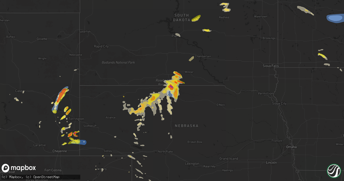
June 12 map
$229
one time, instant access
Download today. No call, no setup
Keep the $229
Bought the map and want the full workflow? Apply the entire $229 to a subscription within 7 days. None of it is wasted.
Every map, not just this one
This buys you this map. Subscription and you get every map we run, in the markets you choose from a few cities to whole states to nationwide. Plus real-time alerts the moment a storm fires.
Contact data
Name, contact info, occupancy, even credit band for addresses in the footprint. You go from where it hit to who to call.
Become the source they trust
Unlimited branding weather history reports on demand. You already have the documented answer ready for the property owner, and you are the one who showed up with it.
Property data and RoofTrace estimates
Pull up any address you have got, its value and the exact code rules for that jurisdiction, straight from One Click Code. Then RoofTrace estimates the squares, pitch, and roof value, priced the way you price.
States Impacted by Hail Map on June 12, 2025
Storm reports
New Mexico
| Date | Description |
|---|---|
| 06/12/20255:51 PM CDT | A local report indicates 69 MPH wind near 6 W Whites City |
| 06/11/20257:45 PM CDT | Em reported structure damage at granada shopping mall. One store had the front wall pushed in and roof collapsed and another business had its roof lifted up and then sl |
Montana
| Date | Description |
|---|---|
| 06/12/20256:55 PM CDT | A local report indicates 1.00 inch wind near 1 NNW Olive |
| 06/12/20256:50 PM CDT | Roof blown off house. Tree uprooted. Time estimated from radar. |
| 06/12/20256:50 PM CDT | Time estimated from radar. |
| 06/12/20256:35 PM CDT | A local report indicates 1.00 inch wind near 11 SW Coalwood |
Tennessee
| Date | Description |
|---|---|
| 06/12/20256:30 PM CDT | Tree down on power lines... Hwy 70 near cedar grove and nickel size hail. |
| 06/12/20255:55 PM CDT | Many trees were blown down in the cedar grove area. |
| 06/11/20259:17 PM CDT | Corrects previous non-tstm wnd dmg report from oakland. Reported a few trees down in the oakland... Tn area. Time and exact location estimated on radar. |
South Dakota
| Date | Description |
|---|---|
| 06/12/20255:50 PM CDT | A local report indicates 60 MPH wind near 20 S Mission |
| 06/12/20255:30 PM CDT | A local report indicates 1.75 inch wind near 18 S Okreek |
| 06/12/20255:15 PM CDT | A local report indicates 1.00 inch wind near 7 E Lakeview |
| 06/12/20255:12 PM CDT | Wind driven hail caused damage to house siding. Shingles also blown off house. Report via facebook also shows picture of hail estimated to be mostly smaller than quarte |
| 06/12/20254:50 PM CDT | A local report indicates 1.50 inch wind near 8 SSE Okreek |
| 06/12/20254:29 PM CDT | A local report indicates 1.00 inch wind near 20 SSE Okreek |
| 06/12/20253:30 PM CDT | A local report indicates 1.50 inch wind near 2 E Okreek |
Minnesota
| Date | Description |
|---|---|
| 06/12/20256:35 PM CDT | Photos of fallen large trees and tree limbs. |
| 06/12/20255:21 PM CDT | A local report indicates 1.25 inch wind near 2 W Odin |
| 06/11/20257:15 PM CDT | Awos station khcd hutchinson ap. |
| 06/11/20257:13 PM CDT | Numerous large trees and power lines down across hutchinson. |
| 06/11/20257:07 PM CDT | A local report indicates 1.50 inch wind near 6 N Lyle |
| 06/11/20257:06 PM CDT | A local report indicates 1.50 inch wind near 1 S Austin |
Wyoming
| Date | Description |
|---|---|
| 06/12/20256:19 PM CDT | Emergency manager shared photo via slack of hail bigger than a half dollar. |
| 06/12/20256:15 PM CDT | Emergency manager reports quarter sized hail at rd 15 and rd 70. |
| 06/12/20256:08 PM CDT | Emergency manager reports quarter sized hail ongoing in ft. Laramie. |
| 06/12/20256:07 PM CDT | Trained spotter reports quarter sized hail ongoing. |
| 06/12/20255:59 PM CDT | Trained spotter reported nickel to quarter sized hail. |
| 06/12/20255:14 PM CDT | Trained spotter estimated 60mph winds in albin. |
| 06/12/20255:12 PM CDT | Mping from storm chaser of measured 64mph wind gust with handheld kestrel. |
| 06/12/20255:06 PM CDT | Trained spotter reported quarter sized hail. This report was delayed. Time estimated via radar. |
| 06/12/20254:56 PM CDT | Mping report of 1.25in hail. Changed time on reprot due to report being delayed until after the storm left the area. |
| 06/12/20254:03 PM CDT | Nws emloyees reported being impacted by 1.5in hail on their way back to the office. Lost wiper blade due to hail. |
| 06/12/20253:51 PM CDT | Photos from storm spotter show damage consistent with a short-lived ef-1 tornado. Damage to fencing... Tree limbs down... And a flipped and lofted cattle trailer were s |
| 06/12/20253:35 PM CDT | Storm chaser submitted mping of 1.5in hail on the ground from the first storm. Hail time estimated via radar. |
| 06/12/20252:40 PM CDT | Mesonet station pc229 little bitter creek. |
| 06/11/20257:47 PM CDT | Facebook report of golf ball sized hail east of glendo. |
| 06/11/20257:42 PM CDT | Fire fighter reported quarter sized hail while fighting a lightning fire near glendo. |
| 06/11/20257:06 PM CDT | Wydot sensor at coleman reported a 61mph wind gust. |
Texas
| Date | Description |
|---|---|
| 06/12/20256:35 PM CDT | A nws employee reported metal roofing structures and a fence blown over near the intersection of benito ramirez and terry road in edinburg... Tx. |
| 06/12/20254:50 PM CDT | A fence was blown down on the island just northeast of the francine cohn preserve. |
| 06/12/20254:43 PM CDT | Large 30 ft tree down at intersection of leonard and mayfield st. |
| 06/12/20254:30 PM CDT | Nas corpus christi asos. |
| 06/12/20254:30 PM CDT | Power pole blown down blocking the roadway at oso bridge. |
| 06/12/20253:43 PM CDT | Corrects previous time from previous tstm wnd dmg report from corpus christi. Large 30 ft tree down at intersection of leonard and mayfield st. |
| 06/12/202511:00 AM CDT | Tree down in tuleta. |
| 06/12/20257:39 AM CDT | Live oak county emc confirmed minor tree and porch damage along a narrow path through george west. Media relayed photo of well developed funnel cloud with this storm. |
| 06/11/20258:04 PM CDT | Weslaco emergency management reported a residence trailer was rolled during strong winds just north of the expressway near mile 10 and mile 4 1/2 west with no injuries. |
| 06/11/20257:55 PM CDT | Awos station ktxw weslaco midvally. |
North Carolina
| Date | Description |
|---|---|
| 06/12/20254:34 PM CDT | Several trees down on the west side of the city of albemarle in the judy street and burleson street areas... Including some that fell onto homes. No injuries. |
| 06/11/20259:30 PM CDT | Several trees are down and blocking cook school road in pilot mountain. A power line is also down in an adjacent field with the transformer on fire. Time is estimated f |
| 06/11/20259:30 PM CDT | Several trees are down and blocking cook school road in pilot mountain. A power line is also down in an adjacent field with the transformer |
Arkansas
| Date | Description |
|---|---|
| 06/12/20253:55 PM CDT | Corrects previous tornado report from 2 ne little rock afb. Preliminary storm survey finds an ef0 tornado occurred just north of the little rock air force base... Near |
| 06/12/20253:55 PM CDT | Preliminary storm survey finds an ef0 tornado occurred just north of the little rock air force base... Near west maddox and west republican roads. Additional details wi |
Mississippi
| Date | Description |
|---|---|
| 06/12/20252:18 PM CDT | Delayed report: large trees down and power pole snapped in centreville on gordon street from thunderstorm winds. |
| 06/11/20259:35 PM CDT | Corrects previous non-tstm wnd dmg report from 3 e corinth. Reported tree blocking road at intersection of cr 100 and cr 157. |
| 06/11/20259:31 PM CDT | Reported tree down blocking cr 217 near farmington... Ms. |
| 06/11/20258:17 PM CDT | Corrects previous non-tstm wnd dmg report from 5 s oxford. Reported trees knocked down in the waterford... Ms area. Time and exact location estimated on radar. |
| 06/11/20257:43 PM CDT | Corrects previous non-tstm wnd dmg report from 7 nw oxford. Reported tree fell on trailer in tow on county road 198. |
Louisiana
| Date | Description |
|---|---|
| 06/12/20251:49 PM CDT | Broadcast media reports pictures of snapped trees at womens hospital in baton rouge. Time estimated by radar. |
| 06/12/20254:00 AM CDT | La rue angelle road blocked due to tree falling across the road. |
Nebraska
| Date | Description |
|---|---|
| 06/12/20256:21 PM CDT | A local report indicates 1.25 inch wind near Valentine |
| 06/12/20256:20 PM CDT | A local report indicates 1.75 inch wind near Valentine |
| 06/12/20256:13 PM CDT | A local report indicates 67 MPH wind near 1 S Valentine |
| 06/12/20256:05 PM CDT | A local report indicates 1.00 inch wind near 4 N Valentine |
| 06/12/20255:12 PM CDT | Mping from storm chaser of 64mph wind gust measured with handheld kestrel. |
| 06/11/202511:43 PM CDT | Asos s |
| 06/11/202511:43 PM CDT | Asos station kmck mc |
| 06/11/202511:43 PM CDT | Asos station kmck mccook airport measur |
| 06/11/202511:43 PM CDT | Asos station kmck mccook ai |
| 06/11/202511:43 PM CDT | Asos station kmck mccook airport measures 58 mph wind gust with storms. |
| 06/11/20257:48 PM CDT | A local report indicates 1.50 inch wind near 20 W Merritt Reservoir |
| 06/11/20257:01 PM CDT | A local report indicates 1.50 inch wind near 9 N Wood Lake |
Idaho
| Date | Description |
|---|---|
| 06/12/20256:45 PM CDT | Mesonet station ato atomic city. |
| 06/11/20257:00 PM CDT | Mesonet station ebr inl materials fuels complex. |
South Carolina
| Date | Description |
|---|---|
| 06/12/20255:50 PM CDT | Rc winds site recorded a 59 mph wind gust on the north shore of lake murray. |
Iowa
| Date | Description |
|---|---|
| 06/11/20258:50 PM CDT | Rochester news station passed on photos of two mature ponderosa pines that fell onto highway 218 north of floyd. Time estimated on radar. |
| 06/11/20258:36 PM CDT | Photo of fallen large tree. |
| 06/11/20257:30 PM CDT | A third of a large willow tree blown down. |
Cities Impacted by Hail Map on June 12, 2025
- Beeville, TX
- Goliad, TX
- Refugio, TX
- Lagrange, WY
- Hawk Springs, WY
- Mission, SD
- Okreek, SD
- Cheyenne, WY
- Winner, SD
- Tallulah, LA
- Utica, MS
- Vicksburg, MS
- Taft, TX
- Robstown, TX
- Meriden, WY
- Albin, WY
- Portland, TX
- Cotopaxi, CO
- Loveland, CO
- Burns, WY
- Marshall, TX
- Aransas Pass, TX
- Albemarle, NC
- Locust, NC
- Oakboro, NC
- Uvalde, TX
- Homosassa, FL
- Concan, TX
- Lecanto, FL
- Rio Frio, TX
- Corpus Christi, TX
- Kennebec, SD
- Presho, SD
- Hamill, SD
- Picacho, NM
- Chugwater, WY
- Pine Bluffs, WY
- Forsyth, MT
- Bighorn, MT
- Saint Francis, SD
- Reliance, SD
- Hysham, MT
- Odin, MN
- Mountain Lake, MN
- Yoder, WY
- Wheatland, WY
- Bushnell, NE
- Fort Sumner, NM
- Mansfield, SD
- Northville, SD
- Mellette, SD
- Butterfield, MN
- Scotts Hill, TN
- Bath Springs, TN
- Port Aransas, TX
- Harrisburg, NE
- Brandon, MS
- Warner, SD
- Trimont, MN
- Ashton, SD
- Valentine, NE
- Liberty, MS
- Smithdale, MS
- Decaturville, TN
- Creswell, NC
- Ormsby, MN
- Dowagiac, MI
- Morriston, FL
- Williston, FL
- Pelahatchie, MS
- Medina, TN
- Stratford, SD
- Lavinia, TN
- Milan, TN
- Veteran, WY
- Crookston, NE
- Volborg, MT
- Fort Laramie, WY
- Grulla, TX
- Mission, TX
- Albert Lea, MN
- Linn, TX
- Roper, NC
- Conde, SD
- Turton, SD
- Otter, MT
- Trenton, FL
- Glenville, MN
- Cedar Grove, TN
- Jackson, TN
- Edinburg, TX
- Newberry, FL
- Bronson, FL
- Elida, NM
- Sparks, NE
- Maben, MS
- Austin, MN
- Jay Em, WY
- Broadus, MT
- Sturgis, MS
- Starkville, MS
- Truman, MN
- Welcome, MN
- Decatur, MI
- Kilgore, NE
- Ideal, SD
- Witten, SD
- Snyder, CO
- Latimer, IA
- Sheffield, IA
- Alexander, IA
- Ceylon, MN
- Sherburn, MN
- Pheba, MS
- Garciasville, TX
- Benson, MN
- Montevideo, MN
- Danvers, MN
- Sullivan City, TX
- Fairmont, MN
- Nenzel, NE
- Olive, MT
- Wood Lake, NE
- Cody, NE
- Merino, CO
- Sterling, CO
- Henning, TN
- Thornton, IA
- Covington, TN
- Appleton, MN
- Glendo, WY
- Hartville, WY
- Portales, NM
- Pierre, SD
- Ripley, TN
- Lyle, MN
- Maynard, MN
- Murdock, MN
- Lake Butler, FL
- Brooker, FL
- Rose Creek, MN
- Clara City, MN
- Stewart, MN
- Brownton, MN
- Glencoe, MN
- Buffalo Lake, MN
- Hutchinson, MN
- Orient, SD
- Highmore, SD
- Onida, SD
- Forest, MS
- Raymond, MN
- Peetz, CO
- Saint Ansgar, IA
- Hargill, TX
- Silver Lake, MN
- Winsted, MN
- Lester Prairie, MN
- Hamburg, MN
- Norwood Young America, MN
- Young America, MN
- Plato, MN
- Fleming, CO
- Holabird, SD
- Sidney, NE
- Stacyville, IA
- Rogers, NM
- Edcouch, TX
- Manville, WY
- Shawnee, WY
- Weslaco, TX
- Donna, TX
- Elsa, TX
- La Villa, TX
- Mercedes, TX
- Garrett, WY
- Bosler, WY
- Seneca, SD
- Prinsburg, MN
- Manly, IA
- Floyd, NM
- Osage, IA
- Broadwater, NE
- New Germany, MN
- Watertown, MN
- Mayer, MN
- Montrose, MN
- Cologne, MN
- Waconia, MN
- Merriman, NE
- Thedford, NE
- Halls, TN
- Blomkest, MN
- Whitman, NE
- Little Cedar, IA
- Pontotoc, MS
- Saint Bonifacius, MN
- Ree Heights, SD
- Nora Springs, IA
- Swea City, IA
- Ledyard, IA
- Buffalo Center, IA
- Rudd, IA
- Rockford, IA
- Lodgepole, NE
- Crook, CO
- Floyd, IA
- Lusk, WY
- Charles City, IA
- Orchard, IA
- Lakota, IA
- Baldwyn, MS
- Marietta, MS
- Casper, WY
- Bingham, NE
- Ashby, NE
- Ovid, CO
- Miller, SD
- Julesburg, CO
- Big Springs, NE
- Arthur, NE
- Ellsworth, NE
- Hyannis, NE
- Lewellen, NE
- Lemoyne, NE
- Rushville, NE
- Seneca, NE
- Venango, NE
- Holyoke, CO
- Tishomingo, MS
- Booneville, MS
- Keystone, NE
- Grant, NE
- Madrid, NE
- Champion, NE
- Imperial, NE
- Gordon, NE
- Mullen, NE
- Parks, NE
- Enders, NE
- Lance Creek, WY
- Benkelman, NE
- Stapleton, NE
- Wauneta, NE
- Palisade, NE
- Trenton, NE
- Fort Pierre, SD
- Milan, MN
- Saint James, MN
- Brownsdale, MN
- Indianola, NE
- Atwood, KS
- Oberlin, KS
- Herndon, KS
- Culbertson, NE
- McDonald, KS
- Pavillion, WY
- Bird City, KS
- Fort Supply, OK
- Colby, KS
- Ludell, KS
- Wagner, SD
- Guernsey, WY
- Mills, NE
- Emmons, MN
- Lake Andes, SD
- Worthing, SD
- Lake Park, IA
- Bonesteel, SD
- Canton, SD
- Sibley, IA
- Twin Lakes, MN
- Elmore, MN
- Spirit Lake, IA
- Menno, SD
- Springview, NE
- Doon, IA
- Inwood, IA
- Lennox, SD
- Hurley, SD
- Little Rock, IA
- Estherville, IA
- Bricelyn, MN
- Scotland, SD
- George, IA
- Olivet, SD
- Herrick, SD
- Harris, IA
- Dolliver, IA
- Burke, SD
- Alvord, IA
- Ocheyedan, IA
- Davis, SD
- Kiester, MN
- Fairfax, SD
- Armstrong, IA
- Freeman, SD
- Gregory, SD
- Oakley, KS
- Monument, KS
- Butler, OK
- Quinter, KS
- Grinnell, KS
- Utica, KS
- Lookeba, OK
- Hinton, OK
- Geary, OK
- New Iberia, LA
- Enterprise, LA
- Harrisonburg, LA
- Binger, OK
- Gracemont, OK
- Ninnekah, OK
- Rush Springs, OK
- Jetmore, KS
- Marlow, OK