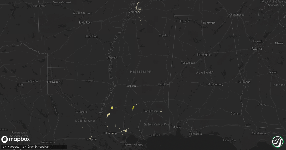
Hail Map in Mississippi on June 12, 2018
Get this storm
June 12 map
$229
one time, instant access
Download today. No call, no setup
Keep the $229
Bought the map and want the full workflow? Apply the entire $229 to a subscription within 7 days. None of it is wasted.
Every map, not just this one
This buys you this map. Subscription and you get every map we run, in the markets you choose from a few cities to whole states to nationwide. Plus real-time alerts the moment a storm fires.
Contact data
Name, contact info, occupancy, even credit band for addresses in the footprint. You go from where it hit to who to call.
Become the source they trust
Unlimited branding weather history reports on demand. You already have the documented answer ready for the property owner, and you are the one who showed up with it.
Property data and RoofTrace estimates
Pull up any address you have got, its value and the exact code rules for that jurisdiction, straight from One Click Code. Then RoofTrace estimates the squares, pitch, and roof value, priced the way you price.
Storm reports in Mississippi
Mississippi
| Date | Description |
|---|---|
| 06/12/20184:35 PM CDT | Hail up to the size of quarters fell along divide road. |
| 06/12/20183:15 PM CDT | Trees and large limbs were blown down near sand hill road... Beauregard road... And monticello road east of wesson. |
| 06/12/20182:30 PM CDT | A few trees downed. Report relayed through social media. Winds estimated at 50 mph. |
| 06/12/201812:49 AM CDT | At 549 PM CDT, a severe thunderstorm was located near Kirby, or 20 miles east of Natchez, moving south at 15 mph. HAZARD...60 mph wind gusts and half dollar size hail. SOURCE...Radar indicated. IMPACT...Hail damage to vehicles is expected. Expect wind damage to roofs, siding, and trees. This severe thunderstorm will be near... Garden City around 615 PM CDT.Other locations impacted by this severe thunderstorm include Roxie. |
| 06/11/201811:36 PM CDT | At 435 PM CDT, a severe thunderstorm was located over Meehan, or 8 miles southwest of Meridian, moving southwest at 10 mph. HAZARD...60 mph wind gusts and quarter size hail. SOURCE...Radar indicated. IMPACT...Hail damage to vehicles is expected. Expect wind damage to roofs, siding, and trees. This severe thunderstorm will be near... Meehan around 440 PM CDT.Other locations impacted by this severe thunderstorm include Pachuta. |
| 06/11/201811:33 PM CDT | At 433 PM CDT, a severe thunderstorm was located over Robinwood, or 18 miles north of Kokomo, moving east at 10 mph. HAZARD...60 mph wind gusts and penny size hail. SOURCE...Radar indicated. IMPACT...Expect damage to roofs, siding, and trees. This severe thunderstorm will be near... Arm around 440 PM CDT. Tilton around 445 PM CDT. Oak Vale and Progress around 500 PM CDT. Society Hill and Goss around 515 PM CDT.Other locations impacted by this severe thunderstorm include SilverCreek. |
| 06/11/20188:53 PM CDT | At 152 PM CDT, a severe thunderstorm was located over Kiln, or near Diamondhead, moving northeast at 5 mph. HAZARD...60 mph wind gusts. SOURCE...Radar indicated. IMPACT...Expect damage to roofs, siding, and trees. Locations impacted include... Kiln. |
All States Impacted by Hail Map on June 12, 2018
Cities Impacted by Hail Map on June 12, 2018
- Cadiz, KY
- Follett, TX
- Shattuck, OK
- St John, KS
- Macksville, KS
- Larned, KS
- Gleason, WI
- Tomahawk, WI
- Monticello, KY
- Happy, TX
- Hammond, LA
- Hartley, TX
- Channing, TX
- Vega, TX
- Dalhart, TX
- Miami, TX
- Albion, IL
- Grayville, IL
- Butler, OK
- Clinton, OK
- Custer City, OK
- Lewis, KS
- Wanette, OK
- Minneola, KS
- Gate, OK
- Liberal, KS
- Boley, OK
- Bristow, OK
- Castle, OK
- Elbert, CO
- Colorado Springs, CO
- Greensburg, KS
- Mullinville, KS
- Pocahontas, IA
- Rosston, OK
- Stroud, OK
- Depew, OK
- Thibodaux, LA
- Roxie, MS
- Taloga, OK
- Putnam, OK
- Seiling, OK
- Thomas, OK
- Manistique, MI
- Offerle, KS
- Glen Flora, WI
- Kennan, WI
- Hawkins, WI
- Tony, WI
- Ladysmith, WI
- Bucklin, KS
- Spearville, KS
- Kinsley, KS
- Coyle, OK
- Panhandle, TX
- Kendall, KS
- Cordova, TN
- Memphis, TN
- Hugoton, KS
- Turpin, OK
- Kismet, KS
- Garfield, KS
- Belpre, KS
- Providence, KY
- Bertrand, MO
- Charleston, MO
- Groom, TX
- Jim Falls, WI
- Cadott, WI
- Bloomer, WI
- Cornell, WI
- Lublin, WI
- Gilman, WI
- Withee, WI
- Thorp, WI
- Boyd, WI
- Medford, WI
- Stanley, WI
- Granite, OK
- Mangum, OK
- Gilmore City, IA
- Woodville, MS
- Gloster, MS
- Drumright, OK
- Prentice, WI
- Tripoli, WI
- Brantwood, WI
- Big Sandy, TN
- Canadian, TX
- Hugo, CO
- Meridian, OK
- Guthrie, OK
- Park Falls, WI
- Capulin, NM
- Des Moines, NM
- Hereford, TX
- Holden, LA
- Quail, TX
- Wellington, TX
- Cheneyville, LA
- Bunkie, LA
- Humboldt, IA
- Clare, IA
- Elizabethtown, KY
- Willow, OK
- Erick, OK
- Vinson, OK
- Sayre, OK
- Ford, KS
- Canyon, TX
- Silverton, TX
- Tulia, TX
- Stinnett, TX
- Gould, OK
- Haviland, KS
- Byers, KS
- Wayside, TX
- Amarillo, TX
- Thornton, IA
- Rockwell, IA
- Sheffield, IA
- Swaledale, IA
- Sweetwater, OK
- Cheyenne, OK
- Keyes, OK
- Beaver, OK
- Chester, OK
- Myakka City, FL
- Pampa, TX
- Iron Belt, WI
- Fountain, CO
- Luther, OK
- Athens, WI
- Caledonia, MN
- Texhoma, OK
- Berry, AL
- Bankston, AL
- Baton Rouge, LA
- Decorah, IA
- Goodwell, OK
- Caldwell, KS
- Booker, TX
- Lipscomb, TX
- Pueblo, CO
- Claude, TX
- Briscoe, TX
- Lynnville, IN
- Nazareth, TX
- Dimmitt, TX
- Rolfe, IA
- Boonville, IN
- Mamou, LA
- Corning, AR
- Neelyville, MO
- Delaplaine, AR
- Memphis, TX
- Childress, TX
- Catawba, WI
- Ashland, KS
- Harshaw, WI
- Hazelhurst, WI
- Forgan, OK
- Laverne, OK
- Buffalo, OK
- Protection, KS
- Plains, KS
- Englewood, KS
- Meade, KS
- Stewart, TN
- Dover, TN
- Pickerel, WI
- White Lake, WI
- Bryant, WI
- Murphysboro, IL
- De Soto, IL
- Hornersville, MO
- Hardinsburg, KY
- Harned, KY
- Altenburg, MO
- Grand Tower, IL
- Frohna, MO
- Knobel, AR
- Puryear, TN
- Guymon, OK
- Hooker, OK
- Jonesboro, IL
- Phillips, WI
- Ulysses, KS
- Rock, MI
- Cornell, MI
- Tickfaw, LA
- Ponchatoula, LA
- Johnson, KS
- Jackson, TN
- Bells, TN
- Humboldt, TN
- Gadsden, TN
- Carter, OK
- Kit Carson, CO
- Scott, LA
- Lafayette, LA
- Pawnee Rock, KS
- Carmi, IL
- Mount Carmel, IL
- Burnt Prairie, IL
- Owensville, IN
- Golden Gate, IL
- Ellery, IL
- Fairfield, IL
- Griffin, IN
- Clarendon, TX
- Quitaque, TX
- Rector, AR
- Piggott, AR
- Denton, GA
- Aredale, IA
- Greene, IA
- Albany, LA
- Dorchester, IA
- Hollis, OK
- Coffeeville, AL
- Abernathy, TX
- Shallowater, TX
- Winter, WI
- Lone Wolf, OK
- Borger, TX
- Cooks, MI
- Edmond, OK
- Garner, IA
- Klemme, IA
- Leachville, AR
- Haxtun, CO
- Spearman, TX
- Hardesty, OK
- Mooreland, OK
- Chappell, NE
- Jacob, IL
- Wolfforth, TX
- Ropesville, TX
- Glidden, WI
- Bruce, WI
- Balmorhea, TX
- Plover, IA
- Ottosen, IA
- Bradgate, IA
- Rutland, IA
- Lakin, KS
- Stillwater, OK
- Perkins, OK
- North Vernon, IN
- Drummonds, TN
- Millington, TN
- Ogema, WI
- Grant, NE
- Elk City, OK
- Bruce Crossing, MI
- Venango, NE
- Perryton, TX
- Earlsboro, OK
- Shawnee, OK
- Mobile, AL
- Masterson, TX
- Fritch, TX
- Paragould, AR
- Eitzen, MN
- New Albin, IA
- Bono, AR
- Beech Grove, AR
- Cushing, OK
- Westboro, WI
- Bluff City, KS
- Syracuse, KS
- Dumont, IA
- Dougherty, IA
- Bristow, IA
- Sharon, OK
- Arlington, TN
- Great Bend, KS
- Wayne City, IL
- Bloomfield, MO
- Dexter, MO
- Longdale, OK
- Colfax, WI
- Wheeler, WI
- Prague, OK
- Alpine, TX
- Florence, AL
- Scott City, MO
- Jackson, MO
- Wolf Lake, IL
- Britt, IA
- Viroqua, WI
- Belle Rive, IL
- Crossville, IL
- Folsom, NM
- Springfield, LA
- Minocqua, WI
- Woodruff, WI
- Harvey, LA
- Gretna, LA
- Ina, IL
- Bonnie, IL
- Skellytown, TX
- Barnhill, IL
- New Concord, KY
- Hazel, KY
- Walls, MS
- Southaven, MS
- Horn Lake, MS
- Senatobia, MS
- Ironwood, MI
- Reydon, OK
- Oakwood, OK
- Dumas, TX
- Okemah, OK
- Harviell, MO
- Turkey, TX
- Marble Hill, MO
- Zalma, MO
- Kiowa, CO
- Elizabeth, CO
- Amherst, TX
- Martin, TN
- Dresden, TN
- Holcombe, WI
- Owen, WI
- Merrill, WI
- Balko, OK
- Crandon, WI
- Jackson, LA
- Alto Pass, IL
- Loranger, LA
- Bartlesville, OK
- Emerson, AR
- Elkhart, KS
- Walnut Ridge, AR
- Alicia, AR
- Boulder Junction, WI
- Manitowish Waters, WI
- Ava, IL
- Cape Girardeau, MO
- Genoa, WI
- Stoddard, WI
- Mclean, TX
- Medford, OK
- Fayette, AL
- Marksville, LA
- Holly Springs, MS
- Folsom, LA
- Irma, WI
- Rhinelander, WI
- Chaseburg, WI
- Parrish, FL
- Magnolia, AL
- Linden, AL
- Clinton, LA
- Blytheville, AR
- Richton, MS
- Kanawha, IA
- Carencro, LA
- Chandler, IN
- Olive Branch, MS
- Byhalia, MS
- Charles City, IA
- Duson, LA
- Glenallen, MO
- Agra, OK
- Tryon, OK
- Chandler, OK
- Thomaston, AL
- Puxico, MO
- Cumberland City, TN
- Tennessee Ridge, TN
- Lake Tomahawk, WI
- Stratford, TX
- Walsh, CO
- Carbon Hill, AL
- Prentiss, MS
- Silver Creek, MS
- Crosby, MS
- Centreville, MS
- Tennyson, IN
- Asher, OK
- Greenwell Springs, LA
- Fifield, WI
- Kuttawa, KY
- Shongaloo, LA
- Higgins, TX
- Mill Shoals, IL
- Gorham, IL
- Munford, TN
- Brighton, TN
- Burlison, TN
- Freetown, IN
- Philpot, KY
- Independence, KS
- New Auburn, WI
- Raleigh, MS
- Norman, IN
- Orlando, FL
- Monticello, MS
- Jayess, MS
- Union City, TN
- Wellston, OK
- Arcadia, OK
- Ripley, OK
- Powhatan, AR
- Tamaroa, IL
- Cloutierville, LA
- Larkspur, CO
- Karval, CO
- White Deer, TX
- Summerfield, TX
- Palmer, IA
- Fort Dodge, IA


