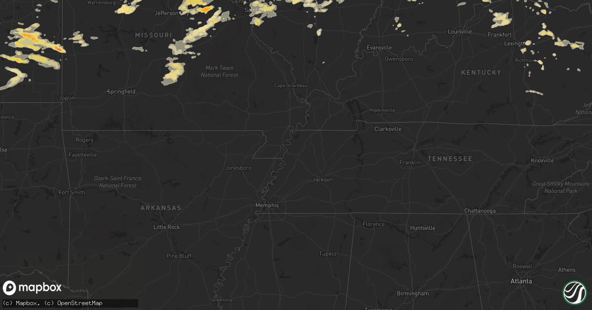
Hail Map in Virginia on June 10, 2011
Get this storm
June 10 map
$229
one time, instant access
Download today. No call, no setup
Keep the $229
Bought the map and want the full workflow? Apply the entire $229 to a subscription within 7 days. None of it is wasted.
Every map, not just this one
This buys you this map. Subscription and you get every map we run, in the markets you choose from a few cities to whole states to nationwide. Plus real-time alerts the moment a storm fires.
Contact data
Name, contact info, occupancy, even credit band for addresses in the footprint. You go from where it hit to who to call.
Become the source they trust
Unlimited branding weather history reports on demand. You already have the documented answer ready for the property owner, and you are the one who showed up with it.
Property data and RoofTrace estimates
Pull up any address you have got, its value and the exact code rules for that jurisdiction, straight from One Click Code. Then RoofTrace estimates the squares, pitch, and roof value, priced the way you price.
Storm reports in Virginia
Virginia
| Date | Description |
|---|---|
| 06/10/20116:50 PM CDT | Two trees down on route 685 |
| 06/10/20116:31 PM CDT | Tree down |
| 06/10/20116:18 PM CDT | Tree down |
| 06/10/20116:09 PM CDT | Multiple 15-20 plus inch diameter trees blown down. |
| 06/10/20116:09 PM CDT | 8-12 inch diameter tree blown down. |
| 06/10/20115:36 PM CDT | Trees down along a quarter mile path from crafts ford road and 3 quarter point road. |
| 06/10/20115:28 PM CDT | Dime to quarter size hail |
| 06/10/20115:26 PM CDT | A local report indicates 1.50 inch wind near 2 ESE WHITE HALL |
| 06/10/20114:45 PM CDT | Tree down |
| 06/10/20114:38 PM CDT | Occurred on union church road |
| 06/10/20114:00 PM CDT | Large limbs down vicinity of virginia beach friends school. |
| 06/10/20113:10 PM CDT | Tree down in yard. |
| 06/10/20112:55 PM CDT | Trees down on power lines |
| 06/10/20112:26 PM CDT | A local report indicates 1.50 inch wind near 2 ESE WHITE HALL |
| 06/10/20112:20 PM CDT | Several 4 in diameter tree limbs down |
| 06/10/20112:00 PM CDT | Several 4 in diameter tree limbs down |
| 06/10/20118:54 AM CDT | A local report indicates 1.00 inch wind near CASCADE |
| 06/09/20117:30 PM CDT | Trees down all over city. |
| 06/09/20117:05 PM CDT | Numerous trees reported down on us 301 |
All States Impacted by Hail Map on June 10, 2011
Cities Impacted by Hail Map on June 10, 2011
- Farmersville, OH
- Germantown, OH
- Economy, IN
- Hagerstown, IN
- Losantville, IN
- Modoc, IN
- Morris, GA
- Georgetown, GA
- Eufaula, AL
- Lumpkin, GA
- Durham, NC
- Marshville, NC
- Phenix City, AL
- Irvine, KY
- McDavid, FL
- Columbus, OH
- Galloway, OH
- Greenville, IL
- Smithboro, IL
- Pocahontas, IL
- Carlyle, IL
- Keyesport, IL
- Mulberry Grove, IL
- Vandalia, IL
- Moberly, MO
- Thompson, MO
- Santa Fe, MO
- Madison, MO
- Boonville, MO
- Pilot Grove, MO
- Franklin, MO
- Paris, MO
- Higbee, MO
- Centralia, MO
- Bunceton, MO
- Clark, MO
- New Franklin, MO
- Otterville, MO
- Blackwater, MO
- Mexico, MO
- Sturgeon, MO
- Fayette, MO
- Attica, OH
- New Washington, OH
- Republic, OH
- Tiffin, OH
- Bloomville, OH
- Glasgow, MO
- Tahoka, TX
- Chelsea, AL
- Mattaponi, VA
- Centreville, AL
- Lawley, AL
- Blissfield, OH
- Rawson, OH
- Fredericktown, OH
- Morral, OH
- Ottawa, OH
- Bellville, OH
- Mount Vernon, OH
- Mount Blanchard, OH
- Fresno, OH
- Millersburg, OH
- Mansfield, OH
- Mount Gilead, OH
- Danville, OH
- Brinkhaven, OH
- Columbus Grove, OH
- Baltic, OH
- Glenmont, OH
- Dunkirk, OH
- Howard, OH
- Jenera, OH
- Upper Sandusky, OH
- Butler, OH
- Ada, OH
- Arlington, OH
- Coshocton, OH
- Caledonia, OH
- Killbuck, OH
- Mount Cory, OH
- Marion, OH
- Bluffton, OH
- Pandora, OH
- Harpster, OH
- Warsaw, OH
- Edison, OH
- Bucyrus, OH
- Forest, OH
- Galion, OH
- Williamstown, OH
- Nevada, OH
- Shawboro, NC
- Moyock, NC
- New London, OH
- Sullivan, OH
- Wellington, OH
- Attica, IN
- Covington, IN
- Farina, IL
- La Prairie, IL
- Plymouth, IL
- Rutledge, MO
- Warsaw, IL
- Basco, IL
- Camden, IL
- Canton, MO
- Wyaconda, MO
- Huntsville, IL
- Alexandria, MO
- West Point, IL
- Williamstown, MO
- Bowen, IL
- Monticello, MO
- Gorin, MO
- Sutter, IL
- Carthage, IL
- Saint Patrick, MO
- Kahoka, MO
- Augusta, IL
- Littleton, IL
- Bland, MO
- Owensville, MO
- Rosebud, MO
- Alexandria, KY
- Melbourne, KY
- California, KY
- Newport, KY
- Ralls, TX
- Orient, OH
- Grove City, OH
- West Jefferson, OH
- Groveport, OH
- Lockbourne, OH
- Cincinnati, OH
- Smithton, MO
- Gastonia, NC
- Milton, FL
- Jay, FL
- Odonnell, TX
- Lamesa, TX
- North Bend, OH
- Cleves, OH
- Addyston, OH
- Hebron, KY
- Thomasville, AL
- Coffeeville, AL
- White Hall, IL
- Palmyra, IL
- Murrayville, IL
- Franklin, IL
- Roodhouse, IL
- Payson, IL
- Liberty, IL
- Plainville, IL
- Cedar Vale, KS
- Cameron, NC
- Wooster, OH
- Smithville, OH
- Orrville, OH
- Sterling, OH
- Creston, OH
- Camp Point, IL
- Clayton, IL
- Pine Mountain, GA
- Vevay, IN
- Madison, IN
- Washington, MO
- Belle, MO
- Dixon, MO
- Marthasville, MO
- Gerald, MO
- Saint James, MO
- Beaufort, MO
- Union, MO
- Vienna, MO
- New Haven, MO
- Leslie, MO
- Cuba, MO
- Vichy, MO
- Rolla, MO
- Paducah, TX
- Monroe City, MO
- Hunnewell, MO
- Bethel, MO
- Emden, MO
- Shelbyville, MO
- Philadelphia, MO
- Maysville, KY
- Morrison, MO
- Lorenzo, TX
- Jacksonville, MO
- Cairo, MO
- Fort Monroe, VA
- Hampton, VA
- Newport News, VA
- Yorktown, VA
- Poquoson, VA
- Franklin, IN
- Owenton, KY
- Corolla, NC
- Tell, TX
- Childress, TX
- Cee Vee, TX
- Big Spring, TX
- Garnett, KS
- Westphalia, KS
- Kincaid, KS
- Welda, KS
- Colony, KS
- Blue Mound, KS
- Gail, TX
- Snyder, TX
- Colorado City, TX
- Ira, TX
- Fluvanna, TX
- Coahoma, TX
- Monroeville, AL
- Brent, AL
- Coffeen, IL
- Bingham, IL
- Ramsey, IL
- Fillmore, IL
- Worden, IL
- Hamel, IL
- East Lynn, WV
- Valmeyer, IL
- Charles City, VA
- Chester, VA
- Hopewell, VA
- Henrico, VA
- Colonial Heights, VA
- Richmond, VA
- Drummond, OK
- Norwich, OH
- Cumberland, OH
- New Concord, OH
- Cambridge, OH
- Haviland, OH
- Cloverdale, OH
- Paulding, OH
- Grover Hill, OH
- Oakwood, OH
- Covington, OH
- Russia, OH
- Greenville, OH
- Versailles, OH
- Rossburg, OH
- Ansonia, OH
- Bradford, OH
- Newton, IL
- Fostoria, OH
- Kansas, OH
- Urbana, OH
- Moores Hill, IN
- Mauk, GA
- Kinderhook, IL
- Hull, IL
- Lockport, KY
- Bethlehem, KY
- Littleton, NC
- Wayne, WV
- Crocker, MO
- Saint Louis, MO
- Bessie, OK
- Cordell, OK
- Granite, OK
- Dill City, OK
- Sentinel, OK
- Mangum, OK
- Corn, OK
- Willow, OK
- Lone Wolf, OK
- Maplesville, AL
- Sandy Hook, MS
- Semmes, AL
- Wilmer, AL
- Lucedale, MS
- Moss Point, MS
- Mobile, AL
- Martinsville, IN
- Sabina, OH
- Washington Court House, OH
- Chatom, AL
- Sedalia, MO
- Dale, IN
- Ferdinand, IN
- Ravenna, KY
- Butler, GA
- Whatley, AL
- Grove Hill, AL
- Blakely, GA
- Huntington, IN
- Roanoke, IN
- Waynetown, IN
- Crawfordsville, IN
- Hannibal, MO
- Cable, OH
- Crozet, VA
- North Garden, VA
- Free Union, VA
- Charlottesville, VA
- Crosbyton, TX
- Lancaster, VA
- Dalmatia, PA
- Benedict, KS
- Altoona, KS
- Thayer, KS
- Glade Valley, NC
- Hillsboro, OH
- Schell City, MO
- Rockville, MO
- Piedmont, OK
- New Douglas, IL
- Alhambra, IL
- Highland, IL
- Montgomery City, MO
- London, KY
- East Bernstadt, KY
- Manchester, KY
- Birmingham, AL
- Norborne, MO
- Braymer, MO
- Carrollton, MO
- Richmond, MO
- Sunman, IN
- Smithfield, VA
- West Salem, OH
- Richards, MO
- Fort Scott, KS
- Fulton, KS
- Kenton, OH
- Mount Victory, OH
- Okarche, OK
- North Vernon, IN
- Mocksville, NC
- Batchtown, IL
- Fieldon, IL
- Winfield, MO
- Grafton, IL
- Brussels, IL
- Covington, VA
- Clifton Forge, VA
- Iron Gate, VA
- Mount Sterling, KY
- Winchester, KY
- Richmond, KY
- Lexington, KY
- Mount Airy, NC
- Lowgap, NC
- New Canton, IL
- Barry, IL
- Baylis, IL
- Bunn, NC
- Zebulon, NC
- Castalia, NC
- Louisburg, NC
- Spring Hope, NC
- Nashville, NC
- Monroe, NC
- Wingate, NC
- Greensboro, AL
- Grantville, PA
- Annville, PA
- Jonestown, PA
- Ashley, IL
- Woodlawn, IL
- Pelzer, SC
- Bahama, NC
- Cantrall, IL
- Athens, IL
- Argos, IN
- Culver, IN
- Tippecanoe, IN
- Plymouth, IN
- Xenia, OH
- Mount Solon, VA
- Sweet Water, AL
- Virginia Beach, VA
- Pageland, SC
- Mount Croghan, SC
- Zanesville, OH
- Bay Minette, AL
- Perdido, AL
- Daphne, AL
- Loxley, AL
- Stapleton, AL
- Sherman, IL
- Wilson, TX
- Spur, TX
- Idalou, TX
- Slaton, TX
- Ransom Canyon, TX
- Lubbock, TX
- El Reno, OK
- Eastanollee, GA
- Toccoa, GA
- Marion, AL
- Jamestown, OH
- Jeffersonville, OH
- Edmond, OK
- Cashion, OK
- Lumberton, MS
- Mooresville, IN
- Macclesfield, NC
- Fountain, NC
- Ozark, AL
- New Brockton, AL
- Enterprise, AL
- Ariton, AL
- Charlotte, NC
- Fort Wayne, IN
- Quincy, IL
- Mendon, IL
- Paloma, IL
- Fowler, IL
- Coatsburg, IL
- Newland, NC
- Savonburg, KS
- Hepler, KS
- Elsmore, KS
- Uniontown, KS
- Hermann, MO
- Berger, MO
- Memphis, TX
- Heath Springs, SC
- Bonnie, IL
- Opdyke, IL
- Mount Vernon, IL
- Waverly, VA
- Courtland, VA
- Yale, VA
- Coeburn, VA
- Raleigh, NC
- Wake Forest, NC
- Shellman, GA
- Cuthbert, GA
- Parrott, GA
- Weston, GA
- Dawson, GA
- Perry, MO
- Martinsville, VA
- Williamston, SC
- Mount Vernon, AL
- Rising Sun, IN
- Skipperville, AL
- Wellsville, MO
- New Bremen, OH
- Celina, OH
- Maria Stein, OH
- Sidney, OH
- Minster, OH
- Fort Loramie, OH
- Patriot, IN
- Troy, IL
- O'Fallon, IL
- Caseyville, IL
- Collinsville, IL
- Greenfield, IN
- Sparta, NC
- Selma, NC
- Lucama, NC
- Kenly, NC
- Bailey, NC
- Princeton, NC
- Smithfield, NC
- Middlesex, NC
- Sims, NC
- Patoka, IL
- Odessa, MO
- Laddonia, MO
- Rush Hill, MO
- Edgewood, IL
- Mason, IL
- Brownstown, IL
- Saint Peter, IL
- Winslow, IN
- Velpen, IN
- Newburg, MO
- Jerome, MO
- Excello, MO
- Clarence, MO
- Macon, MO
- Anabel, MO
- Wilmington, OH
- Holliday, MO
- Matador, TX
- Selma, AL
- Sheridan, IN
- Rich Hill, MO
- Butler, MO
- Sanford, NC
- Altus, OK
- La Harpe, KS
- Moran, KS
- Iola, KS
- Ackerly, TX
- Tarzan, TX
- Dayton, KY
- Bellevue, KY
- Macon, NC
- Winchester, IL
- Hydro, OK
- Clarksville, OH
- Oregonia, OH
- Camdenton, MO
- Macks Creek, MO
- Fort Rucker, AL
- Kingman, IN
- Trafalgar, IN
- Morgantown, IN
- Edinburgh, IN
- Okeana, OH
- Hamilton, OH
- Oxford, OH
- Sterrett, AL
- Williamsburg, MO
- Brewton, AL
- Granite City, IL
- Shawnee, KS
- Bonner Springs, KS
- Alexandria, IN
- Elwood, IN
- Daleville, AL
- Mapleton, KS
- Bronson, KS
- Skippers, VA
- Emporia, VA
- Drewryville, VA
- Branchville, VA
- Pleasant Hill, NC
- Post, TX
- Genoa, WV
- Mount Sterling, IL
- Rushville, IL
- Kilbourne, IL
- Marine, IL
- Sorento, IL
- Edwardsville, IL
- Elizabeth City, NC
- Belvidere, NC
- Benld, IL
- Bunker Hill, IL
- Sawyerville, IL
- Mount Olive, IL
- Staunton, IL
- Gillespie, IL
- Wilsonville, IL
- Stuarts Draft, VA
- Faber, VA
- Lyndhurst, VA
- Roseland, VA
- Nellysford, VA
- Worthville, KY
- Corinth, KY
- Stamping Ground, KY
- Columbia, IL
- Waterloo, IL
- Buckingham, VA
- Calumet, OK
- Ashley, OH
- Old Monroe, MO
- O'Fallon, MO
- Foley, MO
- Golden Eagle, IL
- Moorefield, KY
- Hillsboro, KY
- Salt Lick, KY
- Carlisle, KY
- Sharpsburg, KY
- Owingsville, KY
- Bronaugh, MO
- Richland, GA
- Preston, GA
- South Mills, NC
- Lykens, PA
- Berrysburg, PA
- Millersburg, PA
- Pillow, PA
- Herndon, PA
- Elizabethville, PA
- Rhineland, MO
- Portland, MO
- Rochester, IN
- Mentone, IN
- Appalachia, VA
- Quaker City, OH
- Woodsfield, OH
- Summerfield, OH
- Sarahsville, OH
- Lewisville, OH
- Salem, IL
- Latonia, KY
- New Richmond, OH
- Silver Grove, KY
- Hershey, PA
- Palmyra, PA
- Vandalia, MO
- Farber, MO
- Scottsburg, IN
- Brooksville, KY
- Waverly, KS
- Williamsburg, KS
- Repton, AL
- Frankfort, KY
- Pleasureville, KY
- Bagdad, KY
- Milan, IN
- Aurora, IN
- Daleville, IN
- Anderson, IN
- Jacksonville, IL
- Ashland, IL
- Alexander, IL
- Fort Stockton, TX
- Griggsville, IL
- Chambersburg, IL
- Piqua, KS
- Yates Center, KS
- Humboldt, KS
- Elberon, VA
- King, NC
- Clopton, AL
- Clio, AL
- Fredericksburg, OH
- Holmesville, OH
- Sibley, MO
- Bates City, MO
- Camden, MO
- Henrietta, MO
- Napoleon, MO
- Buckner, MO
- Levasy, MO
- Orrick, MO
- Grain Valley, MO
- Oak Grove, MO
- Blue Springs, MO
- Independence, MO
- Kingfisher, OK
- Shreve, OH
- Chamois, MO
- Linn, MO
- Berea, KY
- Crane, IN
- Tipton, IN
- Atlanta, IN
- Ruby, SC
- Paris, KY
- Burbank, OH
- Dayton, OH
- Clayton, OH
- Kiahsville, WV
- Fort Thomas, KY
- Covington, KY
- Ft Mitchell, KY
- Dickens, TX
- Afton, TX
- Auxvasse, MO
- Fulton, MO
- Kingdom City, MO
- Truxton, MO
- Hawk Point, MO
- Westerville, OH
- Versailles, IL
- Clayton, AL
- Sherrodsville, OH
- Leesville, OH
- Dennison, OH
- Bowerston, OH
- Louisville, IL
- Williamstown, KY
- Fleetwood, NC
- Center, MO
- Lancaster, SC
- Osgood, OH
- Yorkshire, OH
- Hardin, MO
- Cherryvale, KS
- Neodesha, KS
- Elk City, KS
- Fredonia, KS
- Independence, KS
- Talladega, AL
- New Castle, IN
- Mooreland, IN
- New Matamoras, OH
- Friendly, WV
- Mechanicsburg, OH
- Rotan, TX
- Hermleigh, TX
- Sweetwater, TX
- Annada, MO
- Clarksville, MO
- Hamburg, IL
- Elsberry, MO
- Duke, OK
- Greenfield, OK
- Weatherford, OK
- Hinton, OK
- Clinton, OK
- Yukon, OK
- Foss, OK
- Gould, OK
- Watonga, OK
- Geary, OK
- Summitville, IN
- Whiteland, IN
- Greenwood, IN
- Bargersville, IN
- Morehead, KY
- Kimbolton, OH
- Newcomerstown, OH
- New Salem, IL
- Augusta, WV
- Wiggins, MS
- Ursa, IL
- Mora, MO
- Florence, MO
- Green Ridge, MO
- Lebanon, PA
- Andalusia, AL
- Perkinston, MS
- Welch, TX
- Rockford, AL
- Kellyton, AL
- Muncie, IN
- Litchfield, IL
- Walshville, IL
- Lynn, IN
- Union City, IN
- Farmland, IN
- Winchester, IN
- Deer Park, AL
- Englewood, OH
- Brookville, OH
- Vandalia, OH
- New London, MO
- Success, MO
- Beulah, MO
- Bucyrus, MO
- Duke, MO
- Waynesville, MO
- Roby, MO
- Edgar Springs, MO
- Fort Leonard Wood, MO
- Mountain Grove, MO
- Lynchburg, MO
- Huggins, MO
- Licking, MO
- Laquey, MO
- Plato, MO
- Toronto, KS
- Harrison, OH
- Seagraves, TX
- Curryville, MO
- Bowling Green, MO
- Frankford, MO
- Louisiana, MO
- Brookville, IN
- Batesville, IN
- Chandlersville, OH
- Lentner, MO
- Shelbina, MO
- Smith Center, KS
- Morrow, OH
- Goshen, OH
- Loveland, OH
- Kaw City, OK
- Newkirk, OK
- Churubusco, IN
- Glen Carbon, IL
- Maryville, IL
- Cropwell, AL
- Poplarville, MS
- Malinta, OH
- Deshler, OH
- Delray, WV
- Brownfield, TX
- Laurel, DE
- Mize, MS
- Armstrong, MO
- Brookwood, AL
- Dublin, OH
- Graham, NC
- Mayslick, KY
- Richmond, KS
- Greeley, KS
- Ridgeville, IN
- Freeport, OH
- Lore City, OH
- Port Washington, OH
- Springboro, OH
- Franklin, OH
- West Friendship, MD
- Ellicott City, MD
- Bloomfield, IN
- Golden, IL
- Iuka, IL
- Kinmundy, IL
- Xenia, IL
- Crown City, OH
- Gallipolis, OH
- Effingham, IL
- Watson, IL
- Vernon, IL
- Surry, VA
- Creedmoor, NC
- West End, NC
- Pinehurst, NC
- Aberdeen, NC
- Mount Vernon, KY
- Princeton, KS
- Rantoul, KS
- Canaan, IN
- Amelia, OH
- Miamitown, OH
- Holton, IN
- Moscow, OH
- Union, KY
- Versailles, IN
- Osgood, IN
- Lawrenceburg, IN
- Dupont, IN
- West Harrison, IN
- Petersburg, KY
- Batavia, OH
- Guilford, IN
- Erlanger, KY
- Florence, KY
- Dillsboro, IN
- Burlington, KY
- Cross Plains, IN
- Hooven, OH
- Butlerville, IN
- Saint Charles, MO
- Saint Peters, MO
- Capron, VA
- Toxey, AL
- Newton, AL
- Atchison, KS
- Saint Joseph, MO
- Rushville, MO
- New Florence, MO
- Bellflower, MO
- Warrenton, MO
- High Hill, MO
- Jonesburg, MO
- Middletown, MO
- Taylorsville, MS
- New Knoxville, OH
- Anna, OH
- Chickasaw, OH
- Coldwater, OH
- Montezuma, OH
- Saint Henry, OH
- Portland, IN
- Fort Recovery, OH
- West Point, VA
- Range, AL
- Equality, AL
- London, OH
- South Bloomingville, OH
- Logan, OH
- Rockbridge, OH
- Blackwell, OK
- Ponca City, OK
- Maple City, KS
- Dexter, KS
- Galax, VA
- Little River, AL
- Jackson, AL
- Canute, OK
- Laurelville, OH
- Lucerne, IN
- Kansas City, MO
- Prairie Village, KS
- Leawood, KS
- Clayton, GA
- Polk, OH
- Ashland, OH
- Wellsville, KS
- Headland, AL
- Mountville, SC
- Maywood, MO
- Taylor, MO
- Fort Gaines, GA
- Bellbrook, OH
- Bloomington, IN
- Franklinton, LA
- Osyka, MS
- Mount Hermon, LA
- Tylertown, MS
- Alexander City, AL
- Meadow, TX
- Florala, AL
- Virginia, IL
- Sanders, KY
- Turners Station, KY
- Carrollton, KY
- Norfolk, VA
- Stockton, AL
- Louisa, KY
- Mount Sterling, OH
- Deputy, IN
- Austin, IN
- Lexington, IN
- Jackson, KY
- North Lawrence, OH
- Massillon, OH
- Dalton, OH
- Fort Gay, WV
- Odin, IL
- Sandoval, IL
- Rocky Mount, VA
- Bassett, VA
- Forkland, AL
- Columbia, NC
- Wardensville, WV
- Star Tannery, VA
- Winchester, VA
- High View, WV
- Moscow Mills, MO
- Troy, MO
- Clintwood, VA
- Pound, VA
- Navarre, OH
- Ridgeway, OH
- Belle Center, OH
- Bellefontaine, OH
- Rushsylvania, OH
- Springfield, OH
- New Carlisle, OH
- Prince George, VA
- Abbeville, AL
- Pleasant City, OH
- Fairmount, IN
- Williamsville, IL
- Hartford, AL
- Chancellor, AL
- Ewing, KY
- Laura, OH
- West Milton, OH
- Arcanum, OH
- Chanute, KS
- Clinton, SC
- Kinards, SC
- Joanna, SC
- Shipman, IL
- Louisville, AL
- Brooklyn, MS
- Oklahoma City, OK
- Ono, PA
- Wiconisco, PA
- Halifax, PA
- Veedersburg, IN
- Plain City, OH
- Powell, OH
- New Lebanon, OH
- Vass, NC
- Timewell, IL
- Enfield, NC
- Wellington, MO
- Garber, OK
- Southern Pines, NC
- Jackson Springs, NC
- Carthage, NC
- Pittsfield, IL
- Windsor Mill, MD
- Gwynn Oak, MD
- Catonsville, MD
- Devils Elbow, MO
- Bloomingburg, OH
- South Solon, OH
- Opp, AL
- Vancleave, MS
- Salisbury, NC
- Yoder, IN
- Augusta, KY
- Mokane, MO
- Tebbetts, MO
- Springfield, IL
- Osceola, MO
- Appleton City, MO
- De Kalb, MO
- Dryfork, WV
- Frankfort, IN
- Thorntown, IN
- Red Creek, WV
- Harman, WV
- Davis, WV
- Dover, KY
- Ripley, OH
- Palmyra, MO
- Stoutsville, MO
- Williams, IN
- Shoals, IN
- Butler, KY
- Foster, KY
- Pacific, MO
- Branchland, WV
- Lowry City, MO
- Walnut Cove, NC
- Elkfork, KY
- Sandy Hook, KY
- West Liberty, KY
- Columbia, MO
- Pleasant Hill, IL
- Hurdland, MO
- Arenzville, IL
- Milton, IL
- Carrollton, IL
- Rockport, IL
- Brashear, MO
- Bonnots Mill, MO
- Eolia, MO
- Eldred, IL
- Wright City, MO
- Perry, IL
- Pearl, IL
- Loraine, IL
- Waverly, IL
- Rockbridge, IL
- Greenfield, IL
- Ashburn, MO
- Concord, IL
- Browning, IL
- Martinsburg, MO
- Chapin, IL
- La Grange, MO
- Hallsville, MO
- Colchester, IL
- Baring, MO
- Hillview, IL
- Frederick, IL
- Benton City, MO
- La Belle, MO
- New Bloomfield, MO
- Meredosia, IL
- Edina, MO
- Bluffs, IL
- Vermont, IL
- Nebo, IL
- Silex, MO
- Kampsville, IL
- Steedman, MO
- Astoria, IL
- Modesto, IL
- Greenleaf, KS
- Barnes, KS
- Farlington, KS
- Buffalo, KS
- Erie, KS
- Stark, KS
- Walnut, KS
- Redfield, KS
- Virgil, KS
- Arcadia, KS
- Arma, KS
- Garland, KS
- Liberty, SC
- Anderson, SC
- Pendleton, SC
- Fairland, IN
- Indianapolis, IN
- Cedar Grove, IN
- Loogootee, IN
- Boggstown, IN
- Shelbyville, IN
- Fayetteville, WV
- Claypool, IN
- South Whitley, IN
- North Manchester, IN
- Windfall, IN
- Clinton, IN
- Hillsdale, IN
- Montezuma, IN
- West Lafayette, OH
- Pinetops, NC
- Germantown, KY
- Roanoke, VA
- Jewett, OH
- Deep Gap, NC
- Broadway, NC
- Butler, OK
- Scottdale, PA
- Ruffs Dale, PA
- Smithton, PA
- Alverton, PA
- Troy, OH
- Tipp City, OH
- Graff, MO
- Richland, MO
- Hartville, MO
- Durham, MO
- Leonard, MO
- Ewing, MO
- Amanda, OH
- Lancaster, OH
- Kingston, OH
- Stoutsville, OH
- Tarlton, OH
- Circleville, OH
- Bennington, IN
- Salem, MO
- Marion, IL
- Melrose, OH
- Monroeville, IN
- Continental, OH
- Wharton, OH
- Kirby, OH
- New Bloomington, OH
- Scott, OH
- Dola, OH
- Van Wert, OH
- Walhonding, OH
- Convoy, OH
- Cardington, OH
- Ottoville, OH
- Lima, OH
- La Rue, OH
- Middle Point, OH
- Fort Jennings, OH
- Delphos, OH
- Kalida, OH
- Munden, KS
- Hamilton, GA
- Plainfield, OH
- Stendal, IN
- Williamston, NC
- Windsor, NC
- Hamilton, NC
- Custer City, OK
- Le Roy, KS
- Neosho Falls, KS
- Waynesville, OH
- Lebanon, OH
- Madison, IL
- Pine Ridge, KY
- Campton, KY
- Purlear, NC
- Bedford, VA
- Currituck, NC
- Maple, NC
- Ellisville, MS
- Seaford, DE
- Mount Olivet, KY
- Stanfield, NC
- Fair Play, SC
- Lenexa, KS
- Olathe, KS
- Proctor, WV
- Gridley, KS
- Havana, IL
- Bath, IL
- Noblesville, IN
- Carmel, IN
- Eagle Rock, VA
- McClure, OH
- Olympia, KY
- Frenchburg, KY
- Wellington, KY
- Isonville, KY
- Martha, KY
- Clearfield, KY
- Pelham, AL
- Silver Spring, MD
- Beltsville, MD
- Tuscaloosa, AL
- Sherwood, OH
- Cecil, OH
- Burlington, KS
- Hinton, WV
- Tonkawa, OK
- New Riegel, OH
- Alvada, OH
- Bloomdale, OH
- McCutchenville, OH
- Van Buren, OH
- Arcadia, OH
- Cygnet, OH
- North Baltimore, OH
- Columbia, MS
- Randallstown, MD
- Woodstock, MD
- Hot Springs, VA
- Rich Square, NC
- Roxobel, NC
- Scotland Neck, NC
- Hardy, VA
- Tolono, IL
- Villa Grove, IL
- Pesotum, IL
- Otwell, IN
- Petersburg, IN
- Sunbury, NC
- Corapeake, NC
- Slade, KY
- Stanton, KY
- Hazelwood, MO
- Florissant, MO
- Blair, OK
- New Liberty, KY
- Highland Home, AL
- Eagle Springs, NC
- Frazeysburg, OH
- Dendron, VA
- Gordon, AL
- Gratz, PA
- Spring Glen, PA
- Marysville, OH
- Custar, OH
- Collins, MS
- Mount Olive, MS
- Pleasant Plain, OH
- Leesburg, IN
- Milford, IN
- Syracuse, IN
- Nappanee, IN
- Darlington, IN
- New Richmond, IN
- Bethel, OH
- Felicity, OH
- Hamersville, OH
- Sandyville, WV
- Gallipolis Ferry, WV
- Leon, WV
- Southside, WV
- Apple Grove, WV
- Quail, TX
- Lenorah, TX
- Fruitdale, AL
- State Line, MS
- Millry, AL
- Slater, MO
- Fairview Heights, IL
- East Saint Louis, IL
- Lovejoy, IL
- Alma, IL
- Shobonier, IL
- Northern Cambria, PA
- Ebensburg, PA
- Nicktown, PA
- Penn Run, PA
- Overland Park, KS
- Thorsby, AL
- Clanton, AL
- Dieterich, IL
- Leesville, LA
- Provencal, LA
- Bogalusa, LA
- Peachland, NC
- Paragon, IN
- Monrovia, IN
- Cloverdale, IN
- Quincy, IN
- Brunswick, MO
- Bosworth, MO
- Americus, GA
- Mason, OH
- South Lebanon, OH
- Maineville, OH
- Kings Mills, OH
- Hays, NC
- Knox City, MO
- Hoagland, IN
- Decatur, IN
- Central, SC
- Erick, OK
- Centerville, KS
- Hume, MO
- Mound City, KS
- Prescott, KS
- Chesapeake, VA
- Gosport, IN
- Maryland Heights, MO
- Imperial, MO
- Bridgeton, MO
- Fenton, MO
- Scott Air Force Base, IL
- Arnold, MO
- East Carondelet, IL
- Dupo, IL
- Belleville, IL
- Millstadt, IL
- Lebanon, IL
- Venice, IL
- Saint Ann, MO
- Mitchell, IN
- Mingo, OH
- West Liberty, OH
- North Lewisburg, OH
- Clay City, IL
- Parsons, KS
- Brundidge, AL
- Chandlerville, IL
- Selma, IN
- Walton, KY
- Pine Grove, PA
- Sullivan, MO
- Blaine, KY
- Adams, KY
- Tobaccoville, NC
- Pinnacle, NC
- Suffolk, VA
- Commerce, GA
- Carnesville, GA
- Hillsboro, IL
- Panama, IL
- Donnellson, IL
- Piedmont, SC
- Gilliam, MO
- Duncanville, AL
- Ossian, IN
- Columbia City, IN
- Milford, OH
- Hollister, NC
- Risingsun, OH
- Wayne, OH
- Jonesboro, IN
- Yorktown, IN
- Frankton, IN
- Gaston, IN
- Greentown, IN
- Albany, IN
- Geneva, AL
- Easley, SC
- Millboro, VA
- New Ross, IN
- Kirklin, IN
- Toledo, IL
- Gloucester, VA
- Saluda, VA
- Sedan, KS
- Pittsboro, NC
- Knotts Island, NC
- Sardis, AL
- Adamsville, OH
- Byesville, OH
- Arapaho, OK
- Homerville, OH
- Woodland, NC
- Whitakers, NC
- Pickens, SC
- Knox, IN
- Grovertown, IN
- Holland, IN
- Huntingburg, IN
- Lillington, NC
- Maysville, MO
- Willard, OH
- Plymouth, OH
- McHenry, MS
- Lavonia, GA
- Carter, OK
- Kershaw, SC
- Grandview, MO
- Hertford, NC
- Franklin, VA
- Selinsgrove, PA
- Mount Pleasant Mills, PA
- Port Trevorton, PA
- Marion, IN
- Dresden, OH
- Conesville, OH
- Payne, OH
- Scio, OH
- Mineral City, OH
- New Philadelphia, OH
- Fillmore, IN
- Greencastle, IN
- Bainbridge, IN
- Coatesville, IN
- Rockville, IN
- Fletcher, OH
- Ludlow Falls, OH
- Piqua, OH
- Saint Paris, OH
- Conover, OH
- Wingate, IN
- Omega, OK
- Loyal, OK
- Westfield, IN
- Cicero, IN
- New Haven, IN
- Swayzee, IN
- Sweetser, IN
- Meadville, MO
- Salesville, OH
- Old Washington, OH
- Matthews, NC
- Moro, IL
- Dorsey, IL
- Nashport, OH
- Newark, OH
- Seagrove, NC
- Walnut Hill, IL
- Centralia, IL
- Laurel Hill, FL
- Pilot Mountain, NC
- Columbus, GA
- Clemson, SC
- Jeromesville, OH
- Spencer, OH
- Connelly Springs, NC
- Berkeley Springs, WV
- Falmouth, KY
- Flowery Branch, GA
- Springport, IN
- Whitestown, IN
- Samson, AL
- Morning View, KY
- De Mossville, KY
- Humboldt, NE
- Stella, NE
- Shubert, NE
- Dawson, NE
- Fairborn, OH
- Spring Valley, OH
- Dalton City, IL
- Mt Zion, IL
- Decatur, IL
- Metamora, IN
- Wolfforth, TX
- Mcadoo, TX
- Galesburg, KS
- Brinktown, MO
- Waco, KY
- Baltimore, MD
- Hendricks, WV
- Ingraham, IL
- Colquitt, GA
- Donalsonville, GA
- Townville, SC
- Roach, MO
- Dana, IN
- Chrisman, IL
- Ivor, VA
- Bascom, OH
- Chatfield, OH
- Shelby, OH
- Tiro, OH
- Findlay, OH
- Sycamore, OH
- Rudolph, OH
- Capon Bridge, WV
- Yellow Spring, WV
- Rolesville, NC
- Clay City, KY
- Georgetown, OH
- Bridgewater, VA
- Verdon, NE
- Nemaha, NE
- Falls City, NE
- Arbovale, WV
- Spring Hill, KS
- Foster, MO
- Bennett, NC
- Lexington, MO
- Wendell, NC
- Hillsborough, NC
- Youngsville, NC
- Tower City, PA
- Soso, MS
- Tennessee, IL
- McKee, KY
- Williamstown, PA
- Myerstown, PA
- Liverpool, PA
- Hughesville, MO
- Bucyrus, KS
- Livingston, IL
- Wheeler, IL
- Altamont, IL
- Brighton, IL
- Saint Elmo, IL
- Lewisburg, WV
- Maxwelton, WV
- Point Pleasant, WV
- Grady, AL
- Luverne, AL
- Goshen, AL
- Richwood, OH
- West Mansfield, OH
- New Palestine, IN
- Peebles, OH
- Bainbridge, OH
- Seneca, SC
- Carrsville, VA
- Camden, NC
- Labadie, MO
- Augusta, MO
- Saint Robert, MO
- Villa Ridge, MO
- Upland, IN
- Hartford City, IN
- Woodstock, OH
- Yellow Springs, OH
- Laurel, MS
- Ovett, MS
- Harrisburg, PA
- Macomb, IL
- Battleboro, NC
- Tarboro, NC
- Burtonsville, MD
- Hyattsville, MD
- Hale, MO
- Polkton, NC
- Bourbon, MO
- Etna Green, IN
- Bourbon, IN
- Bois D Arc, MO
- Ash Grove, MO
- Elm City, NC
- Rocky Mount, NC
- Arcadia, IN
- Wathena, KS
- Linwood, KS
- Ottawa, KS
- Randolph, AL
- Medina, OH
- Lodi, OH
- Chippewa Lake, OH
- Westfield Center, OH
- Seville, OH
- Delaware, OH
- Lewis Center, OH
- Hollis, OK
- Parker City, IN
- Hillsboro, IN
- Swoope, VA
- Crowell, TX
- Crestline, OH
- Gates, NC
- Williamsport, IN
- Cayuga, IN
- Ridge Farm, IL
- Canton, OK
- Murdock, IL
- Hume, IL
- Camargo, IL
- Tuscola, IL
- Newman, IL
- Syracuse, MO
- Wooldridge, MO
- Harrisburg, MO
- Walhalla, SC
- Roachdale, IN
- Sadieville, KY
- Tyler, AL


