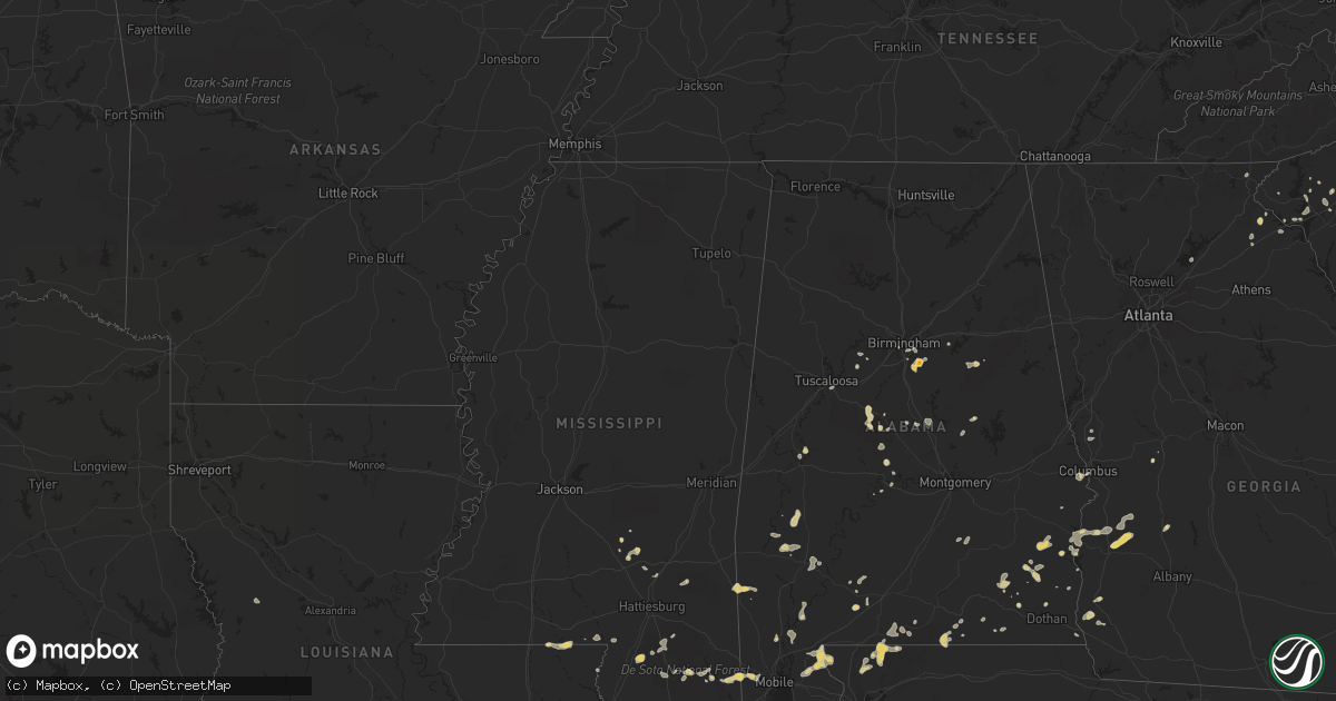
Hail Map on June 10, 2011
Get this storm
June 10 map
$229
one time, instant access
Download today. No call, no setup
Keep the $229
Bought the map and want the full workflow? Apply the entire $229 to a subscription within 7 days. None of it is wasted.
Every map, not just this one
This buys you this map. Subscription and you get every map we run, in the markets you choose from a few cities to whole states to nationwide. Plus real-time alerts the moment a storm fires.
Contact data
Name, contact info, occupancy, even credit band for addresses in the footprint. You go from where it hit to who to call.
Become the source they trust
Unlimited branding weather history reports on demand. You already have the documented answer ready for the property owner, and you are the one who showed up with it.
Property data and RoofTrace estimates
Pull up any address you have got, its value and the exact code rules for that jurisdiction, straight from One Click Code. Then RoofTrace estimates the squares, pitch, and roof value, priced the way you price.
States Impacted by Hail Map on June 10, 2011
Storm reports
Georgia
| Date | Description |
|---|---|
| 06/10/20116:22 PM CDT | One tree down near lumpkin road |
| 06/10/20114:40 PM CDT | Several trees down mainly along rock creek road...but also on wolf pit road at turner road...williams circle...brookhaven...all in east central stephens county. |
| 06/10/20113:20 PM CDT | Pea to quarter sized hail in clayton. Some limbs down on road to black rock mtn. |
Kentucky
| Date | Description |
|---|---|
| 06/10/20114:25 PM CDT | Tree down from a 48 mph wind gust measured by asos at nws jackson. |
| 06/10/20114:25 PM CDT | Tree down on along hwy 15. |
| 06/10/20114:12 PM CDT | A local report indicates 1.00 inch wind near 1 NE ALUMBAUGH |
| 06/10/20113:35 PM CDT | Multiple trees down in the city. |
| 06/10/20113:35 PM CDT | Multiple trees down. |
| 06/10/20113:31 PM CDT | A local report indicates 1.00 inch wind near IRVINE |
| 06/10/20113:30 PM CDT | Trees down on hwy 77 near tar ridge. |
| 06/10/20113:23 PM CDT | A local report indicates 1.00 inch wind near 1 NE IRVINE |
| 06/10/20113:12 PM CDT | Trees down on hwy 3036. |
| 06/10/20113:10 PM CDT | Trees down. Pea size hail. |
| 06/10/20113:00 PM CDT | Hail covered the ground |
| 06/10/20112:38 PM CDT | Hail covered the ground. Corrected location and time. |
| 06/10/20112:36 PM CDT | On pleasant ridge road. |
| 06/10/20112:30 PM CDT | Several trees downed. |
| 06/10/20112:10 PM CDT | Quarter to half dollar size hail along highway 119 near odessa. |
| 06/10/20112:10 PM CDT | Trees down on hwy 36 near nicholas county line. |
| 06/10/201112:55 PM CDT | A local report indicates 2.00 inch wind near ALEXANDRIA |
| 06/10/201112:52 PM CDT | A local report indicates 1.75 inch wind near ALEXANDRIA |
| 06/10/201111:48 AM CDT | Trees and powerlines down along highway 490. |
| 06/09/20117:00 PM CDT | Trees down on sr 607 |
South Carolina
| Date | Description |
|---|---|
| 06/10/20116:22 PM CDT | Trees down around walhalla. |
| 06/10/20115:55 PM CDT | Several large limbs down on holly springs road. |
| 06/10/20115:55 PM CDT | A tree limb fell and brought down 2 power lines near intersection of crescent street and spartanburg road. |
| 06/10/20115:45 PM CDT | Quarter sized hail fell on highway 88 between pendleton and piedmont. |
| 06/10/20114:45 PM CDT | A few trees down. |
| 06/10/20114:22 PM CDT | Trees down around walhalla. |
| 06/09/20117:40 PM CDT | Tree down on pickens street near a house. Power lines down at that location possibly from the tree fall. |
| 06/09/20117:29 PM CDT | Tree down on bush river road. |
| 06/09/20117:25 PM CDT | Many trees down near highway 560 near the newberry county line. |
Ohio
| Date | Description |
|---|---|
| 06/10/20116:58 PM CDT | Nickle to quarter size hail. |
| 06/10/20116:50 PM CDT | 1 1/4 to 2 inch hail. |
| 06/10/20116:27 PM CDT | A local report indicates 60 MPH wind near VANDALIA |
| 06/10/20116:15 PM CDT | A local report indicates 1.00 inch wind near PLYMOUTH |
| 06/10/20115:46 PM CDT | Trees damage reported near fort jennings. |
| 06/10/20115:28 PM CDT | A local report indicates 1.00 inch wind near TROTWOOD |
| 06/10/20115:24 PM CDT | A local report indicates 1.00 inch wind near 3 SSE ENGLEWOOD |
| 06/10/20115:24 PM CDT | A local report indicates 58 MPH wind near KLUK LUNKEN AIRPORT |
| 06/10/20115:21 PM CDT | A local report indicates 63 MPH wind near KLUK LUNKEN AIRPORT |
| 06/10/20115:15 PM CDT | Spotter reported quarter size hail. |
| 06/10/20114:50 PM CDT | A local report indicates 1.00 inch wind near WAYNESVILLE |
| 06/10/20114:50 PM CDT | Power lines down. Time estimated from radar. |
| 06/10/20114:40 PM CDT | One tree down. |
| 06/10/20111:12 PM CDT | A local report indicates 1.00 inch wind near NEW RICHMOND |
| 06/10/201111:37 AM CDT | Along us-50 just southeast of north bend. |
| 06/10/201111:25 AM CDT | A local report indicates 1.00 inch wind near 5 ESE HARRISON |
| 06/10/201111:16 AM CDT | Dime to quarter size hail |
| 06/09/201110:00 PM CDT | Powerlines down |
| 06/09/20119:30 PM CDT | Numerous trees down throughout guernsey county |
| 06/09/20119:20 PM CDT | Numerous trees down |
| 06/09/20118:45 PM CDT | A local report indicates 60 MPH wind near DRESDEN |
| 06/09/20118:40 PM CDT | Tree down on route 83 south of clark |
| 06/09/20118:15 PM CDT | Large branches broken |
| 06/09/20117:56 PM CDT | Trees damage reported near fort jennings. |
| 06/09/20117:49 PM CDT | A local report indicates 60 MPH wind near 8 NW FREDERICKTOWN |
| 06/09/20117:45 PM CDT | Spotter reported several large tree branches and road signs down. |
| 06/09/20117:45 PM CDT | A local report indicates 1.00 inch wind near 2 SW GALION |
| 06/09/20117:45 PM CDT | Spotter reported pea to quarter size hail. |
| 06/09/20117:37 PM CDT | A local report indicates 74 MPH wind near BEXLEY |
| 06/09/20117:37 PM CDT | A local report indicates 70 MPH wind near 6 WNW GROVE CITY |
| 06/09/20117:31 PM CDT | A local report indicates 1.00 inch wind near MASSILLON |
| 06/09/20117:29 PM CDT | Numerous power lines downed...blocking some roads. A tree fell through the roof of a house. |
| 06/09/20117:25 PM CDT | 3.5 foot diameter tree fell on a house. |
| 06/09/20117:25 PM CDT | Lg tree limbs down |
| 06/09/20117:23 PM CDT | Also dime size hail |
| 06/09/20117:17 PM CDT | A local report indicates 1.25 inch wind near 3 NW NEW BREMEN |
| 06/09/20117:10 PM CDT | Corrected time. |
| 06/09/20117:00 PM CDT | Several large grain storage silos were damaged and destroyed. A garage roof was blown off and shingles were blown off of several structures. A large barn was blown off |
Mississippi
| Date | Description |
|---|---|
| 06/10/20116:25 PM CDT | Power outages...many trees down. Reported by smith county cd |
| 06/10/20116:19 PM CDT | A tree was down on highway 49 just north of maxie. |
| 06/10/20115:45 PM CDT | Tree or two down...along with lots of limbs down in howells community. Dime to nickel sized hail. Power out in the community. Reported by public. |
| 06/09/20117:40 PM CDT | A tree fell on a house |
| 06/09/20117:19 PM CDT | Vehicle with a trailer overturned due to high winds on i-59 near the gumpond-beal road 3 miles north of hillsdale exit 35. |
| 06/09/20117:02 PM CDT | Tree down on ridge road near magnolia |
West Virginia
| Date | Description |
|---|---|
| 06/10/201112:30 PM CDT | Trees down on power lines and across livesay rd. There was also hail with this storm...size unknown. |
Oklahoma
| Date | Description |
|---|---|
| 06/10/20116:30 PM CDT | An 18-wheeler was blown over at mile marker 95 on i-40. Two other accidents occurred as a result of the very heavy rainfall and wind. |
| 06/09/201110:20 PM CDT | A local report indicates 59 MPH wind near 4 WSW WEATHERFORD |
| 06/09/20119:10 PM CDT | A local report indicates 58 MPH wind near 5 SE MANGUM |
| 06/09/20119:05 PM CDT | The wind report was measured at the retrop mesonet site. |
| 06/09/20118:50 PM CDT | The hail lasted about 12 minutes. Relayed by the altus eoc. |
| 06/09/20118:47 PM CDT | A local report indicates 1.00 inch wind near WILLOW |
| 06/09/20118:27 PM CDT | 60 mph winds were also estimated at this location. |
| 06/09/20118:25 PM CDT | A local report indicates 1.50 inch wind near 6 SW MANGUM |
| 06/09/20117:14 PM CDT | A local report indicates 58 MPH wind near PONCA CITY |
| 06/09/20117:13 PM CDT | The wind gust was reported near northwest expressway and council road. |
Maryland
| Date | Description |
|---|---|
| 06/10/201112:15 PM CDT | Two utility poles downed |
Illinois
| Date | Description |
|---|---|
| 06/10/20116:59 PM CDT | A local report indicates 1.75 inch wind near BEVERLY |
| 06/10/20116:59 PM CDT | A local report indicates 1.75 inch wind near 4 W BROOKLYN |
| 06/10/20116:55 PM CDT | One large tree uprooted and several pine trees snapped off |
| 06/10/20116:50 PM CDT | Power lines down east of bowen. Power outage in bowen. |
| 06/10/20116:45 PM CDT | Large tree down. Report from augusta fire department relayed by hancock county sheriffs office. |
| 06/10/20116:45 PM CDT | Golf ball to baseball sized hail. Report from augusta fire department relayed by hancock county sheriffs office. |
| 06/10/20116:44 PM CDT | 1.5 to 2 inch diameter hail |
| 06/10/20116:42 PM CDT | A local report indicates 1.00 inch wind near 1 W LYNNVILLE |
| 06/10/20116:40 PM CDT | A local report indicates 1.25 inch wind near ESE BOWEN |
| 06/10/20116:40 PM CDT | Estimated 55 to 60 mph. Lots of small limbs down. |
| 06/10/20116:34 PM CDT | A local report indicates 1.75 inch wind near BARRY |
| 06/10/20116:25 PM CDT | 12 inch diameter tree branch down along with several other smaller branches and tree limbs. |
| 06/10/20116:25 PM CDT | Trees and large tree limbs down and fifteen large power poles snapped...no power in winchester |
| 06/10/20116:24 PM CDT | Time estimated from radar. |
| 06/10/20116:23 PM CDT | Hail happened with winds up to 55 miles per hour |
| 06/10/20115:07 PM CDT | A local report indicates 1.00 inch wind near SALEM |
| 06/10/201112:48 AM CDT | Measured at olney-noble airport |
| 06/09/201111:30 PM CDT | Tree blocking highway 140 on north side of town. |
| 06/09/201111:21 PM CDT | Estimated 60 mph plus straight line winds caused a tree to block illinois 143 0.5 miles west of illinois 127. |
| 06/09/201110:01 PM CDT | At champaign airport |
| 06/09/20118:32 PM CDT | Hail covering ground. |
| 06/09/20118:13 PM CDT | 20-foot ornamental tree snapped 3 feet above ground...large maple tree lost a 4-inch diamater branch over route 97 |
| 06/09/20117:34 PM CDT | A local report indicates 1.00 inch wind near 3 S MOUNT STERLING |
| 06/09/20117:00 PM CDT | Power lines down east of bowen. Power outage in bowen. |
Pennsylvania
| Date | Description |
|---|---|
| 06/10/20113:14 PM CDT | Large tree down across ruskin road - 5800 block |
| 06/10/20112:55 PM CDT | Trees down in west carroll twp |
| 06/10/20112:45 PM CDT | Trees and wires down on blue goose rd and wolfe rd in barr twp |
Delaware
| Date | Description |
|---|---|
| 06/10/20114:22 PM CDT | Roof damage to homes. Trees down. Produce stand damaged. |
Alabama
| Date | Description |
|---|---|
| 06/10/20116:54 PM CDT | Two trees were blown down blocking hwy 17 near hwy 80. Winds estimated at 40 mph. |
| 06/10/20116:41 PM CDT | Several trees were blown down blocking hwy 17 near hwy 80. Winds estimated at 40 mph. |
| 06/10/20115:45 PM CDT | Tree or two down...along with lots of limbs down in howells community. Dime to nickel sized hail. Power out in the community. Reported by public. |
| 06/10/20115:41 PM CDT | A local report indicates 1.00 inch wind near SWEET WATER |
| 06/10/20114:55 PM CDT | Multiple trees down in and around clanton |
| 06/10/20114:21 PM CDT | Multiple trees down just north of u.s. Hwy 82 on serty boyd rd. |
| 06/10/20114:15 PM CDT | Roof damage to a shed near mexia. |
| 06/10/20114:15 PM CDT | Limbs down near talladega national forest south of brent |
| 06/10/20114:00 PM CDT | Small tree limbs and power lines down in monroeville. |
| 06/10/20113:37 PM CDT | Quarter sized hail reported on highway 25 near highway 82 in centreville |
| 06/10/20113:01 PM CDT | Golfball sized hail reported covering the ground on cheser park drive off of highway 280. |
| 06/10/20112:35 PM CDT | Quarter sized hail reported on county road 84 just off of county road 63 between valley grande and plantersville. |
Kansas
| Date | Description |
|---|---|
| 06/10/20116:55 PM CDT | A local report indicates 1.00 inch wind near 9 WSW HARRIS |
| 06/09/201110:45 PM CDT | Between barton and colorado roads. |
| 06/09/201110:35 PM CDT | 2 foot diameter tree down. |
| 06/09/20119:40 PM CDT | A local report indicates 66 MPH wind near 2 N PARSONS |
| 06/09/20119:39 PM CDT | A local report indicates 1.00 inch wind near 4 N GALESBURG |
| 06/09/20119:39 PM CDT | Emergency manager reports 70 to 80 mph winds on highway 47. |
| 06/09/20119:20 PM CDT | A local report indicates 2.00 inch wind near 5 S FULTON |
| 06/09/20119:08 PM CDT | A local report indicates 1.00 inch wind near NEODESHA |
| 06/09/20118:58 PM CDT | A local report indicates 60 MPH wind near 4 ENE ELK CITY |
| 06/09/20118:45 PM CDT | Public reported sustained 50 mph winds with gusts up to 60 to 70 mph. |
| 06/09/20118:40 PM CDT | A local report indicates 1.00 inch wind near 7 SW MOUND CITY KS |
| 06/09/20118:25 PM CDT | Estimated 50 to 60 mph winds in sedan at 825 pm. |
| 06/09/20118:21 PM CDT | Estimated winds of 45-50 mph |
| 06/09/20117:55 PM CDT | A local report indicates 1.00 inch wind near 15 E CEDAR VALE |
| 06/09/20117:51 PM CDT | Report relayed via allen county dispatch and wfo wichita. |
| 06/09/20117:50 PM CDT | A local report indicates 1.00 inch wind near KINCAID |
| 06/09/20117:32 PM CDT | A local report indicates 1.00 inch wind near 1 SW PETROLIA |
| 06/09/20117:23 PM CDT | Quarter size to golfball size hail covering the ground. |
| 06/09/20117:15 PM CDT | Most stones quarter size with few golf ball sized stones mixed in. |
| 06/09/20117:14 PM CDT | A local report indicates 1.75 inch wind near 5 SE ROSE |
| 06/09/20117:12 PM CDT | A local report indicates 1.00 inch wind near 8 S YATES CENTER |
Indiana
| Date | Description |
|---|---|
| 06/10/20116:05 PM CDT | Trees and power lines down near 325 w and sr 26. |
| 06/10/20114:20 PM CDT | Utility poles have been blown or knocked down...time is approximate |
| 06/10/20113:55 PM CDT | Utility poles down...time approximated |
| 06/10/20113:50 PM CDT | Utility poles and trees or tree limbs down...damage to a swimming pool. Located in the vicinity of 700 east and 50s near state route 32 |
| 06/10/20113:46 PM CDT | Accompanied by estimated 60 mph winds |
| 06/10/20113:46 PM CDT | Eight to twelve inch diameter tree branch blown down |
| 06/10/20113:46 PM CDT | Accompanied by 1 inch hail. 8 to 12 diameter tree limb down. |
| 06/10/20113:45 PM CDT | A local report indicates 1.00 inch wind near 2 SE MUNCIE |
| 06/10/20113:40 PM CDT | Hail has been falling for 10 minutes now. |
| 06/10/20113:30 PM CDT | Located on west weber drive |
| 06/10/20113:10 PM CDT | A local report indicates 1.00 inch wind near OLD TIP TOWN |
| 06/10/20112:59 PM CDT | Quarter size hail is covering the ground |
| 06/10/20111:57 PM CDT | Hail size of quarters fell on mound street for 5 to 7 minutes |
| 06/10/20112:38 AM CDT | Very brief gust associated with outflow boundary. Other sustained gusts of 40-45 mph. No damage. |
| 06/10/20111:40 AM CDT | A tree fell on a mobile home on ewing avenue...temporarily trapping the occupant. Possible injury. Time estimated based on radar. |
| 06/10/20111:29 AM CDT | Anderson university reported to emergency management that a large live tree with about a 3-foot diameter blew down at 6th and cottage on the campus |
| 06/10/20111:28 AM CDT | Location...morningside. Branches broken approx 2.5 inches in diameter. Report from spotternetwork.org |
| 06/10/201112:42 AM CDT | A local report indicates 74 MPH wind near 2 E CARMEL |
| 06/10/201112:37 AM CDT | A power pole has been snapped off |
| 06/10/201112:04 AM CDT | A local report indicates 60 MPH wind near 2 W CRAWFORDSVILLE |
| 06/09/201111:53 PM CDT | A local report indicates 65 MPH wind near 3 E FILLMORE |
| 06/09/201111:53 PM CDT | Tree on car on state road 231 3 miles south of 36. Multiple power lines down in northern part of county. Multiple trees down. |
| 06/09/201111:13 PM CDT | Winds gusted to this estimated speed several times during a 10-minute period. Trees and limbs down. |
| 06/09/201111:10 PM CDT | Estimating 55 to 60 mph |
Missouri
| Date | Description |
|---|---|
| 06/10/20116:59 PM CDT | A local report indicates 2.00 inch wind near 5 S SEDALIA |
| 06/10/20116:57 PM CDT | A local report indicates 1.75 inch wind near 5 S SEDALIA |
| 06/10/20116:49 PM CDT | A local report indicates 1.00 inch wind near 3 S SEDALIA |
| 06/10/20116:11 PM CDT | Hail ranges from pea sized to quarter sized |
| 06/10/20116:05 PM CDT | A local report indicates 1.00 inch wind near 5 ESE NEW HAVEN |
| 06/10/20115:55 PM CDT | A local report indicates 1.75 inch wind near 3 ESE WINCHESTER |
| 06/10/20115:45 PM CDT | Hail ranged from dime to quarter size. Estimated winds in excess of 60 mph. |
| 06/10/20115:42 PM CDT | A local report indicates 1.75 inch wind near 3 S VANDALIA |
| 06/10/20115:41 PM CDT | A local report indicates 1.75 inch wind near 1 S VANDALIA |
| 06/10/20115:40 PM CDT | A local report indicates 1.00 inch wind near 2 S CURRYVILLE |
| 06/10/20115:38 PM CDT | A local report indicates 1.00 inch wind near 3 S VANDALIA |
| 06/10/20115:15 PM CDT | Strong winds of unknown speed. |
| 06/10/20115:14 PM CDT | Time estimated from radar. |
| 06/10/20115:13 PM CDT | Hail is ongoing. Ranging from golfball to baseball sized. |
| 06/10/20115:01 PM CDT | Wind gust estimated at 50 to 60 mph. |
| 06/10/20115:00 PM CDT | A local report indicates 1.00 inch wind near WELLSVILLE |
| 06/10/20114:37 PM CDT | A local report indicates 1.25 inch wind near WILLIAMSBURG |
| 06/10/20114:35 PM CDT | A local report indicates 1.75 inch wind near 2 W WILLIAMSBURG |
| 06/10/20113:50 PM CDT | A local report indicates 1.00 inch wind near MOKANE |
| 06/09/201111:06 PM CDT | Early evening friday a large tree unknown size downed by wind gust. Wind speed unknown. Tree down in the 6600 block of washington in university city missouri. |
| 06/09/201110:25 PM CDT | Large trees blown down near gray summit along highway 100. |
| 06/09/201110:00 PM CDT | Large trees blown down near intersection of highways 50 and ee. |
| 06/09/20119:40 PM CDT | Large trees blown down near the intersection of highways j and u. |
| 06/09/20119:35 PM CDT | Two large trees blown down in the city of warrenton |
| 06/09/20119:28 PM CDT | A local report indicates 1.75 inch wind near OWENSVILLE |
| 06/09/20118:52 PM CDT | A local report indicates 1.00 inch wind near DOOLITTLE |
| 06/09/20118:40 PM CDT | Hail size varied from tennis ball to baseball size. |
| 06/09/20118:40 PM CDT | A local report indicates 1.00 inch wind near 7 SW MOUND CITY |
| 06/09/20118:15 PM CDT | Hail size varied from tennis ball to baseball size. |
| 06/09/20118:11 PM CDT | On highway 22 near county road 308. |
| 06/09/20118:11 PM CDT | On highway 22 near county road 308. |
| 06/09/20118:06 PM CDT | A local report indicates 1.00 inch wind near DIXON |
| 06/09/20118:02 PM CDT | Hail covering ground. |
| 06/09/20118:00 PM CDT | Five inch diameter tree limbs down...also...a truck camper shell blown ontu roof of a residence. |
| 06/09/20117:54 PM CDT | A local report indicates 1.00 inch wind near 6 W HANNIBAL |
| 06/09/20117:46 PM CDT | A local report indicates 1.00 inch wind near MEXICO |
| 06/09/20117:43 PM CDT | A local report indicates 1.00 inch wind near BOONVILLE |
| 06/09/20117:30 PM CDT | A local report indicates 1.00 inch wind near 5 N FLORENCE |
| 06/09/20117:30 PM CDT | 190 foot tall communications tower destroyed at slumberland furniture building...also large trees damaged at mexico country club approx 1 mile down the road. Event time |
| 06/09/20117:28 PM CDT | A local report indicates 1.75 inch wind near NEW FRANKLIN |
| 06/09/20117:08 PM CDT | A local report indicates 1.00 inch wind near SEDALIA |
Louisiana
| Date | Description |
|---|---|
| 06/10/20112:15 PM CDT | Report of a roof blown off of a barn and powerlines down on felice cutoff rd. Time estimated by radar. |
Texas
| Date | Description |
|---|---|
| 06/10/20116:55 PM CDT | Roof damage reported on a home. Wind gusts est over 70 mph. |
| 06/10/20116:55 PM CDT | Measured by wtm. Sustained speed of 53 mph. |
| 06/10/20116:47 PM CDT | Tree damage occurring and heavy outdoor objects being blown about. Small hail increasing in size. Est 70 plus mph. |
| 06/10/20115:40 PM CDT | A local report indicates 70 MPH wind near RALLS |
| 06/10/20114:50 PM CDT | City hall est gusts |
| 06/10/20114:40 PM CDT | A local report indicates 61 MPH wind near 2 S BROWNFIELD |
| 06/09/20118:09 PM CDT | A local report indicates 63 MPH wind near 2 NW CHILDRESS |
| 06/09/20118:01 PM CDT | A local report indicates 59 MPH wind near 2 NW CHILDRESS |
| 06/09/20117:35 PM CDT | A local report indicates 65 MPH wind near 15 W CROWELL |
| 06/09/20117:10 PM CDT | Minor structural damage reported at paducah high school. Press box at football field severely damaged. Garage door blown in at hs ag building. Tree damage. |
| 06/09/20117:06 PM CDT | Kvii-tv schoolnet |
| 06/09/20117:05 PM CDT | Utility poles and lines downed by thunderstorm winds. |
North Carolina
| Date | Description |
|---|---|
| 06/10/20116:56 PM CDT | Tree down |
| 06/10/20116:53 PM CDT | Roof blown off house |
| 06/10/20116:53 PM CDT | Tree down 1 mile south of bunn... Time estimated by radar |
| 06/10/20116:43 PM CDT | Tree down ne of bunn... Time estimated by radar |
| 06/10/20116:00 PM CDT | Numerous trees down across mocksville. Power out. |
| 06/10/20115:55 PM CDT | Tree down in taylortown. |
| 06/10/20115:47 PM CDT | Carport roof blown off at hedgepeth and drapers road |
| 06/10/20115:42 PM CDT | Time is radar estimated...nickel to quarter size hail |
| 06/10/20115:40 PM CDT | One tree down near vass. Time estimated by radar. |
| 06/10/20115:37 PM CDT | Carport roof blown off at hedgepeth and drapers road |
| 06/10/20115:37 PM CDT | Tree down at drapers road and 561 |
| 06/10/20115:36 PM CDT | Tree down along white road. |
| 06/10/20115:31 PM CDT | Tree down in the charleston court area. |
| 06/10/20115:31 PM CDT | A tree down along newsome road. |
| 06/10/20115:31 PM CDT | A tree down along newsome road. |
| 06/10/20115:25 PM CDT | Jupiter fire department knew of at least 2 trees down under where the storm crossed. There were rumors of more trees down back on property of nearby residents. Also had |
| 06/10/20115:20 PM CDT | Tree down across the road. |
| 06/10/20115:14 PM CDT | One tree down near linville and stanley road area. |
| 06/10/20114:57 PM CDT | One tree down on airview drive. |
| 06/10/20114:55 PM CDT | One tree down on power lines along muse avenue. |
| 06/10/20114:40 PM CDT | A spotter was not at home when the hail fell but arrived about an hour after the hail ended. He found pieces of melting hail that were still as large as nickels. No nei |
| 06/10/20114:28 PM CDT | Trees on 2 homes at 3208 and 3209 argyll drive in carolina trace |
| 06/10/20114:28 PM CDT | Tree on a home at 3204 belfast lane in carolina trace |
| 06/10/20114:13 PM CDT | One tree in the roadway on hwy 25...asheville hwy. |
| 06/10/20114:11 PM CDT | Tree down at drapers and ringwood roads... Time estimated by radar |
| 06/10/20114:08 PM CDT | One tree down on pattys chapel road. |
| 06/10/20114:00 PM CDT | Tree down... Time estimated by radar |
| 06/10/20114:00 PM CDT | Tree down... Time estimated by radar |
| 06/10/20113:30 PM CDT | A local report indicates 1.00 inch wind near 5 NNE TRAPHILL |
| 06/10/20112:58 PM CDT | Large limbs down in town. Dime size hail. |
| 06/10/20112:17 PM CDT | A local report indicates 1.00 inch wind near 1 SW NEWLAND |
| 06/09/20119:20 PM CDT | Several trees down in the allens crossroads area...including a tree that fell on a fire fighting truck with people in the truck. |
| 06/09/20118:15 PM CDT | Many trees and power lines down. Also several fires sparked by downed power lines. |
| 06/09/20117:51 PM CDT | One tree down along harrington highway. |
| 06/09/20117:51 PM CDT | Trees down along highway 311. |
| 06/09/20117:42 PM CDT | Several trees down |
| 06/09/20117:36 PM CDT | Trees down near the intersection of highway 135 and leprechaun lane. |
Virginia
| Date | Description |
|---|---|
| 06/10/20116:50 PM CDT | Two trees down on route 685 |
| 06/10/20116:31 PM CDT | Tree down |
| 06/10/20116:18 PM CDT | Tree down |
| 06/10/20116:09 PM CDT | 8-12 inch diameter tree blown down. |
| 06/10/20116:09 PM CDT | Multiple 15-20 plus inch diameter trees blown down. |
| 06/10/20115:36 PM CDT | Trees down along a quarter mile path from crafts ford road and 3 quarter point road. |
| 06/10/20115:28 PM CDT | Dime to quarter size hail |
| 06/10/20115:26 PM CDT | A local report indicates 1.50 inch wind near 2 ESE WHITE HALL |
| 06/10/20114:45 PM CDT | Tree down |
| 06/10/20114:38 PM CDT | Occurred on union church road |
| 06/10/20114:00 PM CDT | Large limbs down vicinity of virginia beach friends school. |
| 06/10/20113:10 PM CDT | Tree down in yard. |
| 06/10/20112:55 PM CDT | Trees down on power lines |
| 06/10/20112:26 PM CDT | A local report indicates 1.50 inch wind near 2 ESE WHITE HALL |
| 06/10/20112:20 PM CDT | Several 4 in diameter tree limbs down |
| 06/10/20112:00 PM CDT | Several 4 in diameter tree limbs down |
| 06/10/20118:54 AM CDT | A local report indicates 1.00 inch wind near CASCADE |
| 06/09/20117:30 PM CDT | Trees down all over city. |
| 06/09/20117:05 PM CDT | Numerous trees reported down on us 301 |
Cities Impacted by Hail Map on June 10, 2011
- Farmersville, OH
- Germantown, OH
- Economy, IN
- Hagerstown, IN
- Losantville, IN
- Modoc, IN
- Morris, GA
- Georgetown, GA
- Eufaula, AL
- Lumpkin, GA
- Durham, NC
- Marshville, NC
- Phenix City, AL
- Irvine, KY
- McDavid, FL
- Columbus, OH
- Galloway, OH
- Greenville, IL
- Smithboro, IL
- Pocahontas, IL
- Carlyle, IL
- Keyesport, IL
- Mulberry Grove, IL
- Vandalia, IL
- Moberly, MO
- Thompson, MO
- Santa Fe, MO
- Madison, MO
- Boonville, MO
- Pilot Grove, MO
- Franklin, MO
- Paris, MO
- Higbee, MO
- Centralia, MO
- Bunceton, MO
- Clark, MO
- New Franklin, MO
- Otterville, MO
- Blackwater, MO
- Mexico, MO
- Sturgeon, MO
- Fayette, MO
- Attica, OH
- New Washington, OH
- Republic, OH
- Tiffin, OH
- Bloomville, OH
- Glasgow, MO
- Tahoka, TX
- Chelsea, AL
- Mattaponi, VA
- Centreville, AL
- Lawley, AL
- Blissfield, OH
- Rawson, OH
- Fredericktown, OH
- Morral, OH
- Ottawa, OH
- Bellville, OH
- Mount Vernon, OH
- Mount Blanchard, OH
- Fresno, OH
- Millersburg, OH
- Mansfield, OH
- Mount Gilead, OH
- Danville, OH
- Brinkhaven, OH
- Columbus Grove, OH
- Baltic, OH
- Glenmont, OH
- Dunkirk, OH
- Howard, OH
- Jenera, OH
- Upper Sandusky, OH
- Butler, OH
- Ada, OH
- Arlington, OH
- Coshocton, OH
- Caledonia, OH
- Killbuck, OH
- Mount Cory, OH
- Marion, OH
- Bluffton, OH
- Pandora, OH
- Harpster, OH
- Warsaw, OH
- Edison, OH
- Bucyrus, OH
- Forest, OH
- Galion, OH
- Williamstown, OH
- Nevada, OH
- Shawboro, NC
- Moyock, NC
- New London, OH
- Sullivan, OH
- Wellington, OH
- Attica, IN
- Covington, IN
- Farina, IL
- La Prairie, IL
- Plymouth, IL
- Rutledge, MO
- Warsaw, IL
- Basco, IL
- Camden, IL
- Canton, MO
- Wyaconda, MO
- Huntsville, IL
- Alexandria, MO
- West Point, IL
- Williamstown, MO
- Bowen, IL
- Monticello, MO
- Gorin, MO
- Sutter, IL
- Carthage, IL
- Saint Patrick, MO
- Kahoka, MO
- Augusta, IL
- Littleton, IL
- Bland, MO
- Owensville, MO
- Rosebud, MO
- Alexandria, KY
- Melbourne, KY
- California, KY
- Newport, KY
- Ralls, TX
- Orient, OH
- Grove City, OH
- West Jefferson, OH
- Groveport, OH
- Lockbourne, OH
- Cincinnati, OH
- Smithton, MO
- Gastonia, NC
- Milton, FL
- Jay, FL
- Odonnell, TX
- Lamesa, TX
- North Bend, OH
- Cleves, OH
- Addyston, OH
- Hebron, KY
- Thomasville, AL
- Coffeeville, AL
- White Hall, IL
- Palmyra, IL
- Murrayville, IL
- Franklin, IL
- Roodhouse, IL
- Payson, IL
- Liberty, IL
- Plainville, IL
- Cedar Vale, KS
- Cameron, NC
- Wooster, OH
- Smithville, OH
- Orrville, OH
- Sterling, OH
- Creston, OH
- Camp Point, IL
- Clayton, IL
- Pine Mountain, GA
- Vevay, IN
- Madison, IN
- Washington, MO
- Belle, MO
- Dixon, MO
- Marthasville, MO
- Gerald, MO
- Saint James, MO
- Beaufort, MO
- Union, MO
- Vienna, MO
- New Haven, MO
- Leslie, MO
- Cuba, MO
- Vichy, MO
- Rolla, MO
- Paducah, TX
- Monroe City, MO
- Hunnewell, MO
- Bethel, MO
- Emden, MO
- Shelbyville, MO
- Philadelphia, MO
- Maysville, KY
- Morrison, MO
- Lorenzo, TX
- Jacksonville, MO
- Cairo, MO
- Fort Monroe, VA
- Hampton, VA
- Newport News, VA
- Yorktown, VA
- Poquoson, VA
- Franklin, IN
- Owenton, KY
- Corolla, NC
- Tell, TX
- Childress, TX
- Cee Vee, TX
- Big Spring, TX
- Garnett, KS
- Westphalia, KS
- Kincaid, KS
- Welda, KS
- Colony, KS
- Blue Mound, KS
- Gail, TX
- Snyder, TX
- Colorado City, TX
- Ira, TX
- Fluvanna, TX
- Coahoma, TX
- Monroeville, AL
- Brent, AL
- Coffeen, IL
- Bingham, IL
- Ramsey, IL
- Fillmore, IL
- Worden, IL
- Hamel, IL
- East Lynn, WV
- Valmeyer, IL
- Charles City, VA
- Chester, VA
- Hopewell, VA
- Henrico, VA
- Colonial Heights, VA
- Richmond, VA
- Drummond, OK
- Norwich, OH
- Cumberland, OH
- New Concord, OH
- Cambridge, OH
- Haviland, OH
- Cloverdale, OH
- Paulding, OH
- Grover Hill, OH
- Oakwood, OH
- Covington, OH
- Russia, OH
- Greenville, OH
- Versailles, OH
- Rossburg, OH
- Ansonia, OH
- Bradford, OH
- Newton, IL
- Fostoria, OH
- Kansas, OH
- Urbana, OH
- Moores Hill, IN
- Mauk, GA
- Kinderhook, IL
- Hull, IL
- Lockport, KY
- Bethlehem, KY
- Littleton, NC
- Wayne, WV
- Crocker, MO
- Saint Louis, MO
- Bessie, OK
- Cordell, OK
- Granite, OK
- Dill City, OK
- Sentinel, OK
- Mangum, OK
- Corn, OK
- Willow, OK
- Lone Wolf, OK
- Maplesville, AL
- Sandy Hook, MS
- Semmes, AL
- Wilmer, AL
- Lucedale, MS
- Moss Point, MS
- Mobile, AL
- Martinsville, IN
- Sabina, OH
- Washington Court House, OH
- Chatom, AL
- Sedalia, MO
- Dale, IN
- Ferdinand, IN
- Ravenna, KY
- Butler, GA
- Whatley, AL
- Grove Hill, AL
- Blakely, GA
- Huntington, IN
- Roanoke, IN
- Waynetown, IN
- Crawfordsville, IN
- Hannibal, MO
- Cable, OH
- Crozet, VA
- North Garden, VA
- Free Union, VA
- Charlottesville, VA
- Crosbyton, TX
- Lancaster, VA
- Dalmatia, PA
- Benedict, KS
- Altoona, KS
- Thayer, KS
- Glade Valley, NC
- Hillsboro, OH
- Schell City, MO
- Rockville, MO
- Piedmont, OK
- New Douglas, IL
- Alhambra, IL
- Highland, IL
- Montgomery City, MO
- London, KY
- East Bernstadt, KY
- Manchester, KY
- Birmingham, AL
- Norborne, MO
- Braymer, MO
- Carrollton, MO
- Richmond, MO
- Sunman, IN
- Smithfield, VA
- West Salem, OH
- Richards, MO
- Fort Scott, KS
- Fulton, KS
- Kenton, OH
- Mount Victory, OH
- Okarche, OK
- North Vernon, IN
- Mocksville, NC
- Batchtown, IL
- Fieldon, IL
- Winfield, MO
- Grafton, IL
- Brussels, IL
- Covington, VA
- Clifton Forge, VA
- Iron Gate, VA
- Mount Sterling, KY
- Winchester, KY
- Richmond, KY
- Lexington, KY
- Mount Airy, NC
- Lowgap, NC
- New Canton, IL
- Barry, IL
- Baylis, IL
- Bunn, NC
- Zebulon, NC
- Castalia, NC
- Louisburg, NC
- Spring Hope, NC
- Nashville, NC
- Monroe, NC
- Wingate, NC
- Greensboro, AL
- Grantville, PA
- Annville, PA
- Jonestown, PA
- Ashley, IL
- Woodlawn, IL
- Pelzer, SC
- Bahama, NC
- Cantrall, IL
- Athens, IL
- Argos, IN
- Culver, IN
- Tippecanoe, IN
- Plymouth, IN
- Xenia, OH
- Mount Solon, VA
- Sweet Water, AL
- Virginia Beach, VA
- Pageland, SC
- Mount Croghan, SC
- Zanesville, OH
- Bay Minette, AL
- Perdido, AL
- Daphne, AL
- Loxley, AL
- Stapleton, AL
- Sherman, IL
- Wilson, TX
- Spur, TX
- Idalou, TX
- Slaton, TX
- Ransom Canyon, TX
- Lubbock, TX
- El Reno, OK
- Eastanollee, GA
- Toccoa, GA
- Marion, AL
- Jamestown, OH
- Jeffersonville, OH
- Edmond, OK
- Cashion, OK
- Lumberton, MS
- Mooresville, IN
- Macclesfield, NC
- Fountain, NC
- Ozark, AL
- New Brockton, AL
- Enterprise, AL
- Ariton, AL
- Charlotte, NC
- Fort Wayne, IN
- Quincy, IL
- Mendon, IL
- Paloma, IL
- Fowler, IL
- Coatsburg, IL
- Newland, NC
- Savonburg, KS
- Hepler, KS
- Elsmore, KS
- Uniontown, KS
- Hermann, MO
- Berger, MO
- Memphis, TX
- Heath Springs, SC
- Bonnie, IL
- Opdyke, IL
- Mount Vernon, IL
- Waverly, VA
- Courtland, VA
- Yale, VA
- Coeburn, VA
- Raleigh, NC
- Wake Forest, NC
- Shellman, GA
- Cuthbert, GA
- Parrott, GA
- Weston, GA
- Dawson, GA
- Perry, MO
- Martinsville, VA
- Williamston, SC
- Mount Vernon, AL
- Rising Sun, IN
- Skipperville, AL
- Wellsville, MO
- New Bremen, OH
- Celina, OH
- Maria Stein, OH
- Sidney, OH
- Minster, OH
- Fort Loramie, OH
- Patriot, IN
- Troy, IL
- O'Fallon, IL
- Caseyville, IL
- Collinsville, IL
- Greenfield, IN
- Sparta, NC
- Selma, NC
- Lucama, NC
- Kenly, NC
- Bailey, NC
- Princeton, NC
- Smithfield, NC
- Middlesex, NC
- Sims, NC
- Patoka, IL
- Odessa, MO
- Laddonia, MO
- Rush Hill, MO
- Edgewood, IL
- Mason, IL
- Brownstown, IL
- Saint Peter, IL
- Winslow, IN
- Velpen, IN
- Newburg, MO
- Jerome, MO
- Excello, MO
- Clarence, MO
- Macon, MO
- Anabel, MO
- Wilmington, OH
- Holliday, MO
- Matador, TX
- Selma, AL
- Sheridan, IN
- Rich Hill, MO
- Butler, MO
- Sanford, NC
- Altus, OK
- La Harpe, KS
- Moran, KS
- Iola, KS
- Ackerly, TX
- Tarzan, TX
- Dayton, KY
- Bellevue, KY
- Macon, NC
- Winchester, IL
- Hydro, OK
- Clarksville, OH
- Oregonia, OH
- Camdenton, MO
- Macks Creek, MO
- Fort Rucker, AL
- Kingman, IN
- Trafalgar, IN
- Morgantown, IN
- Edinburgh, IN
- Okeana, OH
- Hamilton, OH
- Oxford, OH
- Sterrett, AL
- Williamsburg, MO
- Brewton, AL
- Granite City, IL
- Shawnee, KS
- Bonner Springs, KS
- Alexandria, IN
- Elwood, IN
- Daleville, AL
- Mapleton, KS
- Bronson, KS
- Skippers, VA
- Emporia, VA
- Drewryville, VA
- Branchville, VA
- Pleasant Hill, NC
- Post, TX
- Genoa, WV
- Mount Sterling, IL
- Rushville, IL
- Kilbourne, IL
- Marine, IL
- Sorento, IL
- Edwardsville, IL
- Elizabeth City, NC
- Belvidere, NC
- Benld, IL
- Bunker Hill, IL
- Sawyerville, IL
- Mount Olive, IL
- Staunton, IL
- Gillespie, IL
- Wilsonville, IL
- Stuarts Draft, VA
- Faber, VA
- Lyndhurst, VA
- Roseland, VA
- Nellysford, VA
- Worthville, KY
- Corinth, KY
- Stamping Ground, KY
- Columbia, IL
- Waterloo, IL
- Buckingham, VA
- Calumet, OK
- Ashley, OH
- Old Monroe, MO
- O'Fallon, MO
- Foley, MO
- Golden Eagle, IL
- Moorefield, KY
- Hillsboro, KY
- Salt Lick, KY
- Carlisle, KY
- Sharpsburg, KY
- Owingsville, KY
- Bronaugh, MO
- Richland, GA
- Preston, GA
- South Mills, NC
- Lykens, PA
- Berrysburg, PA
- Millersburg, PA
- Pillow, PA
- Herndon, PA
- Elizabethville, PA
- Rhineland, MO
- Portland, MO
- Rochester, IN
- Mentone, IN
- Appalachia, VA
- Quaker City, OH
- Woodsfield, OH
- Summerfield, OH
- Sarahsville, OH
- Lewisville, OH
- Salem, IL
- Latonia, KY
- New Richmond, OH
- Silver Grove, KY
- Hershey, PA
- Palmyra, PA
- Vandalia, MO
- Farber, MO
- Scottsburg, IN
- Brooksville, KY
- Waverly, KS
- Williamsburg, KS
- Repton, AL
- Frankfort, KY
- Pleasureville, KY
- Bagdad, KY
- Milan, IN
- Aurora, IN
- Daleville, IN
- Anderson, IN
- Jacksonville, IL
- Ashland, IL
- Alexander, IL
- Fort Stockton, TX
- Griggsville, IL
- Chambersburg, IL
- Piqua, KS
- Yates Center, KS
- Humboldt, KS
- Elberon, VA
- King, NC
- Clopton, AL
- Clio, AL
- Fredericksburg, OH
- Holmesville, OH
- Sibley, MO
- Bates City, MO
- Camden, MO
- Henrietta, MO
- Napoleon, MO
- Buckner, MO
- Levasy, MO
- Orrick, MO
- Grain Valley, MO
- Oak Grove, MO
- Blue Springs, MO
- Independence, MO
- Kingfisher, OK
- Shreve, OH
- Chamois, MO
- Linn, MO
- Berea, KY
- Crane, IN
- Tipton, IN
- Atlanta, IN
- Ruby, SC
- Paris, KY
- Burbank, OH
- Dayton, OH
- Clayton, OH
- Kiahsville, WV
- Fort Thomas, KY
- Covington, KY
- Ft Mitchell, KY
- Dickens, TX
- Afton, TX
- Auxvasse, MO
- Fulton, MO
- Kingdom City, MO
- Truxton, MO
- Hawk Point, MO
- Westerville, OH
- Versailles, IL
- Clayton, AL
- Sherrodsville, OH
- Leesville, OH
- Dennison, OH
- Bowerston, OH
- Louisville, IL
- Williamstown, KY
- Fleetwood, NC
- Center, MO
- Lancaster, SC
- Osgood, OH
- Yorkshire, OH
- Hardin, MO
- Cherryvale, KS
- Neodesha, KS
- Elk City, KS
- Fredonia, KS
- Independence, KS
- Talladega, AL
- New Castle, IN
- Mooreland, IN
- New Matamoras, OH
- Friendly, WV
- Mechanicsburg, OH
- Rotan, TX
- Hermleigh, TX
- Sweetwater, TX
- Annada, MO
- Clarksville, MO
- Hamburg, IL
- Elsberry, MO
- Duke, OK
- Greenfield, OK
- Weatherford, OK
- Hinton, OK
- Clinton, OK
- Yukon, OK
- Foss, OK
- Gould, OK
- Watonga, OK
- Geary, OK
- Summitville, IN
- Whiteland, IN
- Greenwood, IN
- Bargersville, IN
- Morehead, KY
- Kimbolton, OH
- Newcomerstown, OH
- New Salem, IL
- Augusta, WV
- Wiggins, MS
- Ursa, IL
- Mora, MO
- Florence, MO
- Green Ridge, MO
- Lebanon, PA
- Andalusia, AL
- Perkinston, MS
- Welch, TX
- Rockford, AL
- Kellyton, AL
- Muncie, IN
- Litchfield, IL
- Walshville, IL
- Lynn, IN
- Union City, IN
- Farmland, IN
- Winchester, IN
- Deer Park, AL
- Englewood, OH
- Brookville, OH
- Vandalia, OH
- New London, MO
- Success, MO
- Beulah, MO
- Bucyrus, MO
- Duke, MO
- Waynesville, MO
- Roby, MO
- Edgar Springs, MO
- Fort Leonard Wood, MO
- Mountain Grove, MO
- Lynchburg, MO
- Huggins, MO
- Licking, MO
- Laquey, MO
- Plato, MO
- Toronto, KS
- Harrison, OH
- Seagraves, TX
- Curryville, MO
- Bowling Green, MO
- Frankford, MO
- Louisiana, MO
- Brookville, IN
- Batesville, IN
- Chandlersville, OH
- Lentner, MO
- Shelbina, MO
- Smith Center, KS
- Morrow, OH
- Goshen, OH
- Loveland, OH
- Kaw City, OK
- Newkirk, OK
- Churubusco, IN
- Glen Carbon, IL
- Maryville, IL
- Cropwell, AL
- Poplarville, MS
- Malinta, OH
- Deshler, OH
- Delray, WV
- Brownfield, TX
- Laurel, DE
- Mize, MS
- Armstrong, MO
- Brookwood, AL
- Dublin, OH
- Graham, NC
- Mayslick, KY
- Richmond, KS
- Greeley, KS
- Ridgeville, IN
- Freeport, OH
- Lore City, OH
- Port Washington, OH
- Springboro, OH
- Franklin, OH
- West Friendship, MD
- Ellicott City, MD
- Bloomfield, IN
- Golden, IL
- Iuka, IL
- Kinmundy, IL
- Xenia, IL
- Crown City, OH
- Gallipolis, OH
- Effingham, IL
- Watson, IL
- Vernon, IL
- Surry, VA
- Creedmoor, NC
- West End, NC
- Pinehurst, NC
- Aberdeen, NC
- Mount Vernon, KY
- Princeton, KS
- Rantoul, KS
- Canaan, IN
- Amelia, OH
- Miamitown, OH
- Holton, IN
- Moscow, OH
- Union, KY
- Versailles, IN
- Osgood, IN
- Lawrenceburg, IN
- Dupont, IN
- West Harrison, IN
- Petersburg, KY
- Batavia, OH
- Guilford, IN
- Erlanger, KY
- Florence, KY
- Dillsboro, IN
- Burlington, KY
- Cross Plains, IN
- Hooven, OH
- Butlerville, IN
- Saint Charles, MO
- Saint Peters, MO
- Capron, VA
- Toxey, AL
- Newton, AL
- Atchison, KS
- Saint Joseph, MO
- Rushville, MO
- New Florence, MO
- Bellflower, MO
- Warrenton, MO
- High Hill, MO
- Jonesburg, MO
- Middletown, MO
- Taylorsville, MS
- New Knoxville, OH
- Anna, OH
- Chickasaw, OH
- Coldwater, OH
- Montezuma, OH
- Saint Henry, OH
- Portland, IN
- Fort Recovery, OH
- West Point, VA
- Range, AL
- Equality, AL
- London, OH
- South Bloomingville, OH
- Logan, OH
- Rockbridge, OH
- Blackwell, OK
- Ponca City, OK
- Maple City, KS
- Dexter, KS
- Galax, VA
- Little River, AL
- Jackson, AL
- Canute, OK
- Laurelville, OH
- Lucerne, IN
- Kansas City, MO
- Prairie Village, KS
- Leawood, KS
- Clayton, GA
- Polk, OH
- Ashland, OH
- Wellsville, KS
- Headland, AL
- Mountville, SC
- Maywood, MO
- Taylor, MO
- Fort Gaines, GA
- Bellbrook, OH
- Bloomington, IN
- Franklinton, LA
- Osyka, MS
- Mount Hermon, LA
- Tylertown, MS
- Alexander City, AL
- Meadow, TX
- Florala, AL
- Virginia, IL
- Sanders, KY
- Turners Station, KY
- Carrollton, KY
- Norfolk, VA
- Stockton, AL
- Louisa, KY
- Mount Sterling, OH
- Deputy, IN
- Austin, IN
- Lexington, IN
- Jackson, KY
- North Lawrence, OH
- Massillon, OH
- Dalton, OH
- Fort Gay, WV
- Odin, IL
- Sandoval, IL
- Rocky Mount, VA
- Bassett, VA
- Forkland, AL
- Columbia, NC
- Wardensville, WV
- Star Tannery, VA
- Winchester, VA
- High View, WV
- Moscow Mills, MO
- Troy, MO
- Clintwood, VA
- Pound, VA
- Navarre, OH
- Ridgeway, OH
- Belle Center, OH
- Bellefontaine, OH
- Rushsylvania, OH
- Springfield, OH
- New Carlisle, OH
- Prince George, VA
- Abbeville, AL
- Pleasant City, OH
- Fairmount, IN
- Williamsville, IL
- Hartford, AL
- Chancellor, AL
- Ewing, KY
- Laura, OH
- West Milton, OH
- Arcanum, OH
- Chanute, KS
- Clinton, SC
- Kinards, SC
- Joanna, SC
- Shipman, IL
- Louisville, AL
- Brooklyn, MS
- Oklahoma City, OK
- Ono, PA
- Wiconisco, PA
- Halifax, PA
- Veedersburg, IN
- Plain City, OH
- Powell, OH
- New Lebanon, OH
- Vass, NC
- Timewell, IL
- Enfield, NC
- Wellington, MO
- Garber, OK
- Southern Pines, NC
- Jackson Springs, NC
- Carthage, NC
- Pittsfield, IL
- Windsor Mill, MD
- Gwynn Oak, MD
- Catonsville, MD
- Devils Elbow, MO
- Bloomingburg, OH
- South Solon, OH
- Opp, AL
- Vancleave, MS
- Salisbury, NC
- Yoder, IN
- Augusta, KY
- Mokane, MO
- Tebbetts, MO
- Springfield, IL
- Osceola, MO
- Appleton City, MO
- De Kalb, MO
- Dryfork, WV
- Frankfort, IN
- Thorntown, IN
- Red Creek, WV
- Harman, WV
- Davis, WV
- Dover, KY
- Ripley, OH
- Palmyra, MO
- Stoutsville, MO
- Williams, IN
- Shoals, IN
- Butler, KY
- Foster, KY
- Pacific, MO
- Branchland, WV
- Lowry City, MO
- Walnut Cove, NC
- Elkfork, KY
- Sandy Hook, KY
- West Liberty, KY
- Columbia, MO
- Pleasant Hill, IL
- Hurdland, MO
- Arenzville, IL
- Milton, IL
- Carrollton, IL
- Rockport, IL
- Brashear, MO
- Bonnots Mill, MO
- Eolia, MO
- Eldred, IL
- Wright City, MO
- Perry, IL
- Pearl, IL
- Loraine, IL
- Waverly, IL
- Rockbridge, IL
- Greenfield, IL
- Ashburn, MO
- Concord, IL
- Browning, IL
- Martinsburg, MO
- Chapin, IL
- La Grange, MO
- Hallsville, MO
- Colchester, IL
- Baring, MO
- Hillview, IL
- Frederick, IL
- Benton City, MO
- La Belle, MO
- New Bloomfield, MO
- Meredosia, IL
- Edina, MO
- Bluffs, IL
- Vermont, IL
- Nebo, IL
- Silex, MO
- Kampsville, IL
- Steedman, MO
- Astoria, IL
- Modesto, IL
- Greenleaf, KS
- Barnes, KS
- Farlington, KS
- Buffalo, KS
- Erie, KS
- Stark, KS
- Walnut, KS
- Redfield, KS
- Virgil, KS
- Arcadia, KS
- Arma, KS
- Garland, KS
- Liberty, SC
- Anderson, SC
- Pendleton, SC
- Fairland, IN
- Indianapolis, IN
- Cedar Grove, IN
- Loogootee, IN
- Boggstown, IN
- Shelbyville, IN
- Fayetteville, WV
- Claypool, IN
- South Whitley, IN
- North Manchester, IN
- Windfall, IN
- Clinton, IN
- Hillsdale, IN
- Montezuma, IN
- West Lafayette, OH
- Pinetops, NC
- Germantown, KY
- Roanoke, VA
- Jewett, OH
- Deep Gap, NC
- Broadway, NC
- Butler, OK
- Scottdale, PA
- Ruffs Dale, PA
- Smithton, PA
- Alverton, PA
- Troy, OH
- Tipp City, OH
- Graff, MO
- Richland, MO
- Hartville, MO
- Durham, MO
- Leonard, MO
- Ewing, MO
- Amanda, OH
- Lancaster, OH
- Kingston, OH
- Stoutsville, OH
- Tarlton, OH
- Circleville, OH
- Bennington, IN
- Salem, MO
- Marion, IL
- Melrose, OH
- Monroeville, IN
- Continental, OH
- Wharton, OH
- Kirby, OH
- New Bloomington, OH
- Scott, OH
- Dola, OH
- Van Wert, OH
- Walhonding, OH
- Convoy, OH
- Cardington, OH
- Ottoville, OH
- Lima, OH
- La Rue, OH
- Middle Point, OH
- Fort Jennings, OH
- Delphos, OH
- Kalida, OH
- Munden, KS
- Hamilton, GA
- Plainfield, OH
- Stendal, IN
- Williamston, NC
- Windsor, NC
- Hamilton, NC
- Custer City, OK
- Le Roy, KS
- Neosho Falls, KS
- Waynesville, OH
- Lebanon, OH
- Madison, IL
- Pine Ridge, KY
- Campton, KY
- Purlear, NC
- Bedford, VA
- Currituck, NC
- Maple, NC
- Ellisville, MS
- Seaford, DE
- Mount Olivet, KY
- Stanfield, NC
- Fair Play, SC
- Lenexa, KS
- Olathe, KS
- Proctor, WV
- Gridley, KS
- Havana, IL
- Bath, IL
- Noblesville, IN
- Carmel, IN
- Eagle Rock, VA
- McClure, OH
- Olympia, KY
- Frenchburg, KY
- Wellington, KY
- Isonville, KY
- Martha, KY
- Clearfield, KY
- Pelham, AL
- Silver Spring, MD
- Beltsville, MD
- Tuscaloosa, AL
- Sherwood, OH
- Cecil, OH
- Burlington, KS
- Hinton, WV
- Tonkawa, OK
- New Riegel, OH
- Alvada, OH
- Bloomdale, OH
- McCutchenville, OH
- Van Buren, OH
- Arcadia, OH
- Cygnet, OH
- North Baltimore, OH
- Columbia, MS
- Randallstown, MD
- Woodstock, MD
- Hot Springs, VA
- Rich Square, NC
- Roxobel, NC
- Scotland Neck, NC
- Hardy, VA
- Tolono, IL
- Villa Grove, IL
- Pesotum, IL
- Otwell, IN
- Petersburg, IN
- Sunbury, NC
- Corapeake, NC
- Slade, KY
- Stanton, KY
- Hazelwood, MO
- Florissant, MO
- Blair, OK
- New Liberty, KY
- Highland Home, AL
- Eagle Springs, NC
- Frazeysburg, OH
- Dendron, VA
- Gordon, AL
- Gratz, PA
- Spring Glen, PA
- Marysville, OH
- Custar, OH
- Collins, MS
- Mount Olive, MS
- Pleasant Plain, OH
- Leesburg, IN
- Milford, IN
- Syracuse, IN
- Nappanee, IN
- Darlington, IN
- New Richmond, IN
- Bethel, OH
- Felicity, OH
- Hamersville, OH
- Sandyville, WV
- Gallipolis Ferry, WV
- Leon, WV
- Southside, WV
- Apple Grove, WV
- Quail, TX
- Lenorah, TX
- Fruitdale, AL
- State Line, MS
- Millry, AL
- Slater, MO
- Fairview Heights, IL
- East Saint Louis, IL
- Lovejoy, IL
- Alma, IL
- Shobonier, IL
- Northern Cambria, PA
- Ebensburg, PA
- Nicktown, PA
- Penn Run, PA
- Overland Park, KS
- Thorsby, AL
- Clanton, AL
- Dieterich, IL
- Leesville, LA
- Provencal, LA
- Bogalusa, LA
- Peachland, NC
- Paragon, IN
- Monrovia, IN
- Cloverdale, IN
- Quincy, IN
- Brunswick, MO
- Bosworth, MO
- Americus, GA
- Mason, OH
- South Lebanon, OH
- Maineville, OH
- Kings Mills, OH
- Hays, NC
- Knox City, MO
- Hoagland, IN
- Decatur, IN
- Central, SC
- Erick, OK
- Centerville, KS
- Hume, MO
- Mound City, KS
- Prescott, KS
- Chesapeake, VA
- Gosport, IN
- Maryland Heights, MO
- Imperial, MO
- Bridgeton, MO
- Fenton, MO
- Scott Air Force Base, IL
- Arnold, MO
- East Carondelet, IL
- Dupo, IL
- Belleville, IL
- Millstadt, IL
- Lebanon, IL
- Venice, IL
- Saint Ann, MO
- Mitchell, IN
- Mingo, OH
- West Liberty, OH
- North Lewisburg, OH
- Clay City, IL
- Parsons, KS
- Brundidge, AL
- Chandlerville, IL
- Selma, IN
- Walton, KY
- Pine Grove, PA
- Sullivan, MO
- Blaine, KY
- Adams, KY
- Tobaccoville, NC
- Pinnacle, NC
- Suffolk, VA
- Commerce, GA
- Carnesville, GA
- Hillsboro, IL
- Panama, IL
- Donnellson, IL
- Piedmont, SC
- Gilliam, MO
- Duncanville, AL
- Ossian, IN
- Columbia City, IN
- Milford, OH
- Hollister, NC
- Risingsun, OH
- Wayne, OH
- Jonesboro, IN
- Yorktown, IN
- Frankton, IN
- Gaston, IN
- Greentown, IN
- Albany, IN
- Geneva, AL
- Easley, SC
- Millboro, VA
- New Ross, IN
- Kirklin, IN
- Toledo, IL
- Gloucester, VA
- Saluda, VA
- Sedan, KS
- Pittsboro, NC
- Knotts Island, NC
- Sardis, AL
- Adamsville, OH
- Byesville, OH
- Arapaho, OK
- Homerville, OH
- Woodland, NC
- Whitakers, NC
- Pickens, SC
- Knox, IN
- Grovertown, IN
- Holland, IN
- Huntingburg, IN
- Lillington, NC
- Maysville, MO
- Willard, OH
- Plymouth, OH
- McHenry, MS
- Lavonia, GA
- Carter, OK
- Kershaw, SC
- Grandview, MO
- Hertford, NC
- Franklin, VA
- Selinsgrove, PA
- Mount Pleasant Mills, PA
- Port Trevorton, PA
- Marion, IN
- Dresden, OH
- Conesville, OH
- Payne, OH
- Scio, OH
- Mineral City, OH
- New Philadelphia, OH
- Fillmore, IN
- Greencastle, IN
- Bainbridge, IN
- Coatesville, IN
- Rockville, IN
- Fletcher, OH
- Ludlow Falls, OH
- Piqua, OH
- Saint Paris, OH
- Conover, OH
- Wingate, IN
- Omega, OK
- Loyal, OK
- Westfield, IN
- Cicero, IN
- New Haven, IN
- Swayzee, IN
- Sweetser, IN
- Meadville, MO
- Salesville, OH
- Old Washington, OH
- Matthews, NC
- Moro, IL
- Dorsey, IL
- Nashport, OH
- Newark, OH
- Seagrove, NC
- Walnut Hill, IL
- Centralia, IL
- Laurel Hill, FL
- Pilot Mountain, NC
- Columbus, GA
- Clemson, SC
- Jeromesville, OH
- Spencer, OH
- Connelly Springs, NC
- Berkeley Springs, WV
- Falmouth, KY
- Flowery Branch, GA
- Springport, IN
- Whitestown, IN
- Samson, AL
- Morning View, KY
- De Mossville, KY
- Humboldt, NE
- Stella, NE
- Shubert, NE
- Dawson, NE
- Fairborn, OH
- Spring Valley, OH
- Dalton City, IL
- Mt Zion, IL
- Decatur, IL
- Metamora, IN
- Wolfforth, TX
- Mcadoo, TX
- Galesburg, KS
- Brinktown, MO
- Waco, KY
- Baltimore, MD
- Hendricks, WV
- Ingraham, IL
- Colquitt, GA
- Donalsonville, GA
- Townville, SC
- Roach, MO
- Dana, IN
- Chrisman, IL
- Ivor, VA
- Bascom, OH
- Chatfield, OH
- Shelby, OH
- Tiro, OH
- Findlay, OH
- Sycamore, OH
- Rudolph, OH
- Capon Bridge, WV
- Yellow Spring, WV
- Rolesville, NC
- Clay City, KY
- Georgetown, OH
- Bridgewater, VA
- Verdon, NE
- Nemaha, NE
- Falls City, NE
- Arbovale, WV
- Spring Hill, KS
- Foster, MO
- Bennett, NC
- Lexington, MO
- Wendell, NC
- Hillsborough, NC
- Youngsville, NC
- Tower City, PA
- Soso, MS
- Tennessee, IL
- McKee, KY
- Williamstown, PA
- Myerstown, PA
- Liverpool, PA
- Hughesville, MO
- Bucyrus, KS
- Livingston, IL
- Wheeler, IL
- Altamont, IL
- Brighton, IL
- Saint Elmo, IL
- Lewisburg, WV
- Maxwelton, WV
- Point Pleasant, WV
- Grady, AL
- Luverne, AL
- Goshen, AL
- Richwood, OH
- West Mansfield, OH
- New Palestine, IN
- Peebles, OH
- Bainbridge, OH
- Seneca, SC
- Carrsville, VA
- Camden, NC
- Labadie, MO
- Augusta, MO
- Saint Robert, MO
- Villa Ridge, MO
- Upland, IN
- Hartford City, IN
- Woodstock, OH
- Yellow Springs, OH
- Laurel, MS
- Ovett, MS
- Harrisburg, PA
- Macomb, IL
- Battleboro, NC
- Tarboro, NC
- Burtonsville, MD
- Hyattsville, MD
- Hale, MO
- Polkton, NC
- Bourbon, MO
- Etna Green, IN
- Bourbon, IN
- Bois D Arc, MO
- Ash Grove, MO
- Elm City, NC
- Rocky Mount, NC
- Arcadia, IN
- Wathena, KS
- Linwood, KS
- Ottawa, KS
- Randolph, AL
- Medina, OH
- Lodi, OH
- Chippewa Lake, OH
- Westfield Center, OH
- Seville, OH
- Delaware, OH
- Lewis Center, OH
- Hollis, OK
- Parker City, IN
- Hillsboro, IN
- Swoope, VA
- Crowell, TX
- Crestline, OH
- Gates, NC
- Williamsport, IN
- Cayuga, IN
- Ridge Farm, IL
- Canton, OK
- Murdock, IL
- Hume, IL
- Camargo, IL
- Tuscola, IL
- Newman, IL
- Syracuse, MO
- Wooldridge, MO
- Harrisburg, MO
- Walhalla, SC
- Roachdale, IN
- Sadieville, KY
- Tyler, AL