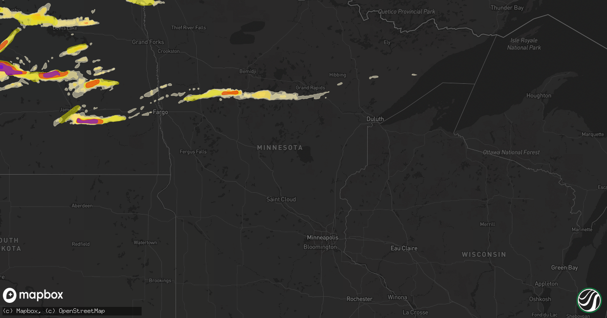
Hail Map in Minnesota on June 9, 2017
Get this storm
June 9 map
$229
one time, instant access
Download today. No call, no setup
Keep the $229
Bought the map and want the full workflow? Apply the entire $229 to a subscription within 7 days. None of it is wasted.
Every map, not just this one
This buys you this map. Subscription and you get every map we run, in the markets you choose from a few cities to whole states to nationwide. Plus real-time alerts the moment a storm fires.
Contact data
Name, contact info, occupancy, even credit band for addresses in the footprint. You go from where it hit to who to call.
Become the source they trust
Unlimited branding weather history reports on demand. You already have the documented answer ready for the property owner, and you are the one who showed up with it.
Property data and RoofTrace estimates
Pull up any address you have got, its value and the exact code rules for that jurisdiction, straight from One Click Code. Then RoofTrace estimates the squares, pitch, and roof value, priced the way you price.
Storm reports in Minnesota
Minnesota
| Date | Description |
|---|---|
| 06/09/20173:14 PM CDT | Trees down in the city of newfolden. |
| 06/09/20173:40 AM CDT | Time estimated by radar. |
| 06/09/20172:27 AM CDT | Boat dock blown over on the northern side of leech lake in sucker bay. Time estimated from radar. |
| 06/09/20172:20 AM CDT | Time estimated from radar. |
| 06/09/20172:15 AM CDT | Few trees blown over on the western side of leech lake township. Time estimated from radar. |
| 06/09/20172:10 AM CDT | A weak tornado track to the northeast for about one half mile from the forest tree line and across a farmstead... Ending after a minute... Around 211 am cdt. This torna |
| 06/09/20172:08 AM CDT | Numerous trees were blown down around kabekona lake and across southern lakeport township. Peak winds estimated from 85 to 95 mph. Time estimated based on radar. |
| 06/09/20172:00 AM CDT | Started as dime to nickel sized. Largest at size of quarters. |
| 06/09/20171:50 AM CDT | A local report indicates 1.75 inch wind near 7 WSW LAKE GEORGE |
| 06/09/20171:45 AM CDT | Report received via twitter from itasca state park. |
| 06/09/20171:15 AM CDT | A local report indicates 1.25 inch wind near TULABY LAKE |
| 06/09/20171:14 AM CDT | At elk horn resort on south twin lake |
| 06/09/20171:14 AM CDT | At elk horn resort on south twin lake |
| 06/09/20171:00 AM CDT | Hail lasted 20 minutes |
| 06/09/201712:50 AM CDT | Hail lasted 20 minutes |
| 06/09/201712:20 AM CDT | A local report indicates 1.00 inch wind near ULEN |
| 06/08/20179:20 PM CDT | Trees down in the city of newfolden. |
| 06/08/20177:24 PM CDT | A local report indicates 1.25 inch wind near 3 ENE BAKER |
All States Impacted by Hail Map on June 9, 2017
Cities Impacted by Hail Map on June 9, 2017
- Lakota, ND
- Brocket, ND
- Crary, ND
- Hebron, ND
- Stanton, ND
- Center, ND
- Beulah, ND
- New Salem, ND
- Hazen, ND
- Glen Ullin, ND
- Taylor, ND
- Gladstone, ND
- Dickinson, ND
- Richardton, ND
- South Heart, ND
- Zap, ND
- Mandan, ND
- Courtenay, ND
- Deering, ND
- Glenburn, ND
- Minot, ND
- Remer, MN
- Walker, MN
- Cass Lake, MN
- Akeley, MN
- Laporte, MN
- Longville, MN
- Warba, MN
- Ada, MN
- Hendrum, MN
- Saint Thomas, ND
- Crystal, ND
- Johnson City, TX
- Harwood, ND
- Grandin, ND
- Perley, MN
- Gardner, ND
- Argusville, ND
- Arthur, ND
- Hunter, ND
- Anamoose, ND
- Wimberley, TX
- Dripping Springs, TX
- Cavalier, ND
- Walhalla, ND
- Milton, ND
- Edinburg, ND
- Langdon, ND
- Mountain, ND
- Hannah, ND
- Stephen, MN
- Osnabrock, ND
- Grafton, ND
- Drayton, ND
- Wales, ND
- Kennedy, MN
- Hoople, ND
- Hensel, ND
- Harvey, ND
- Spiritwood, ND
- Leeds, ND
- Chaseley, ND
- Hurdsfield, ND
- Bowdon, ND
- Grace City, ND
- Wing, ND
- Sykeston, ND
- Washburn, ND
- Glenfield, ND
- Mcclusky, ND
- Kensal, ND
- Goodrich, ND
- Regan, ND
- Denhoff, ND
- Wilton, ND
- Carrington, ND
- Turtle Lake, ND
- Mercer, ND
- Upham, ND
- Newburg, ND
- Baldwin, ND
- Twin Valley, MN
- Luverne, ND
- Cooperstown, ND
- Hannaford, ND
- Wimbledon, ND
- Knox, ND
- Towner, ND
- Rugby, ND
- Esmond, ND
- Penn, ND
- Minnewaukan, ND
- Bantry, ND
- Devils Lake, ND
- Churchs Ferry, ND
- York, ND
- White Earth, MN
- Ogema, MN
- Naytahwaush, MN
- Park Rapids, MN
- Ponsford, MN
- Waubun, MN
- Bagley, MN
- Hope, ND
- Dazey, ND
- Sutton, ND
- Montpelier, ND
- Ypsilanti, ND
- Litchville, ND
- Marion, ND
- Jamestown, ND
- Kathryn, ND
- New Rockford, ND
- Pekin, ND
- Warwick, ND
- Tolna, ND
- Junction, TX
- Binford, ND
- Sheyenne, ND
- Granville, ND
- Hibbing, MN
- Surrey, ND
- Martin, ND
- Drake, ND
- Casselton, ND
- Sanborn, ND
- Mason, TX
- Cleveland, ND
- Driftwood, TX
- Round Mountain, TX
- Lawton, ND
- Nevis, MN
- Mapleton, ND
- Maxbass, ND
- Fessenden, ND
- Cando, ND
- West Fargo, ND
- Georgetown, MN
- San Marcos, TX
- Willow City, ND
- Tuttle, ND
- Robinson, ND
- Cathay, ND
- Finley, ND
- Borup, MN
- Hill City, MN
- Grand Rapids, MN
- Spicewood, TX
- Marble Falls, TX
- Ulen, MN
- Fingal, ND
- Valley City, ND
- Wheatland, ND
- Buffalo, ND
- Lake George, MN
- Federal Dam, MN
- Lake Park, MN
- Butte, ND
- Woodworth, ND
- Mchenry, ND
- Oriska, ND
- Tower City, ND
- Aurora, MN
- Makinen, MN
- Fortuna, ND
- Finland, MN
- Underwood, ND
- Goodland, MN
- Deer River, MN
- Hitterdal, MN
- Hawley, MN
- Aneta, ND
- Buchanan, ND
- Adams, ND
- Jud, ND
- Swan River, MN
- Callaway, MN


