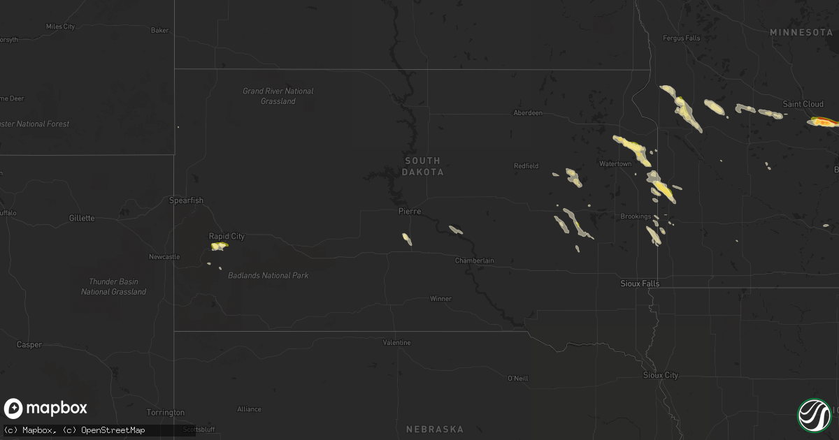
Hail Map in South Dakota on June 9, 2015
Get this storm
June 9 map
$229
one time, instant access
Download today. No call, no setup
Keep the $229
Bought the map and want the full workflow? Apply the entire $229 to a subscription within 7 days. None of it is wasted.
Every map, not just this one
This buys you this map. Subscription and you get every map we run, in the markets you choose from a few cities to whole states to nationwide. Plus real-time alerts the moment a storm fires.
Contact data
Name, contact info, occupancy, even credit band for addresses in the footprint. You go from where it hit to who to call.
Become the source they trust
Unlimited branding weather history reports on demand. You already have the documented answer ready for the property owner, and you are the one who showed up with it.
Property data and RoofTrace estimates
Pull up any address you have got, its value and the exact code rules for that jurisdiction, straight from One Click Code. Then RoofTrace estimates the squares, pitch, and roof value, priced the way you price.
Storm reports in South Dakota
South Dakota
| Date | Description |
|---|---|
| 06/09/20156:32 PM CDT | Strong winds blew down a dead tree along with penny size hail |
| 06/09/20156:30 PM CDT | Trees down... Branches down... Telephone poles down |
| 06/09/20156:05 PM CDT | A local report indicates 1.00 inch wind near 4 NNE CARTHAGE |
| 06/09/20155:24 PM CDT | A local report indicates 1.00 inch wind near 7 NW WILLOW LAKE |
| 06/09/20155:20 PM CDT | A local report indicates 1.00 inch wind near 4 NE ROCKERVILLE |
| 06/09/20155:15 PM CDT | Shave report |
| 06/09/20155:13 PM CDT | Large evergreen tree blown down... Estimated winds between 60-70 mph |
| 06/09/20154:47 PM CDT | Hail covered the ground and lasted 2-3 minutes with no noticeable damage |
| 06/09/20154:28 PM CDT | A local report indicates 1.25 inch wind near 4 NE ROCKERVILLE |
| 06/09/20154:25 PM CDT | A local report indicates 1.00 inch wind near 4 NE ROCKERVILLE |
| 06/09/20153:47 PM CDT | Estimated wind gusts around 50 mph... Hail broke a bedroom window... Some vegetable plants flattened |
| 06/09/20153:35 PM CDT | Also had dime size hail with small tree branches blown down |
| 06/09/20153:35 PM CDT | Also had dime size hail with small tree branches blown down |
All States Impacted by Hail Map on June 9, 2015
Cities Impacted by Hail Map on June 9, 2015
- Moore, SC
- Palestine, TX
- Hollywood, SC
- Tyrone, GA
- Fayetteville, GA
- Hardeeville, SC
- Danvers, MN
- Holloway, MN
- Birmingham, AL
- Simpsonville, SC
- Butternut, WI
- Glidden, WI
- Hermanville, MS
- Osteen, FL
- Lincolnton, GA
- Shorter, AL
- Tuskegee, AL
- Tallassee, AL
- Hardaway, AL
- Lueders, TX
- Albany, TX
- Stockbridge, GA
- Rex, GA
- Woodville, MS
- Clark, SD
- Lower Brule, SD
- Harrold, SD
- White Oak, NC
- Tar Heel, NC
- Lumberton, NC
- Merritt, NC
- Rapid City, SD
- Rock Hill, SC
- Newellton, LA
- Dudley, NC
- Clarks Grove, MN
- Bloomingdale, GA
- Ellabell, GA
- Pink Hill, NC
- Trenton, NC
- Lockhart, SC
- Chester, SC
- Sharon, SC
- Morrow, GA
- Forest Park, GA
- Jonesboro, GA
- Ellenwood, GA
- Riverdale, GA
- Atlanta, GA
- Lithonia, GA
- Salem, AL
- Buffalo, SD
- Lake Benton, MN
- Watkinsville, GA
- Madison, GA
- Shiloh, GA
- Pantego, NC
- Jamestown, SC
- Cross, SC
- Eutawville, SC
- Mauldin, SC
- Greenville, SC
- Piedmont, SC
- Beckville, TX
- Henderson, TX
- Zolfo Springs, FL
- Ruthton, MN
- Pipestone, MN
- Shawmut, MT
- Hector, MN
- Draper, SD
- Sumpter, OR
- Morris, MN
- Leeds, AL
- Wetumpka, AL
- Richmond Hill, GA
- Lakeland, FL
- Whitehouse, TX
- Tyler, TX
- Swainsboro, GA
- Coushatta, LA
- Fayetteville, NC
- Goodwater, AL
- Fort Bidwell, CA
- Lake City, CA
- Vicksburg, MS
- Victor, MT
- Hope Hull, AL
- McBee, SC
- Millry, AL
- Chatom, AL
- Blythe, GA
- Hephzibah, GA
- Augusta, GA
- Rockford, AL
- Kellyton, AL
- Alexander City, AL
- Columbia, LA
- Grayson, LA
- Newnan, GA
- Flandreau, SD
- Douglas, WY
- Utica, NE
- Lancaster, SC
- Graniteville, SC
- White, SD
- Dubberly, LA
- Athens, LA
- Gibsland, LA
- Arcadia, LA
- Louisville, GA
- San Augustine, TX
- Wills Point, TX
- Canton, TX
- Willow Lake, SD
- Fort Benning, GA
- Columbus, GA
- Bloomingdale, NY
- Vermontville, NY
- Glenrock, WY
- Casper, WY
- Chokio, MN
- Buckhead, GA
- Dover, NC
- Cove City, NC
- Kinston, NC
- Cold Spring, MN
- Dumont, MN
- Donnelly, MN
- Wheaton, MN
- Maynard, MN
- Dodson, LA
- West Point, GA
- Red Bluff, CA
- Cedartown, GA
- Iowa, LA
- Delhi, LA
- Tallulah, LA
- Winnsboro, LA
- Smiths Station, AL
- Phenix City, AL
- Leland, NC
- Saint Joseph, LA
- Jeffers, MN
- Clear Lake, SD
- Eaton Park, FL
- Brookwood, AL
- Matador, TX
- Farmerville, LA
- Downsville, LA
- Wellford, SC
- Spartanburg, SC
- Una, SC
- Arcadia, SC
- Inman, SC
- Monroe, LA
- Truckee, CA
- Gary, SD
- Revillo, SD
- Clear Lake, MN
- Becker, MN
- Maple Lake, MN
- Big Lake, MN
- Elk River, MN
- Clearwater, MN
- Monticello, MN
- Carthage, SD
- Paynesville, MN
- Bremen, GA
- Buchanan, GA
- Tallapoosa, GA
- Cyrus, MN
- Starbuck, MN
- Zebulon, GA
- Williamson, GA
- Utica, MS
- Conyers, GA
- Pine Mountain, GA
- Pine Mountain Valley, GA
- Hamilton, GA
- McConnells, SC
- Pembine, WI
- Dunbar, WI
- Niagara, WI
- Vulcan, MI
- Autryville, NC
- Stedman, NC
- Wade, NC
- Greer, SC
- Stephens, GA
- Union Point, GA
- Simsboro, LA
- Garland, NC
- Elizabethtown, NC
- Elm Grove, LA
- Huger, SC
- Milledgeville, GA
- Marksville, LA
- Sierraville, CA
- Sterrett, AL
- Easley, SC
- Fountain Inn, SC
- Woodruff, SC
- Williamston, SC
- Pelzer, SC
- Harrells, NC
- Labolt, SD
- Stockholm, SD
- Strandburg, SD
- Summit, SD
- South Shore, SD
- Jamestown, LA
- Ringgold, LA
- Knoxville, GA
- Saint Landry, LA
- Cary, MS
- Rolling Fork, MS
- Iroquois, SD
- Epps, LA
- Pioneer, LA
- Macon, GA
- Parrish, AL
- Oakman, AL
- Summerville, SC
- North Charleston, SC
- Charleston, SC
- Ladson, SC
- Charleston Afb, SC
- Griffin, GA
- New Iberia, LA
- Saint Martinville, LA
- Opelika, AL
- Waverly, AL
- Spearsville, LA
- Judith Gap, MT
- Two Dot, MT
- West Monroe, LA
- Calhoun, LA
- Overton, TX
- Dallas, GA
- Temple, GA
- Abbeville, LA
- Taylorsville, GA
- Alzada, MT
- Lakehead, CA
- Lake Placid, FL
- Bishop, GA
- Good Hope, GA
- Liberty, SC
- Beulaville, NC
- Soperton, GA
- Adrian, GA
- Tarrytown, GA
- Gardendale, AL
- Arp, TX
- Camp Hill, AL
- White Sulphur Springs, MT
- Canby, MN
- Brandt, SD
- Ivanhoe, MN
- Hendricks, MN
- Astoria, SD
- Beech Island, SC
- Branch, LA
- Kingsford, MI
- Iron Mountain, MI
- Geneva, FL
- Norwood, GA
- Crawfordville, GA
- Swan Valley, ID
- Irwin, ID
- Elkton, SD
- De Berry, TX
- Marshall, TX
- Palm Coast, FL
- Bunnell, FL
- Avon Park, FL
- Morven, NC
- Cheraw, SC
- New Bern, NC
- Prattville, AL
- Auburndale, FL
- Polk City, FL
- Joseph, OR
- Thomson, GA
- Warrenton, GA
- Welsh, LA
- Lake Providence, LA
- Sondheimer, LA
- Wrens, GA
- Oak Ridge, LA
- Rayville, LA
- Greensboro, GA
- Midway, AL
- Ridgeville, SC
- Labelle, FL
- Prairie City, OR
- Concord, GA
- Raymond, SD
- Lewistown, MT
- Roanoke, AL
- Springville, AL
- Castor, LA
- Fairburn, GA
- Union City, GA
- South Haven, MN
- Annandale, MN
- Anoka, MN
- Saint Pauls, NC
- Arcadia, FL
- Alberta, MN
- Port Gibson, MS
- Notasulga, AL
- East Dublin, GA
- Ozark, AL
- Savannah, GA
- Port Wentworth, GA
- Ohatchee, AL
- Adams Run, SC
- Mount Olive, NC
- Heflin, LA
- Quinnesec, MI
- Clarkton, NC
- Ashland, WI
- Ivanhoe, NC
- Monterey, LA
- Milbank, SD
- Three Forks, MT
- Patrick, SC
- Hartsville, SC
- Woodruff, WI
- Sayner, WI
- Boulder Junction, WI
- Tatum, TX
- Rockmart, GA
- Palmetto, GA
- Beaufort, SC
- Mcarthur, CA
- Gueydan, LA
- Anderson, SC
- Baker City, OR
- Porter, MN
- Taunton, MN
- Green Pond, SC
- Edisto Island, SC
- Northport, AL
- Chireno, TX
- Waterproof, LA
- Cameron, MT
- Trussville, AL
- Ariton, AL
- Norway, MI
- Goose Creek, SC
- Sulphur, LA
- Artesian, SD
- Lowndesboro, AL
- Montgomery, AL
- Lac Du Flambeau, WI
- Bethune, SC
- Kershaw, SC
- Etoile, TX
- Union Springs, AL
- Hatchechubbee, AL
- Hurtsboro, AL
- Burney, CA
- Bessemer, AL
- Adger, AL
- Forest Grove, MT
- Clinton, NC
- Eros, LA
- Peachtree City, GA
- Sharpsburg, GA
- Jacksons Gap, AL
- Ailey, GA
- Sylacauga, AL
- Ridgeland, SC
- Ortley, SD
- Goodwin, SD
- Mercer, WI
- Park Falls, WI
- Barnesville, GA
- Meansville, GA
- Pittsview, AL
- Eufaula, AL
- Roseboro, NC
- Milner, GA
- Townsend, GA
- Cataula, GA
- Fortson, GA
- Chatham, LA
- Winnfield, LA
- Goldonna, LA
- Jonesboro, LA
- Glenwood, MN
- Roscoe, MN
- Richmond, MN
- Red Springs, NC
- Hope Mills, NC
- Shannon, NC
- Monroe, GA
- Stamford, TX
- Flora, MS
- Fort Pierce, FL
- Monticello, FL
- Pinson, AL
- Thomaston, GA
- Washington, GA
- Appleton, MN
- Clayton, LA
- Council, NC
- Lake Waccamaw, NC
- Valley, AL
- Moncks Corner, SC
- Belgrade, MN
- Bartow, GA
- Wadley, GA
- Mount Croghan, SC
- Jefferson, SC
- Bell City, LA
- Social Circle, GA
- Fort Mitchell, AL
- Decatur, GA
- Deatsville, AL
- Ryegate, MT
- Forest, MS
- Greenville, NC
- Ayden, NC
- Grimesland, NC
- Cottonwood, CA
- Haughton, LA
- Cameron, LA
- Darlington, SC
- Bladenboro, NC
- Hancock, MN
- Shell, WY
- Greybull, WY
- Jonesville, SC
- Union, SC
- Society Hill, SC
- Fence, WI
- Florence, WI
- Custer, SD
- Seale, AL
- Covington, GA
- Redding, CA
- Shasta Lake, CA
- Little Rock, IA
- Gloster, LA
- Grand Cane, LA
- Godwin, NC
- Lumpkin, GA
- Omaha, GA
- Eudora, AR
- De Smet, SD
- Parrish, FL
- Monticello, GA
- Grand Bay, AL
- Groveland, FL
- Brooten, MN
- Rowland, NC
- Berry, AL
- Leesburg, FL
- Avera, GA
- Pendleton, SC
- Central, SC
- Keysville, GA
- Johns Island, SC
- Skipperville, AL
- Timpson, TX
- Ravenel, SC
- Glenwood, GA
- Mount Vernon, GA
- Vidalia, GA
- Johnstown, NY
- Amsterdam, NY
- Gloversville, NY
- Miami, FL
- Florence, SC
- Benson, MN
- Murdock, MN
- Canton, MS
- Lena, MS
- Morton, MS
- Pelahatchie, MS
- Okatie, SC
- Loretto, MI
- Arco, MN
- Longview, TX
- North Augusta, SC
- Lafayette, AL
- Opelousas, LA
- Church Point, LA
- Madison Lake, MN
- Jacksonville, FL
- Jacksonville Beach, FL
- Appling, GA
- Travelers Rest, SC
- Canova, SD
- Howard, SD
- Cowarts, AL
- Hobson, MT
- Buffalo, MT
- Gary, TX
- Manderson, WY
- Hyattville, WY
- Okahumpka, FL
- Bogart, GA
- Pineville, SC
- Vanceboro, NC
- Winnett, MT
- Tillman, SC
- Lake Charles, LA
- Helena, AL
- Pelham, AL
- Alabaster, AL
- Bentonia, MS
- Menominee, MI
- Cosmos, MN
- Campti, LA
- Wallace, MI
- Kelly, NC
- Pinecrest, CA
- Pinetown, NC
- Manton, CA
- Leadore, ID
- Redwood, MS
- Campobello, SC
- Riggins, ID
- Whiteville, NC
- Chadbourn, NC
- Hialeah, FL
- Oxford, GA
- Loganville, GA
- Deep Run, NC
- Saint Cloud, FL
- Cavour, SD
- Lovell, WY
- Nacogdoches, TX
- Fort Rucker, AL
- Dallas, TX
- Ventress, LA
- Bartow, FL
- Homeland, FL
- New Richland, MN
- Roebuck, SC
- Pauline, SC
- Ruffin, SC
- Smoaks, SC
- Chelsea, AL
- Marbury, AL
- Hayward, WI
- Carthage, TX
- Rutledge, GA
- Ruston, LA
- Parkton, NC
- Sparta, GA
- Cartersville, GA
- Kingston, GA
- Dora, AL
- Aragon, GA
- Georgetown, SC
- Ernul, NC
- Mitchell, GA
- Waynesboro, GA
- Dearing, GA
- Doland, SD
- Saxon, WI
- Leary, GA
- Albany, GA
- Quinton, AL
- Huron, SD
- Edwards, MS
- Shingletown, CA
- Floriston, CA
- Bennettsville, SC
- Harlowton, MT
- Huntington, OR
- Okeechobee, FL
- Hermosa, SD
- Aiken, SC


