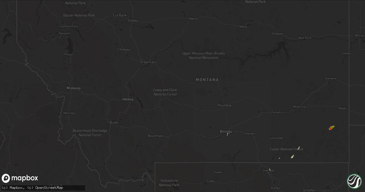
Hail Map in Montana on June 7, 2020
Get this storm
June 7 map
$229
one time, instant access
Download today. No call, no setup
Keep the $229
Bought the map and want the full workflow? Apply the entire $229 to a subscription within 7 days. None of it is wasted.
Every map, not just this one
This buys you this map. Subscription and you get every map we run, in the markets you choose from a few cities to whole states to nationwide. Plus real-time alerts the moment a storm fires.
Contact data
Name, contact info, occupancy, even credit band for addresses in the footprint. You go from where it hit to who to call.
Become the source they trust
Unlimited branding weather history reports on demand. You already have the documented answer ready for the property owner, and you are the one who showed up with it.
Property data and RoofTrace estimates
Pull up any address you have got, its value and the exact code rules for that jurisdiction, straight from One Click Code. Then RoofTrace estimates the squares, pitch, and roof value, priced the way you price.
Storm reports in Montana
Montana
| Date | Description |
|---|---|
| 06/07/20201:33 AM CDT | At 633 PM MDT, severe thunderstorms were located along a line extending from 16 miles northwest of Ekalaka to 23 miles northwest of Ridgeway, moving northeast at 35 mph. HAZARD...60 mph wind gusts and half dollar size hail. SOURCE...Radar indicated. IMPACT...Hail damage to vehicles is expected. Expect wind damage to roofs, siding, and trees. Locations impacted include... Ekalaka, Webster, Medicine Rocks State Park, Willard and Mill Iron. |
| 06/06/20208:03 PM CDT | A local report indicates 1.75 inch wind near 5 W EKALAKA |
All States Impacted by Hail Map on June 7, 2020
Cities Impacted by Hail Map on June 7, 2020
- Westport, SD
- Eureka, SD
- New Leipzig, ND
- New Salem, ND
- Mott, ND
- Elgin, ND
- Glen Ullin, ND
- Almont, ND
- Deer River, MN
- Midland, SD
- Vivian, SD
- Philip, SD
- Pierre, SD
- Buffalo, ND
- Leola, SD
- Cody, NE
- Hayes, SD
- Holabird, SD
- Mound City, SD
- Java, SD
- Selby, SD
- Gilby, ND
- Manvel, ND
- Minto, ND
- Luverne, ND
- Okaton, SD
- Fort Pierre, SD
- Kadoka, SD
- Quinn, SD
- Kyle, SD
- Scenic, SD
- Wall, SD
- Ashley, ND
- Zeeland, ND
- Wishek, ND
- Prairie City, SD
- Wakpala, SD
- Pine Ridge, SD
- Stephen, MN
- Kennedy, MN
- Drayton, ND
- Driscoll, ND
- Highmore, SD
- Bathgate, ND
- Hamilton, ND
- White River, SD
- Eagle Butte, SD
- Spiritwood, ND
- Sanborn, ND
- Draper, SD
- Edgeley, ND
- Lake Bronson, MN
- Merriman, NE
- Forest River, ND
- Blunt, SD
- Dawson, ND
- Napoleon, ND
- Tappen, ND
- Sheyenne, ND
- New Rockford, ND
- Wilton, ND
- Wing, ND
- Center, ND
- Regan, ND
- Mandan, ND
- Bismarck, ND
- Baldwin, ND
- Presho, SD
- Saint Michael, ND
- Gettysburg, SD
- Belvidere, SD
- Murdo, SD
- Roscoe, SD
- Ulen, MN
- Twin Valley, MN
- Borup, MN
- Strandquist, MN
- Argyle, MN
- Pollock, SD
- Strasburg, ND
- Hettinger, ND
- Strathcona, MN
- Thief River Falls, MN
- Parmelee, SD
- Billings, MT
- Agar, SD
- Finley, ND
- Fullerton, ND
- Newfolden, MN
- Valley City, ND
- Tolstoy, SD
- Hoven, SD
- Faulkton, SD
- Grace City, ND
- Cathay, ND
- Sykeston, ND
- Carrington, ND
- Halma, MN
- Karlstad, MN
- Donaldson, MN
- Tuthill, SD
- Willard, UT
- Wood, SD
- Seneca, SD
- Orient, SD
- Lancaster, MN
- Norris, SD
- Lawton, ND
- Felton, MN
- Glyndon, MN
- Ada, MN
- Bovey, MN
- Warwick, ND
- Fort Ransom, ND
- Verona, ND
- Linton, ND
- Kintyre, ND
- Middle River, MN
- Brocket, ND
- Bowdle, SD
- Mcclusky, ND
- Kensal, ND
- Pembina, ND
- Glasston, ND
- Saint Thomas, ND
- Hallock, MN
- Badger, MN
- Neche, ND
- Oslo, MN
- Alvarado, MN
- Hensel, ND
- Crystal, ND
- Grafton, ND
- Devils Lake, ND
- Sheridan, WY
- Buchanan, ND
- Litchville, ND
- Tuttle, ND
- Lankin, ND
- Lakota, ND
- Adams, ND
- Tolna, ND
- Lehr, ND
- Ayr, ND
- Regent, ND
- Hosmer, SD
- Long Lake, SD
- Fingal, ND
- Harrold, SD
- Fredonia, ND
- Kulm, ND
- Braddock, ND
- Steele, ND
- Medina, ND
- Lamoure, ND
- Long Valley, SD
- Otter, MT
- Mission, SD
- Saint Francis, SD
- Onaka, SD
- Ogden, UT
- Remer, MN
- Crawford, NE
- Enderlin, ND
- Ellendale, ND
- Lisbon, ND
- Nome, ND
- Kathryn, ND
- Streeter, ND
- Herreid, SD
- Hague, ND
- Lower Brule, SD
- Fertile, MN
- Crookston, MN
- Onida, SD
- Lebanon, SD
- Tremonton, UT
- Sharon, ND
- Ipswich, SD
- Aberdeen, SD
- Cresbard, SD
- Forbes, ND
- Martin, SD
- Greenbush, MN
- Hannaford, ND
- Longville, MN
- Goodridge, MN
- Frederick, SD
- Columbia, SD
- Grand Forks, ND
- East Grand Forks, MN
- Saint Hilaire, MN
- Viking, MN
- Red Lake Falls, MN
- Thompson, ND
- Grand Rapids, MN
- Cohasset, MN
- Jamestown, ND
- Berlin, ND
- Humboldt, MN
- Saint Vincent, MN
- Woodworth, ND
- Mekinock, ND
- Crary, ND
- Robinson, ND
- Pingree, ND
- Rogers, ND
- Kennebec, SD
- Rosebud, SD
- Warren, MN
- Hoople, ND
- Fordville, ND
- Dahlen, ND
- Petersburg, ND
- Mansfield, SD
- Beltrami, MN
- Gary, MN
- Akaska, SD
- Cooperstown, ND
- Decker, MT
- Montpelier, ND
- Ree Heights, SD
- Crookston, NE
- Miller, SD
- Highwood, MT
- Ypsilanti, ND
- Barnard, SD
- Galesburg, ND
- Wales, ND
- Northville, SD
- Warroad, MN
- Glenfield, ND
- Cotton, MN
- Jud, ND
- Lake Butler, FL
- Fort White, FL
- Branford, FL
- Lake City, FL
- Ekalaka, MT
- Kilgore, NE
- Stirum, ND
- Cogswell, ND
- Hecla, SD
- Oakes, ND
- Gwinner, ND
- Milnor, ND
- Forman, ND
- Britton, SD
- Havana, ND
- Groton, SD
- Houghton, SD
- Langford, SD
- Rutland, ND
- Bath, SD
- Amherst, SD
- Claremont, SD
- Warner, SD
- Arthur, ND
- Davenport, ND
- Leonard, ND
- Mapleton, ND
- Hunter, ND
- Hillsboro, ND
- Casselton, ND
- Amenia, ND
- Wheatland, ND
- Fargo, ND
- Moorhead, MN
- Carson, ND
- Euclid, MN
- Wannaska, MN
- Hatton, ND
- Larimore, ND
- Wimbledon, ND
- Reynolds, ND
- Nielsville, MN
- Shelly, MN
- Climax, MN
- Dazey, ND
- Roseau, MN
- Fisher, MN
- Aneta, ND
- Caledonia, ND
- Northwood, ND
- Gatzke, MN
- Buxton, ND
- Mayville, ND
- Halstad, MN
- Grygla, MN
- Emerado, ND
- Hope, ND
- Clifford, ND
- Portland, ND
- Arvilla, ND
- Mentor, MN
- Cummings, ND
- Grand Forks Afb, ND
- Pekin, ND
- Page, ND
- Oriska, ND
- Pillsbury, ND
- Tower City, ND
- Erie, ND
- Grandin, ND
- Absaraka, ND
- Winger, MN
- Perley, MN
- Argusville, ND
- Erskine, MN
- Harwood, ND
- Hendrum, MN
- Georgetown, MN
- Bejou, MN
- Fosston, MN
- Gully, MN
- Trail, MN
- Gonvick, MN
- Plummer, MN
- Clearbrook, MN
- Oklee, MN
- Mcintosh, MN
- Box Elder, SD
- Rapid City, SD


