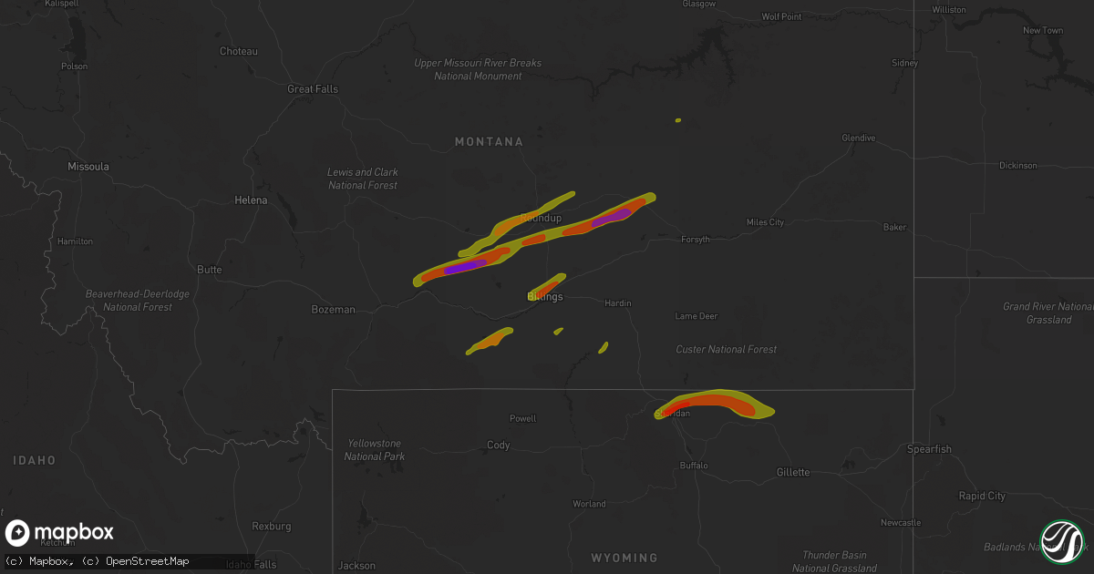
Hail Map on June 6, 2013
Get this storm
June 6 map
$229
one time, instant access
Download today. No call, no setup
Keep the $229
Bought the map and want the full workflow? Apply the entire $229 to a subscription within 7 days. None of it is wasted.
Every map, not just this one
This buys you this map. Subscription and you get every map we run, in the markets you choose from a few cities to whole states to nationwide. Plus real-time alerts the moment a storm fires.
Contact data
Name, contact info, occupancy, even credit band for addresses in the footprint. You go from where it hit to who to call.
Become the source they trust
Unlimited branding weather history reports on demand. You already have the documented answer ready for the property owner, and you are the one who showed up with it.
Property data and RoofTrace estimates
Pull up any address you have got, its value and the exact code rules for that jurisdiction, straight from One Click Code. Then RoofTrace estimates the squares, pitch, and roof value, priced the way you price.
States Impacted by Hail Map on June 6, 2013
Storm reports
North Carolina
| Date | Description |
|---|---|
| 06/06/20133:45 AM CDT | Trees down. Possible tornado. |
| 06/06/20133:45 AM CDT | Trees down. Possible tornado. |
| 06/06/201312:22 AM CDT | A few tree tops snapped. Storage building damaged by fallen branch. |
Arkansas
| Date | Description |
|---|---|
| 06/06/20131:30 PM CDT | A few trees were reported down. |
| 06/06/20131:10 PM CDT | Large trees were reported down in monticello. |
| 06/06/201312:50 PM CDT | Trees were reported down on power lines and small hail. |
| 06/06/20139:50 AM CDT | Tree down near 71 and 160 |
Texas
| Date | Description |
|---|---|
| 06/06/20136:33 PM CDT | A local report indicates 60 MPH wind near 7 N VIDOR |
| 06/06/20136:20 PM CDT | Sheriffs dept reports numerous trees down and power outages in the lumberton area. |
| 06/06/20136:16 PM CDT | Golfball hail in liberty. |
| 06/06/20136:16 PM CDT | Tree down in new caney on heights blvd. |
| 06/06/20136:15 PM CDT | Trees down in dayton |
| 06/06/20135:40 PM CDT | Trees down at the corner of fm 1725 and highway 105 in cleveland. |
| 06/06/20135:35 PM CDT | Sheriffs dept reports numerous trees down in the jasper area. |
| 06/06/20135:25 PM CDT | Sign snapped off and blown into a wrecker truck damaging the vehicle around 525 pm near calvary road and interstate 45. |
| 06/06/20135:16 PM CDT | Sheriffs dept reports numerous trees down from colmesneil to woodville. |
| 06/06/20135:00 PM CDT | Tree down across fm 1669 on the north side of huntington. |
| 06/06/20134:46 PM CDT | Trees down near highway 190 in livingston. |
| 06/06/20134:45 PM CDT | Wind gust to 30 mph. |
| 06/06/20134:42 PM CDT | Numerous trees down along highway 59 just south of diboll. |
| 06/06/20134:42 PM CDT | Wind gusts to 70 mph taken along highway 59 just south of diboll. |
| 06/06/20134:31 PM CDT | Large limbs down in diboll. |
| 06/06/20134:31 PM CDT | Trees down along highway 287 near carmona. |
| 06/06/20134:30 PM CDT | Trees and power lines down in the northern part of polk county. |
| 06/06/20134:16 PM CDT | Numerous trees and power lines down...especially between apple springs and groveton. |
| 06/06/20133:50 PM CDT | Trees down throughout houston county. |
| 06/06/20133:18 PM CDT | Report from buna sawmill. |
| 06/06/20133:12 PM CDT | Quarter size hail reported in the northern city limits of grapeland. |
| 06/06/20133:09 PM CDT | Pea size hail and trees down near grapeland. |
| 06/06/20133:06 PM CDT | Nickle to quarter size hail with wind gusts to 55 mph at spivey road. |
| 06/06/20139:12 AM CDT | Several trees down on power lines just outside linden |
| 06/06/20137:00 AM CDT | Wind blew down a tree and threw a trampoline 30 yards over a house |
| 06/05/20137:30 PM CDT | Tennis ball size hail in seabrook. |
| 06/05/20137:30 PM CDT | Tennis ball size hail just north of seabrook. |
| 06/05/20137:20 PM CDT | Photo from public showing 1.25 inch hail. |
| 06/05/20137:12 PM CDT | Quarter size hail at the corner of interstate 10 and west loop of beltway 8 in channelview. |
| 06/05/20137:05 PM CDT | Golfball size hail reported on fry road between little york and fm 529. |
New Mexico
| Date | Description |
|---|---|
| 06/05/201310:10 PM CDT | A local report indicates 68 MPH wind near 12 WNW OROGRANDE |
Louisiana
| Date | Description |
|---|---|
| 06/06/20136:55 PM CDT | Delayed report from off duty nws employee that observed 2 trees down along highway 12 near dequincy. Time estimated from radar. |
| 06/06/20135:10 PM CDT | Quarter size hail in marrero relayed via social media. |
| 06/06/20134:55 PM CDT | Trees down along magnolia ridge rd and old spanish trail in boutte. |
| 06/06/20134:50 PM CDT | Hail up to 1 inch in luling. |
| 06/06/20134:42 PM CDT | Reports of quarter size hail in st rose. |
| 06/06/20134:41 PM CDT | Quarter size hail reported along duncan street in slidell. |
| 06/06/20134:40 PM CDT | A few trees down along highway 307 in chackbay. |
| 06/06/20134:29 PM CDT | 1.25 inch hail reported by off duty nws employee near indian village. |
| 06/06/20131:15 PM CDT | A few trees blown down in the moss bluff area |
| 06/06/201312:45 PM CDT | Sheriffs dept reports tree down at camp edgewood. |
| 06/06/20139:55 AM CDT | Multiple trees down near barrons marina - s. Lakeshore drive at pines road |
| 06/05/20137:30 PM CDT | Power poles snapped off on alamo street near memorial hospital. |
| 06/05/20137:26 PM CDT | Storm survey finds microburst damage with the axis just north of i-210 in the south portion of lake charles. Several trees were snapped. In addition power poles were sn |
| 06/05/20137:07 PM CDT | Calcasieu em reported power poles down on the west side of suphur on picard st. |
| 06/05/20137:00 PM CDT | Vinton pd reported several small trees across roadway. |
Nevada
| Date | Description |
|---|---|
| 06/06/20136:38 PM CDT | Outflow from storm near mt rose. Also produced wind gusts around 45 mph in northern washoe valley and pleasant valley areas of highway 395. |
Mississippi
| Date | Description |
|---|---|
| 06/06/20133:35 PM CDT | Reports of a couple of trees down on hillsboro-ludlow road near highway 25. |
| 06/06/20133:25 PM CDT | Rankin s.o. Reports a few trees down througout mainly the eastern part of the county. |
| 06/06/20133:25 PM CDT | Rankin s.o. Reports a few trees down througout mainly the eastern part of the county. |
| 06/06/20133:15 PM CDT | A few trees were reported down. |
| 06/06/20132:00 PM CDT | Reports of a tree down on east broad street near highway 84 and atwood water park and one down on carmel-new hope road. Also two trees fell on a powerline in monticello |
| 06/06/20132:00 PM CDT | A local report indicates 1.00 inch wind near MONTICELLO |
| 06/06/20131:50 PM CDT | A few trees and large limbs down along everett rd |
| 06/06/20131:47 PM CDT | Penny to quarter hail fell on everett rd |
| 06/06/20131:30 PM CDT | Reports of a tree down on rockport new hebron road. |
| 06/06/20131:20 PM CDT | A local report indicates 1.00 inch wind near RALEIGH |
Florida
| Date | Description |
|---|---|
| 06/06/20134:12 PM CDT | Report of tornado on ground in fernandina beach near 1300 block of north fletcher ave. Damager reported. |
| 06/06/20133:48 PM CDT | A national weather service storm survey found a tornado with 75 to 90 mph winds impacted the extreme eastern side of maport naval station. Several non-critical structur |
| 06/06/201311:45 AM CDT | Roof damage to humane society after waterspout moved onshore |
| 06/06/201310:20 AM CDT | Several reports of tornado damage. Downed trees...roof damage on syracuse and neptune roads. Survey likely tomorrow. |
| 06/06/201310:20 AM CDT | Several reports of tornado damage. Downed trees...roof damage on syracuse and neptune roads. Survey likely tomorrow. |
| 06/06/20139:10 AM CDT | Trees down on roadway...vehicle and roof of restaurant located on beach blvd in gulfport. |
Cities Impacted by Hail Map on June 6, 2013
- Dayton, TX
- Huffman, TX
- Liberty, TX
- Lake Charles, LA
- Deer Park, TX
- La Porte, TX
- Folsom, LA
- Livingston, TX
- Corrigan, TX
- Garden City, TX
- Loranger, LA
- Elkhart, TX
- San Augustine, TX
- Willis, TX
- New Waverly, TX
- Huntsville, TX
- Conroe, TX
- Pasadena, TX
- Seabrook, TX
- Ama, LA
- Fairfield, TX
- Oakwood, TX
- Grapeland, TX
- Buffalo, TX
- Eudora, AR
- Mansfield, LA
- Nacogdoches, TX
- Annona, TX
- Avery, TX
- El Dorado, AR
- Warren, TX
- Fred, TX
- Spurger, TX
- Morton, MS
- Pelahatchie, MS
- Fresno, TX
- Louisville, MS
- Lacombe, LA
- Lena, MS
- Hockley, TX
- Richmond, TX
- Cypress, TX
- Katy, TX
- Saint Rose, LA
- Destrehan, LA
- Westwego, LA
- Luling, LA
- Centerville, TX
- Channelview, TX
- Tomball, TX
- Macon, MS
- Cleveland, TX
- Baytown, TX
- Highlands, TX
- Crosby, TX
- Houston, TX
- Chester, TX
- Sweeny, TX
- Bay City, TX
- Newhebron, MS
- Iowa, LA
- Montezuma, NM
- Marshall, TX
- Mooringsport, LA
- Karnack, TX
- Sulphur, LA
- Vinton, LA
- Madisonville, TX
- Midway, TX
- Groveton, TX
- Moscow, TX
- Diboll, TX
- Apple Springs, TX
- Bay Springs, MS
- Louin, MS
- Brandon, MS
- Braxton, MS
- Kinder, LA
- Leona, TX
- Trinity, TX
- Buna, TX
- Slidell, LA
- Trinchera, CO
- Call, TX
- Silsbee, TX
- Kirbyville, TX
- Jefferson, TX
- Kaplan, LA
- Thornton, TX
- Buckner, AR
- Gheens, LA
- Damon, TX
- Welsh, LA
- Larue, TX
- Frankston, TX
- Mora, NM
- Rociada, NM
- Midland, TX
- Dequincy, LA
- Devers, TX
- Hankamer, TX
- Holman, NM
- Cleveland, NM
- Center, TX
- Timpson, TX
- New Iberia, LA
- Jeanerette, LA
- Palestine, TX
- Chacon, NM
- Braithwaite, LA
- Belle Chasse, LA
- Crockett, TX
- Mount Pleasant, TX
- Moselle, MS
- Hattiesburg, MS
- Oakhurst, TX
- Bogata, TX
- Deweyville, TX
- Raleigh, MS
- Silver Creek, MS
- Brazoria, TX
- Long Branch, TX
- Garrison, TX
- Mount Enterprise, TX
- Mendenhall, MS
- Bryan, TX
- Anahuac, TX
- Wallisville, TX
- Ragley, LA
- Pinehurst, TX
- Magnolia, TX
- Jewett, TX
- Lovelady, TX
- Monticello, MS
- Natchez, LA
- Natchitoches, LA
- Talco, TX
- Converse, LA
- Las Vegas, NM
- Clarksville, TX
- Iota, LA
- Kentwood, LA
- Chamisal, NM
- Stanley, NM
- Branson, CO
- Folsom, NM
- Webster, TX
- Friendswood, TX
- Branch, LA
- Galena Park, TX
- Alvin, TX
- Pearland, TX
- Bacliff, TX
- Dickinson, TX
- South Houston, TX
- Sugar Land, TX
- Deport, TX
- New Orleans, LA
- Van Vleck, TX
- Boling, TX
- Pledger, TX
- Seminary, MS
- Texas City, TX
- La Marque, TX
- Marrero, LA
- Orange, TX
- Woodville, TX
- Pennington, TX
- Forest, MS
- Hull, TX
- League City, TX
- Harrisville, MS
- Georgetown, MS
- Kennard, TX
- Odessa, TX
- Youngsville, LA
- Ellisville, MS
- Laneville, TX
- Needville, TX
- North Zulch, TX
- Boutte, LA
- Paradis, LA
- Guy, TX
- Mount Vernon, TX
- Pinola, MS
- Manvel, TX
- Lafayette, LA
- Stamps, AR
- Wesson, MS
- Jacksonville, TX
- Athens, TX
- Kim, CO
- Teague, TX
- Kenner, LA
- Worden, MT
- Big Timber, MT
- Melville, MT
- Hysham, MT
- Roundup, MT
- Custer, MT
- Ingomar, MT
- Musselshell, MT
- Ryegate, MT
- Lavina, MT
- Rapelje, MT
- Broadview, MT
- Lodge Grass, MT
- Shawmut, MT
- Wolf, WY
- Arvada, WY
- Clearmont, WY
- Recluse, WY
- Gillette, WY
- Sheridan, WY
- Ranchester, WY
- Joliet, MT
- Red Lodge, MT
- Roberts, MT
- Roscoe, MT
- Billings, MT
- Shepherd, MT
- Huntley, MT