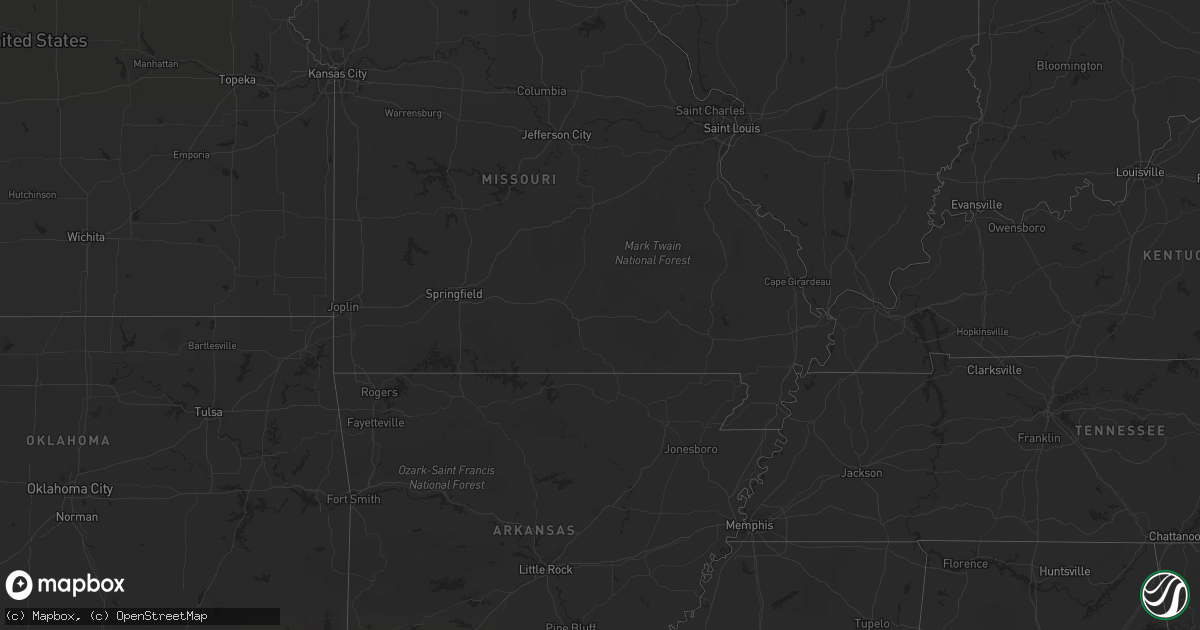
Hail Map on June 6, 2012
Get this storm
June 6 map
$229
one time, instant access
Download today. No call, no setup
Keep the $229
Bought the map and want the full workflow? Apply the entire $229 to a subscription within 7 days. None of it is wasted.
Every map, not just this one
This buys you this map. Subscription and you get every map we run, in the markets you choose from a few cities to whole states to nationwide. Plus real-time alerts the moment a storm fires.
Contact data
Name, contact info, occupancy, even credit band for addresses in the footprint. You go from where it hit to who to call.
Become the source they trust
Unlimited branding weather history reports on demand. You already have the documented answer ready for the property owner, and you are the one who showed up with it.
Property data and RoofTrace estimates
Pull up any address you have got, its value and the exact code rules for that jurisdiction, straight from One Click Code. Then RoofTrace estimates the squares, pitch, and roof value, priced the way you price.
States Impacted by Hail Map on June 6, 2012
Storm reports
Florida
| Date | Description |
|---|---|
| 06/06/20126:45 PM CDT | A few trees and power lines down from tstm winds around jackson county |
| 06/06/201212:35 PM CDT | 1 tree down. Tree fell on the holy ground homeless shelter. Time estimated by radar. |
| 06/06/20127:50 AM CDT | Numerous trees reported down throughout southeastern miami-dade county...mainly in the areas between homestead and cutler bay. Time of damage ranged between 800 and 900 |
| 06/06/20127:35 AM CDT | A member of the public estimated wind gusts to 60 mph in perrine...near the intersection of us 1 and southwest 168th street at 835 am edt. Business signs were blown off |
| 06/06/20127:34 AM CDT | A member of the public estimated wind gusts to 60 mph in west kendall...near the intersection of southwest 120th street and the florida turnpike at 834 am edt. |
| 06/06/20127:32 AM CDT | A trained spotter reported quarter-sized hail just west of the cutler bay area...near the intersection of us 1 and caribbean boulevard at 832 am edt. |
| 06/06/20127:25 AM CDT | An off-duty nws employee estimated wind gusts to 60 mph in homestead...near the intersection of southwest 259th street and southwest 125th avenue at 825 am edt. |
| 06/06/20127:22 AM CDT | A ham radio operator esimated wind gusts to 60 mph in princeton...near the intersection of southwest 253rd street and southwest 137th avenue at 822 am edt. |
| 06/06/20127:18 AM CDT | A trained spotter reported wind gusts between 55 and 60 mph near the intersection of us 1 and southwest 248th street at 818 am edt. |
| 06/06/20127:11 AM CDT | A member of the public reported quarter-sized hail in leisure citiy...near the intersection of southwest 288th street and the florida turnpike at 811 am edt. |
Texas
| Date | Description |
|---|---|
| 06/06/20126:50 PM CDT | 10 inch diameter trees snapped in half |
| 06/06/20126:40 PM CDT | A tree fell on a car on phillips street in tyler. |
| 06/06/20126:36 PM CDT | Mostly dime-sized with a few quarter-sized hail |
| 06/06/20126:36 PM CDT | Sheriffs office reports numerous trees and powerlines down throughout smith county. |
| 06/06/20125:45 PM CDT | Report of a two foot diameter tree falling into a carport in bullard...damaging the carport and a car. |
| 06/06/20125:40 PM CDT | A tree was reported down on fm 855 near the community of mount selman. |
| 06/06/20125:35 PM CDT | Trees reported down on highway 135 near the mixon community north of jacksonville. |
| 06/06/20124:50 PM CDT | 60 mph wind i 30 at east grand |
| 06/06/20124:35 PM CDT | High winds reported near mckinney |
| 06/06/20124:30 PM CDT | Several fences and medium trees down in vicinity of malone and bethany |
| 06/06/20124:15 PM CDT | Partial roof collapse at the wayside plaza apartments...pennsylvania and 9th ave in fort worth |
| 06/06/20124:10 PM CDT | 4 inch diameter tree limbs downed due to estimated 60+ mph winds on oakmont blvd |
| 06/06/20124:07 PM CDT | Reported near dallas north tollway and eldorado pkwy 2 nw frisco |
| 06/06/20124:05 PM CDT | Power lines reported down near intersection of fm 1277 and highway 147 in broaddus. |
| 06/06/20124:00 PM CDT | Trees snapped |
| 06/06/20123:53 PM CDT | Quarter sized hail reported near sh 66 and fm 205 |
| 06/06/20123:30 PM CDT | Public report of trees down in kirbyville. Relayed by kbmt-tv. Event time estimated by radar. |
| 06/06/20123:20 PM CDT | Quarter sized hail reported in chireno. |
| 06/06/20123:20 PM CDT | Several trees were blown down in chireno. |
| 06/06/20123:17 PM CDT | A local report indicates 1.00 inch wind near 1 NW HIGHLAND VILLAGE |
| 06/06/20122:15 PM CDT | Power lines down in forestburg |
| 06/06/20121:30 PM CDT | Quarter hail reported near lake bridgeport |
| 06/06/20128:11 AM CDT | Quarter size hail reported at coop gin in halfway. |
| 06/05/20127:15 PM CDT | Tree fell on and damaged a house near wills point |
Colorado
| Date | Description |
|---|---|
| 06/06/20126:28 PM CDT | A local report indicates 1.00 inch wind near 3 W BRIGGSDALE |
| 06/06/20126:05 PM CDT | Small landspout just north of denver international airport |
| 06/06/20125:57 PM CDT | A local report indicates 1.25 inch wind near 8 SW KEOTA |
| 06/06/20125:56 PM CDT | A local report indicates 1.00 inch wind near 1 E SEGUNDO |
| 06/06/20125:45 PM CDT | Delayed report of 1 inch diameter hail. |
| 06/06/20122:10 AM CDT | Quebec and c-470 |
| 06/06/20121:55 AM CDT | Street flooding with water running over the curbs |
| 06/06/20121:00 AM CDT | Ping pong sized hail kipling and hamden |
| 06/06/201212:10 AM CDT | A local report indicates 1.00 inch wind near CENTENNIAL |
| 06/06/201212:08 AM CDT | Hail covered the ground to a depth of two inches |
| 06/06/201212:00 AM CDT | Hail covered the ground to a depth of three inches |
| 06/05/201211:55 PM CDT | A local report indicates 1.00 inch wind near LONE TREE |
| 06/05/201211:35 PM CDT | A local report indicates 1.75 inch wind near HIGHLANDS RANCH |
| 06/05/201210:40 PM CDT | A local report indicates 1.25 inch wind near PARKER |
| 06/05/201210:30 PM CDT | A local report indicates 1.00 inch wind near HIGHLANDS RANCH |
| 06/05/201210:23 PM CDT | A local report indicates 1.00 inch wind near 4 W SEGUNDO |
| 06/05/201210:03 PM CDT | A local report indicates 1.00 inch wind near HIGHLANDS RANCH |
| 06/05/20129:57 PM CDT | A local report indicates 66 MPH wind near DENVER INTL AIRPORT |
| 06/05/20129:56 PM CDT | Hail covered the ground to a depth of two inches |
| 06/05/20129:54 PM CDT | Nickel to quarter sized hail covered the ground to a depth of several inches |
| 06/05/20129:51 PM CDT | On the ground for several minutes |
| 06/05/20129:48 PM CDT | A local report indicates 1.50 inch wind near 5 SSW ARAPAHOE PARK |
| 06/05/20129:44 PM CDT | Hail fell at 800pm mdt. |
| 06/05/20129:30 PM CDT | A local report indicates 1.75 inch wind near 3 W THE PINERY |
| 06/05/20129:24 PM CDT | A local report indicates 1.00 inch wind near 3 SSW CASTLE PINES |
| 06/05/20129:16 PM CDT | Fell at 803 pm mdt. |
| 06/05/20129:06 PM CDT | A local report indicates 1.00 inch wind near 4 SSE COLORADO SPRINGS |
| 06/05/20128:49 PM CDT | 1.50 inches of rain. |
| 06/05/20128:49 PM CDT | A local report indicates 1.75 inch wind near 2 NE COLORADO SPRINGS |
| 06/05/20128:48 PM CDT | A local report indicates 1.75 inch wind near 4 SSE COLORADO SPRINGS |
| 06/05/20128:45 PM CDT | A local report indicates a tornado near 14 SW BENNETT |
| 06/05/20128:44 PM CDT | A local report indicates a tornado near 12 NW KIOWA |
| 06/05/20128:44 PM CDT | A local report indicates 1.00 inch wind near 2 SSW COLORADO SPRINGS |
| 06/05/20128:43 PM CDT | A local report indicates 1.50 inch wind near 4 WSW COLORADO SPRINGS |
| 06/05/20128:40 PM CDT | A local report indicates 1.25 inch wind near 3 SE COLORADO SPRINGS |
| 06/05/20128:40 PM CDT | A local report indicates a tornado near 5 NW ELIZABETH |
| 06/05/20128:33 PM CDT | A local report indicates 1.25 inch wind near 3 SE COLORADO SPRINGS |
| 06/05/20128:32 PM CDT | A local report indicates 1.25 inch wind near 4 SW COLORADO SPRINGS |
| 06/05/20128:30 PM CDT | 720 to 724pm mdt |
| 06/05/20128:30 PM CDT | A local report indicates a tornado near 10 WSW KIOWA |
| 06/05/20128:26 PM CDT | A local report indicates 1.75 inch wind near 2 NE COLORADO SPRINGS |
| 06/05/20128:22 PM CDT | A local report indicates 1.25 inch wind near 4 WSW COLORADO SPRINGS |
| 06/05/20128:21 PM CDT | A local report indicates 1.25 inch wind near 5 NNW PETERSON AFB |
| 06/05/20128:20 PM CDT | A local report indicates 60 MPH wind near 3 NE PETERSON AFB |
| 06/05/20128:19 PM CDT | A local report indicates 1.50 inch wind near 7 NE COLORADO SPRINGS |
| 06/05/20128:19 PM CDT | Home gutters being ripped off of house by hail fall. |
| 06/05/20128:19 PM CDT | A local report indicates 1.25 inch wind near 4 ENE COLORADO SPRINGS |
| 06/05/20128:14 PM CDT | A local report indicates 60 MPH wind near 3 NNW COLORADO SPRINGS |
| 06/05/20128:14 PM CDT | A local report indicates 1.00 inch wind near 3 NNW COLORADO SPRINGS |
| 06/05/20128:13 PM CDT | A local report indicates 1.00 inch wind near 6 NNE COLORADO SPRINGS |
| 06/05/20128:10 PM CDT | A local report indicates 1.00 inch wind near 3 N PETERSON AFB |
| 06/05/20128:05 PM CDT | A local report indicates 1.00 inch wind near THE PINERY |
| 06/05/20128:04 PM CDT | A local report indicates 1.50 inch wind near 3 ENE COLORADO SPRINGS |
| 06/05/20128:02 PM CDT | A local report indicates 1.25 inch wind near 7 NE COLORADO SPRINGS |
| 06/05/20128:01 PM CDT | A local report indicates 1.00 inch wind near 2 NE COLORADO SPRINGS |
| 06/05/20128:00 PM CDT | A local report indicates 1.00 inch wind near PARKER |
| 06/05/20128:00 PM CDT | A local report indicates 1.00 inch wind near 3 SE COLORADO SPRINGS |
| 06/05/20127:56 PM CDT | A local report indicates 1.00 inch wind near 7 NNE COLORADO SPRINGS |
| 06/05/20127:54 PM CDT | A local report indicates 1.00 inch wind near 5 SSW BLACK FOREST |
| 06/05/20127:53 PM CDT | A local report indicates 1.00 inch wind near 6 NNE COLORADO SPRINGS |
| 06/05/20127:51 PM CDT | A local report indicates 1.00 inch wind near 5 SSW BLACK FOREST |
| 06/05/20127:45 PM CDT | A local report indicates 1.75 inch wind near 5 NE PARKER |
| 06/05/20127:38 PM CDT | Tornado ripped out small tree and threw it 20 feet |
| 06/05/20127:00 PM CDT | A local report indicates 1.00 inch wind near 12 W KEOTA |
Minnesota
| Date | Description |
|---|---|
| 06/06/20126:05 PM CDT | Little boy resort and campground. At least one tree down. Still checking out property. |
Oklahoma
| Date | Description |
|---|---|
| 06/06/20122:50 PM CDT | A local report indicates 60 MPH wind near 2 E RUBOTTOM |
Wyoming
| Date | Description |
|---|---|
| 06/06/20126:51 PM CDT | A local report indicates 1.25 inch wind near 4 W BURNS |
| 06/06/20126:30 PM CDT | A local report indicates 1.50 inch wind near 5 WSW BURNS |
| 06/06/20126:25 PM CDT | A local report indicates 1.50 inch wind near 5 NW BURNS |
| 06/06/20126:15 PM CDT | A local report indicates 1.00 inch wind near 3 NW BURNS |
| 06/06/20126:08 PM CDT | One inch hail reported in hillsdale in laramie county. |
| 06/06/20126:05 PM CDT | 0.50 to 1.00 inch hail lasted for 70 minutes. |
| 06/06/20126:01 PM CDT | A local report indicates 1.75 inch wind near 6 WSW BURNS |
| 06/06/20126:00 PM CDT | A local report indicates 1.00 inch wind near 5 N BURNS |
| 06/06/20126:00 PM CDT | A local report indicates 1.25 inch wind near 5 ESE BURNS |
| 06/06/20126:00 PM CDT | A local report indicates 1.50 inch wind near 3 NNE BURNS |
| 06/06/20125:53 PM CDT | A local report indicates 1.25 inch wind near 11 SSW HILLSDALE |
| 06/06/20125:50 PM CDT | A local report indicates 1.00 inch wind near 5 SW HILLSDALE |
| 06/06/20125:45 PM CDT | A local report indicates 1.25 inch wind near 7 W BURNS |
| 06/06/20125:40 PM CDT | A local report indicates 1.50 inch wind near 10 WSW BURNS |
| 06/06/20125:39 PM CDT | Observed along interstate 80 just south of burns |
| 06/06/20125:30 PM CDT | A local report indicates 1.25 inch wind near 10 WSW BURNS |
| 06/06/20125:30 PM CDT | A local report indicates 1.50 inch wind near 8 WSW BURNS |
| 06/06/20125:30 PM CDT | A local report indicates 1.00 inch wind near 8 ENE CARPENTER |
| 06/06/20125:30 PM CDT | A local report indicates 1.50 inch wind near 7 NE CARPENTER |
| 06/06/20125:15 PM CDT | A local report indicates 1.00 inch wind near 11 WSW BURNS |
| 06/06/20125:15 PM CDT | A local report indicates 1.00 inch wind near 8 NE CARPENTER |
| 06/06/20124:55 PM CDT | Hail ended at 355 pm mdt. |
| 06/06/20124:54 PM CDT | A local report indicates 1.00 inch wind near 12 WNW CHEYENNE |
| 06/06/20124:50 PM CDT | A local report indicates 1.00 inch wind near 8 WNW CARPENTER |
| 06/05/20127:00 PM CDT | A local report indicates 1.00 inch wind near 7 NNE BURNS |
| 06/05/20127:00 PM CDT | A local report indicates 1.50 inch wind near 6 SSW GUN BARREL |
North Dakota
| Date | Description |
|---|---|
| 06/06/20126:17 PM CDT | Hail ongoing at time of call. Hail started at 617 pm cdt. |
| 06/06/20125:54 PM CDT | Hail ongoing for 10 minutes. |
| 06/06/20125:13 PM CDT | Lots of nickels. Largest stone was quarter size. Hail lasted two minutes. |
| 06/06/20125:13 PM CDT | Lots of nickels. Largest stone was quarter size. Hail lasted two minutes. |
| 06/05/20128:18 PM CDT | Hail damaged truck. Report relayed by media. |
New Mexico
| Date | Description |
|---|---|
| 06/06/201212:42 AM CDT | Krtn asos. |
New York
| Date | Description |
|---|---|
| 06/05/20127:00 PM CDT | Public |
Cities Impacted by Hail Map on June 6, 2012
- Esmond, ND
- Godley, TX
- Raton, NM
- Aurora, CO
- Lone Tree, CO
- Englewood, CO
- Galeton, CO
- Gill, CO
- Eaton, CO
- Parker, CO
- Itasca, TX
- Hillsboro, TX
- Milford, TX
- Nocona, TX
- Saint Jo, TX
- Voltaire, ND
- Velva, ND
- Elgin, ND
- Flasher, ND
- Almont, ND
- Raleigh, ND
- Carson, ND
- Plainview, TX
- Abernathy, TX
- Hale Center, TX
- Coppell, TX
- Irving, TX
- Lakeview, TX
- Frisco, TX
- Little Elm, TX
- Folsom, NM
- Alto, TX
- Nacogdoches, TX
- Lufkin, TX
- Pollok, TX
- Wells, TX
- Keenesburg, CO
- Roggen, CO
- Maurice, LA
- Hart, TX
- Kress, TX
- Cushing, TX
- Douglass, TX
- Morgan, TX
- Kopperl, TX
- Grover, CO
- Briggsdale, CO
- Lyman, NE
- Gering, NE
- Mitchell, NE
- Morrill, NE
- Lake Charles, LA
- Iowa, LA
- Clarendon, TX
- Childress, TX
- Matador, TX
- Midway, TX
- Bell City, LA
- Flint, TX
- Chandler, TX
- Larue, TX
- Bullard, TX
- Frankston, TX
- Bedias, TX
- Huntsville, TX
- Bainbridge, GA
- Fort Morgan, CO
- Brush, CO
- Branson, CO
- Weatherford, TX
- Maddock, ND
- Oberon, ND
- Pierre Part, LA
- Morgan City, LA
- Karlsruhe, ND
- Balfour, ND
- Oakwood, TX
- Buffalo, TX
- Littleton, CO
- Denver, CO
- Kountze, TX
- Realitos, TX
- Spurger, TX
- Fred, TX
- Hillister, TX
- Weston, CO
- Hawley, TX
- Bowbells, ND
- Troup, TX
- Eustace, TX
- Malakoff, TX
- Athens, TX
- Franktown, CO
- Castle Rock, CO
- Elizabeth, CO
- Bennett, CO
- Oakhurst, TX
- Pointblank, TX
- Kennard, TX
- Grapeland, TX
- Pinehurst, TX
- Magnolia, TX
- Hereford, CO
- Cheyenne, WY
- Meriden, WY
- Albin, WY
- Lagrange, WY
- Pine Bluffs, WY
- Hillsdale, WY
- Carpenter, WY
- Burns, WY
- Ringgold, TX
- Bridgeport, TX
- Gainesville, TX
- Lafayette, LA
- Granbury, TX
- Lipan, TX
- Spring, TX
- Singer, LA
- Longville, MN
- Saucier, MS
- Pequot Lakes, MN
- Pine River, MN
- Lockport, LA
- Colorado Springs, CO
- Woodville, TX
- Bowie, TX
- Brookeland, TX
- Jasper, TX
- Trinchera, CO
- Chireno, TX
- Palestine, TX
- Valley View, TX
- Surrey, ND
- Norwich, ND
- Rugby, ND
- Sanger, TX
- Jacksboro, TX
- Baird, TX
- Kemp, TX
- Scurry, TX
- Donnybrook, ND
- Stanley, ND
- Palermo, ND
- Whitesboro, TX
- Burkeville, TX
- Newton, TX
- Bon Wier, TX
- Era, TX
- Rosston, TX
- Muenster, TX
- Commerce City, CO
- Vernon, TX
- Elmer, OK
- Kenmare, ND
- Cairo, GA
- Ochlocknee, GA
- Thomasville, GA
- Abilene, TX
- Altamonte Springs, FL
- Longwood, FL
- Cleburne, TX
- Wills Point, TX
- Ryder, ND
- Douglas, ND
- Whitehouse, TX
- Trinity, TX
- Sherman, TX
- Henderson, TX
- Desoto, TX
- Red Oak, TX
- Morse, LA
- Estherwood, LA
- Rayne, LA
- Crowley, LA
- Tyler, TX
- Houston, TX
- Winter Springs, FL
- Sanford, FL
- Denison, TX
- Pottsboro, TX
- Conifer, CO
- Lance Creek, WY
- Garyville, LA
- La Place, LA
- Reserve, LA
- Zephyr, TX
- Broaddus, TX
- San Augustine, TX
- Glenburn, ND
- Sulphur, LA
- Westlake, LA
- Rockwall, TX
- Dublin, TX
- Hico, TX
- Argyle, TX
- Hayes, SD
- Clifton, TX
- Cranfills Gap, TX
- Springtown, TX
- Paradise, TX
- Wood Lake, MN
- Hanley Falls, MN
- Oelrichs, SD
- Chadron, NE
- Baton Rouge, LA
- Baker, LA
- Blum, TX
- Covington, TX
- Bellevue, TX
- Bena, MN
- Houma, LA
- Hawk Springs, WY
- Torrington, WY
- Yoder, WY
- Ponchatoula, LA
- Garrison, ND
- Roseglen, ND
- Beulah, ND
- Zap, ND
- Fairfield, TX
- Forestburg, TX
- Montague, TX
- Antler, ND
- Sunset, TX
- Alvord, TX
- Plano, TX
- Krum, TX
- Corsicana, TX
- Fountain, CO
- Kaplan, LA
- Abbeville, LA
- New Iberia, LA
- Lewisville, TX
- Carrollton, TX
- The Colony, TX
- Lubbock, TX
- New Deal, TX
- Idalou, TX
- Strawn, TX
- Ranger, TX
- Towner, ND
- Blackduck, MN
- Squaw Lake, MN
- De Leon, TX
- Mexia, TX
- Maxbass, ND
- Glen Ullin, ND
- Lacombe, LA
- Albany, TX
- Petersburg, TX
- Livingston, TX
- Moran, TX
- Anson, TX
- Sedalia, CO
- Olton, TX
- Remer, MN
- Deer River, MN
- Federal Dam, MN
- Altus, OK
- Keene, TX
- Deweyville, TX
- Fort Worth, TX
- Louviers, CO
- Morrison, CO
- Watkins, CO
- Mullin, TX
- Merryville, LA
- Springfield, LA
- Peyton, CO
- Homestead, FL
- Miami, FL
- Trinidad, CO
- Boncarbo, CO
- New Rockford, ND
- Crowley, TX
- Des Allemands, LA
- Gray, LA
- Chico, TX
- Dallas, TX
- White Castle, LA
- Claude, TX
- Groom, TX
- Evergreen, CO
- Kiowa, CO
- Saratoga, TX
- Gueydan, LA
- Early, TX
- Dequincy, LA
- Youngsville, LA
- Prairieville, LA
- Geismar, LA
- Jennings, LA
- Haskell, TX
- Weinert, TX
- Rusk, TX
- Jacksonville, TX
- Brule, WI
- Iron River, WI
- Terrell, TX
- Stamford, TX
- Teague, TX
- Robertsdale, AL
- Madisonville, TX
- Model, CO
- Normangee, TX
- Minot, ND
- Denton, TX
- Campbellton, FL
- Burleson, TX
- Joshua, TX
- Granville, ND
- Desdemona, TX
- Mohall, ND
- Ragley, LA
- Midlothian, TX
- Venus, TX
- Maypearl, TX
- Alvarado, TX
- Grandview, TX
- Aubrey, TX
- Balta, ND
- Call, TX
- Boston, GA
- Alliance, NE
- Rule, TX
- Mabank, TX
- West Branch, MI
- Trinidad, TX
- Encino, TX
- Lansford, ND
- Azle, TX
- Denham Springs, LA
- Walker, LA
- Stephenville, TX
- Golden, CO
- Des Moines, NM
- Capulin, NM
- Perkinston, MS
- Lueders, TX
- Strasburg, CO
- Carrington, ND
- Edgewood, TX
- Rio Vista, TX
- Quinlan, TX
- Brownsboro, TX
- Winona, TX
- Cut Off, LA
- Larose, LA
- Max, ND
- Crockett, TX
- Elkhart, TX
- Holt, FL
- Milton, FL
- Hamilton, TX
- Pottsville, TX
- Meridian, TX
- Evant, TX
- Jefferson, CO
- Kirbyville, TX
- Moscow, TX
- Justin, TX
- Ponder, TX
- Minnewaukan, ND
- Fort Pierre, SD
- Tennessee Colony, TX
- Garland, TX
- Zachary, LA
- Rhome, TX
- Boyd, TX
- Decatur, TX
- Kaufman, TX
- Crestview, FL
- Baker, FL
- Orange, TX
- Livingston, LA
- Duson, LA
- Erath, LA
- Colmesneil, TX
- Canton, TX
- Kerens, TX
- Groesbeck, TX
- Longville, LA
- Wylie, TX
- Richardson, TX
- Allen, TX
- Gonzales, LA
- Carr, CO
- Lake Arthur, LA
- Pavo, GA
- Warren, TX
- Orchard, CO
- Tie Siding, WY
- Chugwater, WY
- Raceland, LA
- Luling, LA
- Shawnee, CO
- Addison, TX
- Coldspring, TX
- Brownwood, TX
- Gladwin, MI
- Pine Grove, LA
- Amite, LA
- Mart, TX
- Gordon, TX
- Welsh, LA
- Lacassine, LA
- Beaverton, MI
- Harris, MN
- Grantsburg, WI
- Montalba, TX
- Fruitvale, TX
- Goldthwaite, TX
- Prosper, TX
- Hendrix, OK
- Colbert, OK
- Durant, OK
- Calera, OK
- Waxahachie, TX
- Dixie, GA
- Rhodes, MI
- Crosslake, MN
- Wellington, CO
- Greenwood, FL
- Reklaw, TX
- Laneville, TX
- Ellsworth, NE
- Grand Chenier, LA
- Hudson, CO
- Wiggins, CO
- Memphis, TX
- Bosler, WY
- Starks, LA
- Avoca, TX
- Greenwell Springs, LA
- Gheens, LA
- Olustee, OK
- Evans, LA
- Deridder, LA
- Broussard, LA
- Lovelady, TX
- Comanche, TX
- Terral, OK
- Ryan, OK
- Hurst, TX
- Marianna, FL