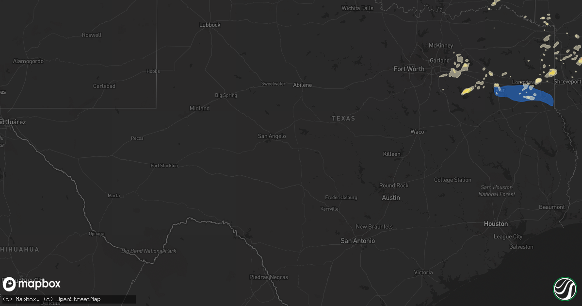
Hail Map in Texas on June 3, 2024
Get this storm
June 3 map
$229
one time, instant access
Download today. No call, no setup
Keep the $229
Bought the map and want the full workflow? Apply the entire $229 to a subscription within 7 days. None of it is wasted.
Every map, not just this one
This buys you this map. Subscription and you get every map we run, in the markets you choose from a few cities to whole states to nationwide. Plus real-time alerts the moment a storm fires.
Contact data
Name, contact info, occupancy, even credit band for addresses in the footprint. You go from where it hit to who to call.
Become the source they trust
Unlimited branding weather history reports on demand. You already have the documented answer ready for the property owner, and you are the one who showed up with it.
Property data and RoofTrace estimates
Pull up any address you have got, its value and the exact code rules for that jurisdiction, straight from One Click Code. Then RoofTrace estimates the squares, pitch, and roof value, priced the way you price.
Storm reports in Texas
Texas
| Date | Description |
|---|---|
| 06/03/20246:46 PM CDT | Report from mping: quarter |
| 06/03/20246:27 PM CDT | Power lines down. |
| 06/03/20246:05 PM CDT | Report from mping: quarter |
| 06/03/20245:20 PM CDT | Quarter size hail fell in booker. |
| 06/03/20246:53 AM CDT | Angleton asos recorded a 59 mph wind gust. |
| 06/02/20249:20 PM CDT | Multiple trees down in the area west of carthage. |
| 06/02/20248:55 PM CDT | A local report indicates 75 MPH wind near 1 NE Henderson |
| 06/02/20248:55 PM CDT | Numerous trees and power lines across town. |
| 06/02/20248:20 PM CDT | Reports of multiple trees down. Report via nws employee. |
| 06/02/20248:16 PM CDT | Reports of 60 to 70 mph wind gusts. |
| 06/02/20248:15 PM CDT | *** 1 fatal... 1 inj *** delayed report - tree uprooted. Fell on top of car traveling westbound on 279 causing one fatality. Wind estimated between 75-80 mph. |
| 06/02/20248:14 PM CDT | Asos records a wind gust of 70 mph. |
| 06/02/20248:14 PM CDT | Numerous trees and power lines were downed near highway 64 and fm 279 just west of tyler pounds field. |
| 06/02/20247:47 PM CDT | Numerous trees and power lines down in and near lindale. |
| 06/02/20247:42 PM CDT | Social media reports of many trees down and blocking portions of fm 279 between edom and ben wheeler. Time estimated from radar. |
| 06/02/20247:33 PM CDT | Social media report of trees down and blocking state highway 19 near walton. Time estimated from radar. |
All States Impacted by Hail Map on June 3, 2024
Cities Impacted by Hail Map on June 3, 2024
- Hawarden, IA
- Sedan, KS
- Howard, KS
- Shattuck, OK
- Coffeyville, KS
- Peru, KS
- Liberty, KS
- Severy, KS
- El Dorado, KS
- Rosalia, KS
- Eufaula, OK
- Cedar Vale, KS
- Eureka, KS
- Chetopa, KS
- Kinta, OK
- Bartlett, KS
- Wichita, KS
- Edna, KS
- Arnett, OK
- Pawhuska, OK
- Altamont, KS
- Dexter, KS
- Tupelo, OK
- Welch, OK
- Lenapah, OK
- Dearing, KS
- Fairfax, OK
- Ralston, OK
- Pawnee, OK
- Burbank, OK
- Stillwater, OK
- Leedey, OK
- Allen, KS
- Hammon, OK
- Afton, OK
- Vinita, OK
- Council Grove, KS
- Ripley, OK
- Perkins, OK
- Glencoe, OK
- Guthrie, OK
- Butler, OK
- Meridian, OK
- Admire, KS
- Terlton, OK
- Weleetka, OK
- Quapaw, OK
- Wellston, OK
- Luther, OK
- Depew, OK
- Bristow, OK
- Wyandotte, OK
- Stroud, OK
- Mannford, OK
- Carney, OK
- Sand Springs, OK
- Beggs, OK
- Wetumka, OK
- Oklahoma City, OK
- Kellyville, OK
- Henryetta, OK
- Mounds, OK
- Sapulpa, OK
- Choctaw, OK
- Okmulgee, OK
- Okemah, OK
- Council Hill, OK
- Checotah, OK
- Morris, OK
- Hanna, OK
- Dustin, OK
- Mcalester, OK
- Stuart, OK
- Lamar, OK
- Oktaha, OK
- Indianola, OK
- Whitefield, OK
- Stigler, OK
- Quinton, OK
- Warner, OK
- Porum, OK
- Webbers Falls, OK
- Mccurtain, OK
- Wilburton, OK
- Red Oak, OK
- Wister, OK
- Talihina, OK
- Winthrop, IA
- Independence, IA
- Canadian, OK
- Clayton, OK
- Shady Point, OK
- Bokoshe, OK
- Elkland, MO
- Ada, OK
- Roff, OK
- Poteau, OK
- Cameron, OK
- Nashoba, OK
- Fitzhugh, OK
- Whitewater, MO
- Stonewall, OK
- Greenville, MO
- Long Lane, MO
- Delhi, IA
- Lebanon, MO
- Richland, MO
- Tunas, MO
- Windyville, MO
- Booneville, AR
- Hopkinton, IA
- Earlville, IA
- Manchester, IA
- Stoutland, MO
- Boles, AR
- Beloit, WI
- Brodhead, WI
- Worthington, IA
- Janesville, WI
- Orfordville, WI
- Mound Valley, KS
- Mena, AR
- Dexter, MO
- Tiptonville, TN
- Ulman, MO
- Brumley, MO
- Bloomfield, MO
- Afton, WI
- Dyersville, IA
- Essex, MO
- Dubuque, IA
- Peosta, IA
- Epworth, IA
- Sikeston, MO
- Holy Cross, IA
- Farley, IA
- Tuscumbia, MO
- Union City, TN
- De Kalb, MS
- Hickman, KY
- Durand, IL
- Sherrill, IA
- Durango, IA
- Waynesboro, TN
- Bell City, MO
- Ridgely, TN
- Cascade, IA
- East Dubuque, IL
- Hazel Green, WI
- Starkville, MS
- Fulton, KY
- South Fulton, TN
- Martin, TN
- Boyceville, WI
- Ridgeland, WI
- Wheeler, WI
- Fulton, MO
- New Bloomfield, MO
- Hurricane Mills, TN
- Lobelville, TN
- Waverly, TN
- Troy, TN
- Maud, TX
- Mukwonago, WI
- Bradley, AR
- Texarkana, TX
- Bernie, MO
- Doddridge, AR
- Water Valley, KY
- Atlanta, TX
- Douglassville, TX
- East Troy, WI
- Fouke, AR
- Gurdon, AR
- Queen City, TX
- Parma, MO
- Bowman, ND
- Lewisville, AR
- Stamps, AR
- Booker, TX
- Perryton, TX
- Gallatin, TN
- Magnolia, AR
- Waldo, AR
- Scranton, ND
- Haynesville, LA
- Bloomburg, TX
- Sarepta, LA
- Cotton Valley, LA
- Plain Dealing, LA
- Taylor, AR
- Buckner, AR
- Gilbertsville, KY
- Junction City, AR
- Emerson, AR
- Shongaloo, LA
- Prairie City, SD
- Avinger, TX
- Golconda, IL
- Lodgepole, SD
- Karnack, TX
- Reeder, ND
- Mooringsport, LA
- Jefferson, TX
- Linden, TX
- Rodessa, LA
- El Dorado, AR
- Springhill, LA
- Vivian, LA
- Ida, LA
- Hosston, LA
- Quinlan, TX
- Royse City, TX
- Lemmon, SD
- Hettinger, ND
- New England, ND
- Regent, ND
- Dumas, TX
- Eustace, TX
- Choudrant, LA
- Downsville, LA
- Marshall, TX
- Terrell, TX
- Hawkins, TX
- Mabank, TX
- Oil City, LA
- Wills Point, TX
- Benton, KY
- Mott, ND
- Clarendon, TX
- Meadow, SD
- Strong, AR
- Spearsville, LA
- Trenton, KY
- Clarksville, TN
- Guthrie, KY
- Farmerville, LA
- Minden, LA
- Homer, LA
- Gilliam, LA
- Big Sandy, TX
- Alba, TX
- Pleasant View, TN
- Brookhaven, MS
- Haughton, LA
- Benton, LA
- Annapolis, MO
- Bogue Chitto, MS
- Wilmer, AL
- Semmes, AL
- Nevada, TX
- Hermanville, MS
- Caddo Mills, TX
- Bernice, LA
- Marion, LA
- Huttig, AR
- Seagoville, TX
- Port Gibson, MS
- Mineola, TX
- Keldron, SD
- Tyler, TX
- Hopkinsville, KY
- Russellville, KY
- Dubach, LA
- Selfridge, ND
- Garland City, AR
- Crandall, TX
- Gracey, KY
- Cerulean, KY
- Ruston, LA
- Flint, TX
- Whitehouse, TX
- Arp, TX
- Troup, TX
- Tuskahoma, OK
- Rattan, OK
- Broken Bow, OK
- S Coffeyville, OK
- Overton, TX
- Selman City, TX
- Henderson, TX
- Dupree, SD
- Carthage, TX
- Kilgore, TX
- Beckville, TX
- Tatum, TX
- Winona, TX
- Longview, TX
- Hallsville, TX
- Ashland City, TN
- Portland, TN
- De Berry, TX
- Kaufman, TX
- Forney, TX
- Ferris, TX
- Grand Saline, TX
- Athens, TX
- Wilmot, AR
- Eudora, AR
- Yazoo City, MS
- Ben Wheeler, TX
- Canton, TX
- Van, TX
- Waskom, TX
- Murchison, TX
- Ennis, TX
- Tchula, MS
- Benton, MS
- Utica, MS
- Belzoni, MS
- Brandon, MS
- Canton, MS
- Lena, MS
- Big Sandy, TN
- Camden, TN
- Camden, MS
- Holladay, TN
- Parkdale, AR
- Portland, AR
- West Monroe, LA
- Rolling Fork, MS
- Valley Park, MS
- Calhoun, LA
- Louise, MS
- Anguilla, MS
- Mullen, NE
- Mayersville, MS
- Lake Providence, LA
- Transylvania, LA
- Tallulah, LA
- Arthur City, TX
- Grant, OK
- Haworth, OK
- Whitman, NE
- Lookeba, OK
- Binger, OK
- Hugo, OK
- Hinton, OK
- Fort Towson, OK
- Sawyer, OK
- Foreman, AR
- Holdenville, OK
- Calumet, OK
- Minco, OK
- Atwood, OK
- Ashdown, AR
- Spencerville, OK
- Norman, OK
- Gracemont, OK
- Wewoka, OK
- Tuttle, OK
- Hydro, OK
- Geary, OK
- El Reno, OK
- Shawnee, OK
- Seminole, OK
- Anadarko, OK
- Harrah, OK
- Mustang, OK
- Okarche, OK
- Yukon, OK
- Mcloud, OK
- Calvin, OK
- Newcastle, OK
- Amber, OK
- Pocasset, OK
- Ringold, OK
- Rufe, OK
- Edmond, OK
- Earlsboro, OK
- Thomas, OK
- Chickasha, OK
- Blanchard, OK
- Washington, OK
- Spencer, OK
- Wilton, AR
- Purcell, OK
- Boley, OK
- Lindsay, OK
- Tecumseh, OK
- Wayne, OK
- Maud, OK
- Lexington, OK
- Brewster, NE
- Asher, OK
- Wanette, OK
- Macomb, OK
- Byars, OK
- Watonga, OK
- Bowlegs, OK
- Stratford, OK
- Maysville, OK
- Sasakwa, OK
- Konawa, OK
- Fort Smith, AR
- Allen, OK
- Fittstown, OK
- Centrahoma, OK
- Coalgate, OK
- Wapanucka, OK
- Milburn, OK
- Wardville, OK
- Mulberry, AR
- Atoka, OK
- Ozark, AR
- Pattonville, TX
- Kiowa, OK
- Savanna, OK
- Pittsburg, OK
- Stringtown, OK
- Hartshorne, OK
- Spavinaw, OK
- Eucha, OK
- Placedo, TX
- Bloomington, TX
- Wray, CO
- Blanco, OK
- Daisy, OK
- Lane, OK
- Caddo, OK
- Caney, OK
- Krebs, OK
- Saint Francis, KS
- Antlers, OK
- Snow, OK
- Finley, OK
- Newalla, OK
- Trenton, NE
- Centralia, MO
- Noel, MO
- Culbertson, NE
- South West City, MO
- Sulphur Springs, AR
- Pineville, MO
- Jones, OK
- Lanagan, MO
- Anderson, MO
- Arkoma, OK
- Muldrow, OK
- Spiro, OK
- Roland, OK
- Bird City, KS
- McDonald, KS
- Atwood, KS
- Edson, KS
- Goodland, KS
- Hooks, TX
- Herndon, KS
- Lindale, TX
- Chandler, TX
- Brownsboro, TX
- Price, TX
- Laneville, TX
- Mount Enterprise, TX
- Long Branch, TX
- Garrison, TX
- Timpson, TX
- Gary, TX
- Tenaha, TX
- Joaquin, TX
- Shelbyville, TX
- Center, TX
- Logansport, LA
- Mansfield, LA
- Noble, LA
- Keatchie, LA
- Converse, LA
- Grand Cane, LA
- Coushatta, LA
- Pleasant Hill, LA
- Pelican, LA
- Zwolle, LA
- Belmont, LA
- Marthaville, LA
- New Leipzig, ND


