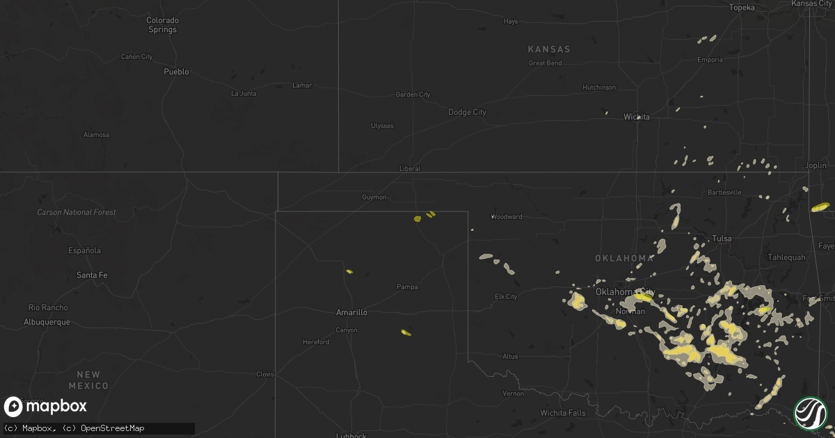
Hail Map on June 3, 2024
Get this storm
June 3 map
$229
one time, instant access
Download today. No call, no setup
Keep the $229
Bought the map and want the full workflow? Apply the entire $229 to a subscription within 7 days. None of it is wasted.
Every map, not just this one
This buys you this map. Subscription and you get every map we run, in the markets you choose from a few cities to whole states to nationwide. Plus real-time alerts the moment a storm fires.
Contact data
Name, contact info, occupancy, even credit band for addresses in the footprint. You go from where it hit to who to call.
Become the source they trust
Unlimited branding weather history reports on demand. You already have the documented answer ready for the property owner, and you are the one who showed up with it.
Property data and RoofTrace estimates
Pull up any address you have got, its value and the exact code rules for that jurisdiction, straight from One Click Code. Then RoofTrace estimates the squares, pitch, and roof value, priced the way you price.
States Impacted by Hail Map on June 3, 2024
Storm reports
Montana
| Date | Description |
|---|---|
| 06/02/202410:48 PM CDT | A local report indicates 63 MPH wind near 1 SSE Baker |
| 06/02/202410:00 PM CDT | Mesonet station gw0525 bloomfield. |
| 06/02/20249:35 PM CDT | 2 1/2 inch cottonwood tree branch blown down |
| 06/02/20249:08 PM CDT | A local report indicates 68 MPH wind near 3 WNW Miles City |
| 06/02/20248:00 PM CDT | Anchored empty 4000 bushel 30 ft grain bin knocked over. Some windows bowed in... But didnt break. Preliminary wind in excess of 80 mph. |
| 06/02/20247:46 PM CDT | Asos station kjdn jordan. |
Iowa
| Date | Description |
|---|---|
| 06/03/20243:33 PM CDT | Delayed report. Several trees down in the neighborhood with one on a house. |
| 06/03/20243:33 PM CDT | Large tree blown down. |
| 06/03/20243:30 PM CDT | Large tree downed. Time estimated using radar. |
| 06/03/20243:29 PM CDT | Four inch diameter branches down and shingles blown off roof. |
| 06/03/20243:29 PM CDT | Measured wind from a home weather station. |
| 06/03/20243:18 PM CDT | Report from mping: 1-inch tree limbs broken; shingles blown off. |
| 06/03/20243:00 PM CDT | Power pole leaning. |
Texas
| Date | Description |
|---|---|
| 06/03/20246:46 PM CDT | Report from mping: quarter |
| 06/03/20246:27 PM CDT | Power lines down. |
| 06/03/20246:05 PM CDT | Report from mping: quarter |
| 06/03/20245:20 PM CDT | Quarter size hail fell in booker. |
| 06/03/20246:53 AM CDT | Angleton asos recorded a 59 mph wind gust. |
| 06/02/20249:20 PM CDT | Multiple trees down in the area west of carthage. |
| 06/02/20248:55 PM CDT | A local report indicates 75 MPH wind near 1 NE Henderson |
| 06/02/20248:55 PM CDT | Numerous trees and power lines across town. |
| 06/02/20248:20 PM CDT | Reports of multiple trees down. Report via nws employee. |
| 06/02/20248:16 PM CDT | Reports of 60 to 70 mph wind gusts. |
| 06/02/20248:15 PM CDT | *** 1 fatal... 1 inj *** delayed report - tree uprooted. Fell on top of car traveling westbound on 279 causing one fatality. Wind estimated between 75-80 mph. |
| 06/02/20248:14 PM CDT | Numerous trees and power lines were downed near highway 64 and fm 279 just west of tyler pounds field. |
| 06/02/20248:14 PM CDT | Asos records a wind gust of 70 mph. |
| 06/02/20247:47 PM CDT | Numerous trees and power lines down in and near lindale. |
| 06/02/20247:42 PM CDT | Social media reports of many trees down and blocking portions of fm 279 between edom and ben wheeler. Time estimated from radar. |
| 06/02/20247:33 PM CDT | Social media report of trees down and blocking state highway 19 near walton. Time estimated from radar. |
South Dakota
| Date | Description |
|---|---|
| 06/03/20246:37 PM CDT | A local report indicates 1.00 inch wind near 9 SE Lodgepole |
| 06/02/20248:36 PM CDT | A local report indicates 1.00 inch wind near 4 WSW Glad Valley |
| 06/02/20247:49 PM CDT | A local report indicates 1.00 inch wind near 8 SE Lemmon |
| 06/02/20247:18 PM CDT | Very hard hail... Broken windshield in truck. |
| 06/02/20247:06 PM CDT | Nws employee at shadehill reservoir |
Tennessee
| Date | Description |
|---|---|
| 06/03/20245:23 PM CDT | Approximately 20 large trees down... Some of which brought down power lines and blocked streets in the inglewood neighborhood of nashville. |
| 06/03/20243:36 PM CDT | A local report indicates 1.00 inch wind near 1 NNW Union City |
Arkansas
| Date | Description |
|---|---|
| 06/03/20246:35 PM CDT | Multiple trees down across iron mountain road. |
| 06/03/20246:17 PM CDT | Roof blown of building downtown. |
| 06/03/20245:26 PM CDT | Reports of multiple trees down across the north part of the county. |
| 06/03/20245:15 PM CDT | A tree fell and landed across a road... Blocking both lanes of traffic. |
| 06/03/20244:54 PM CDT | Reports of multiple trees down across the county. |
| 06/03/20244:40 PM CDT | Trees and power lines down county wide. |
| 06/03/20244:00 PM CDT | Nearly two dozen trees were downed across the city. |
| 06/03/20242:02 PM CDT | Power lines down at n6th st and division st. Report relayed via ham operator. Time is radar estimated. |
| 06/02/20248:30 PM CDT | Report of tree downed across hwy-159 south of eudora. |
| 06/02/20247:27 PM CDT | Corrects previous tstm wnd dmg report from crossett. Report of multiple trees and power poles downed around the city of crossett. |
| 06/02/20247:00 PM CDT | Report of multiple trees and power poles downed around the city of crossett. |
Missouri
| Date | Description |
|---|---|
| 06/03/20245:00 PM CDT | Large tree blown down onto owens school road near intersection with highway z. |
| 06/03/20244:43 PM CDT | Tree down on mobile home and vehicle. |
| 06/03/20245:09 AM CDT | A local report indicates 1.00 inch wind near Pineville |
| 06/03/20245:02 AM CDT | A local report indicates 1.00 inch wind near Noel |
Illinois
| Date | Description |
|---|---|
| 06/03/20244:10 PM CDT | Intersection closed due to flash flooding. |
Washington
| Date | Description |
|---|---|
| 06/03/20243:10 PM CDT | Downed trees blocking both lanes on sr 26. |
| 06/03/20242:35 PM CDT | Weather related pow |
| 06/03/20242:35 PM CDT | Several trees at the fairgrounds suffered significant damage. Time estimated. |
| 06/03/20242:35 PM CDT | Weather related power outage affecting 760 customers. |
| 06/03/20242:10 PM CDT | Downed trees blocking sb lane of us 395 near orin rice road. |
| 06/03/20241:07 PM CDT | Time corrected by weather spotter. Several trees at the fairgrounds suffered significant damage. |
Louisiana
| Date | Description |
|---|---|
| 06/03/20246:55 PM CDT | A local report indicates 1.00 inch wind near Farmerville |
| 06/03/20246:00 PM CDT | Report of large hail north of shongaloo. |
| 06/02/202410:47 PM CDT | Multiple trees down on and along highway 371 in the hall summit community. |
| 06/02/202410:21 PM CDT | Power lines were downed across highway 513 just north of the mansfield golf and country club. |
| 06/02/202410:15 PM CDT | A tree was downed across ellerbe road. |
| 06/02/202410:00 PM CDT | A tree was blown down across power lines on tyler road between logansport and stanley. |
| 06/02/20249:43 PM CDT | A few trees down in the western part of the parish... Scattered power outages as well. |
| 06/02/20249:40 PM CDT | A tree was blown down across power lines on mclaughlin road in the verda community. |
| 06/02/20249:37 PM CDT | Power lines downed along us 84 near french fork. |
| 06/02/20249:35 PM CDT | Large limbs were downed in jena. |
| 06/02/20249:25 PM CDT | Power lines downed along la highway 8. |
| 06/02/20249:21 PM CDT | A tree was blown down across highway 500 near bear creek road. |
| 06/02/20249:10 PM CDT | Large limbs were downed in olla. |
| 06/02/20249:00 PM CDT | Several trees were blown down in various parts of the parish... And power outages had been reported. |
| 06/02/20248:55 PM CDT | Corrects previous tstm wnd dmg report from winnsboro. Report of multiple trees and powerlines downed. |
| 06/02/20248:45 PM CDT | Report of multiple trees and powerlines downed. |
| 06/02/20248:35 PM CDT | A few power poles and power lines were broken in portions of the parish. |
| 06/02/20248:35 PM CDT | Report of multiple trees and powerlines downed. |
| 06/02/20248:19 PM CDT | Asos recorded a 58 mph wind gust. |
| 06/02/20248:15 PM CDT | Several trees down. |
| 06/02/20248:10 PM CDT | Trees down across several powerlines on highway 593. |
| 06/02/20248:10 PM CDT | A large tree snapped and fell onto a mobile home on old darbonne road in west monroe. |
| 06/02/20248:02 PM CDT | Numerous trees were also blown down... Trunk diameters estimated around 12-16 in. Shingles and metal roofing on agricultural structures were compromised and damaged... |
| 06/02/20248:00 PM CDT | Multiple trees down across interstate 20 west near mm 106. Forcing the closure of the interstate. |
| 06/02/20247:40 PM CDT | Trees down county wide. |
| 06/02/20247:05 PM CDT | Numerous trees down. |
Wisconsin
| Date | Description |
|---|---|
| 06/03/20244:15 PM CDT | Corrects previous tstm wnd dmg report from 1 w eagle. A couple trees uprooted and snapped. Tree down on a car. Time estimated from radar. |
| 06/03/20243:15 PM CDT | Trees and a few power poles down. Time estimated by radar. |
| 06/03/20243:14 PM CDT | 6 inch to 1 ft tree branches down and irrigation equipment overturned relayed through social media. Time estimate from radar. |
| 06/03/20241:45 AM CDT | Tree and powerline damage. |
| 06/03/20241:15 AM CDT | Several reports of tree... Powerline... And building damage east and south of eden. |
| 06/02/20247:16 PM CDT | A couple trees uprooted and snapped. Tree down on a car. Time estimated from radar. |
| 06/02/20247:10 PM CDT | Several small branches down with some larger branches down on an rv. A few piers along lake koshkonong are damaged due to the high waves and wind. Time estimated from r |
North Dakota
| Date | Description |
|---|---|
| 06/03/20246:25 PM CDT | Time estimated based on radar. Some hailstones up to quarter size... And many hailstones around one-half inch in diameter. The hail was accompanied by strong winds. |
| 06/02/20248:10 PM CDT | Thunderstorm wind gusts were accompanied by pea to dime size hail and heavy rain. |
Oklahoma
| Date | Description |
|---|---|
| 06/03/20243:25 PM CDT | Reports of trees down in the tom... Shinewell... Haworth... And moon areas with some trees on power lines. |
| 06/03/20241:24 PM CDT | Tree down onto road. Time is radar estimated. |
| 06/03/202412:12 PM CDT | Report from mping: quarter |
| 06/03/202412:07 PM CDT | A few quarter size hailstones reported by a media storm chaser near whitefield. Location estimated by a combo of radar and the information provided by broadcast media. |
| 06/03/202412:06 PM CDT | A local report indicates 1.00 inch wind near 3 E Enterprise |
| 06/03/20244:59 AM CDT | Report from mping: quarter |
| 06/03/20243:57 AM CDT | Tree uprooted and banners torn from fence at mike deak field. |
| 06/03/20243:55 AM CDT | Multiple trees down on buckholt road. Radar estimated time. |
| 06/03/20243:55 AM CDT | Multiple tree limbs blown down. Radar estimated time. |
Mississippi
| Date | Description |
|---|---|
| 06/02/202411:07 PM CDT | Tree snapped along morton rankin county line rd. |
| 06/02/202410:57 PM CDT | Report from mping of wind damage similar to 3-inch tree limbs broken or power poles broken. |
| 06/02/202410:53 PM CDT | Several trees were blown down across the road near the ms highway 17 and sulphur springs road area. |
| 06/02/202410:53 PM CDT | Two trees were blown down on ms highway 469 in harrisville. |
| 06/02/202410:45 PM CDT | Numerous reports of trees down in power lines had come in from southern portions of the county mainly south of ms highway 468. |
| 06/02/202410:42 PM CDT | One house with roof off... A few trees down. |
| 06/02/202410:38 PM CDT | A large oak tree was blown down onto and through a home on gloria drive. No injuries were reported... But several residents had to be rescued from the home. |
| 06/02/202410:29 PM CDT | A large oak tree was blown down onto two homes. The next evening... A fire started at one of the damaged homes. |
| 06/02/202410:28 PM CDT | Metal roof panels were ripped off the oyo hotel along interstate 55. Report relayed via spotter network. |
| 06/02/202410:27 PM CDT | A tree was blown down across tank road near green gable road. |
| 06/02/202410:27 PM CDT | Several trees were blown down along interstate 55 from hazlehurst to terry... And a tree was blown down onto wyndale road just west of interstate 55. |
| 06/02/202410:25 PM CDT | Several trees and large branches were blown down on kimbell road. |
| 06/02/202410:23 PM CDT | Several trees were blown down along interstate 55 from hazlehurst to terry. |
| 06/02/202410:18 PM CDT | A tree was blown down onto a home along midway road near oakley palestine road. |
| 06/02/202410:15 PM CDT | A few trees down along foster mound road. |
| 06/02/202410:02 PM CDT | A tree was blown down across learned road north of learned. |
| 06/02/20249:43 PM CDT | Trees downed across i-20 east of vicksburg... Roadway blocked. |
| 06/02/20249:41 PM CDT | Numerous trees and powerlines down. |
| 06/02/20249:30 PM CDT | Trees and tree limbs downed along ms highway 465. Report via facebook. |
| 06/02/20249:21 PM CDT | Couple of trees down... No structural damage reported. |
| 06/02/20248:50 PM CDT | A tree was blown down across highway 1. |
Cities Impacted by Hail Map on June 3, 2024
- Hawarden, IA
- Sedan, KS
- Howard, KS
- Shattuck, OK
- Coffeyville, KS
- Peru, KS
- Liberty, KS
- Severy, KS
- El Dorado, KS
- Rosalia, KS
- Eufaula, OK
- Cedar Vale, KS
- Eureka, KS
- Chetopa, KS
- Kinta, OK
- Bartlett, KS
- Wichita, KS
- Edna, KS
- Arnett, OK
- Pawhuska, OK
- Altamont, KS
- Dexter, KS
- Tupelo, OK
- Welch, OK
- Lenapah, OK
- Dearing, KS
- Fairfax, OK
- Ralston, OK
- Pawnee, OK
- Burbank, OK
- Stillwater, OK
- Leedey, OK
- Allen, KS
- Hammon, OK
- Afton, OK
- Vinita, OK
- Council Grove, KS
- Ripley, OK
- Perkins, OK
- Glencoe, OK
- Guthrie, OK
- Butler, OK
- Meridian, OK
- Admire, KS
- Terlton, OK
- Weleetka, OK
- Quapaw, OK
- Wellston, OK
- Luther, OK
- Depew, OK
- Bristow, OK
- Wyandotte, OK
- Stroud, OK
- Mannford, OK
- Carney, OK
- Sand Springs, OK
- Beggs, OK
- Wetumka, OK
- Oklahoma City, OK
- Kellyville, OK
- Henryetta, OK
- Mounds, OK
- Sapulpa, OK
- Choctaw, OK
- Okmulgee, OK
- Okemah, OK
- Council Hill, OK
- Checotah, OK
- Morris, OK
- Hanna, OK
- Dustin, OK
- Mcalester, OK
- Stuart, OK
- Lamar, OK
- Oktaha, OK
- Indianola, OK
- Whitefield, OK
- Stigler, OK
- Quinton, OK
- Warner, OK
- Porum, OK
- Webbers Falls, OK
- Mccurtain, OK
- Wilburton, OK
- Red Oak, OK
- Wister, OK
- Talihina, OK
- Winthrop, IA
- Independence, IA
- Canadian, OK
- Clayton, OK
- Shady Point, OK
- Bokoshe, OK
- Elkland, MO
- Ada, OK
- Roff, OK
- Poteau, OK
- Cameron, OK
- Nashoba, OK
- Fitzhugh, OK
- Whitewater, MO
- Stonewall, OK
- Greenville, MO
- Long Lane, MO
- Delhi, IA
- Lebanon, MO
- Richland, MO
- Tunas, MO
- Windyville, MO
- Booneville, AR
- Hopkinton, IA
- Earlville, IA
- Manchester, IA
- Stoutland, MO
- Boles, AR
- Beloit, WI
- Brodhead, WI
- Worthington, IA
- Janesville, WI
- Orfordville, WI
- Mound Valley, KS
- Mena, AR
- Dexter, MO
- Tiptonville, TN
- Ulman, MO
- Brumley, MO
- Bloomfield, MO
- Afton, WI
- Dyersville, IA
- Essex, MO
- Dubuque, IA
- Peosta, IA
- Epworth, IA
- Sikeston, MO
- Holy Cross, IA
- Farley, IA
- Tuscumbia, MO
- Union City, TN
- De Kalb, MS
- Hickman, KY
- Durand, IL
- Sherrill, IA
- Durango, IA
- Waynesboro, TN
- Bell City, MO
- Ridgely, TN
- Cascade, IA
- East Dubuque, IL
- Hazel Green, WI
- Starkville, MS
- Fulton, KY
- South Fulton, TN
- Martin, TN
- Boyceville, WI
- Ridgeland, WI
- Wheeler, WI
- Fulton, MO
- New Bloomfield, MO
- Hurricane Mills, TN
- Lobelville, TN
- Waverly, TN
- Troy, TN
- Maud, TX
- Mukwonago, WI
- Bradley, AR
- Texarkana, TX
- Bernie, MO
- Doddridge, AR
- Water Valley, KY
- Atlanta, TX
- Douglassville, TX
- East Troy, WI
- Fouke, AR
- Gurdon, AR
- Queen City, TX
- Parma, MO
- Bowman, ND
- Lewisville, AR
- Stamps, AR
- Booker, TX
- Perryton, TX
- Gallatin, TN
- Magnolia, AR
- Waldo, AR
- Scranton, ND
- Haynesville, LA
- Bloomburg, TX
- Sarepta, LA
- Cotton Valley, LA
- Plain Dealing, LA
- Taylor, AR
- Buckner, AR
- Gilbertsville, KY
- Junction City, AR
- Emerson, AR
- Shongaloo, LA
- Prairie City, SD
- Avinger, TX
- Golconda, IL
- Lodgepole, SD
- Karnack, TX
- Reeder, ND
- Mooringsport, LA
- Jefferson, TX
- Linden, TX
- Rodessa, LA
- El Dorado, AR
- Springhill, LA
- Vivian, LA
- Ida, LA
- Hosston, LA
- Quinlan, TX
- Royse City, TX
- Lemmon, SD
- Hettinger, ND
- New England, ND
- Regent, ND
- Dumas, TX
- Eustace, TX
- Choudrant, LA
- Downsville, LA
- Marshall, TX
- Terrell, TX
- Hawkins, TX
- Mabank, TX
- Oil City, LA
- Wills Point, TX
- Benton, KY
- Mott, ND
- Clarendon, TX
- Meadow, SD
- Strong, AR
- Spearsville, LA
- Trenton, KY
- Clarksville, TN
- Guthrie, KY
- Farmerville, LA
- Minden, LA
- Homer, LA
- Gilliam, LA
- Big Sandy, TX
- Alba, TX
- Pleasant View, TN
- Brookhaven, MS
- Haughton, LA
- Benton, LA
- Annapolis, MO
- Bogue Chitto, MS
- Wilmer, AL
- Semmes, AL
- Nevada, TX
- Hermanville, MS
- Caddo Mills, TX
- Bernice, LA
- Marion, LA
- Huttig, AR
- Seagoville, TX
- Port Gibson, MS
- Mineola, TX
- Keldron, SD
- Tyler, TX
- Hopkinsville, KY
- Russellville, KY
- Dubach, LA
- Selfridge, ND
- Garland City, AR
- Crandall, TX
- Gracey, KY
- Cerulean, KY
- Ruston, LA
- Flint, TX
- Whitehouse, TX
- Arp, TX
- Troup, TX
- Tuskahoma, OK
- Rattan, OK
- Broken Bow, OK
- S Coffeyville, OK
- Overton, TX
- Selman City, TX
- Henderson, TX
- Dupree, SD
- Carthage, TX
- Kilgore, TX
- Beckville, TX
- Tatum, TX
- Winona, TX
- Longview, TX
- Hallsville, TX
- Ashland City, TN
- Portland, TN
- De Berry, TX
- Kaufman, TX
- Forney, TX
- Ferris, TX
- Grand Saline, TX
- Athens, TX
- Wilmot, AR
- Eudora, AR
- Yazoo City, MS
- Ben Wheeler, TX
- Canton, TX
- Van, TX
- Waskom, TX
- Murchison, TX
- Ennis, TX
- Tchula, MS
- Benton, MS
- Utica, MS
- Belzoni, MS
- Brandon, MS
- Canton, MS
- Lena, MS
- Big Sandy, TN
- Camden, TN
- Camden, MS
- Holladay, TN
- Parkdale, AR
- Portland, AR
- West Monroe, LA
- Rolling Fork, MS
- Valley Park, MS
- Calhoun, LA
- Louise, MS
- Anguilla, MS
- Mullen, NE
- Mayersville, MS
- Lake Providence, LA
- Transylvania, LA
- Tallulah, LA
- Arthur City, TX
- Grant, OK
- Haworth, OK
- Whitman, NE
- Lookeba, OK
- Binger, OK
- Hugo, OK
- Hinton, OK
- Fort Towson, OK
- Sawyer, OK
- Foreman, AR
- Holdenville, OK
- Calumet, OK
- Minco, OK
- Atwood, OK
- Ashdown, AR
- Spencerville, OK
- Norman, OK
- Gracemont, OK
- Wewoka, OK
- Tuttle, OK
- Hydro, OK
- Geary, OK
- El Reno, OK
- Shawnee, OK
- Seminole, OK
- Anadarko, OK
- Harrah, OK
- Mustang, OK
- Okarche, OK
- Yukon, OK
- Mcloud, OK
- Calvin, OK
- Newcastle, OK
- Amber, OK
- Pocasset, OK
- Ringold, OK
- Rufe, OK
- Edmond, OK
- Earlsboro, OK
- Thomas, OK
- Chickasha, OK
- Blanchard, OK
- Washington, OK
- Spencer, OK
- Wilton, AR
- Purcell, OK
- Boley, OK
- Lindsay, OK
- Tecumseh, OK
- Wayne, OK
- Maud, OK
- Lexington, OK
- Brewster, NE
- Asher, OK
- Wanette, OK
- Macomb, OK
- Byars, OK
- Watonga, OK
- Bowlegs, OK
- Stratford, OK
- Maysville, OK
- Sasakwa, OK
- Konawa, OK
- Fort Smith, AR
- Allen, OK
- Fittstown, OK
- Centrahoma, OK
- Coalgate, OK
- Wapanucka, OK
- Milburn, OK
- Wardville, OK
- Mulberry, AR
- Atoka, OK
- Ozark, AR
- Pattonville, TX
- Kiowa, OK
- Savanna, OK
- Pittsburg, OK
- Stringtown, OK
- Hartshorne, OK
- Spavinaw, OK
- Eucha, OK
- Placedo, TX
- Bloomington, TX
- Wray, CO
- Blanco, OK
- Daisy, OK
- Lane, OK
- Caddo, OK
- Caney, OK
- Krebs, OK
- Saint Francis, KS
- Antlers, OK
- Snow, OK
- Finley, OK
- Newalla, OK
- Trenton, NE
- Centralia, MO
- Noel, MO
- Culbertson, NE
- South West City, MO
- Sulphur Springs, AR
- Pineville, MO
- Jones, OK
- Lanagan, MO
- Anderson, MO
- Arkoma, OK
- Muldrow, OK
- Spiro, OK
- Roland, OK
- Bird City, KS
- McDonald, KS
- Atwood, KS
- Edson, KS
- Goodland, KS
- Hooks, TX
- Herndon, KS
- Lindale, TX
- Chandler, TX
- Brownsboro, TX
- Price, TX
- Laneville, TX
- Mount Enterprise, TX
- Long Branch, TX
- Garrison, TX
- Timpson, TX
- Gary, TX
- Tenaha, TX
- Joaquin, TX
- Shelbyville, TX
- Center, TX
- Logansport, LA
- Mansfield, LA
- Noble, LA
- Keatchie, LA
- Converse, LA
- Grand Cane, LA
- Coushatta, LA
- Pleasant Hill, LA
- Pelican, LA
- Zwolle, LA
- Belmont, LA
- Marthaville, LA
- New Leipzig, ND