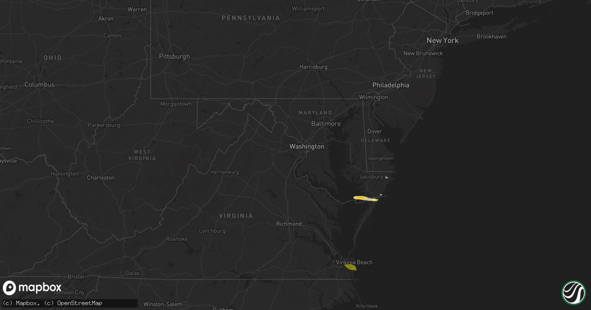
Hail Map in Maryland on May 31, 2025
Get this storm
May 31 map
$229
one time, instant access
Download today. No call, no setup
Keep the $229
Bought the map and want the full workflow? Apply the entire $229 to a subscription within 7 days. None of it is wasted.
Every map, not just this one
This buys you this map. Subscription and you get every map we run, in the markets you choose from a few cities to whole states to nationwide. Plus real-time alerts the moment a storm fires.
Contact data
Name, contact info, occupancy, even credit band for addresses in the footprint. You go from where it hit to who to call.
Become the source they trust
Unlimited branding weather history reports on demand. You already have the documented answer ready for the property owner, and you are the one who showed up with it.
Property data and RoofTrace estimates
Pull up any address you have got, its value and the exact code rules for that jurisdiction, straight from One Click Code. Then RoofTrace estimates the squares, pitch, and roof value, priced the way you price.
Storm reports in Maryland
Maryland
| Date | Description |
|---|---|
| 05/31/20253:00 PM CDT | Time is radar estimated. |
| 05/31/20252:48 PM CDT | Estimated quarter size hail just east of crisfield. |
| 05/31/20252:27 PM CDT | Trees blew down on md-2 solomons island road at forest drive. |
| 05/31/20252:20 PM CDT | A local report indicates 1.00 inch wind near 1 NNE Berlin |
| 05/31/20252:18 PM CDT | Trees and wires blew down near the intersection of md-450 defense highway near md-3 crain highway. |
| 05/31/20252:17 PM CDT | Trees blew down on southbound md-197 collington road at tulip grove drive. |
| 05/31/20251:41 PM CDT | Trees blew down onto southbound i-270 past exit 1/md-187 old georgetown road. |
| 05/31/20251:41 PM CDT | Trees blew down onto southbound i-270 past exit 1/md-187 old georgetown road... Including one onto a car. |
| 05/31/20251:37 PM CDT | Trees blew down on westbound md-190 river road blocking all lanes between wilson lane and nevis road/beech tree road. |
| 05/31/20251:37 PM CDT | Trees blew down on westb |
| 05/31/202512:57 PM CDT | Trees down reported in federalsburg. Time estimated from radar. |
| 05/31/202512:52 PM CDT | Trees down around denton. Time estimated from radar. |
| 05/31/202512:31 PM CDT | Trees blew down on jewel road near cavalier drive. |
| 05/31/202512:29 PM CDT | Trees blew down onto power lines causing a fire and power outages near the intersection of md-260 west chesapeake beach road and perrywood lane. |
| 05/31/202512:25 PM CDT | Trees blew down on md-382 croom road at croom station road. |
| 05/31/202512:24 PM CDT | Trees down reported in saint michaels. Time estimated from radar. |
All States Impacted by Hail Map on May 31, 2025
Cities Impacted by Hail Map on May 31, 2025
- Marion Station, MD
- Crisfield, MD
- Pocomoke City, MD
- Stockton, MD
- Oak Hall, VA
- New Church, VA
- Withams, VA
- Wallops Island, VA
- Horntown, VA
- Chincoteague Island, VA
- Colon, NE
- Malmo, NE
- Wahoo, NE
- Weston, NE
- Ceresco, NE
- Yutan, NE
- Mead, NE
- Ithaca, NE
- Virginia Beach, VA
- Lake George, CO
- Waverly, NE
- Alvo, NE
- Divide, CO
- Fremont, NE
- Lincoln, NE
- Martell, NE
- Walton, NE
- Florissant, CO
- Syracuse, NE
- Firth, NE
- Adams, NE
- Colorado Springs, CO
- Peyton, CO
- Victor, CO
- Maricopa, CA
- Westcliffe, CO
- Cortland, NE
- Beatrice, NE
- Talmage, NE
- Wetmore, CO
- De Witt, NE
- Humboldt, NE
- Auburn, NE
- Johnson, NE
- Jansen, NE
- Pueblo, CO
- Malta Bend, MO
- Marshall, MO
- Atchison, KS
- Rushville, MO
- Avoca, NE
- Ponca City, OK
- Enid, OK
- Kremlin, OK
- Garber, OK
- Covington, OK
- Stillwater, OK
- Douglas, OK
- Fairmont, OK
- Waukomis, OK
- Chalmers, IN
- Wolcott, IN
- Lucien, OK
- Perkins, OK
- Brookston, IN
- Marshall, OK
- Hennessey, OK
- Crescent, OK
- Orlando, OK
- Guthrie, OK
- Mulhall, OK
- Aline, OK
- Waynoka, OK
- Chester, OK
- Woodward, OK
- Fairview, OK
- Chelsea, OK
- Perry, OK
- Arcadia, FL
- Ona, FL
- Coyle, OK
- Luther, OK
- Arcadia, OK
- Harrah, OK
- Choctaw, OK
- Jones, OK
- Newalla, OK
- Edmond, OK
- Meridian, OK
- Okeene, OK
- Moore Haven, FL
- Pauls Valley, OK
- Wynnewood, OK
- Elmore City, OK
- Sulphur, OK
- Davis, OK
- Springer, OK
- Ardmore, OK
- Dougherty, OK
- Berlin, MD


